EXISTING SHORELINE CONDITIONS STUDY EAO Condition 39
The full pdf of this report is contained in this pdf:
BC EAO Condition 39 Exisitng Shoreline Conditions Report – May 2023 – for engagement
The purpose of this posting is to reference the part of the report referring to Metchosin’s coastline and to provide comment on it.
===========================================================
 From page 4 of the REPORT:
1 Introduction
As defined by the amendment to Trans Mountain’s BC Environmental Assessment Certificate (EAC) issued by the Province of British Columbia (the Province) on February 24, 2022, Trans Mountain must prepare an Existing Shorelines Condition Report and submit to the Province within 18 months (August 2023) as Condition No. 39.
Polaris Applied Sciences was retained to prepare a report containing shoreline baseline data for shoreline areas closest to spill scenario locations modeled along the marine shipping route and submitted in the Project application. The Province listed the specific scenario locations for the purpose of this study (Figure 1) as:
- English Bay (Location B)
- Roberts Bank (Location C)
- Strait of Georgia (Location D)
- Arachne Reef (Location E)
- Strait of Juan de Fuca (south of Race Rocks) (Location G); and
- Buoy J (Location H)
Page 25
Strait of Juan de Fuca (south of Race Rocks) (Location G);
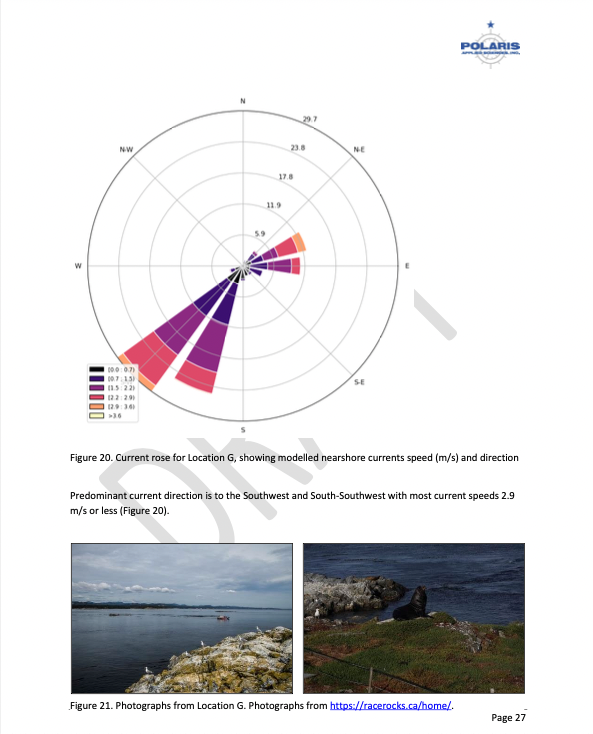
Figure 18 shows the Location G – Race Rocks site with the available existing spatial data. Shoreline data are from the Shorezone mapping effort available from the BC Data Catalogue, which show the shore type consisting of rock cliff. Shore-zone Bioband data indicate the presence of barnacles, dark brown kelps, fucus, bull kelp, red algae, surf grass, and Verrucaria. Other data sources indicate offshore kelp beds and multiple seal and sealion haulouts. The Race Rocks Ecological Reserve (RRER) website (https://racerocks.ca/home/) provides more details on ecological resources documented and studied at the site, but not in a spatial format for mapping.
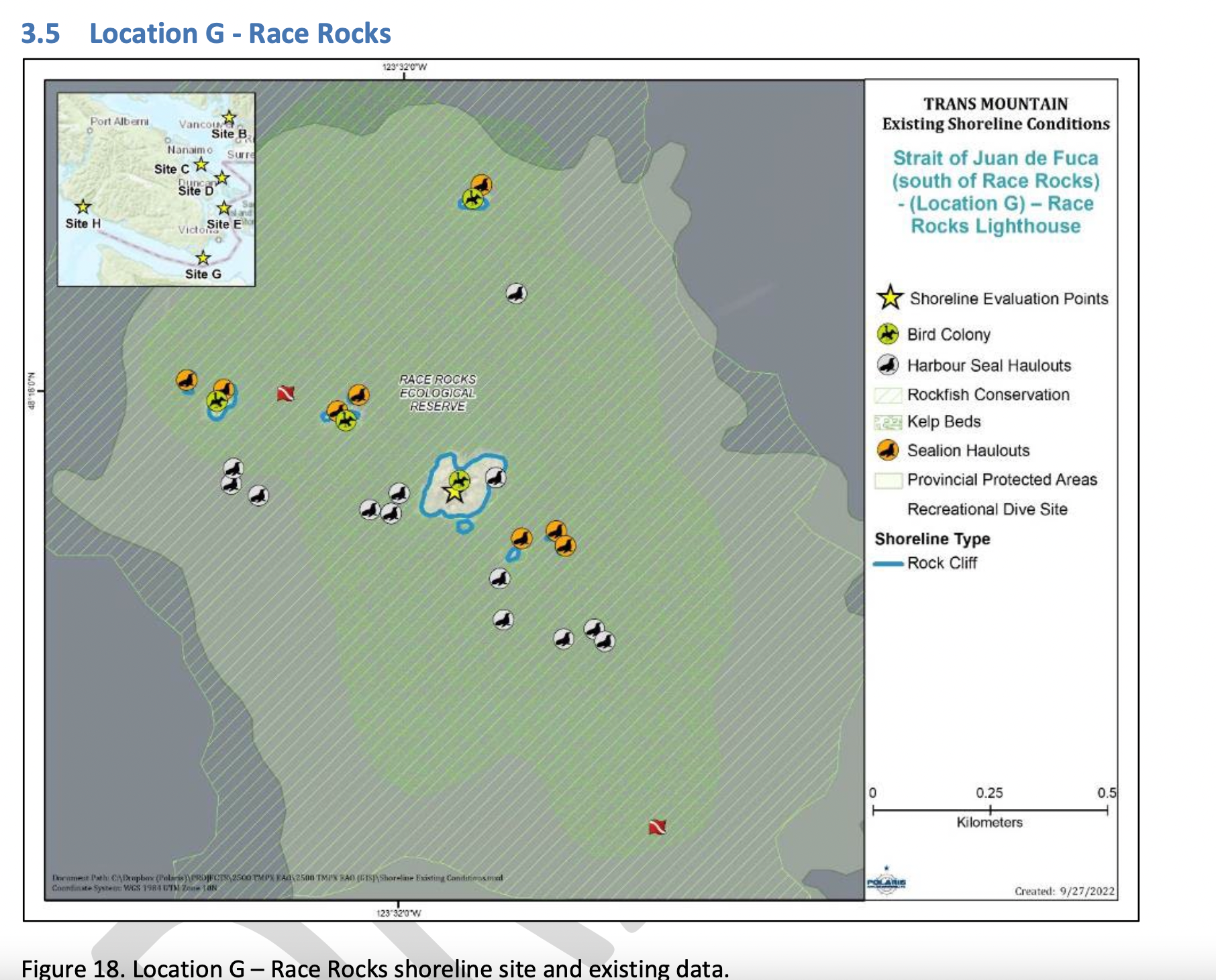
COMMENTS : The exceptionally high Biodiversity of the area and high level of protection since 1980 as a Provincial Ecological Reserve are not reflected at all in the map presented. If one were to look at the Race Rocks Taxonomy presented at https://racerocks.ca/race-rocks-animals-plants/taxonomy-image-gallery/ there may be a better appreciation of the natural capital of this area
- Rock Cliff Beach designation is inaccurate.. there is a pebble beach and Intertidal areas with tidepools on much of the shorelines of the 9 islandfsd in the Archipelago. Also several surge channels are located around the main island.
- Bird Colonies :
–no mentions is made of four species of nesting seabirds.
–no mention is made of the fact this is a winter roosting area for thousands of seabirds.
— no mention of the fact that the archipelago of islands are an important migratory stopover for marine and terrestrial migratory birds. - Marine Mammals:
–no mention is made of the fact this is the most northerly haul-out and pupping colony for Elephant seals — no mention of the fact that California and Northern sealions haul out in numbers over 1000 in the fall of the year.
—no mention that the haul-out locations for harbour seals are also pupping colonies.
— no mention of the ocurrence of river otters and sea otters on and within the islands.
– no mention of the fact that it is an important feeding area for Biggs killer whales. https://racerocks.ca/humpback-and-orca-sightings-race-rocks/
–no mention of the fact that the surrounding waters have had a rapid increase in the past few years of Humpback whales - Invertebrates:
–The extremely high biodiversity of invertebrate species both inter-tidally and sub-tidally is not mentioned.
–Several rare species of invertebrates are found here and are not acknowledged - Fish :
–This is a rockfish protection area and all species of BC Rockfish are represented.– a high diversity of other fish are also represented here, with even sitings of Sturgeon occurring. - Marine Algae :
–There is a much higher species diversity of Marine Algae found in the ecological reserve than is n surrounding areas.
— the indication of kelp beds on the map presented here is totally inaccurate and insufficient. Given the decline of kelp beds in our coastal water , this is highly relevant. - Indigenous and Historical Significance:
— the presence of archaeological sites and the significance of the historic structures cannot be minimized . All are sprayed with seawater and therefore subject to immersion in pollutants during intense winds which occur regularly.
===============================================================
Page 26
Comments:
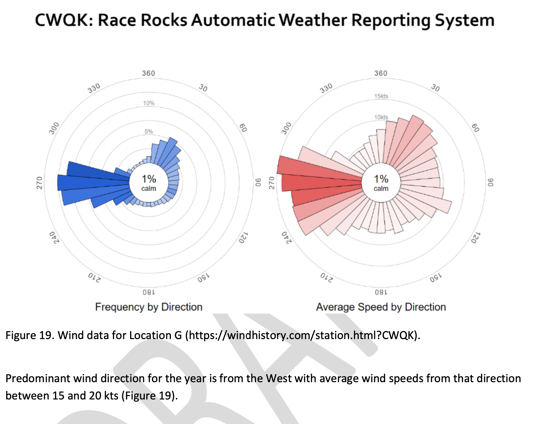
The reference at the Race Rocks website from racerocks.ca which analyzes the Wind speed from observations of the hourly data provided by Environment Canada show a completely different picture . https://racerocks.ca/race-rocks-lightstation-weather-conditions-environment-canada-problems-for-oil-spill-cleanup/
Some facts from the Environment Canada data:
1. In July of 2022 there were 11 days when the wind speed every hour was 28 km/hr or greater. and 69.5% of the hours in the month, clean up equipment could not be deployed due to high velocity wind conditions.
2. In March of 2023, the wind speed was 28 km/hr or greater 37% of the time.
3. In Februarry of 2023 , the wind speed was 28 km/hr or greater 43 % of the time
4. In January of 2023 , the wind speed was 28 km/hr or greater 36% of the time
============================================================
Page 27
================================================
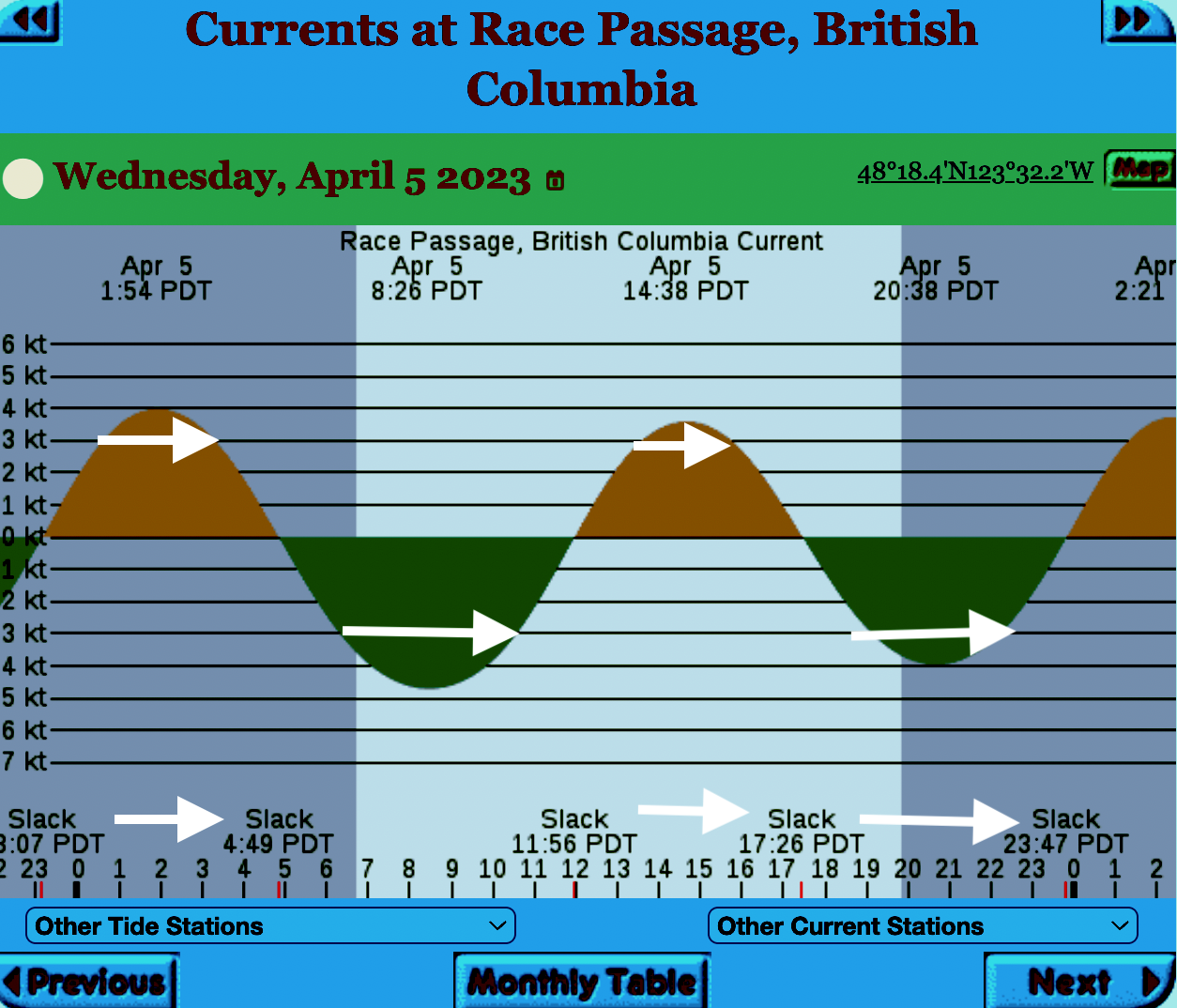
The reality of current speed is that there is a very small window of time during the day that the waters around Race Rocks are not over three knots. In the graph below only in the few hours a day not covered by the white arrows could any boom placement be established. WHen looked at from this perspective, added onto the small windows of time when the wind speed is under 28 km per hour could spilled oil containment even be possible.
=============================================================
From page 28 of the Polaris report
Field surveys were not conducted at Race Rocks due to the long lead time in acquiring a “research” permit from BC Parks to access the Ecological Reserve. Information detailed below comes from reviewing the existing data available, Google Earth, the RRER website, and a First Nations representative.
The shoreline at Race Rocks, specifically Great Race Rock, appears to be mostly bedrock cliff, ramp, and platform, possibly with some small pocket pebble/cobble beaches. Bedrock cliffs and ramps are observable in Figure 21 which show some example photographs from the Race Rocks Ecological Reserve website. The backshore appears to be mostly bedrock with some vegetation.
An active lighthouse along with several other buildings are present. Pearson College UWC conducts research and teaches classes at the site. Whale and sightseeing boats frequent the waters around Great Race Rock and are visible from photographs on the Race Rocks website and on Google Earth.
As mentioned before, Race Rocks is a BC Parks Ecological Reserve which are “areas selected to preserve representative and special natural ecosystems, plant and animal species, features and phenomena. Scientific research and educational purposes are the principal uses of ecological reserves”7. A wide variety of ecological resources are documented, tracked, and studied at the site. This documentation includes a weekly animal census, annual bird counts, and an entire list of species ever documented with photos/videos since 2000 (https://racerocks.ca/race-rocks-animals-plants/taxonomy-image-gallery/). Additional research conducted at the site can also be found on the RRER website. The extensive use of the site as a haulout location by pinnipeds is documented on the website and visible on Google Earth.
This area has historically been used by First Nations for harvesting food, as documented on the Race Rocks website, and a First Nations representative indicated that fishing is common in the waters around the site. Burial mounds/cairns have been researched and documented on Great Race Rock.
A helicopter pad is located near the lighthouse.
Based on the available data, and without visiting Race Rocks, the Shorezone mapping appears to be relatively accurate. The detailed observation of the flora and fauna on the Race Rocks website and other research conducted by Pearson College provides the most thorough documentation of the ecological resources present compared to any of the other sites visited.
7 https://bcparks.ca/eco_reserve/
================================================================
So much of what we are expected to do in response to the Trans Mountain EAO requests has been done before.
However….
I am pointing out some information from work that Mike Fenger and myself did on the Board of Friends of Ecological Reserves the past for the NEB hearings .
1. In this document, although it lists species of several of the marine ecological reserves, Race Rocks is included with examples
page 48 -page 54 : Marine mammals
see page 52
page 55-page 61 Birds
page 63-67 fish (including forage fish on our beaches
page 67- page 71 .. Invertebrates
page 72- page 74 .. macroalgae
page 75- terrestrial plants in upper foreshore areas
From this link ….
there is a lot of information of the biological resources along the Strait of Juan De Fuca also in section
3.5 SARA-Listed Species in Two Ecological Reserves and in appendix page 139
==============================
Garry Fletcher.. Metchosin Environmental Advisory Select Committee
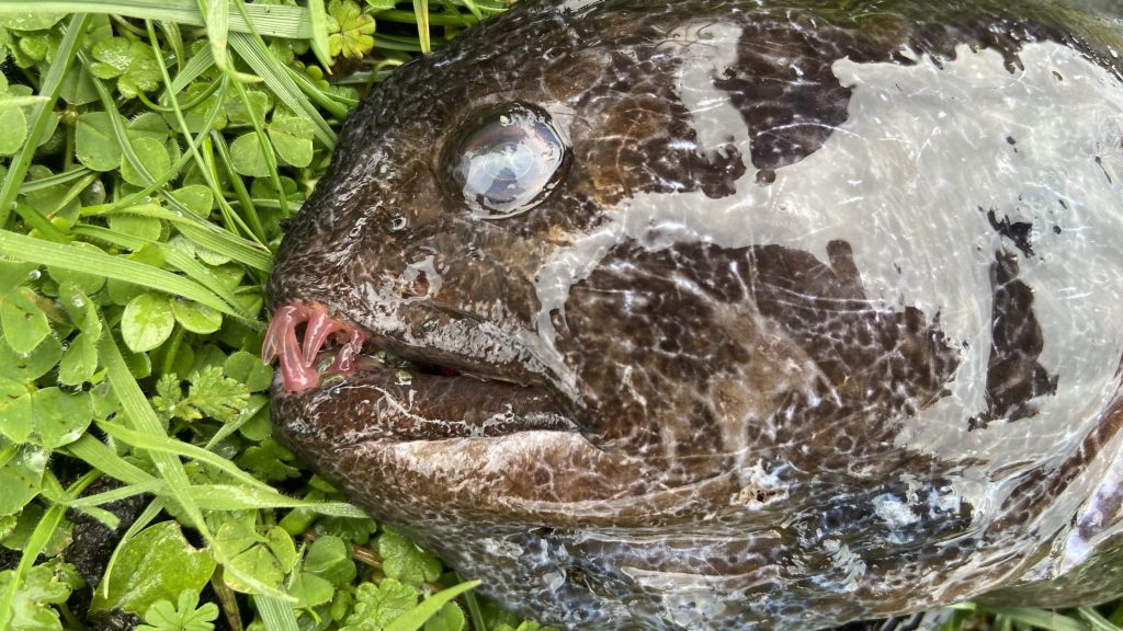
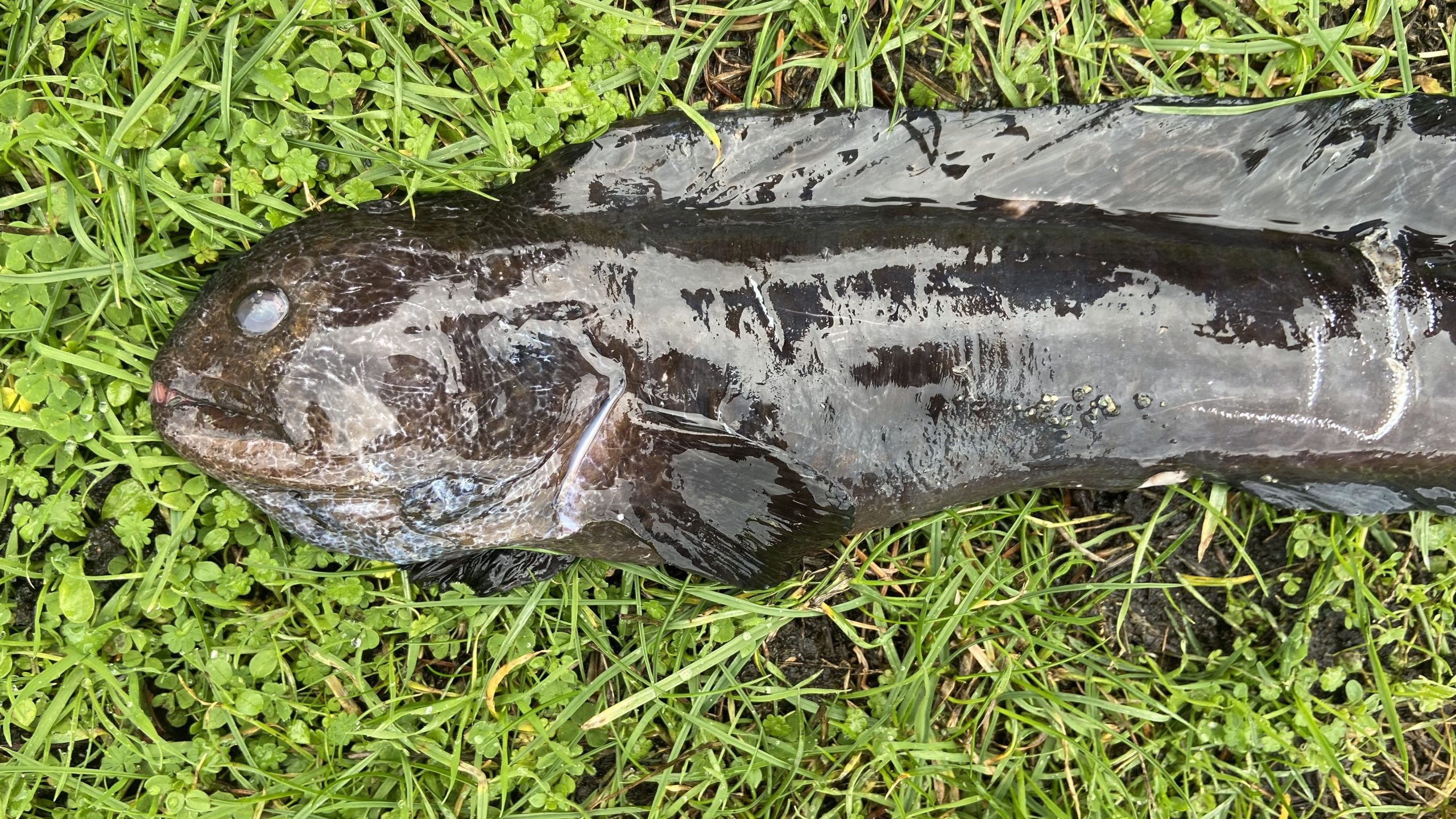
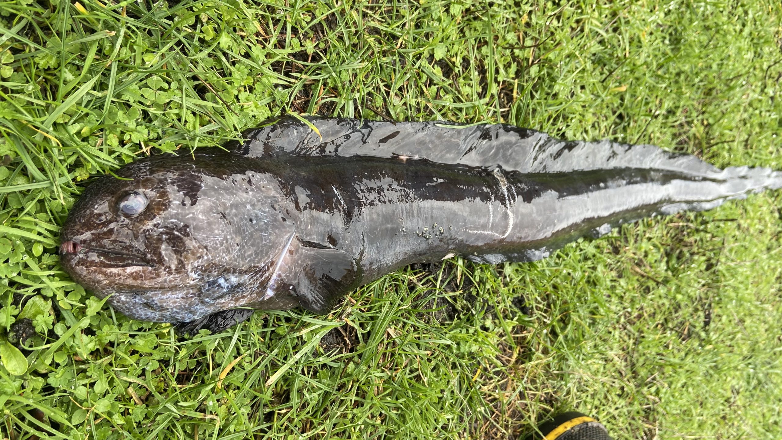
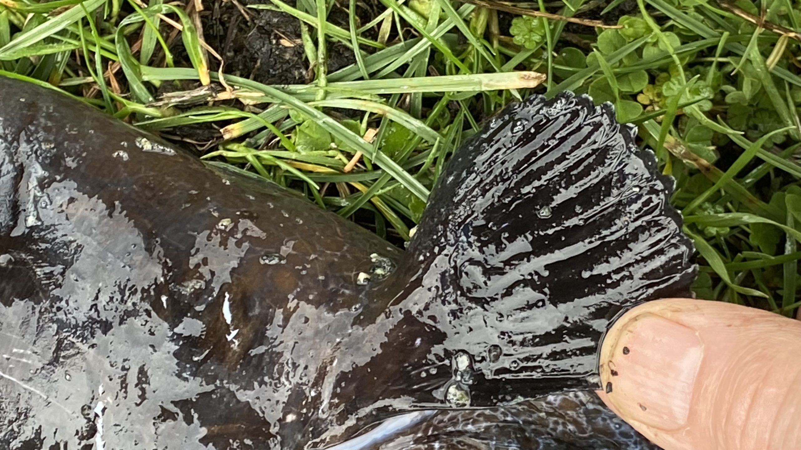
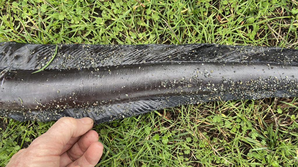
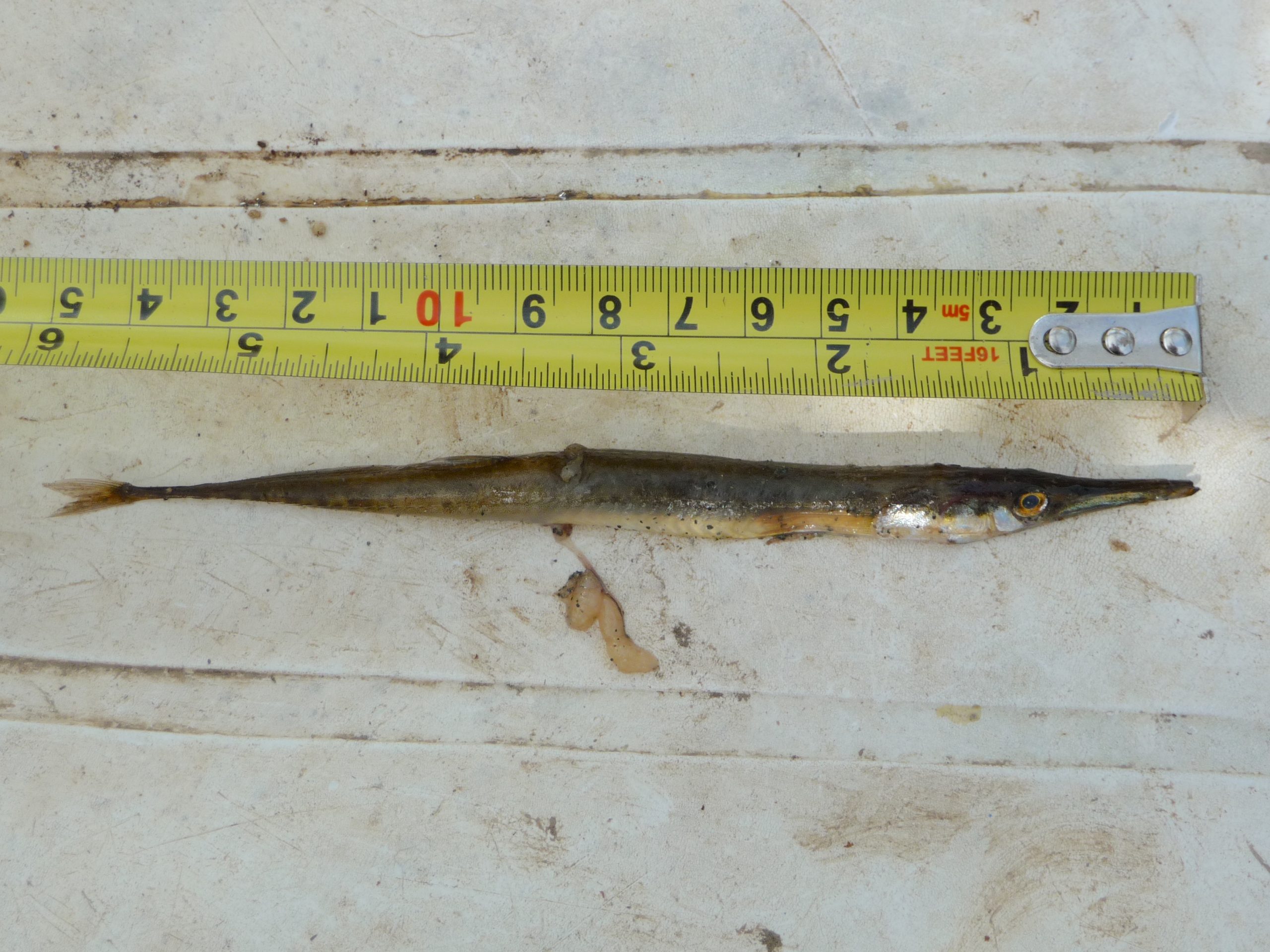
Wolf Eel : Anarrhichthys ocellatus on Taylor beach
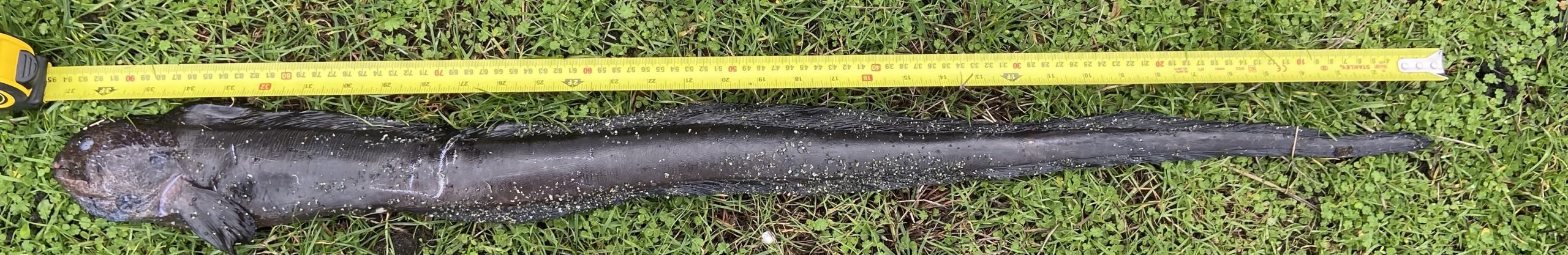
On February 9, 2023 Deidre Chettleburgh and her grandson Ben retrieved this 37 cm wolf eel from the strand line on Taylor beach.
Although the experts on iNaturalist identified it as a wolf eel, (https://inaturalist.ca/observations/148414762 ) this description of a juvenile wolf eel from Wikipedia doesn’t really fit . ???
“Younger wolf eels are orange with big dark spots in the posterior part of the body. Once older they turn grey, brown greyish or dark olive.”[7][8]
This individual was very dark black. Also in my many years of Diving around Race Rocks Ecological Reserve I never saw anything like it.
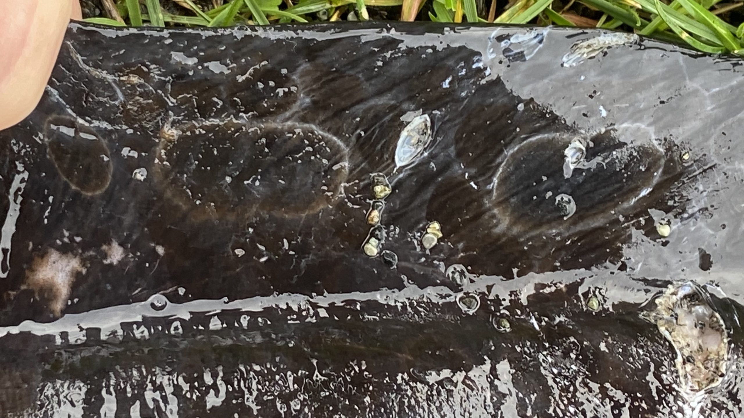
https://racerocks.ca/anarrhichthys-ocellatus-wolf-eel-the-race-rocks-taxonomy-2/
-
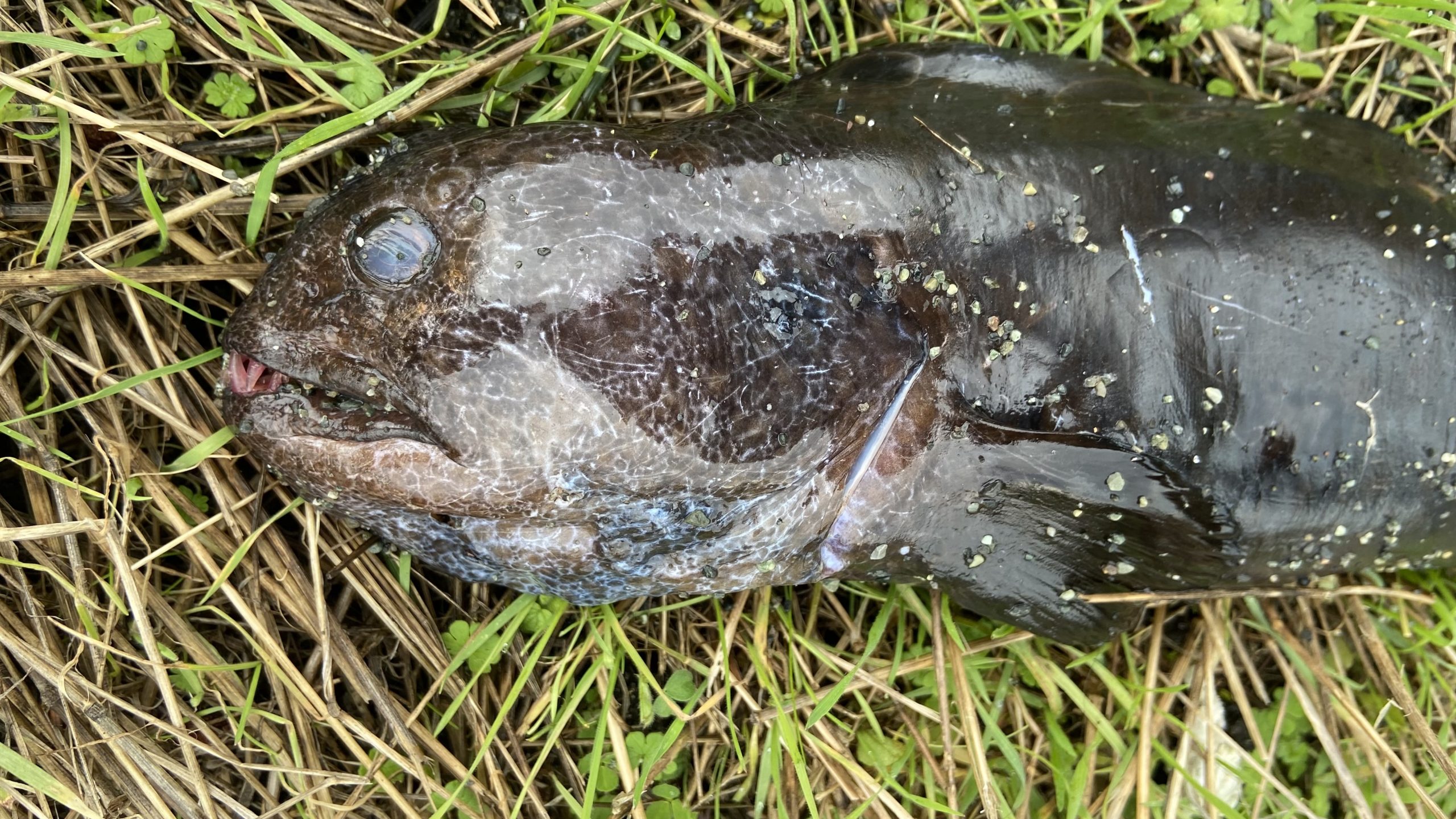
- wolf eel teeth

-

- pectoral fim
-
- dorsal and ventral fin run the full length of the body

-
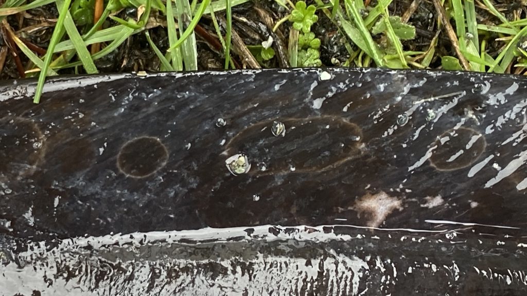
- oval markings on dorsal fin

-
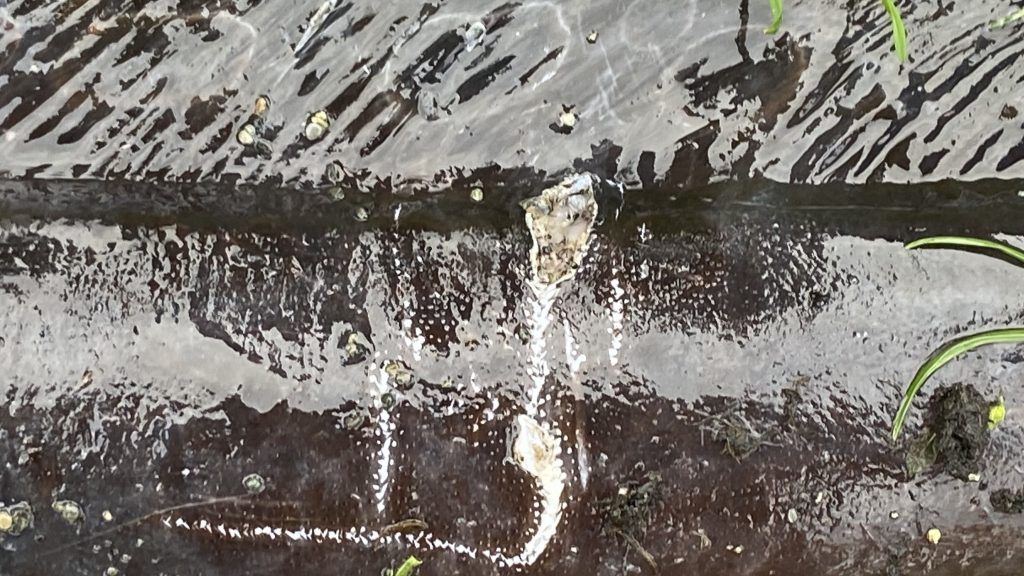
- on each side there were two holes punctured
Classification from Wikkipedia:
| Kingdom: | Animalia |
| Phylum: | Chordata |
| Class: | Actinopterygii |
| Order: | Scorpaeniformes |
| Family: | Anarhichadidae |
| Genus: | Anarrhichthys Ayres, 1855 |
| Species: |
A. ocellatus
|
| Binomial name | |
|---|---|
| Anarrhichthys ocellatus
Ayres, 1855
|
|
When will those humans stop abusing our beaches
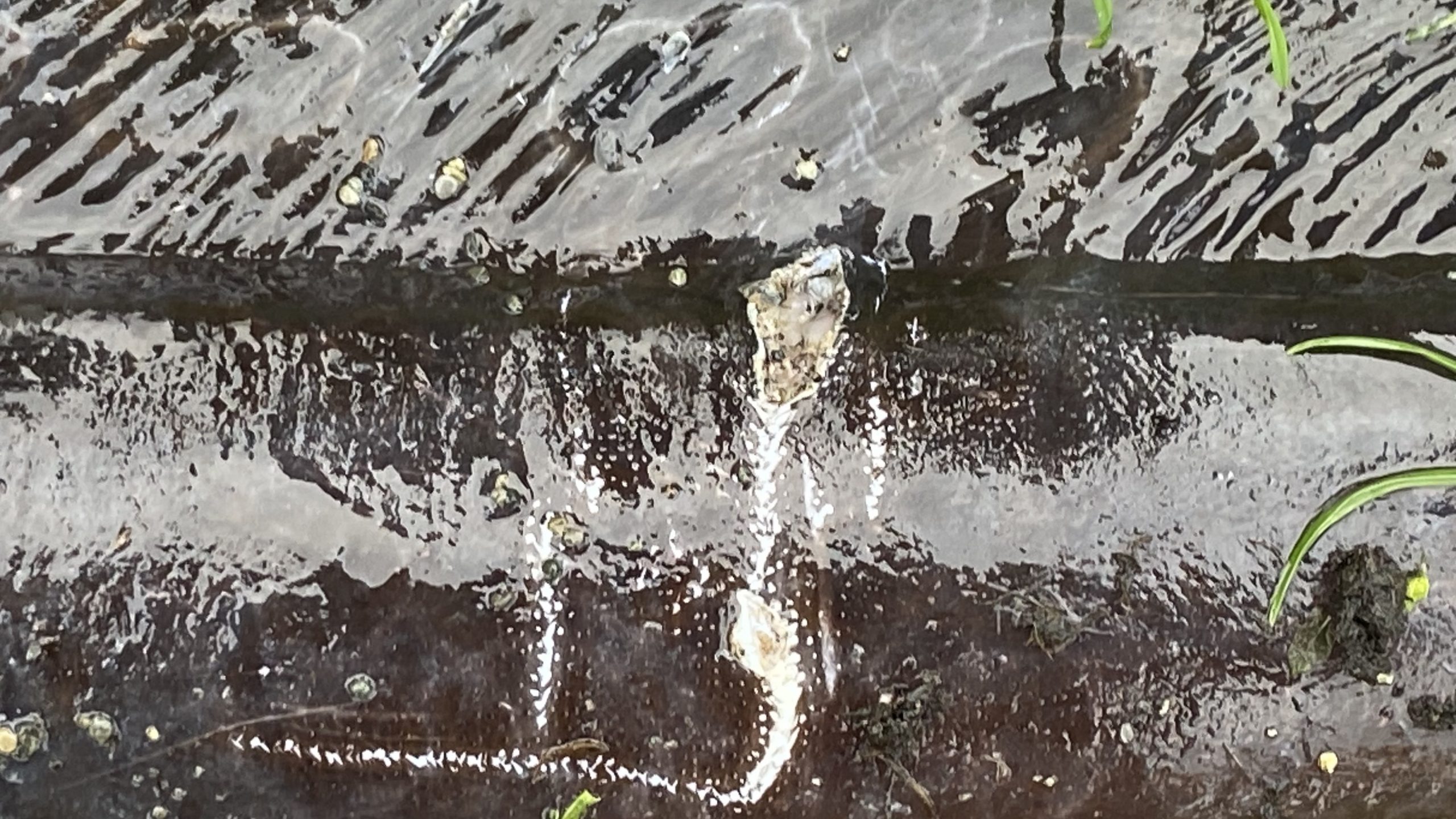
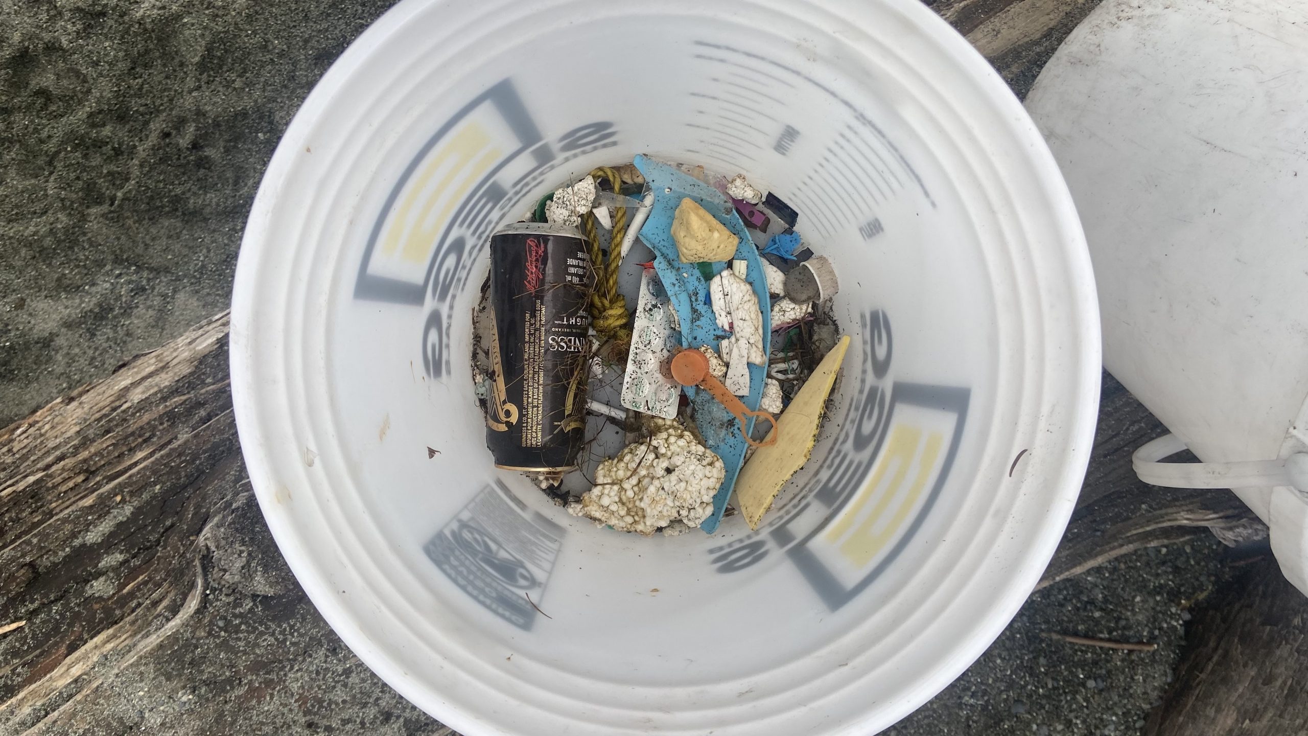
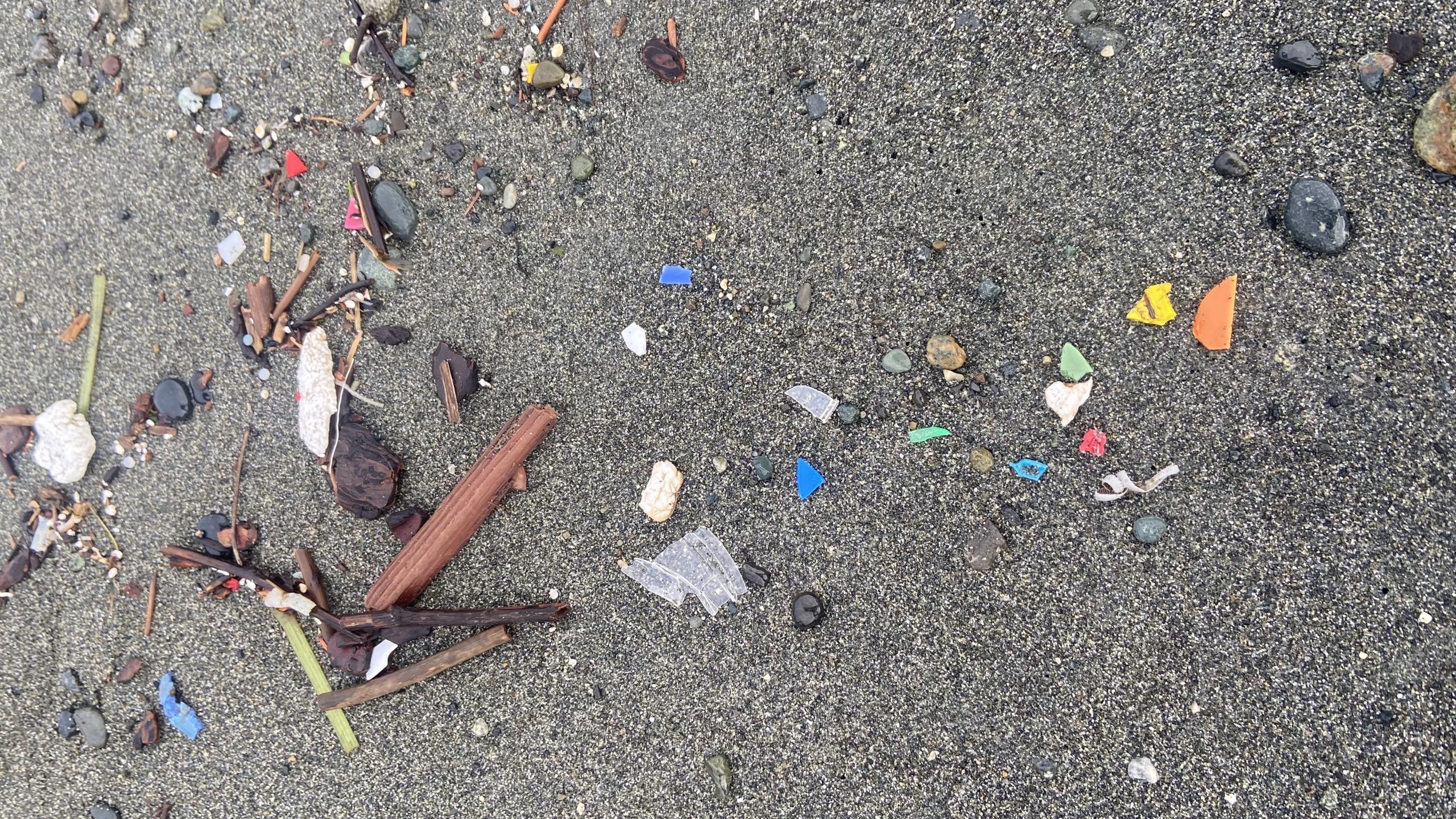
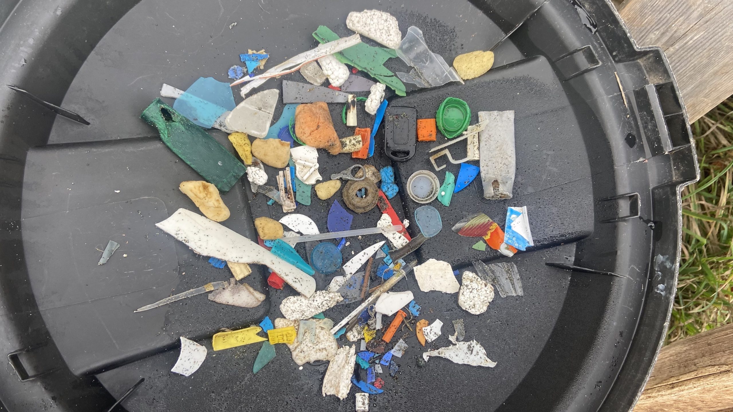
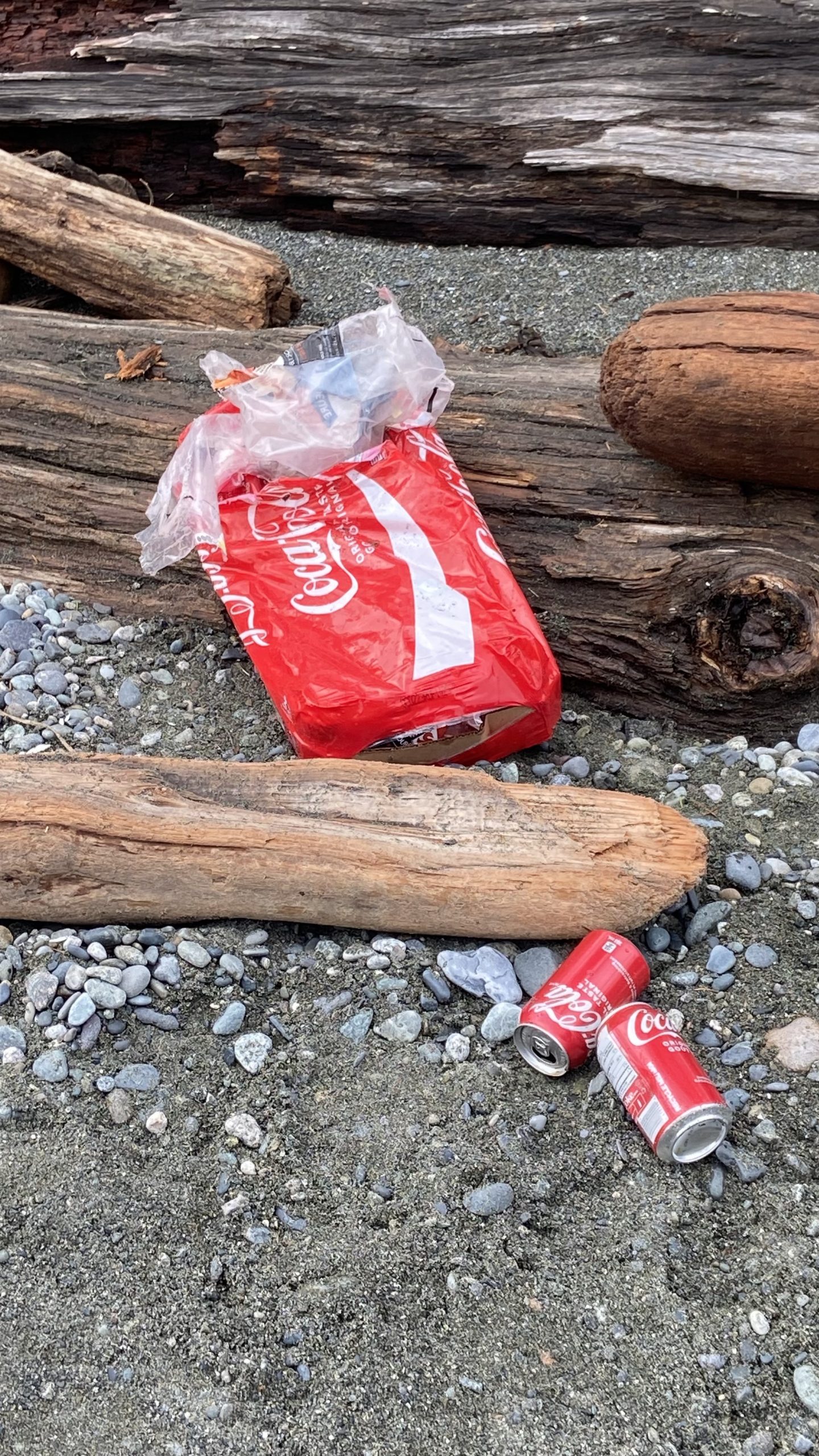
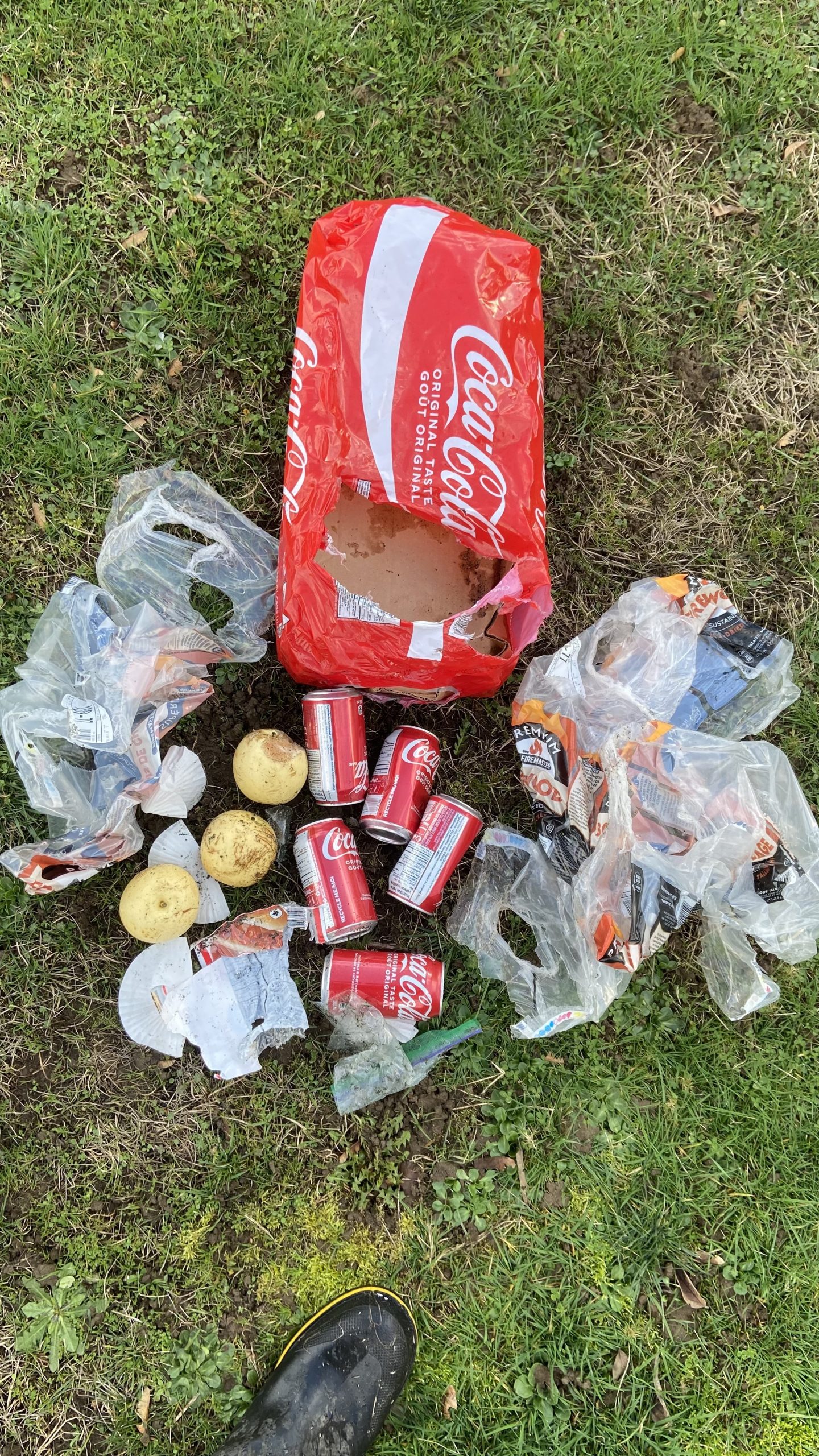
A walk on Taylor beach today turned up the typical abuse that humans manage to perpetuate.
- Plastic particles disposed in the marine environment which wash up on shore
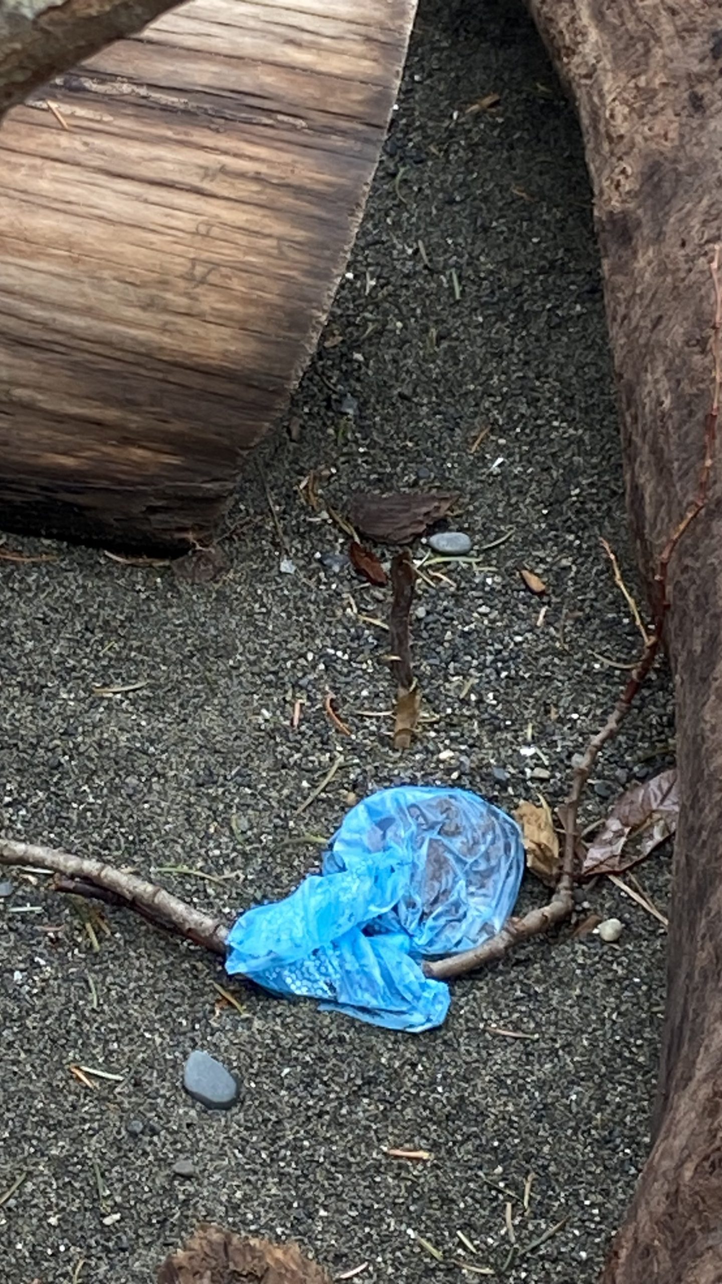
- Dog feces bags left on the beach
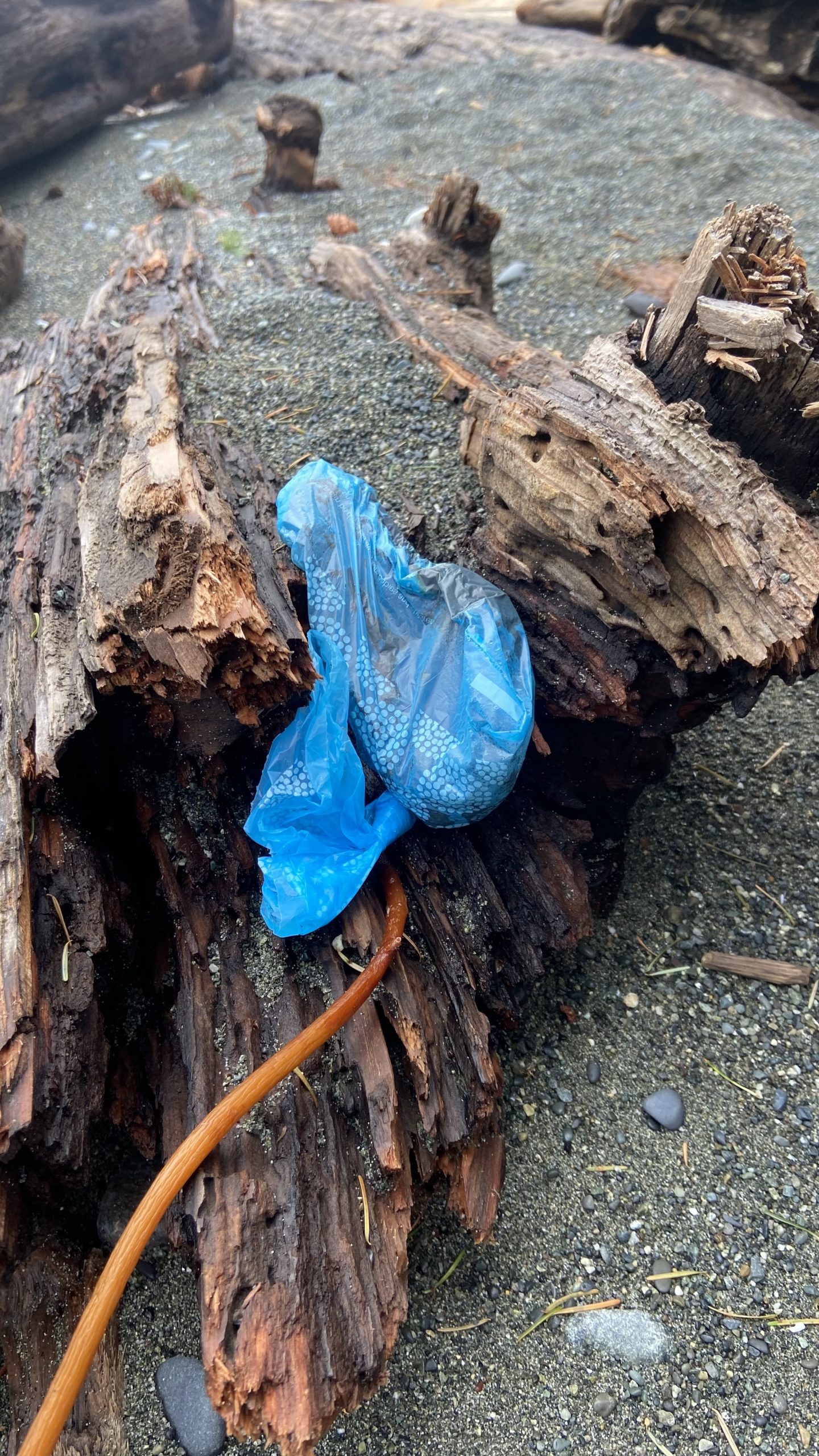
- Garbage left from a party
-
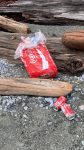
- It was nicely packaged and leaning against a log near a firepit that had been covered with sand
-

- The contents,
-
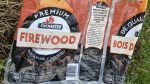
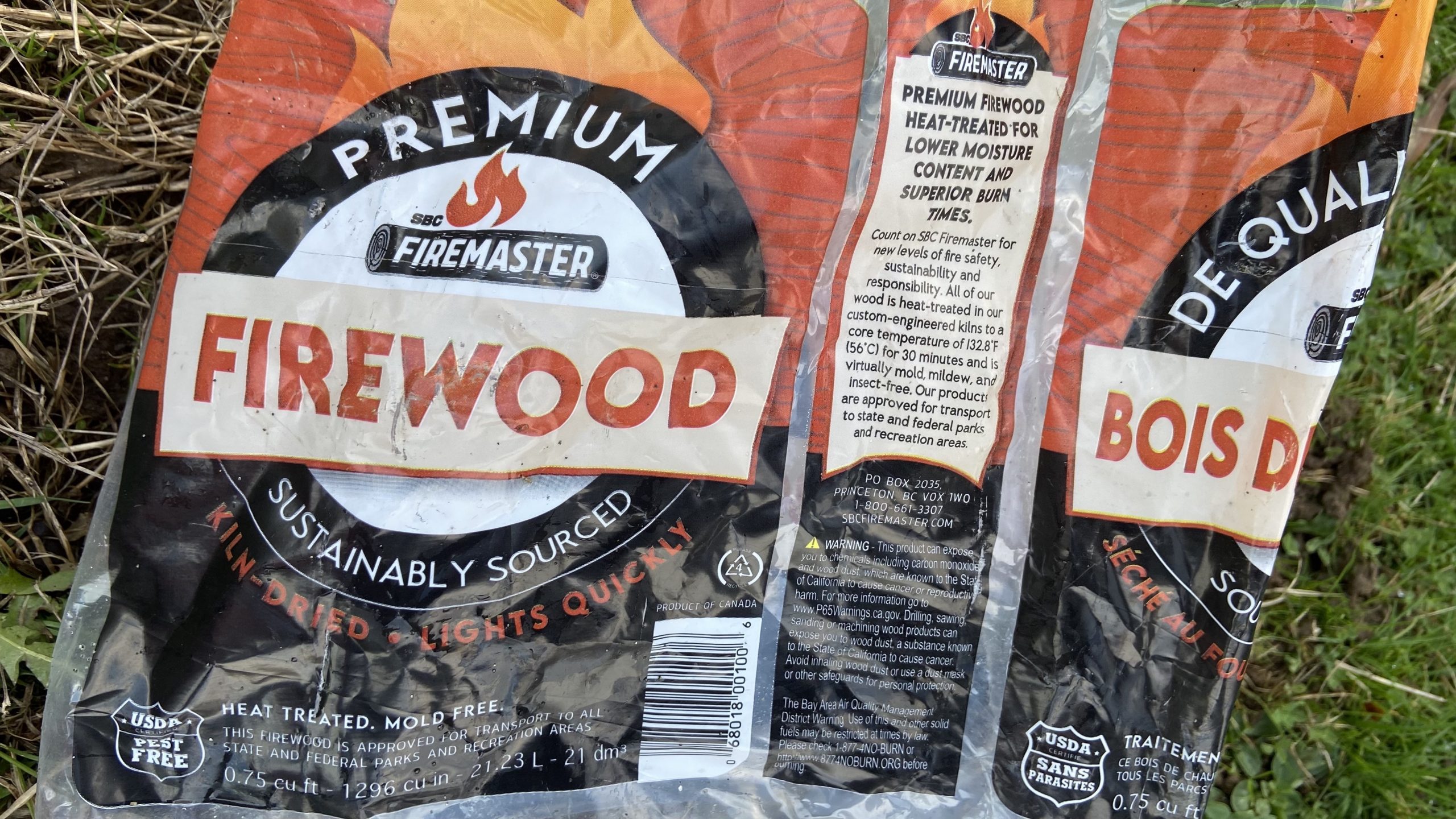
- At least they didnt use firewood from the beach
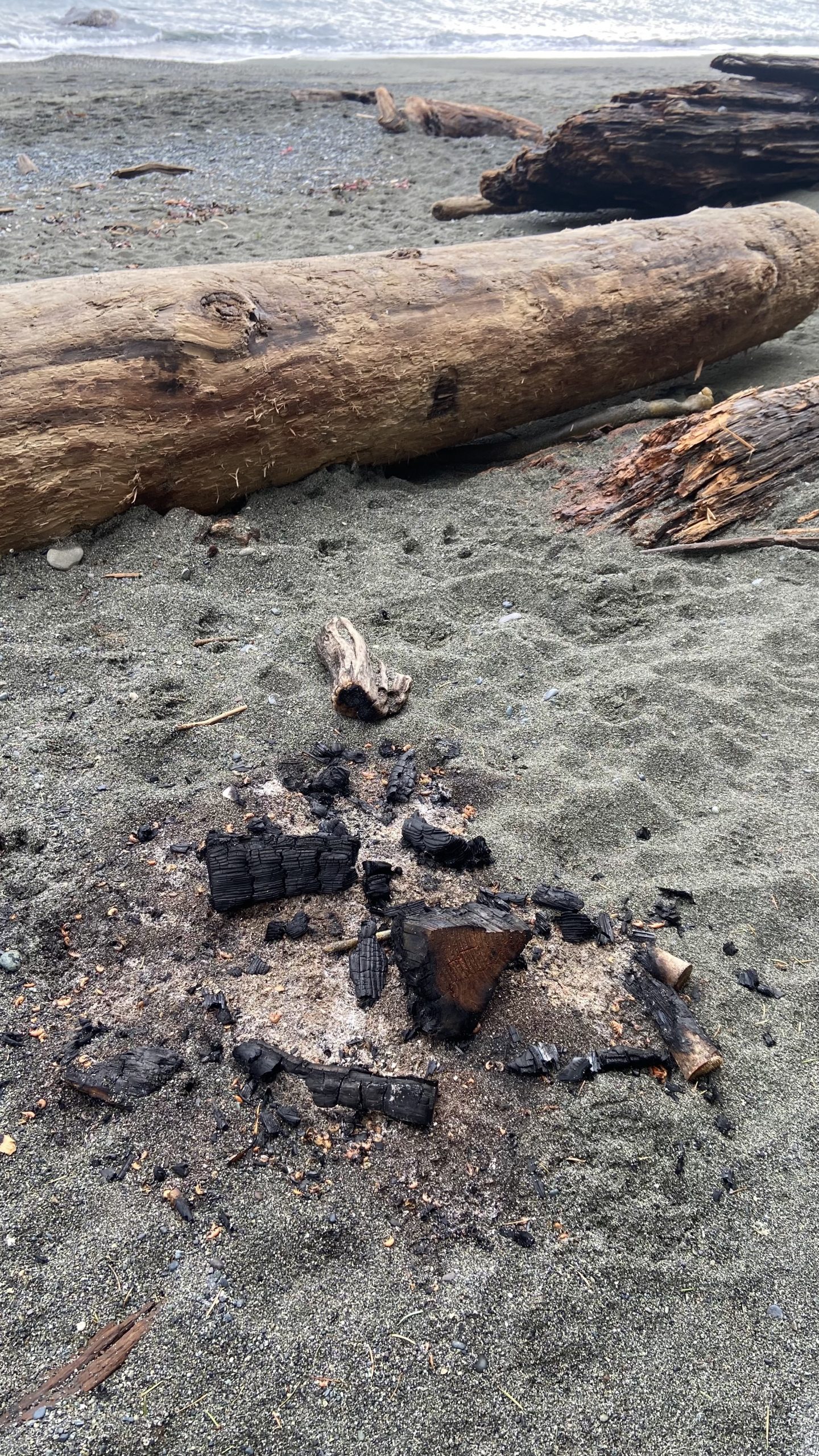
- Beach fires
-
Fish of the Metchosin Coastal Area
The following fish have been found on Taylor beach
Gobiesox meandrous–Northern Clingfish
Ammodytes hexapterus: Pacific Sand lance, (Needle fish)
Aluolorhychus flavidus: Tubesnout
Gasterosteus aculeatus : Threespine Stickleback
Shiner perch : Cymatogaster aggregata
Other fish from the Race Rocks taxonomy :
Subphylum Vertebrata:
Class Elasmobranchii: sharks and skates
Squalus acanthias (Spiny Dogfish):
Raja rhina (Longnose skate):
Hydrolagus colliei (ratfish):
Class Actinopterygii: rockfish and sculpins-Order Scorpaeniformes
Scorpaenichthyes marmoratus (Cabezon):
Hexagrammos decagrammus (Kelp greenling):
Ophiodon elongatus (Lingcod):
Oligocottus maculosus (Tidepool sculpin):
Nautichthys oculofasciatus (Sailfin Sculpin):
Ronquilus jordani (Northern ronquil)
Sebastes melanopsi (Black rockfish):
Sebastes maliger (Quillback rockfish):
Sebastes nigrocinctus (Tiger Rockfish):
Sebastes flavidus (Yellowtail Rockfish):
Sebastes caurinus (Copper Rockfish):
Sebastes emphaeus (Puget Sound Rockfish):
Agonomalus mozinol (Kelp Poacher):
Chirolophis decoratus (Decorated warbonnet):
Lupensus sagitta (Snake Prickleback):
Clupea pallasii (Pacific Herring):
Engraulis mordax (Northern Anchovie)
Pholis clemensi: (Longfin gunnel)
Rhamphocottus richarsonii (Grunt Sculpin):
Acipenser transmontanus(White Sturgeon):
Anarrhichthys ocellatus (Wolf eel):
Apodichtys flavidus (Penpoint gunnel):
Oncorhynchus keta (Chum salmon):
Oncorhynchus kisutch (coho salmon):
Myctophidae (lanternfish):
Aulorhynchus flavidus. tubesnout .
Aulorhynchus flavidus. tubesnout
This fish showed up dead in the strand line on Taylor beach Dec 19 , 2022
Link to Fish of Metchosin Coastal
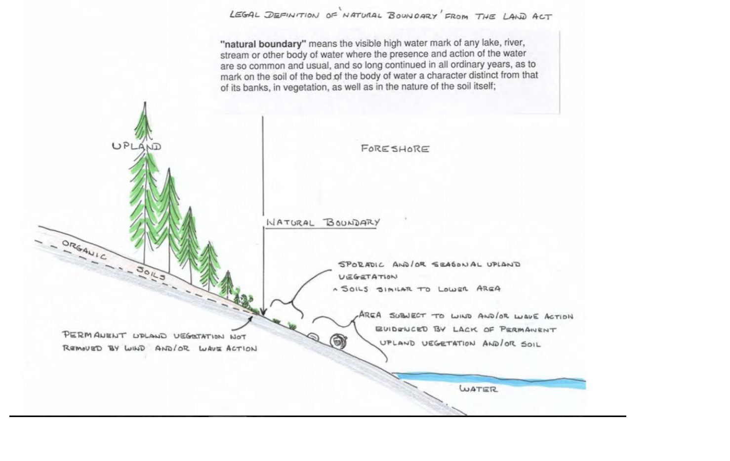
Determination of the “NATURAL BOUNDARY ” of the Coastline
The determination of the natural boundary of the coastline is important in establishing ownership of property and therefore public access along a coastline: The following reference may help clarify this .
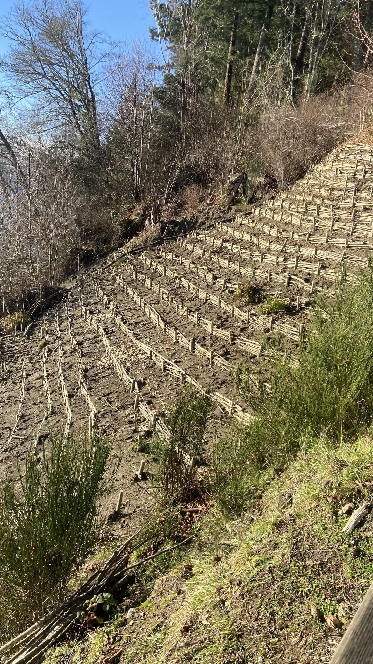
Habitat Restoration at Witty’s Lagoon Regional Park
Over the past year a volunteer group has worked with CRD Parks staff to restore some of the sensitive habitat at Witty’s beach and lagoon.
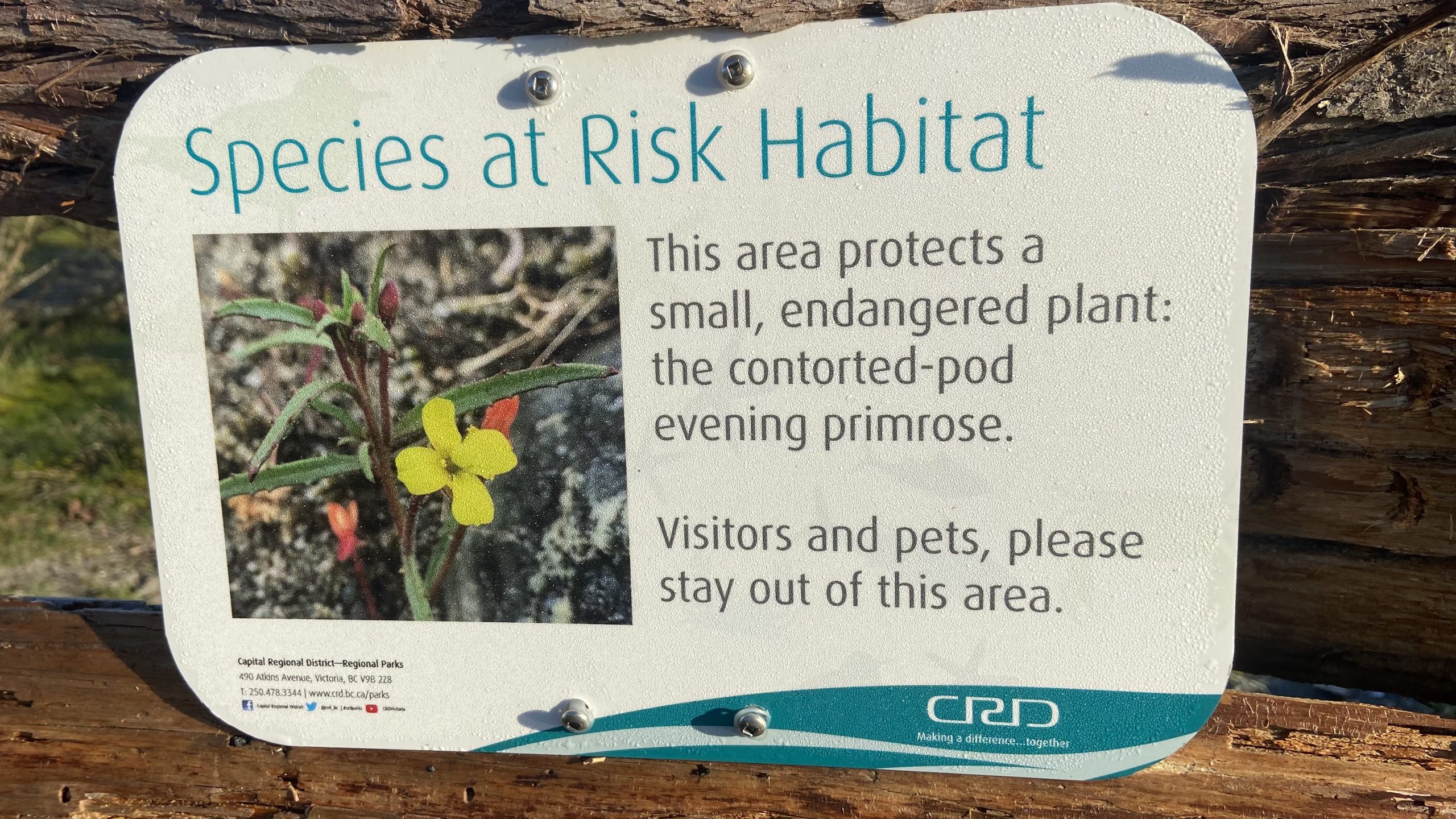
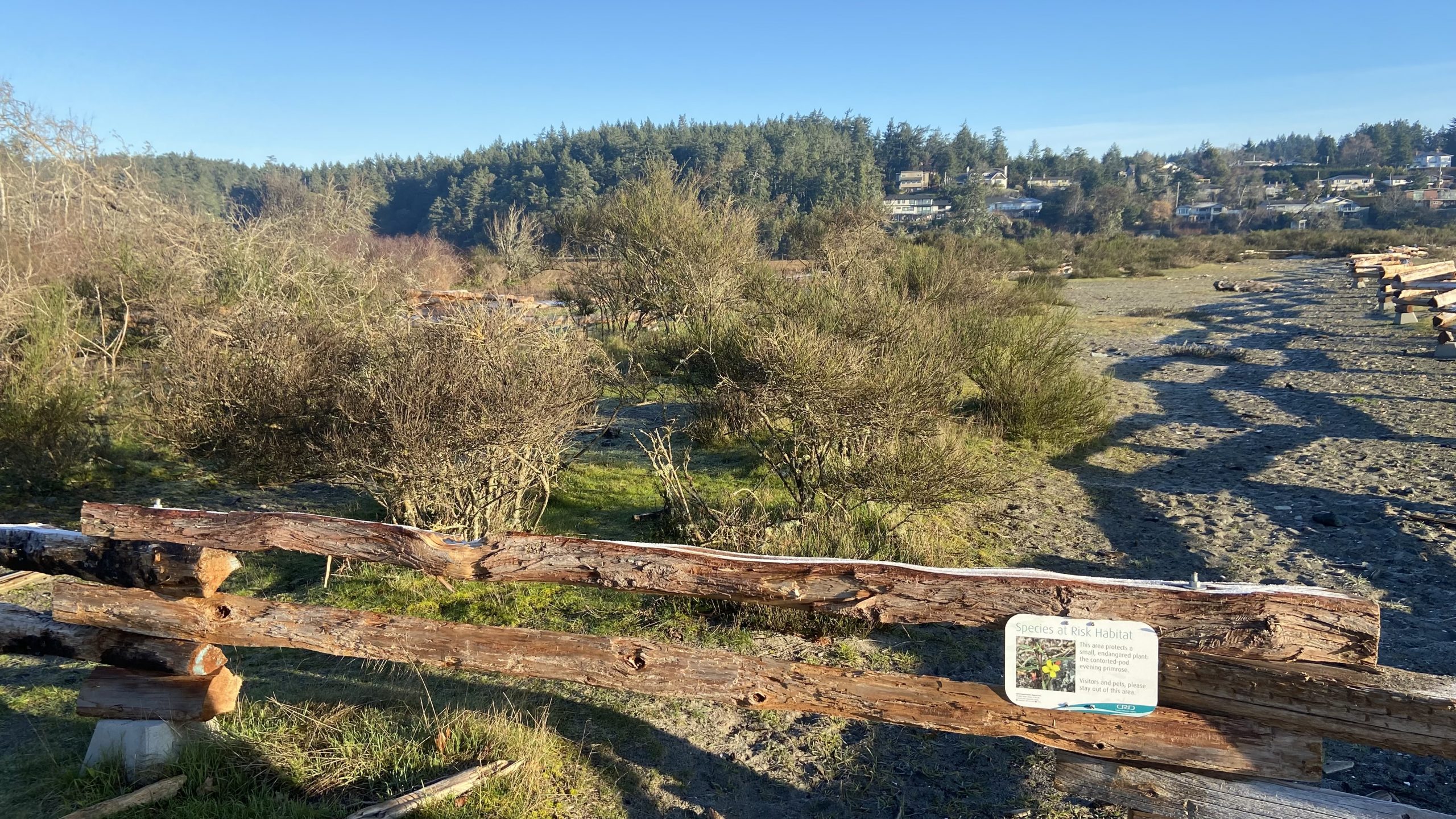
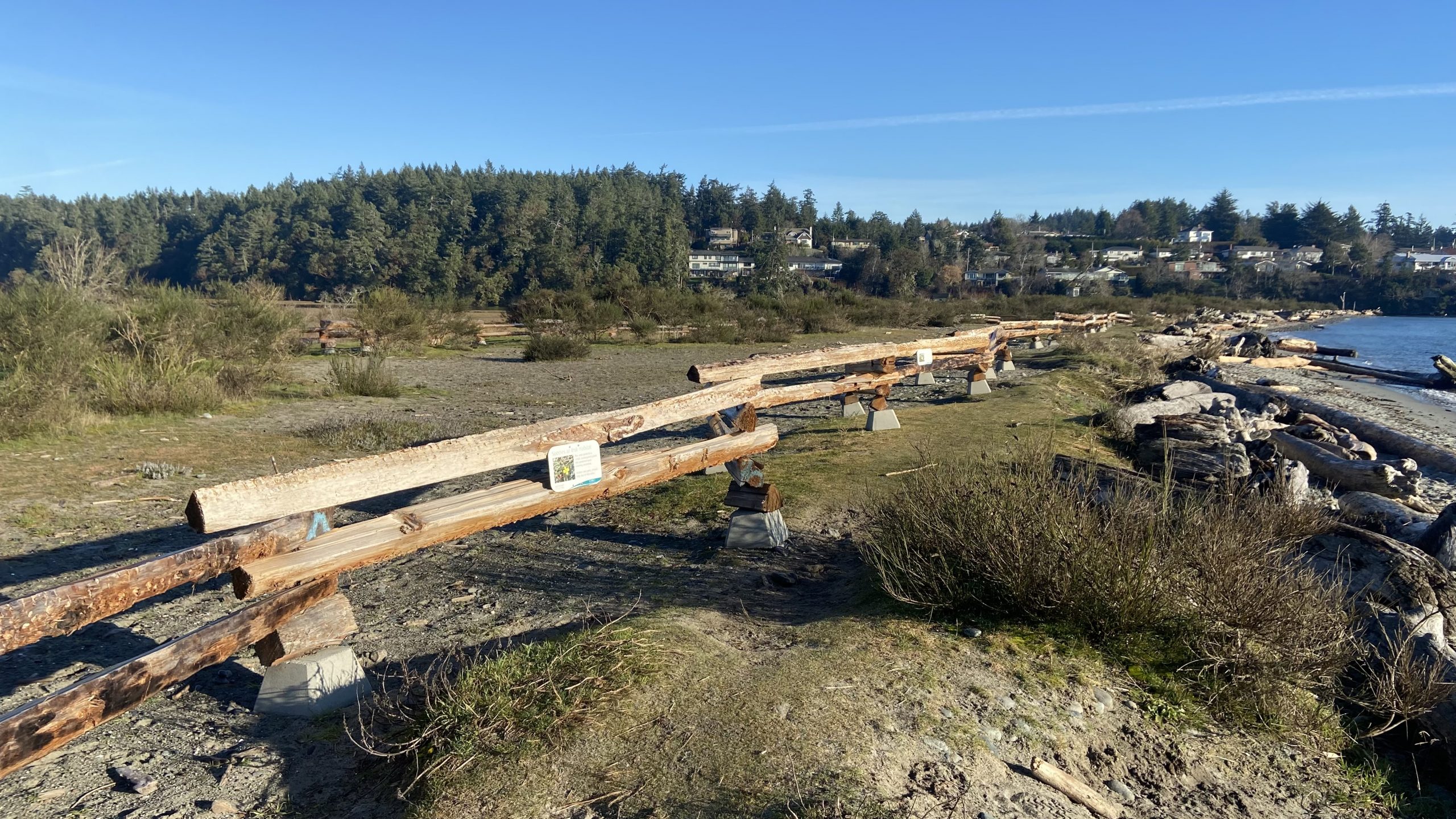
It is important to observe the signage and avoid walking in this area.
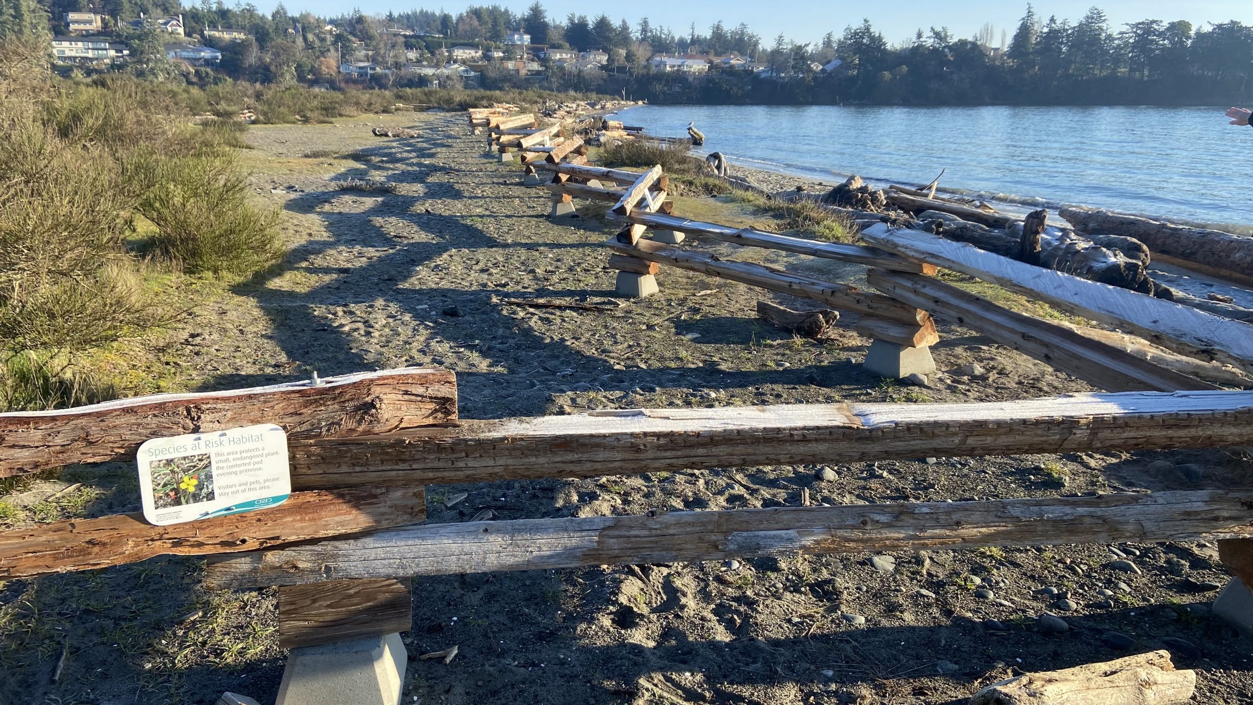
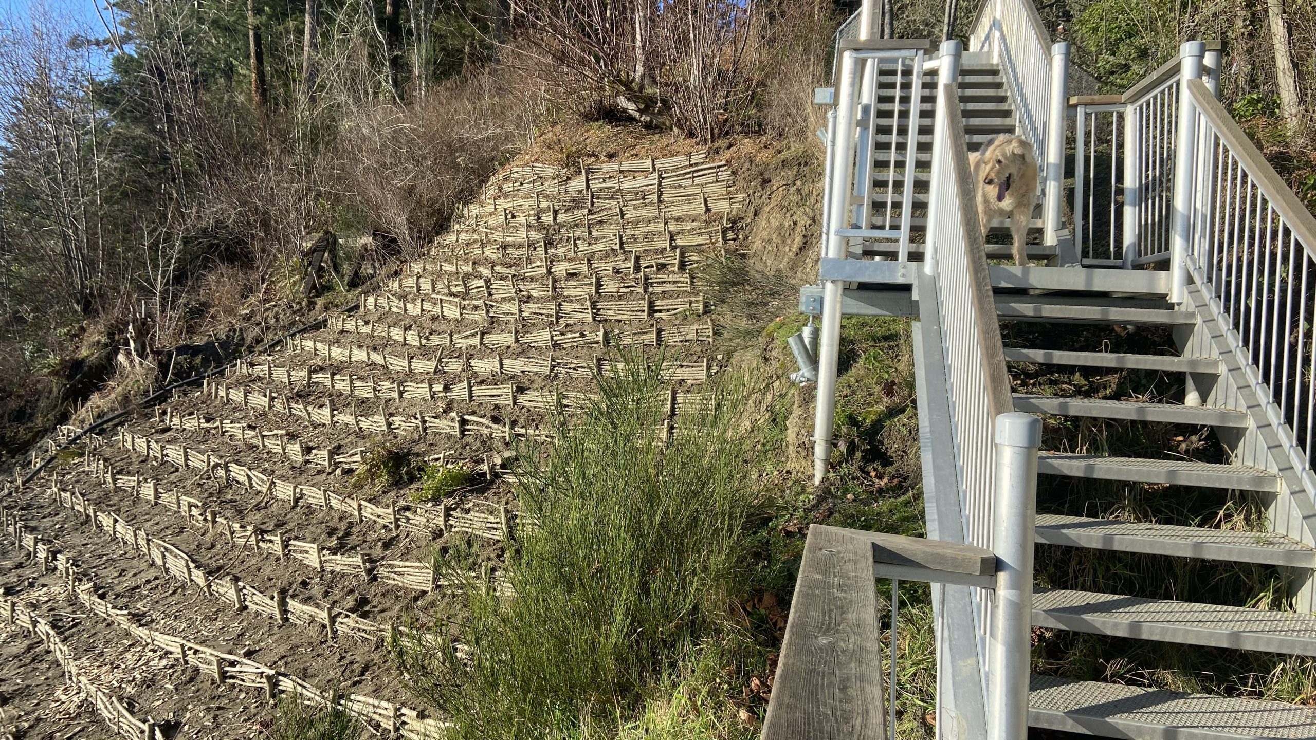
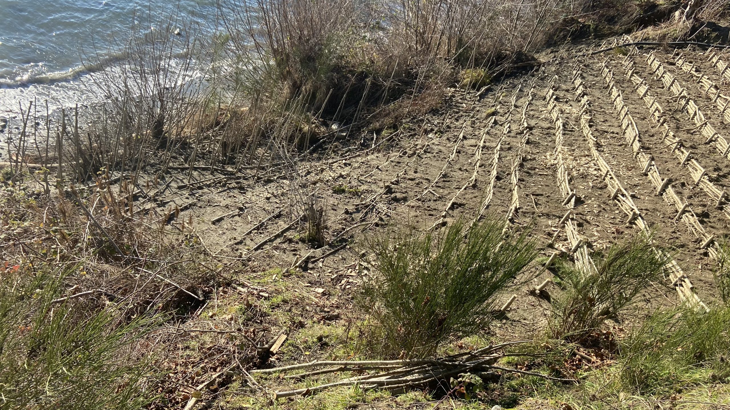
Shoreline Stabilization at Witty’s beach .
In the fall of 2021, a cliff stabilization exercise was carried out along with the re-establishment of the stairway down to Witty’s Beach . Cuttings of willow were planted in the area of the back that had been eroding.
Policy and Planning for Coastal Ecosystems in British Columbia through a Blue Carbon Lens. WCEL
 Subject:
 Climate Adaptation, Blue Carbon, Nature-Based Climate Solutions, Coastal Ecosystems
See the PDF: 2020-11-discussionpaper-bluecarbonpolicy-final
Summary:
Healthy coastal ecosystems are essential for maintaining biodiversity and liveable coastal communities, providing critical habitat, water quality protection, food and medicinal plants for harvesting, lessening of coastal erosion, resilience to climate change, and flood regulation.
Perhaps less well known is that coastal ecosystems also play an important role in long-term carbon storage and sequestration. This paper looks at emerging policy opportunities and needs in Canada, and specifically British Columbia, for “blue carbon” – the carbon stored in vegetated coastal ecosystems – and how protecting blue carbon as a climate action measure aligns with coastal biodiversity protection and resilience more broadly.
Publication Date:
November 18, 2020
Publication Pages:
44
Publication Format:
PDF