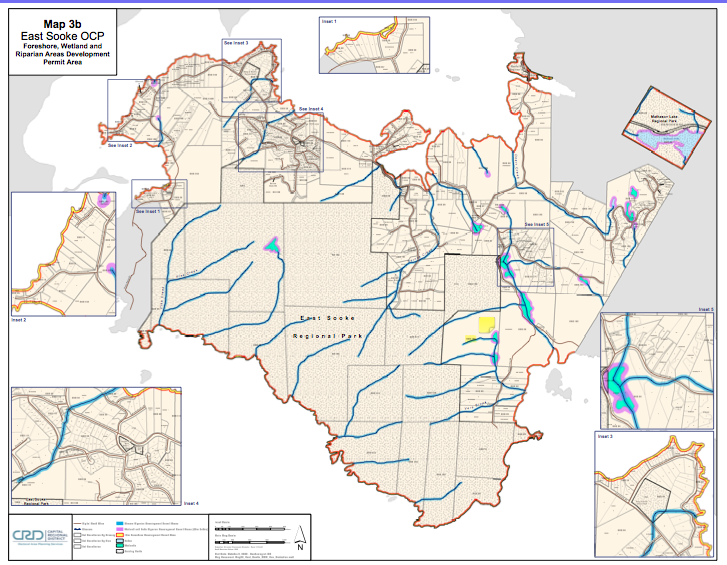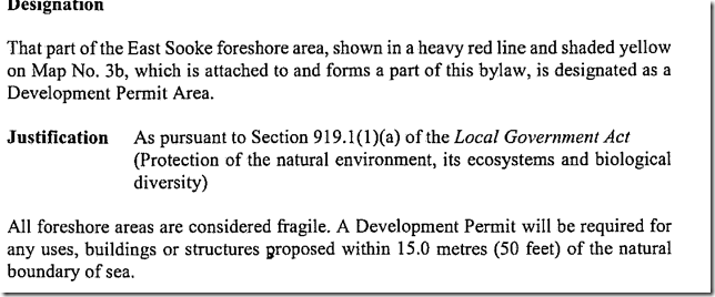
The following CRD Map shows almost the Complete Coastline of our Neighbouring District. This East Sooke Official Community Plan Map 3b on Foreshore , Wetland and Riparian Areas Development Permit Areas shows the DPA designation:
East_Sooke_Land_Use_Map in PDF format.
or click on the map below for link