Rethinking Shoreline Armoring

Given the many occurances of slumping of coastal bluffs in Metchoisn over the past winter, this series provides an excellent analysis reflecting on the effects of human interference in natural shoreline processes and the mitigation efforts being made in Puget Sound.

Rethinking shoreline armoring

Before and after view of shoreline restoration project at Penrose Point State Park in Pierce County, WA.

Salish Sea Currents presents an in-depth series focusing on shoreline armoring in the Puget Sound region. Close to a third of Puget Sound’s shoreline is classified as armored with bulkheads and other structures meant to hold back storm surge and erosion. But new studies reveal the often significant toll this is taking on the environment. To be notified of new Salish Sea Currents stories, subscribe to the Puget Sound Institute eNews.

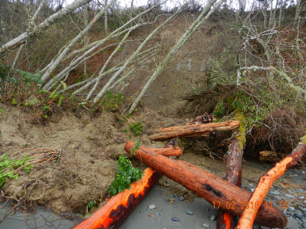
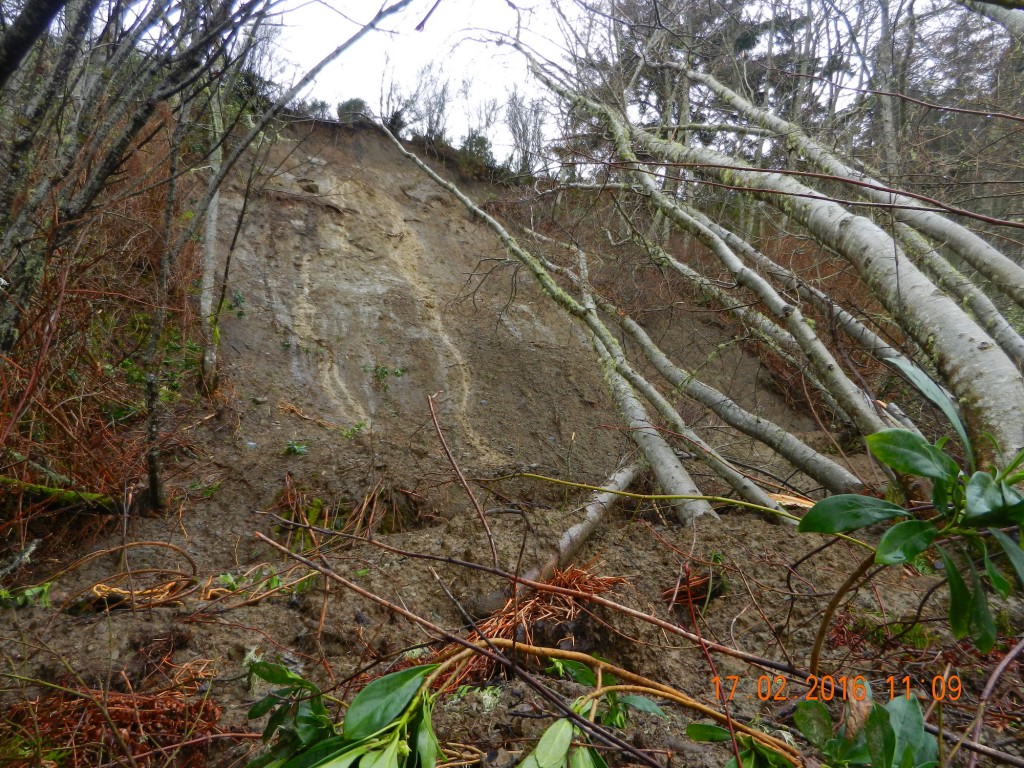
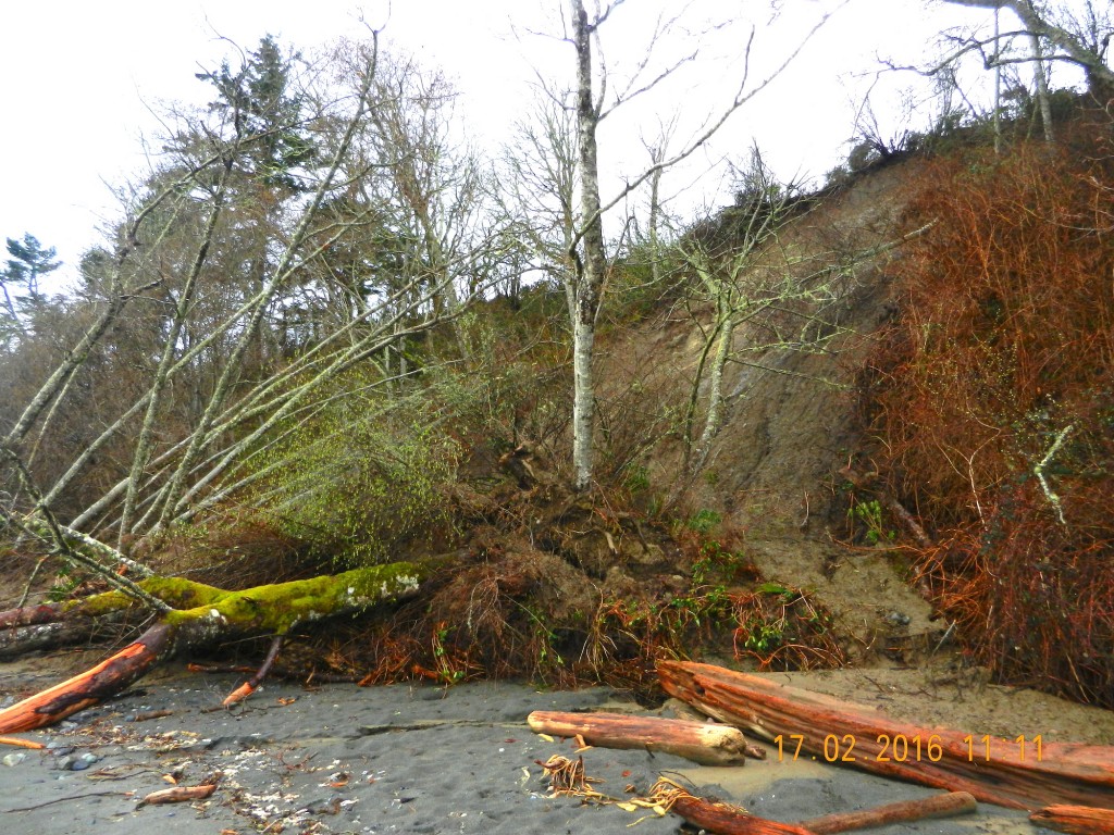
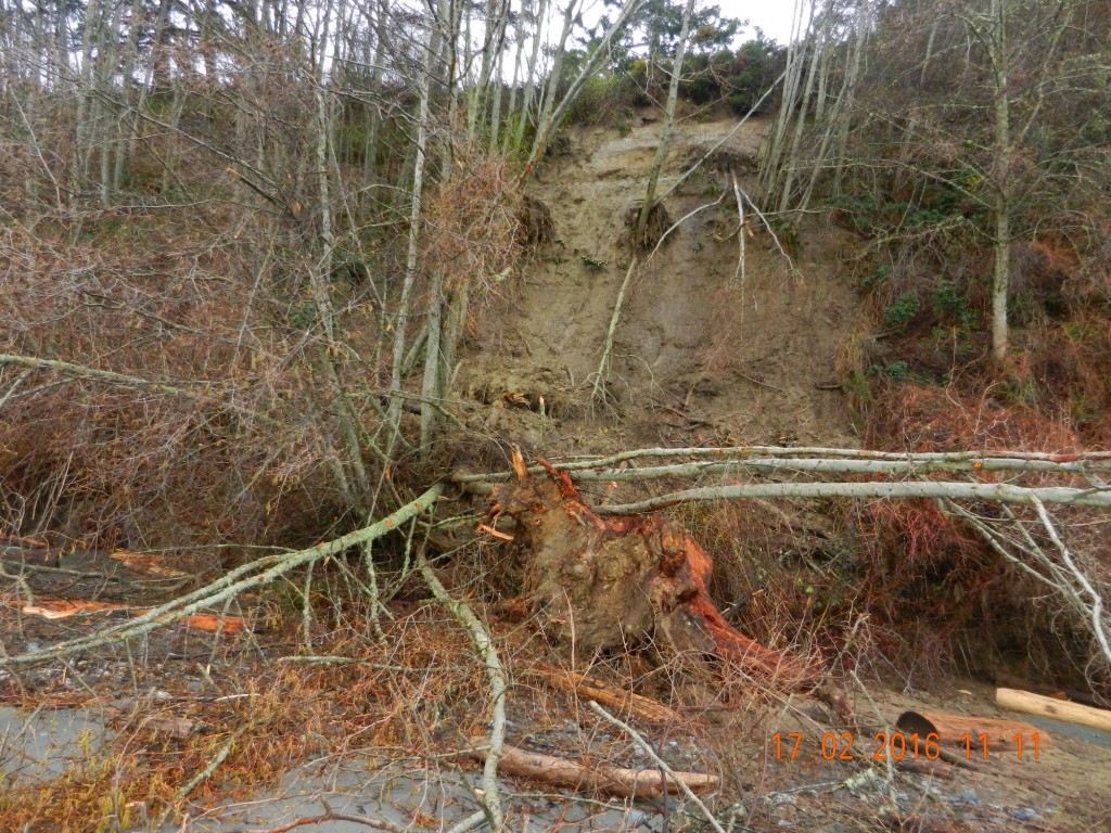
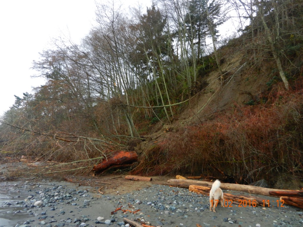
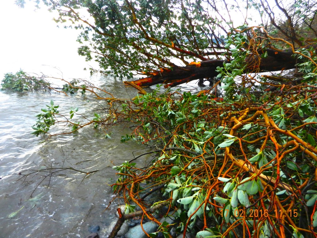
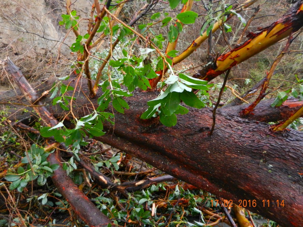
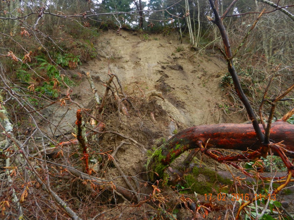
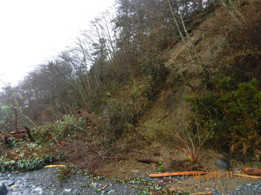
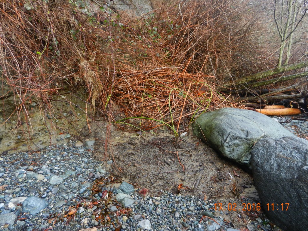
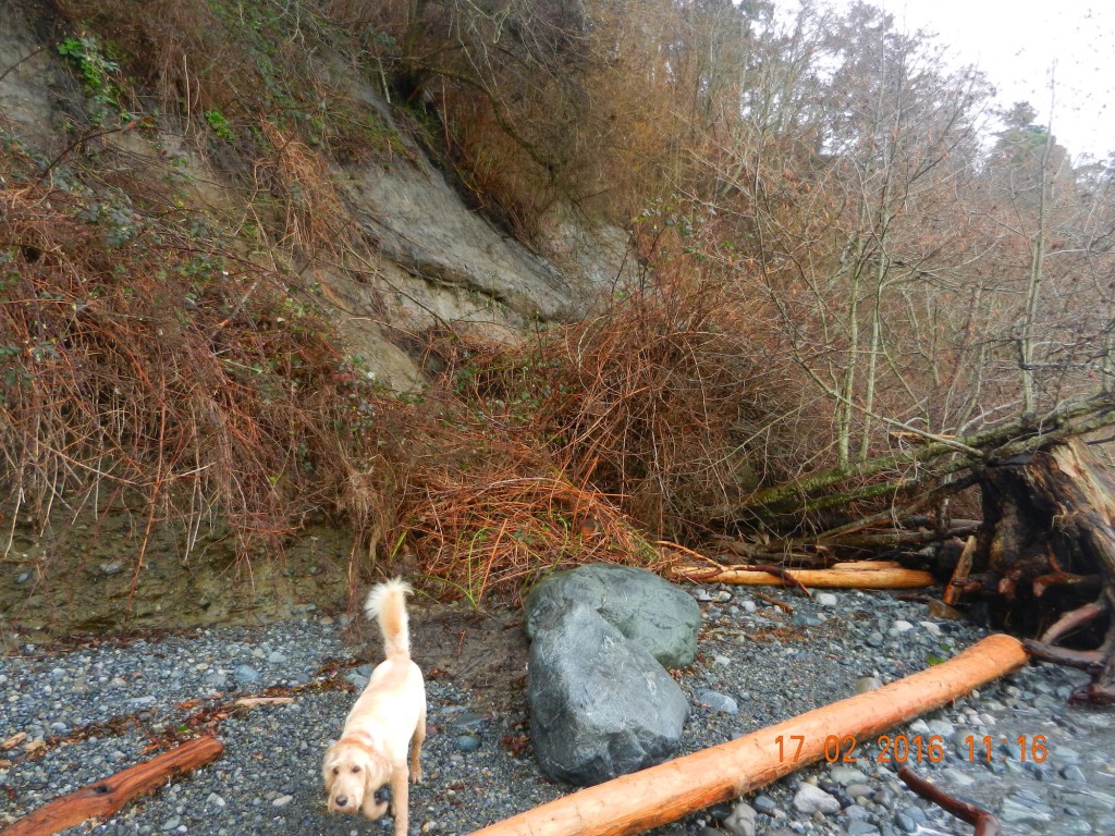
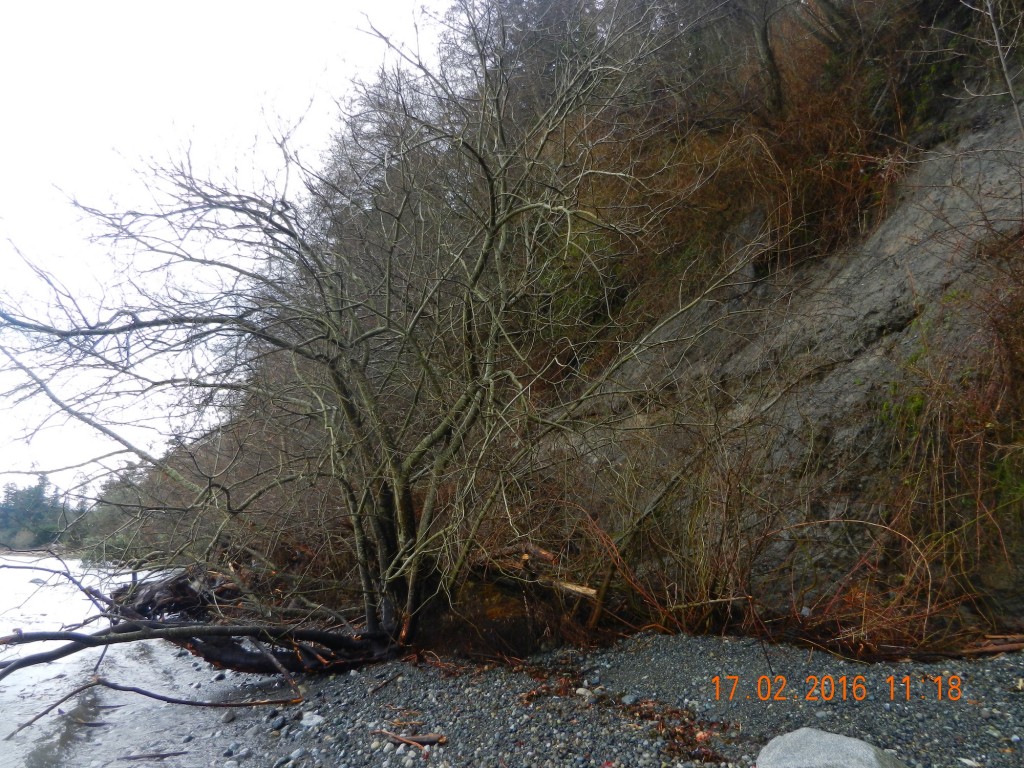
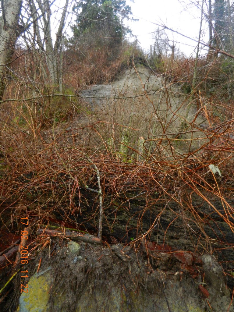
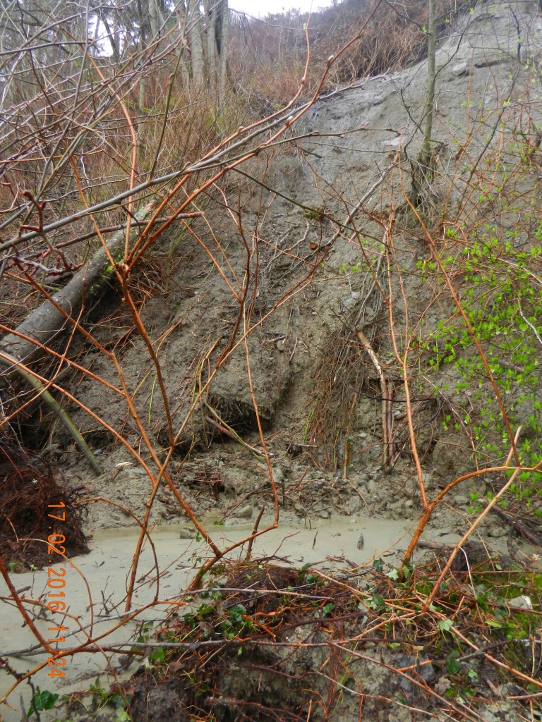
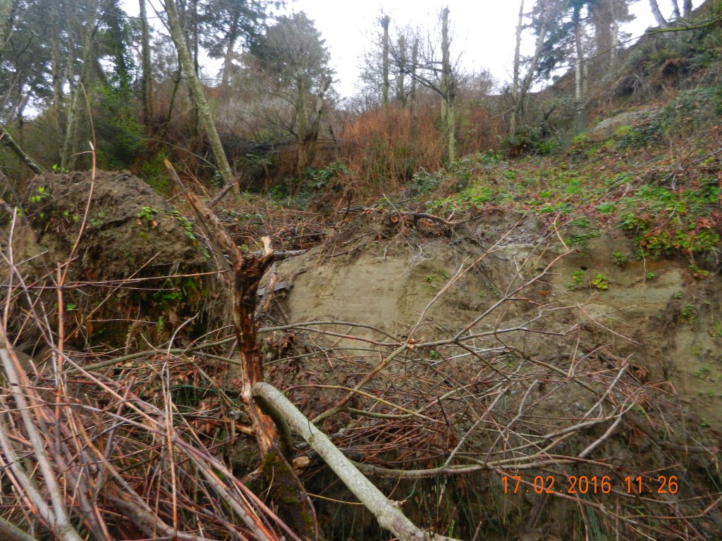
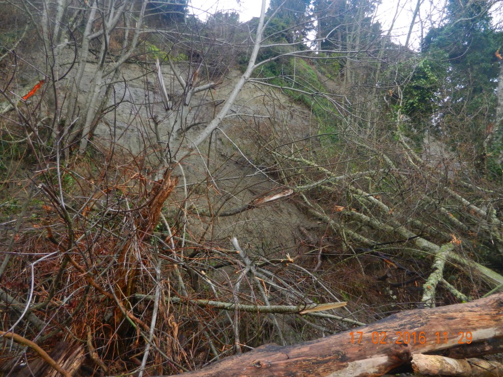
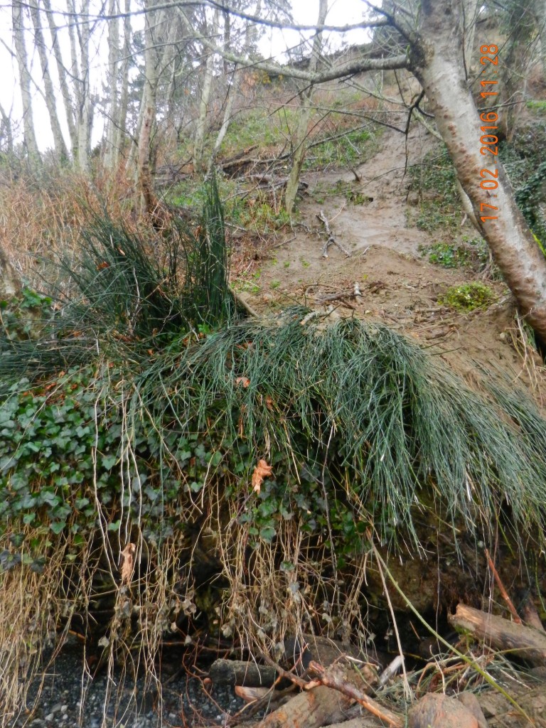
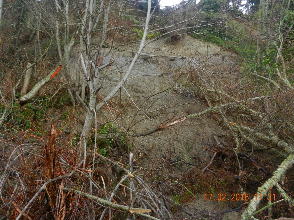
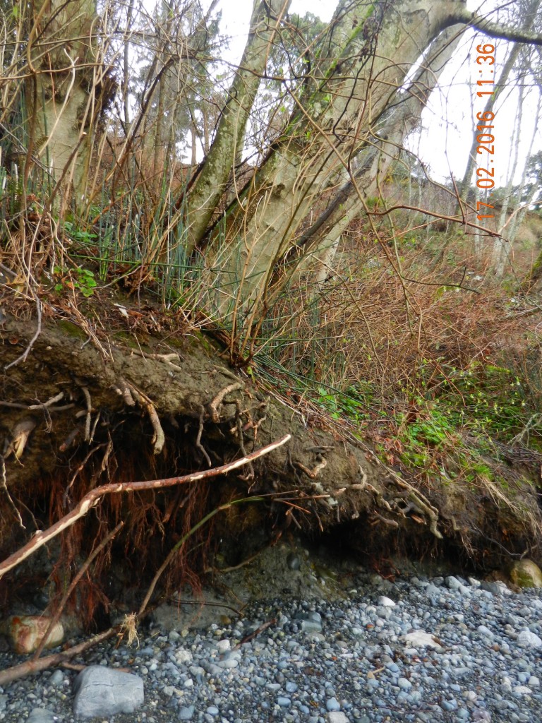
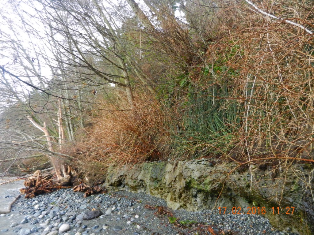
Taylor Beach Land Slides in February 2016

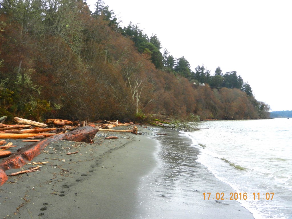
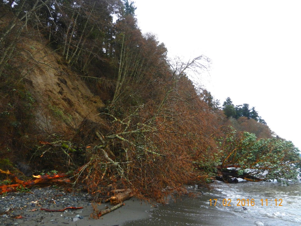
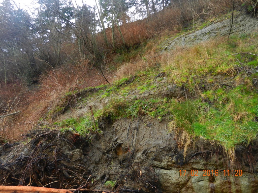
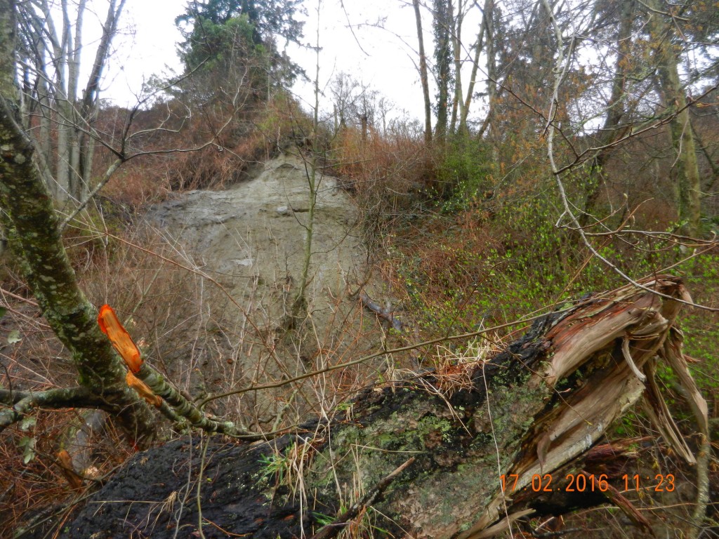
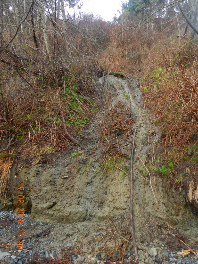
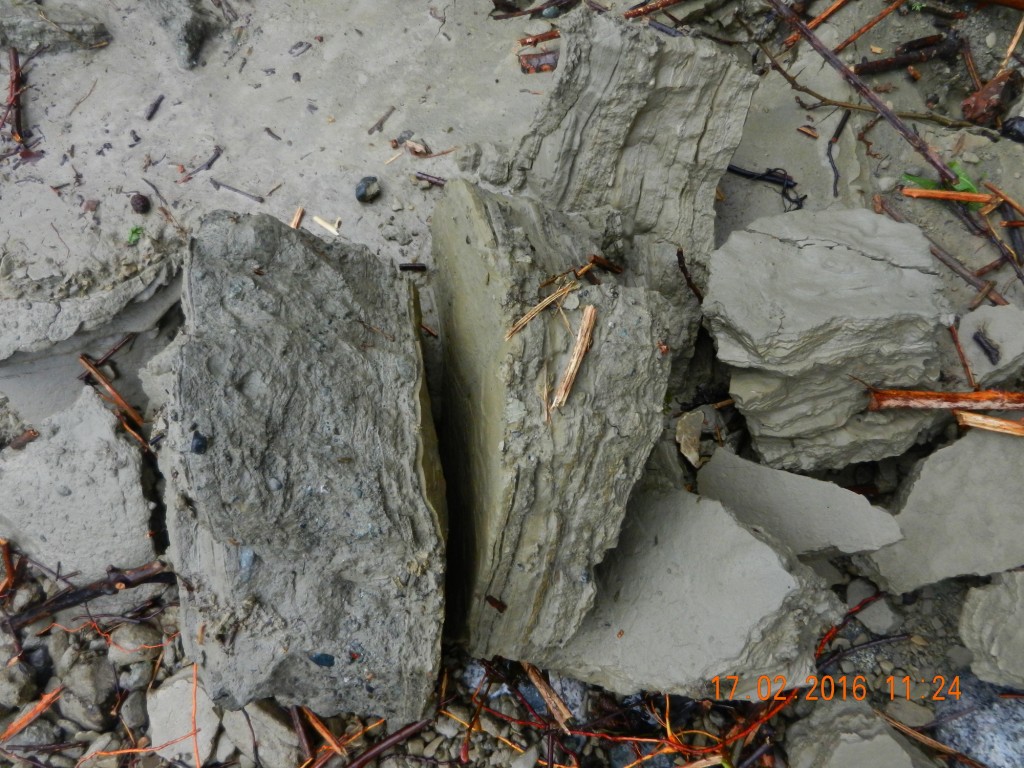
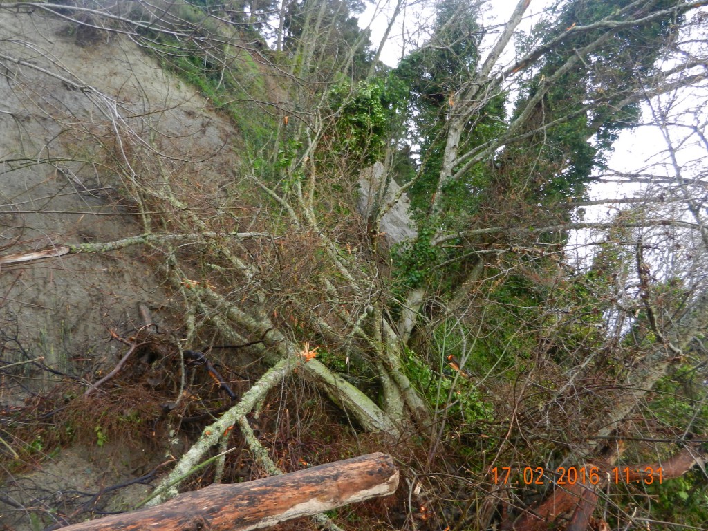
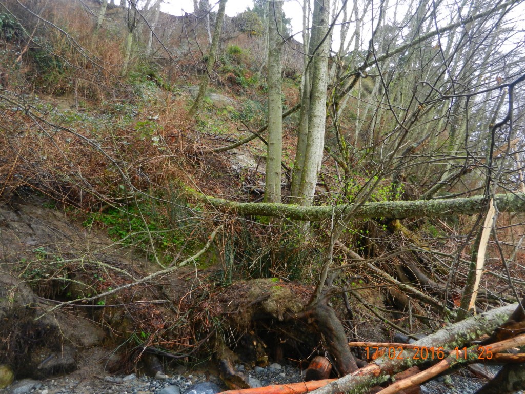
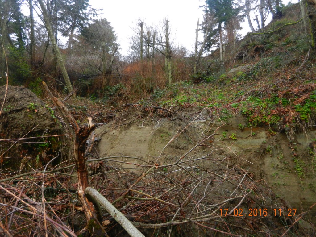
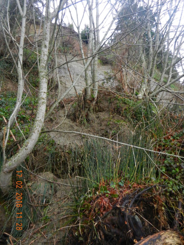
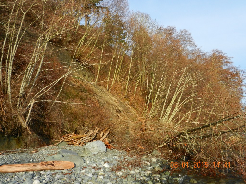
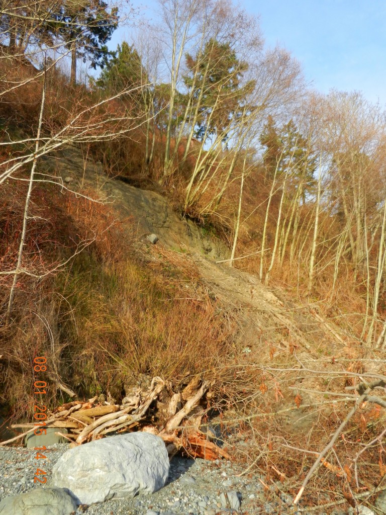
This past week we have had a few days of extra heavy rainfall in Metchosin and  consequently the hazard land slopes of the Development Permit Area along the Taylor Beach bluff have certainly met the designation.  On the South end of the bluffs alone, at least ten new slides have left large gaps on the cliff and have deposited piles of vegetation on the beach. Residents on the top of the bluff are continuously at risk of losing property so development of any new structures or vegetation removal is inadvisable.

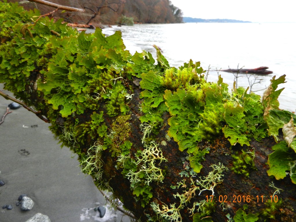
The following pictures were taken starting from the south end of the cliff toward the first corner heading North.


Cliff failure on Taylor Beach

In the last 24 hours, a large slump has occurred on the Taylor Beach cliff. This is located just at the north end of the beach component. The properties along the top of the cliff have for several years experienced various human impacts which have likely contributed to this erosion.

  • Disposal of yard waste over the bank.
  • Removal of trees on properties to create better viewscapes
  • Building too close to an erosional bank feature
  • Topping of trees on the cliff face to improve views
2015-01-08taylorslump

Taylor Beach slump. G. Fletcher photo.

This Cliff is all included in the Hazard lands DPA, and it is also a naturally occurring geological erosional feature which, unfortunately poor enforcement over the years has contributed to this problem.

There remains further evidence of slipping in the separated section showing a grey clay bank along a wider stretch of this bank so we can anticipate more similar events.

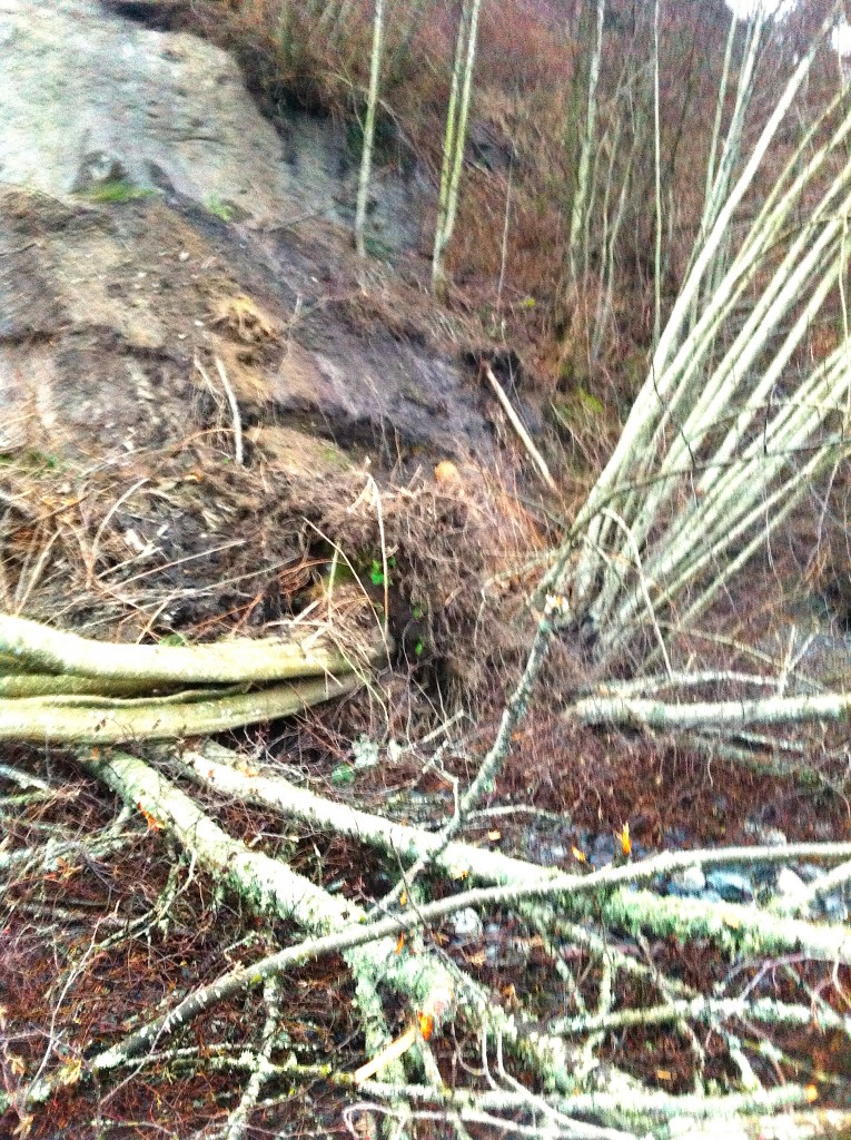
Currently a large deposit of soil, broken mature alders and debris remains on the beach. The next big storm from the East at a high tide will clear this out causing increased sedimentation along the inter and sub-tidal areas off shore.  There us a thriving community of organisms on this shore so an impact on those populations is predicted. .

2015-01-08taylorslump3 copy

Taylor Beach erosion- G. Fletcher photo.

2015-01-07 cliffslide

Taylor Beach erosion with tangle of alders. G. Fletcher photo.


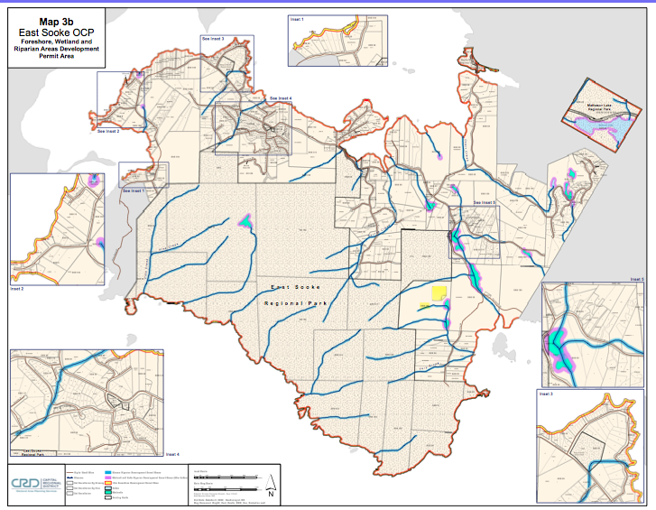
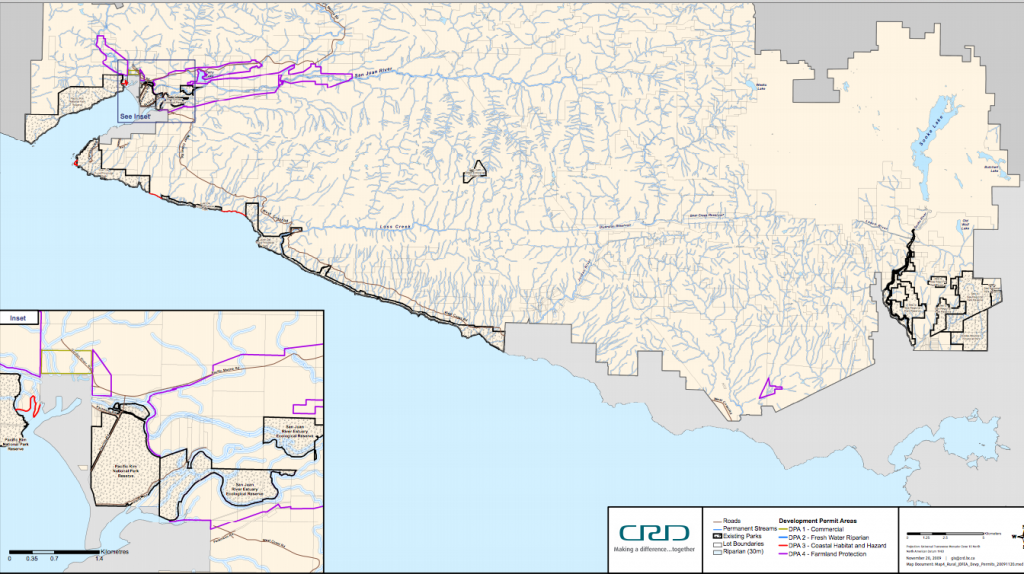
Development Permit Areas Line Most of East Sooke’s Shoreline.

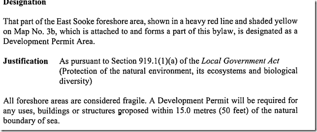
The following CRD Map shows almost the Complete Coastline of our Neighbouring District. This East Sooke Official Community Plan Map 3b  on Foreshore , Wetland and Riparian Areas Development Permit Areas shows the DPA designation:

East_Sooke_Land_Use_Map in PDF format.

or click on the map below for link

eastsookedpa


devpermareas

Preparing for Climate Change: DPAs

From:
PREPARING FOR CLIMATE CHANGE:
Page 35 Development Permit Areas
Creating a DPA is a way to shape the development or redevelopment of a given area, and guidelines for the DPA (in the OCP or in a zoning bylaw) can include both broad prescriptions for land use as well as site specific requirements. Preparing for climate change impacts may mean updating existing DPAs to account for different levels of risk or changes to best practices, or in some cases developing new DPAs. There is already well-established practice in BC with respect to using DPAs to manage land use in areas with defined hazards, such as interface wildfires, or slope stability issues and many examples to draw on. DPAs for wildfire hazards may also include requirements about landscaping and the siting, form, exterior design and finish of buildings. DPAs can also be used to restrict development and protect and/or restore natural features and areas, and can be used to help protect key natural ecosystems in the face of climate change.
DPAs can offer local governments a more flexible approach to regulating development than zoning because guidelines can specify results and allow site-specific solutions. For example, a DPA can specify a certain level of onsite stormwater infiltration, while a zoning bylaw could only specify the site coverage allowed.
The Local Government (Green Communities) Statutes Amendment Act (2008) created the opportunity for new types of DPAs, including those designed to promote energy and water conservation. Local governments can employ these DPAs to help make their communities more resilient to climate change impacts like water shortages and potential disruptions in centralized energy supply due to heavy seasonal demand or extreme weather events. Like
DPAs for wildfire hazards, they may also include requirements about landscaping and the siting, form, exterior design and finish of buildings to further energy and water conservation and greenhouse gas reduction goals. For more information see
DPAs can offer local governments a more flexible approach to regulating development than zoning because guidelines can specify results and allow site- specific solutions.

An Implementation Guide for Local Governments in British Columbia DPAs for energy and water conservation may also establish restrictions on the type and placement of trees and other vegetation in proximity to the buildings and other structures in order to provide for the conservation of energy, which can be considered in the context of reducing the heat island effect in urban areas. DPAs can be used together with complementary measures such as servicing requirements, development cost charges and other local government tools to achieve climate change adaptation objectives


DEVELOPMENT PERMIT AREAS: Local Government Act, ss. 919.1-920
In an OCP a local government may designate areas within its jurisdiction where development permits are required before any subdivision, rezoning, construction or (in some cases) any disturbance of the land may occur, the reason the development permit is required, along with guidelines outlining the requirements for obtaining a development permit (which may be in the OCP or a zoning bylaw). The range of purposes that may be relied on for creating development permit areas is quite broad. Those of most interest with respect to climate change adaptation measures are likely protection of the natural environment, protection of the community from hazardous conditions, and establishing objectives to promote conservation of water and energy

District of Metchosin Official Community Plan Section on Shoreline Slopes Development Permit Areas

From the Official Community Plan : Available at this link
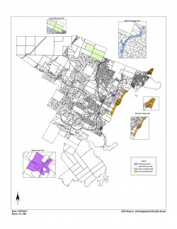
Map6_Development_Permit_Areas

DPAs in Metchosin ( click to enlarge)

2.16    SHORELAND SLOPES DEVELOPMENT PERMIT AREAS:
The Municipal Act
provides that a community plan may designate development areas to be protected from hazardous conditions. The Municipal Act further provides that in such areas land shall not be altered in any way or subdivided and structures not be built or added to until a Development Permit has been  issued. Council has established the following designation, special conditions, and guidelines.

2.16.1    Designation:  (Bylaw 418, 2004)
The 1993 Hazard Land Management Plan has identified areas of the Metchosin shoreland slopes as having erosion, land sloughing and drainage problems.
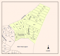
AlbertHead portion of DPAs

Farhill Road portion of DPAs,

southsectionDPA

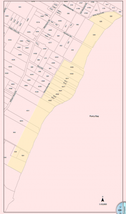
Parry Bay ( Taylor Beach ) section of DPA lands

The Shoreland Slopes areas are shown on Map 6 Shoreline Slopes DPA, and are hereby designated as areas for the protection of development from hazardous conditions pursuant to Section 919.1(1)(b) of the Local Government Act.
The Plan has identified three Shoreland Slope classification zones, based on the degree of slope instability and surface erosion potential. Slopes classified as zone 2 and 3 are slopes with the greatest potential for sloughing, slumping and debris flows and have been included in the Development Permit Area.
2.16.2    Special Conditions:
The major concern is that lands, particularly in the Park Drive – Farhill Road area, have experienced a  dramatic rise in ground water levels due to adjacent developments during the last two decades. Other areas of the Shoreland slopes have experienced significant slope erosion in the past. There is a community desire to mitigate any further development related impacts on the marine shorelands.

2.16.3    Policies Development Permits issued shall be in accordance with the following:
(1)    The construction or alteration of buildings on existing lots shall be permitted subject to the Building  Permit process when Council is satisfied that the Development Permit Guidelines (Section 2.14.4) have been met, and, when required, Council is satisfied with the Engineer’s Report (Section 2.14.5).
(2)Where a Development Permit is applied for in conjunction with an application for subdivision approval, rezoning, or both, the Development Permit shall be conditional on the successful completion of those other permits and shall lapse if the subdivision or rezoning is not approved.

2.16.4    Guidelines:
(1)    All applications for new development in the Development Permit Areas shall be required to have an Engineer’s Report (described below).
(2) Removal of vegetation shall be minimized.
(3) House construction, regrading, and excavation of till (including for road building) is not permitted within 60 metres of the edge of the slope except where geotechnical engineering and resource management studies indicate that a lesser setback is acceptable.
page 31

2.16.5    Engineer’s Report:
Before a development permit is issued, the applicant shall be required to furnish a report at his\her expense from a registered professional engineer with geotechnical experience which will certify that the proposed development will produce no adverse impacts on the shoreland slopes and will not place buildings or structures in danger of slope slippage.

The Engineer’s Report shall demonstrate that consideration has been given to the following:
(1)(a) siting and setbacks of development structures, roads, and services,
(b) minimizing paving and impervious materials, and,
(c) implementing infiltration techniques so as to limit runoff;
(2) designing runoff detention ponds, drainage works, or
sediment traps or basins to reduce the flow of  runoff and silt during land clearing and construction.
(3) development near shoreland slopes must address the impact of surface water on slope stability, vegetation and soils, and make recommendations to remedy that already damaged; and
(4) removal of trees (with a valid tree-cutting permit) or other vegetation should be allowed only where  necessary and where alternate vegetation and/or erosion control measures are established. If possible,  stumps should be left in place to provide some soil stabilizing influence until alternative vegetation is  established. Plans delineating extent of vegetation/tree removal (location, species and diameter of trees) and location of proposed construction, ex cavation and/or blasting, may be required.

The DISTRICT, at its discretion, may also submit the Engineer’s Report to review by a second Engineer at the applicant’s expense, and/or directly to the Ministry of Environment for their comments.

2.16.6    Municipal Response, 
The DISTRICT should:
(1) evaluate the feasibility of purchasing environmentally sensitive shorelands for use as park, forest reserve, or greenbelt;
(2) initiate programs to monitor both surface and ground water to establish patterns of change;
(3)work with proximate agencies to establish erosion and land sloughing control measures.

Development Permit Areas in Neighbouring Juan de Fuca Electoral District

DPAshorelineDPA 3= Coastal Habitat and Hazard Section Click on image to see enlargement.. red zone.

4.4.5 of the OCP lays out details of DPAs for all Foreshore and Marine Areas .

Section 4.4.6 of the OCP details DPAs for watercourses,wetlands and riparian areas.
See the complete document here:

CRD on Development Permits: