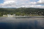
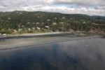
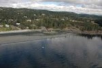
This gallery starts on Albert Head and ends in Beecher Bay.
The aerial images were provided by GeoBC.
- Beecher Bay Marina
- Arden Island
- Log boom
- Near Border of Beecher Bay Reserve
- John Parker Islands
- Village Islands
- Village Islands with Frazer Isl. behind
- Village Islands
- Frazer Island
- Frazer Island in Beecher Bay
- Argyle Islet
- Bedford Islands
- Tombolo of Bedford Island
- Bedford island
- West Bedford
- West Bedford Island
- Church Island into Beecher Bay
- Church Island with Swordfish Isl. in background
- Swordfish island
- Swordfish Island
- Coastline west of Shelter Island
- Shelter Island and Bay
- Shelter Island
- Christopher Point
- Entering the Bay inside of Christopher Point.
- The cleared field is part of the DND facility.
- Eemdyck Pass from the South end, View north through Eemdyk Pass. At low tide you can almost walk across this passage. Moon snail egg cases are found on the sandy bottom.
- Race Rocks Archipelago
- Looking West down the Strait of Juan de Fuca with Bentinck Island to the lower right
- This is Pilot Bay on the south east side of Bentinck Island. The shipwreck “The Barnard Castle” lies in this bay.
- View looking to the north with Pedder Bay in the upper right distance.
- The east lobe of Bentinck Island, viewed from the East.
- Bentinck Island, three lobes and the three bays. view looking south west.
- Bentinck Island with Rocky Point DND facility . Eemdyck Channel–
- Bentinck Island on the left with Eemdyk pass separating the island and Rocky Point
- Rocky Point
- Cape Calver at Pedder Bay entrance
- Navy Jetty in Pedder bay
- South side of Pedder Bay
- William Head into Pedder Bay
- William Head
- William Head Quaranteen Bay
- Isthmus to William Head
- Shoreline at South end of Weir’s beach
- Weir’s Beach
- Pocket beach south of Taylor Road
- Shore of Devonian Park
- Sherwood Pond
- Beach at end of Taylor Road
- Sand Beach of Parry Bay
- Cliffs of Parry Bay
- Coastline south of Witty’s
- Witty’s lagoon spit
- Witty’s lagoon
- Tower Pioint looking to Witty’s lagoon
- Bay north of Tower Point
- South side Albert Head
- Albert Head
- Albert Head Lagoon
- Sea walls on Albert Head Beach
- Beach north of Albert Head


