The Unique Value of our Coastal Ecosystems
The Coastal Resources of Metchosin are a valuable form of Natural Capital that must have special consideration when Development Planning is done in the District. The Crown owns the foreshore to the high tide mark, and although one would think this allowed protection, there are still considerable threats to the ecological integrity of this area, which must be considered. The shoreline is an interface between two systems, the terrestrial uplands and the open ocean. As typical of any natural system, one cannot separate them in terms of management decisions, as they have processes, which interact. Community members of a progressive coastal community should tolerate no activities involving human action that contribute to any level of destabilization or decline of our present shoreline ecosystems.
Along our shorelines in Metchosin, we have a variety of unique marine ecosystems.
- Tidal marshes,
- lagoons,
- estuaries,
- bays,
- eel-grass beds,
- high speed current channels,
- underwater caves,
- vertical underwater cliffs,
- boulder beaches,
- sand beaches,
- and pebble (pocket) beaches.
Every metre of coastal intertidal zone also has a characteristic set of organisms, which can be impacted by actions of humans either from the land side or the ocean side. Larger commercial species of fish often feed or spawn near the shoreline interface, juvenile fish migrate along shorelines, often relying on protective habitat of overhanging vegetation or kelp beds, and the energy flow in the food webs of at least 7 local marine mammal species are directly affected.
It is further recognized that a viable commercial crab fishery, as well as an extensive sports fishery operates along the coastal areas of Metchosin.
 The ocean environment in the area of Race Passage has also been recognized as an important habitat for the regeneration of Rockfish stock leading to the creation of a DFO rockfish conservation areas where all fishing is prohibited.
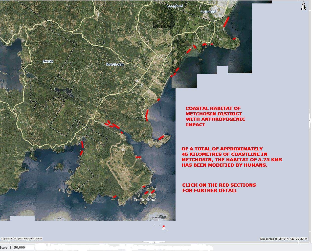
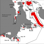
 This file and map of the the Metchosin Shoreline shows the major areas where humans have modified the habitat, often resulting in ecosystem modification and loss of habitat for local species of fish, invertebrates and marine mammals. The term Anthropogenic refers to human modification.
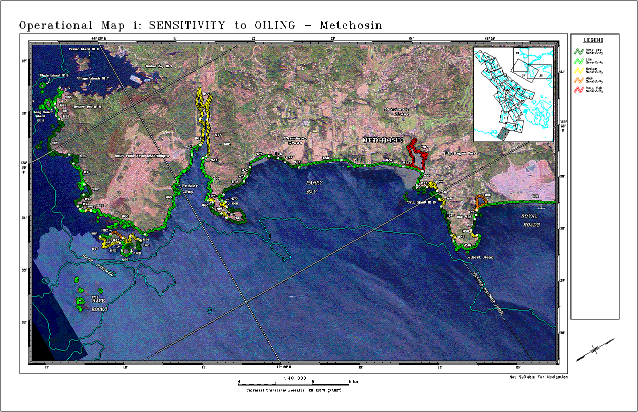
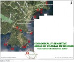 This file contains a map with the ecologically sensitive areas of Metchosin’s Coastal Ecosystems.
Terrestrial Threats:
- Erosion from road building, utility and sewer installation, subdivision development carrying silt into the receiving waters has a negative impact on filter feeders (e.g. Clams, mussels and anemone) in the ocean.
- Crushed rock deposited in upland areas in road building and building lot creation may have serious toxic impacts on marine life as water leaches through it carrying dissolved metallic ions to the sea.
- Accidental or planned deposition of hazardous materials in soils can also lead to leaching to the marine waters.
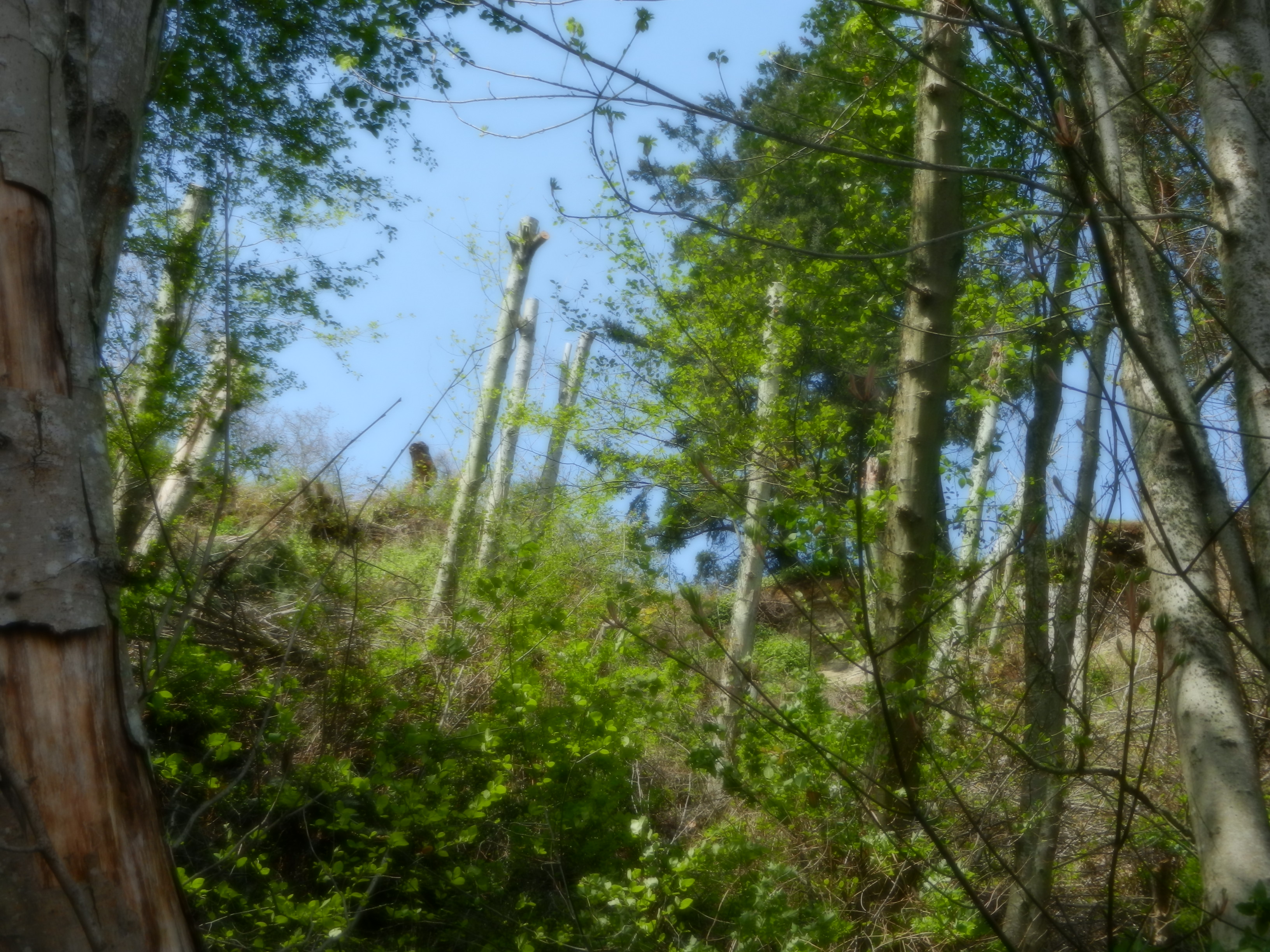
- Deforestation on upland slopes leads to deterioration of coastal ecosystems.
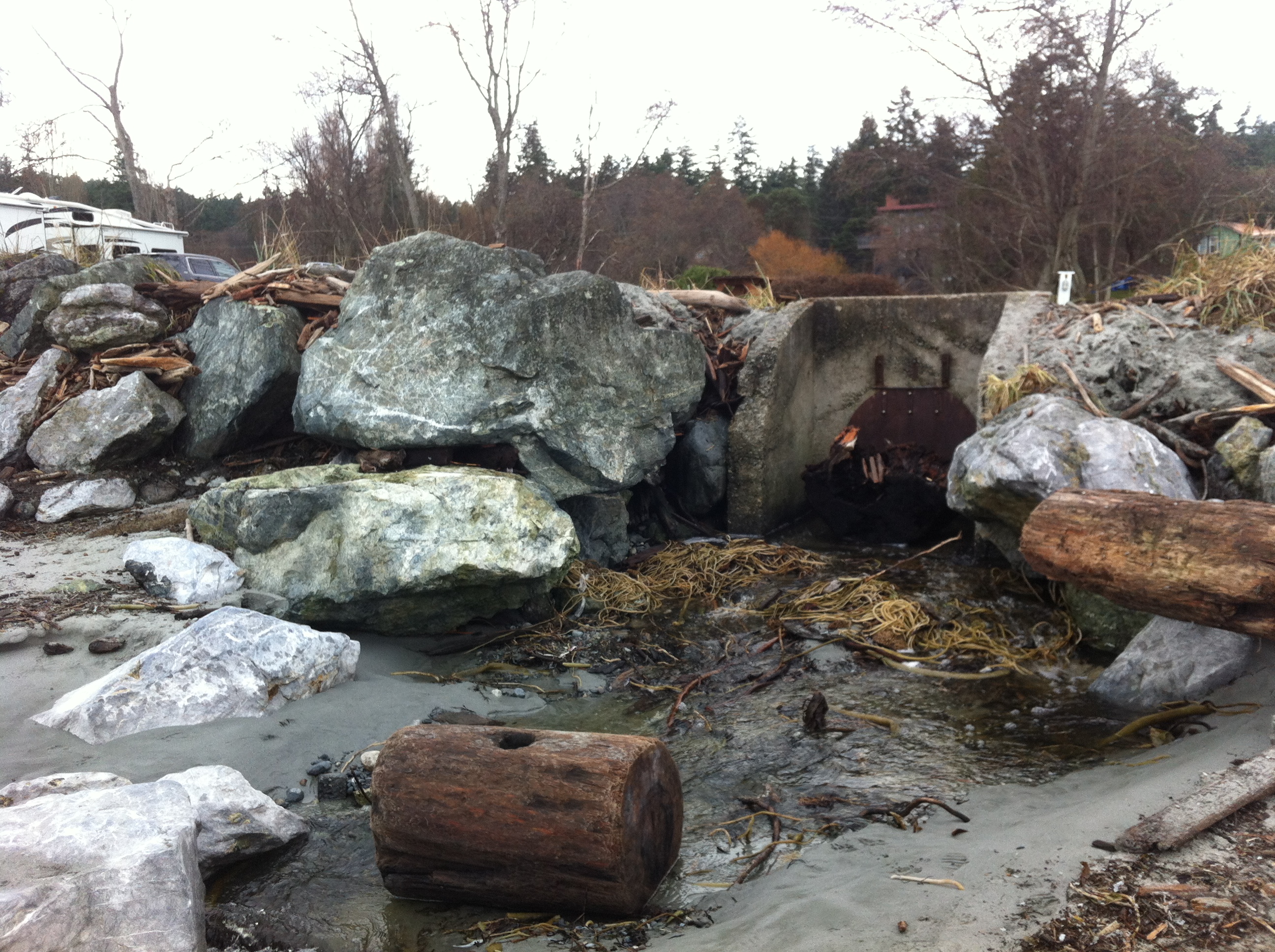
- Channelization of streams leads to silt output and increased fresh water flow to ocean environments.
- Human traffic, (especially horses) on beaches can severely impact on spawning areas of needle fish (on Taylor beach)
- Uncontrolled dogs can have a serious impact on feeding patterns of shorebirds- especially crucial during migration.
- Humans and dogs on beaches can impact on molting elephant seals.
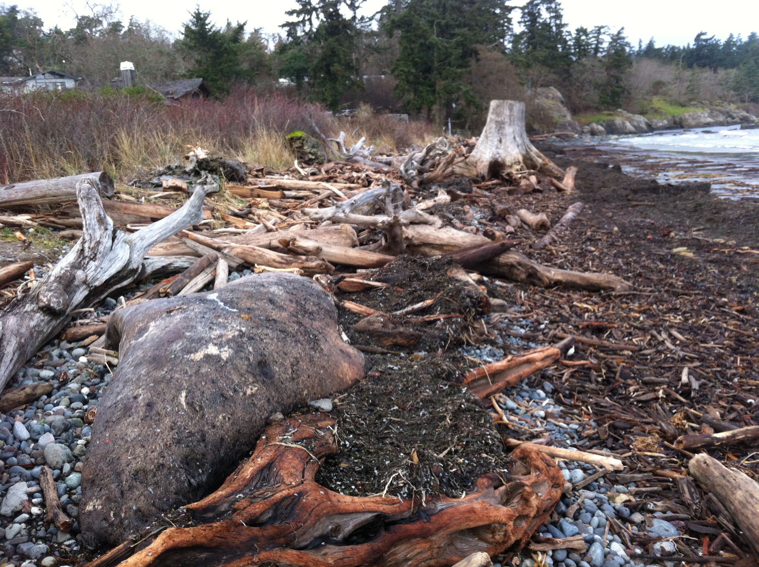
- Beach debris can be washed seaward, to be ingested by marine animals.
- Oil and chemicals from storm sewer drains is toxic to marine creatures.
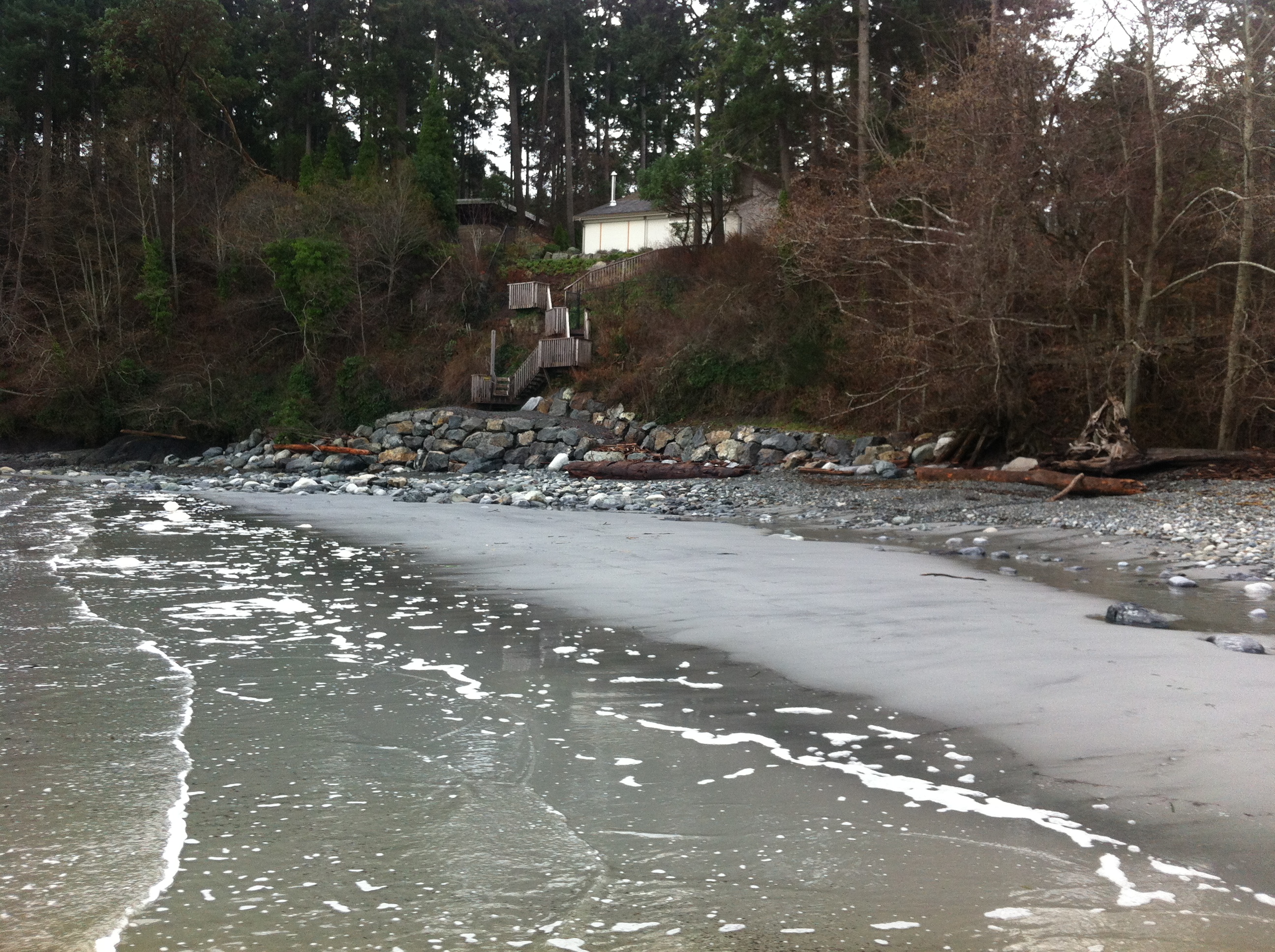
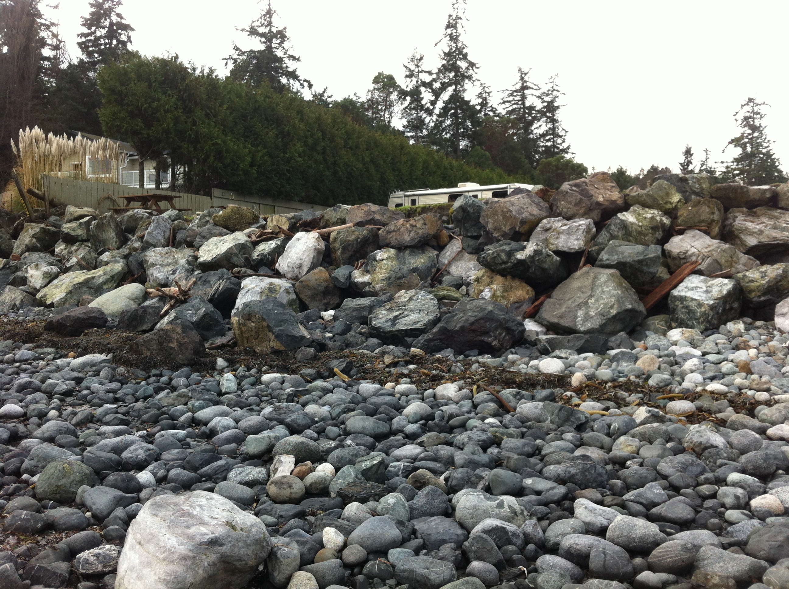
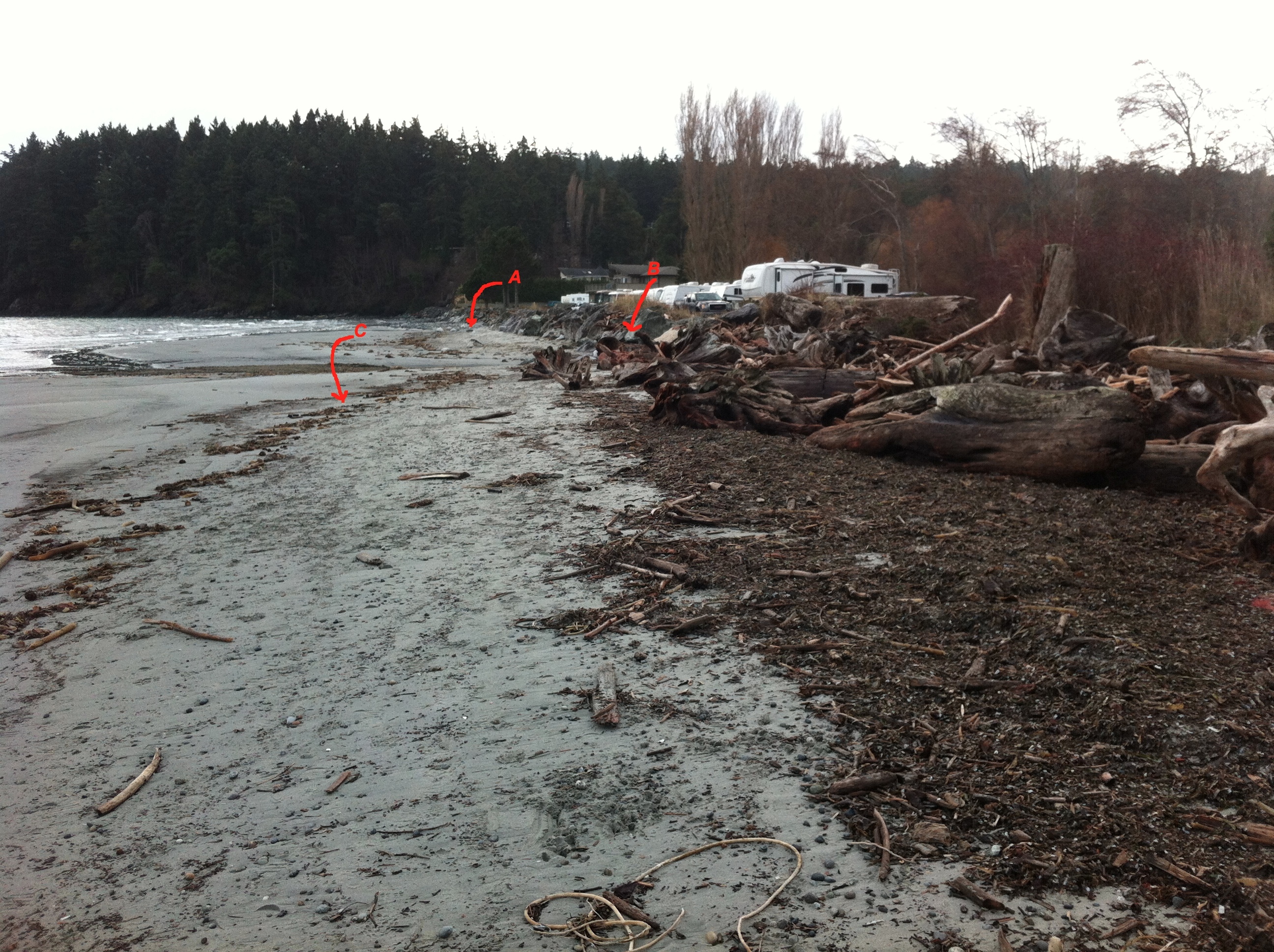
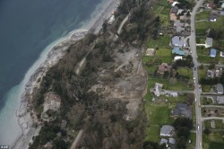
- Building too close to cliffs can lead to destabilization and therefore slumping of land into the ocean. This is especially of concern along the cliffs of Parry Bay and Albert Head.
- Sewage disposal on land in septic fields, contributes a large nutrient load as it leaches through to the shoreline. The heavy die-off of algal growth on Weir?s beach annually, is evidence of this.
- Development on the coastline as has recently occurred South of Devonian Park can lead to alteration of the coastal resource, habitat smothering and destruction, and increases shoreline erosion risk.
- Backshore alteration of any beach habitat for intended purposes of bank stabilization, inevitably in the long run leads to shorefront habitat deterioration.
Marine Threats:
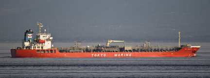
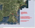
Tanker traffic very close to our shores, poses a continual risk of oil and chemical spills. In the areas shown in the map, red indicates highly sensitive and a long term residency of oil. Yellow indicates a lesser residence time of oil. Green indicates a faster cleanup may be possible because of exposure to waves and currents. See this reference on Threats from tanker traffic
- Increase in cruise lines in recent years has a potential to impact our coastal resources.
- Increasing fast boat traffic is hazardous to harbour seal pups and slow moving marine mammals (such as elephant seals) in particular. It also increases rates of coastal erosion in sheltered bays.
- Boat motor sound underwater affects animals relying on the underwater seascape for communication.
 Whale watching boating patterns have an impact on the time whales can spend foraging in the area.
- Antifouling compounds on ships (some military) and in boats in marinas provide a further risk to the marine environment
Return to MetchosinCoastal
Originally published by G.Fletcher in 2004.