EXISTING SHORELINE CONDITIONS STUDY EAO Condition 39

The full pdf of this report is contained in this pdf:
BC EAO Condition 39 Exisitng Shoreline Conditions Report – May 2023 – for engagement

The purpose of this posting is to reference the part of the report referring to Metchosin’s coastline  and to provide comment on it.

===========================================================

From page 4 of the REPORT:
1 Introduction
As defined by the amendment to Trans Mountain’s BC Environmental Assessment Certificate (EAC) issued by the Province of British Columbia (the Province) on February 24, 2022, Trans Mountain must prepare an Existing Shorelines Condition Report and submit to the Province within 18 months (August 2023) as Condition No. 39.

Polaris Applied Sciences was retained to prepare a report containing shoreline baseline data for shoreline areas closest to spill scenario locations modeled along the marine shipping route and submitted in the Project application. The Province listed the specific scenario locations for the purpose of this study (Figure 1) as:

  • English Bay (Location B)
  • Roberts Bank (Location C)
  • Strait of Georgia (Location D)
  • Arachne Reef (Location E)
  • Strait of Juan de Fuca (south of Race Rocks) (Location G); and
  • Buoy J (Location H)


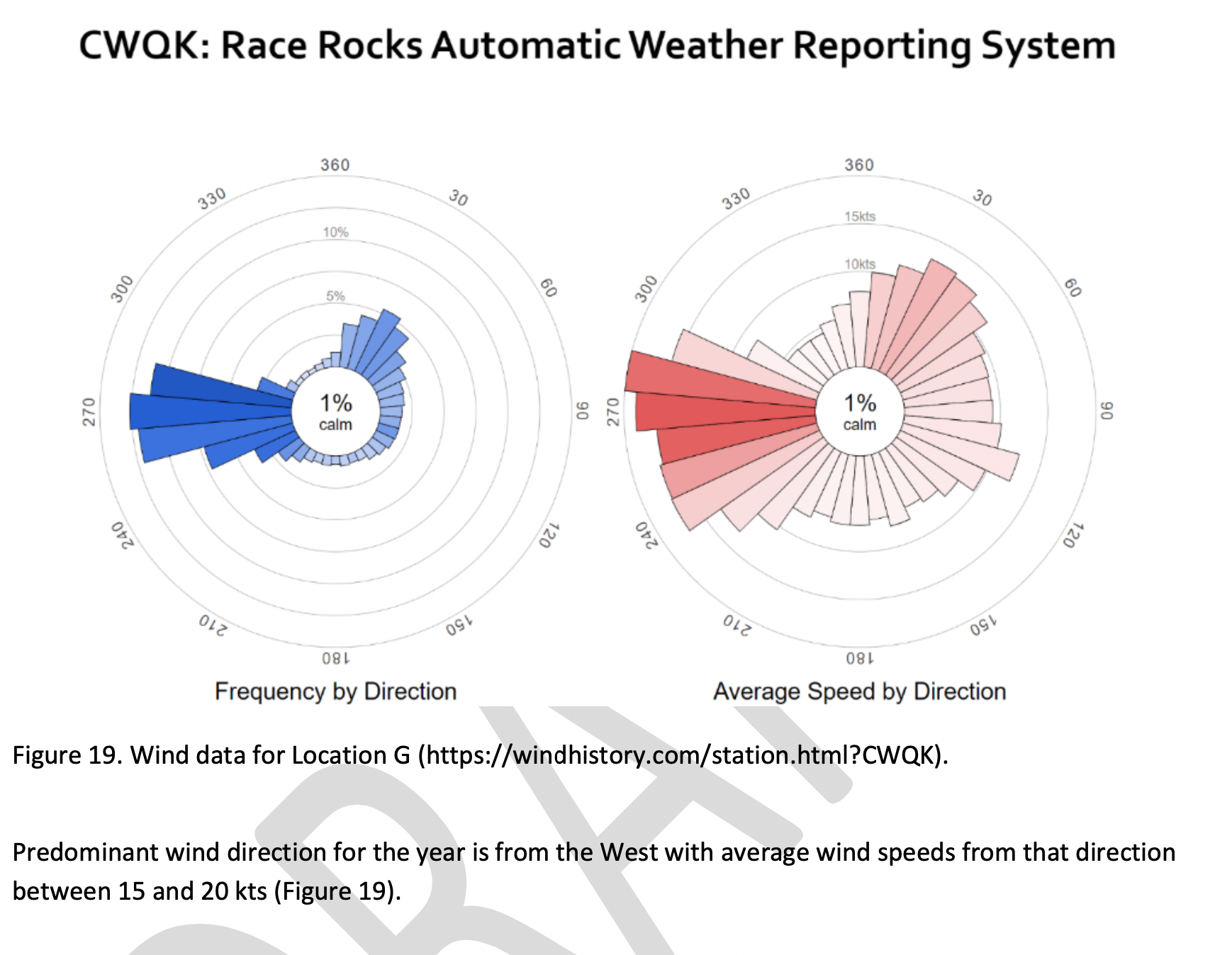
Page 25
Strait of Juan de Fuca (south of Race Rocks) (Location G);
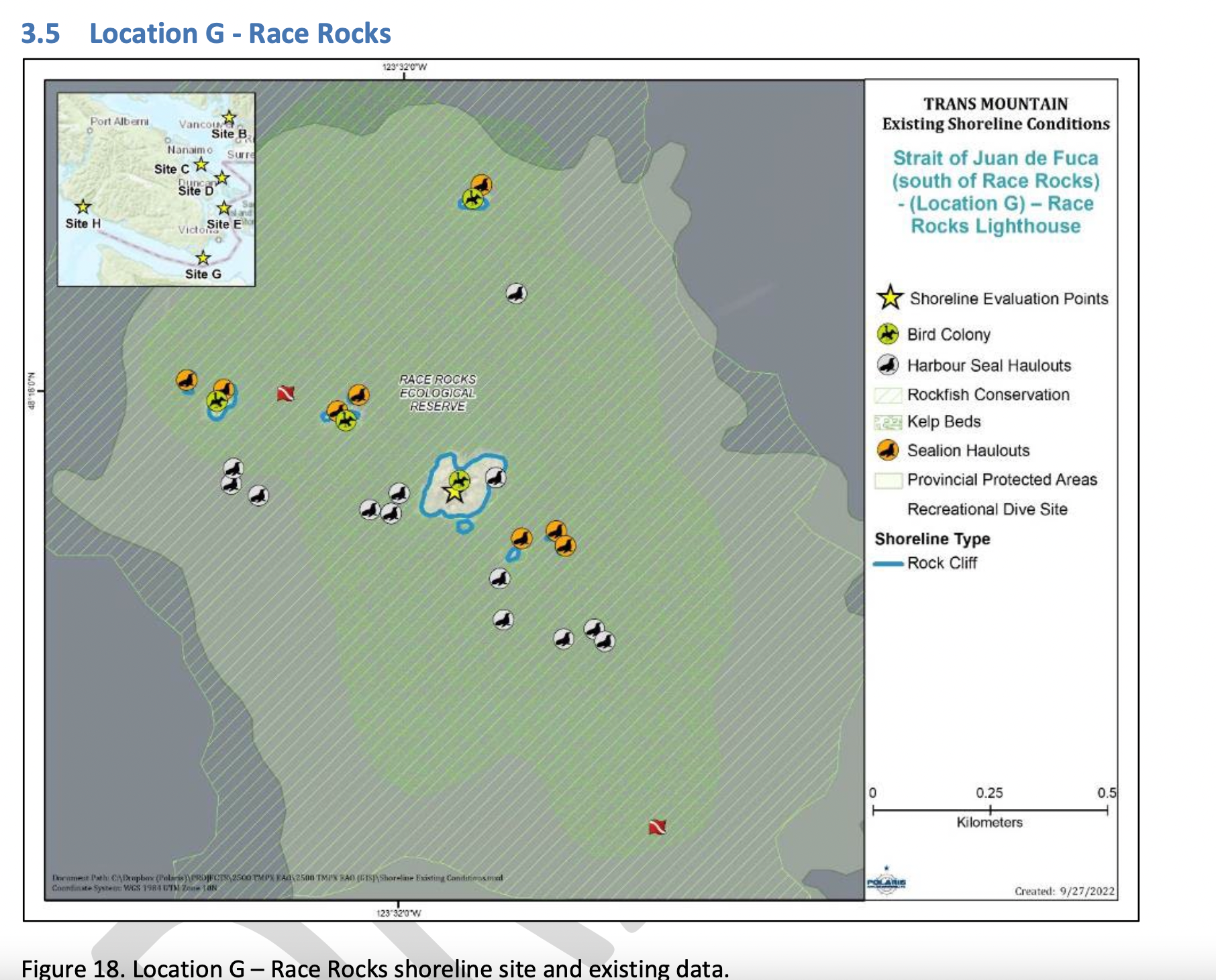
Figure 18 shows the Location G – Race Rocks site with the available existing spatial data. Shoreline data are from the Shorezone mapping effort available from the BC Data Catalogue, which show the shore type consisting of rock cliff. Shore-zone Bioband data indicate the presence of barnacles, dark brown kelps, fucus, bull kelp, red algae, surf grass, and Verrucaria. Other data sources indicate offshore kelp beds and multiple seal and sealion haulouts. The Race Rocks Ecological Reserve (RRER) website (https://racerocks.ca/home/) provides more details on ecological resources documented and studied at the site, but not in a spatial format for mapping.

COMMENTS :  The exceptionally high Biodiversity of the area and high level of protection since 1980 as a Provincial Ecological Reserve  are not reflected at all in the map presented. If one were to look at the Race Rocks Taxonomy presented at https://racerocks.ca/race-rocks-animals-plants/taxonomy-image-gallery/ there may be a better appreciation of the natural capital of this area

  1. Rock Cliff  Beach designation is inaccurate.. there is a pebble beach and Intertidal areas with tidepools on much of the shorelines of the 9 islandfsd in the Archipelago.  Also several surge channels are located around the main island. 
  2. Bird Colonies :
    –no mentions is made of four species of nesting seabirds.
    –no mention is made of the fact this is a winter roosting area for thousands of seabirds.
    — no mention of the fact that the archipelago of islands are an important migratory stopover for marine and terrestrial migratory birds.
  3. Marine Mammals:
    –no mention is made of the fact this is the most northerly haul-out and pupping colony  for Elephant seals — no mention of the fact that California and Northern sealions haul  out in numbers over 1000 in the fall of the year. 
    —no mention  that the haul-out locations for harbour seals are also pupping colonies. 
    — no mention of the ocurrence of river otters and sea otters on and within the islands.
    – no mention of the fact that it is an important feeding area for Biggs killer whales. https://racerocks.ca/humpback-and-orca-sightings-race-rocks/
    –no mention of the fact that the surrounding waters have had a rapid increase in the past few years of Humpback whales 
  4. Invertebrates: 
    –The extremely high biodiversity of invertebrate species both inter-tidally and sub-tidally is not mentioned. 
    –Several rare species of invertebrates are found here and are not acknowledged
  5. Fish :
    –This is a rockfish protection area and all species of BC Rockfish are represented.– a high diversity of other fish are also represented here,  with even sitings of Sturgeon occurring.
  6. Marine Algae :
    –There is a much higher  species diversity of Marine Algae found in the ecological reserve than is n surrounding areas. 
    — the indication of kelp beds on the map presented here is totally inaccurate and insufficient.  Given the decline of kelp beds in our coastal water , this is highly relevant. 
  7. Indigenous and Historical Significance: 
    — the presence of archaeological sites and the significance of the historic structures cannot be minimized . All are sprayed with seawater and therefore subject to immersion in pollutants during intense winds  which occur regularly. 

===============================================================

Page 26


Comments:
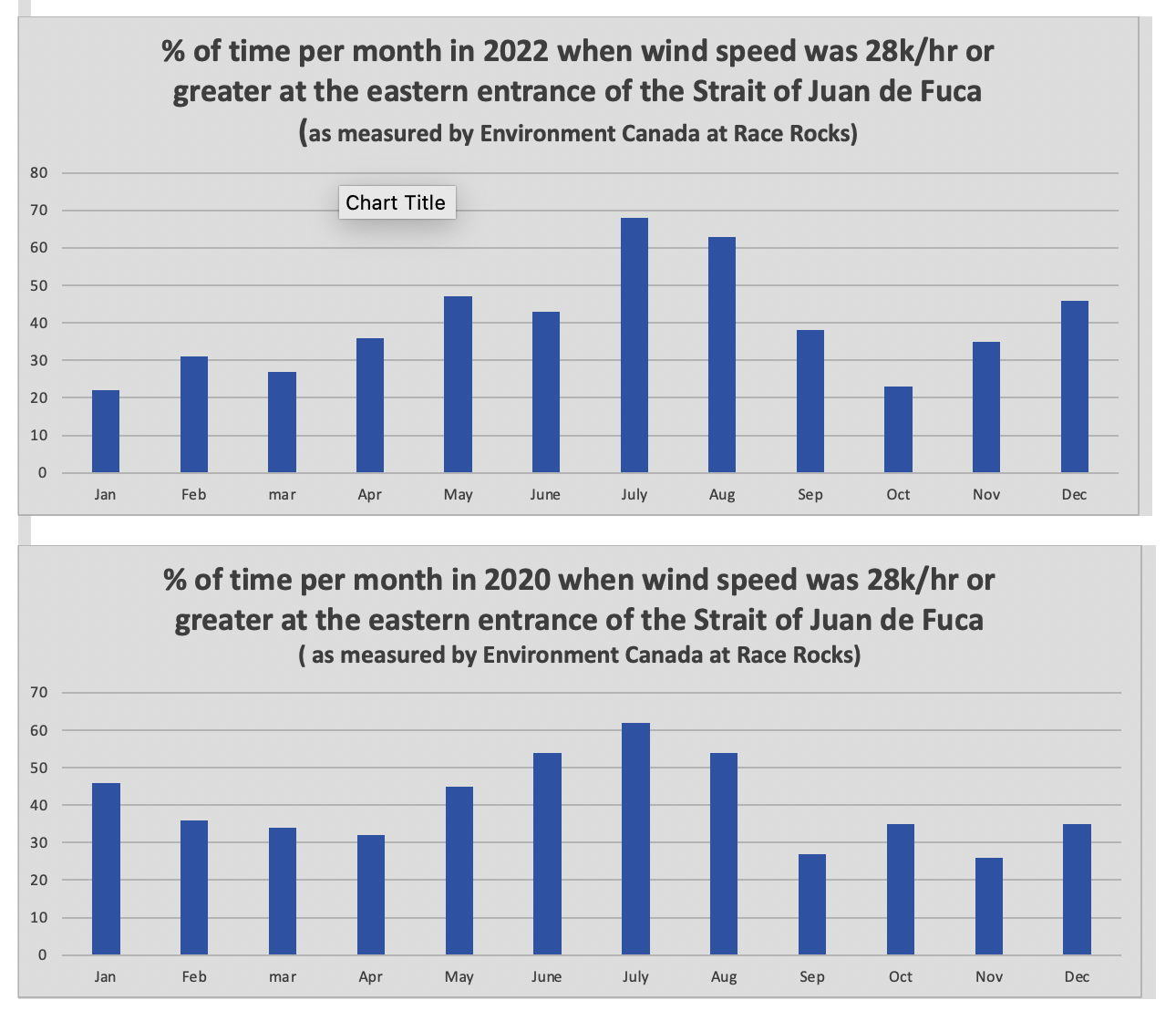
The reference at the Race Rocks website  from racerocks.ca which analyzes the Wind speed from observations of the hourly data provided by Environment Canada show a completely different picture . https://racerocks.ca/race-rocks-lightstation-weather-conditions-environment-canada-problems-for-oil-spill-cleanup/

 Some facts from the Environment Canada data:
1. In July of 2022  there were 11 days when the wind speed every hour was 28 km/hr or greater. and 69.5% of the hours in the month, clean up equipment could not be deployed due to high velocity wind conditions.
2. In March of 2023, the wind speed was 28 km/hr or greater  37% of the time.
3. In Februarry of 2023 , the wind speed was 28 km/hr or greater 43 % of the time
4. In January of 2023 , the wind speed was 28 km/hr or greater 36% of the time 

============================================================

Page 27


================================================

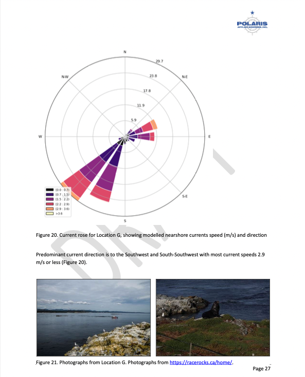
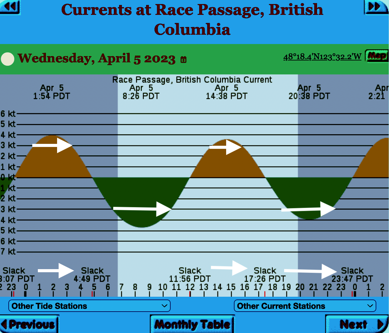
The reality of current speed  is that there is a very small window of time during the day that the waters around Race Rocks are not over three knots. In the graph below only in the few hours a day not covered by the white arrows could any boom placement be established. WHen looked at from this perspective, added onto the small windows of time when the wind speed is under 28 km per hour could spilled oil containment even be possible. 


=============================================================

From page 28 of the Polaris report

Field surveys were not conducted at Race Rocks due to the long lead time in acquiring a “research” permit from BC Parks to access the Ecological Reserve. Information detailed below comes from reviewing the existing data available, Google Earth, the RRER website, and a First Nations representative.
The shoreline at Race Rocks, specifically Great Race Rock, appears to be mostly bedrock cliff, ramp, and platform, possibly with some small pocket pebble/cobble beaches. Bedrock cliffs and ramps are observable in Figure 21 which show some example photographs from the Race Rocks Ecological Reserve website. The backshore appears to be mostly bedrock with some vegetation.
An active lighthouse along with several other buildings are present. Pearson College UWC conducts research and teaches classes at the site. Whale and sightseeing boats frequent the waters around Great Race Rock and are visible from photographs on the Race Rocks website and on Google Earth.
As mentioned before, Race Rocks is a BC Parks Ecological Reserve which are “areas selected to preserve representative and special natural ecosystems, plant and animal species, features and phenomena. Scientific research and educational purposes are the principal uses of ecological reserves”7. A wide variety of ecological resources are documented, tracked, and studied at the site. This documentation includes a weekly animal census, annual bird counts, and an entire list of species ever documented with photos/videos since 2000 (https://racerocks.ca/race-rocks-animals-plants/taxonomy-image-gallery/). Additional research conducted at the site can also be found on the RRER website. The extensive use of the site as a haulout location by pinnipeds is documented on the website and visible on Google Earth.
This area has historically been used by First Nations for harvesting food, as documented on the Race Rocks website, and a First Nations representative indicated that fishing is common in the waters around the site. Burial mounds/cairns have been researched and documented on Great Race Rock.
A helicopter pad is located near the lighthouse.
Based on the available data, and without visiting Race Rocks, the Shorezone mapping appears to be relatively accurate. The detailed observation of the flora and fauna on the Race Rocks website and other research conducted by Pearson College provides the most thorough documentation of the ecological resources present compared to any of the other sites visited.
7 https://bcparks.ca/eco_reserve/

================================================================

So much of what we are expected to do in response to the Trans Mountain EAO requests has been done before. 
However…. 
I am pointing out some information from work that Mike Fenger and myself did on the Board of Friends of Ecological Reserves the past for the NEB hearings . 
1. In this document, although it  lists species of several of the marine ecological reserves,  Race Rocks is included with examples 
page 48 -page 54 : Marine mammals
see page 52  
page 55-page 61 Birds 
page 63-67  fish (including forage fish on our beaches
page 67- page 71 .. Invertebrates
page 72- page  74  .. macroalgae
page 75-  terrestrial plants in upper foreshore areas
From this link ….
there is a lot of information of the biological resources along the Strait of Juan De Fuca also in section
3.5 SARA-Listed Species in Two Ecological Reserves and in appendix page 139
============================================
Garry Fletcher.. Metchosin Environmental Advisory Select Committee 

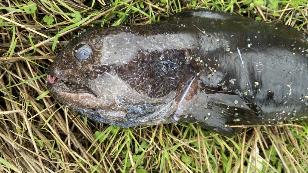
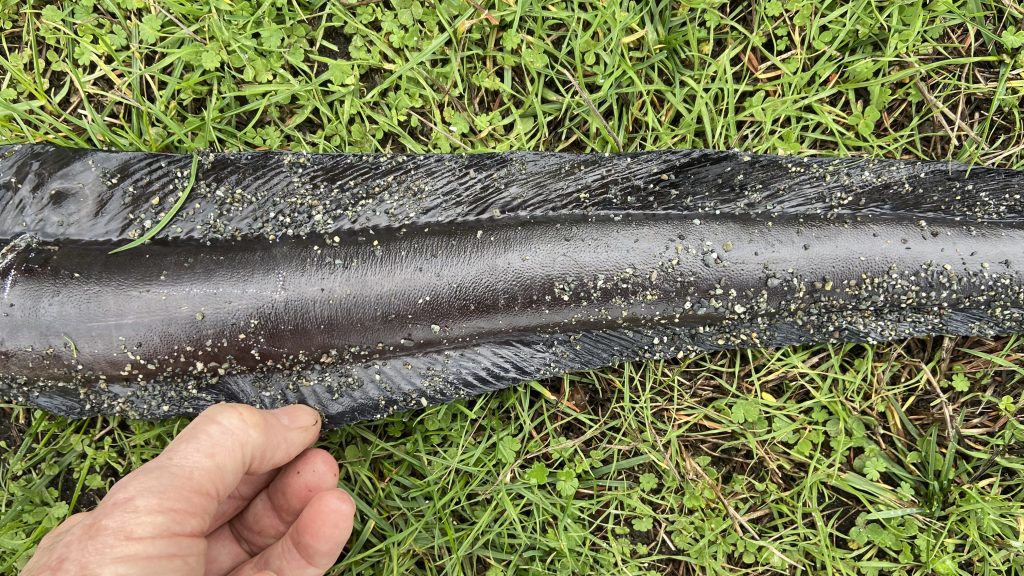
Wolf Eel : Anarrhichthys ocellatus on Taylor beach

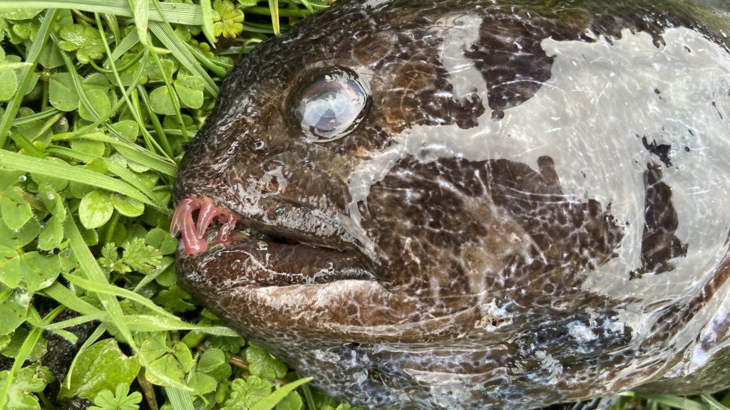
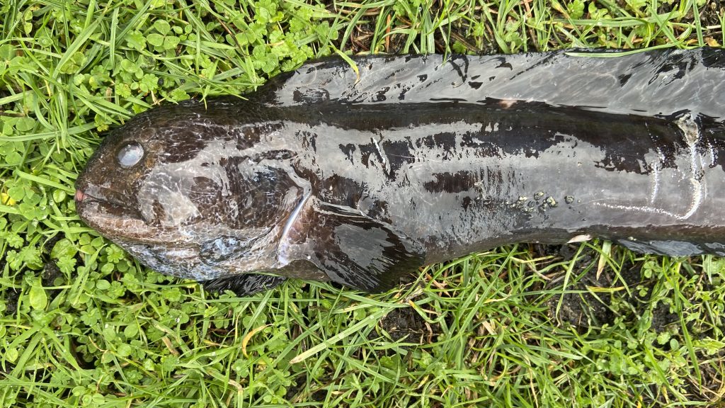
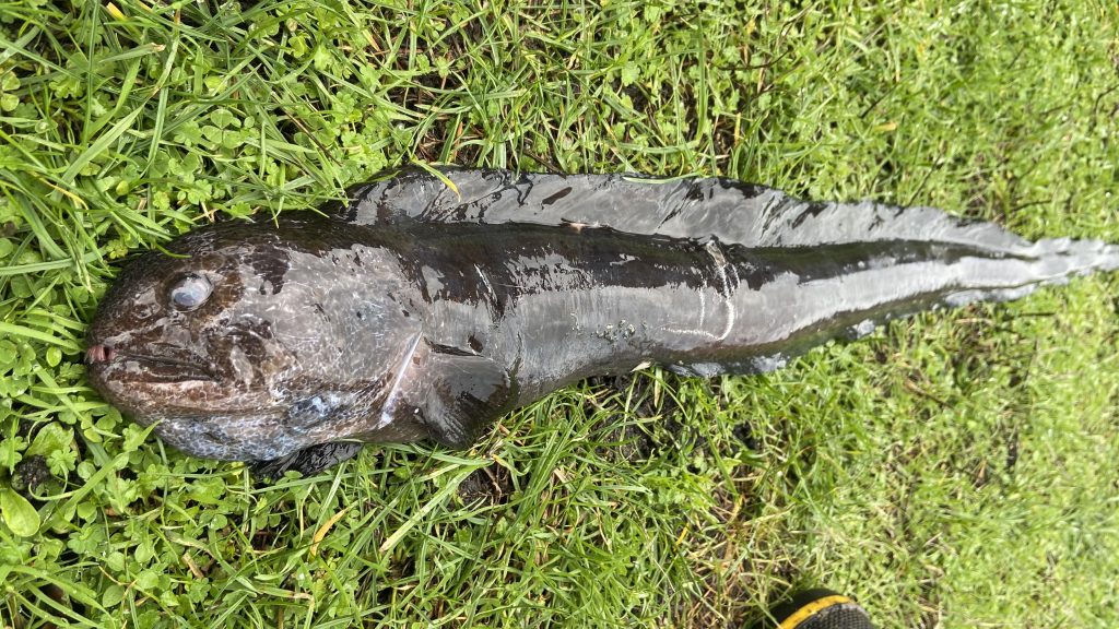
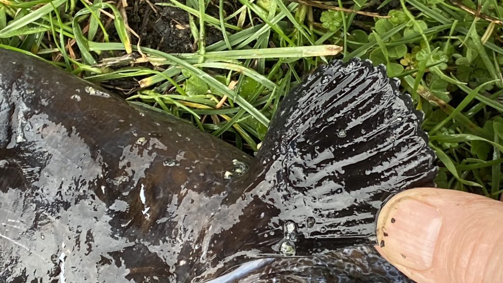
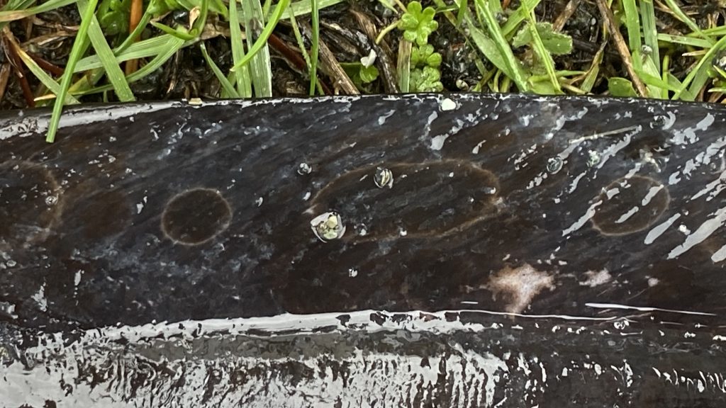
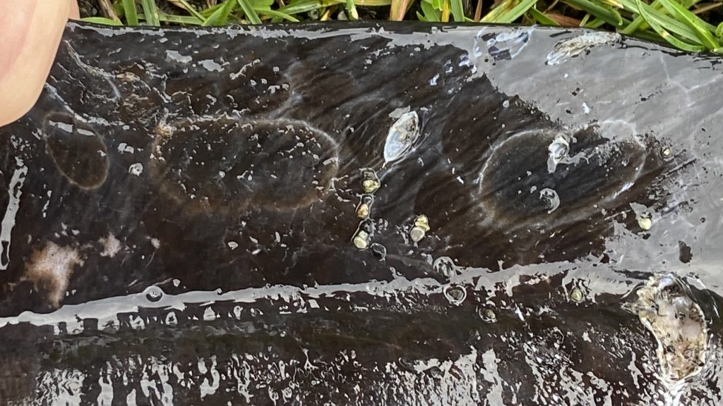
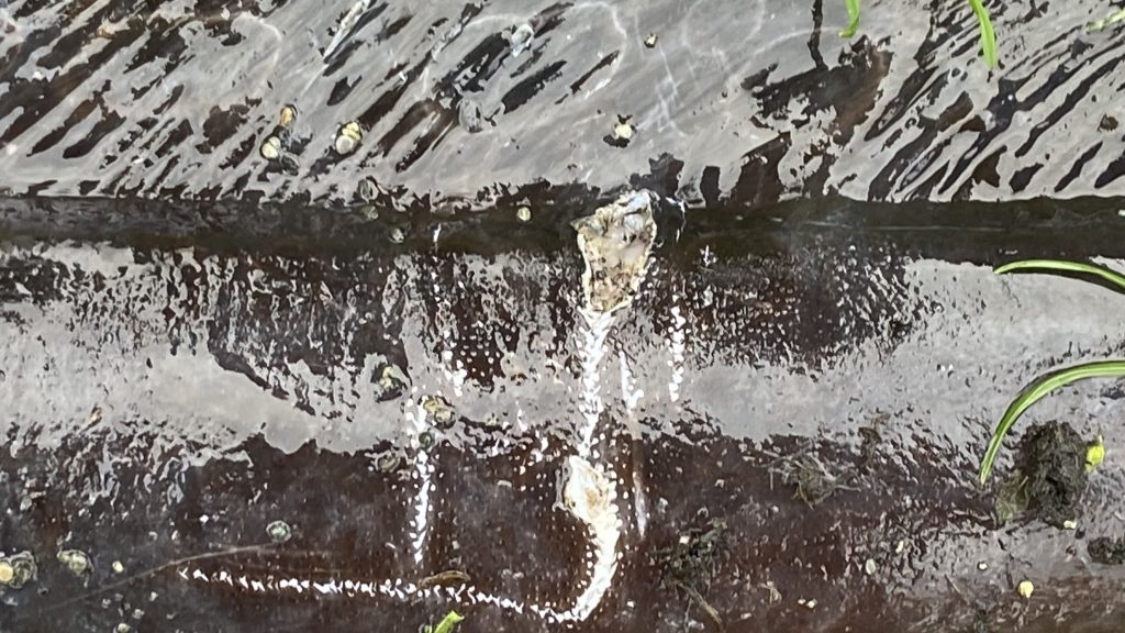
On February 9, 2023  Deidre Chettleburgh and her grandson Ben retrieved this 37 cm wolf eel from the strand line on Taylor beach.  

Although the experts on iNaturalist identified it as a wolf eel, (https://inaturalist.ca/observations/148414762 ) this description of a juvenile wolf eel from Wikipedia doesn’t really fit . ???

“Younger wolf eels are orange with big dark spots in the posterior part of the body. Once older they turn grey, brown greyish or dark olive.”[7][8]
This individual was very dark black. Also in  my many years of Diving around Race Rocks Ecological Reserve I never saw anything like it.
https://racerocks.ca/anarrhichthys-ocellatus-wolf-eel-the-race-rocks-taxonomy-2/

Classification from Wikkipedia:

Kingdom: Animalia
Phylum: Chordata
Class: Actinopterygii
Order: Scorpaeniformes
Family: Anarhichadidae
Genus: Anarrhichthys
Ayres, 1855
Species:
A. ocellatus
Binomial name
Anarrhichthys ocellatus

Ayres, 1855

Six Problems with Beach Fires in Metchosin

It would be nice if we all were careful, cleaned up after ourselves and were considerate of others and the environment. Unfortunately the annual spring and early summer problem of Fires on Metchosin beaches provides much evidence to the contrary.  Those of us who frequent the area have observed a deterioration in the situation in the last few years on Taylor and Weir’s beach. This spring with the stair access to Wittty’s lagoon cut off and the announcement on local media that beach fires are not allowed in other municipalities but it was still okay  to have them in Metchosin, the problem has reached a tipping point.

Ed Note: Metchosin Council finally banned all beach fires in a meeting in mid-June this year.

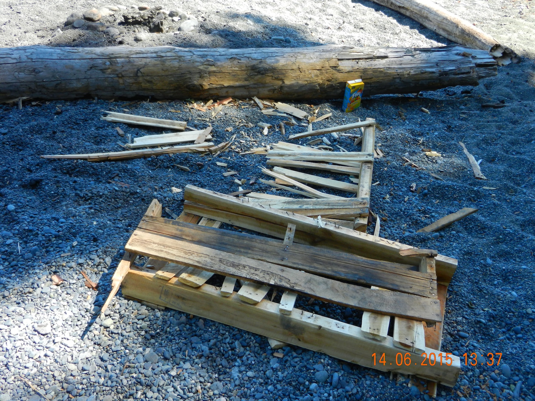
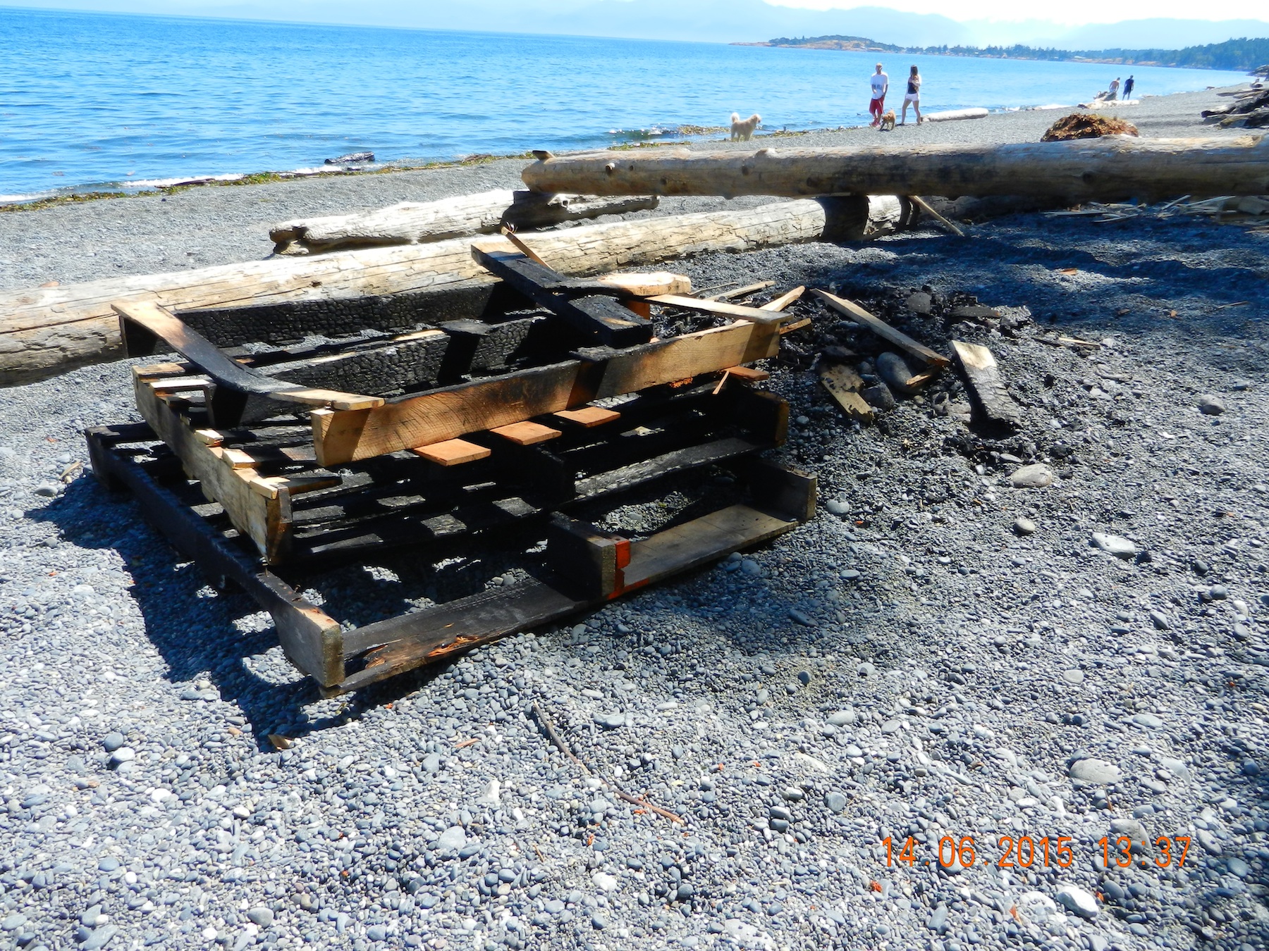
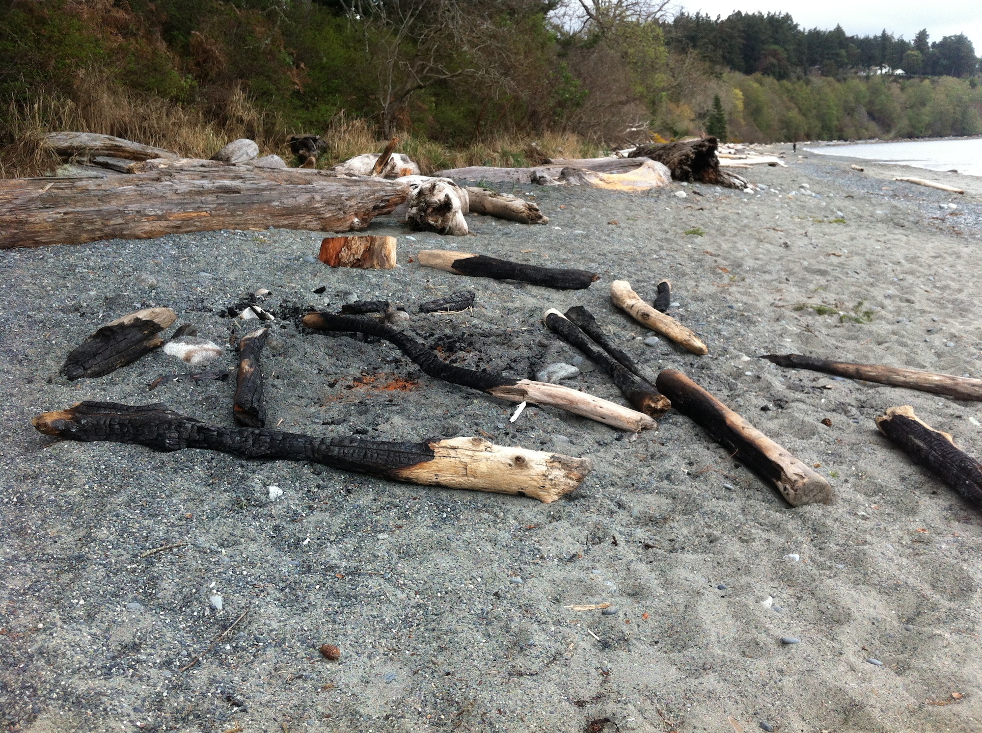
1. THE PROBLEM OF THE BURNING OF PALETTES:

The above was just part of last weeks legacy on Taylor Beach:

A quick review of the internet points out that :
Many Pre-2005 pallets have been treated with Methyl Bromide prior to exporting (part of phytosanitary regulations before import/export shipping to reduce risk of importing wood diseases and pests from country to country). The Methyl Bromide treated pallets should be disposed of as hazardous waste since it is dangerous to both people and the environment.  Newer pallets are heat treated, but don’t rule out mildicides ( for fungal inhibition) applied to some pallets.

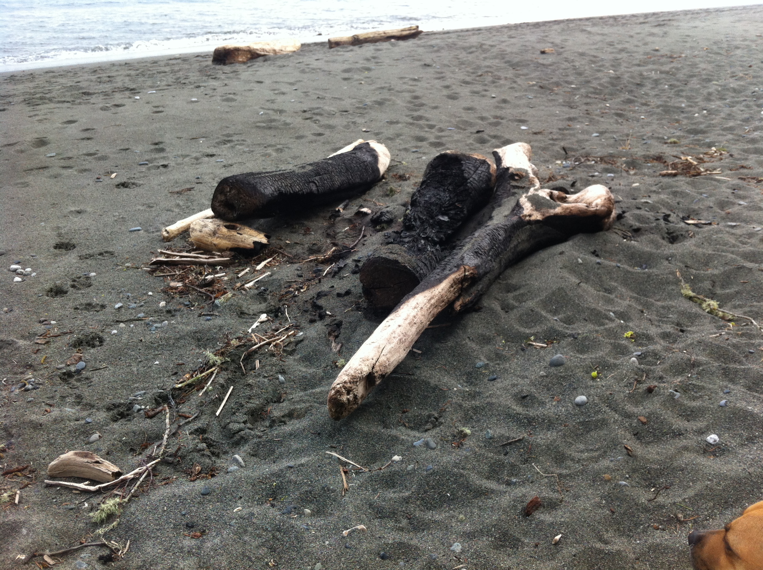
2. THE BURNING BEACH DRIFTWOOD PROBLEM:

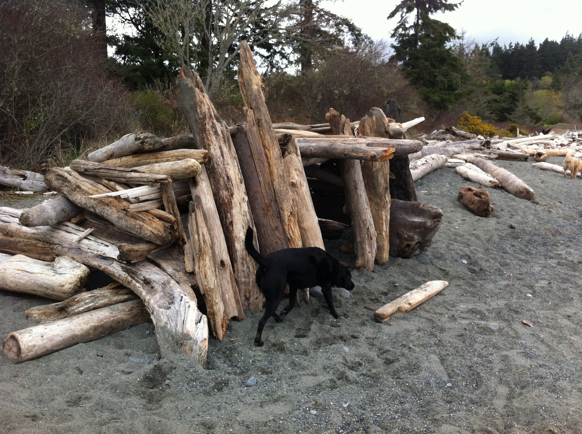
It saddens us to see people chopping or sawing up  large logs  or dragging them whole onto fires . These logs,  some well over 50 years old provide habitat for beach creatures and being moveable, can absorb wave energy and help to stabilize the backshore from increasing erosion.

Why do people continue to burn driftwood when there is clear evidence that it can produce toxic substances?

This from the EPA in the US:

  • Never burn household garbage or cardboard. Plastics, foam and the colored ink on magazines, boxes, and wrappers produce harmful chemicals when burned.
  • Never burn coated, painted, or pressure-treated wood because it releases toxic chemicals when burned.
  • Never burn ocean driftwood, plywood, particle board, or any wood with glue on or in it. They all release toxic chemicals when burned.
  • Never burn wet, rotted, diseased, or moldy wood.

From:http://www.bcairquality.ca/topics/stove-burning-practices.html
” The driftwood found on B.C. beaches may seem like an economically attractive heat source. Driftwood, however, is laden with salt, and burning it releases sodium and chlorine ions. The potential exists for these chlorine ions to form chlorinated compounds such as dioxins and furans, which are suspected human carcinogens. They may also corrode your stove and venting system.”

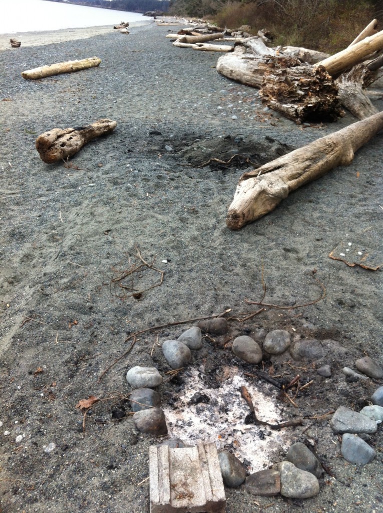
3. THE “I’VE GOT TO HAVE MY OWN PIECE OF THE BEACH” PROBLEM:2015-03-23multiplefirepitsjpg


Why is it not okay to use someone’s old firepit instead of building a new one a few feet away, creating another mess?
Last week I counted 40 old and recent firepits from this season along a stretch of no more than 200 metres of Taylor Beach.


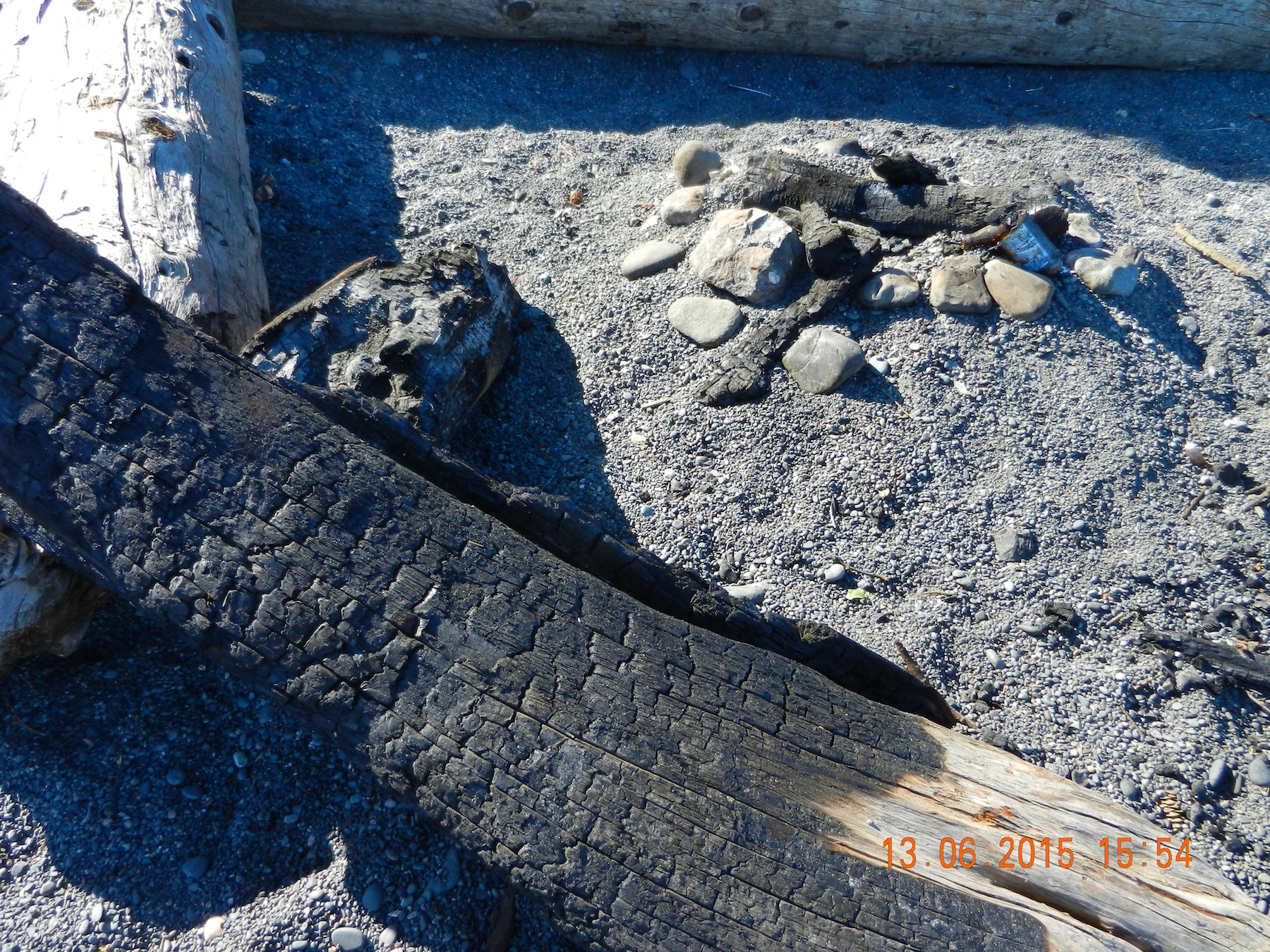
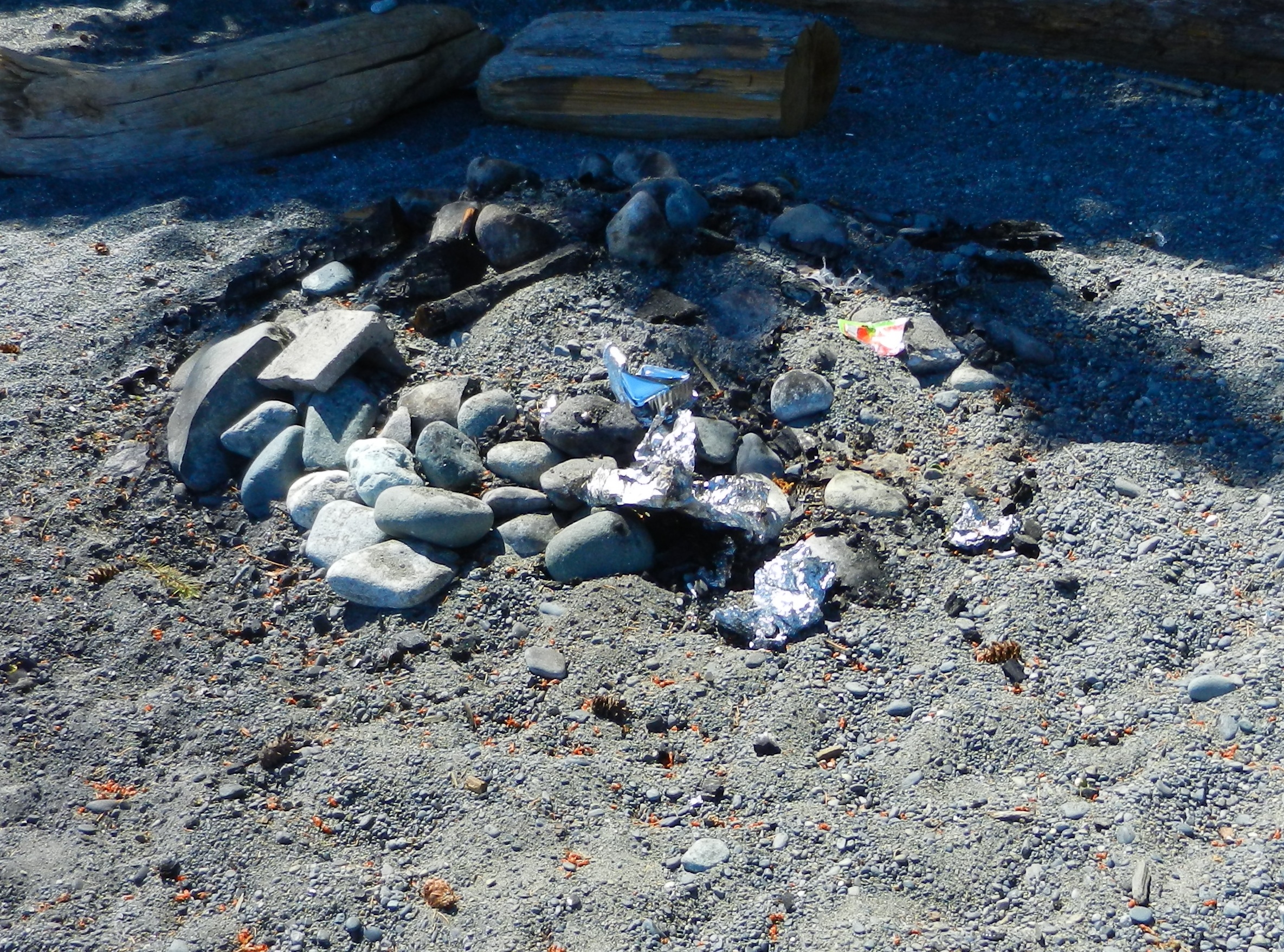
4. THE PROBLEM WITH THE MESS PEOPLE LEAVE:

Probably before the end of summer I will get a picture of the melted broken bottles and aluminum beer cans left in fire-pits, but for now this will have to do. The hazard this poses for children and animals is unacceptable. Winter storms will distribute any material left like in mounds and pits  over the beach, posing an unsuspecting hazard.

5. THE  HABITAT DESTRUCTION PROBLEM:

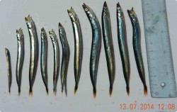
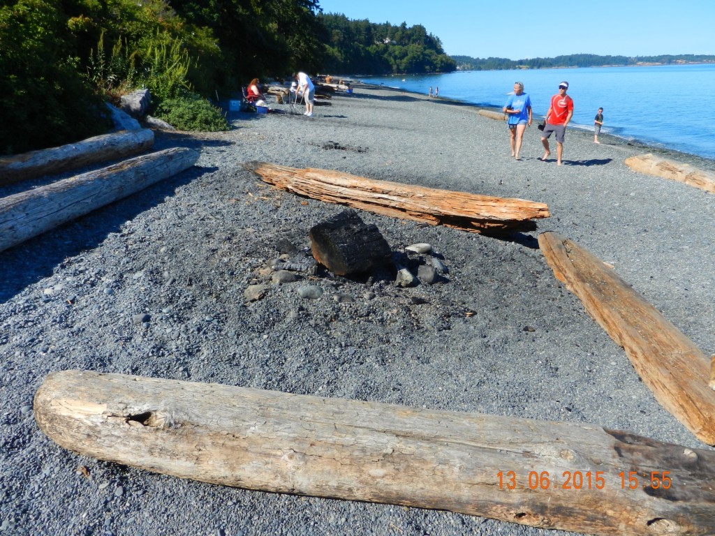
gf-sandlance-july1320154In the photo below, the darkened sand area, a diameter of around 4 metres or 12 feet , is where there will be complete sterilization of the sand and death of any organisms living within it. Sand is not an inert environment to begin with. It can have a complex ecosystem of  bacteria and invertebrates which contribute to decomposition and nutrient cycling , as well as a habitat for forage fish.


2015-06-13firepit1

Darkened sand shows area of influence of a beach fire.

6. THE EXTREMELY DRY WEATHER AND WILDFIRE RISK PROBLEM:

Perhaps this is the biggest problem that threatens to have a huge impact on life in Metchosin. The continuity of dry brush and forest from the beaches to backyards is a real threat for wildfires. Fanned by winds, fires that escape or were not completely extinguished and left unattended could cause untold damage to residents and property in the district.

****RECOMMENDATIONS:
So one shouldn’t complain unless they are prepared to do something about it. Here are my recommendations:
1. Have fires in designated locations only . Why not install a set of  metal container pits for the duration of the fire season, and all wood must be brought to the beach by the fire-maker.. ie no in-situ burning of driftwood (see reasons above)
2. The allowed season for fires must be regulated by conditions not by a  standard date like the start of a certain month.
3. Absolutely no burning of old habitat logs.
4. Absolutely no leaving of trash including bottles or cans in fires..( Pack it in pack it out. )
5. All fires to be extinguished by water. ( Everyone needs a bucket with them.)
6. Make very clear signage at the end of Taylor road… and if necessary for a few weekends have volunteers sit there and hand out information pamphlets on sustainability of the values of the beach.
7. Note that municipalities can regulate: from http://www.bcairquality.ca/topics/outdoor-burning-laws.html
8.. As a taxpayer I keep this in the back of my mind:  from the BC Forest Service website :
  • Q: Are people entitled to build fires on the beach?
    A: Yes, people have the right to build fires on the beach as long as they are in compliance with either their local government bylaws or the Wildfire Act & Regulations. If Campfires are restricted in this area, then a beach campfire fire is also prohibited.
  • Q: What are the rules that apply to having a campfire (a half a meter by a half a meter used for recreational or first nation’s ceremonial purposes)?
    A: A person may light, fuel or use a Campfire when:
     the person is not prohibited from doing so under another enactment;
     to do so is safe and is likely to continue to be safe;
     the person establishes a fuel break around the burn area;  while the fire is burning, the person ensures that
     the fuel break is maintained, and
     the fire is watched and patrolled by a person to prevent the escape of fire and the person is equipped with at least o one fire fighting hand tool, or o 8 litres of water in one or more containers;
     before leaving the area, the person ensures that the fire is extinguished.
  • Q: What are some safety guidelines when conducting a beach fire?
    A: Ensure that you comply with regulations and/or bylaws in your area regarding fire size and safety measures. Always check whether there are any bans or restrictions in effect, and pay close attention to wind conditions before lighting a fire. Keep fires at a reasonable distance from flammable materials and never leave them unattended. As hot coals can easily reignite: use water to extinguish the fire and ensure that it is cold to the touch before leaving it unattended.Q: If a fire is started illegally, who is liable for the suppression costs it if it escapes?
    A: If the fire is started within an organized area, costs are assumed by the fire department (local government) and area tax payers. If it is started outside of a fire department’s jurisdiction (crown land), the BC Forest Service responds and assumes costs. If the person who started the fire is caught and found to be in non-compliance with regulations, there are penalties that can be enforced, such as restorative justice, ticketing (fines), cost recovery, or criminal prosecution in serious cases.“Local governments have the power to set bylaws to control (back)yard burning, campfires and beach fires within their boundaries. A growing number of municipalities have passed their own bylaws that ban backyard burning and other kinds of burning. For more information on municipal burning bylaws, see Inventory of Air Quality Bylaws in British Columbia for Anti-Idling, Open Burning and Wood-Burning Appliances (PDF: 1017 KB/197 pages), and Review of Open Burning Bylaws on Vancouver Island (PDF: 150 KB/25 pages).”

Some other references :

BC Govt Regulations:

District of Metchosin Burning Regulations:

Metchosin FIre Department Burning regulations:

Colwood Burning Regulations:

Central Saanich Burning Regulations:

Saanich Beach Fire regulations:

Comox Valley Regional District:

Newport Beach Fire Problems


Herring Spawn Video from Denman Island

Why are BC residents so concerned about what might happen to their coastline from an increase in shipping and oil tankers?

We don’t have a scene like this video portrays in Metchosin, although we do get frenzy feeding by birds and mammals in the fall at Race Rocks but we do have forage fish which live on our beaches and provide year round food for the ecosystem.

Don’t miss this video from Denman Island : https://vimeo.com/121960894?fb_action_ids=10153160722717497&fb_action_types=

Horses on Taylor Beach

horseonbeach

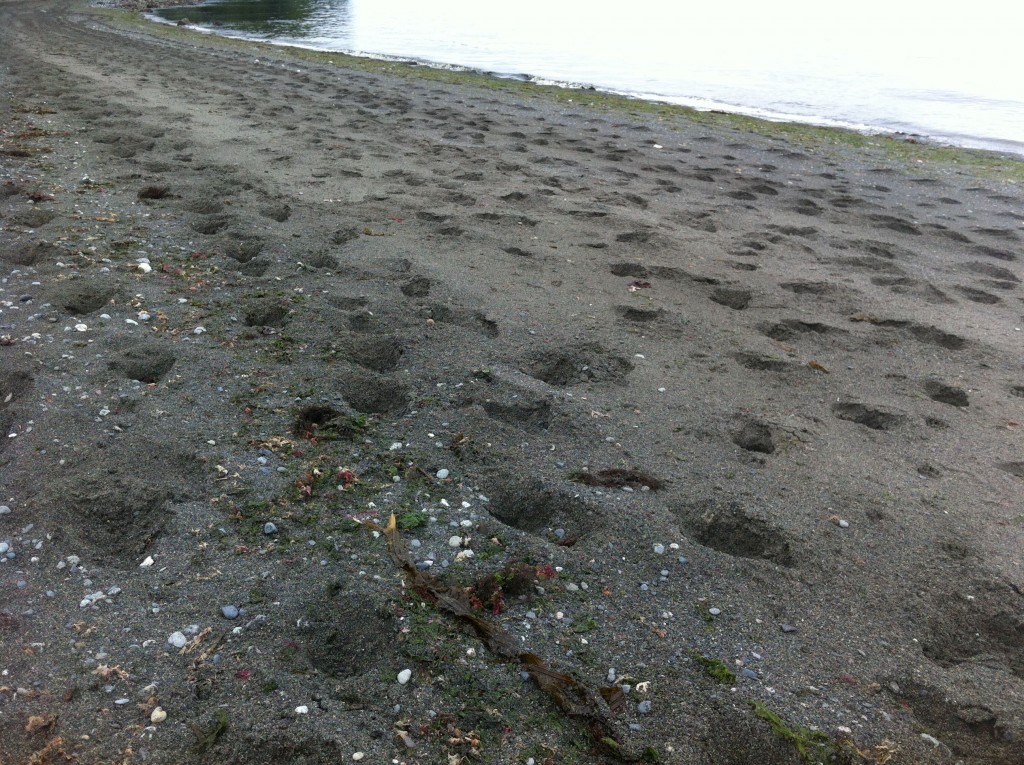
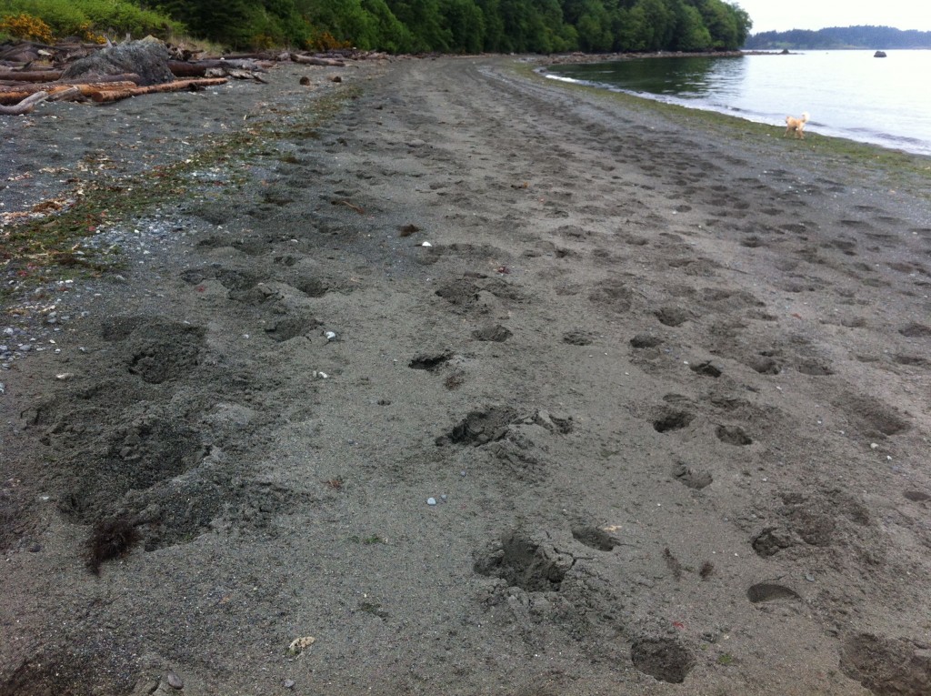
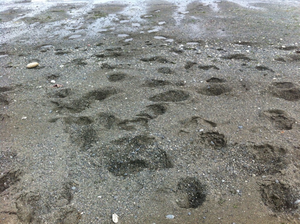
The holes punched out by horses can be up to 25 cm. in depth.

The Metchosin Community has a considerable population of recreational horses. It is accepted that to criticize anything horse-related might not be politically correct in Metchosin.

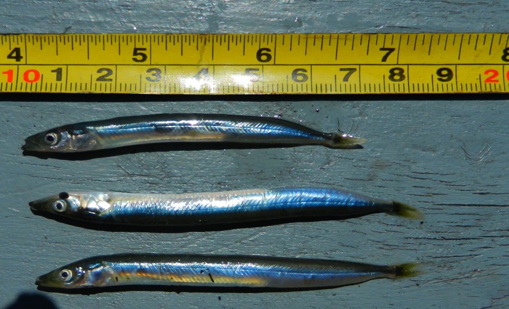
The pictures included in this post represent an extreme example but they are useful in order to point out the potential environmental impact of this activity. Let alone making it gf-sandlance-july1320154difficult to walk on until the next high tide comes in to smooth it out, the real issue is what is happening to the habitat of the forage fish. Both Pacific Smelt and Sand lance inhabit intertidal zones on Taylor beach. When they spawn, these forage fish deposit eggs  just under the surface of the sand . They are vulnerable to compaction and excessive drying out before they are carried out by the tide.  Given the lack of protection afforded the habitat of these fish and the over-harvesting in the herring fishery, these essential small fish of the food web are challenged enough already.

horsehoof

horsetracksonbeach

Horse hoof punctures in the sand right down in the area where sand lance are depositing their eggs in burrows.