EXISTING SHORELINE CONDITIONS STUDY EAO Condition 39

The full pdf of this report is contained in this pdf:
BC EAO Condition 39 Exisitng Shoreline Conditions Report – May 2023 – for engagement

The purpose of this posting is to reference the part of the report referring to Metchosin’s coastline  and to provide comment on it.

===========================================================

From page 4 of the REPORT:
1 Introduction
As defined by the amendment to Trans Mountain’s BC Environmental Assessment Certificate (EAC) issued by the Province of British Columbia (the Province) on February 24, 2022, Trans Mountain must prepare an Existing Shorelines Condition Report and submit to the Province within 18 months (August 2023) as Condition No. 39.

Polaris Applied Sciences was retained to prepare a report containing shoreline baseline data for shoreline areas closest to spill scenario locations modeled along the marine shipping route and submitted in the Project application. The Province listed the specific scenario locations for the purpose of this study (Figure 1) as:

  • English Bay (Location B)
  • Roberts Bank (Location C)
  • Strait of Georgia (Location D)
  • Arachne Reef (Location E)
  • Strait of Juan de Fuca (south of Race Rocks) (Location G); and
  • Buoy J (Location H)


Page 25
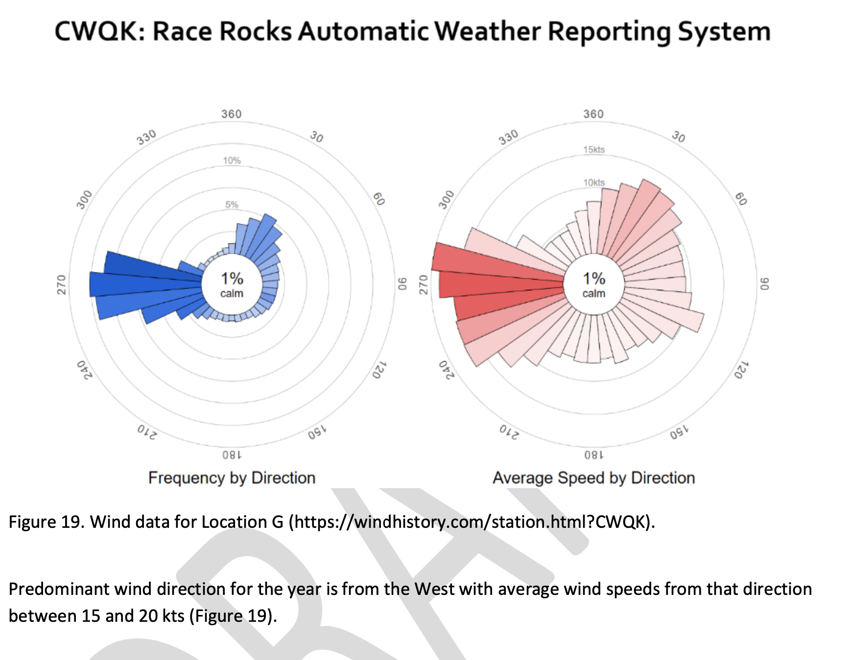
Strait of Juan de Fuca (south of Race Rocks) (Location G);
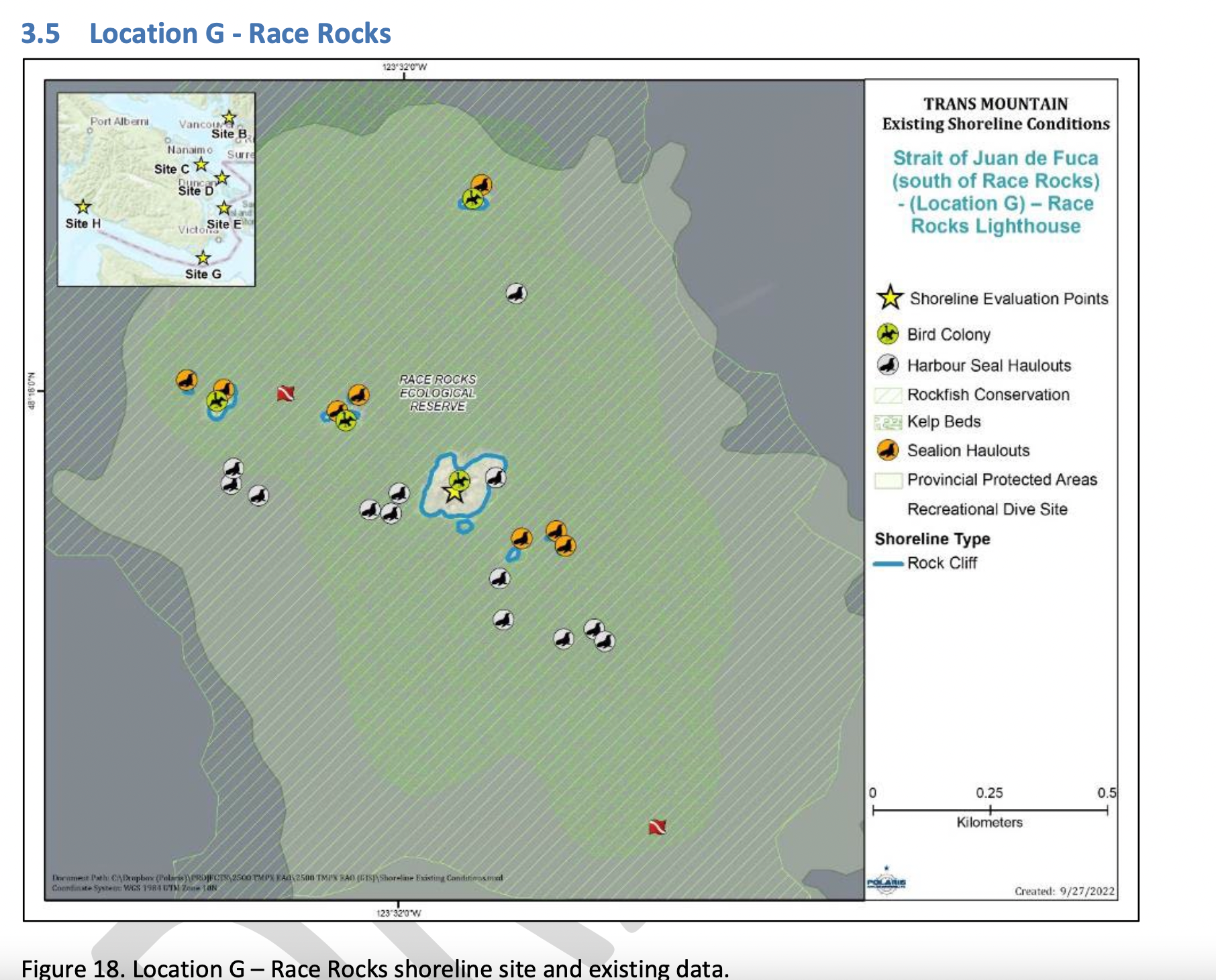
Figure 18 shows the Location G – Race Rocks site with the available existing spatial data. Shoreline data are from the Shorezone mapping effort available from the BC Data Catalogue, which show the shore type consisting of rock cliff. Shore-zone Bioband data indicate the presence of barnacles, dark brown kelps, fucus, bull kelp, red algae, surf grass, and Verrucaria. Other data sources indicate offshore kelp beds and multiple seal and sealion haulouts. The Race Rocks Ecological Reserve (RRER) website (https://racerocks.ca/home/) provides more details on ecological resources documented and studied at the site, but not in a spatial format for mapping.

COMMENTS :  The exceptionally high Biodiversity of the area and high level of protection since 1980 as a Provincial Ecological Reserve  are not reflected at all in the map presented. If one were to look at the Race Rocks Taxonomy presented at https://racerocks.ca/race-rocks-animals-plants/taxonomy-image-gallery/ there may be a better appreciation of the natural capital of this area

  1. Rock Cliff  Beach designation is inaccurate.. there is a pebble beach and Intertidal areas with tidepools on much of the shorelines of the 9 islandfsd in the Archipelago.  Also several surge channels are located around the main island. 
  2. Bird Colonies :
    –no mentions is made of four species of nesting seabirds.
    –no mention is made of the fact this is a winter roosting area for thousands of seabirds.
    — no mention of the fact that the archipelago of islands are an important migratory stopover for marine and terrestrial migratory birds.
  3. Marine Mammals:
    –no mention is made of the fact this is the most northerly haul-out and pupping colony  for Elephant seals — no mention of the fact that California and Northern sealions haul  out in numbers over 1000 in the fall of the year. 
    —no mention  that the haul-out locations for harbour seals are also pupping colonies. 
    — no mention of the ocurrence of river otters and sea otters on and within the islands.
    – no mention of the fact that it is an important feeding area for Biggs killer whales. https://racerocks.ca/humpback-and-orca-sightings-race-rocks/
    –no mention of the fact that the surrounding waters have had a rapid increase in the past few years of Humpback whales 
  4. Invertebrates: 
    –The extremely high biodiversity of invertebrate species both inter-tidally and sub-tidally is not mentioned. 
    –Several rare species of invertebrates are found here and are not acknowledged
  5. Fish :
    –This is a rockfish protection area and all species of BC Rockfish are represented.– a high diversity of other fish are also represented here,  with even sitings of Sturgeon occurring.
  6. Marine Algae :
    –There is a much higher  species diversity of Marine Algae found in the ecological reserve than is n surrounding areas. 
    — the indication of kelp beds on the map presented here is totally inaccurate and insufficient.  Given the decline of kelp beds in our coastal water , this is highly relevant. 
  7. Indigenous and Historical Significance: 
    — the presence of archaeological sites and the significance of the historic structures cannot be minimized . All are sprayed with seawater and therefore subject to immersion in pollutants during intense winds  which occur regularly. 

===============================================================

Page 26


Comments:
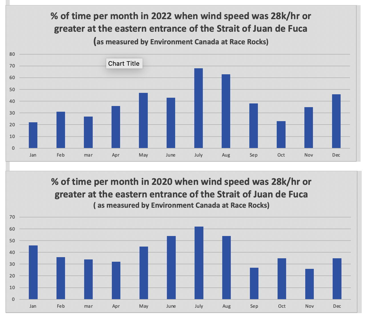
The reference at the Race Rocks website  from racerocks.ca which analyzes the Wind speed from observations of the hourly data provided by Environment Canada show a completely different picture . https://racerocks.ca/race-rocks-lightstation-weather-conditions-environment-canada-problems-for-oil-spill-cleanup/

 Some facts from the Environment Canada data:
1. In July of 2022  there were 11 days when the wind speed every hour was 28 km/hr or greater. and 69.5% of the hours in the month, clean up equipment could not be deployed due to high velocity wind conditions.
2. In March of 2023, the wind speed was 28 km/hr or greater  37% of the time.
3. In Februarry of 2023 , the wind speed was 28 km/hr or greater 43 % of the time
4. In January of 2023 , the wind speed was 28 km/hr or greater 36% of the time 

============================================================

Page 27


================================================

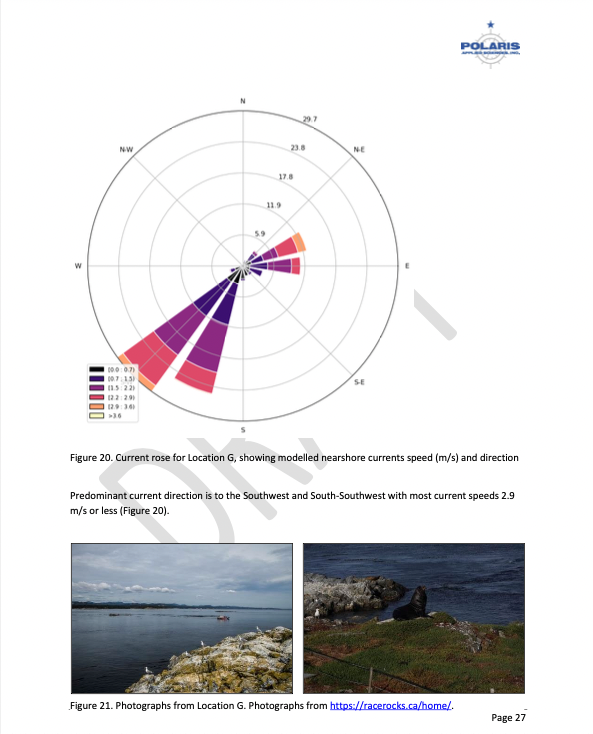
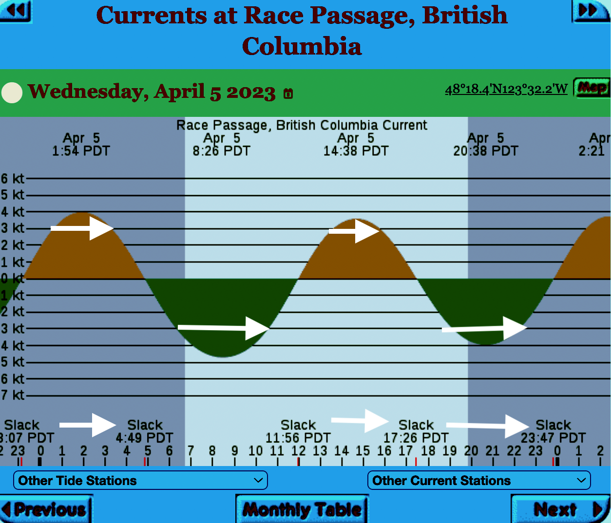
The reality of current speed  is that there is a very small window of time during the day that the waters around Race Rocks are not over three knots. In the graph below only in the few hours a day not covered by the white arrows could any boom placement be established. WHen looked at from this perspective, added onto the small windows of time when the wind speed is under 28 km per hour could spilled oil containment even be possible. 


=============================================================

From page 28 of the Polaris report

Field surveys were not conducted at Race Rocks due to the long lead time in acquiring a “research” permit from BC Parks to access the Ecological Reserve. Information detailed below comes from reviewing the existing data available, Google Earth, the RRER website, and a First Nations representative.
The shoreline at Race Rocks, specifically Great Race Rock, appears to be mostly bedrock cliff, ramp, and platform, possibly with some small pocket pebble/cobble beaches. Bedrock cliffs and ramps are observable in Figure 21 which show some example photographs from the Race Rocks Ecological Reserve website. The backshore appears to be mostly bedrock with some vegetation.
An active lighthouse along with several other buildings are present. Pearson College UWC conducts research and teaches classes at the site. Whale and sightseeing boats frequent the waters around Great Race Rock and are visible from photographs on the Race Rocks website and on Google Earth.
As mentioned before, Race Rocks is a BC Parks Ecological Reserve which are “areas selected to preserve representative and special natural ecosystems, plant and animal species, features and phenomena. Scientific research and educational purposes are the principal uses of ecological reserves”7. A wide variety of ecological resources are documented, tracked, and studied at the site. This documentation includes a weekly animal census, annual bird counts, and an entire list of species ever documented with photos/videos since 2000 (https://racerocks.ca/race-rocks-animals-plants/taxonomy-image-gallery/). Additional research conducted at the site can also be found on the RRER website. The extensive use of the site as a haulout location by pinnipeds is documented on the website and visible on Google Earth.
This area has historically been used by First Nations for harvesting food, as documented on the Race Rocks website, and a First Nations representative indicated that fishing is common in the waters around the site. Burial mounds/cairns have been researched and documented on Great Race Rock.
A helicopter pad is located near the lighthouse.
Based on the available data, and without visiting Race Rocks, the Shorezone mapping appears to be relatively accurate. The detailed observation of the flora and fauna on the Race Rocks website and other research conducted by Pearson College provides the most thorough documentation of the ecological resources present compared to any of the other sites visited.
7 https://bcparks.ca/eco_reserve/

================================================================

So much of what we are expected to do in response to the Trans Mountain EAO requests has been done before. 
However…. 
I am pointing out some information from work that Mike Fenger and myself did on the Board of Friends of Ecological Reserves the past for the NEB hearings . 
1. In this document, although it  lists species of several of the marine ecological reserves,  Race Rocks is included with examples 
page 48 -page 54 : Marine mammals
see page 52  
page 55-page 61 Birds 
page 63-67  fish (including forage fish on our beaches
page 67- page 71 .. Invertebrates
page 72- page  74  .. macroalgae
page 75-  terrestrial plants in upper foreshore areas
From this link ….
there is a lot of information of the biological resources along the Strait of Juan De Fuca also in section
3.5 SARA-Listed Species in Two Ecological Reserves and in appendix page 139
============================================
Garry Fletcher.. Metchosin Environmental Advisory Select Committee 

An Interesting representation of the Coastal Consequences of KM/TMX Pipeline

BurnabyKM:TMXThis presentation from the Globe and Mail provides an interesting  report n the future of Oil transportation on our coast.

“Weigh Anchor

With the BC Greens and NDP reaching an agreement to form government, the future of the Trans Mountain pipeline is up in the air. The expansion project could bring billions in new revenue, but it would also mean an increase in coast-to-port tanker traffic, and with that, an increased risk of oil spills. We follow a tanker as it threads the needle from Burnaby to the open ocean.”
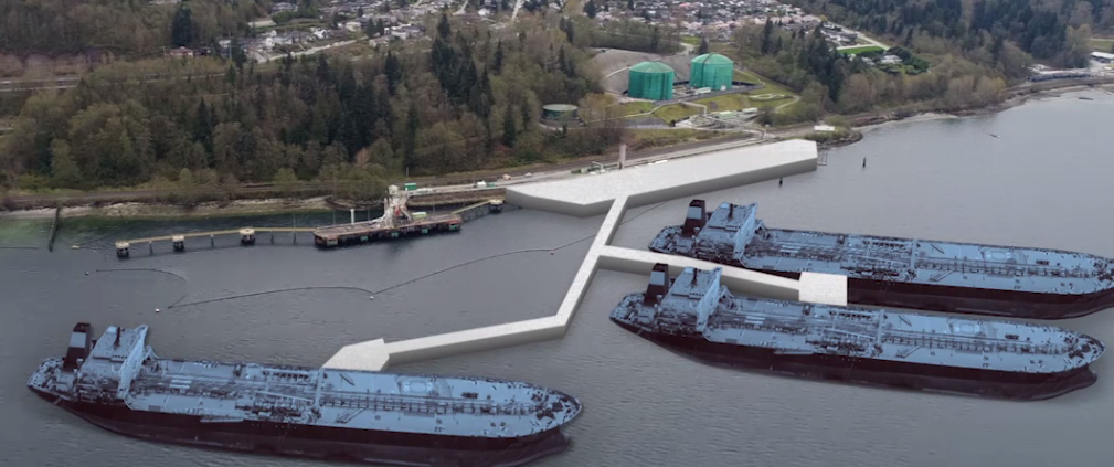
Tanker

The Illusion about our efforts to clean up oil spills

Andrew Nikiforuk has written an article in the Hakai magazine which supports one of our arguments in the work we did as intervenors in the National Energy Board Hearings on the Kinder Morgan/Trans Mountain Extension Pipeline project. This article profiles how we are being duped by oil companies and governments into believing that oil spills can be cleaned up and that oiled birds and mammals can be rehabilitated.

“And that’s where the state of marine oil spill response sits today: it creates little more than an illusion of a cleanup. Scientists — outside the oil industry — call it “prime-time theatre” or “response theatre.””

HakaiinstWhy Do We Pretend to Clean Up Ocean Oil Spills?

https://www.hakaimagazine.com/article-long/oil-spill-cleanup-illusion


dilbitAlso see:

Oil Sands Dilbit Causes Developmental Problems in Fish


Information Requests from the Board of Friends of Ecological Reserves submitted to Kinder Morgan on Jan 15

On January 15, 2014, The Board of Friends of Ecological reserves submitted the round 2 set of Information Requests to Kinder Morgan /TMX project . Since it has some questions related to local sensitive marine ecological areas, It is posted here:

C33-4-1_-_Information_Request_No._2_-_A4G5Q9

Other posts on our concerns about the risk of oil spills on Metchosin’s Coastline may be found here:

50 other intervenors in the NEB hearings also submitted questions.. The link to these will be added here when the National Energy Board puts up a link.


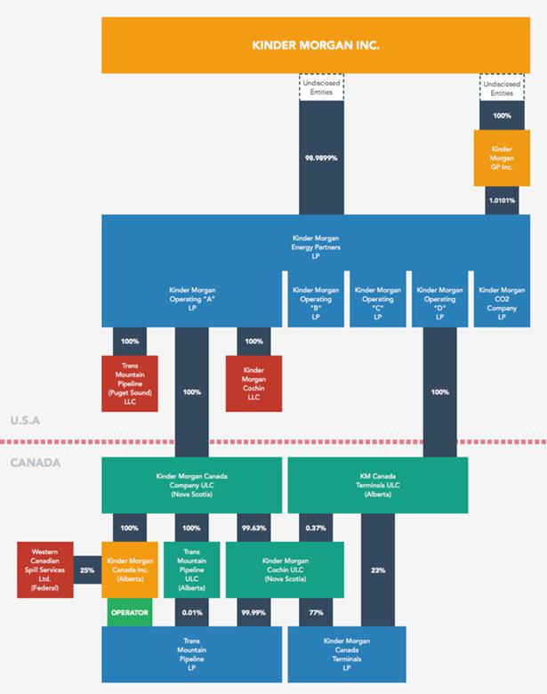
How Trans Mountain Project Will Pump Profits to Its Texas Owners Charting the Houston-driven inner workings of Kinder Morgan.

While doing work as an Intervenor for the Board of Friends of Ecological Reserves in the National Energy Board hearings on the Kinder Morgan Trans-Mountain Pipeline Expansion proposal , we have received notice throughout the past few months of the posting of many motions and questions to the Board from Intervenor Robyn Allan. The incredible amount of research she has done may be accessed on the NEB website:  https://docs.neb-one.gc.ca/ll-eng/llisapi.dll/Open/2451015

By Robyn Allan, Monday, January 10– TheTyee.ca

U.S.-based Kinder Morgan says its Trans Mountain expansion project represents financial and economic benefit to the Canadian economy, and our federal and provincial public treasuries.
Who would spend a year investigating such claims, rooted as they are in complex tax law, regulations and corporate structure? I did.
What I found made me conclude the opposite — Kinder Morgan drains financial wealth from our economy and does not pay its fair share of taxes.
I have written about the project’s complicated design to yield meagre tax revenues for Canadians in a previous Tyee article.
Now let me examine just how Canadian Kinder Morgan Canada Inc. is. The answer: hardly at all.
Pop the hood and take a look at Kinder Morgan’s inner workings and the idea that this is a Canadian company operating for the good of Canadians is dispelled quicker than Kinder Morgan can say injunction.
If you are bored by arcane discussions of corporate structure and governance, that may be just what Kinder Morgan is hoping. Please bear with me. It’s critical we know who really runs, and benefits from, Kinder Morgan Canada Inc.  —From the boys who brought us Enron

continued at: http://thetyee.ca/Opinion/2015/01/12/Trans-Mountain-Texas-Profits/

CHART.KMStructure_page_thumb

Click to enlarge (some browsers may require a second click to further enlarge image). Kinder Morgan corporate chart prepared by Robyn Allan. Graphic design by Karl Jensen.


Economic Impacts of an Oil Spill

This  recent cover story by Lovel Pratt in the Whatcom Watch Onlinehttp://www.whatcomwatch.org/php/WW_open.php?id=1795 is well worth reading for Metchosin residents .
Examples it has stated:

  • “The consequences are huge: The Department of Ecology(Washington State)  estimates that a major oil spill in the state would cost 165,000 jobs and $10.8 billion in annual economic activity.
  • However, these figures are undervalued because, in addition to being two years outdated, this estimate does not include any costs associated with the impacts of oil spills to privately owned shoreline and water-view properties.”
  • “Property owners may be required to evacuate if faced with fire danger and/or air pollution from emissions of benzene and other volatile organic compounds. If evacuation is not required, shoreline and water access could be cut back or prohibited. Water views would be spoiled by oil slicks and noisy cleanup operations, and oiled shorelines would likely be mechanically cleaned by pressure washing and bulldozing.–Property owners also face losses to assessed values. A study conducted in British Columbia revealed that privately owned properties can lose from 10-40 percent in value, and even properties near spills that are not directly affected can lose value by association.”
  • “Typical homeowner’s insurance would not provide compensation in the event of an oil spill. Pollutants are excluded in property policies unless the coverage is specifically defined to include the pollutant. According to my local insurance agent, unless a homeowner’s policy specifically covers oil spills, there would be no compensation for loss of use or loss of value resulting directly or indirectly from an oil spill. Further, it would be both difficult and most likely quite expensive to find such coverage.
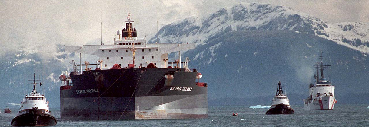
  • “The Exxon Valdez oil spill, which hasn’t been completely cleaned up after 25 years, still has continuous and compounding environmental and economic impacts.8 Washington State can’t afford that tragedy. The 165,000 jobs and $10.8 billion in annual economic activity don’t accurately estimate the costs that such a catastrophe would have on the state.”
  • See the well-referenced article here: http://www.whatcomwatch.org/php/WW_open.php?id=1795
  • Thanks to Andy MacKinnon for pointing to this.

Letter of Support for the BC Government Motion of Dec 5 from the Board of FER

Our shoreline and Race Rocks Ecological reserve are  at risk of an oil spill. Metchosin resident Garry Fletcher and Victoria resident Mike Fenger have been Intervenors in the NEB Kinder Morgan/ Trans Mountain Pipeline Proposal Hearing  on behalf of the Board of Friends of Ecological Reserves. The letter linked here was sent in support of the Province of British Columbia’s  attempts to have full disclosure of the emergency Plans of the WCMRC (Western Canada Marine Response Corporation). ( which happens to be over 50% owned by Kinder Morgan…)

RE: Notice of Motion by the Province of British Columbia submitted December 5, 2014 OH -01- 2014 Trans Mountain Pipeline ULC (“Trans Mountain”) Trans Mountain Expansion Project (the “Project”) File Number OF-Fac-Oil-T260-2013-03 02

As an Intervenor in the above mentioned application, the Board of Friends of Ecological Reserve’s (Board of FER )provides the following comments in support for BC’s Motion submitted by the Province of British Columbia on December 5, 2014.
Please be advised that the Board of FER supports the order sought in the Province of British Columbia’s Notice of Motion dated December 5, 2014:————-

The complete text of this letter can be viewed here on the National Energy Board Website .

 Internal FER website link to this pdf:

Special Report: Tar Sands Reporting Project

Ed note: This link  is included here as an ongoing record of the problem associated with the tar sands project which has resulted in the Kinder Morgan Pipeline Expansion and the Northern Gateway Project of Enbridge.   It is an indication of the state of the Social License Oil companies have achieved with such projects.

mine-site-oil-sands_N3G4651_webSpecial Report: Tar Sands Reporting Project
From the Vancouver Observer: “
Our award-winning team’s crowd-funded series on the people, places and conflicts associated with Canada’s tar sands.”

B.C. coast, St. Lawrence Estuary most at Risk for Major Marine Oil Spill: Report

Adapted from the Times Colonist at this link:
http://www.timescolonist.com/opinion/b-c-coast-st-lawrence-estuary-most-at-risk-for-major-marine-oil-spill-report-1.806714

The Canadian Press
January 29, 2014 01:24 PM  

OTTAWA — A government-commissioned risk analysis says the coast of southern British Columbia and the Gulf of St. Lawrence are the Canadian areas most vulnerable marine oil spills and among the most likely for a major spill to occur.

The findings will add to the debate over several pipeline proposals — including two in B.C. that the report says will substantially increase marine risks.

The 256-page study, delivered this month to Transport Canada, looks at the risks associated with marine oil spills south of the 60th parallel under current shipping volumes.

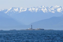
race-rocks-lighthouseIt identifies the southern tip of Vancouver Island, the Cabot Strait off Newfoundland, the eastern coast of Cape Breton Island and the Gulf of St. Lawrence as the most probable areas for a major oil spill.

But the study also assesses the potential impact of four proposed pipeline projects, including the Northern Gateway Pipeline to Kitimat and Kinder Morgan’s plan to almost triple its Trans Mountain line into Vancouver.

The report says the Kinder Morgan proposal would essentially double oil traffic in an already vulnerable marine environment — with a corresponding increase in spill frequency — while the Northern Gateway marine route would turn what are currently very low, near-shore risks into very high risks.

The study found that reversing Enbridge’s Line 9 to carry Western Canadian crude to refineries in Montreal and Quebec City would actually lower marine spill risks, as it would reduce oil imports through the sensitive Gulf of St. Lawrence.

And the study found that the proposed Energy East Pipeline to St. John, N.B., would likely be a wash, reducing shipping imports but increasing oil exports to leave the overall marine risk about where it is now.

© Copyright Times Colonist

Posts on this website about the risk of oil spills on Metchosin’s shores:

Posts on the Ecological Reserves website about the threat of Oil Spills from Tanker Traffic

Posts on the Race Rocks website about the Risk from Increased Tanker Traffic

See the following posts for further information on Tanker traffic off our shores:

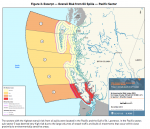
figure-3-overall-risks-oil- spills

 Review of Canada’s Ship-Source Oil-Spill Preparedness and response Regime: 


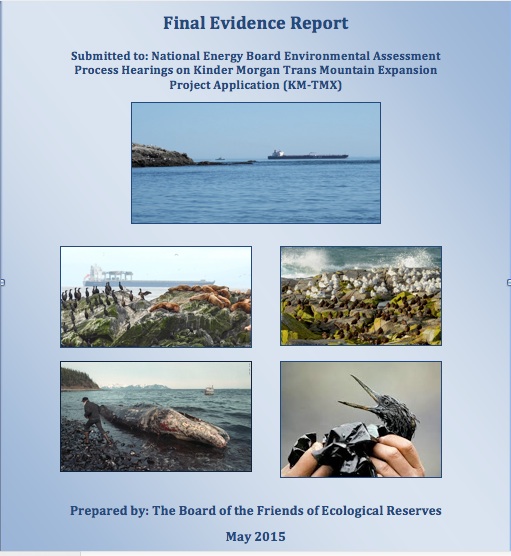
Application to NEB by Board of Friends of Ecological Reserves

mapandships
 Ship traffic in the Strait of Juan de Fuca