Liparidae ( snail fish) today on Taylor Beach

My dog led me to this very unusual fish washed up on the shore today, Nov. 12 -2014.  There was a brisk cold wind blowing from the North east, with a two-foot chop.

I am posting it here to try to get it identified.
Possibilities here on Fishbase

blacksuckerfishventralm

Note sucker on ventral side

blackfishfrontallm

very small eyes indicating it may be an abyssal species.

blackfishlateralm2014-11-12

lateral view of unidentified fish species G. Fletcher photos

blackfishspanm

Length 24 cm.

blackfishlateral2m

Family Liparidae


blacksuckerfishventralm

Liparidae ventral view

A good suggestion has been made by Rick Harbo that it is a snail fish (Liparidae)
From Fishbase:

Deep fin  Classification :Osteichthyes | Actinopterygii | Actinopteri | Neopterygii | Teleostei | Osteoglossocephalai | Clupeocephala | Euteleosteomorpha | Neoteleostei | Eurypterygia | Ctenosquamata | Acanthomorphata | Euacanthomorphacea | Percomorphaceae | Percomorpharia | Perciformes | Cottoidei | Liparidae

Also From Fishbase:
“Liparidae – (Snailfishes)
Distribution: Arctic to Antarctic, Atlantic, and Pacific. Body elongate, scaleless (small prickles in some) and skin jellylike; dorsal fin (28-82 soft rays) and anal fin (24-76 soft rays) long, confluent, or nearly so with caudal fin; pelvic fin (disc) absent in species of Paraliparis and in the monotypic Nectoliparis; nostrils single or paired (usually in Liparis); vertebrae 38-86. Maximum length about 50 cm. Occur from tidepools to depths of over 7,000 m.”

Below: I took this image in late November of a red-breasted merganser female eating what may be one of these fish. I am not sure if she actually got it down whole!

mergandfish

The Hooded nudibranch: Melibe leonina

Laura Verhegge has posted this note about Melibe leonina, seen today in Pedder Bay  on the Pearson College Marine Science website

A multitude of Melibe drift to the Pearson College dock

melibe

Melibe the hooded nudibranch photo by Laura Verhegge

melibe3

Melibe leonina photos on Race Rocks Taxonomy by Ryan Murphy


(see other images and a video of the movement on her website)


Ryan Murphy got these images for the  Race Rocks Taxonomy.


Domain: Eukarya
Kingdom: Animalia
Phylum: Mollusca
Class: Gastropoda
Subclass: Opisthobranchia
Order: Nudibranchia
Superfamily: Tritoniodea
Family: Tethydidae
Genus: Melibe
Species: leonina Gould, 1852
Common Name: Hooded Nudibranch

Seabirds abundant on Taylor Beach today

I had thought that the Mergansers which started showing up on Taylor Beach this past week were Common Merganser females. Now I am not so sure, as most of them lok more like Red-breasted merganser females . Click for enlargement.

merganser females

Group of female Mergansers off the north end of Taylor Beach

merganserfemaleclose

Zoomed in view of mergansers- possibly a mix of mainly red-breasted merganser females and common merganser females..

flyingcorm

Flying merganser females

flyingmergansersclose

Flying merganser females closer–

buffleheads

Buffleheads in large flocks of up to 100 individuals

buffleandcorm

Flying Buffleheads go past Double -crested Cormorants

shipand cormorants

Double-crested Cormorants with an ocean-going vessel in the background. If all projects for the Pacific North-west go ahead as planned, over 1000 more ships of this size above the high number already using this waterway, will be transiting these waters each year, all carrying bunker and diesel fuel and if Kinder Morgan has its way 350 a year carrying highly toxic dilbit. Click on the oil-spill risk category link below.

See the Census Page on the seabirds showing up in the last few weeks.

References on Oil Spill Risk

A search of oil spill risk and response shows some very useful references from the State of Washington. The PUGET SOUND PARTNERSHIP has produced an excellent study

http://www.psp.wa.gov/ FINAL REPORT: VTRA 2010

EXECUTIVE SUMMARY

Vessels transiting the Salish Sea traverse waters bordering numerous communities en route to ports in both the US and Canada. The Salish Sea is a large (over 1000 square miles) and diverse water body physically characterized by passages that are broad and deep, as well as narrow ones that are navigationally challenging with swift currents. In addition, it is a biologically rich ecosystem with significant natural resources these communities depend upon.

The Strait of Juan de Fuca serves as the entrance to these U.S. and Canadian ports and facilities and is transited by approximately 10,000 deep draft vessels annually including arrivals and departures. Additional transits occur internally as vessels shift locations. There are also tug and barge movements, ferry operations, fishing and recreational vessels throughout. For example, the U.S. Coast Guard Vessel Traffic Service (VTS) alone handles approximately 230,000 transits annually with about 170,000 of those being Washington State Ferries meaning there are more than 50,000 transits other than ferries. The Puget Sound Pilots report nearly 8,000 assignments annually which provide a good metric for how many deep draft vessel movements there are on the U.S. Side. ———–

While a previous GW/VCU analysis [2] of this area demonstrated significant risk reduction of oil transportation risk due to existing risk mitigation measures, the potential for large oil spills continues to be a prominent public concern heightened by proposed maritime terminal developments. In this study we focus on the following three (although other ones are under consideration) since these three are in advanced stages of a permitting process:

(1)The proposed Gateway bulk carrier terminal at Cherry Point, Washington.

(2)The Trans-Mountain/Kinder Morgan pipeline expansion in Vancouver, BC.

(3)The coal, grain and container terminal expansions at Delta Port, BC.

The purpose of this vessel traffic risk assessment (VTRA) is to evaluate potential changes in risk in light of above three maritime terminal developments and to inform the State of Washington, the United States Coast Guard and the Puget Sound Harbor Safety Committee on what actions could be taken to mitigate potential increases in oil spill risk from large commercial vessel in the VTRA study area. This study was not designed to measure the effectiveness of risk mitigation measures already in place. This study is also intended to inform tribes,local governments, industry and non-profit groups in Washington State and British Columbia on potential risk management options.

Summarizing, this study was conducted because study sponsors and involved stakeholders want to ensure potential risks of maritime development projects above are better understood so informed decisions could be made about additional risk mitigation measures that would add to the continuous improvement efforts of the past.

See the comlete pdf:http://www.psp.wa.gov/ FINAL REPORT: VTRA 2010

Common Loons ( Gavia immer) off shore today

Nov 5: Yesterday  there were several loons offshore from Taylor Beach. They normally stay over 100 m off shore, so photography without a telephoto is challenging. I think the following images are of two Common Loons (Gavia immer) in various stages of maturity.

commonloon male

Common Loon off the bluff at the North end of taylor Beach

Nov 8 : Definitely Common Loons–a pair of them are feeding every day off Taylor beach (north end) this week.
Scientific classification
Kingdom: Animalia
Phylum: Chordata
Class: Aves
Clade: Aequornithes
Order: Gaviiformes
Family: Gaviidae Coues, 1903
Genus: Gavia Forster, 1788
Species: G. immer
Gavia immer Morten Thrane Brunnich, 1764)

Why Sand Is Disappearing ( from beaches)

beachlooknorth

The heavily impacted Weir’s Beach which has experienced considerable sand loss in recent years largely due to bad management of the shoreline.

This article highlights a good example how human interference ( anthropogenic) in a number of ways can result in the loss of Natural Capital and long term sustainability . 

The beaches of Metchosin are not immune  to the forces of Climate change and uninformed decisions of upland landowners and municipal governments which refuse to enact rigid Shoreline Development Bylaws. 

This has been quoted  from: The NYT Opinion Pages    NOV. 4, 2014

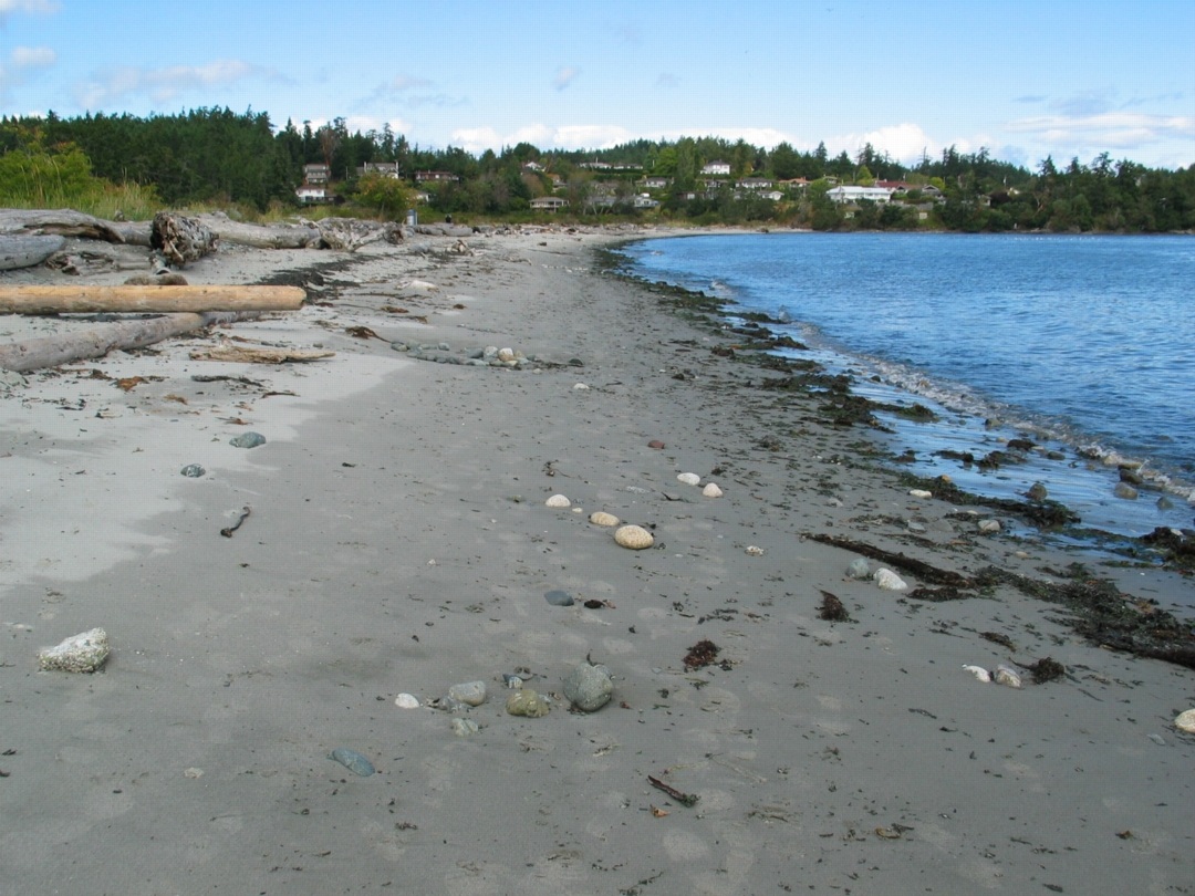
” BERKELEY, Calif. — To those of us who visit beaches only in summer, they seem as permanent a part of our natural heritage as the Rocky Mountains and the Great Lakes. But shore dwellers know differently. Beaches are the most transitory of landscapes, and sand beaches the most vulnerable of all. During big storms, especially in winter, they can simply vanish, only to magically reappear in time for the summer season.

It could once be said that “a beach is a place where sand stops to rest for a moment before resuming its journey to somewhere else,” as the naturalist D. W. Bennett wrote in the book “Living With the New Jersey Shore.” Sand moved along the shore and from beach to sea bottom and back again, forming shorelines and barrier islands that until recently were able to repair themselves on a regular basis, producing the illusion of permanence.

Today, however, 75 to 90 percent of the world’s natural sand beaches are disappearing, due partly to rising sea levels and increased storm action, but also to massive erosion caused by the human development of shores. Many low-lying barrier islands are already submerged.

Yet the extent of this global crisis is obscured because so-called beach nourishment projects attempt to hold sand in place and repair the damage by the time summer people return, creating the illusion of an eternal shore.

Before next summer, endless lines of dump trucks will have filled in bare spots and restored dunes. Virginia Beach alone has been restored more than 50 times. In recent decades, East Coast barrier islands have used 23 million loads of sand, much of it mined inland and the rest dredged from coastal waters — a practice that disturbs the sea bottom, creating turbidity that kills coral beds and damages spawning grounds, which hurts inshore fisheries.

The sand and gravel business is now growing faster than the economy as a whole. In the United States, the market for mined sand has become a billion-dollar annual business, growing at 10 percent a year since 2008. Interior mining operations use huge machines working in open pits to dig down under the earth’s surface to get sand left behind by ancient glaciers. But as demand has risen — and the damming of rivers has held back the flow of sand from mountainous interiors — natural sources of sand have been shrinking.

One might think that desert sand would be a ready substitute, but its grains are finer and smoother; they don’t adhere to rougher sand grains, and tend to blow away. As a result, the desert state of Dubai brings sand for its beaches all the way from Australia.

And now there is a global beach-quality sand shortage, caused by the industries that have come to rely on it. Sand is vital to the manufacturing of abrasives, glass, plastics, microchips and even toothpaste, and, most recently, to the process of hydraulic fracturing. The quality of silicate sand found in the northern Midwest has produced what is being called a “sand rush” there, more than doubling regional sand pit mining since 2009.

But the greatest industrial consumer of all is the concrete industry. Sand from Port Washington on Long Island — 140 million cubic yards of it — built the tunnels and sidewalks of Manhattan from the 1880s onward. Concrete still takes 80 percent of all that mining can deliver. Apart from water and air, sand is the natural element most in demand around the world, a situation that puts the preservation of beaches and their flora and fauna in great danger. Today, a branch of Cemex, one of the world’s largest cement suppliers, is still busy on the shores of Monterey Bay in California, where its operations endanger several protected species.

The huge sand mining operations emerging worldwide, many of them illegal, are happening out of sight and out of mind, as far as the developed world is concerned. But in India, where the government has stepped in to limit sand mining along its shores, illegal mining operations by what is now referred to as the “sand mafia” defy these regulations. In Sierra Leone, poor villagers are encouraged to sell off their sand to illegal operations, ruining their own shores for fishing. Some Indonesian sand islands have been devastated by sand mining.

It is time for us to understand where sand comes from and where it is going. Sand was once locked up in mountains and it took eons of erosion before it was released into rivers and made its way to the sea. As Rachel Carson wrote in 1958, “in every curving beach, in every grain of sand, there is a story of the earth.” Now those grains are sequestered yet again — often in the very concrete sea walls that contribute to beach erosion.

We need to stop taking sand for granted and think of it as an endangered natural resource. Glass and concrete can be recycled back into sand, but there will never be enough to meet the demand of every resort. So we need better conservation plans for shore and coastal areas. Beach replenishment — the mining and trucking and dredging of sand to meet tourist expectations — must be evaluated on a case-by-case basis, with environmental considerations taking top priority. Only this will ensure that the story of the earth will still have subsequent chapters told in grains of sand.

Areas to Be Avoided- Why Not in Canada Also?

When we look at the protection afforded along the Rugged coast of the Olympic Peninsula, one might quite easily question why we in Canada cannot have an equivalent level of protection for our rugged and sensitive areas.

The Olympic Coast National Marine Sanctuary is one of 14 marine sanctuaries administered by the National Oceanic and Atmospheric Administration, an agency of the U.S. Department of Commerce. It includes 2,408 square nautical miles of marine waters off the rugged Olympic Peninsula coastline.


This reference provides a good explanation of the history and process of having the International Maritime Organization declare this area an ATBA, (Area To Be Avoided) Olympic Coast National Marine Sanctuary Area to be Avoided (ATBA) Education and Monitoring Program


Dave Shannon of Terrace BC has provided his notes and aid to the testimony on December 2012 which he provided as an intervenor in the cross examination in the Northern Gateway Joint review Panel.

The images below are included in the PDF:
ATBA Reference During Transcript #115 Prince Rupert Dec. 2012

ATBA-Olympicpenn1ATBA-Olympicpenn2