The determination of the natural boundary of the coastline is important in establishing ownership of property and therefore public access along a coastline: The following reference may help clarify this .
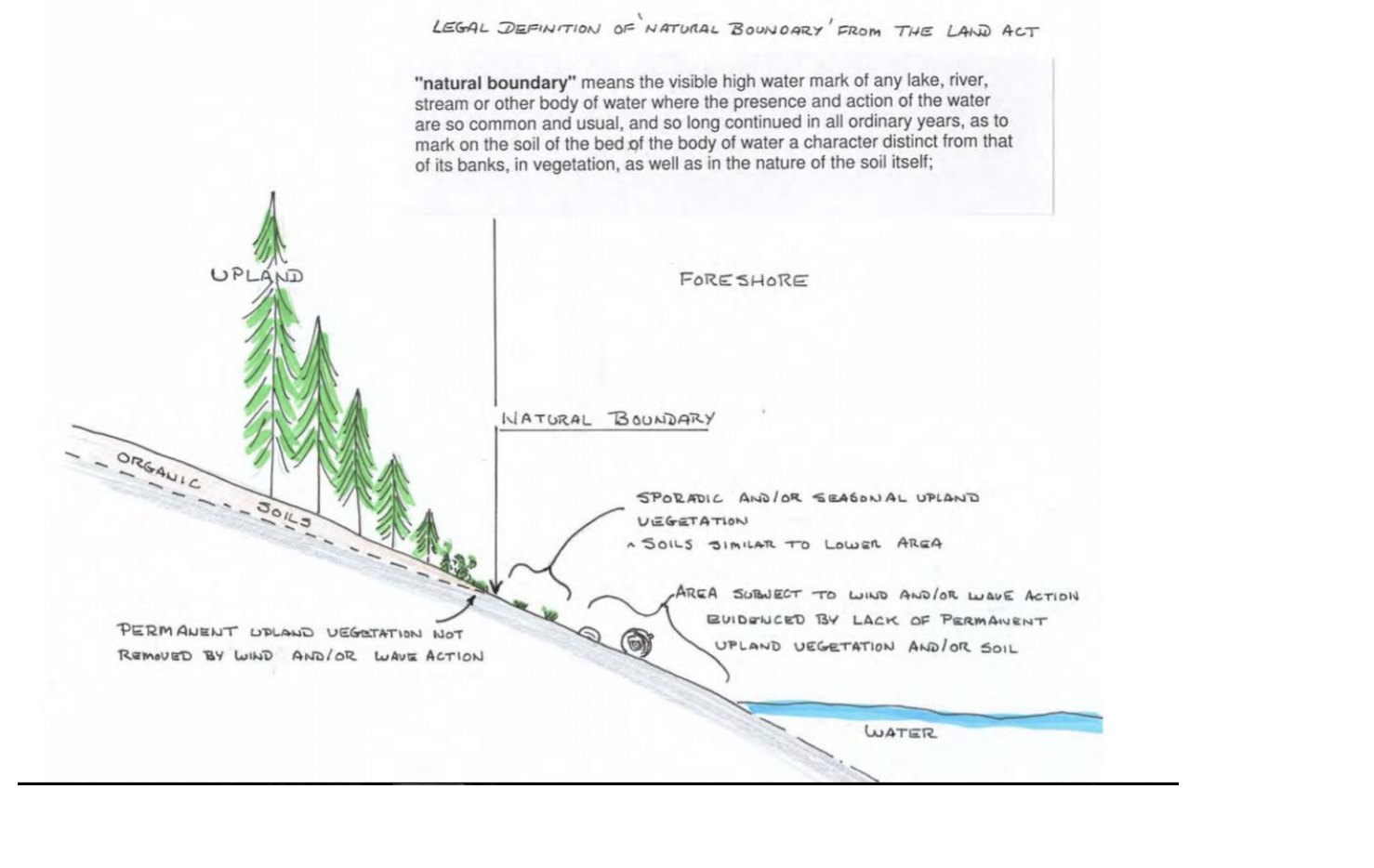
The determination of the natural boundary of the coastline is important in establishing ownership of property and therefore public access along a coastline: The following reference may help clarify this .
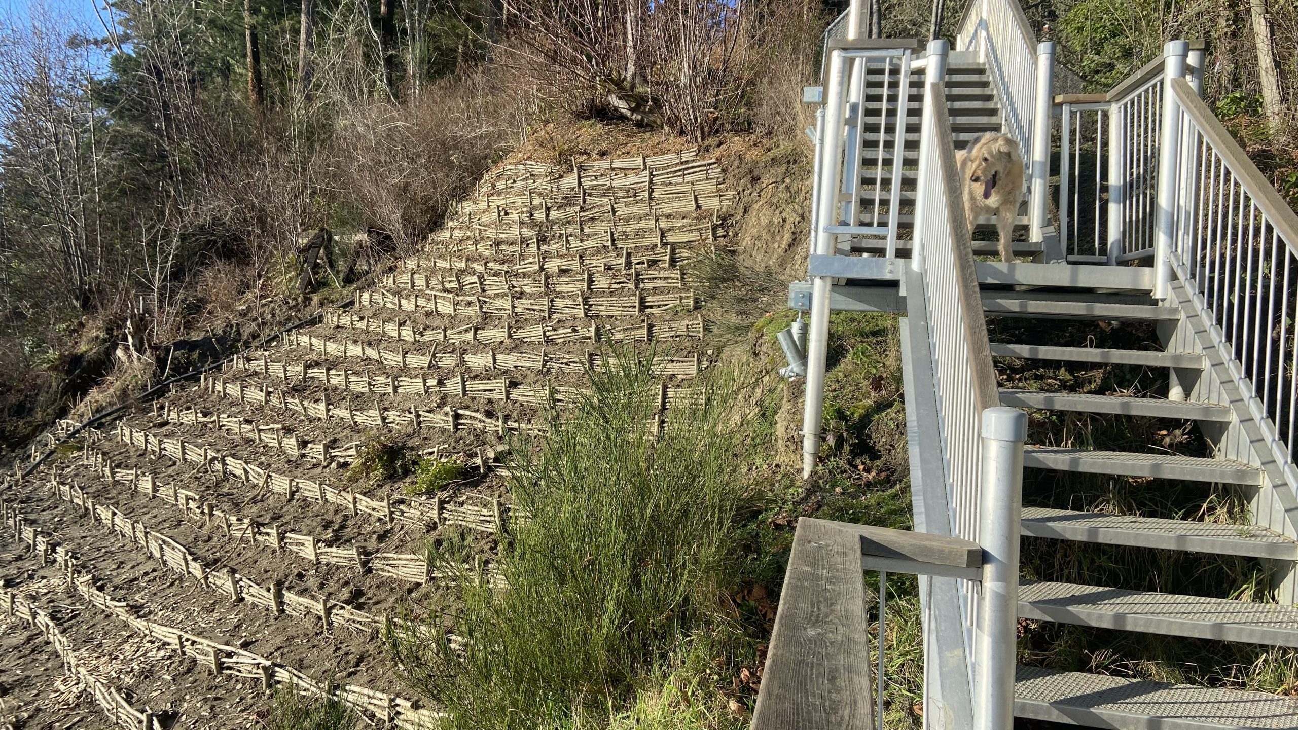
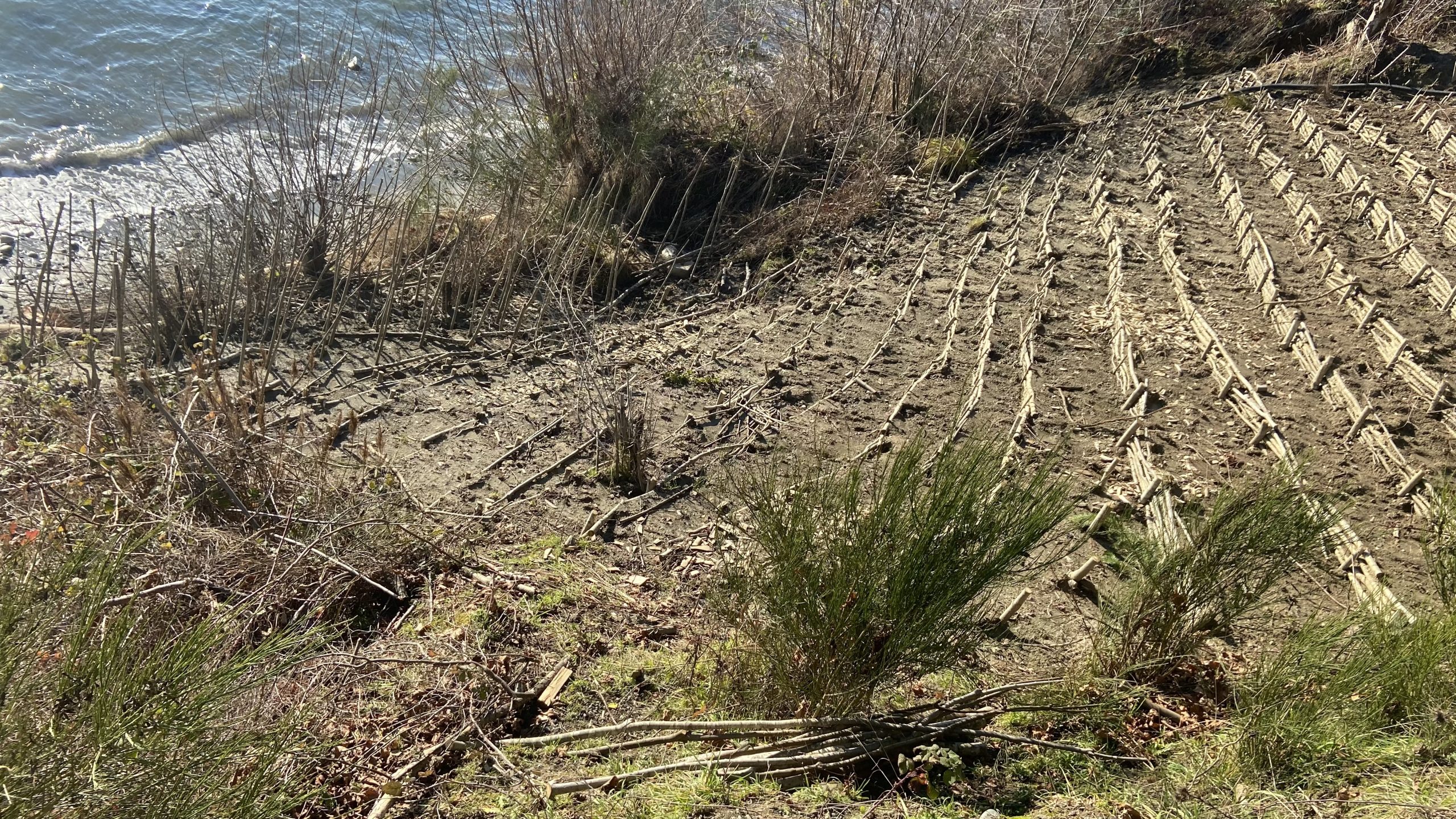
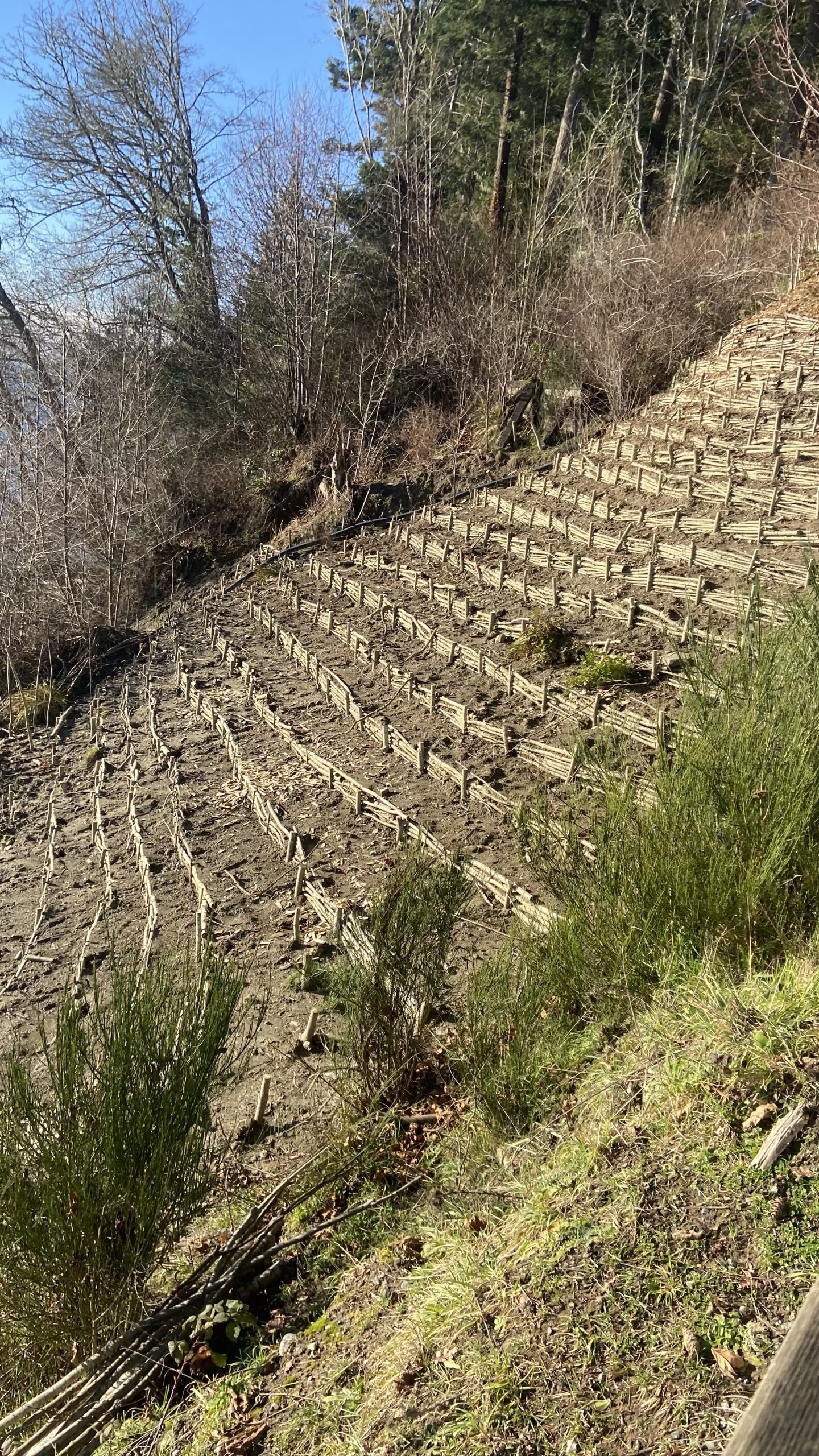
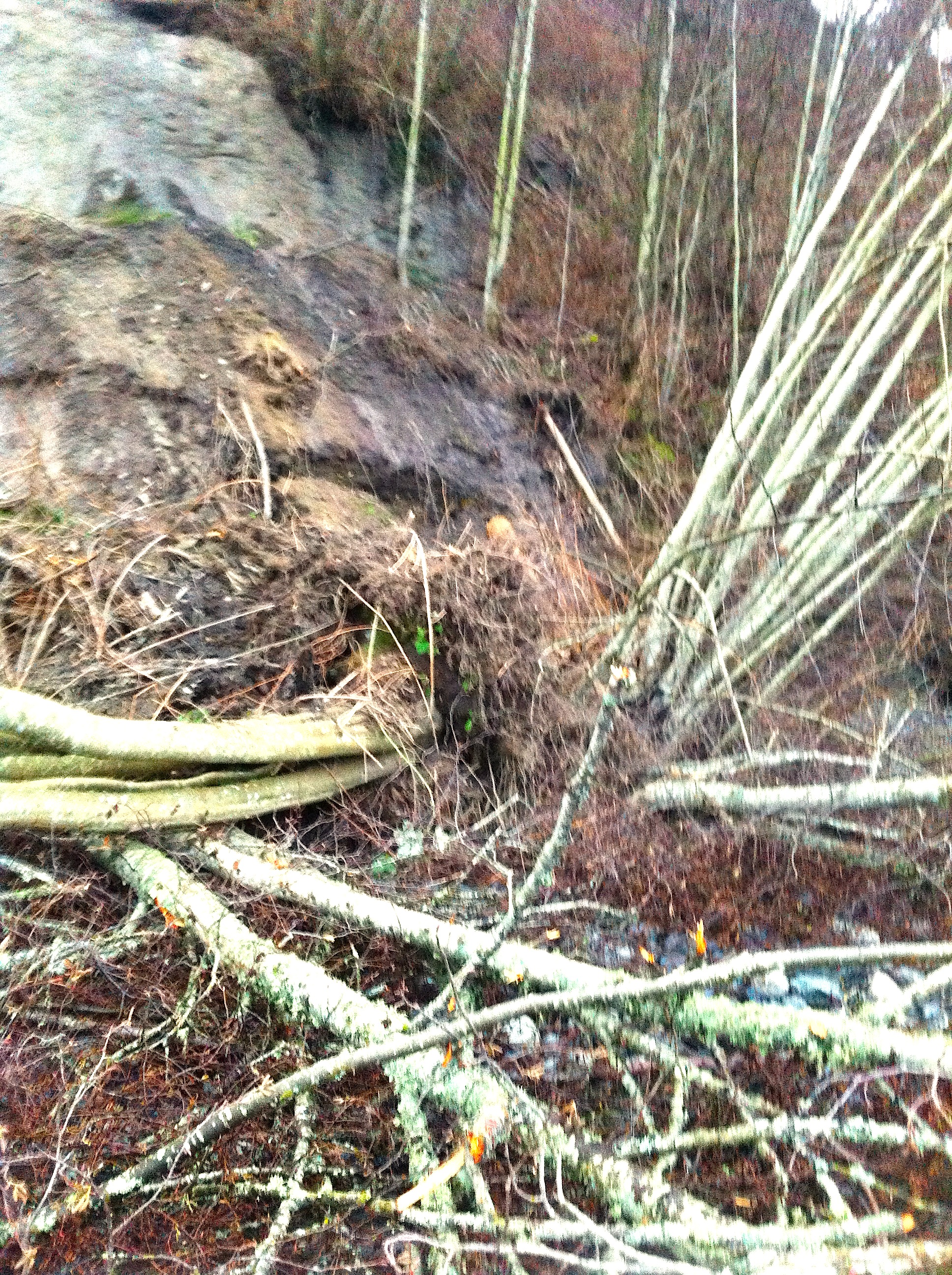
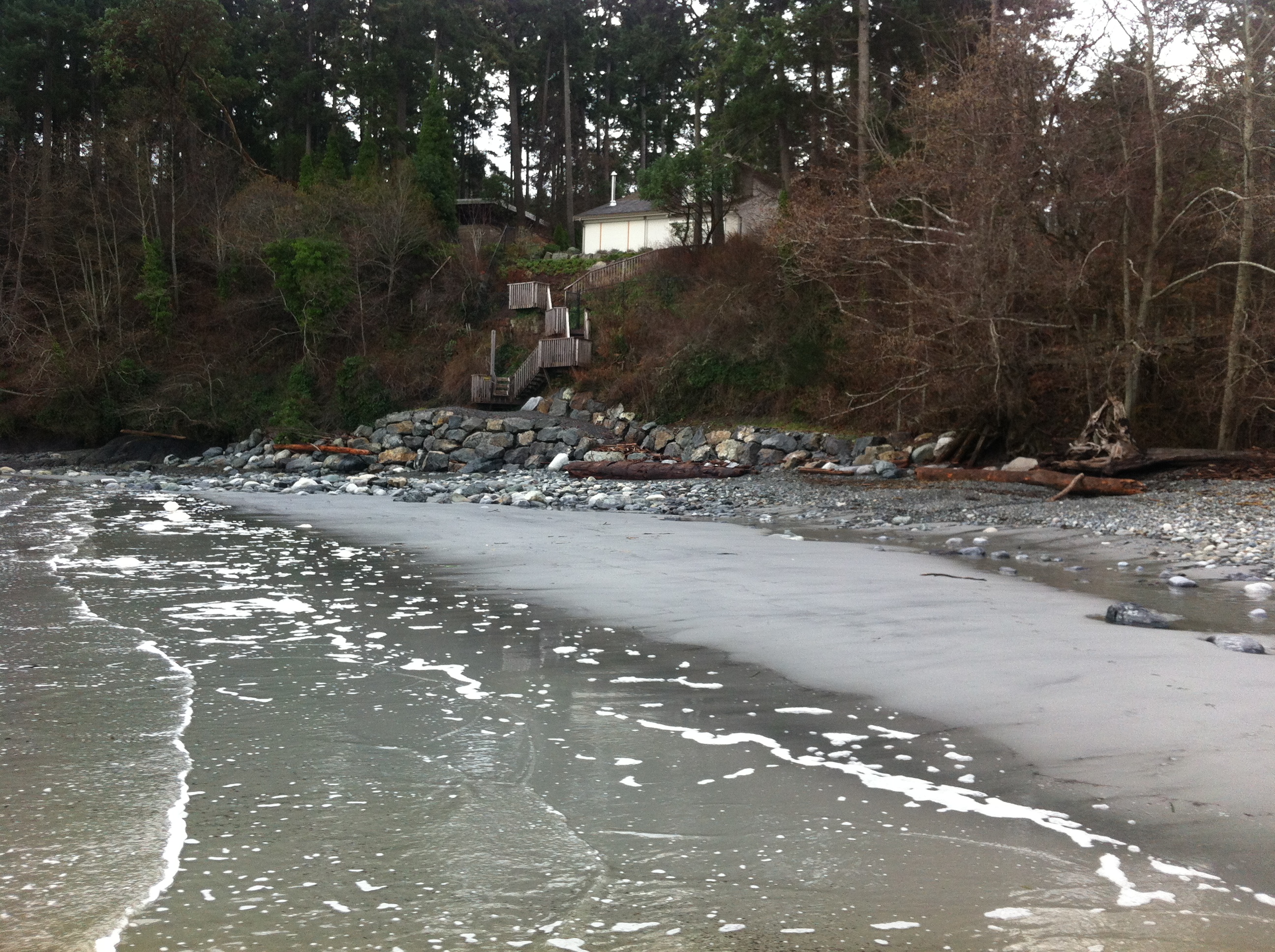
In the fall of 2021, a cliff stabilization exercise was carried out along with the re-establishment of the stairway down to Witty’s Beach . Cuttings of willow were planted in the area of the back that had been eroding.
 Subject:
 Healthy coastal ecosystems are essential for maintaining biodiversity and liveable coastal communities, providing critical habitat, water quality protection, food and medicinal plants for harvesting, lessening of coastal erosion, resilience to climate change, and flood regulation.
Perhaps less well known is that coastal ecosystems also play an important role in long-term carbon storage and sequestration. This paper looks at emerging policy opportunities and needs in Canada, and specifically British Columbia, for “blue carbon” – the carbon stored in vegetated coastal ecosystems – and how protecting blue carbon as a climate action measure aligns with coastal biodiversity protection and resilience more broadly.
This is an important new publication by West Coast Environmental Law
Guide to Coastal & Ocean Protection Law in BC (PDF)

Subject: Marine Protection, Coastal and Ocean LawsAuthor: Stephanie Hewson, Linda Nowlan, Georgia Lloyd-Smith, Deborah Carlson & Michael Bissonnette
Summary:
Are you concerned about the health of your local shoreline, and wondering what your government(s) can do to help? Curious about the complex web of laws, policies and regulations governing the BC coast and ocean? Interested in learning how different authorities and jurisdictions can work together?
Our Guide to Coastal and Ocean Protection Law in BC is a comprehensive resource that covers the wide array of legal tools available to Indigenous, federal, provincial and local governments to protect the coast and ocean in BC.
In addition to being a resource on marine spatial protection law, this Guide is a record of what has been accomplished on the Pacific coast over the last several decades – providing examples that demonstrate how different legal tools have been employed to preserve the health of coastal and marine ecosystems.
This Guide was developed with the generous support of the Sitka Foundation and the Gordon & Betty Moore Foundation. Publication Date: December 3, 2020Publication Pages: 324Publisher: West Coast Environmental LawPublication Format: PDF
Salish Sea Currents presents an in-depth series focusing on shoreline armoring in the Puget Sound region. Close to a third of Puget Sound’s shoreline is classified as armored with bulkheads and other structures meant to hold back storm surge and erosion. But new studies reveal the often significant toll this is taking on the environment. To be notified of new Salish Sea Currents stories, subscribe to the Puget Sound Institute eNews.
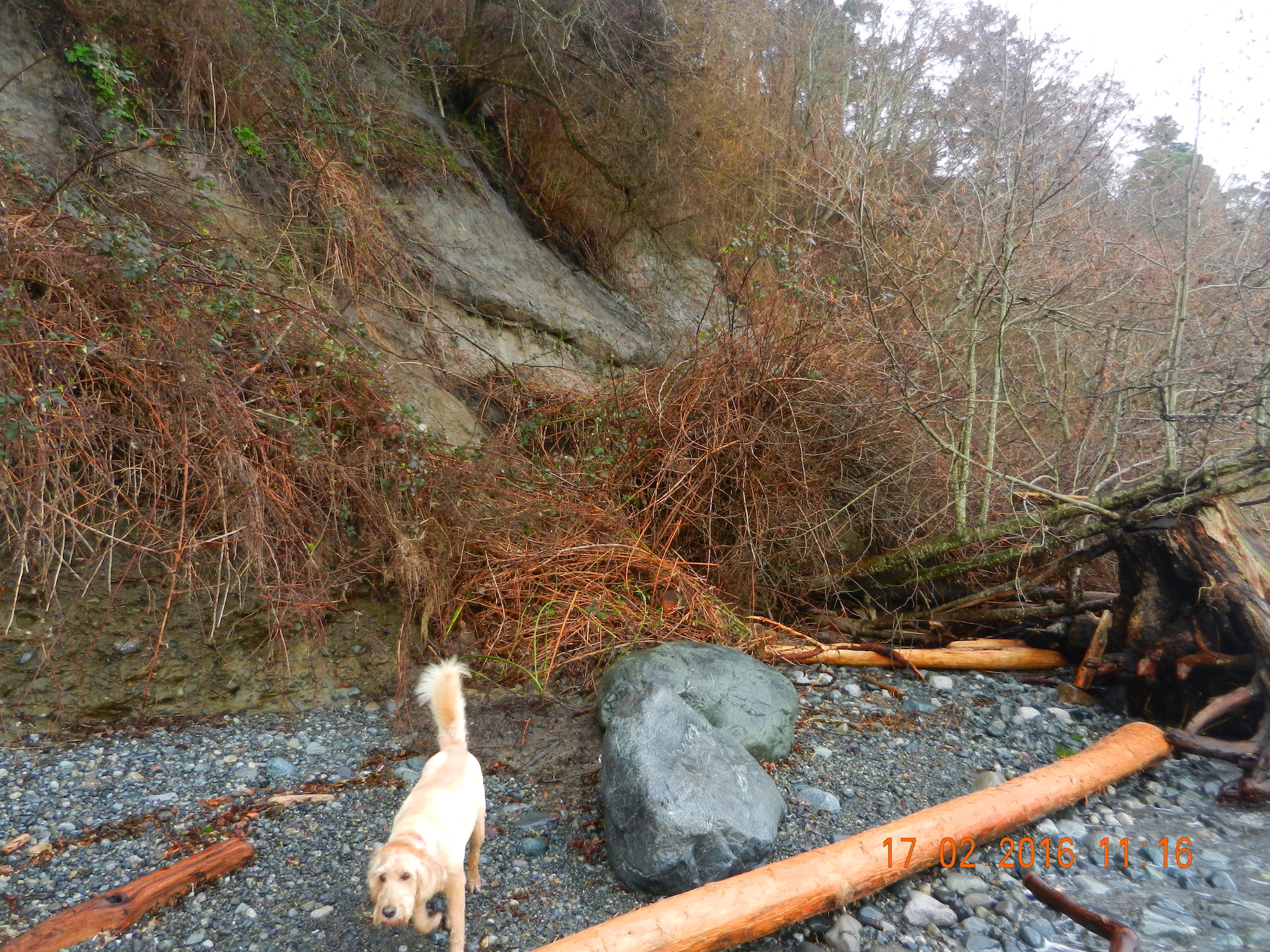
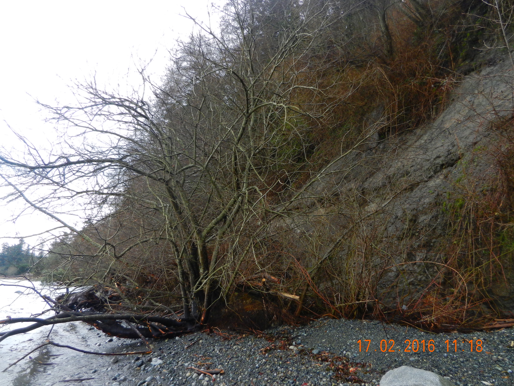
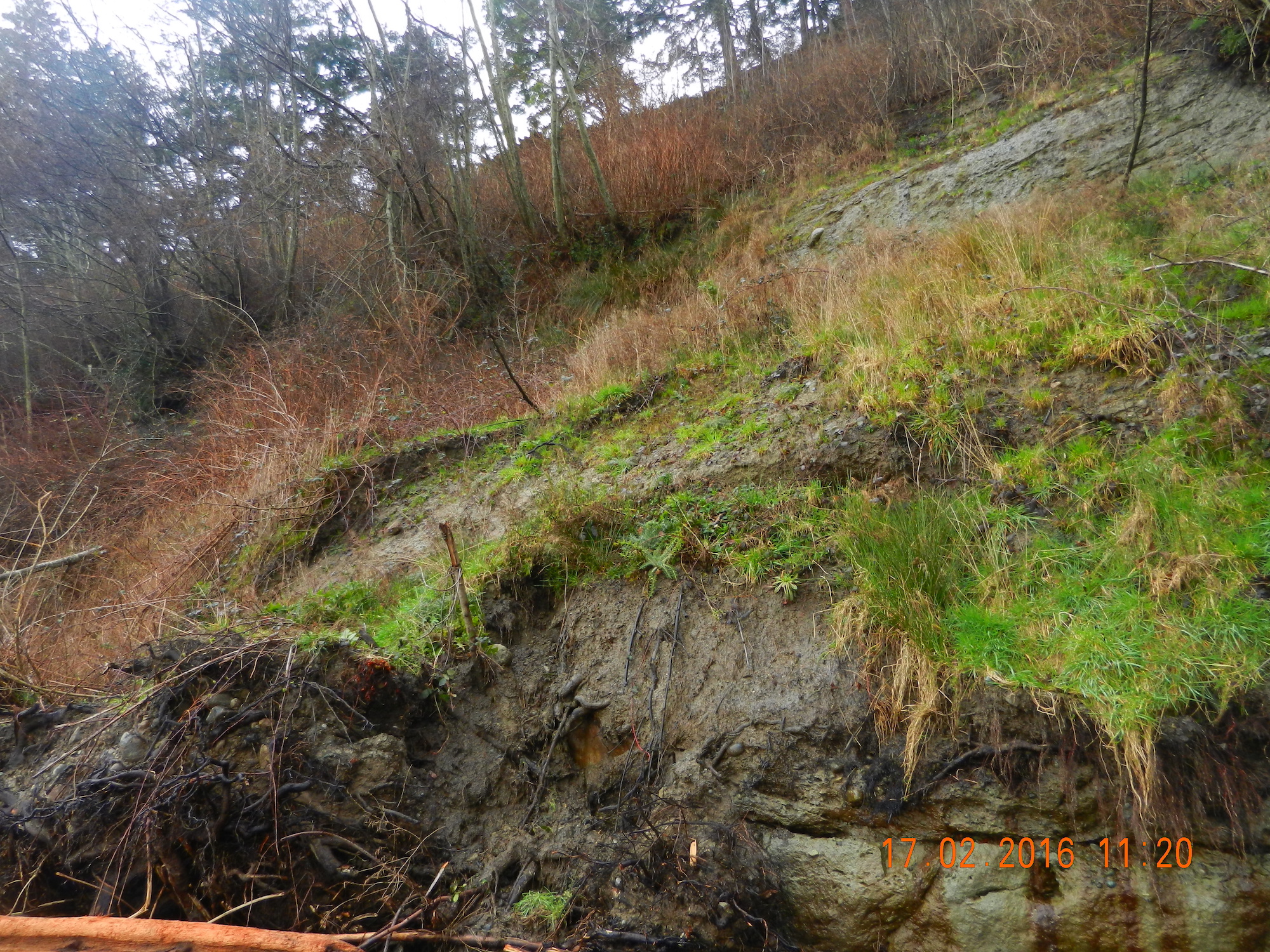
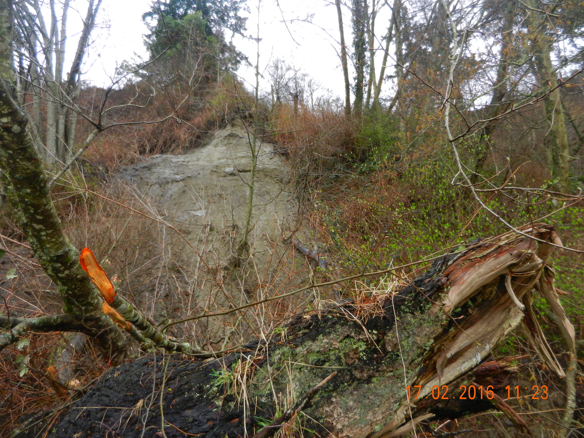
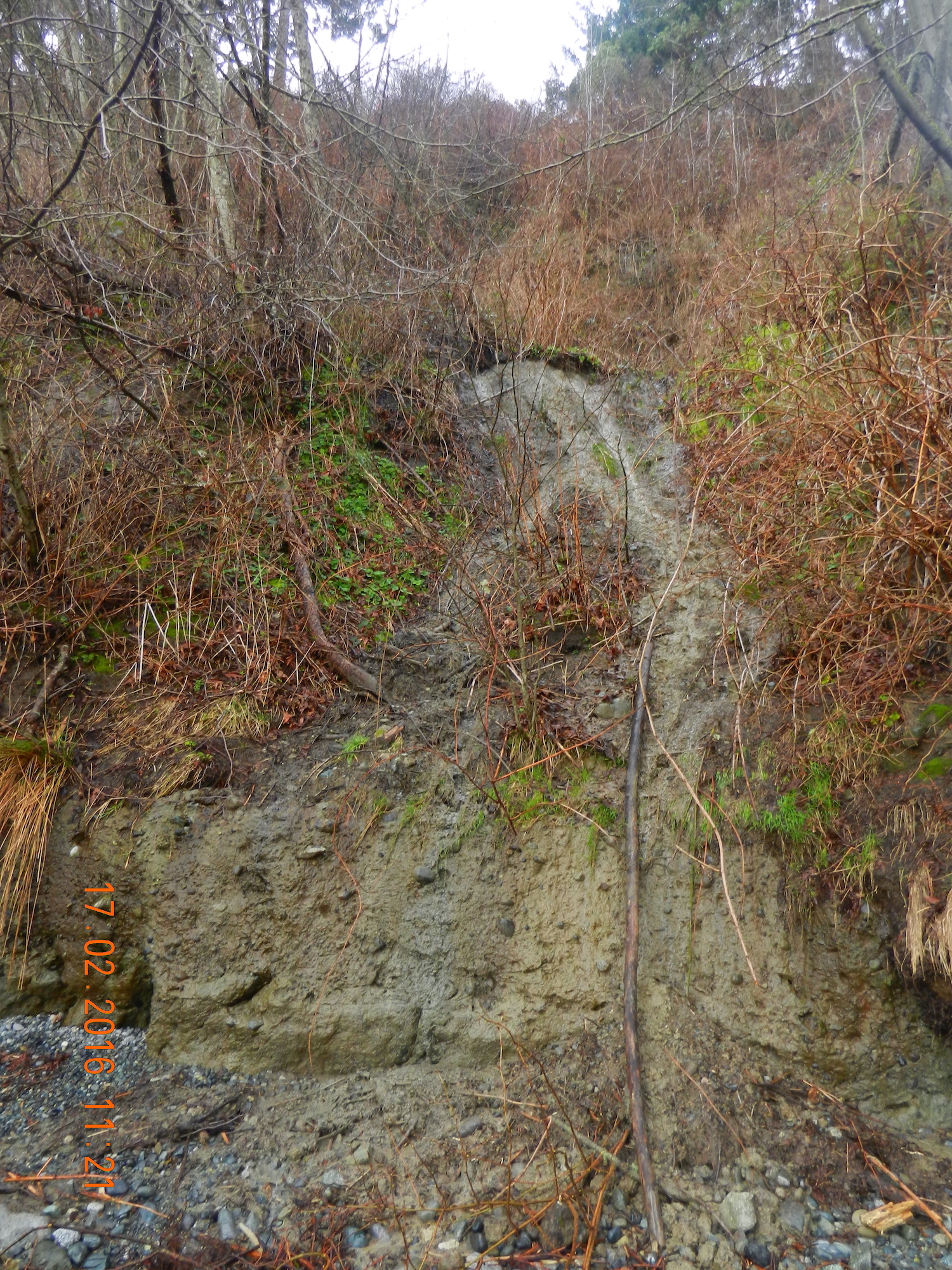
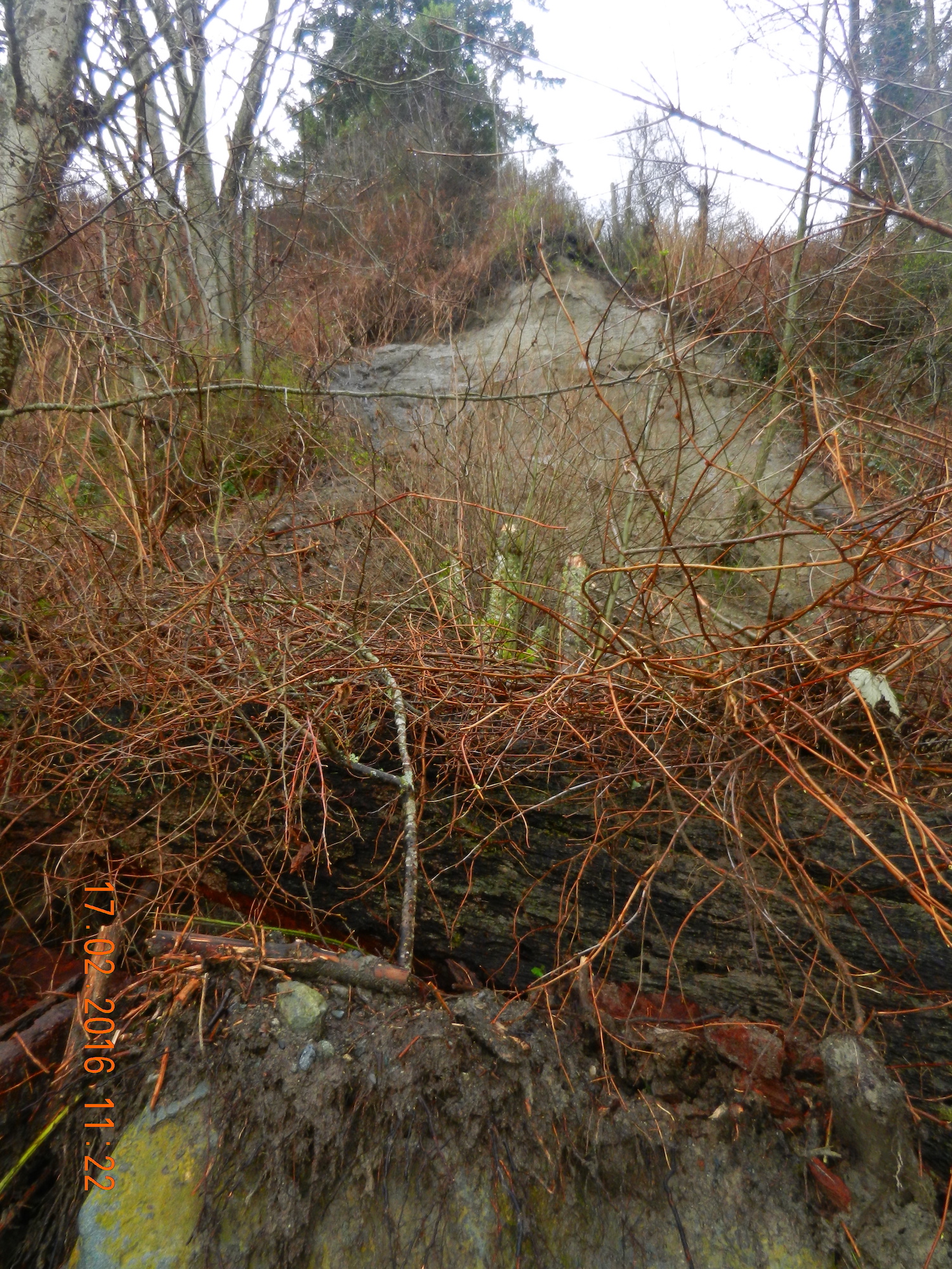
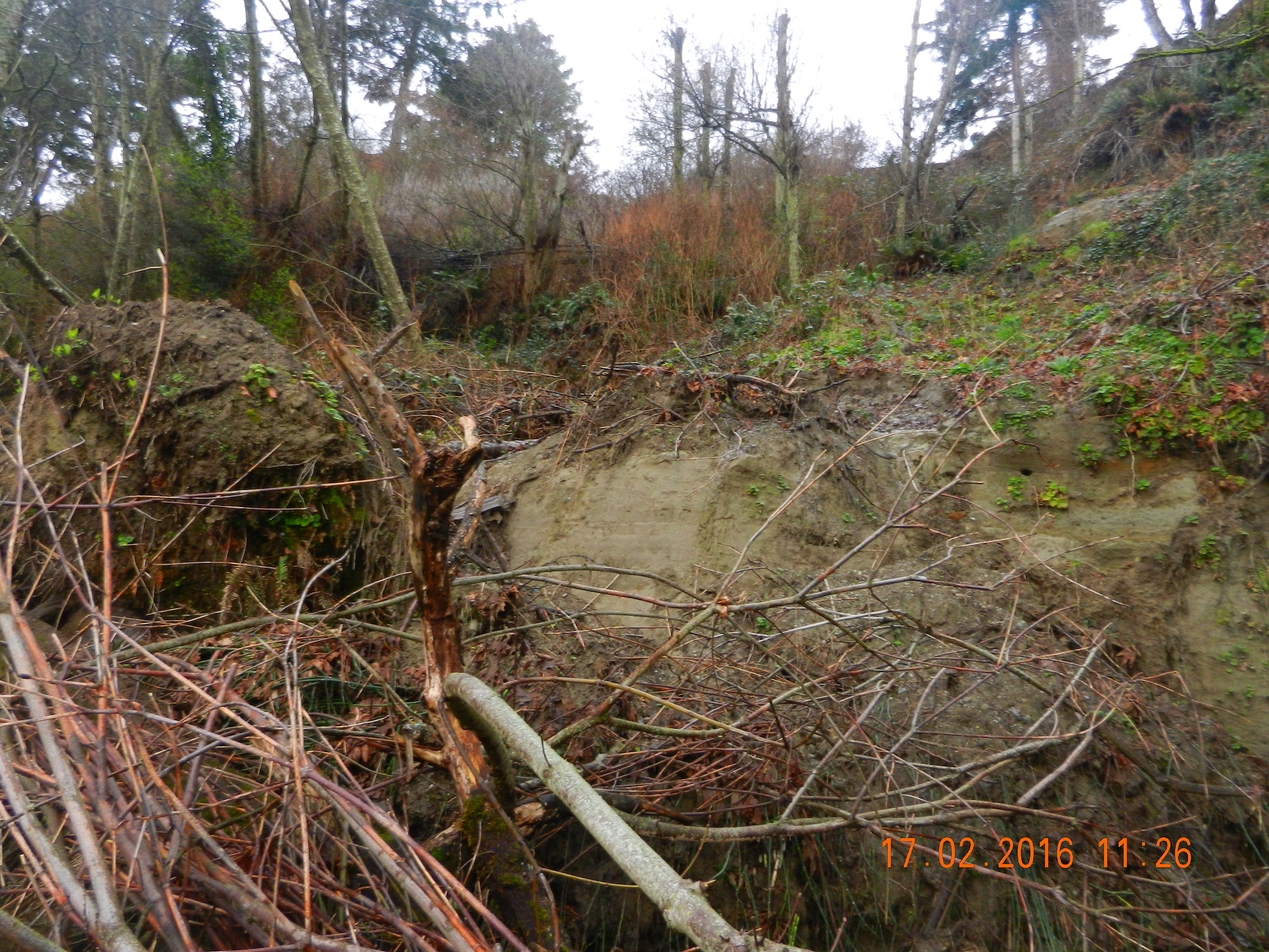
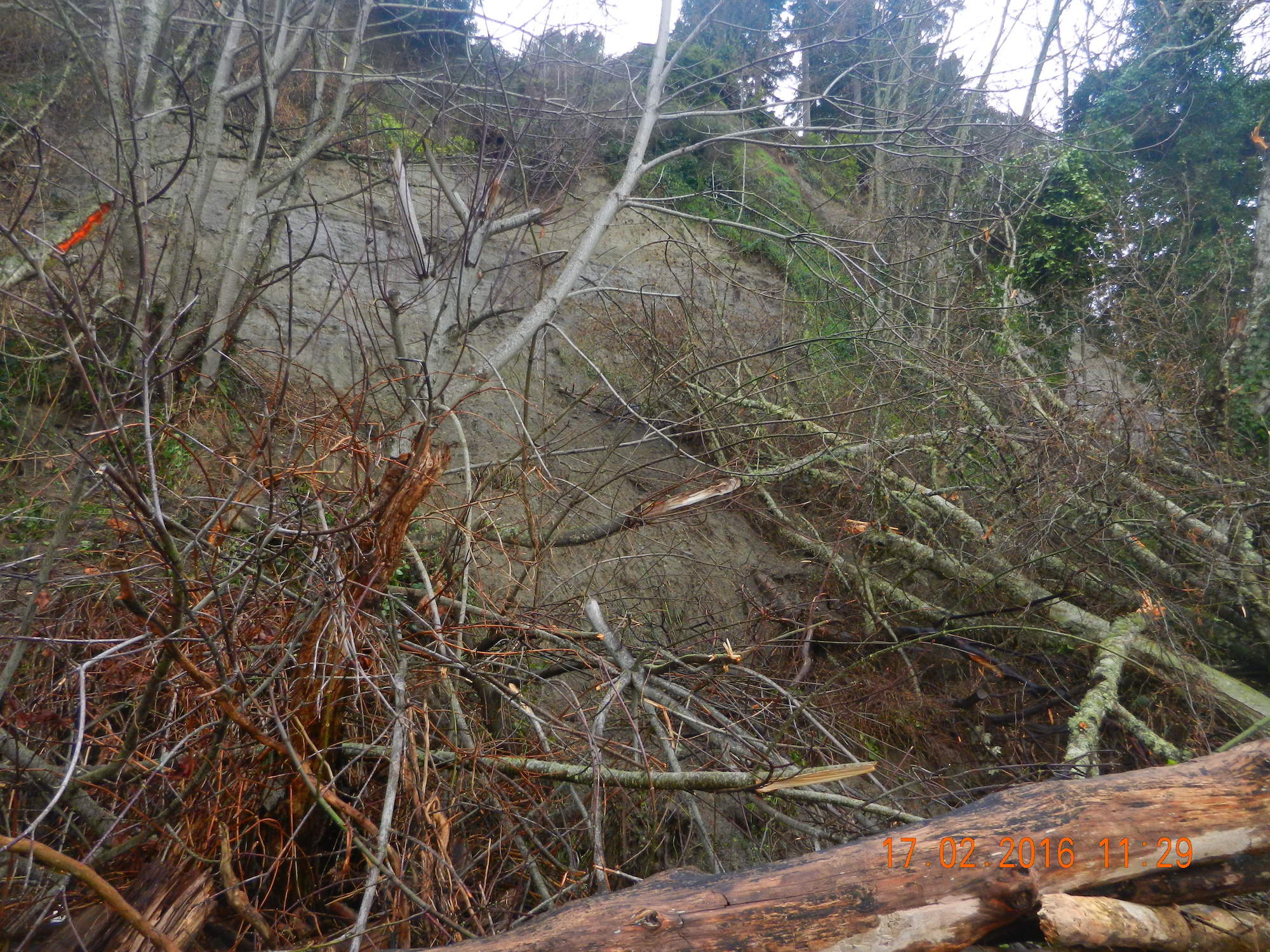
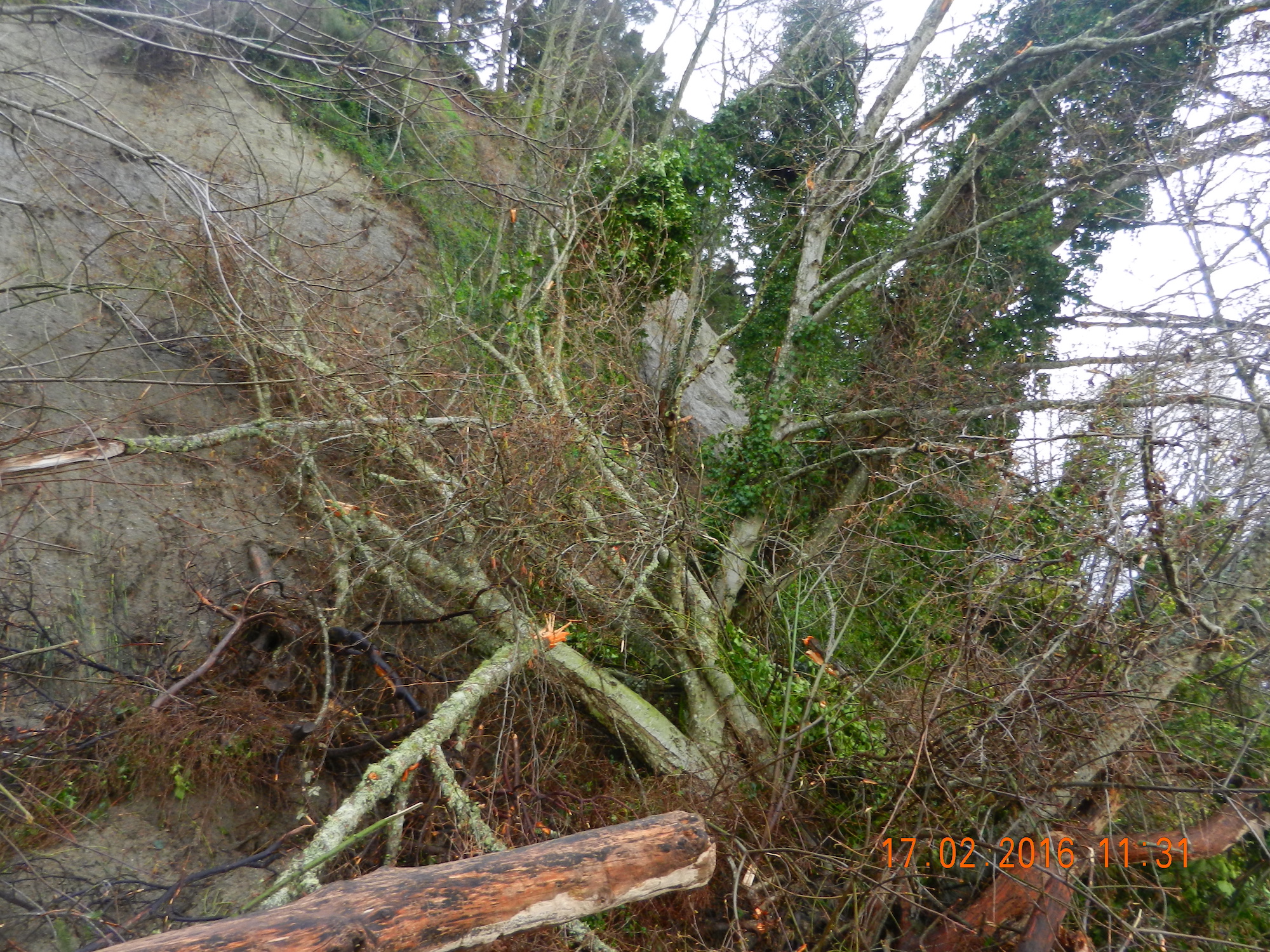
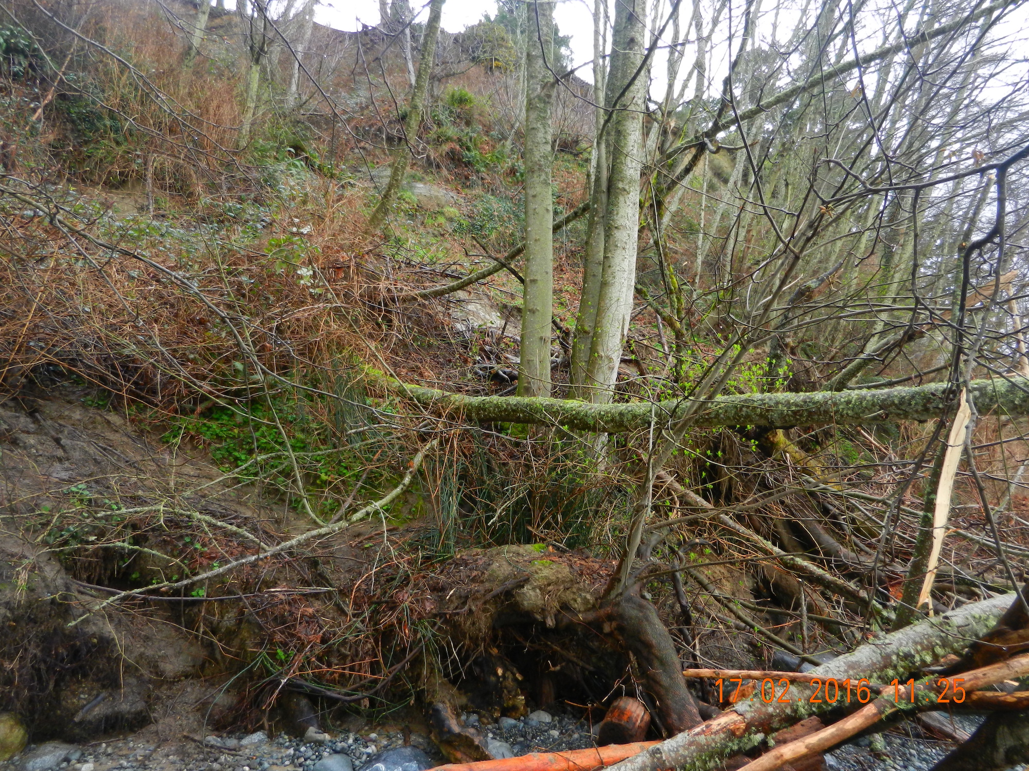
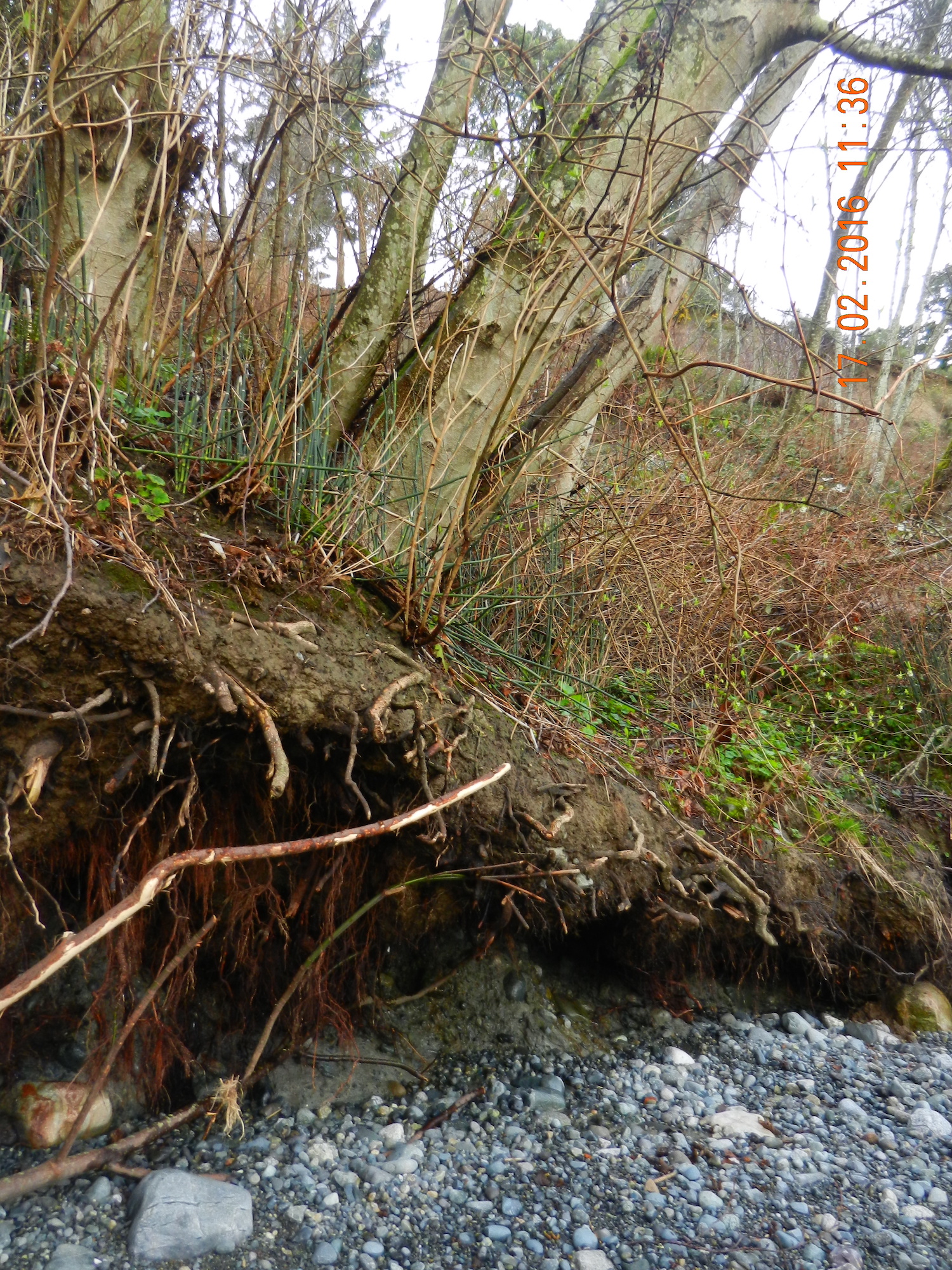
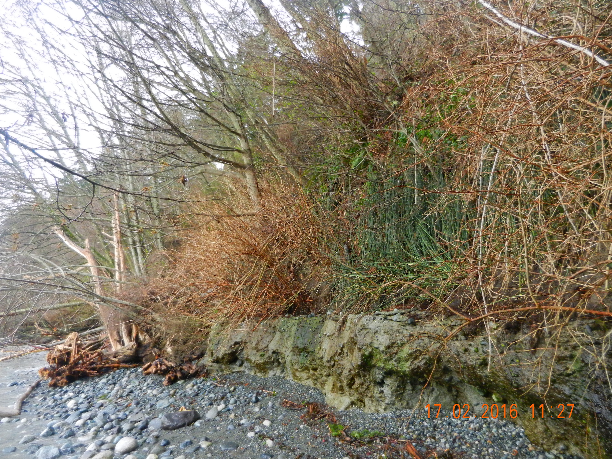
This past week we have had a few days of extra heavy rainfall in Metchosin and consequently the hazard land slopes of the Development Permit Area along the Taylor Beach bluff have certainly met the designation. On the South end of the bluffs alone, at least ten new slides have left large gaps on the cliff and have deposited piles of vegetation on the beach. Residents on the top of the bluff are continuously at risk of losing property so development of any new structures or vegetation removal is inadvisable.
The following pictures were taken starting from the south end of the cliff toward the first corner heading North.
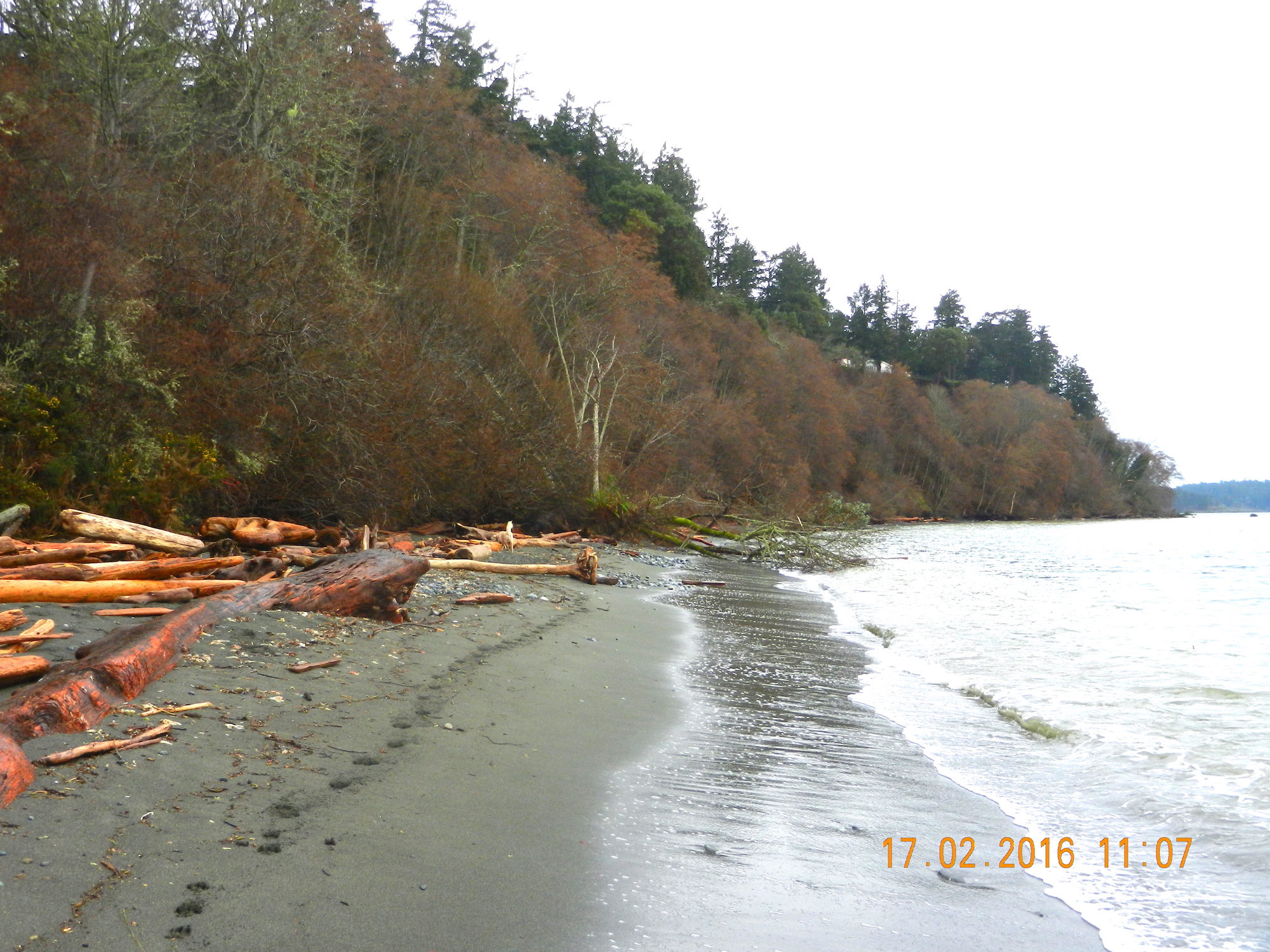
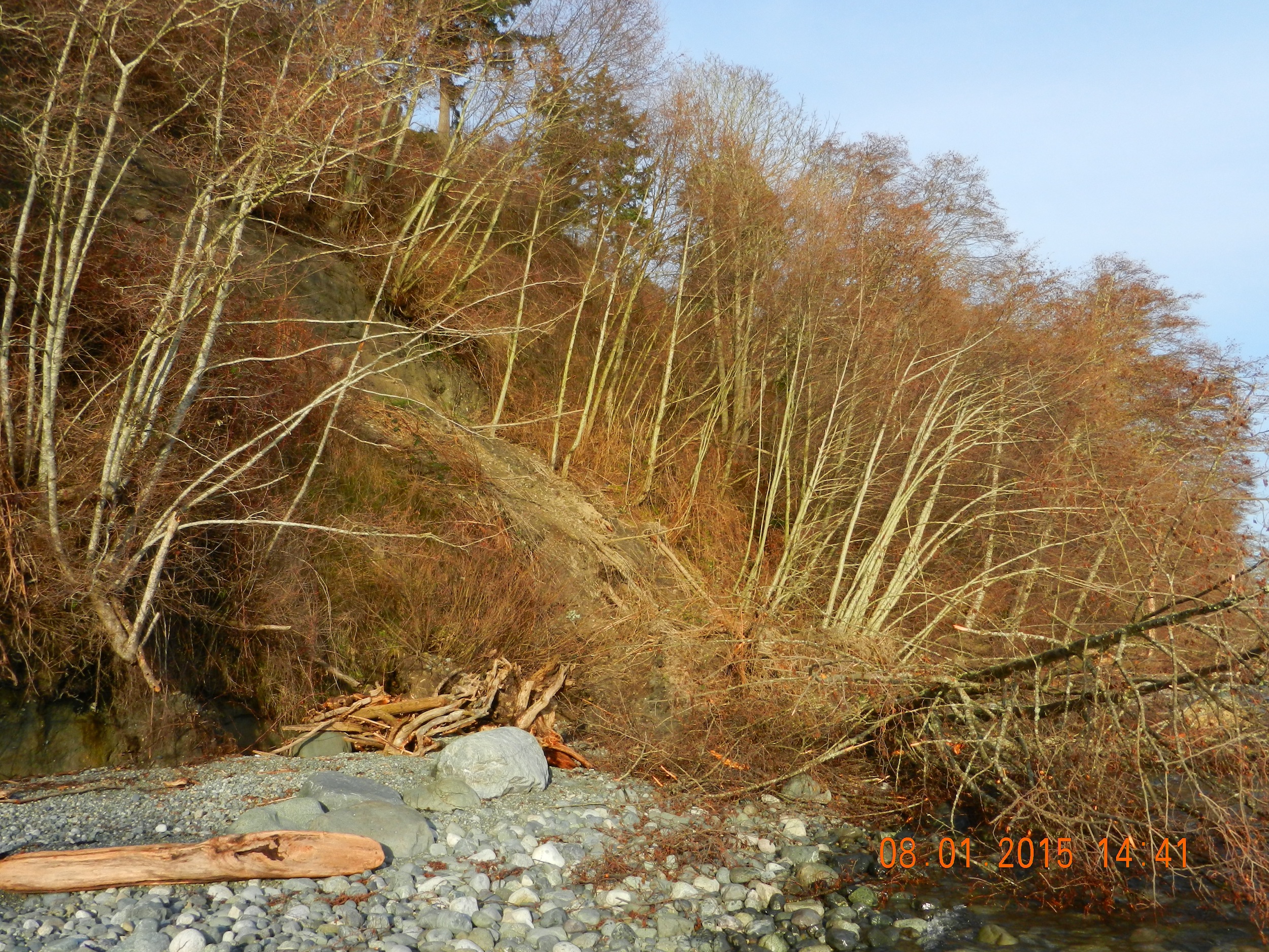
Since the 25th of November, we have had 5 inches of precipitation and in the last two weeks an unusual number of South-Easterly storms providing great action at Taylor beach in front of the farm, especially at high tide. The view starts by looking towards William Head prison and ends with a view of Victoria in the distance
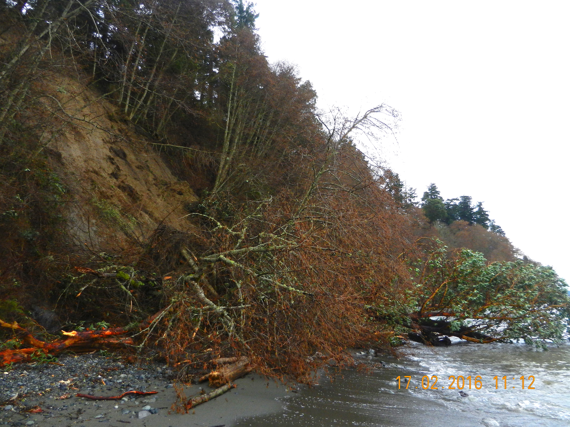
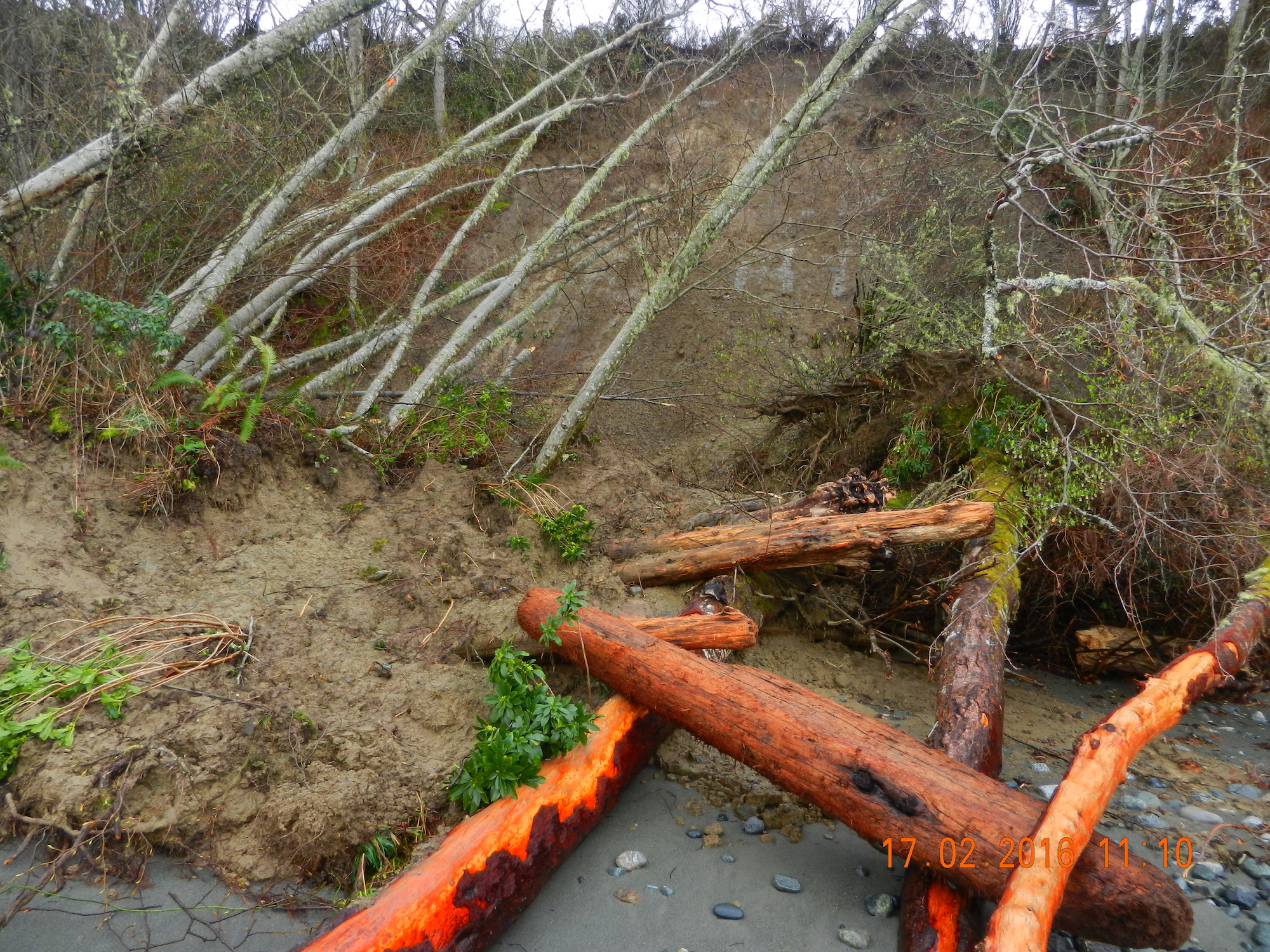
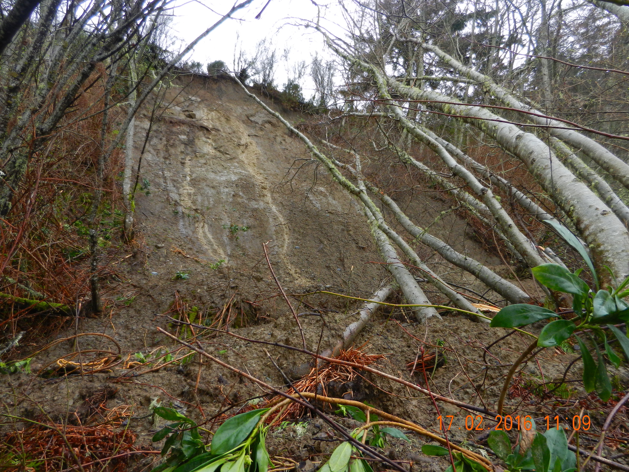
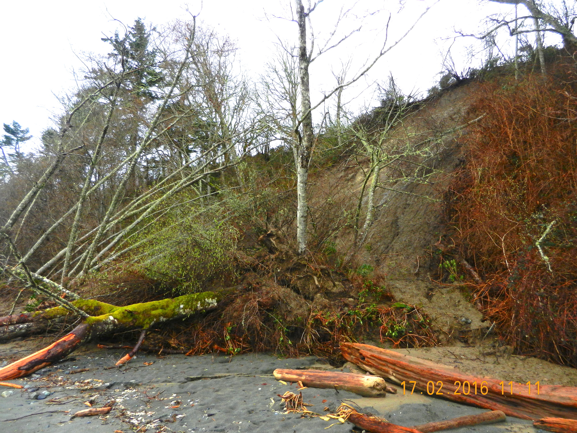
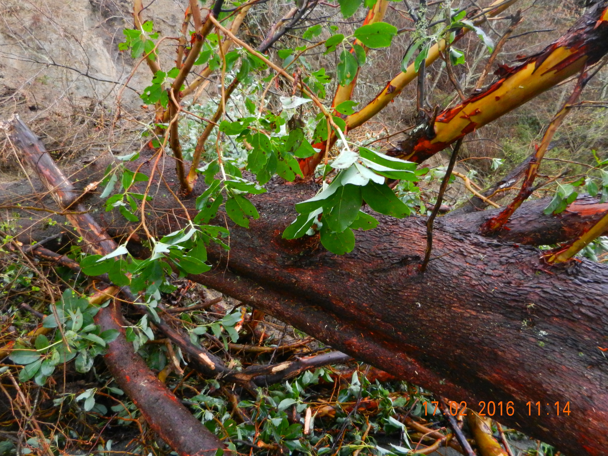
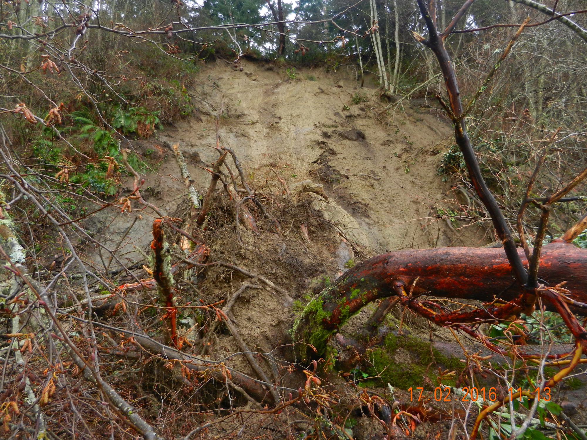
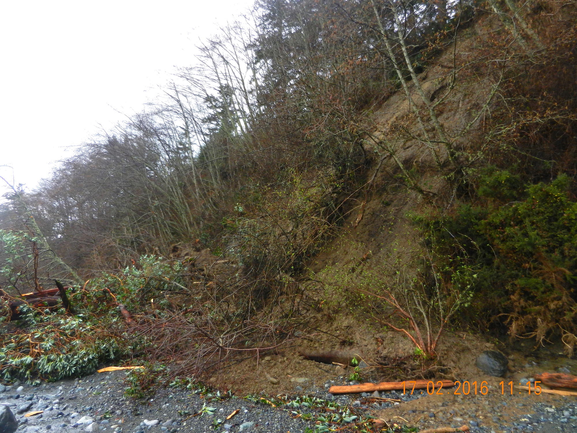
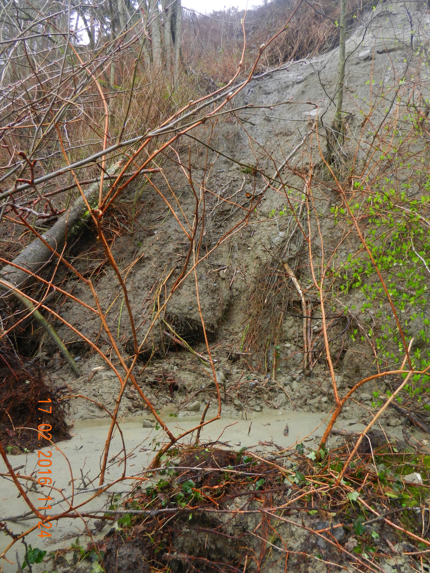
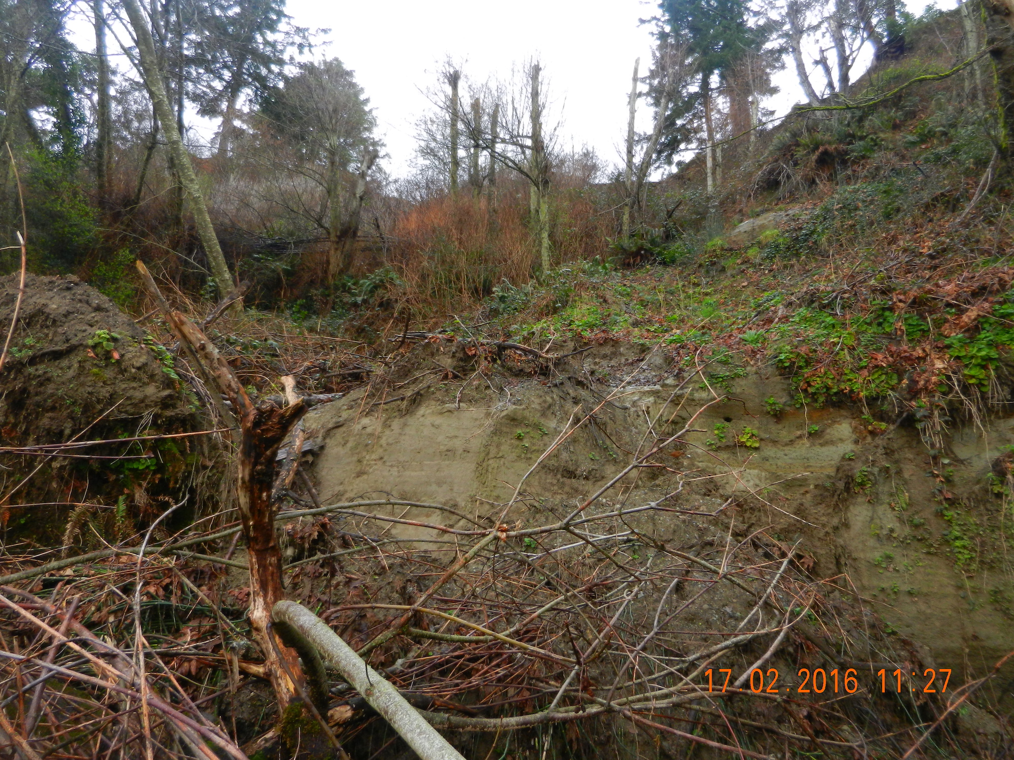
In the last 24 hours, a large slump has occurred on the Taylor Beach cliff. This is located just at the north end of the beach component. The properties along the top of the cliff have for several years experienced various human impacts which have likely contributed to this erosion.
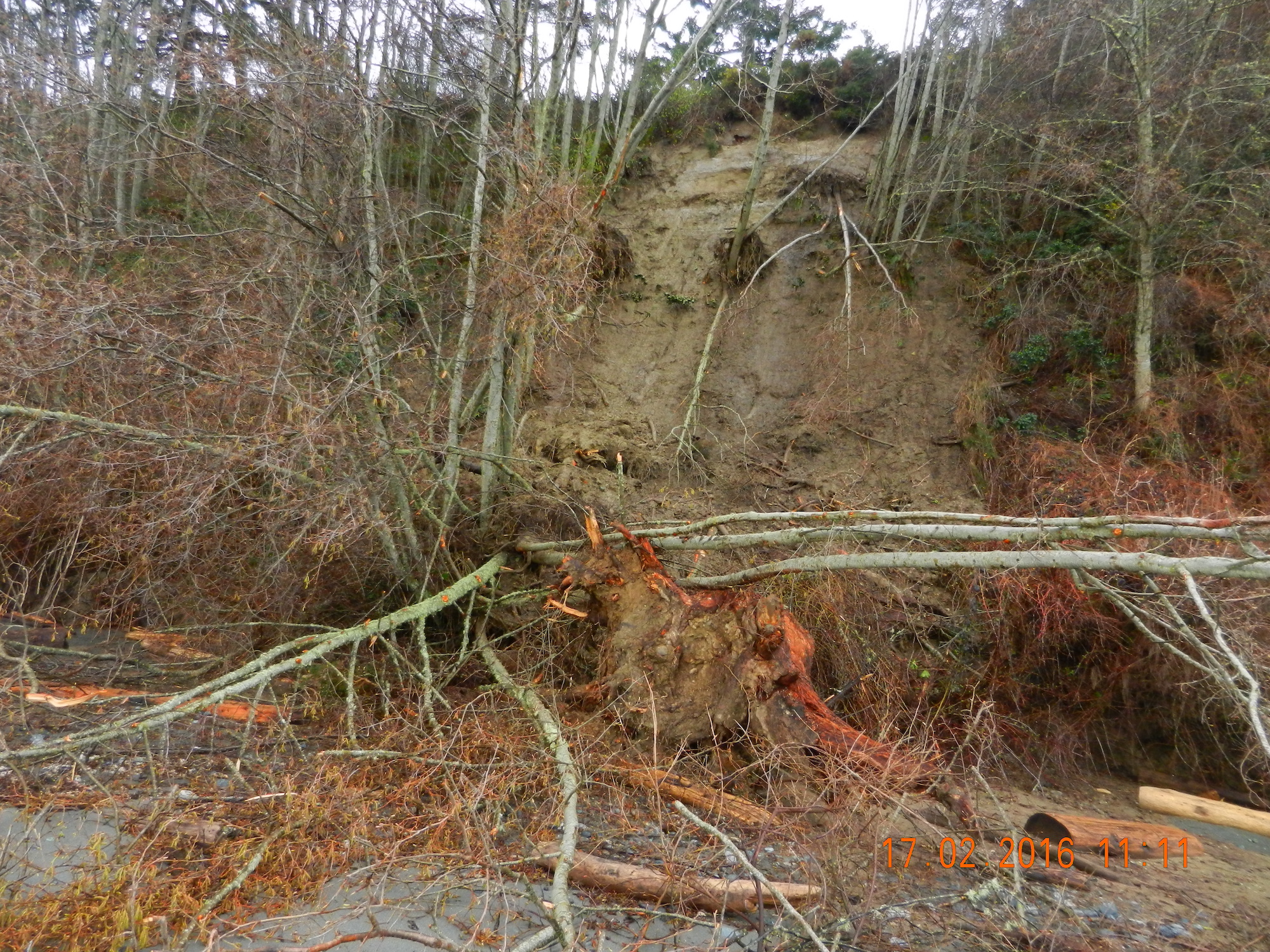
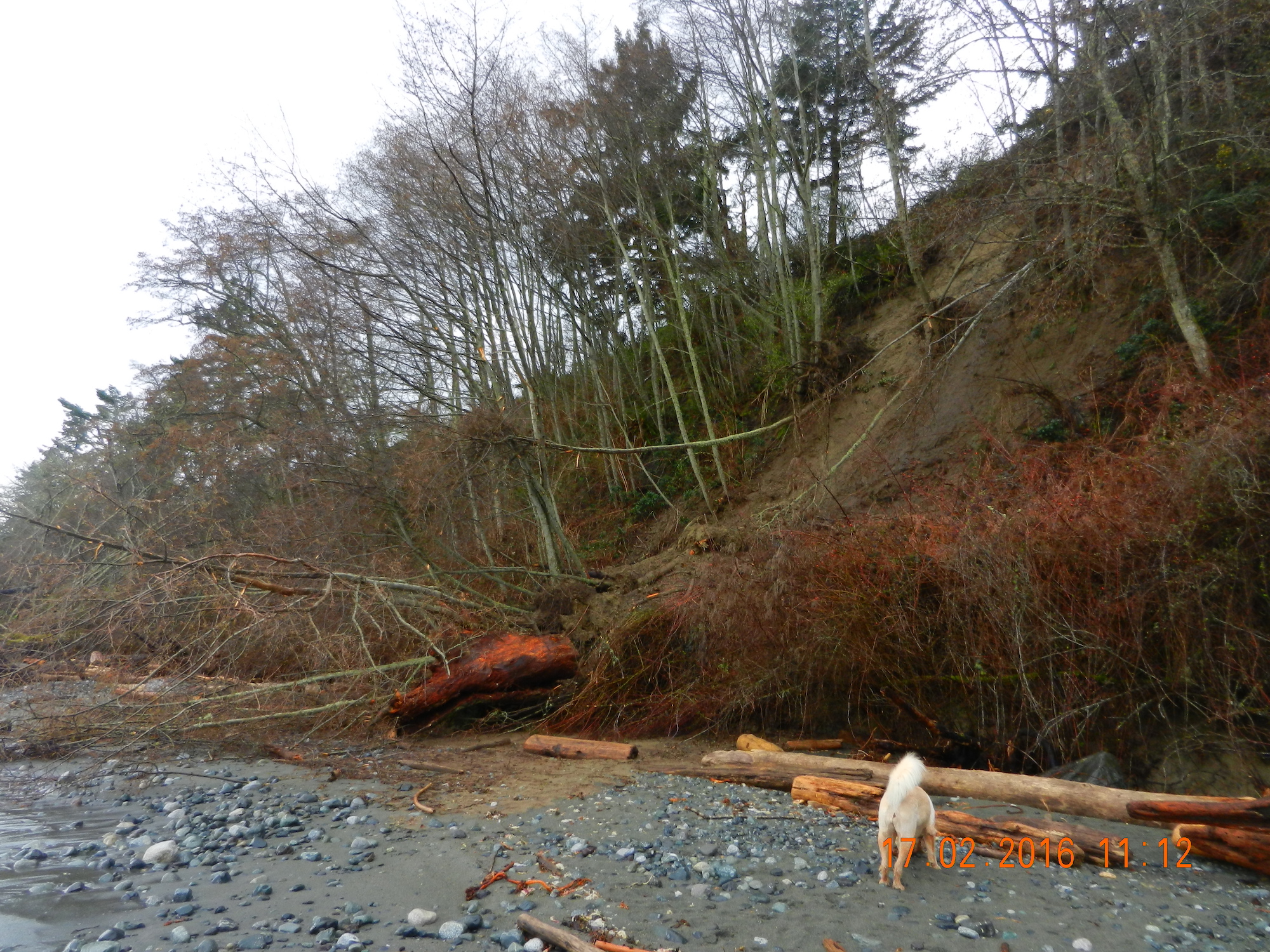
Taylor Beach slump. G. Fletcher photo.
This Cliff is all included in the Hazard lands DPA, and it is also a naturally occurring geological erosional feature which, unfortunately poor enforcement over the years has contributed to this problem.
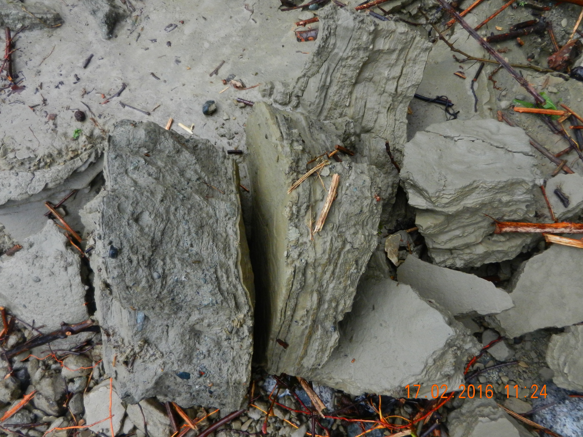
There remains further evidence of slipping in the separated section showing a grey clay bank along a wider stretch of this bank so we can anticipate more similar events.
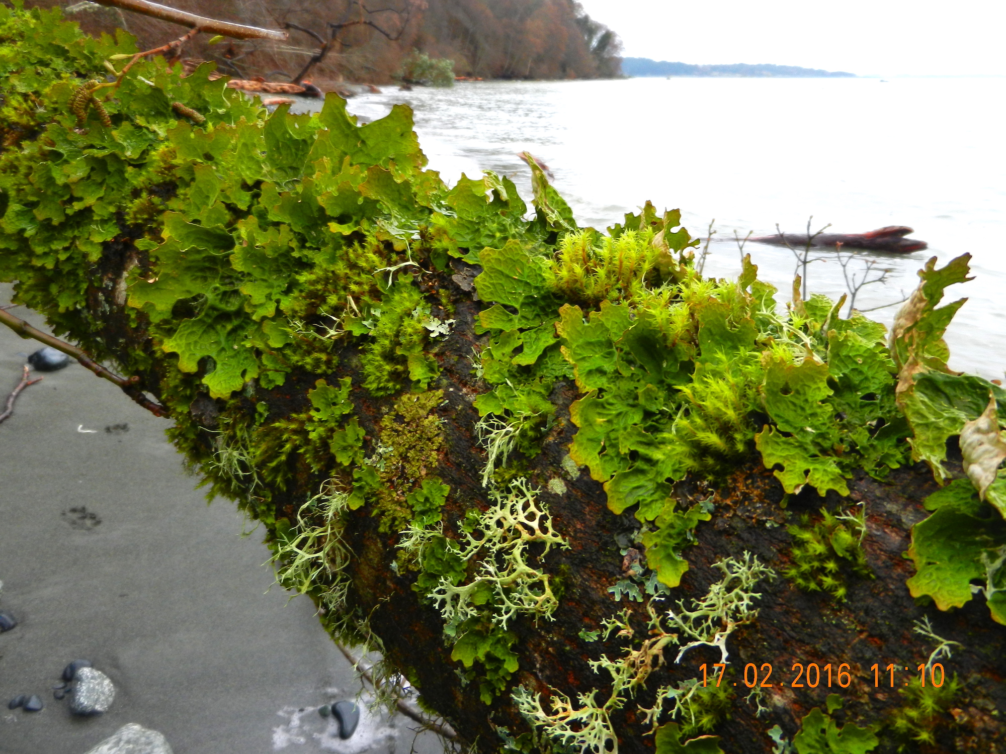
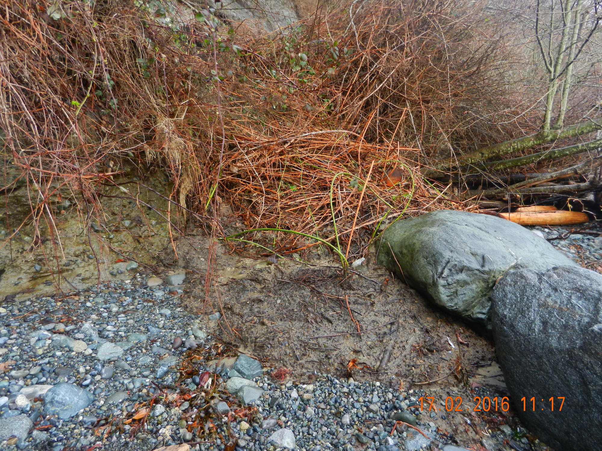
Currently a large deposit of soil, broken mature alders and debris remains on the beach. The next big storm from the East at a high tide will clear this out causing increased sedimentation along the inter and sub-tidal areas off shore. There us a thriving community of organisms on this shore so an impact on those populations is predicted. .
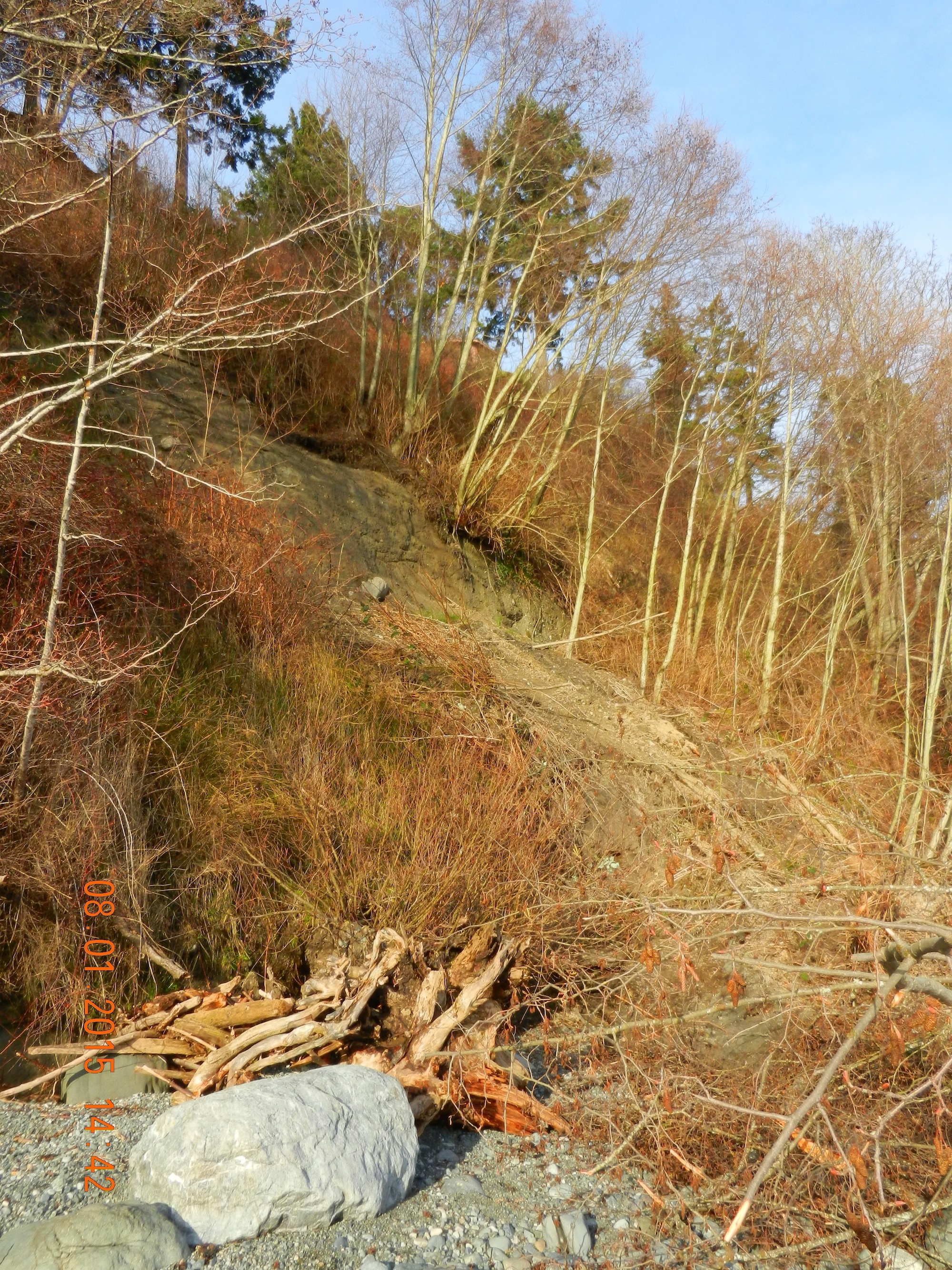
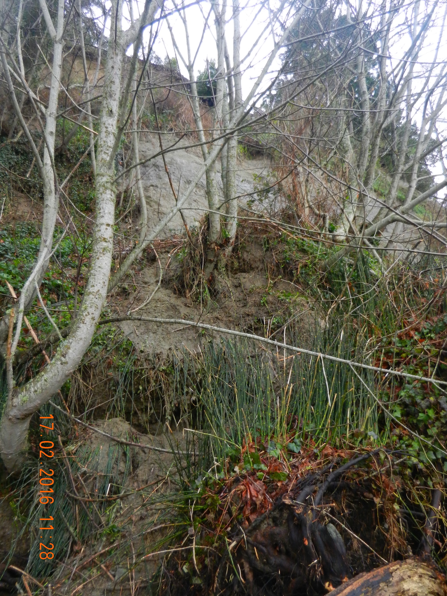
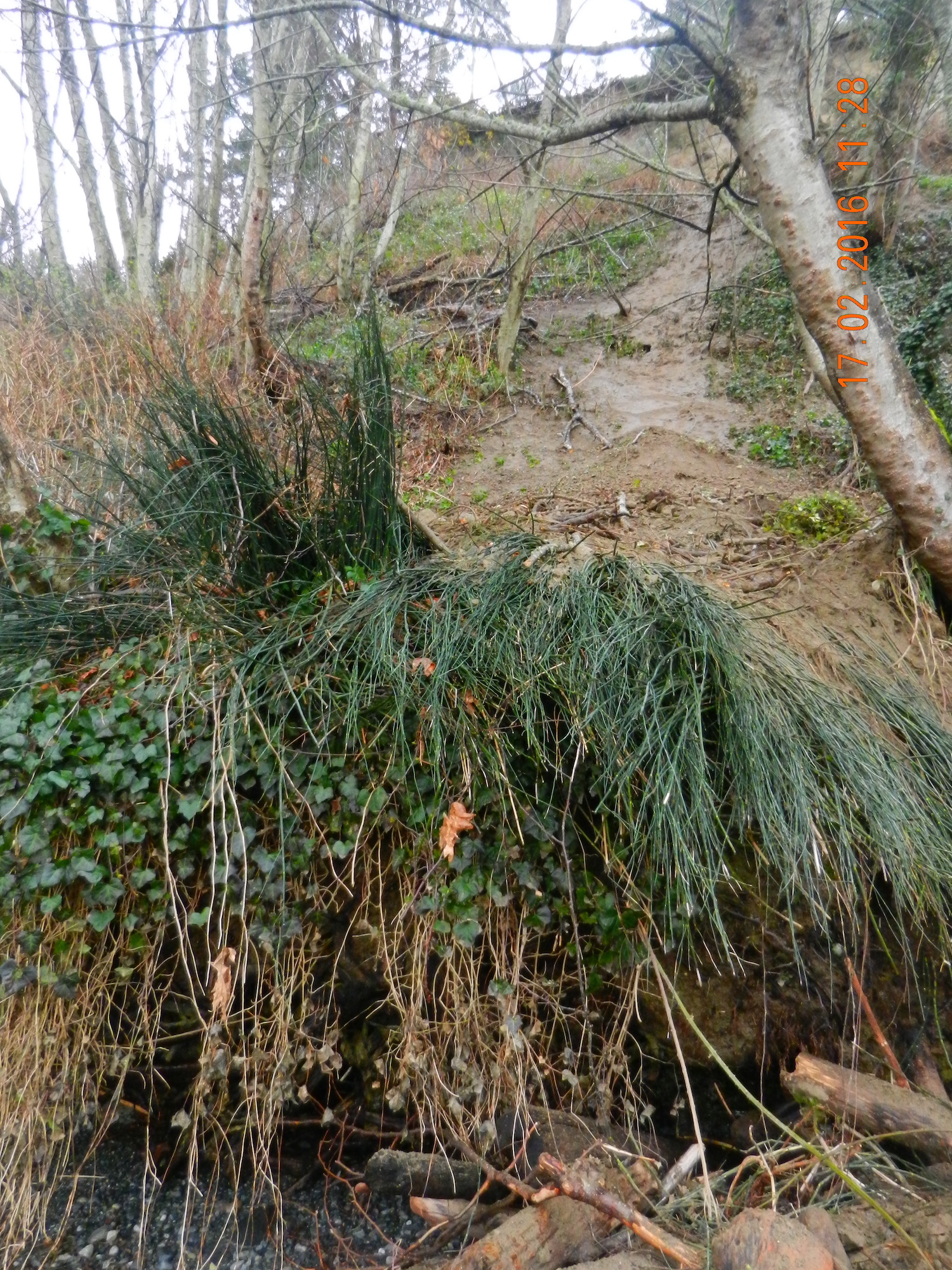
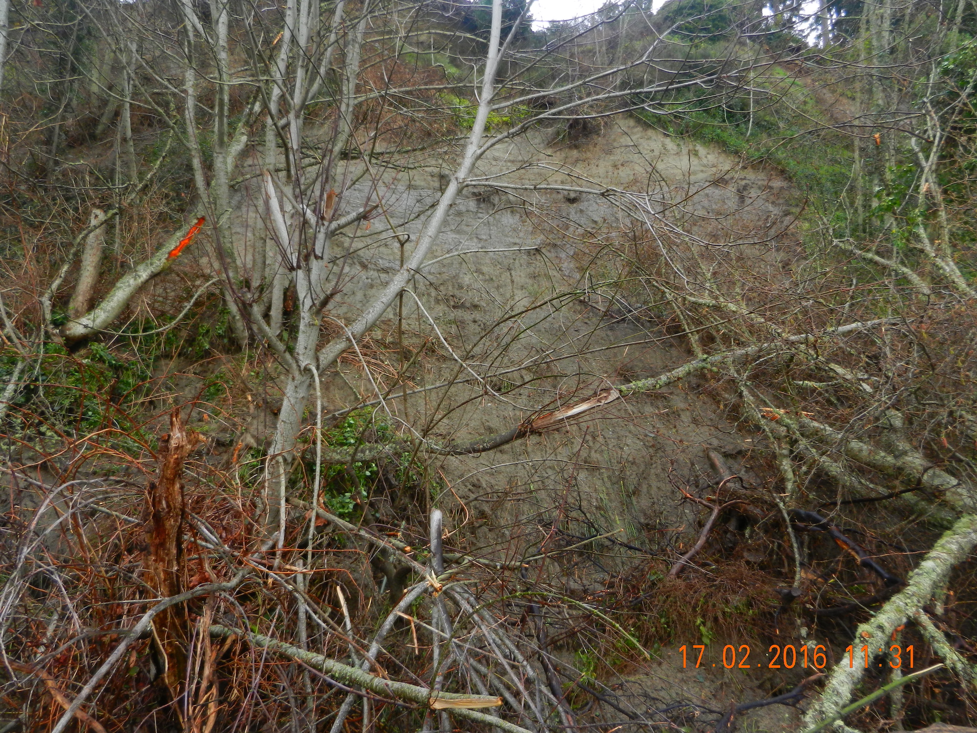
Taylor Beach erosion- G. Fletcher photo.
Taylor Beach erosion with tangle of alders. G. Fletcher photo.
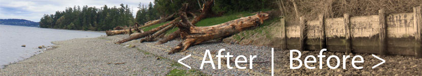
During the past few weeks, we have experienced several storms out of the north east at high tide. These images were taken to document some of the on-going problems from the extensive rip-rapping and seawall construction on that beach. See this page for summer 2013 images for comparison.
The solid sea-wall built only last year will lead to increased scouring and removal of sand. Unfortunately it will not only affect the crown land property in front of the wall, but the crown land foreshore adjacent to this property .
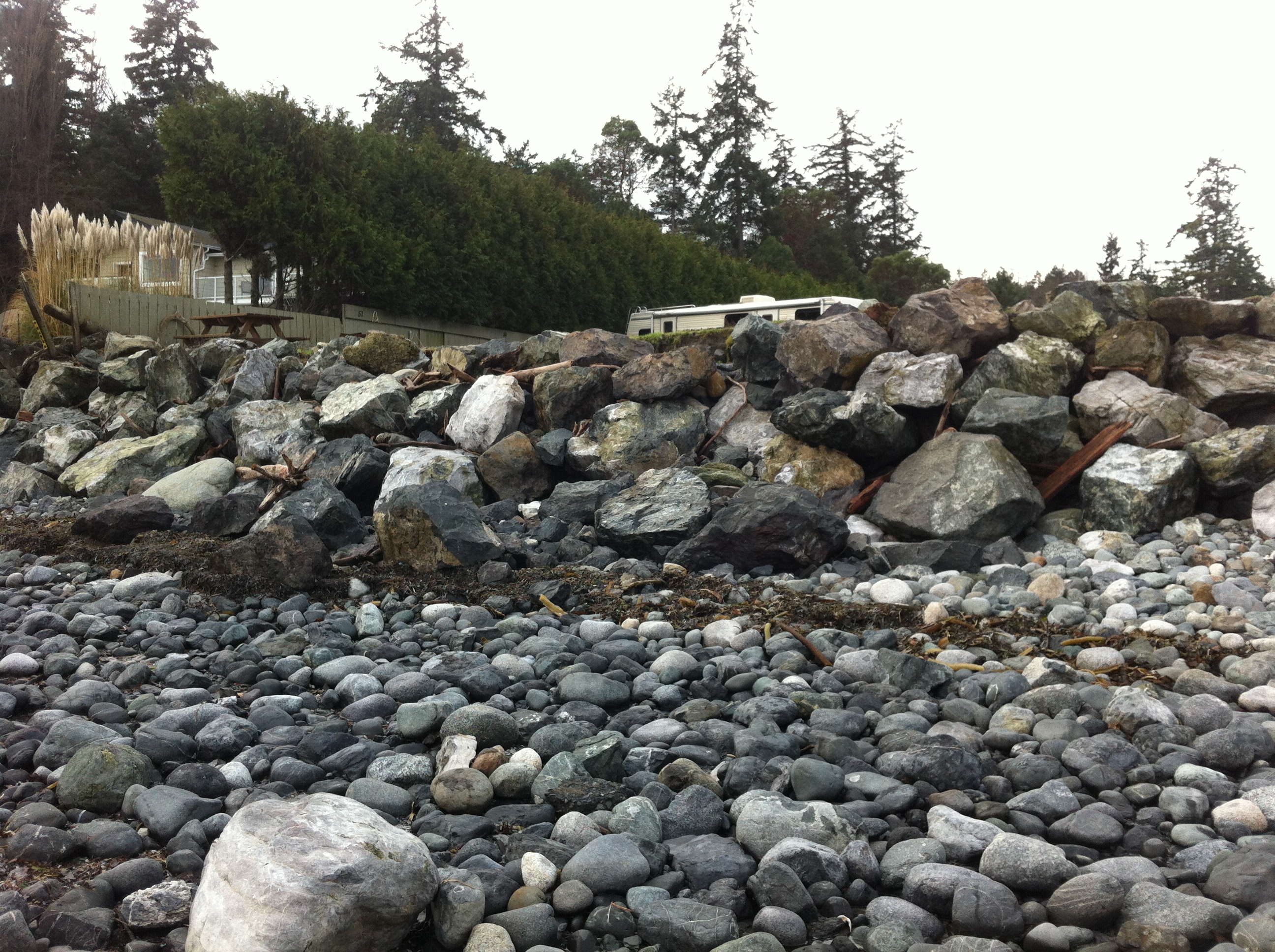
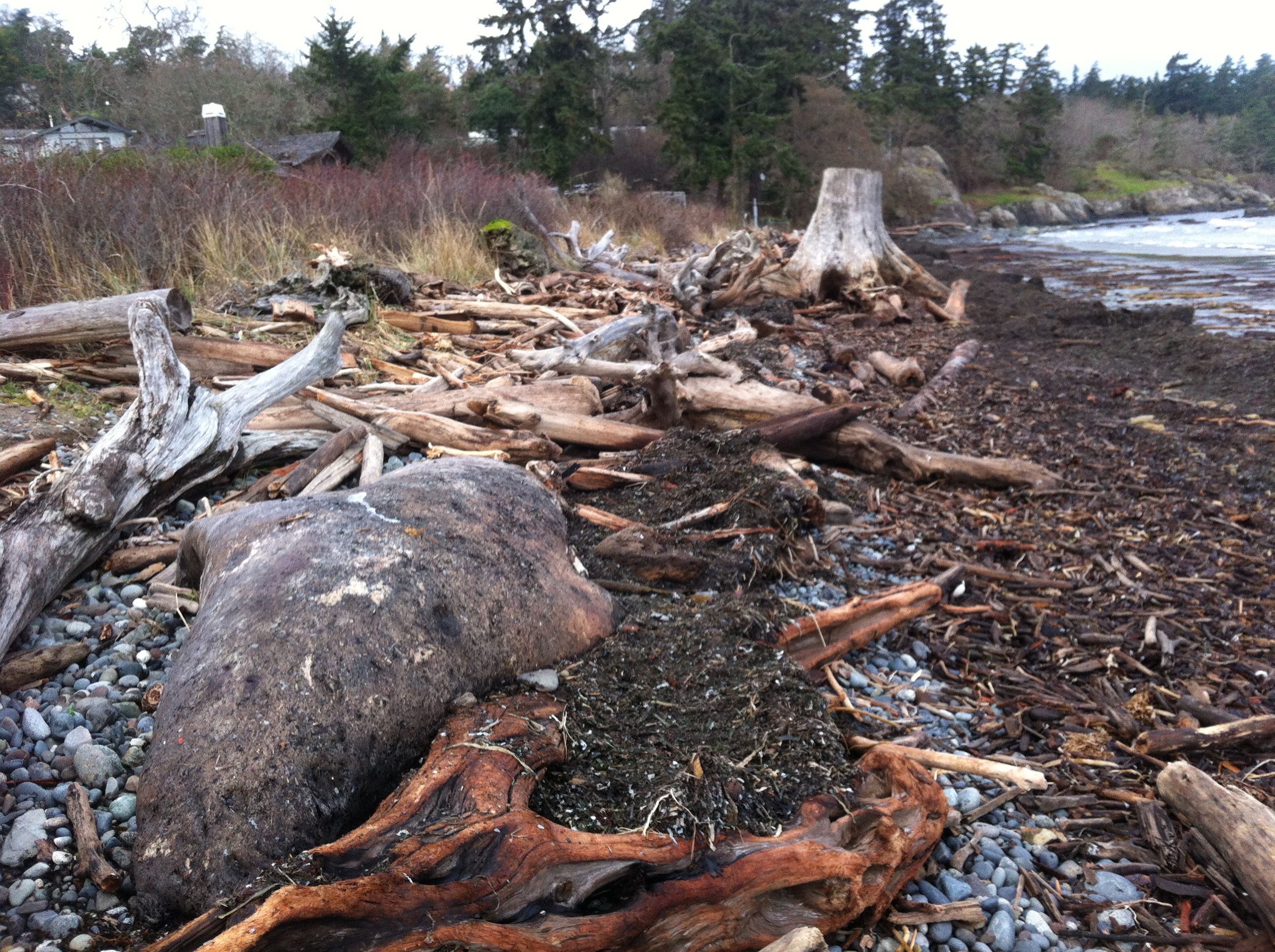
Recent storms have dislodged many of the boulders near the south end of the beach. Note the rubble foreground which was previously sand beach.
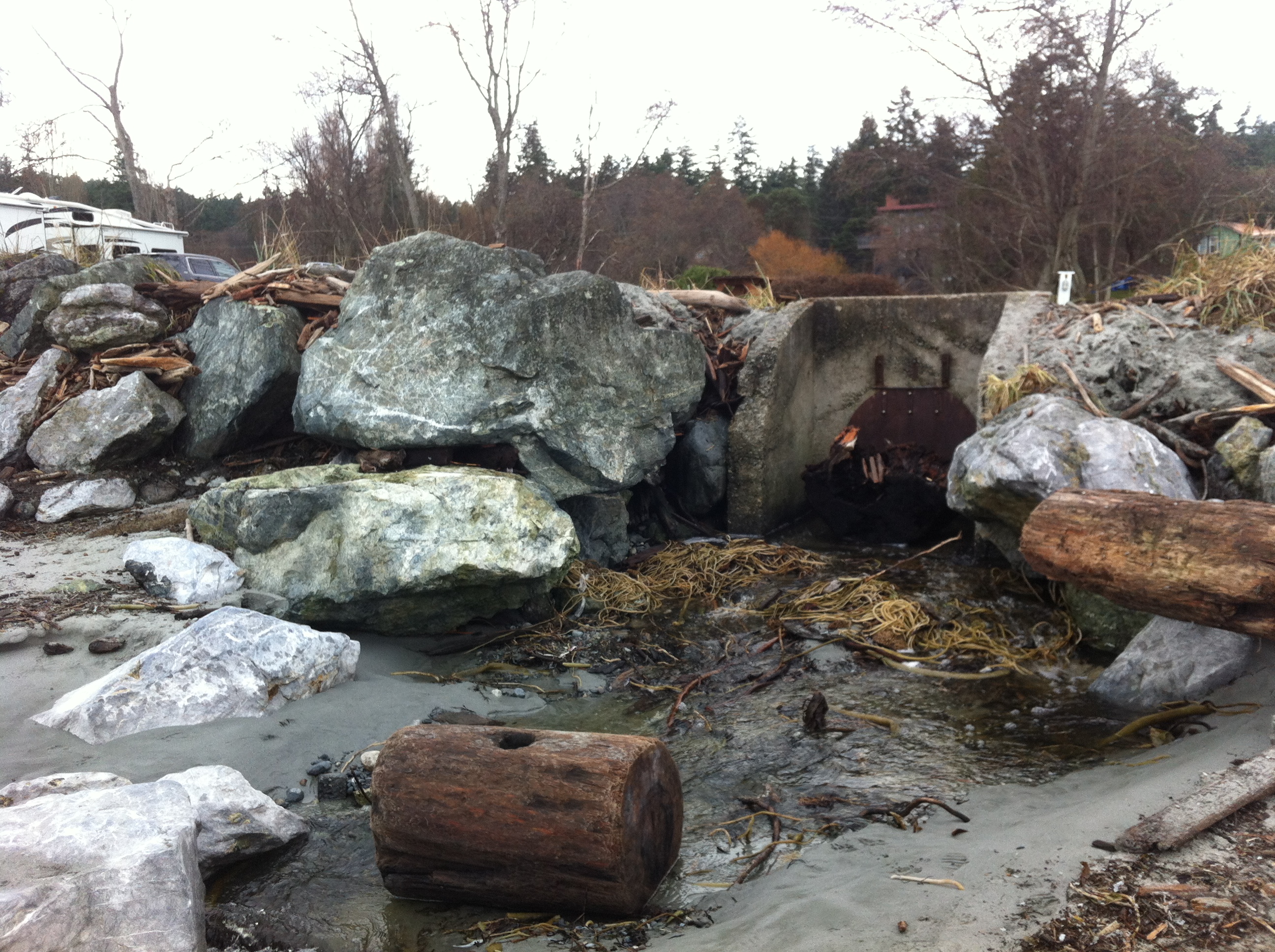
This concrete control gate was built many years ago to control flooding into a lagoon. The rip-rap boulders around it have been disturbed by wave action.
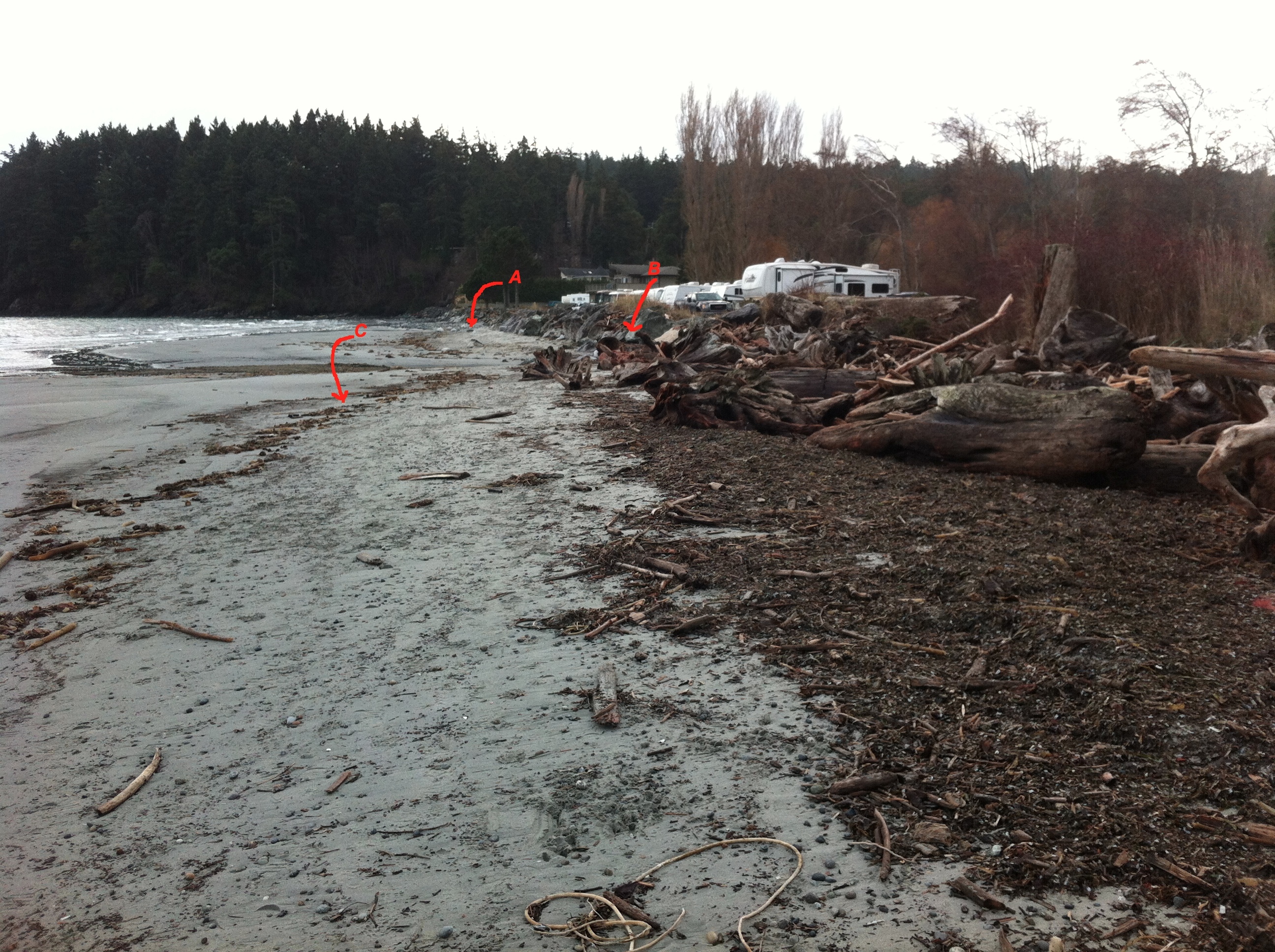
Site A= south end of the beach-sand eroded from base of rip-pap wall. Site B The border of where the rip-rap ends and the natural beach (going northward,) begins. C=the widened sand beach area backed by the natural beach. Scouring of the sand does not occur as it does further south on the beach.
The berm on the North end of Weir’s beach is in a more natural state with logs and debris thrown up by storms. The and natural beach vegetation and debris absorbs the impact of the ocean energy and no scouring of the beach sand has occurred. This will lead to long-term beach stability and erosion-resistance.
See other posts and references on hardening of the shorelines by clicking on links below.
See this file on early pictures of Weir’s beach
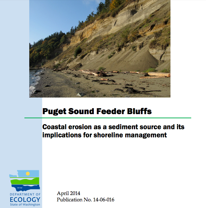
This report examines the role of eroding bluffs as a source of sediment for Puget Sound beaches and includes a review of related geology and coastal processes. It summarizes recent mapping of feeder bluffs and examines ways in which this information can be used to improve shoreline management.
This report is one part of a larger project on Puget Sound feeder bluffs that also includes maps and a series of web pages that cover much of the material in this report. The project was funded by EPA and the WA Department of Fish and Wildlife. Hugh Shipman and colleagues published this important report on feeder bluffs processes and management. Coastal Watershed Index of Port Angeles has been working on the complex and critical topic of feeder bluff management for over a decade. One of their biggest challenges is imparting the critical and unique elements of feeder bluff function and management (including the reality that there are no ‘soft armoring’ techniques appropriate for this land form ). This report provides scientific and management focus specifically to feeder bluffs of the Salish Sea- it’s long overdue.
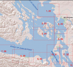
Part 2 is of the maps of feeder bluffs of Puget sound:
Accessed Nov 4, 2014 at :
https://fortress.wa.gov/ecy/publications/SummaryPages
Maps: https://fortress.wa.gov/ecy/publications/publications/1406016part2.pdf/1406016.html.
See More on Feeder Bluff mapping: