Macroalgae rolls in as the storms increase out in the Strait

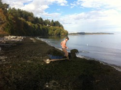
This morning’s walk on the beach showed a different pattern of macroalgal drift on the shore.

Alex gathers a rich mix of brown, red and green algae for enriching the garden mulch.

Alex gathers a rich mix of brown, red and green algae for enriching the garden mulch.

East winds of the last two weeks have torn up most of the immediately offshore red and brown algae and have produced drifts of biomass on the beach.
The  local organic farmers have had a good stretch of seaweed gathering as a result.


2014-11-02nereocystisroll

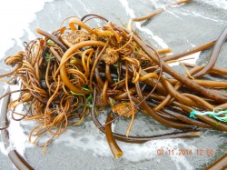
The tangled mass of stipes of Nereocystis leutkeana

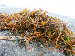
Today however, there were rolls of both Macrocystis pyrifera (Giant Kelp) and Nereocystis leutkeana. (our common Bull kelp.)

The Macrocystis prefers growing in water of higher salinity than we have inside the Salish sea, so it supposedly arrives here by coming down the Strait from the West Coast and then ending up on our beaches.  I have seen it growing off Bamfield and it certainly grows down as far as California and was harvested experimentally for Biogas extraction.

Reference From Biotechnology for Biofuels: “Macroalgae as a source of bioenergy first received intensive scrutiny as part of the US Ocean Food and Energy Farm project as proposed by Wilcox [10], initiated in 1973 and lasting over a decade [11]. It resulted in the construction of ocean farms for cultivation of the giant kelp Macrocystis[12]; reviewed by Kelly and Dworjanyn, [13]. While farming this species of seaweed in this truly offshore environment presented many technical challenges, the biogasification of macroalgal biomass gave excellent results [10,12,14,15]. This and subsequent research highlights some of the major advantages of macroalgae over other sources of biofuels (see Table 1).”

2014-11-02 macrocystisrole

A roll of the complete plants of Macrocystis pyrifera

The more usual macroalgae that we get on Taylor Beach is Nereocystis leutkeana. In the 1980’s there was research done on the volumes of biomass that could be derived for energy extraction from kelp around Vancouver Island, but since kelp beds are such a valuable habitat and fish nursery, fortunately those plans have been put on hold.

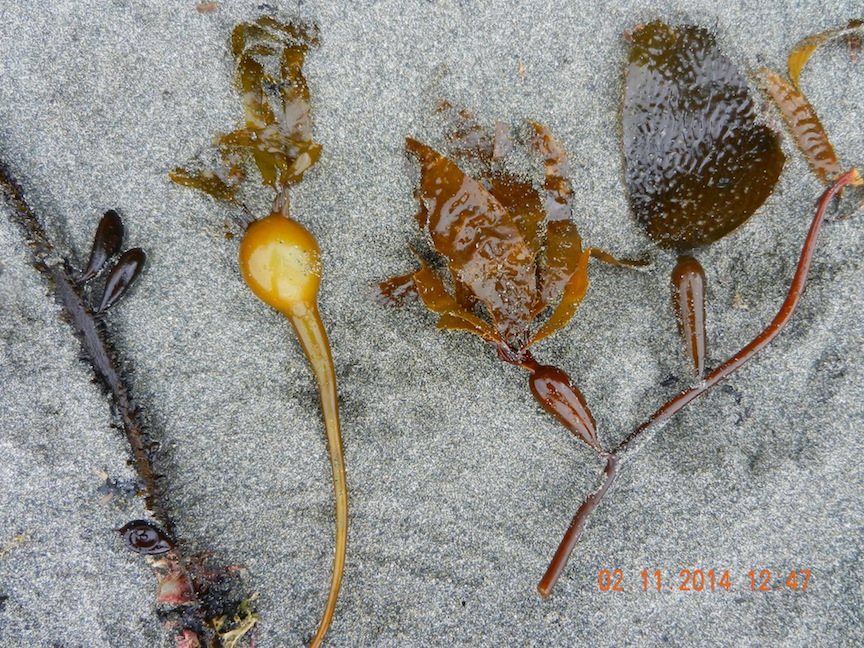
The small floats. or Pneumatocysts of macroalgae often become detached and turn up on the beach . Here is a comparison of pneumatocysts of three Brown algae species.

2014-11-02 pneumatocysts of three species

Pneumatocysts of egregia menziesii on the left, Nereocytis leutkeana in the middle and two floats of Macrocystis pyrifera on the right.

 The arrival of these macroalgae on the beach starts the process of decomposition which is really the first time that the energy fixed by these rapidly growing macroalgae, with very high rates of productivity, is passed on in the food web.

Eelgrass /macroalgae Habitat Survey Guidelines: Washington State

Below is a publication which may be useful in providing ideas for a similar program in Metchosin:

Eelgrass/Macroalgae Habitat Interim Survey Guidelines

This publication was downloaded from http://wdfw.wa.gov/publications/00714/

Introduction

Under the Washington Administrative Code (WAC), eelgrass and macroalgae are defined as saltwater habitats of special concern (WACs 220-110-250 (3)(a, b)). In administering the Hydraulic Project Approval (HPA) process, the Washington Department of Fish and Wildlife (WDFW) requires proponents for projects to: 1) avoid impacting eelgrass and macroalgae, 2) minimize unavoidable impacts, and 3) mitigate for any impacts. Mitigation for the loss of eelgrass typically entails providing eelgrass enhancement away from the project footprint. Because establishment of new eelgrass for mitigation is often unsuccessful, project proponents need to address this uncertainty by increasing the scope of their mitigation effort, such as planting an area larger than the project impact footprint. For macroalgae mitigation measures, the WDFW Area Habitat Biologist (AHB) shall be consulted.

In known or suspected eelgrass areas, proponents shall survey to delineate the spatial extent of eelgrass and macroalgae presence in the project area. If the project cannot be moved or redesigned to avoid direct eelgrass and macroalgae impacts, surveys are required for quantifying potential impacts. Surveys shall be conducted by divers/biologists who are qualified to identify the predominant eelgrass and macroalgae species in the project area. Deviations from the survey guidelines shall be approved by the AHB prior to conducting eelgrass or macroalgae surveys. Survey results and interpretation will be subject to WDFW approval.

Preliminary Surveys

Preliminary surveys are conducted to:

  1. 1)  determine if eelgrass or macroalgae are present at the proposed project site,
  2. 2)  evaluate if the project can be located and constructed to avoid impacting eelgrass or macroalgae, and
  3. 3)  establish a location for the project that will minimize impacts when avoidance is not possible. Eelgrass/Macroalgae Habitat Interim Survey Guidelines 1 of 6 (Rev. 06/16/2008)

Preliminary surveys shall provide:

A project site map indicating all survey transects and showing the qualitative distribution of eelgrass and macroalgae (boundaries of each patch), as well as substrate characterization along each transect. The map should also indicate approximate depth contours and the approximate location of the proposed project footprint (e.g., the dimensions of the pier, ramp and float).

Protocol Guidance

  1. Transects should be referenced to a permanent physical feature at the project site in such a way that transects can be precisely relocated in the future.
  2. Transect length and location should be determined by project and site specifics, and should include the landward margin of the eelgrass or macroalgae habitat, if present. Transect coverage should extend at least 25 feet waterward of the project footprint, and, if possible, to the outer margin of the eelgrass or macroalgae bed.
  3. To document the potential for eelgrass or macroalgae impacts from a project, at least one transect should be aligned along the proposed centerline of the project footprint. Additional transects shall be conducted on either side of the project footprint at 10 and 25 feet from the outer edges of the proposed structure. The inner and outer edges of each eelgrass or macroalgae patch shall be documented along each transect and noted on the site map.
  4. Depth contours should be established relative to mean lower low water equal to 0.0 feet elevation (MLLW=0.0 ft.). Tidal reference and correction should be noted on the site map.
  5. Survey documentation must include the date and time of the survey, name of the surveyor and their affiliation, turbidity/visibility measurements, presence of invertebrate and vertebrate species, and anecdotal observations pertinent to habitat characterization of the project site (e.g., presence of rocky outcroppings, debris, etc.).
  6. Conducting surveys between June 1 and October 1 is strongly preferred because the full extent of eelgrass and macroalgae distribution can be more accurately mapped. However, preliminary surveys may be conducted at any time during the year.

To meet the need to minimize eelgrass and macroalgae impacts, and the requirement to document the centerline of the project footprint, some flexibility at the time of the survey may be necessary. A preferred method is to establish a transect parallel to the shoreline, along the midpoint of the eelgrass or macroalgae bed, to locate any open patches where a

Eelgrass/Macroalgae Habitat Interim Survey Guidelines 2 of 6 (Rev. 06/16/2008)

new centerline for the project could be placed. Typically, an open area sufficient to accommodate a ten-foot buffer around the project footprint will be necessary.

If the preliminary survey shows that the project can be located and built without impacting eelgrass or macroalgae, the preliminary survey will meet the needs for mapping the project area. However, if the project footprint potentially impacts existing eelgrass or macroalgae beds, advanced surveys to quantify the extent of impact and document mitigation success, will be required.

Advanced Surveys

Advanced surveys shall occur between June 1 and October 1 and are conducted to:

  1. quantify the impact from the project to eelgrass and macroalgae, and
  2. quantify the performance of mitigation actions.

Quantifying Impacts

The standard protocols described below are designed to give accurate estimates of project impacts. Eelgrass density is determined by sampling with quadrats along transects. Two methods are typically used to determine project impacts and required mitigation. Project impacts are calculated as the total area of eelgrass affected by the project, as determined by the AHB. Alternatively, project impacts can be monitored in the project area to determine eelgrass or macroalgae loss and required mitigation. Sampling results are used to calculate the size of the mitigation project required to compensate for impacts that cannot be avoided.

As noted above, a project proponent may choose to monitor post-project impacts directly. The size of the required mitigation obligation may be reduced by this approach (e.g., in cases where post project impacts were less than anticipated). However, this approach will require additional monitoring of survey transects for a number of years to evaluate potential changes to eelgrass densities in the project area and within a reference site. This approach involves potentially higher mitigation ratios due to the delay in mitigation project construction (e.g., adjusting for temporal loss of function).

Alternative sampling designs are allowed, when agreed to in consultation with the AHB. This may be particularly appropriate when the potential impacts have been avoided to the maximum extent possible, and only a few small patches of eelgrass remain within or near the project footprint. In such a case, a full census of impacted eelgrass may be the most cost-effective option (e.g., counting all eelgrass shoots in the impact area). Alternatively, a stratified sampling of the existing patches may be a better choice (e.g., taking density estimates in the eelgrass patches only).

Eelgrass/Macroalgae Habitat Interim Survey Guidelines 3 of 6 (Rev. 06/16/2008)

Statistical Considerations

1. Measuring mitigation success (or direct impacts of a project) requires comparing eelgrass densities at a mitigation (or impact) site versus a reference site. These comparisons must be statistically rigorous, and include the following statistical considerations:

  • Low probability of a Type I error – concluding there is loss of eelgrass when, in fact, there is not. This issue is addressed by selecting a small value for α in statistical analyses, usually 0.10.
  • Low probability of a Type II error – failing to detect a loss of eelgrass when, in fact, there is one. Selecting a small value for β (applying high statistical power, (1-β)) ensures this. Power set at 0.90 provides low probability of a Type II error.
  • Effect threshold – the difference in mean eelgrass density between sites. The WDFW has established monitoring standards for these surveys: a) α = 0.10, b) power (1 – β) = 0.90, and c) a difference of mean eelgrass density of 20%. Surveys using an alternative design must meet or exceed these standards. Standard Protocols for Quantifying Impact
  1. For a linear project, a single transect should be aligned along the centerline of the footprint.
  2. A minimum of 30 samples must be taken within the area of eelgrass or macroalgae. Samples consist of eelgrass shoot counts within a (minimum) 1⁄4 m2 area quadrat. Sampling stations may be placed randomly along the transect, or for simplicity, evenly spaced along the same line starting at a random point (i.e., stratified random). Convert raw sample counts to shoot densities per square meter (#/m2).
  3. Using the sample data, calculate mean eelgrass density ( ̄x project) in the impact area, as well as sample variance (s2).

Assessing Mitigation Performance

Eelgrass density often varies substantially among locations and through time, making it difficult to measure mitigation success. To address this uncertainty, WDFW requires the use of a reference site to account for regional differences in eelgrass density and temporal variability. Use of a reference site can also improve monitoring efficiency, supporting rigorous results with fewer samples. The reference site should be chosen to match the characteristics of the mitigation area.

Eelgrass/Macroalgae Habitat Interim Survey Guidelines 4 of 6 (Rev. 06/16/2008)

Quantifying Mitigation Performance

Reference Site Characterization

1. Choose a reference site near the proposed mitigation site. The reference site should be similar to the mitigation site in depth profile, substrate, turbidity, and disturbance regimes.

2. Within the reference site, take a minimum of 30 samples, either randomly or stratified randomly. Samples involve counting eelgrass shoots within a (minimum) 1⁄4 m2 area quadrat. Samples can be larger than 1⁄4 m squares, but all samples need to reference the area from which they were taken so that the data can be converted to shoot densities (#/m2).

3. Calculate the mean density of eelgrass at the reference site ( ̄x reference) as well as sample variance (s2).

Mitigation Area Extent

The objective of eelgrass mitigation is to replace lost shoots and an area equivalent to the impacted area. If the mean density of eelgrass is lower at the reference site than within the impact area, the size of the mitigation project needs to be enlarged such that the reference site has the same total number of shoots as the impact site. For example, if the project impacts an area of 10 m2, with a mean eelgrass density of 20 shoots/m2, while the reference area has a mean shoot density of 10 shoots/m2, the mitigation area would need to be at least 20 m2 (to achieve a 1:1 mitigation ratio). However, if the reference site has greater density than the impact area, no area adjustment to the mitigation site would be necessary to address density differences. In addition, other factors can influence mitigation ratios and thus the required size of the mitigation area.

Mitigation Sampling and Performance

Mitigation monitoring consists of sampling both the reference site and the mitigation area at three and five-years following the completion of the mitigation project. Sampling one year following project completion is recommended to detect early failures at the mitigation site, but the need for this can be determined on a site-specific basis. Enough samples must be taken at the two sites to be able to detect significant differences in eelgrass density at the mitigation site versus the reference site using the statistical considerations noted above. A Microsoft Excel spreadsheet (Sample_Size_Calculator.xls) programmed to calculate the required sample size is provided by WDFW. Specific directions for entering data are included on the spreadsheet. The sample size calculator uses the following formula, modified from Zar (1999).

N = [2*s2reference/( ̄x reference – x ̄ mitigation)2] * (t α(1), v + t β(1), v)2

Eelgrass/Macroalgae Habitat Interim Survey Guidelines 5 of 6 (Rev. 06/16/2008)

Where: N = required sample size in each site (i.e., mitigation and reference), s2reference = sample variance from the reference site,
x ̄ = sample mean
t = percentage values from Student’s t-distribution

v = degrees of freedom

If the required number of samples is prohibitively expensive, due to inherent variability of eelgrass density, the statistical power of the monitoring may be lowered. This will entail a larger mitigation project to account for the increased statistical uncertainty.

Statistical Testing

At year three and five post construction, the proponent is required to re-sample and compare (statistically) eelgrass densities at the reference and mitigation site (using the prescribed number of plots defined in the equation above). We suggest using a two- sample, one-tailed t-test for comparison of eelgrass mean densities from mitigation versus reference areas. The statistical null hypothesis in this case is – H0: eelgrass density at the mitigation site eelgrass density at the reference site.

The year-three sample is designed to detect potential early failures in eelgrass growth at the mitigation site, relative to the reference site, that may suggest the need for additional actions at the mitigation site (e.g., additional transplants). Final mitigation success or failure will be based on year-five survey results and statistical testing (H0: eelgrass density at the mitigation site density at reference site, and total shoot abundance criteria has been met). Failure to meet prescribed eelgrass density (i.e., rejecting the null hypothesis) and shoot abundance will require implementation of contingency actions identified in the mitigation plan.

Eelgrass/Macroalgae Habitat Interim Survey Guidelines 6 of 6 (Rev. 06/16/2008)

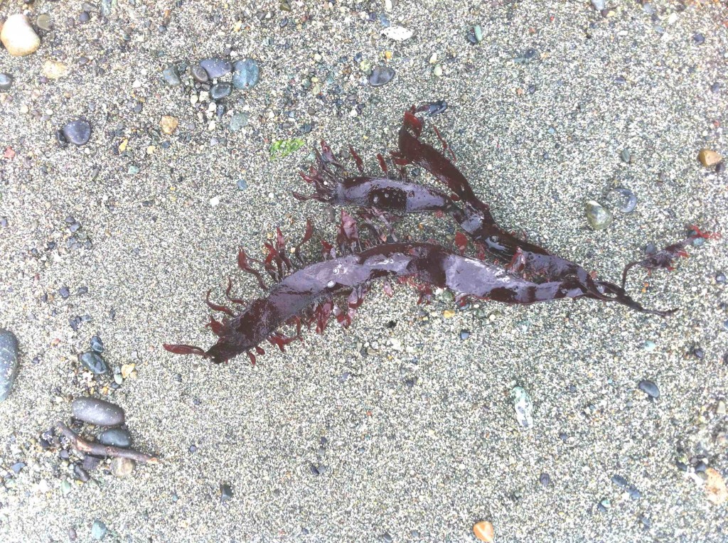
Strand line of Rhodophytes (red algae)

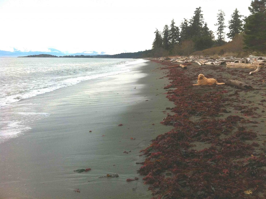
Today there is a strong swell from the North East on Taylor beach which has deposited a good sample of the diversity of the algae that live in the subtidal zone just  below the low-tide level.

gingeronstrasndline2014-03-28

Taylor Beach in Parry Bay at the southern end of Vancouver Island. This beach gets winds and waves from the East in the fall, winter and spring months, but is protected by having only west winds from June to September. There is long-shore drift toward the north end of the beach  in the summer as the energy from the westerlies refract around William Head, visible in the distance on the left.

rhodophytestrand

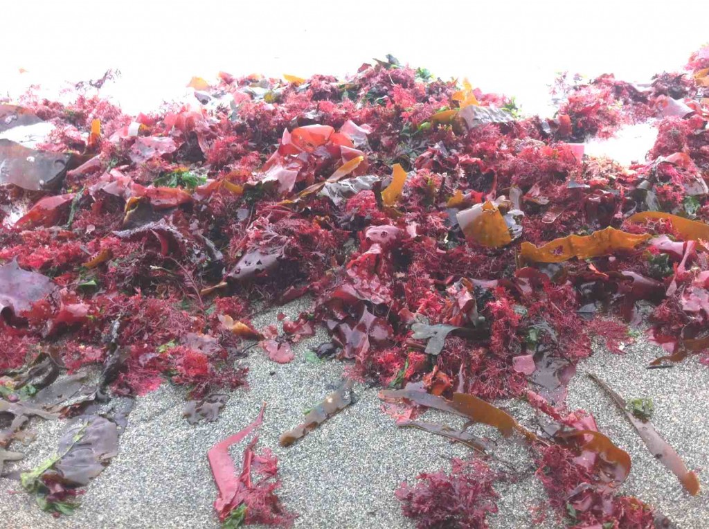
The Red algae as they lay in the strand line showing the upper limits of the last high tide and the swell which deposited the algae.

redalgaediversity2014-03-28

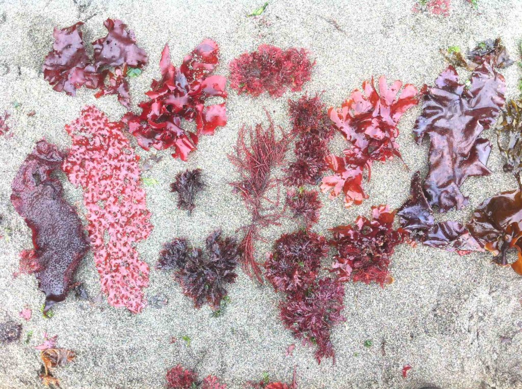
The greatest biodiversity is shown in the Rhodophytes or red algae shown here picked out from the strand line within a few square metres.

redalgaeprionitis2014-03-28

A sample of the red algae, Prionitis lanceolata . which is normally found on the low intertidal of rocky shores.

alaria2014-03-28

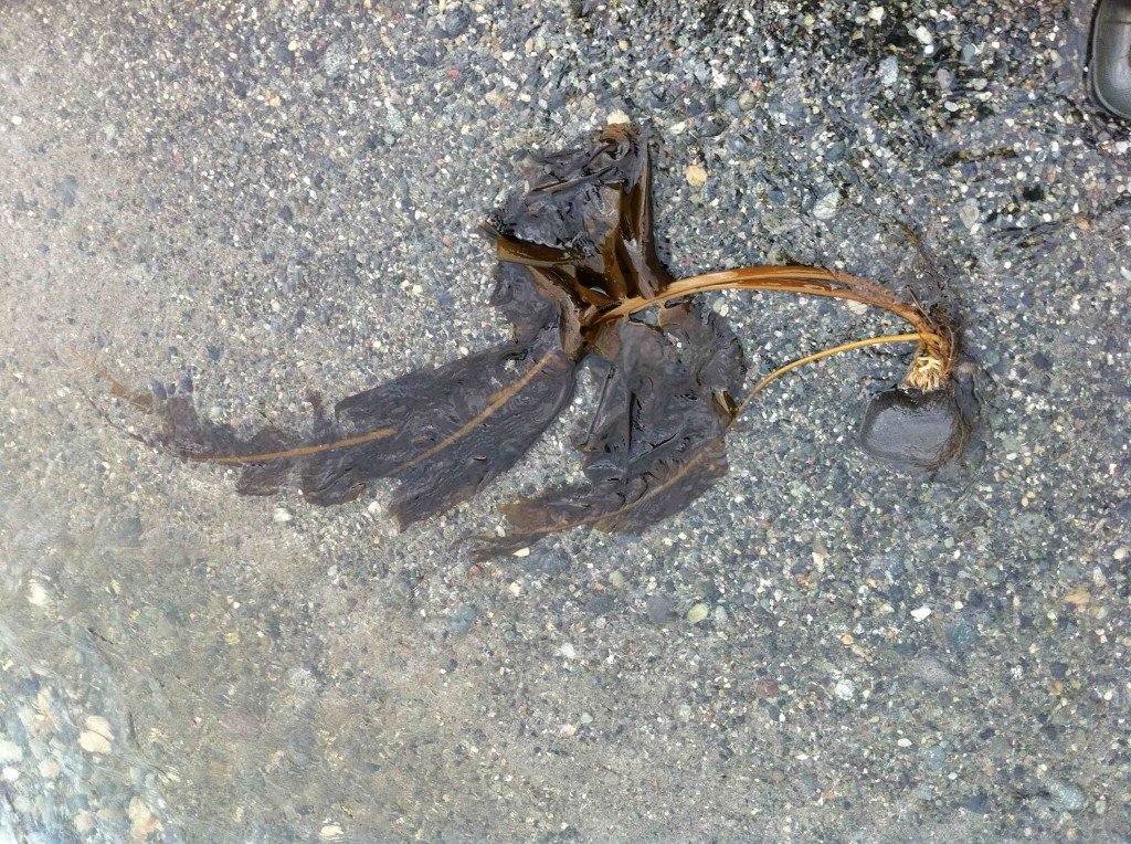
Alaria marginata, a brown algae firmly attached by it’s holdfast which has carried a rock up onto the beach in the surf.

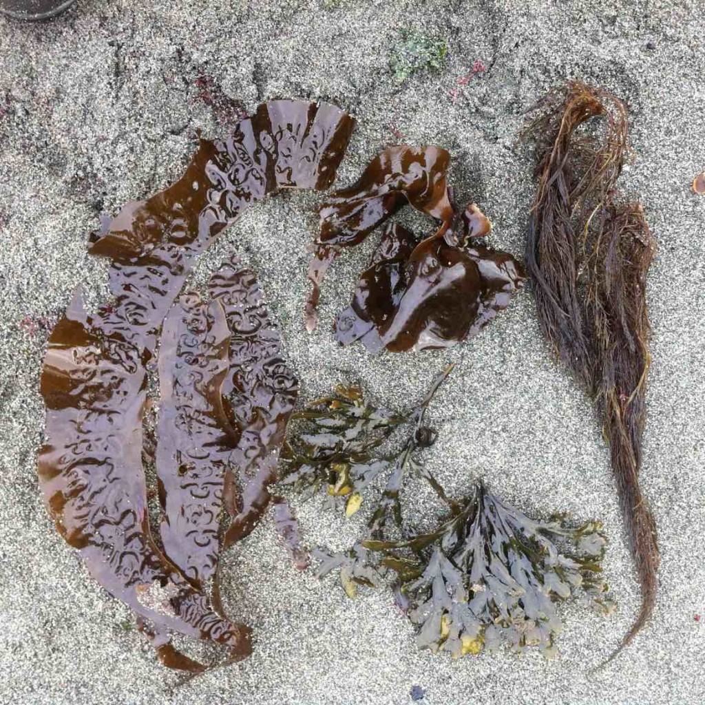
phaeophyte diversity

Some of the brown algae ( Phaeophyte) species in the strand line

Eel grass Distribution along Parry Bay

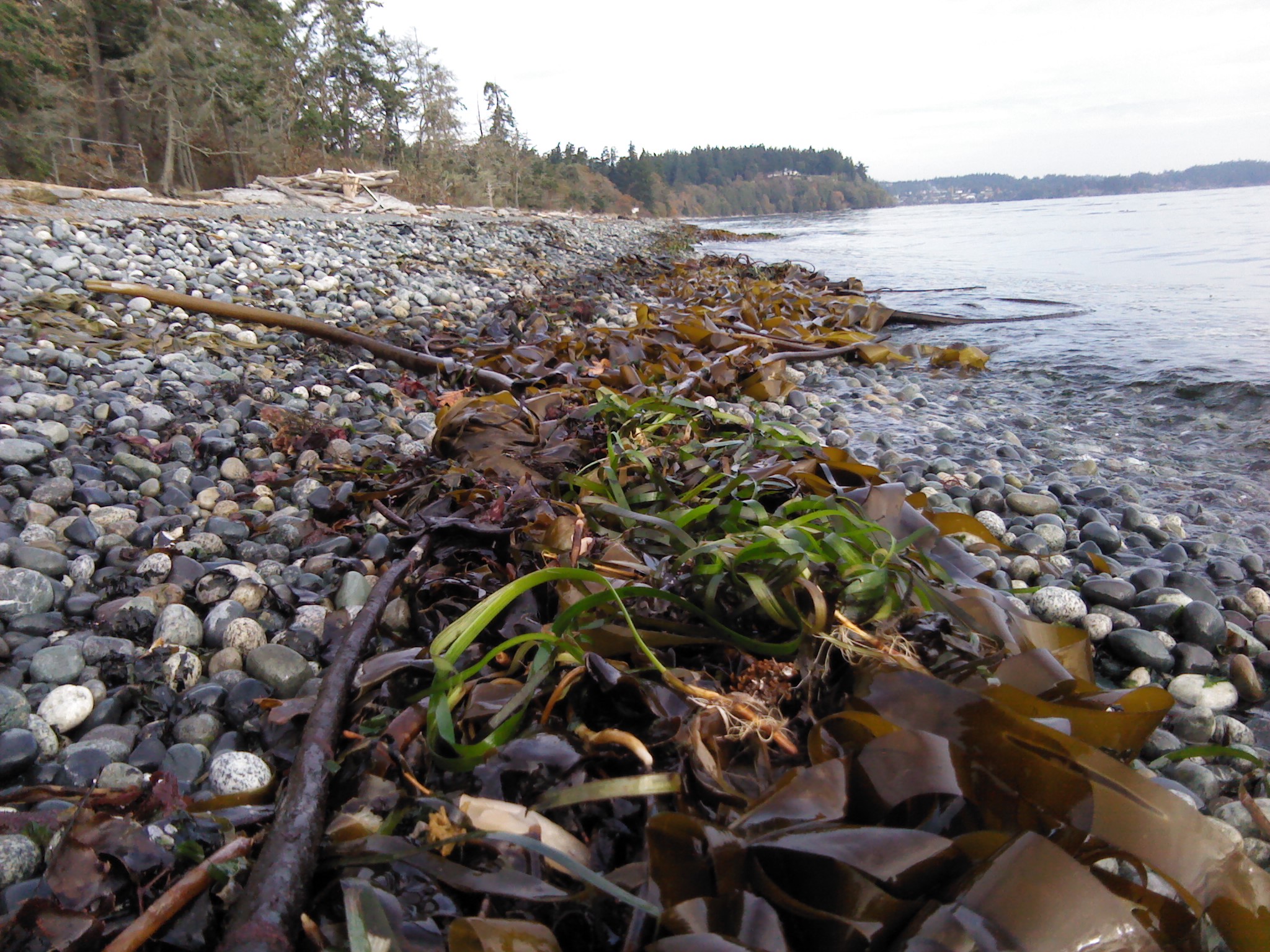
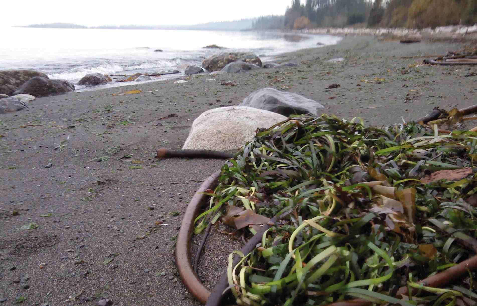
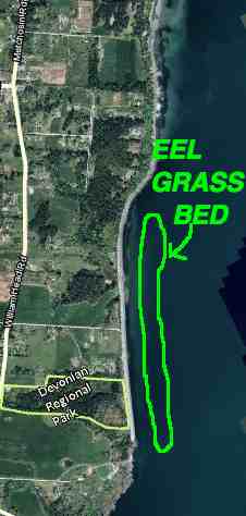
Eel grass along our coastline provides a valuable habitat for juvenile fish, crabs and other invertebrates. This week on October 28 and 29th, there was a wind from the North West which resulted in some debris deposition on the beach. The pictures show the eel grass deposits and the map shows the location where it came from  in the shallow water offshore. Eel grass turned up in the strand line almost the full length of the Taylor beach sector:

It is also important to note that the rocks along the beach at 0.5 M tide level just to the north of Taylor road are covered in Surf grassPhylospadix sp.

eelgrassnov1b

View from the south end of Taylor Beach showing Eel grass in the strand line

eelgrassnov1

View from the North end of Taylor Beach showing Eel grass in the strand line

eelgrassbed

Metchosin Bioblitz 2013: North end of Sector 7, Taylor Beach

Metchosin  BioBlitz Observations by Garry Fletcher and Sandra______on April 27, 2013 on the floodplane and estuary of Gooch Creek, on the 4645 William Head Road Property.


Continue reading

Macroalgae ( Kelp) beds around Southern Vancouver Island and their role in Carbon Sequestration .

Sometimes viewed as a nuisance for boaters around the shores of Metchosin, kelp beds (Nereocystis luetkeana) are however a valuable species of our natural capital
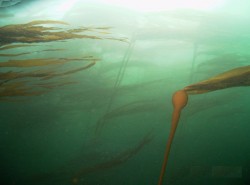
Nereocystis leutkeana, Bull kelp

Nereocystis luetkeana, Bull kelp

Our kelp beds provide ecosystem services such as habitat for juvenile fish, and marine mammals. Research on macroalgae of the temperate coastal areas in the world  has also shown extremely high rates of photosynthetic capacity and therefore another ecosystem service, in these algal beds, carbon fixation,  In this post I will  annotate  some of the significant research that documents the value of this resource.

“Kelp forests occur in cold, nutrient-rich water and are among the most beautiful and biologically productive habitats in the marine environment. They are found throughout the world in shallow open coastal waters, and the larger forests are restricted to temperatures less than 20ºC, extending to both the Arctic and Antarctic Circles. A dependence upon light for photosynthesis restricts them to clear shallow water and they are rarely much deeper than 15-40m. The kelps have in common a capacity for some of the most remarkable growth rates in the plant kingdom. In southern California, the Macrocystis can grow 30 cm per day.”

Abstract: There has been a good deal of interest in the potential of marine vegetation as a sink for anthropogenic carbon emissions , (Blue Carbon). Marine primary producers contribute at least 50% of the world’s carbon fixation and may account for as much as 71 percent of all carbon storage. In this paper, we analyze the current rate of harvesting of both commercial and growing and wild growing macro algae, as well as their capacity for photosynthetically driven carbon dioxide assimilation and growth. We suggest that carbon dioxide acquisition by marine macroalgae can represent a considerable sink for anthropogenic carbon dioxide emissions and the harvesting and appropriate use of macroalgal primary production could play a significant role in carbon sequestration and amelioration of greenhouse gas emissions.

___________________________________________
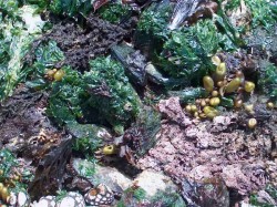
Sea Lettuce, ( Ulva lactuca)

Sea Lettuce, ( Ulva lactuca)

Off the  shores of Weir’s Beach  grows a large bed of Sea lettuce (Ulva lactuca) .  the following article attests to the efficiency of sea lettuce  in carbon dioxide fixation:

Carbon sequestration by a few marine algae: observation and projection

Kaladharan, P and Veena, S and Vivekanandan, E (2009) Carbon sequestration by a few marine algae: observation and projection. Journal of the Marine Biological Association of India, 51 (1). pp. 107-110

Abstract: CO2 sequestration by the marine planktonic microalgae Nannochloropsis salina and Isochrysis galbana as well as macroforms Gracilaria corticata, Sargassum polycystum and Ulva lactuca was estimated under laboratory conditions. The green seaweed U. lactuca registered 100% utilization of CO2 towards carbon fixation from the ambient water up to 15 mg/l and beyond that it declined to 60%. The microalgae were able to utilize 27.7% of dissolved CO2 at 15 mg/l, but did not show any effect either for carbon fixation or for emission at lower and higher levels. Gross primary productivity of these algae were also not affected by increase in the CO2 levels. It is estimated that the seaweed biomass along the Indian coast is capable of utilizing 9052 tCO2/d against emission of 365 tCO2 /d indicating a net carbon credit of 8687 t/d.

Recommendation:
  • A detailed mapping of Nereocystis beds  and Ulva lactuca beds on the Coast of Metchosin  should be done to quantify the extent of these resources.

________________________________________________________________

Concerns for the Kelp Resources of Metchosin:

The potential for commercial exploitation of this species is of concern, since he value as habitat for marine animals may far outweigh commercial possibilities. This reference explains the uses of the plant and it does not even include the potential for harvest for biomass , gas extraction:
“Uses 

Both the stipe and the blades of Nereocystis luetkeana are used for fresh and dried foods, nutritional supplements, cosmetic products such as exfoliants, fertilizers, animal feed, dog snacks, and dog shampoo and moisturizer.  Producers have found that it is rich in calcium, magnesium, sodium, iodine, potassium, phosphorus, iron, bulk fiber, and vitamins A, B complex, C, D, E, and K, protein and free amino acids.  It is used as an herbal remedy, with claims that it detoxifies body tissues of heavy metal and radioactive agents, treats thyroid disorders, arthritis and digestive problems; purifies blood, aids in weight loss, eases lymphatic swelling; treats herpes infections, eases inflammation and neuritis, soothes mucuous membranes, and reduces side effects of chemotherapy and radiation.  Other benefits mentioned for Nereocystis luetkeana in the spa include that it is stimulating, firming, revitalizing, tonic and slimming.  Over 25 products have been identified from over 10 different sellers in Canada, the United States, and the Netherlands.

Harvesting 

Commercial harvesting is known to occur in British Columbia and California

Harvesting Techniques 

As Nereocystis luetkeana grows in the subtidal and shallow intertidal zones, it is typically harvested from a skiff or small boat with a knife, although in some areas it may be harvested on foot at low tide.

Ecosystem 

Nereocystis tends to grow in large kelp forests, and the blades create lush surface canopies. Kelp forests provide important sheltering habitat for many marine fishes and invertebrates, including urchins, sea stars, snails and crabs, and are an important food source for sea urchins.  These forests also provide habitat for sea otters since sea otters eat the invertebrates that live on the kelp forest floor and the kelp itself provides a canopy which the otter can anchor to while resting to keep from drifting away.  The anchoring holdfast can reach a diameter of more that a foot, and can harbor its own collection of organisms by offering them protection among the haptera.  Nereocystis luetkeana is the only kelp which will drop spore patches, so that the right concentration of spores lands near the parent’s holdfast.  They grow out continuously from a meristem located at their base and slough off at their older outer tips.  The detritus formed by the sloughing tips has been shown to be an important source of carbon for inshore intertidal communities.  This detritus feeds species such as Blue rockfish (Sebastes mystinus) and many of the filter feeders, such as Pacific Blue Mussels (Mytilus trossulus) in the intertidal zone.  Urchins feed on Nereocystis luetkeana, and conversely this kelp can opportunistically and rapidly colonize areas that have been cleared by urchins.”

_______________________________________________________________

Research into the role of marine algae and its importance in contributing to energy flow when they end up on a beach is reported in the following research out of the Bamfield Marine Station:

by Malte Mews, Martin Zimmer, Dennis E. Jelinsk
ABSTRACT: The fate of subtidally drifting macrophytal detritus after its deposition ashore was studied based on short-term mass loss effects and species composition of beach-cast detritus. Different species of macroalgae and seagrass varied in both physical and microbial decay, as well as faunal decomposition rates. Their preferred status as food for detritivorous amphipods also varied. Thus, beach-cast detritus changed in species composition during detritus aging. Estimated turnover rates, based on daily input rates and mass loss rates, ranged from <1 d for Nereocystis luetkeana, Macrocystis integrifolia and Ulva spp. to roughly 30 d for Fucus spp. and Phyllospadix spp. Thus, the dynamics of nutrient fluxes within the marine–terrestrial ecotone depends not only on the spatial distribution and amount of beach-cast detritus, but also on its species composition.
_________________________________________________________________
  • Recommendation: The municipality should investigate the possibility of influencing provincial legislation to place a moratorium on the harvest of any natural kelp resources on our shoreline.


Marine Algae of the Metchosin Coastline.

Marine Algae along the Coast of Metchosin contributes to  Biodiversity and to the habitat of the shoreline. The productivity of some of the macroalgae beds is very high, contributing to carbon fixation and a food source for marine ecosystems. Some algae are grazed directly by fish and invertebrates, but many contribute their energy to the ecosystems when they break down in the water column or on the shoreline. The kelp beds of the coastal areas are valuable habitat for larval, and juvenile fish. Thus marine algae contribute to the Natural Capital of our marine systems in a very significant way.
Resources:

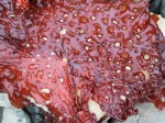
algaeredfenestrThe Algae of Taylor Beach


image005The Race Rocks Digital Herbarium


halosacc

Marine Plants at Race Rocks


saltwaterArchived Videos of Marine Plants at Race Rocks


Seagrass Meadows along Metchosin’s Coastline

There are several areas along Metchosin’s coastline where there are beds of the two species of sea grasses.

zosteraEelgrass : Zostera marina: http://www.racerocks.com/racerock/eco/taxalab/2006/zosteram/zosteram.htm

See this map, for locations of eel grass meadows, at #5 (off Taylor Beach) and # 12, (behind Swordfish Island)


phyllospadixSurf Grass: Phyllospadix scouleri : http://www.racerocks.com/racerock/eco/taxalab/phyllospadix.htm
Surf grass is most common on the   West shore of Race Rocks (#11) and Church Island (#12)


The Coastline of Metchosin is not as protected as the inner shores of the Victoria to Sidney area. Eelgrass needs protection and thus is minimally  important in our area as  fish habitat compared to the macro-algal kelp beds.

The following reference details the work done on the mapping of sea grasses in other areas of lower Vancouver island:
From: Island Trust Fund E-News Update March 27, 2013

Why we are mapping eelgrass

Seagrasses form large meadows that serve as nursery habitat and a refuge for juvenile fishes.  The leaves serve as a cornerstone for the marine food web, supplying nutrients to salmonids and other fish, shellfish, waterfowl and about 124 species of faunal invertebrates.

Eelgrass habitats within the Salish Sea provide the basis for the region’s commercial and recreational fisheries revenue.  The productivity of native seagrasses rivals the world’s richest rainforests.Eelgrass habitats capture and store large amounts of carbon at much more efficient rates than terrestrial forests.  Scientists estimate the salt marshes and seagrass meadows of B.C. sequester the equivalent of the emissions of some 200,000 passenger cars.

Contaminates and shoreline development put pressure on fragile eelgrass meadow ecosystems.  To protect eelgrass, we need to know where it is.  We’re mapping eelgrass habitat so that we can better plan our strategies to conserve these valuable underwater ecosystems

New Eelgrass Maps Released

The Islands Trust Fund is mapping nearshore eelgrass habitat in the Strait of Georgia and Howe Sound, in partnership with SeaChange Marine Conservation Society and the Seagrass Conservation Working Group.

Eelgrass Mapping Completed

Additional Technical Reference :
Mapping of Eelgrass (Zostera marina) at Sidney Spit Marine Park, Gulf Islands National Park Reserve Using High Spatial Resolution Remote Imagery: by Jennifer D. O’Neill BSc, University of Victoria, 2006:

ABSTRACT: The main goal of this thesis was to evaluate the use of high spatial remote imagery to map the location and biophysical parameters of eelgrass at Sidney Spit Marine Park, part of the Gulf Islands National Park Reserve. To meet this goal, three objectives were addressed: (1) Define key spectral variables which provide optimum separation between eelgrass and its associated benthic substrates, using in situ hyperspectral measurements, and simulated IKONOS and Landsat 7ETM+ spectral response; (2) evaluate the efficacy of these key variables in classification of the high spatial resolution imagery, AISA and IKONOS, at various levels of processing, to determine the processing methodology which offers the highest eelgrass mapping accuracy; and (3) evaluate the potential of ―value-added classification of two eelgrass biophysical indicators, LAI and epiphyte type.