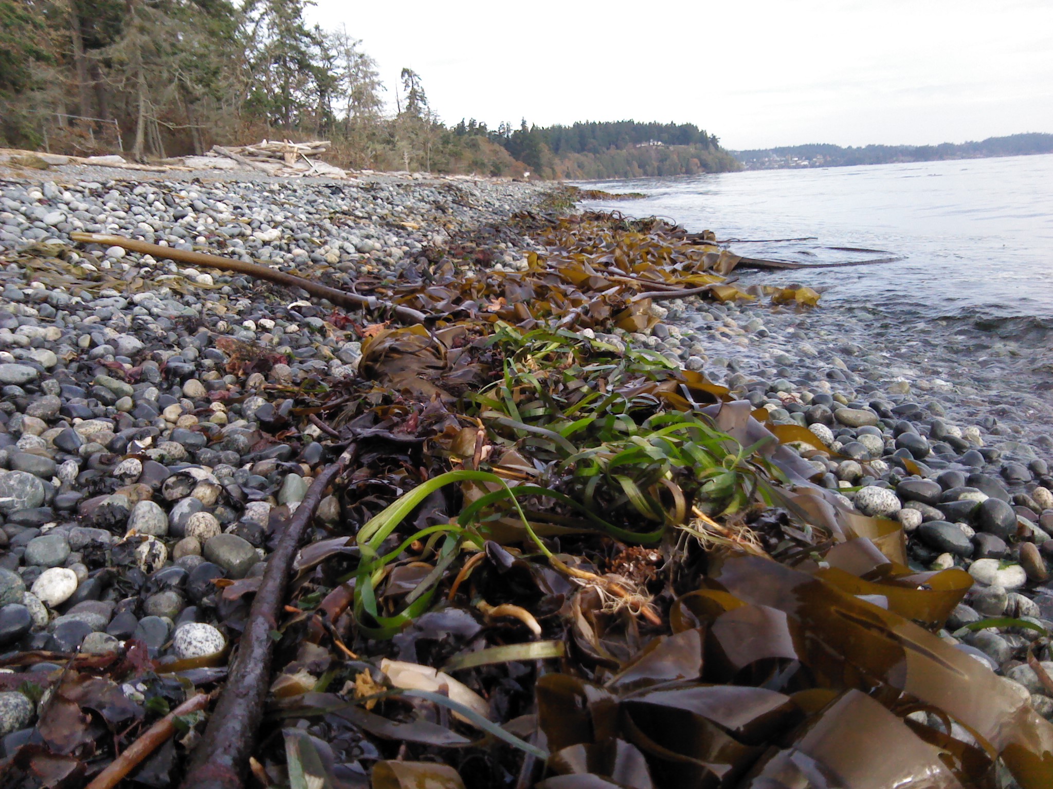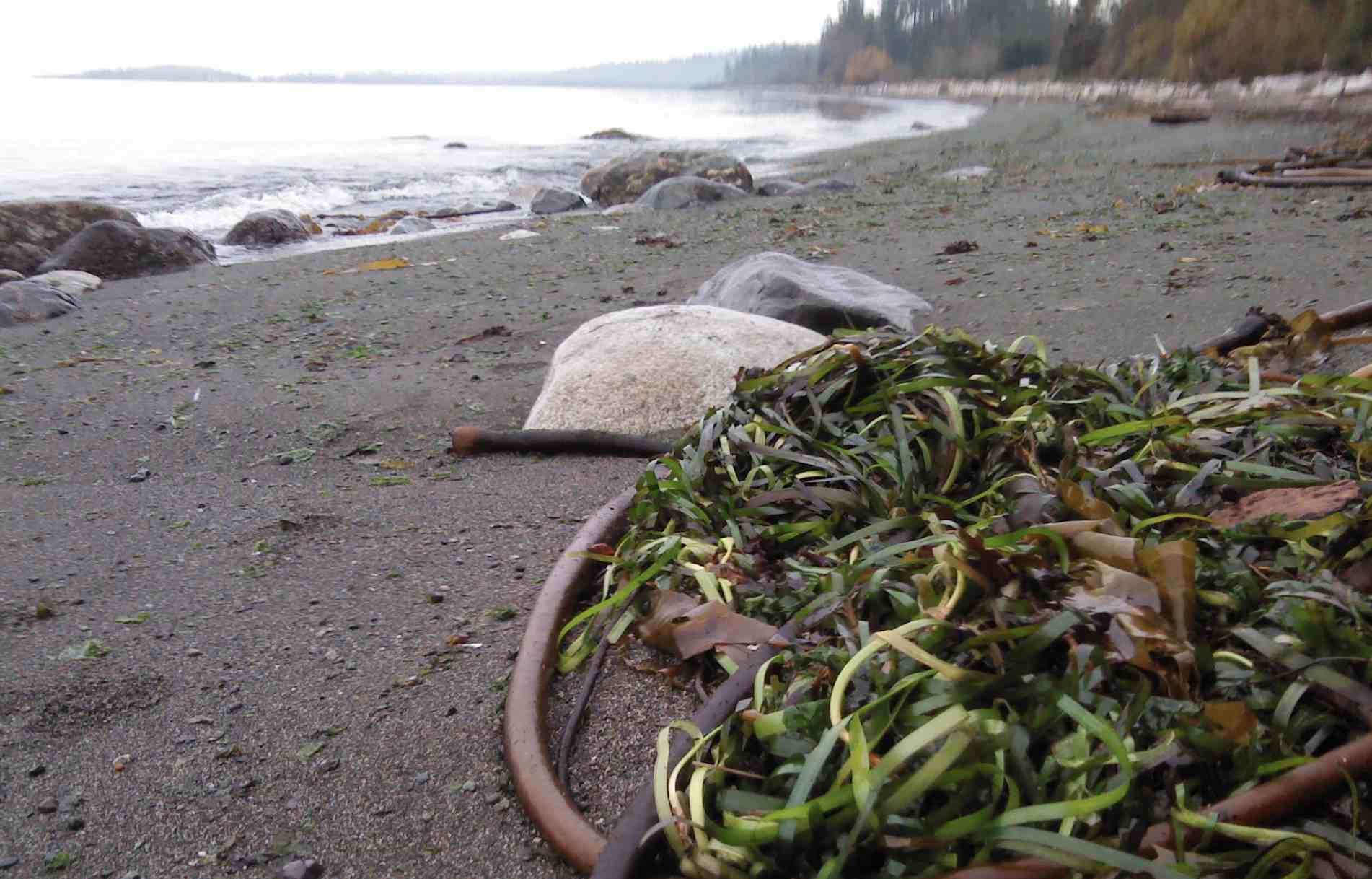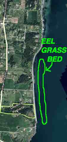
Below is a publication which may be useful in providing ideas for a similar program in Metchosin:
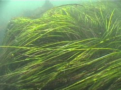
Eelgrass/Macroalgae Habitat Interim Survey Guidelines
This publication was downloaded from http://wdfw.wa.gov/publications/00714/
Introduction
Under the Washington Administrative Code (WAC), eelgrass and macroalgae are defined as saltwater habitats of special concern (WACs 220-110-250 (3)(a, b)). In administering the Hydraulic Project Approval (HPA) process, the Washington Department of Fish and Wildlife (WDFW) requires proponents for projects to: 1) avoid impacting eelgrass and macroalgae, 2) minimize unavoidable impacts, and 3) mitigate for any impacts. Mitigation for the loss of eelgrass typically entails providing eelgrass enhancement away from the project footprint. Because establishment of new eelgrass for mitigation is often unsuccessful, project proponents need to address this uncertainty by increasing the scope of their mitigation effort, such as planting an area larger than the project impact footprint. For macroalgae mitigation measures, the WDFW Area Habitat Biologist (AHB) shall be consulted.
In known or suspected eelgrass areas, proponents shall survey to delineate the spatial extent of eelgrass and macroalgae presence in the project area. If the project cannot be moved or redesigned to avoid direct eelgrass and macroalgae impacts, surveys are required for quantifying potential impacts. Surveys shall be conducted by divers/biologists who are qualified to identify the predominant eelgrass and macroalgae species in the project area. Deviations from the survey guidelines shall be approved by the AHB prior to conducting eelgrass or macroalgae surveys. Survey results and interpretation will be subject to WDFW approval.
Preliminary Surveys
Preliminary surveys are conducted to:
- 1) determine if eelgrass or macroalgae are present at the proposed project site,
- 2) evaluate if the project can be located and constructed to avoid impacting eelgrass or macroalgae, and
- 3) establish a location for the project that will minimize impacts when avoidance is not possible. Eelgrass/Macroalgae Habitat Interim Survey Guidelines 1 of 6 (Rev. 06/16/2008)
Preliminary surveys shall provide:
• A project site map indicating all survey transects and showing the qualitative distribution of eelgrass and macroalgae (boundaries of each patch), as well as substrate characterization along each transect. The map should also indicate approximate depth contours and the approximate location of the proposed project footprint (e.g., the dimensions of the pier, ramp and float).
Protocol Guidance
- Transects should be referenced to a permanent physical feature at the project site in such a way that transects can be precisely relocated in the future.
- Transect length and location should be determined by project and site specifics, and should include the landward margin of the eelgrass or macroalgae habitat, if present. Transect coverage should extend at least 25 feet waterward of the project footprint, and, if possible, to the outer margin of the eelgrass or macroalgae bed.
- To document the potential for eelgrass or macroalgae impacts from a project, at least one transect should be aligned along the proposed centerline of the project footprint. Additional transects shall be conducted on either side of the project footprint at 10 and 25 feet from the outer edges of the proposed structure. The inner and outer edges of each eelgrass or macroalgae patch shall be documented along each transect and noted on the site map.
- Depth contours should be established relative to mean lower low water equal to 0.0 feet elevation (MLLW=0.0 ft.). Tidal reference and correction should be noted on the site map.
- Survey documentation must include the date and time of the survey, name of the surveyor and their affiliation, turbidity/visibility measurements, presence of invertebrate and vertebrate species, and anecdotal observations pertinent to habitat characterization of the project site (e.g., presence of rocky outcroppings, debris, etc.).
- Conducting surveys between June 1 and October 1 is strongly preferred because the full extent of eelgrass and macroalgae distribution can be more accurately mapped. However, preliminary surveys may be conducted at any time during the year.
To meet the need to minimize eelgrass and macroalgae impacts, and the requirement to document the centerline of the project footprint, some flexibility at the time of the survey may be necessary. A preferred method is to establish a transect parallel to the shoreline, along the midpoint of the eelgrass or macroalgae bed, to locate any open patches where a
Eelgrass/Macroalgae Habitat Interim Survey Guidelines 2 of 6 (Rev. 06/16/2008)
new centerline for the project could be placed. Typically, an open area sufficient to accommodate a ten-foot buffer around the project footprint will be necessary.
If the preliminary survey shows that the project can be located and built without impacting eelgrass or macroalgae, the preliminary survey will meet the needs for mapping the project area. However, if the project footprint potentially impacts existing eelgrass or macroalgae beds, advanced surveys to quantify the extent of impact and document mitigation success, will be required.
Advanced Surveys
Advanced surveys shall occur between June 1 and October 1 and are conducted to:
- quantify the impact from the project to eelgrass and macroalgae, and
- quantify the performance of mitigation actions.
Quantifying Impacts
The standard protocols described below are designed to give accurate estimates of project impacts. Eelgrass density is determined by sampling with quadrats along transects. Two methods are typically used to determine project impacts and required mitigation. Project impacts are calculated as the total area of eelgrass affected by the project, as determined by the AHB. Alternatively, project impacts can be monitored in the project area to determine eelgrass or macroalgae loss and required mitigation. Sampling results are used to calculate the size of the mitigation project required to compensate for impacts that cannot be avoided.
As noted above, a project proponent may choose to monitor post-project impacts directly. The size of the required mitigation obligation may be reduced by this approach (e.g., in cases where post project impacts were less than anticipated). However, this approach will require additional monitoring of survey transects for a number of years to evaluate potential changes to eelgrass densities in the project area and within a reference site. This approach involves potentially higher mitigation ratios due to the delay in mitigation project construction (e.g., adjusting for temporal loss of function).
Alternative sampling designs are allowed, when agreed to in consultation with the AHB. This may be particularly appropriate when the potential impacts have been avoided to the maximum extent possible, and only a few small patches of eelgrass remain within or near the project footprint. In such a case, a full census of impacted eelgrass may be the most cost-effective option (e.g., counting all eelgrass shoots in the impact area). Alternatively, a stratified sampling of the existing patches may be a better choice (e.g., taking density estimates in the eelgrass patches only).
Eelgrass/Macroalgae Habitat Interim Survey Guidelines 3 of 6 (Rev. 06/16/2008)
Statistical Considerations
1. Measuring mitigation success (or direct impacts of a project) requires comparing eelgrass densities at a mitigation (or impact) site versus a reference site. These comparisons must be statistically rigorous, and include the following statistical considerations:
- Low probability of a Type I error – concluding there is loss of eelgrass when, in fact, there is not. This issue is addressed by selecting a small value for α in statistical analyses, usually 0.10.
- Low probability of a Type II error – failing to detect a loss of eelgrass when, in fact, there is one. Selecting a small value for β (applying high statistical power, (1-β)) ensures this. Power set at 0.90 provides low probability of a Type II error.
- Effect threshold – the difference in mean eelgrass density between sites. The WDFW has established monitoring standards for these surveys: a) α = 0.10, b) power (1 – β) = 0.90, and c) a difference of mean eelgrass density of ≥ 20%. Surveys using an alternative design must meet or exceed these standards. Standard Protocols for Quantifying Impact
- For a linear project, a single transect should be aligned along the centerline of the footprint.
- A minimum of 30 samples must be taken within the area of eelgrass or macroalgae. Samples consist of eelgrass shoot counts within a (minimum) 1⁄4 m2 area quadrat. Sampling stations may be placed randomly along the transect, or for simplicity, evenly spaced along the same line starting at a random point (i.e., stratified random). Convert raw sample counts to shoot densities per square meter (#/m2).
- Using the sample data, calculate mean eelgrass density ( ̄x project) in the impact area, as well as sample variance (s2).
Assessing Mitigation Performance
Eelgrass density often varies substantially among locations and through time, making it difficult to measure mitigation success. To address this uncertainty, WDFW requires the use of a reference site to account for regional differences in eelgrass density and temporal variability. Use of a reference site can also improve monitoring efficiency, supporting rigorous results with fewer samples. The reference site should be chosen to match the characteristics of the mitigation area.
Eelgrass/Macroalgae Habitat Interim Survey Guidelines 4 of 6 (Rev. 06/16/2008)
Quantifying Mitigation Performance
Reference Site Characterization
1. Choose a reference site near the proposed mitigation site. The reference site should be similar to the mitigation site in depth profile, substrate, turbidity, and disturbance regimes.
2. Within the reference site, take a minimum of 30 samples, either randomly or stratified randomly. Samples involve counting eelgrass shoots within a (minimum) 1⁄4 m2 area quadrat. Samples can be larger than 1⁄4 m squares, but all samples need to reference the area from which they were taken so that the data can be converted to shoot densities (#/m2).
3. Calculate the mean density of eelgrass at the reference site ( ̄x reference) as well as sample variance (s2).
Mitigation Area Extent
The objective of eelgrass mitigation is to replace lost shoots and an area equivalent to the impacted area. If the mean density of eelgrass is lower at the reference site than within the impact area, the size of the mitigation project needs to be enlarged such that the reference site has the same total number of shoots as the impact site. For example, if the project impacts an area of 10 m2, with a mean eelgrass density of 20 shoots/m2, while the reference area has a mean shoot density of 10 shoots/m2, the mitigation area would need to be at least 20 m2 (to achieve a 1:1 mitigation ratio). However, if the reference site has greater density than the impact area, no area adjustment to the mitigation site would be necessary to address density differences. In addition, other factors can influence mitigation ratios and thus the required size of the mitigation area.
Mitigation Sampling and Performance
Mitigation monitoring consists of sampling both the reference site and the mitigation area at three and five-years following the completion of the mitigation project. Sampling one year following project completion is recommended to detect early failures at the mitigation site, but the need for this can be determined on a site-specific basis. Enough samples must be taken at the two sites to be able to detect significant differences in eelgrass density at the mitigation site versus the reference site using the statistical considerations noted above. A Microsoft Excel spreadsheet (Sample_Size_Calculator.xls) programmed to calculate the required sample size is provided by WDFW. Specific directions for entering data are included on the spreadsheet. The sample size calculator uses the following formula, modified from Zar (1999).
N = [2*s2reference/( ̄x reference – x ̄ mitigation)2] * (t α(1), v + t β(1), v)2
Eelgrass/Macroalgae Habitat Interim Survey Guidelines 5 of 6 (Rev. 06/16/2008)
Where: N = required sample size in each site (i.e., mitigation and reference), s2reference = sample variance from the reference site,
x ̄ = sample mean
t = percentage values from Student’s t-distribution
v = degrees of freedom
If the required number of samples is prohibitively expensive, due to inherent variability of eelgrass density, the statistical power of the monitoring may be lowered. This will entail a larger mitigation project to account for the increased statistical uncertainty.
Statistical Testing
At year three and five post construction, the proponent is required to re-sample and compare (statistically) eelgrass densities at the reference and mitigation site (using the prescribed number of plots defined in the equation above). We suggest using a two- sample, one-tailed t-test for comparison of eelgrass mean densities from mitigation versus reference areas. The statistical null hypothesis in this case is – H0: eelgrass density at the mitigation site ≥ eelgrass density at the reference site.
The year-three sample is designed to detect potential early failures in eelgrass growth at the mitigation site, relative to the reference site, that may suggest the need for additional actions at the mitigation site (e.g., additional transplants). Final mitigation success or failure will be based on year-five survey results and statistical testing (H0: eelgrass density at the mitigation site ≥ density at reference site, and total shoot abundance criteria has been met). Failure to meet prescribed eelgrass density (i.e., rejecting the null hypothesis) and shoot abundance will require implementation of contingency actions identified in the mitigation plan.
Eelgrass/Macroalgae Habitat Interim Survey Guidelines 6 of 6 (Rev. 06/16/2008)