NOTE: Updated Version 6 –Feb.2009
The text and images of this page and all those that are contained on the website racerocks.ca are the copyright © 2008, of Garry Fletcher. Images have been contributed for use in this publication only. They remain as copywrite © 2008 of Lester Pearson College and those individuals who produced them
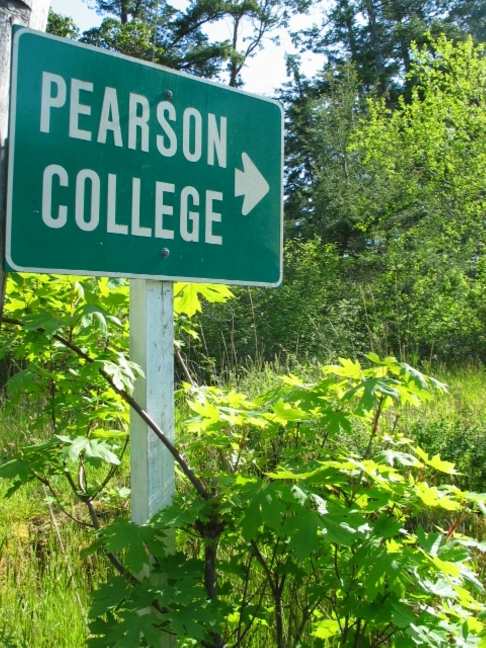
 THE ROAD
ENDS AT OUR PLACE:
The Ecosystems
of Pearson College
This guide was written in 2008 by Garry Fletcher, a former faculty member from Pearson College, with a grant from the British Columbia Ministry of Forests for the Pearson Conversations Program.

Contents:
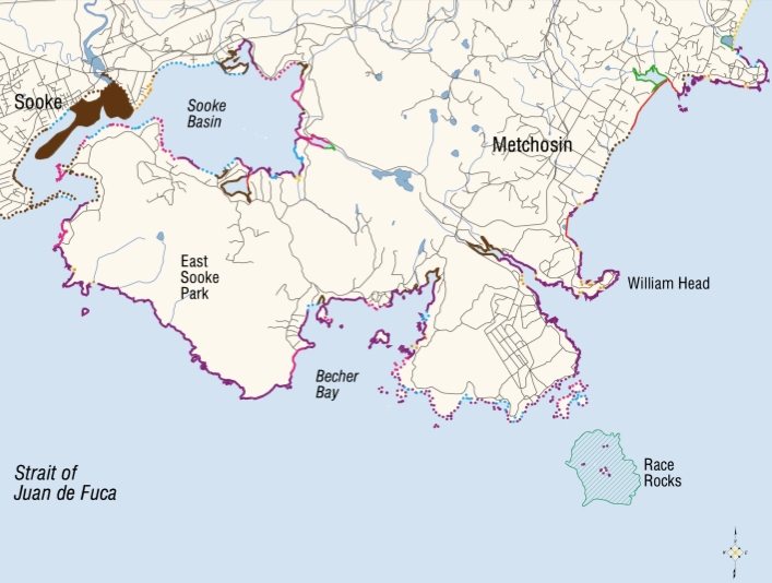
(See the corresponding numbers for area location on the map below)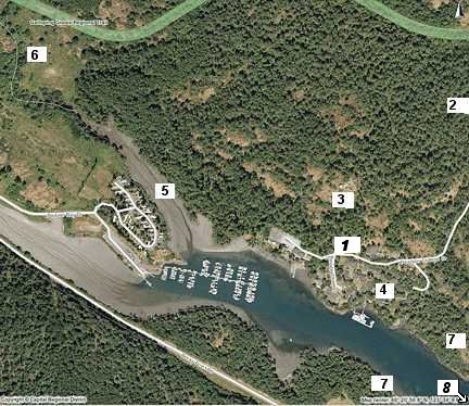
1. Pearson College, the Place and the students
2. The Ecosystems of the northern entrance to the campus
3. To Observatory Hill– up the slope from the campus
4. Central core of campus
5. From the parking lot west along Pedder Bay
6. The Playing field and the waterfall
7. Pearson College docks to the open ocean
8. Race Rocks and the Strait of Juan de Fuc
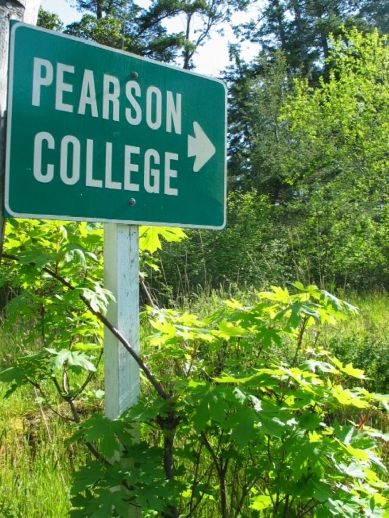
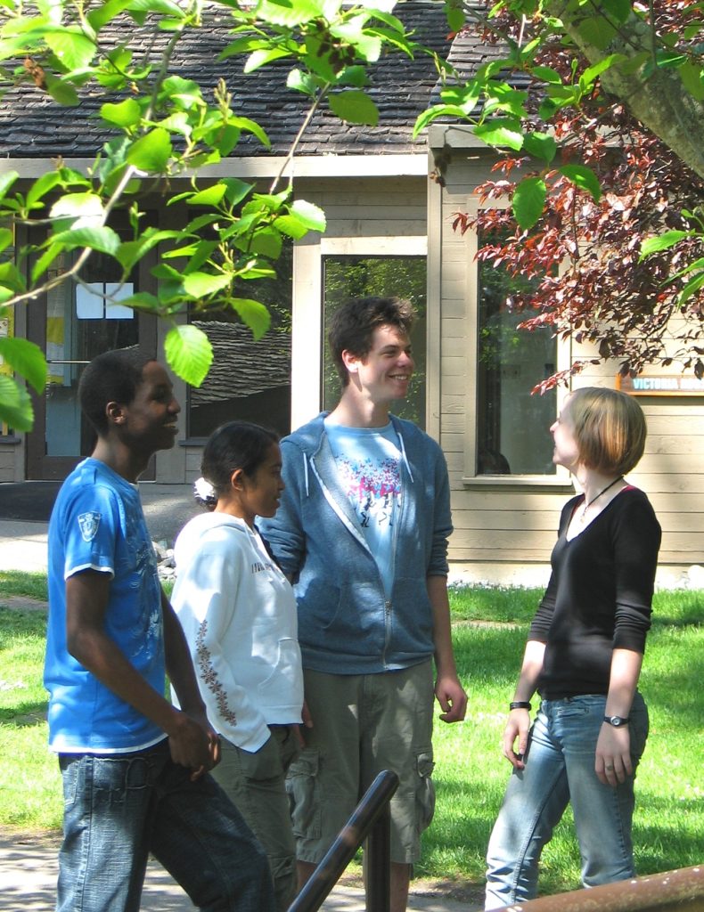 1. Pearson College, The Place and the Students:
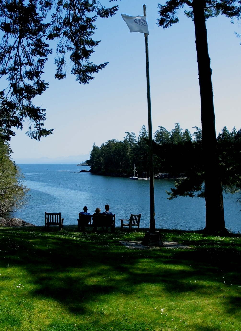
Lester B. Pearson United World College of the Pacific is a unique two year pre-university school for two hundred students selected from around the world. Entry is based solely on their personal merit and potential and demonstrated commitment to engage actively in creating a better world.
All students attend on a full scholarship and live together while studying the International Baccalaureate program and pursuing explicitly the mission of the United World Colleges to make education a “force to unite people, nations and cultures for peace and a sustainable future”.
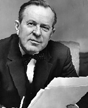 Lester B. Pearson, Nobel Peace Prize Laureate and former Prime Minister of Canada, was the driving force behind the founding of the College. After retiring from public life Mr. Pearson became very interested in the United World Colleges project. At that time he stated: “Students will be welcomed without regard to race, religion or politics and we intend to establish scholarships so that the students who attend the College will be from all levels of society and will be genuine representatives of their own peoples. This system could become a revolutionary force in international education.”
Mr. Pearson became Honorary Chairman of a committee formed to build what was to be known as the College of the Pacific. He worked tirelessly to get things started, but he passed away in December 1972 just as the project was beginning. Soon after his death it was decided that the College would be a most appropriate living memorial and it was renamed Lester B. Pearson College of the Pacific. In 1974, the college opened to its first 100 students in this old growth Douglas fir forest on the North shore of Pedder Bay at the southern tip of Vancouver Island.
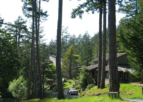 Since then 200 students have attended each year on full scholarship. Pearson College continues to be funded through the generosity of corporations, foundations, individuals and governments. The architecture of Ron Thom enabled the college to blend in as much as possible to be a village in the forest, away from the distractions of Vancouver Island “civilization’ where the goals stated above could be pursued.
 The selection of the campus location on the shores of Pedder Bay provided an opportunity for interaction with the forest and the sea which is unique for many of the students who have an urban background.
This booklet is designed to help one understand and appreciate some of the unique aspects of the local ecosystems, and recognize the influence of humans on shaping the ecosystems and the community of organisms.
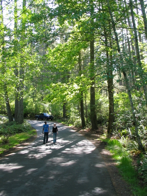
 2. Campus entrance and north slope:
The entrance to the college is along a winding drive off William Head Road, south of Metchosin on the southern tip of Vancouver Island. It is here that you first get the feeling that the pace of life has changed and the values of the surrounding environment become an important part of the way of life to be encountered on the campus.
The forest community here is typical of the Douglas Fir, (Pseudotsuga menziesii,) Garry oak, (Quercus garrryana ) Arbutus, (Arbutus menziesii ) ecosystem.
 These species traditionally occupied a narrow coastal fringe from Metchosin to Nanaimo, which now has been reduced by logging and the spread of development to a mere fraction of its normal range. Included in this type of bioregion are a number of microclimates that lead to variations in vegetation type which we will see on the Pearson College lands. The ecological structure of the forest even changes from the north entrance side to the south-facing slope on the college side. Since the north side is cooler and more heavily shaded, much of the old growth canopy is tall Douglas fir, which leads up to the north side of the high ridge separating Pedder Bay from the rest of Metchosin.
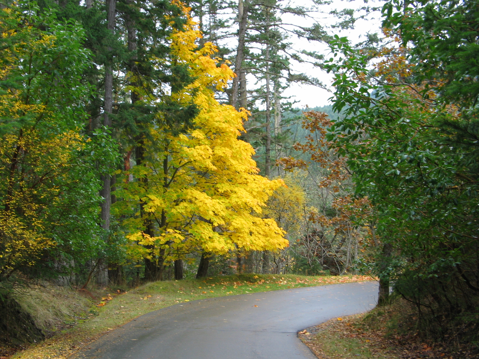
 In the fall the deciduous bigleaf maple, shows up throughout the woods with patches of golden foliage. The forest floor here is open, covered in a thick moss carpet, and interspersed with few shrubs. The soil cover is surprisingly very this here as it is an area that was scoured by the glaciers of the past. This contrasts with the soil deposits which created the farmland that one passes through when driving from Metchosin to the College.
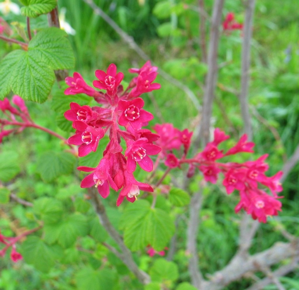 Throughout the forest and along the roadway in March and April, pink splashes of the flowering current, Ribes sanguineum are scattered through the understory and along the driveway. They attract the early arriving migrant rufous hummingbirds, Selasphorus rufus, and provide early spring nectar for the overwintering Anna’s hummingbird. Calypte anna.
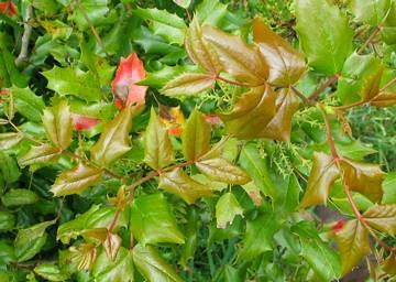 Oregon grape, Mahonia aquifolium with its changing colors of foliage and flowers also proliferates in the understory of this forest. Both of these species provide one of the many sources of berries for food for migrating birds in the late summer and fall.
Introduced Invasive Species on Campus:
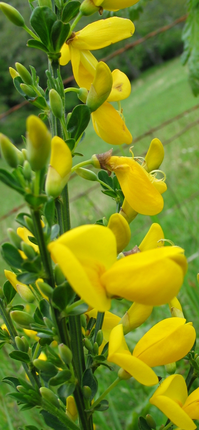
 Along the drive into the college, first opened in 1973, the exposed clay soil and sun exposure in the area has promoted the growth of dense stands of Arbutus. In the understory along the road, several small Garry oaks are sprinkled through the forest. Their branches often support an array of hanging grey lichen. This roadway into the college also allowed for the spread of a problem introduced species on Vancouver Island, scotch broom, Cytisus scoparius.
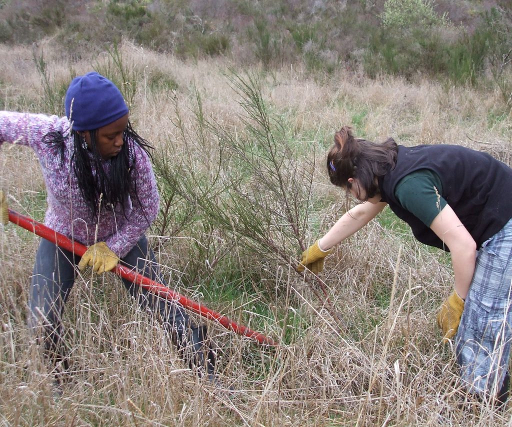
 Broom has a tendency to take over and modify the ecosystem since its roots and leaves force out other plants by exuding chemicals. As a result, considerable effort has been expended in the past few years by students and staff to keep this shrub under control. Regular “broom pulls” are conducted. Unfortunately, since this is a very persistent plant, with seeds lasting many years until conditions are right for germination, we can expect this to be part of our regular stewardship schedule for some time to come.
This brings up an interesting point about the responsibilities we incur when developing in any rural natural area.. Restoration of native species in order to maintain the unique biodiversity of an ecosystem is frequently necessary. The pristine conditions encountered when development first opens an area can be quickly compromised over a few years if the residents do not take a stewardship role seriously, and do not accept that it means committing to a long-term responsibility.
Regeneration of many native species is often hindered by browsing deer, the result of the understory being opened by humans, and lawns being planted.
Geology of the Area:
Vancouver Island developed as a submarine island arc sometime in the Devonian, 380 Million years ago and attached to the North America land mass in the Cretaceous, 100 million years ago. It is also known as the Wrangellia terrane and has accumulated other terranes from collisions. Race Rocks is part of the Crescent Terrane which docked with Vancouver Island 42 million years ago. Pearson College lies on the Metchosin Igneous complex, which is made of fine-grained basalts from extrusive ocean crusts. Thus within a few kilometers of the college one can find masses of pillow lava intact as it came out on the ocean floor. Also, the more coarse-grained gabbros, which were intrusive rocks, formed underground are now exposed by erosion. In the Pleistocene, 80,000 to 10,000 years ago, the area underwent three glacial periods.
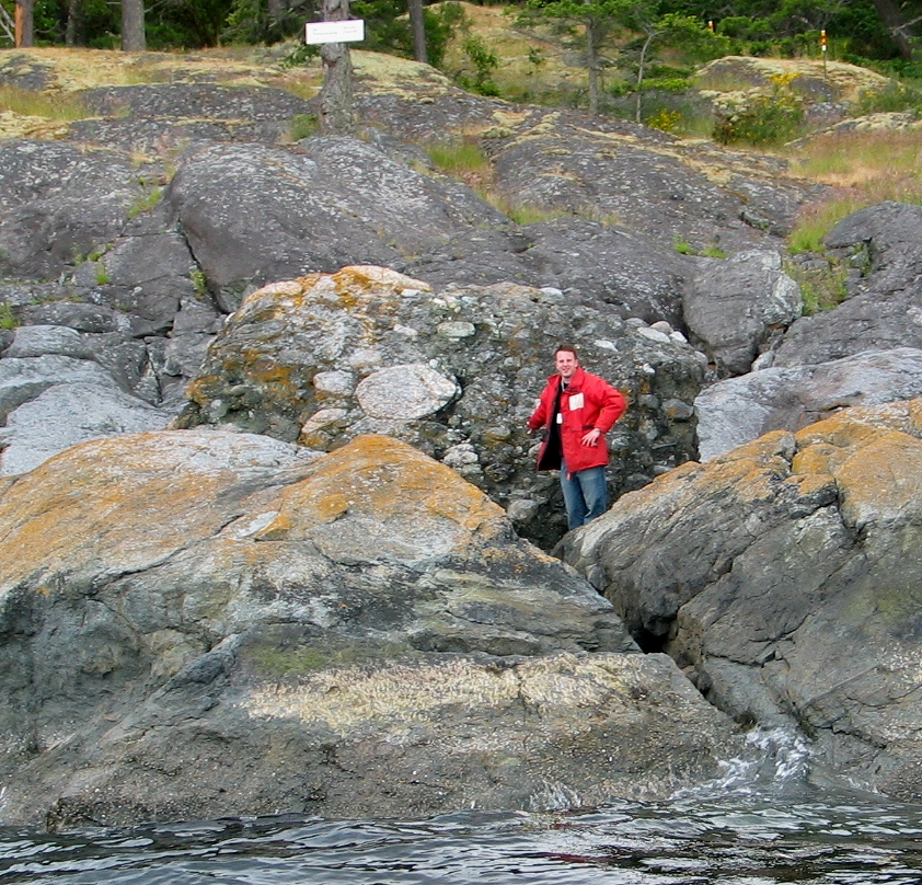 Evidence of the last of these periods can be found around Pedder Bay and at Race Rocks. This large conglomerate boulder at Fossil Point in Pedder Bay and other grey-coloured granite boulders line parts of the shoreline are glacial erratics. Glacial striae, which show as grooves in the rock in Pedder Bay and at Race Rocks testify to the great erosive power of the grinding ice mass that once lay over this region. Seismic activity is common on Vancouver Island and Pedder Bay is formed along a fault line. The Juan de Fuca tectonic plate is slowly plunging under the North American continental plate so we can be reminded for some time that this process of geological change is still happening.
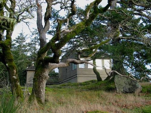
3. Observatory Hill
–up the south-facing slope from Pearson College.
From Max Bell Hall back into the forest a number of features distinguish this dry south-facing slope. The physical conditions of the environment: a warm south-facing exposure, a low soil profile and exposure to the prevailing westerly winds ensure that any organisms growing there have adaptations that allow them either to complete most of their reproductive life cycle in the wet months of the year or conserve water by resisting evaporation. On the lower parts of the slope, the Garry oak open woodland is interspersed among the Douglas fir canopy.
 Arbutus, Arbutus menziesii and Garry oak, Quercus garrryana are common on the south-facing Pearson College side of the ridge. Also scattered throughout, in more heavily forested areas, is the grand fir, Abies grandis. It is often clumped in the understory. It is a short-lived conifer with a flat arrangement of shiny needles on the branches.
Big leaf Maple, Acer macrofolium provide a splash of gold leaves throughout the forest for a few weeks in the fall, and the red bark of the arbutus often flakes and peels in the heat of summer, along with some leaves. The arbutus canopy does not shed for the winter, as the shiny green leaves can withstand the mild climate of Vancouver Island, and can even shed the rare snowfall. Because of the moderate Mediterranean climate, this is the only bioregion of Canada which supports the growth of both the Garry oak and arbutus
 In areas with very little soil cover, moss balds are a unique ecosystem with plants that can withstand the drought of summer. On southern Vancouver Island, these are significant ecosystems which harbour many rare species of moss, lichen and early flowering spring bulbs. Unfortunately, because of the vistas available, this same environment is where people prefer to build homes resulting in a rapid depletion of this habitat locally.
 The thin layer of earth on the rock outcrops dry out in the summer, becoming a xeric community. Only where soil has accumulated will drought-tolerant species of vegetation thrive, and these occasional soil pockets are significant to support the scattered Garry Oaks. By mid-summer, the moss is crisp and the fire hazard is high so one is urged to exercise caution when exploring the area at that time.
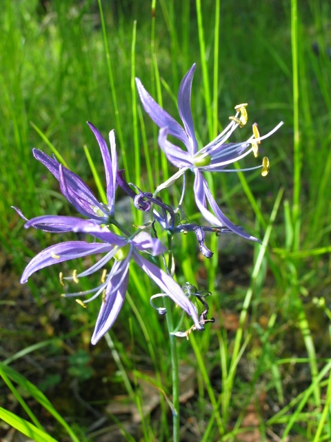 The open Garry oak woodlands are part of an ecosystem that developed through much of Metchosin in pre-European contact times. First Nations peoples used controlled brush fires to maintain open woodlands for the harvesting of camas bulbs from the blue lily, Camassia quamash. It was harvested as a valued source of winter starches for the diet and as a source of medicinals, and it may well represent the first form of agriculture on the island. Today in only a few fields on the way to the college along William Head Road, can small populations of camas be viewed in May each year. A short variety grows on dry rocky slopes and a taller variety is more common in deeper moist soils. One can see patches of Camas by the water storage tank along the road to the Observatory.
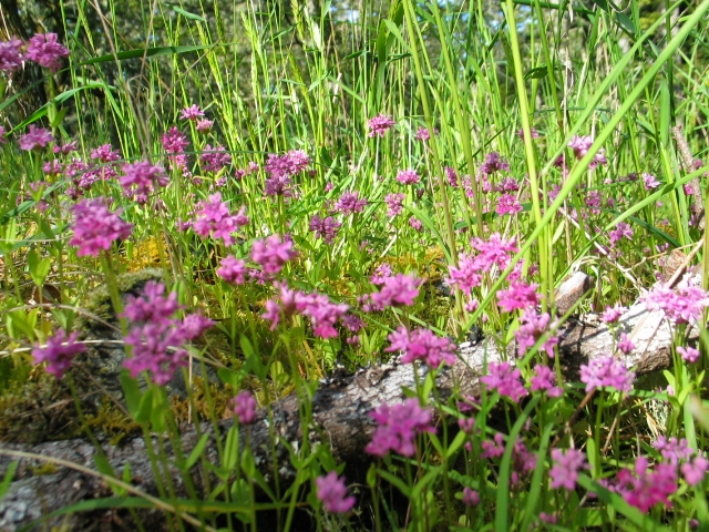 Also in that area with shallow soils, pink patches of sea blush, Plectritis congesta, bloom in May, making for colourful outcrops on the slopes above the campus.
Animals of the Forest in the Pedder Bay Area:
The dry slopes also provide an ideal habitat for the Western Garter snake, Thamnophis elegans, and the North Western Alligator Lizard, Elgaria coerulea principis.
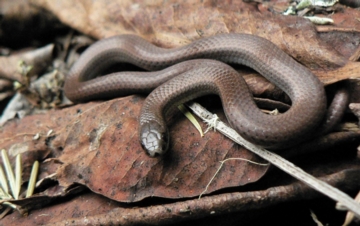 A very rare red-listed snake, the sharp-tailed snake, Contia tenuis, shown here also occurs in a limited area in this corner of Vancouver Island. Their habitat has been reduced by development and they are threatened in the southern Vancouver Island region. One doesn’t have to worry about poisonous snakes here, however, as there are none on Vancouver Island.
This sparsely settled corner of Vancouver Island is also home to a number of mammals, including some of the top predators of this ecosystem. The Vancouver Island black-tailed deer, Odocoileus hemionus columbianuis is common near the campus. Since the college was established, occasional sightings of the Vancouver Island black bear, Ursus americanus vancouveri and cougar, Puma concolor couguar have been made by students and faculty in the vicinity of the campus. A rare sighting of the endangered Vancouver Island wolf, Canis lupus crassodon, has been made as well in the outer Pedder bay area on Rocky Point. Most likely on campus one will encounter raccoons, Procyon lotor, and near the docks, river otters, Lontra canadensis and mink, Neovison vison..
Birds of the campus and local forest:
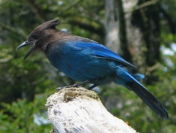 One of the birds that may be encountered in the wooded areas of the college is the Steller’s jay, Cyanocitta stelleri, which are related to the blue jays found on the rest of the continent. The rufous hummingbird, Selasphorus rufus, is common at bird feeders and also sips nectar from the flowering currants and other flowers. During the winter, Oregon junco, Junco oregonus, and a small finch, the pine siskin, Carduelis pinus, are common year-round, as are the American robin, Turdus migratorius. The varied thrush, Ixoreus naevius may be mistaken for robins but have a striped orange and brown plumage. Very rarely, the dusky grouse, Dendragapus obscurus, can be heard drumming in the forest, but it is rarely seen. Often rectangular holes carved in dead trees provide evidence of the large red headed pileated woodpecker, Dryocopus pileatus searching for carpenter ants. Bald eagles, Haliaeetus leucocephalus) are frequently seen in the trees above the college as they nest at the tops of tall fir trees in the area. At night the sound of a barred owl, Strix varia may be heard, and during migration, in spring and fall one can expect a wide variety of small birds passing through.
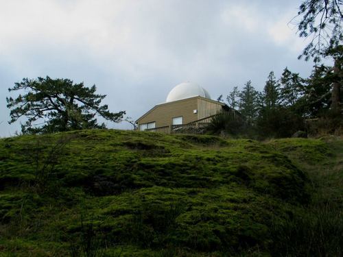 At the top of the hill behind Max Bell Hall, is located the Jack Newton Observatory.
 Students regularly use this facility with a supervising astronomy teacher, who instructs them in the use of several telescopes for astronomy. Some use data obtained here for their research essays in physics..
In the horizontal areas at the top of the ridge, one occasionally comes across small ponds which collect water, providing a varied aquatic ecosystem. These “vernal pools” are unique features which provide a valuable source of water storage for the surrounding vegetation, in an undisturbed forest. In the spring, small tree frogs may be heard around these ponds.
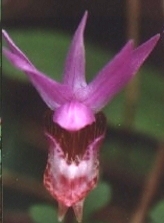 On the north side of the old-growth Douglas fir in the surrounding woodland is the habitat of the Pink Lady slipper orchid Calypso bulbosa. This small plant blooms in April each year.
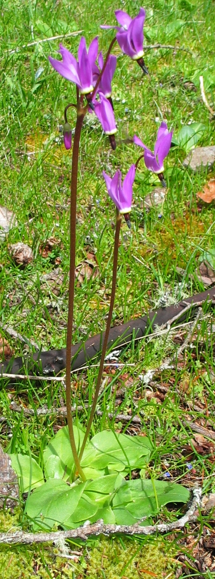
 The shooting star, Dodecatheon integrifolium, can be seen in March and April. Many of the spring flowering lilies and orchids growing in the woodlands around the college may be abundant locally but are considered rare in the province. The special climate of southern Vancouver Island has resulted in a very limited distribution of these plants and their associated communities of organisms.
We urge you to leave the plants where they grow so all can enjoy them for years to come.
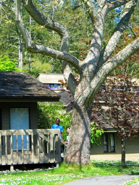
4. Ecosystems of the central core of the campus
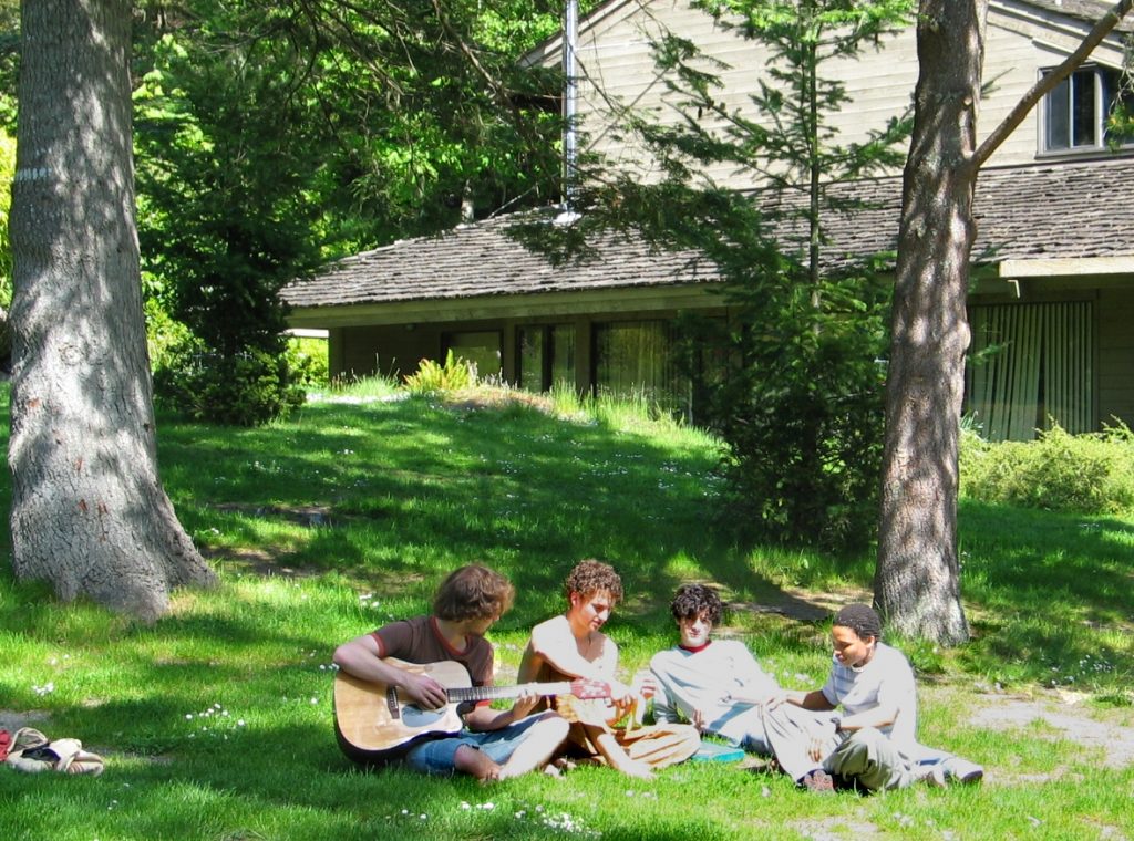 A large grassed area around the five student residences on campus provides a relaxing atmosphere. On either side of the meandering pathway leading through the centre of the campus, we encounter a mix of introduced and native landscapes.
An effort was made when the college was constructed to preserve a small portion of the original forest floor in the centre of the campus with its assemblage of sword fern, Polystichum munitum, salal, Gaultheria shallon and red huckleberry, Vaccinium parvifolium.
 The only native Western Hemlock, Tsuga heterophylla on the campus grows beside the centre walkway in front of the library on an old nurse log. This conifer with short needles, was propped up as a one metre high sapling which had fallen over in 1976. It now struggles against the forces of gravity with a massive curved trunk. As this species usually prefers wetter habitats, this is indicative of the campus being located right in the transition zone between the wetter cedar and hemlock forests to the west of Vancouver Island and the dry Douglas fir inner eastern coastal sites.
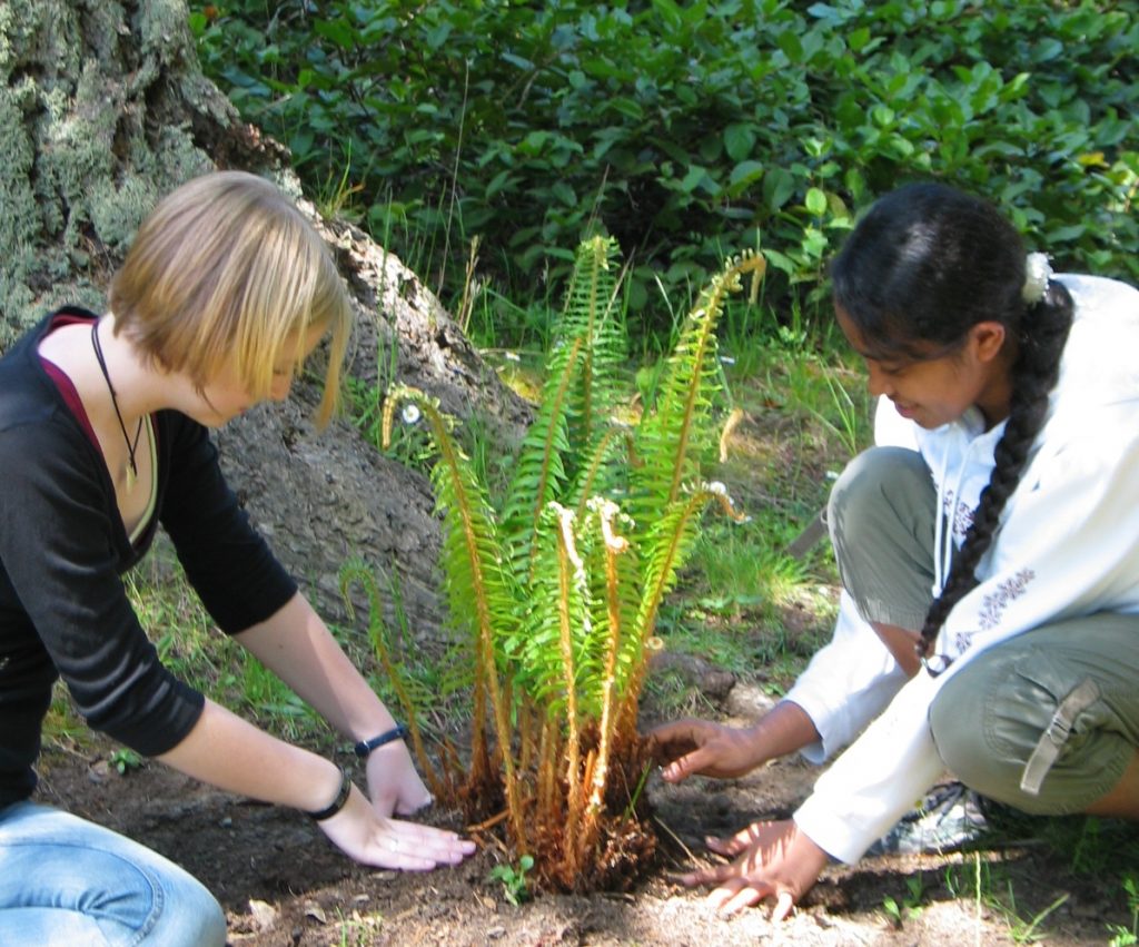 Through the years, students have helped in restoration of some areas of campus. Many areas have been restored with plantings of native plants such as sword ferns in areas where they occurred naturally before construction on the campus.
 Mature Grand Fir , Abies grandis , are also common throughout the campus. This fir is a short lived early successional species, and the smooth bark of those on the campus are often covered with a yellow lichen. Although not as robust as the Douglas fir, they are an early successional stage tree that often grow quickly in an opening on the forest floor. This fir’s bark is much smoother than the deeply grooved bark of the Douglas fir. Several of the tall Douglas fir around the library and the seafront commons building were planted by students in 1976. Also in that area in front of the library, a western flowering dogwood, Cornus nuttallii can be found. It was planted to mark the retirement of Jack Matthews, the first Director of Pearson College. The flower of the dogwood is the provincial flower of British Columbia. Several other specimens of the dogwood exist on campus, one at the eastern corner of McLaughlin House. The shallow soil here is not conducive to the hearty growth of this species which is found in the more porous soil on the way to Victoria.
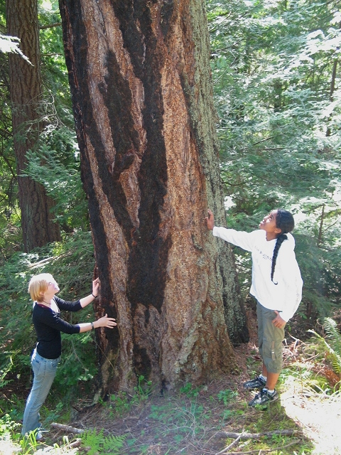
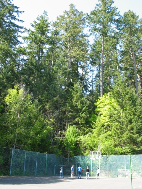 When the campus was first built, there were many more large Douglas fir. When a forest is opened up like this for buildings and campus infrastructure, the trees are more subject to high winds. Since the construction of the campus, a few have fallen with near catastrophic results and many have had to be removed. Near the tennis courts, one can get an appreciation of the height of some of these old-growth trees on the slopes.
Ecological Succession on campus
The resulting growth of new vegetation when the forest is opened up provides an opportunity for studies of the species of the early successional stages.
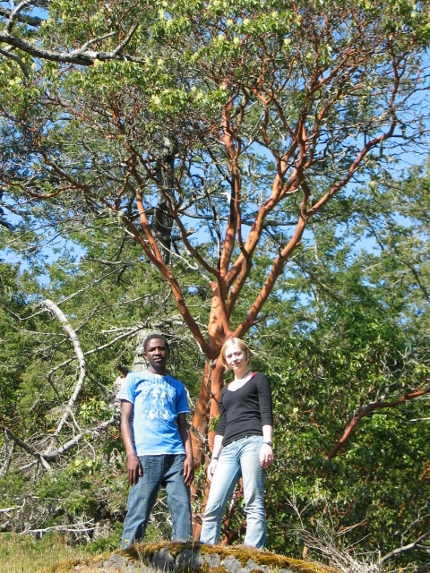
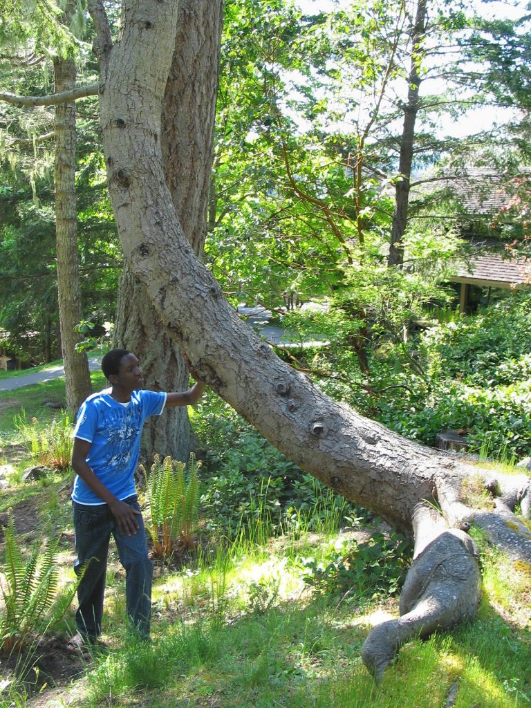
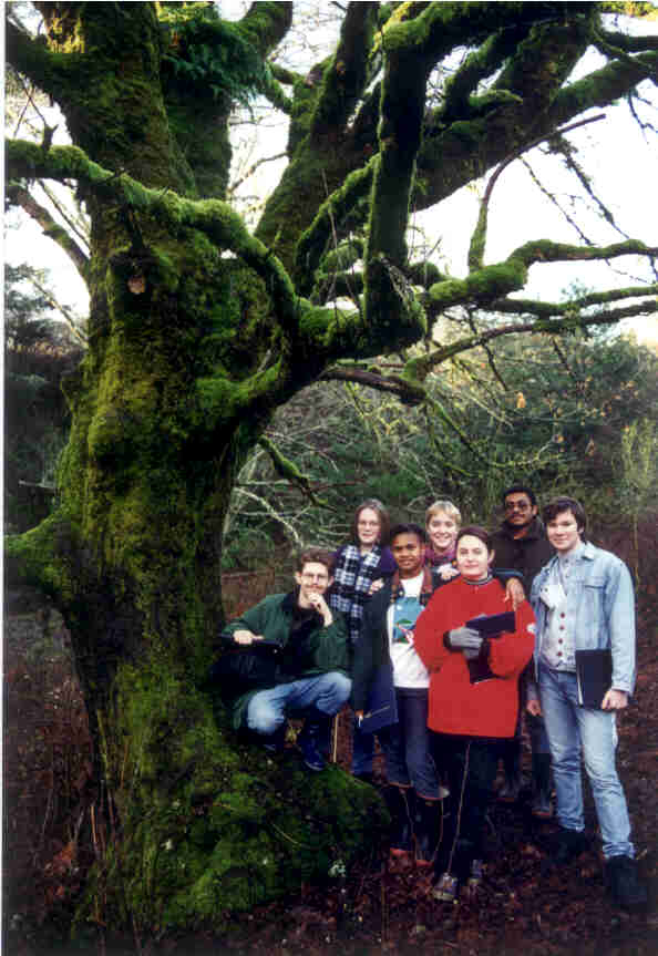
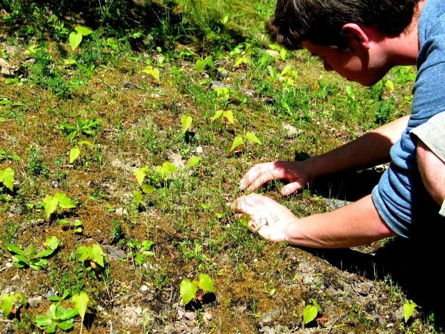 Here Jacob takes a close-up look at seedlings creating a miniature forest of big-leaf maple Acer macrophyllum on the dry clay exposed slope of the driveway to the lower parking lot. One can not imagine what the forest would look like if they all survived to maturity. The few that may survive however will attain the height of ten metres in a decade.
 Another early successional phase tree common on campus and in areas opened up along the Pedder bay, the willow, Salix scouleriana gains an early foothold. Several specimens around the seafront commons area need regular cutting back so the growth does not overwhelm the buildings. This tree is also obvious along the roadway into Pearson College, and the bright golden color of it’s foliage is the last of the deciduous trees to change
Around the sea front commons building, a luxurious bed of the club moss Equisetum pratense, also dominates on an early successional slope. Watch for its pollen-filled stalks early in the year, followed by the graceful fronds. This usually indicates the drainage runs close to the surface as we see on the exposed slopes around the seafront commons building. Although considered by some as a weedy species, as it is related to ancient early evolved plants, it provides a useful plant for the study of plant evolution.
 One of the most important hardwoods in British Columbia is the red alder, Alnus rubra . By the central path next to the science building, one started in the early years of the college and has now grown to a considerable size. The roots of the alder have masses of tiny nodules containing nitrogen-fixing bacteria, thus it is well adapted to gaining a foothold in newly exposed nutrient-depleted soils. It is also a good representative of an early successional tree. First Nations people relied on the inner part of the bark for a red dye, and used the wood for carving utensils, smoking meat and as firewood.
 At the other end of the successional scale, the very long-lived Pacific western yew, Taxus brevifolia has only a few scattered representatives in the understory along the shore and at the inner end of Pedder Bay. On campus, a large one stands near the sewage treatment plant and another by the gazebo. These conifers are very slow-growing, they typically look unhealthy, but they are very long-lived and have very dense wood. In recent years they have been valued as a source of taxol, the anti-cancer medicinal. Typically they need to be growing in rocky soil with a canopy of Douglas fir above. This small western yew behind the student health centre is cloaked in a pendulous fruiticose lichen.
Introduced Ornamental species on campus
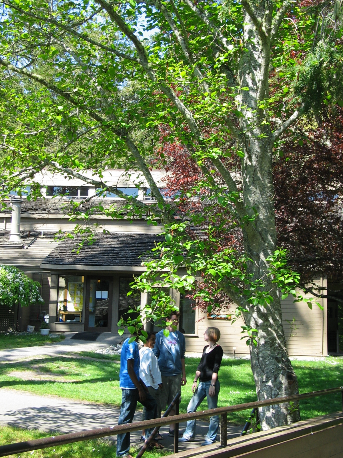
 Introduced ornamental trees and shrubs have also been planted on the campus. One interesting tree is the sycamore tree behind the dining hall. It was planted at the opening of the college as small tree taken as a cutting from the tree on the island of Cos under which Hippocrates, taught students of medicine. Behind this tree, near the economics classroom, an ornamental red maple tree was planted by HRH Prince Charles (now King Charles III, on his last visit to the campus in 1981. He served as the President of the United World Colleges for several years.
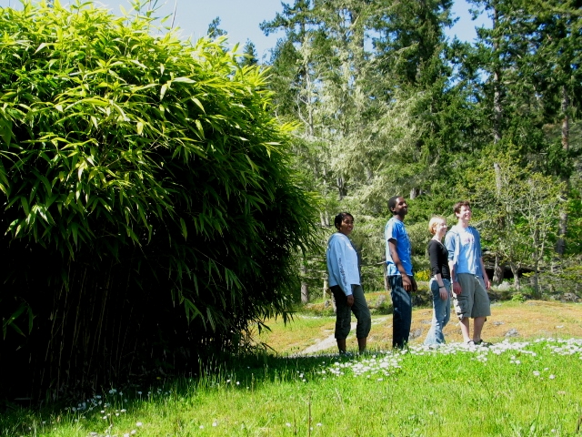 A number of species of bamboo were given as donations when the college first opened. Some of these are rare cultivars.
They are of economic and high cultural significance in East Asia and South East Asia where they are used in gardens, as a building material as well as a food source. In the Phillipines, they are known as kawayan, in Chinese as zhu, in Japanese as take, in Korean as dae or daenamu in Vietnamese as Tre, in Hindi as baans and in Indonesian as bambu. There are over 92 genera of bamboo in the world so the classification of the specimens on campus is designated as in the tribe Bambuseae.
On a sunny day in April, you can’t miss the fragrance of the evergreen white flowered shrub, Osmanthus burkwoodii at the entrance to the Science building. It is actually a member of the olive family, but its small black berries won’t pass as olives.
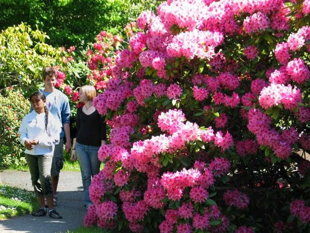 In the early years of the college, several collections of Rhododendron sp. were donated to the college, so a variety of different cultivars exist around the campus providing bloom from January to July. Only one species of rhododendron is native to British Columbia, and it grows in a small area on the mainland, where it lives in a protected valley which escaped the last glacial event ten thousand years ago.
Most varieties on the campus originate in the Himalayan mountains, or are introduced hybrids. Their shiny leaves provide the year round and can provide interesting adaptations when studying snow ecology in the very rare events of cold weeks in the winter.
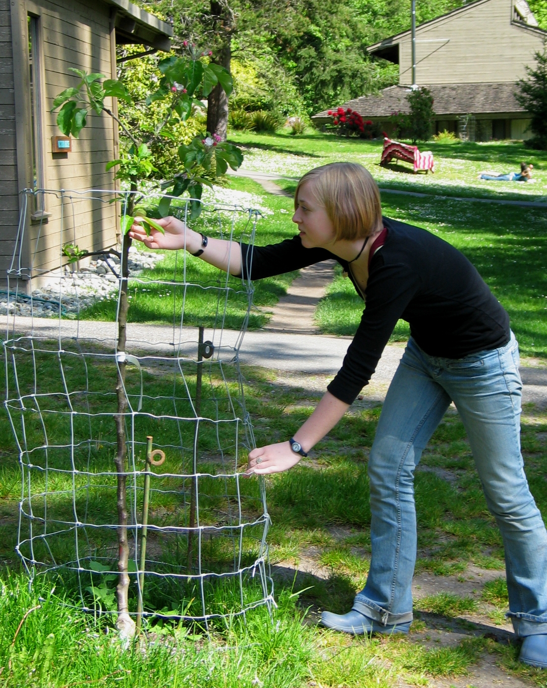
 Near the student residences on the campus are several ornamental fruit trees and in 2007, students planted a number of new fruit trees with the thought that they may contribute to self-sufficiency by providing a local food supply.
Also, a walnut tree planted as a memorial shades the pathway to Max Bell Hall.
5. From the parking lot west along Pedder Bay.
First Nations were the original inhabitants of Pedder Bay: At one time the shores of Pedder Bay were popular areas for their villages. On the shore beside the campus and on the peninsulas jutting into the bay, one can still see the evidence of shells in the middens where molluscs, which formed a major part of the diet, were discarded. These areas are protected by law and must not be disturbed. On this point to the west of the tennis courts a midden is exposed on eroded banks. Here one can see a variety of species, clams, mussels, scallops and snails which formed the diet of the people who lived in the area over the last millennia. Often the native rock oyster can be seen in the shell remains. This species no longer exists in the bay, but you can find the Japanese Oyster, Crassostrea gigas which is a larger commercial species, which has colonized the rocks in the low intertidal zone on the north side of the Bay. It was introduced in the last century to our cost for commercial purposes and has taken over most of the habitat of the native oysters.
For more than just the most recent millennia, indigenous people’s 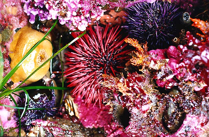 lives and work were an integral part of the coastal ecosystems of Southern Vancouver Island and the Strait of Juan de Fuca. The inner waters of this area are referred to as the Salish Sea in recognition of their long-term dependence on the sea. The land and water ecosystems were valued. Race Rocks was known as the area in which one could get any kind of food they needed.
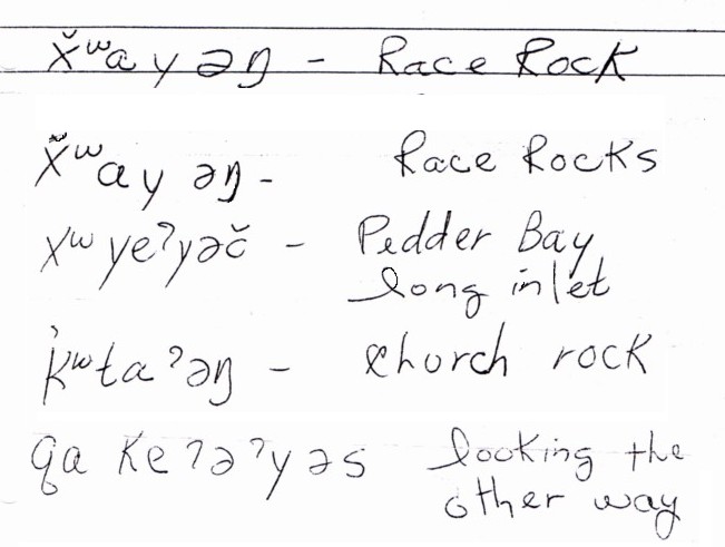 Place names were important since only through the language can one understand the importance of natural areas to the First Nations people. In 2002, Tom Charles, an elder of the Beecher Bay reserve gave us the names in the Klallum language for some of the local areas. Pedder Bay was “Whoayinch” where the fish buyers would meet the local tribes as late as the 1920’s. Race Rocks was the area of “Xwayen” (the fast-flowing water) . Church Island, visible from Race Rocks out in front of Becher Bay was ” Kquitong”, the Raven’s hangout.
The great wealth of sea life provided generous opportunities for harvesting foods and medicines. Careful conservation techniques, passed down through the generations ensured the resources were managed in a truly sustainable manner, at least until the arrival of the Europeans. Often seafood that was collected was traded with the interior people from Washington, as far as the South end of Puget Sound.
Fish were abundant and formed the main protein source for their diet. Sea urchins were also a special food, and sea cucumbers had their top end cut off, and after being cleaned out were stuffed with algae and other kinds of food, before roasting in a pit fire. Mussels and barnacles as well as the myriad of snails, whelks, chitons and other intertidal invertebrates were the standard fare for the early people, and still provide a source of protein along with fish for the coastal First Nations peoples.
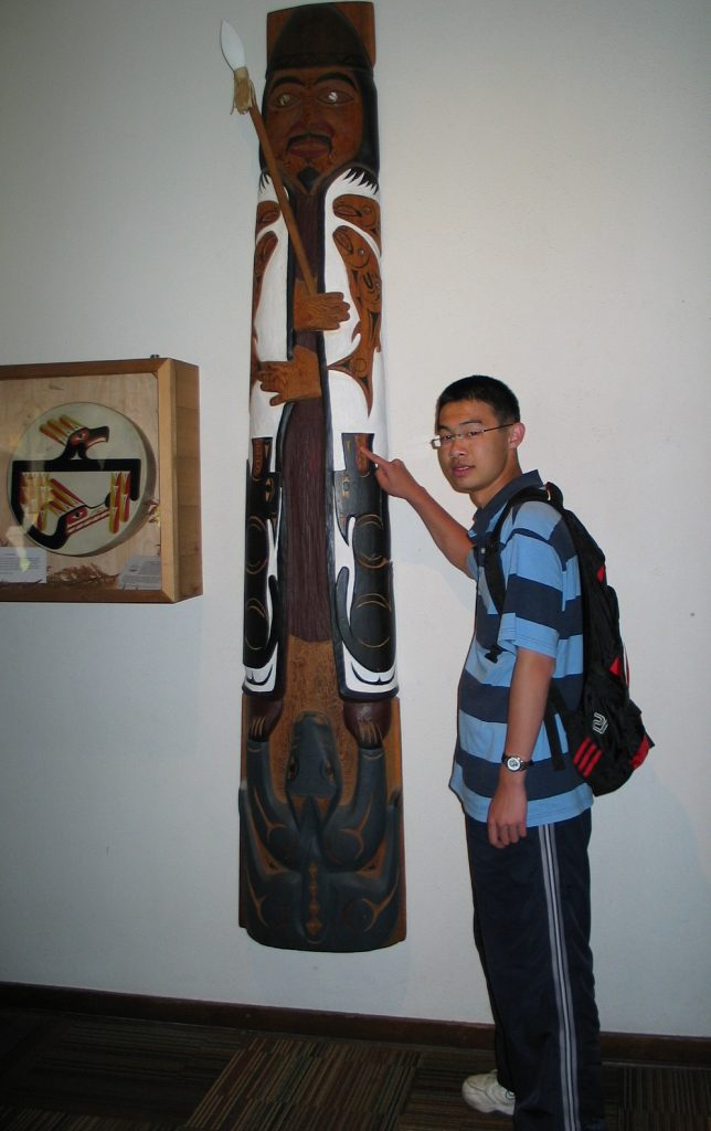 In April, 1994, the Coast Salish Nation people were invited to the college where they performed a special blessing ceremony to dedicate the campus. This was once First Nations traditional territory, so when the college asked for permission to use the land here for international education they called on ancient protocol to welcome and accept the college and its students as neighbours. The Salish House pole, carved by an artist from the Tsartlip Band, stands in the dining hall as a record of this event. The animal figures on the pole are the symbols of the local clans of the south island area.
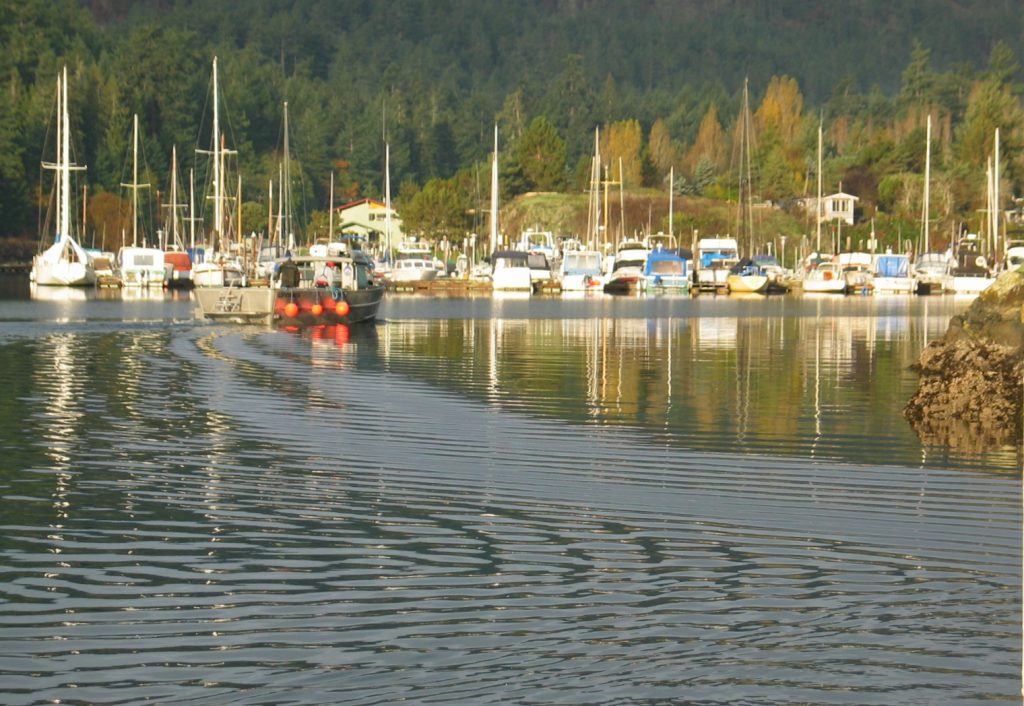 Pedder Bay Marina to the west at the inner end of Pedder Bay is privately owned and used by recreational boaters and fishermen and a local commercial harvest of the Dungeness Crab, Cancer magister. With a fishing license and a properly marked crab trap, one can catch dungeness and red rock crab, Cancer productus, from the docks at the college, or lower a basket net for the coonstripe shrimp, Pandalus danae. The marina is also the landing spot for pacific halibut, Hippoglossus stenolepis, taken annually in the outer waters around Pedder Bay. Photographs on the walls of the marina office attest to the size of these fish, weighing in as high as 60 Kilograms.
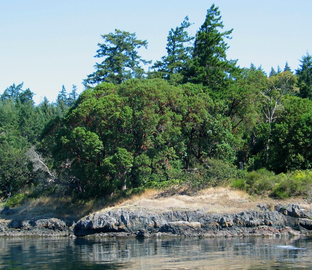
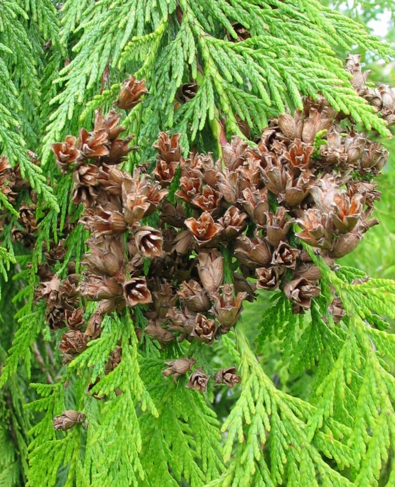 Pedder Bay is on the eastern fringe on southern Vancouver Island of the traditional range of the western red cedar, Thuja plicata . It is common toward Beecher Bay and Sooke, where more rainfall is received, but here, only a few cedar grow in the flats beside the inner arm of Pedder Bay, and none are found further out along the coastal areas of Pedder Bay and Metchosin. The range of distribution of cedar as well as other species in British Columbia dependent on moisture availability will in the future be determined by climate change.
 Along the trail originating behind the tennis courts, we go through a solid stand of old-growth Douglas fir. The blackened scars on the lower trunks of some of these trees are remnants of a forest fire in the early 1900s. The carbon still seems fresh when one brushes against it, and the gaps in the coloration give evidence of the increase in diameter of the tree since the fire.
 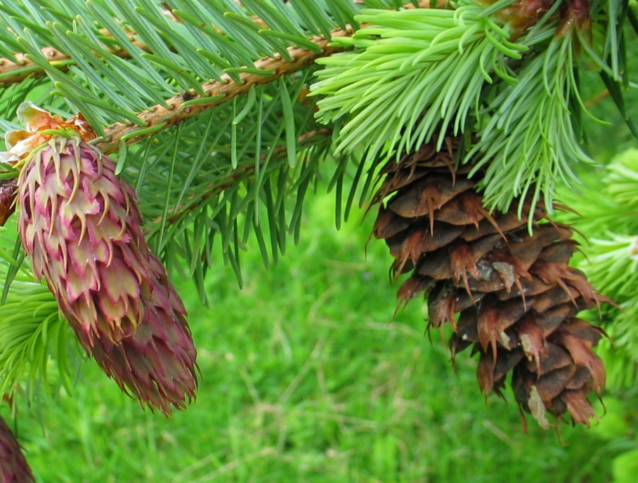 This tree species is the dominant tree of the climax forest in this area. Being relatively drought tolerant it survives our dry summers with a massive root spread out over the thin soil layer. When these trees fall over, the large root platform, which may be 10 metres in diameter, when exposed, makes an impressive display on the forest floor. The logs then go through a long period of decomposition, fertilizing the forest floor, providing nurse logs to seedling trees and providing important carbon input to the soil.
 The seed cones of the Douglas fir go through decomposition as well. Here tiny fungi have invaded and will slowly consume the nutrients.
 The understory along the path near the water is typical of much of the outer coast of the moist temperate rainforest of BC. A dense cover of salal, on the forest floor is shoulder height in places, making penetration difficult, This dense understory along the Coast of Vancouver Island was one of the reasons for the creation of the famous West Coast Trail. It goes from Port Renfrew to Bamfield providing an early rescue trail for shipwreck survivors along the Strait of Juan de Fuca.
The tall Douglas fir cloak the side of the hill until the upper area gives way to exposed rock outcrops where bigleaf maples, Garry oak and arbutus are mixed throughout.
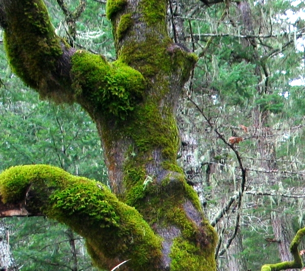
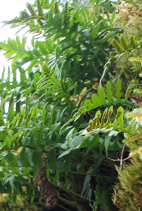 The Garry oaks further up the hill along the “deep woods” trail (which branches off the marina trail) display epiphytic coverings of many species of moss, lichen and the licorice fern, Polypodium glycyrrhiza.
With the fall rains come a variety of forest fungi which provide the decomposition function on the forest floor.
They are especially well decorated throughout the winter, when these plants take advantage of the abundant moisture to go through their life cycles.
 The summers are often hot and dry and the mosses and ferns go dormant. This represents a complex micro-habitat which thrives because of the shaded location and nutrients falling on the branches from the surrounding canopy. Winter is the best time to appreciate the intricate micro-ecosystem of these trees.
The Estuary Near the Marina:
The head of the inlet of Pedder Bay near the southern tip of Vancouver Island is an estuary from October to April when the majority of the annual precipitation falls on the region.
 The influence of fresh water streams flowing into the bay on each side of the marina has a significant impact. The vegetation and invertebrates inhabiting this zone reflect this impact of brackish water. The typical estuarine plant community of Triglochin/Salicornia/Deschampsia/Distichylus inhabits the intertidal zone of the mudflats where they get flooded in salt water at high tide and then rinsed with fresh water from the stream or rain when at low tide. The bay has a tidal range of 3 meters, so any plants or invertebrates in this area have adapted specifically to tolerate the fluctuation of salinity. Although they may appear to be rather lifeless, mudflats such as this are very productive habitats when the tide is out One should think of them as three-dimensional habitats, as the infauna, the animals which burrow in the mud, form a valuable component in the energy flow of the ecosystem.
Mudflats such as this provide a number of ecosystem services such as water quality purification, atmospheric gas regulation, nutrient recycling and a valuable habitat for plants, shorebirds and other animals. The special qualities of estuaries make them ideal for study and teaching environments. Estuaries are not only one of the most biologically productive types of ecosystems, they are also one of the most valuable. It is difficult to attach monetary worth to these ecosystem services, especially since most are needed for life on earth and are not replaceable with human-made systems, at any cost.
6. The Playing Field and the Waterfall:
The trail along Pedder Bay behind the tennis courts leads to a large open soccer field, built on marina land for the students to enjoy.
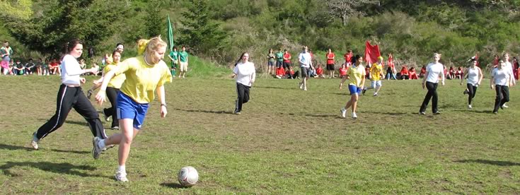 It is a center of entertainment each year when the inter-residence “Golden Shoe” tournament is played.
The area is interesting ecologically since it represents a rather large clearing in what was not long ago an old growth forest. For years the field had been invaded by broom, and the margins still bear heavy infestations of this plant. On the trail just before the clearing, large stumps with notches for springboards are still visible. Years ago, loggers would stand on these boards while they used a cross-cut saw. The notches are up high because it elevated loggers above the wider circumference of the base of the tree. Today there are still many old growth Douglas Fir remaining on the Pearson College property that escaped the selective logging done in the past.
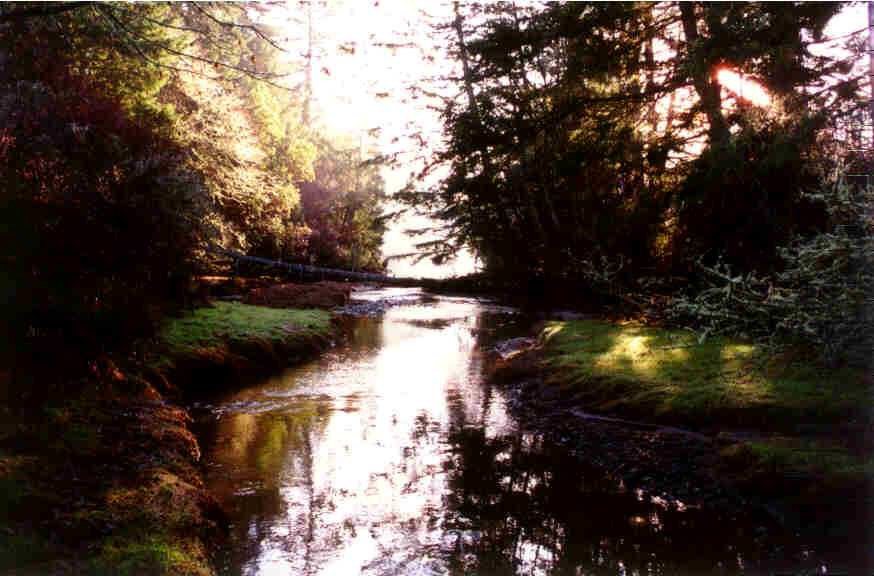
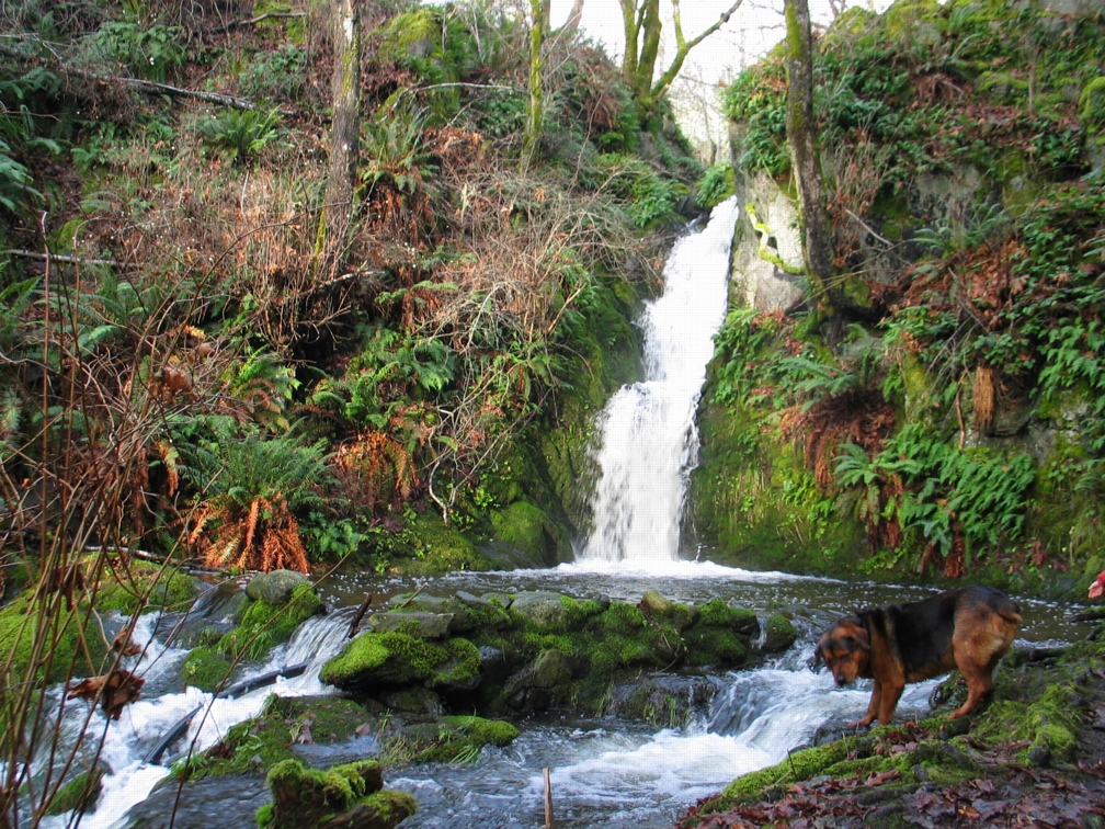 Just beyond on a path from the middle of the field, down the bank into the bottom of a little valley, a spectacular waterfall flows during the spring and winter months.
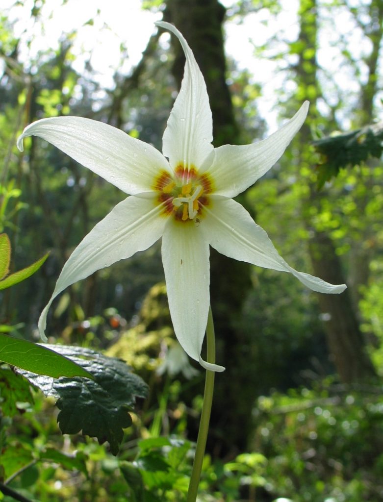 April brings a display of the white fawn lily, Erythronium albidum, on the forest floor by the waterfall. This small stream is home to a small number of cutthroat trout. The stream bed was enhanced by the addition of a spawning channel, hand-dug by students in the late 1980s. For several years the students doing Salmon enhancement released salmon from the hatchery they built there. A shortage of salmon fry from local hatcheries in recent years has curtailed this activity.
 Bigleaf maples, Acer macrophyllum, form the canopy of this area, with a covering of sword ferns on the ground. The maples are clad in a variety of epiphytes of moss, fern and lichens. Although these trees do not have a strong concentration of sugar in their sap, they are tapped in the early spring in some parts of Vancouver Island just like their cousins, the sugar maples of Eastern Canada. In the fall the foliage of the Bigleaf maple turns a bright yellow and the trees show up scattered through the conifers of the surrounding forests.
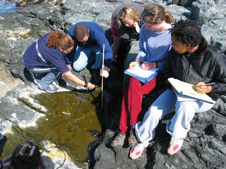
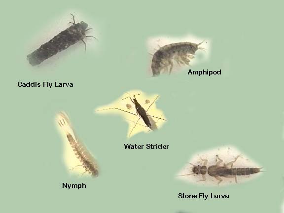 Students doing a study of the invertebrates of the stream coming from the waterfall can easily come up with a variety of larvae and adult invertebrates which serve as a reliable food source for cutthroat trout coming into the stream.
7. Pearson College Docks to the Open Ocean:
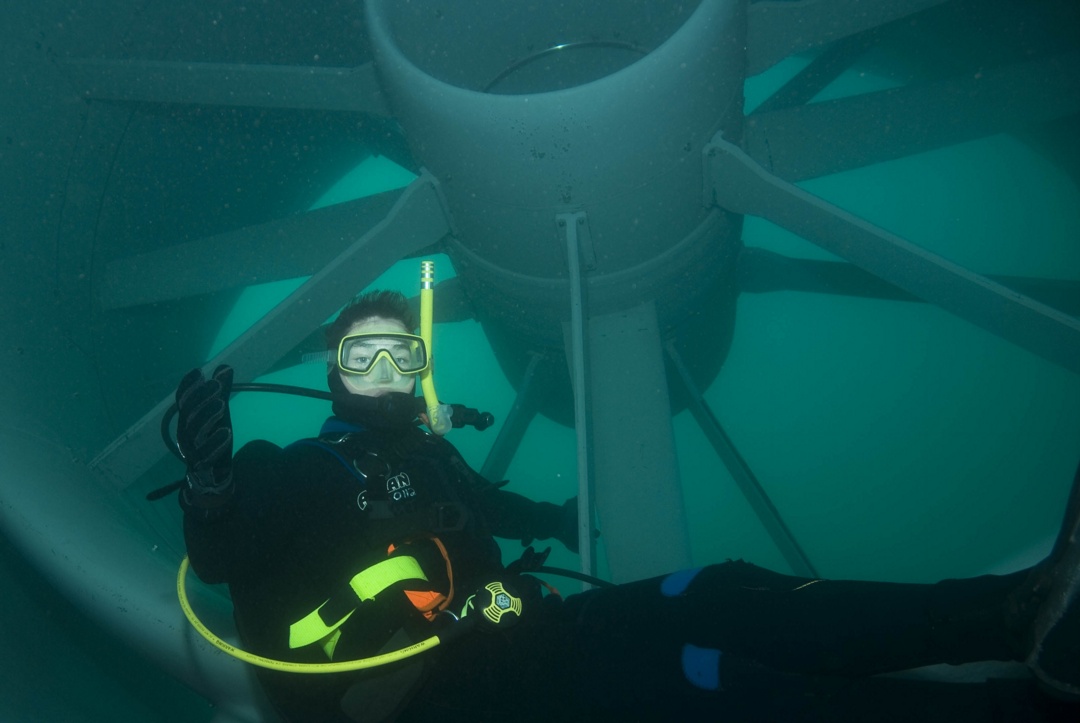
 One of the first projects the students faced when the college was founded was to build the floating docks as their outlet to the sea. This provided for a rich marine environment program which has expanded since that time. College boats provide for field trips in the biology and environmental systems classes, and the afternoon activities in sailing, SCUBA diving and kayaking lead to an active seafront.
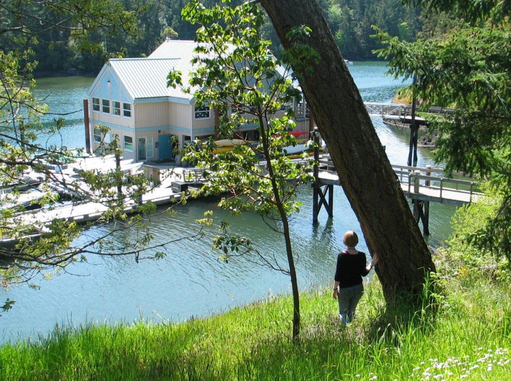 In 2003, the addition of the floating lab provided room for three more classrooms as well as a diving equipment room, workshop, office and storage space for the sea activities. The immediate access to the ecosystems of Pedder Bay makes it an ideal facility for the life sciences.
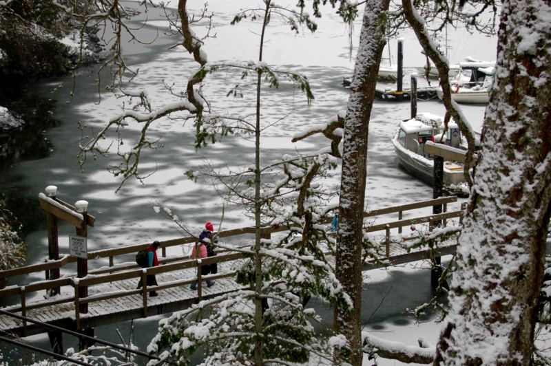 Only on rare occasions (once in ten years) do we get a week of cold weather and snow which causes the inner part of the bay up to the college docks to freeze over. For a few brief days,
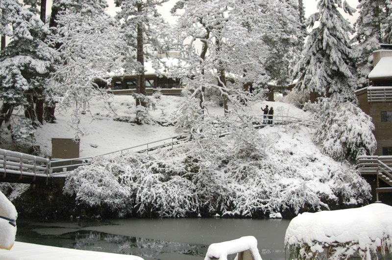 the campus takes on a unique beauty when this happens. It also is a time when we can take advantage of the learning opportunity by having the students experience the unique aspects of “snow ecology”. For students from tropical countries who may never have experienced such conditions, there is a realization that snow has insulating features, can be breathed through, is variable in weight and density, and is adapted to by plants from temperate climates in unique ways. Meanwhile down at the waterfront, unique patterns of salinity and fresh water can be discovered with ice formation.
During the winter months, Pedder Bay provides valuable habitat to shelter overwintering marine birds. Other than these rare periods of partial freezing, the bay usually remains ice free and a calm location with food for diving ducks and grebes.
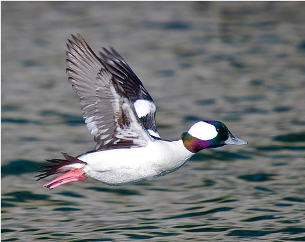 Small white and black buffleheads, Bucephala albeola red-necked grebes, Podiceps grisegena and common mergansers, Mergus merganser can be seen in the bay in the winter.
|
In the outer parts of the bay, long-tailed ducks, Clangula hyemalis, white winged scoter, Melanitta deglandi and pigeon guillemots Cepphus columba also frequent the area during that time.
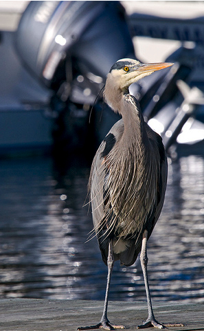 Throughout the year several pairs of Great Blue Heron, Ardea herodias stand on the shoreline or on the docks. Their still pose is only interrupted by a quick jab in the water, resulting in the extraction of a silver herring. They roost in the adjacent forests of the Department of National Defence (DND) land across from the college, and can often be heard in the evening with a loud squawking sound.
Belted Kingfisher, Megaceryle alcyon, are also year-round residents in the bay. They are often seen perched on the dock pilings and the oak trees overhanging the water near the docks, from where they dive into the water to pick off herring and other small fish.
Mudflats and rocky intertidal ecosystems of Pedder Bay
The shores of Pedder Bay provide more fascinating variety to our campus, and the profile of the bay changes considerably from low to high tide, a range of 3 metres. The water of the bay varies in temperature from 8 degrees Celsius in the winter to 13 degrees in the summer.
 The mudflat in front of the seafront commons building is typical of the small inlets along the bay. It provides a rich habitat to mud-dwelling organisms and red-rock and dungeness crabs. Overhanging trees and trees which have fallen into the water provide the substrate for the bay mussel, Mytilus trossulus, and several barnacle species. Several species of limpet and littorine snails graze rocks on the intertidal.
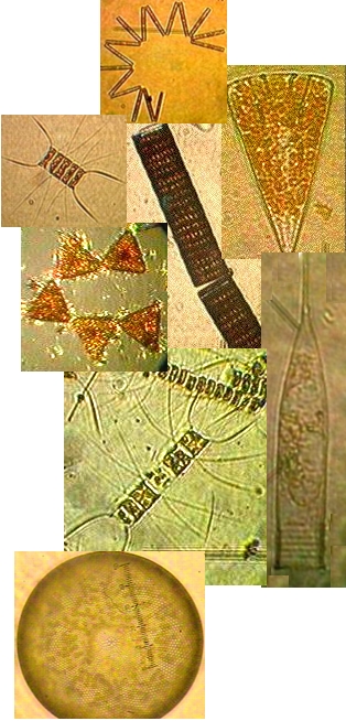
 The large white anemone, Metridium farcimen, can be seen on the bottom of the bay, anchored to submerged branches or exposed rocks. All the invertebrates contribute their larva to the rich planktonic mix in the waters of the bay. The main planktonic producers in the bay are the large round centric diatoms, Coscinodiscus sp. but on different occasions under the microscopes of the biology students, a wide array of geometric shapes of other phytoplankton species will appear. Copepods and the nauplius larvae of barnacles make up the main zooplankton of the bay.
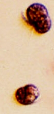 Often in the spring when the sunlight levels are adequate, the nutrient laden water from winter run-off may support a non-poisonous red tide. A deep reddish bloom caused by the microscopic organism Mesodinium rubrum will cover parts of the bay. This is a unique marine photosynthetic ciliate which can fix energy because it has a cryptophyte endosymbiontic red algae inside it. A good example of a mutualistic relationship occurring on a massive scale within the bay.
The Floating lab and docks provide a great amount of substrate on which a variety of organisms attach. These areas have also been useful for the science classes in providing areas for hanging baskets for aquaculture experiments. Within easy access, there is a rich fouling community which provides many specimens used in classes. Almost every invertebrate phylum is represented on the underside of these docks.
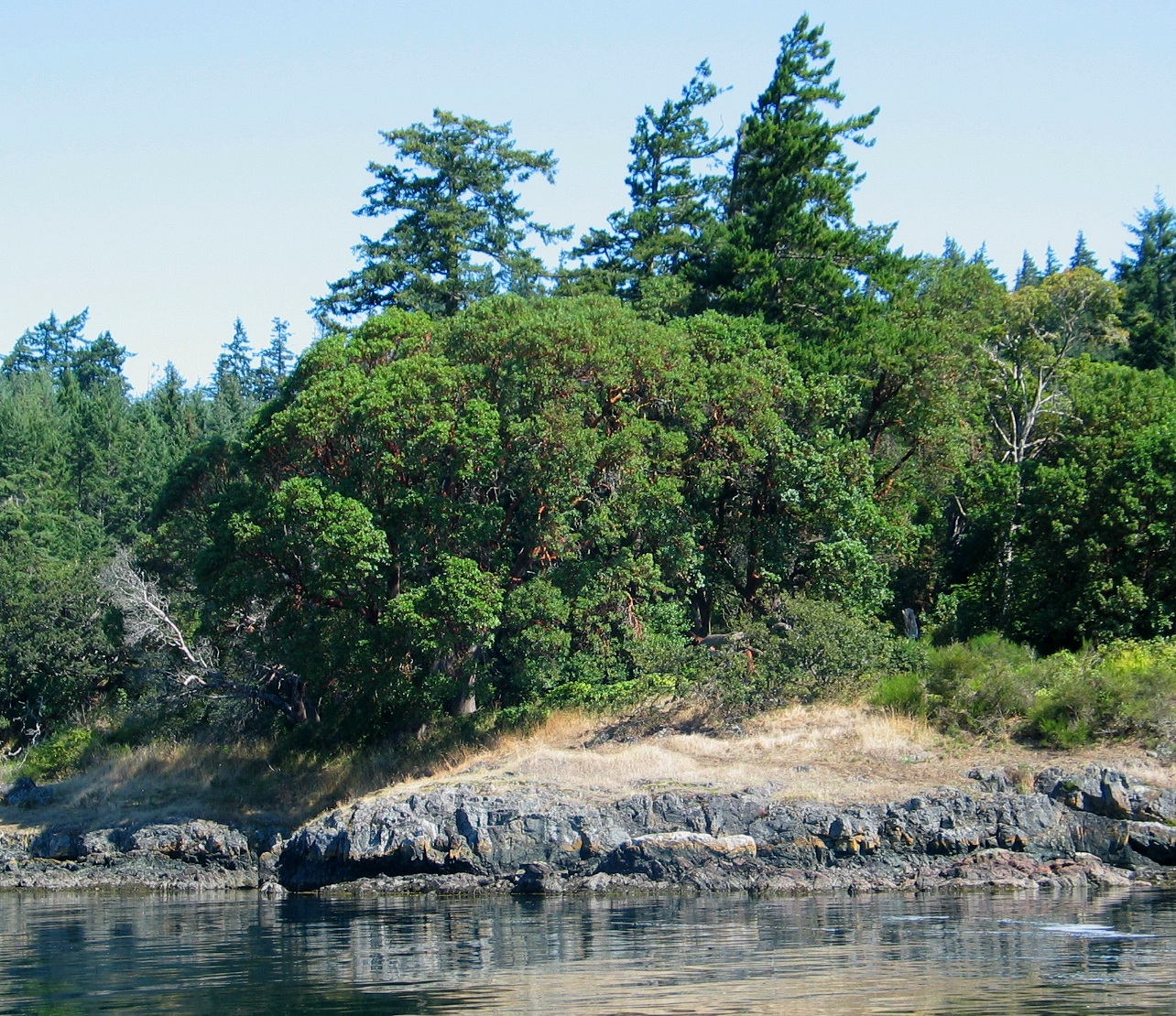
Stunted Garry Oak slopes on the north side of the Bay:
 Although this area is closed to public access, it may be viewed from the water. A feature of this dry slope is the thick concentrations of stunted but very old Garry oak.
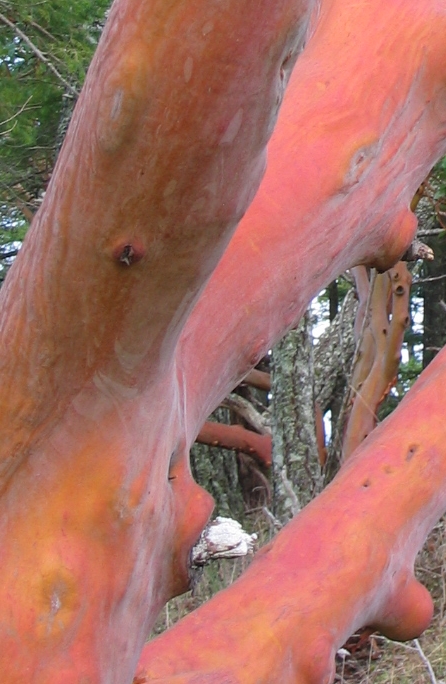 Also along this side of the bay at Weir Point, Arbutus, Arbutus menziesii , grow to a great size in the vicinity of old First Nations fortifications and their red bark reflects on the waters of the Bay. These trees are broad-leaf evergreens, and here we are only within two hundred kilometres of their northern limit. Other than the east side of Vancouver Island and the lower coastal mainland, they grow nowhere else in Canada. Early cream-colored blossoms followed by red berries which are consumed by late summer migrating birds, are distinctive to this tree. In the drought of July and August, they shed their bark and some of their old leaves, but maintain a solid canopy of leaves with a slippery surface which can repel snow on the rare occasions it falls here.
Along the north side of Pedder bay, the native stonecrop, Sedum spathulifolium clings to the rock and is rooted in very little soil. Its star shaped yellow flowers and colourful waxy leaves make a stunning display, as it clings to the cliffs.
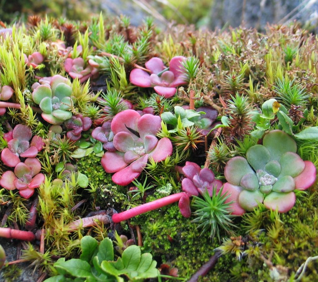 Sedum species such as this have adapted to dry conditions by evolving an alternate photosynthetic pathway which allows carbon dioxide fixation during the cooler nighttime periods. Their fleshy leaves store water to survive through the dry summer months. Above the dry exposed shoreline slopes, the vegetation merges into old growth Douglas fir.
Although closed to the public, the whole length of this shore has a horizontally constructed pathway twenty metres up from sea level. Under this path, and emerging in places, are buried sections of an old steel conduit. This is all that remains of the water line, constructed in the early part of the last century by immigrant labor. All Asian immigration was through the William Head Quaranteen Station, now William Head Prison on the peninsula at the mouth of Pedder Bay. This waterline brought water from the headwaters of Pedder Bay out to the station.
South Side of Pedder Bay.
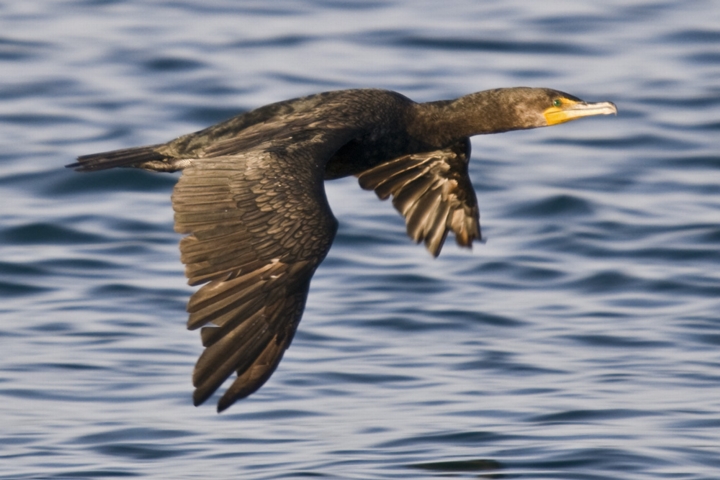 For many years now, an overwintering colony of double crested cormorant, Phalacrocorax auritus, roost on the Douglas fir trees of the second growth forest fringing the water on the south side across from the college docks. A few also roost at night on the campus trees fringing the water. Look up to the top of the Douglas Fir to see how these birds have modified the trees by stripping branches from their roosting sites and by leaving guano on the branches of the trees. By the end of winter, a light grey shroud of guano still envelopes some of the fir trees as a result of the winter roosting
 Shore Pine, Pinus contorta, and Black cottonwood, Populus trichocarpa occur only on the south side at the outer mouth of Pedder Bay on the shores of the DND land. The native shore pine is distributed along the shores of the Strait of Juan de Fuca, but here, it is restricted to the south side of the outer entrance of the Bay. The month of May brings a colourful display of new cones and male flowers on these conifers.
The peninsula on the south side of the bay known as Rocky Point, is a military reserve, and an important migratory stopover for thousands of terrestrial birds, as their last point before leaving Vancouver Island to cross over the Strait of Juan de Fuca on their journey south or their first point of arrival in spring.
Significant research on migratory patterns has been obtained in long term studies at the Rocky Point Bird Observatory (RBPO), located on this peninsula. During migration, RPBO is witness to impressive numbers of songbirds, vultures, raptors, and seabirds. The turkey vultures, Cathartes aura and other raptors gather in the fall, circling in the sky and gaining elevation for several days above southern Vancouver Island before making their migratory crossing of the Strait of Juan de Fuca. A remarkable 299 bird species have been recorded at the research site. In addition, over eighty species breed (or are suspected of breeding) in the area. Approximately 3000 birds and between 55 to 60 species are banded at RPBO each year.
Outside of Pedder Bay, the coastal areas of Metchosin are represented by a number of very different ecosystems. Resources on these may be found in the website link below to the Coastal Ecosystems of Vancouver Island
8. Race Rocks and the Strait of Juan de Fuca
For many students arriving at Pearson College, the waters of the Strait of Juan de Fuca just outside of Pedder Bay are the first experience they have with the Pacific Ocean. Thus there has been a constant effort to include the sea in the curriculum whether through the academic subjects or the afternoon and weekend activities.
 In 1980 students and faculty of biology, marine science and the diving program at Pearson College were successful in getting a proposal accepted by the government of British Columbia to create an Ecological Reserve at Race Rocks.
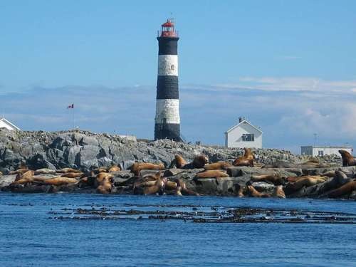
 This archipelago of ten islands with a lighthouse on the central island of Great Race Rock is situated 5 kilometres out from the college at the eastern entrance of the Strait of Juan de Fuca. The reserve covers an area of 222 hectares, and except for the islands is mostly subtidal as shown in this multi-beam sonar image of the bottom to 150 meters. (The black spots represent the above water portion of the islands.)
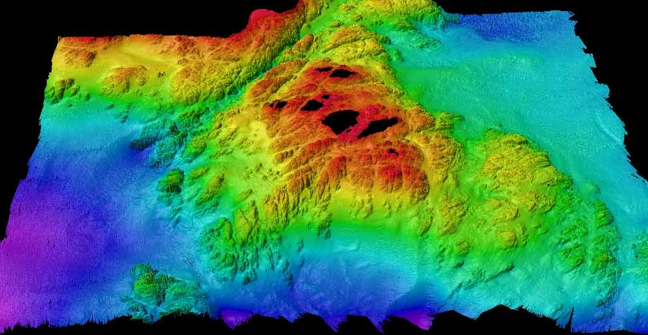
Intertidal and subtidal zones have substrates primarily of continuous rock, and a rugged topography which includes cliffs, chasms, benches and surge channels. This location in a narrow part of the Strait at the southern tip of Vancouver Island, plus the sudden rise from the depths to a shallow sea bottom like an underwater mountain result in strong currents, eddies, and turbulence. This brings plankton in great quantities up to feed the organisms and the result is an area of high biodiversity. In 2002, the central portion of Great Race Island was added to the reserve. The islands were named a Marine Protected Area designate in 1998.
 Since the establishment of the reserve, students have been able to use the resources of the area as an extension of the campus for field trips and research. In 1997, when the station was automated, Lester Pearson College obtained from BC Parks, a long-term lease to manage the island and its ecological resources for education and research. A resident eco-guardian/marine scientist who lives on the island is employed by the college. One building is also available for students and faculty to do research
 In 2000, with a grant from the Canada Millennium Partners Fund, a computer network was set up on the island. A microwave link to the Pearson College network allows the unique educational resources of Race Rocks to be shared with all through the racerocks.com website, while maintaining minimum environmental impact in the area. With remotely operated cameras, real-time readings from instruments measuring physical factors and an ever-expanding database on the resources and images of the islands, a model has been developed for ecological stewardship.
Marine Birds and Mammals:
To most visitors, as they approach Race Rocks, the most unique aspect is the variety of marine mammals which may be hauled out on the rocks.
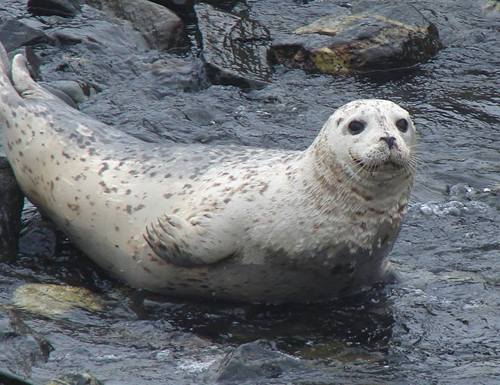 Several hundred harbour seals, Phoca vitulina, are year round residents of the islands of Race Rocks, Pedder Bay and Rocky Point. These seals and the river otters, Lontra canadensis are the two species of marine mammals which bear young in the area.
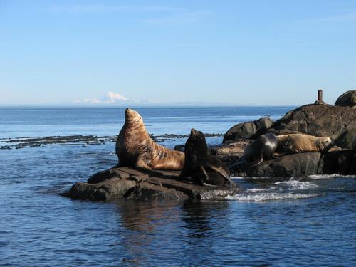 Two species of sea lions are also found here. The beige coloured northern sea lion, Eumetopias jubatus and the dark brown California sea lion, Zalophus californianus are most common in the fall and winter when their populations may number over one thousand.
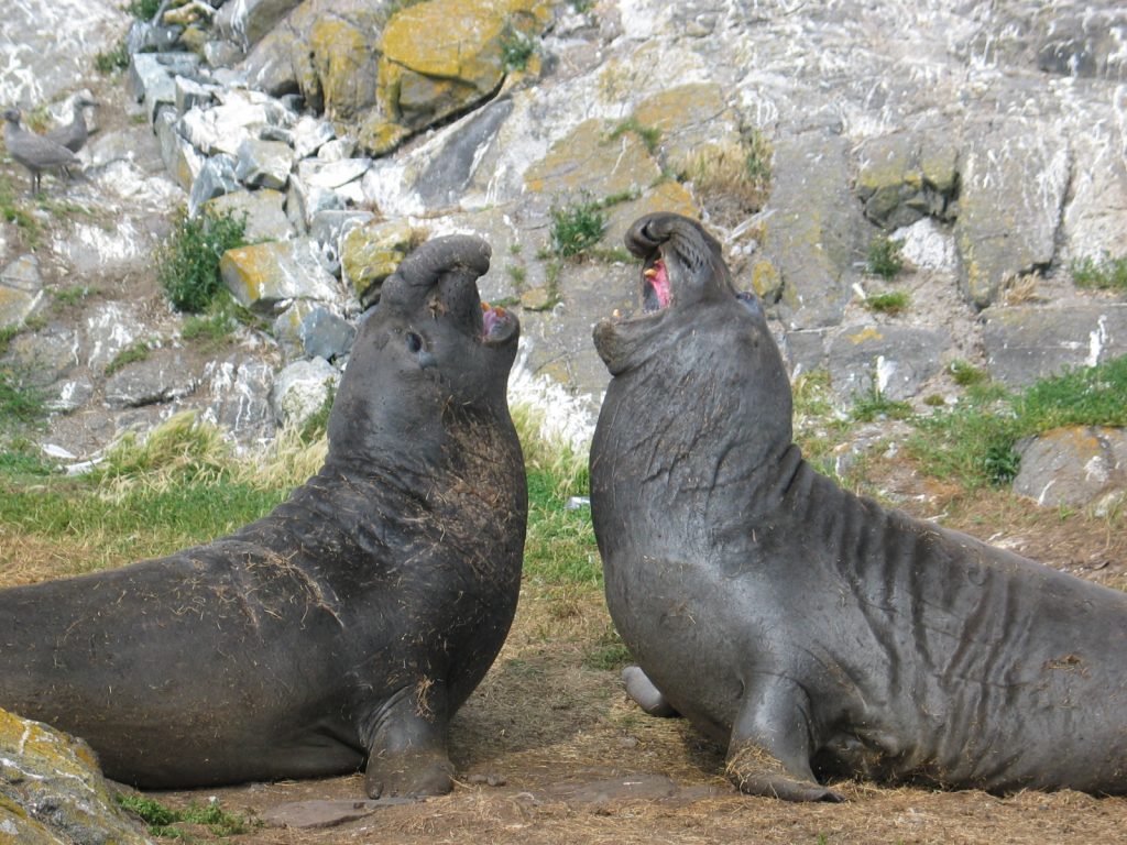 These two male elephant seals, Mirounga angustirostris, were sparring on the main island in the spring. They may exceed four metres in length and their numbers often
 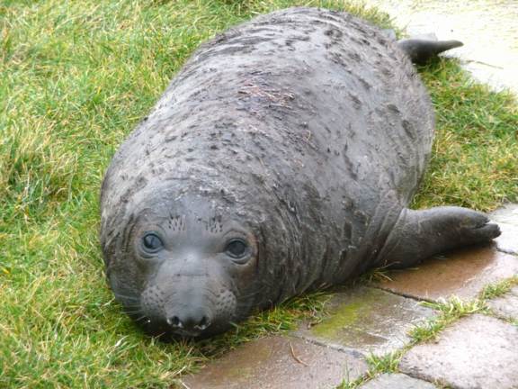 exceed a dozen individuals. The males are year-round residents and females join the group in January. This is the first elephant seal at age 4 weeks to be born at Race Rocks.. It arrived in January 2009, and some interesting videos of its first few weeks are on racerocks.ca. Race Rocks is the most northerly haulout and birthing sight for this marine mammal.
 The largest of the mammal species in the waters of Race Rocks are the cetaceans. Pods of killer whales, Orcinus orca, are most common in the summer months. This skeleton hangs in the biology lab. The Southern British Columbia resident pods of Orcas, which are fish-eating and the transient orcas, which eat seals and other marine mammals, both come by Race Rocks frequently. Various species of porpoise and the two larger baleen whales, the Humpback Megaptera novaeangliae, and the Gray whale, Eschrichtius robustus, have also been seen from Race Rocks.
At he college an adult skeleton of a grey whale is mounted in front of the science building and from the ceiling of the biology/chem lab hangs the skeleton of an orca whale. Both skeletal mounts, were part of projects done by students at the college .
Race Rocks provides nesting habitat for four species of 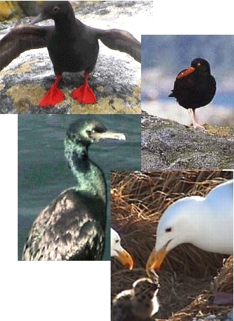 marine birds. Pigeon Guillemots, Cepphus columba, with their striking red feet, feed in the current channel in front of the island and nest in tunnels under the loose rock piles on the island. They are frequently seen feeding in the current channel beside the main island. Up to six pairs of black oystercatcher, Haematopus bachman, will nest just above the spray zone on the central island, whereas the pelagic cormorant, Phalacrocorax pelagicus will only nest on the ledges of the vertical cliff.
The Glaucous-winged Gull, Larus glaucescens are the most abundant nesting bird on the island. Near the end of June chicks in several stages of development stay very close to their highly defended territories. Visiting the island during June to August is restricted and keeping to the paths is essential. When chicks are disturbed and leave their nesting territories, other parent birds will swarm them causing high mortalities.
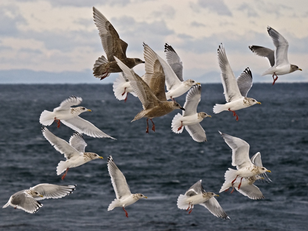 Race Rocks is an important stopover on the migration routes of many other land and marine bird species. The surrounding waters are rich in food during the winter months and provide for a winter resting colony of several thousands of gulls of various species. Through the remote-controlled cameras, close-up views of these birds is available in all seasons regardless of weather. The highest populations of birds occur in the fall and winter time when a large number of Iceland gulls stay on the island and forage for food in the Strait of Juan de Fuca
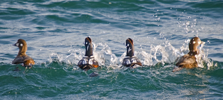 Frequently the bright plumage of the Harlequin ducks that stay through the winter at Race Rocks adds a splash of color to the water.
Underwater at Race Rocks.
Since 1976, students of the Diving Activity have been privileged to be able to experience and work in one of the most biodiverse underwater sites in Canada. Subtidal kelp forests, and rocky cliffs and shelves can be explored at Race Rocks as long as one pays careful attention on to the tidal currents and the weather. High winds in winter and summer and strong currents can make the water very treacherous, so it is only with extra careful training and a high level of respect for the ocean that the divers venture into the waters at Race Rocks
 In the summer a dense canopy of Bull Kelp, Nereocystis leutkeana, anchored on the rocks in water down to 12 meters in depth provides shelter for many fish species and invertebrates.
This macroalgae is not eaten by grazers but its energy from the rapidly growing plants ends up fueling the decomposer food web when it is piled on shorelines after fall and winter storms.
The high exchange of water past the island archipelago provides extra nutrient for algae, fish and invertebrates, resulting in high population density and diversity of fish and invertebrates.
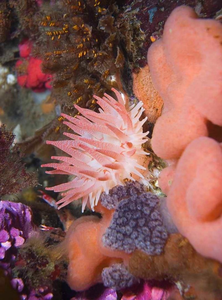 Every square centimeter of surface underwater provides space for one or more species. The bottom is especially rich in numerous species of anemone, ascidians and hydroids.
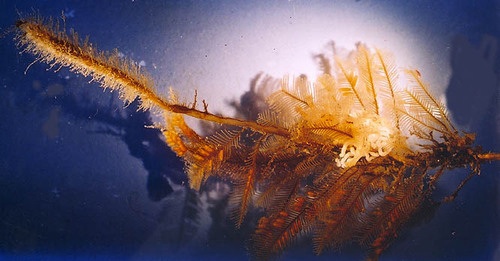 The biodiversity of hydroids at Race Rocks has been researched extensively over the years by the late Dr. Anita Brnckmann-Voss collaborating with Pearson College Divers.
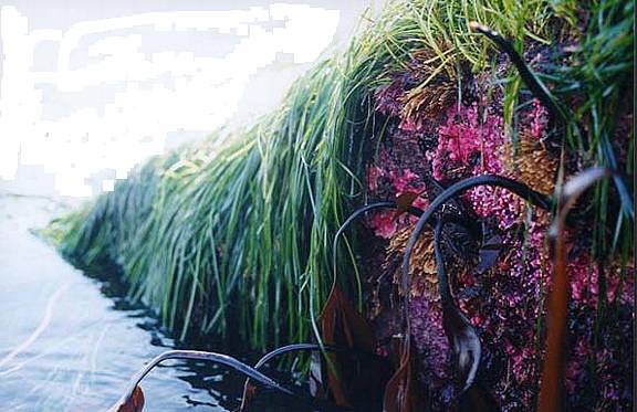 At an extreme low tide, which happens during the day time in June, hydrocorals and hydroids are exposed beneath a layer of surf grass and brown macroalgae on an intertidal shelf laid bare by the receding waters. At a time like this there is a display of the rich diversity of invertebrate life usually only seen by SCUBA divers..
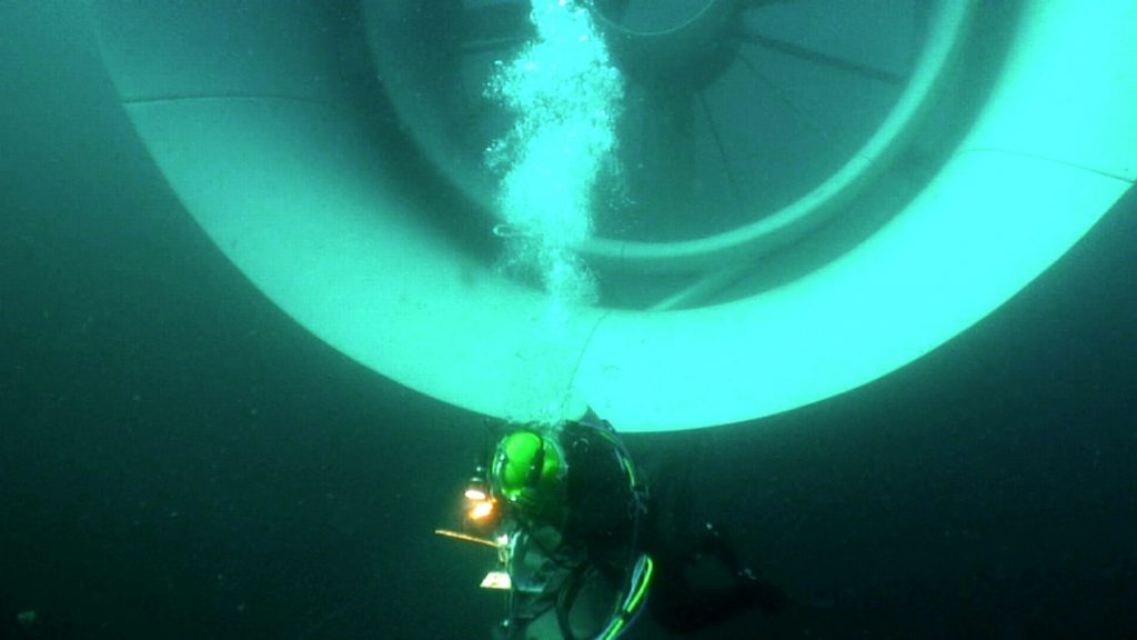 The powerful currents of Race Rocks have also provided an ideal site for the installation of a tidal current generator in 2006 .
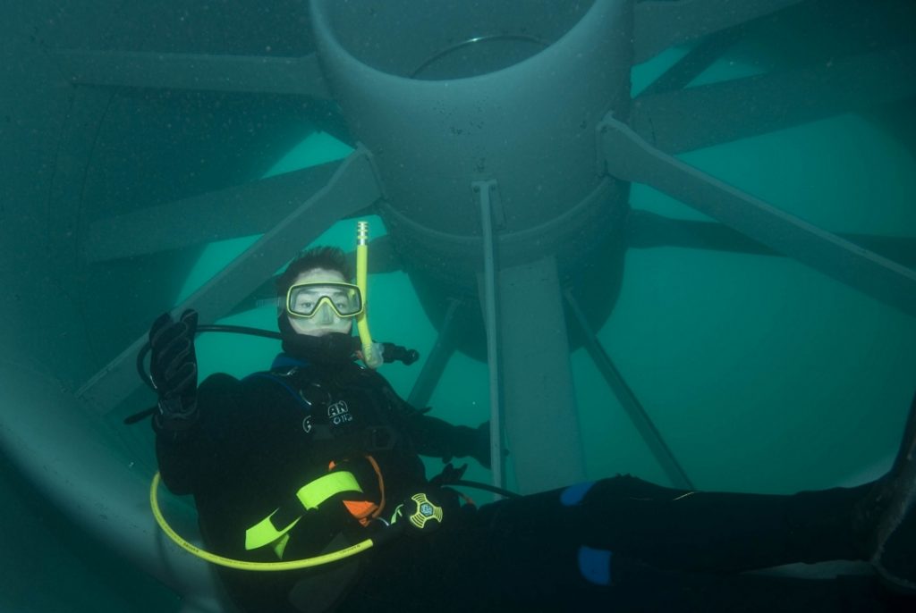 Construction of this facility was a special challenge in such an ecological sensitive area, but it has led to the possibility for sustainable energy for the facilities at Race Rocks. This generator wass under research testing conditions for six years.
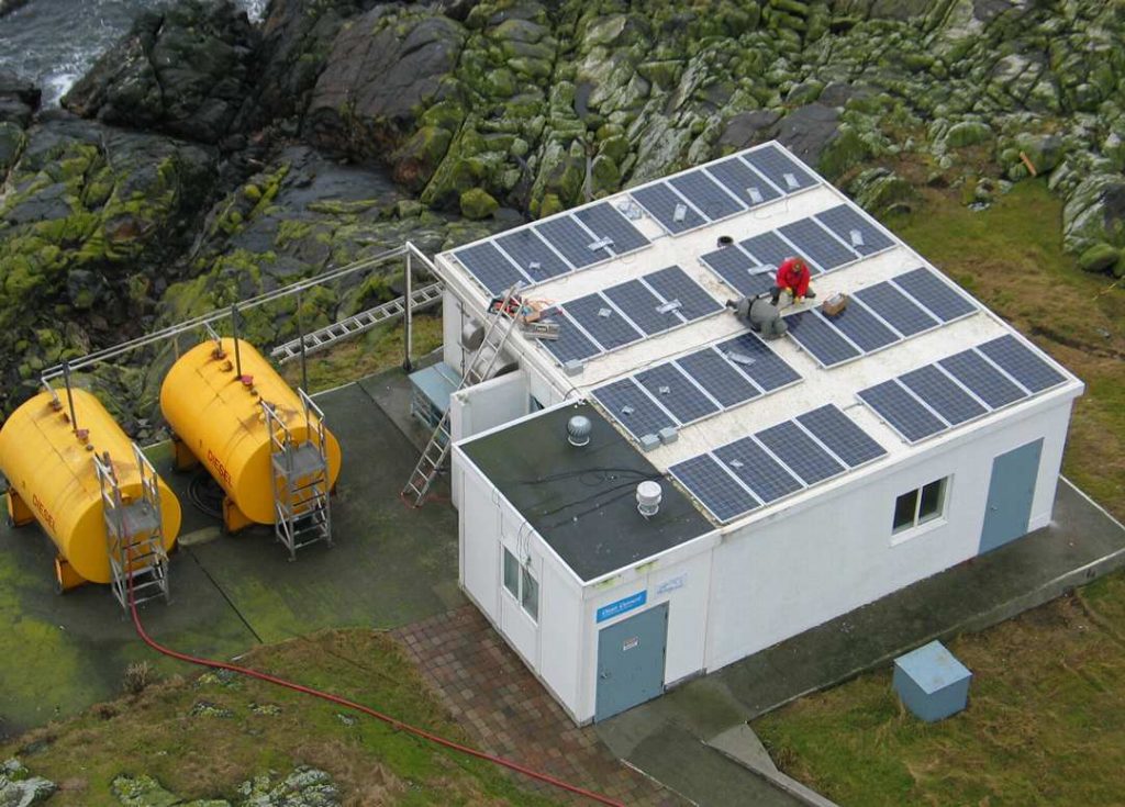 Solar energy at Race Rocks have also been a key factor in creating a sustainable integrated energy system. 38 solar panels were installed in 2007, along with a bank of 96 storage batteries.
Of the archipelago of 10 islands that make up Race Rocks, only the central island of Great Race Rocks has an environment sustaining terrestrial vegetation. Plants that do grow there have to be tolerant of salt spray, and extreme drought in the summer, so they provide good examples of adaptations for these conditions. Some of the soil on the island was transported by barge from Vancouver Island in the early years so that the light keepers could have lawns and gardens. After years of grass trimming when it was leased by the Coast Guard, we now leave the vegetation to form a turf covering which is more effective in conserving water in the soil of the island. Several areas have had old unused concrete structures removed and are also being encouraged to regenerate with the natural drought resistant fescues.
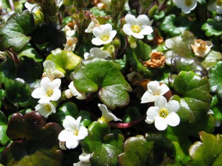 Romanzoffia tracyi, a small rare plant with perennial leaves, is often referred to as mist maiden. It grows (to 10cm only) on rocky ocean bluffs on Southern Vancouver Island and the adjacent islands. Race Rocks has several small colonies of this plant. Other salt and drought tolerant coastal native plants on the island are the thrift, Armeria maritima, and the goosetongue plantain, Plantago maritima.
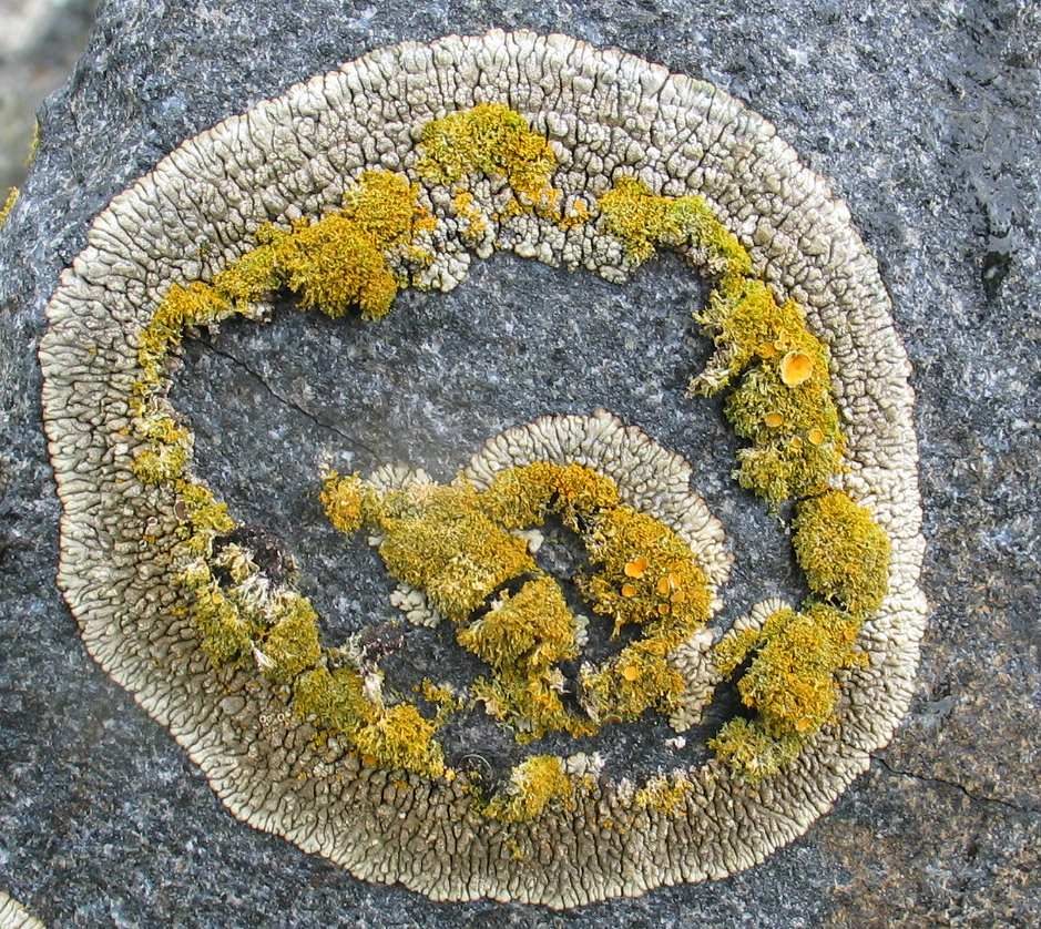 The marine exposed area provides a wide diversity of crustose lichens but very few mosses. The yellow Caloplaca sp. predominates in the spray zone, but other species such as the grey ring-forming Lecanora staminea are common as well.
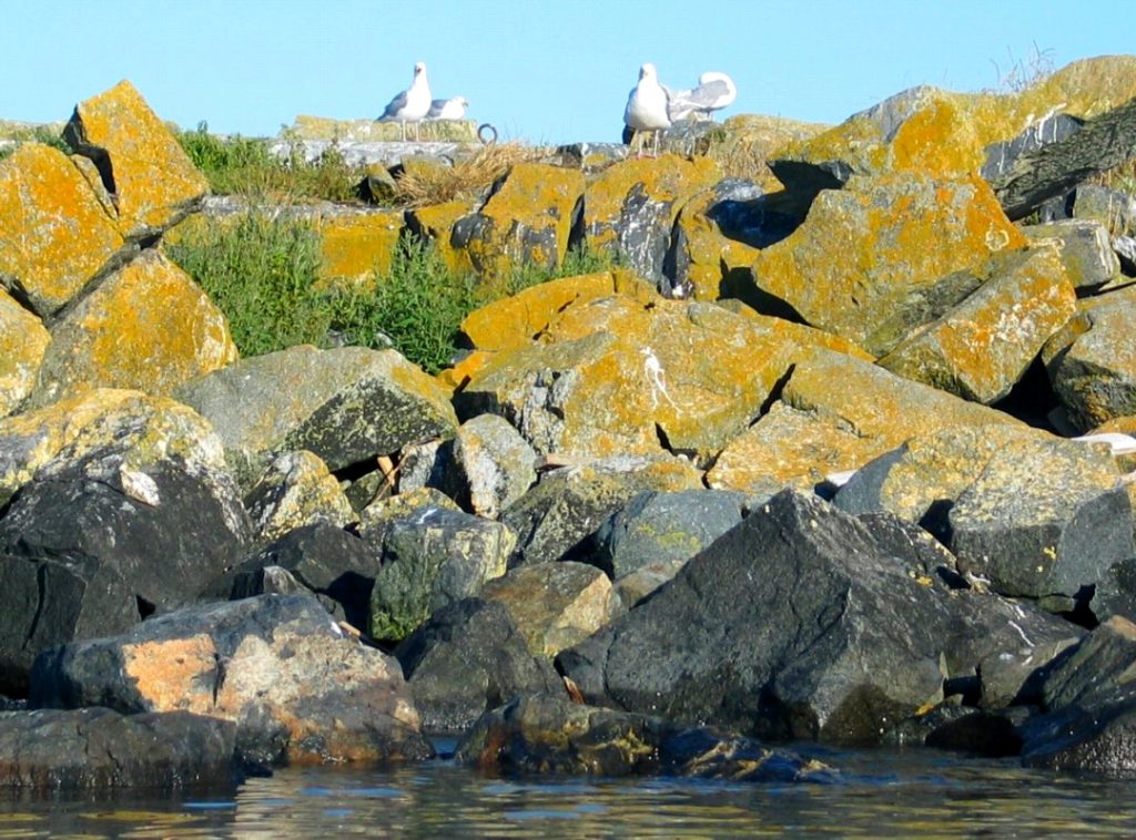 When approached from the sea, a fringe of orange lichen covers the rocks, delineating the spray zone of the island.
 Over the years as a lightstation, numerous introduced garden varieties have survived in the extreme climate of Great Race Rocks .
The purple flowers of evening-scented stocks, Matthiola incana and the bright yellow calendula, Calendula sp. look like they were planted here at Race Rocks but have become naturalized and just come up regularly in appropriate places on their own. An introduced sedum species has also covered many of the upper exposed rocky areas.
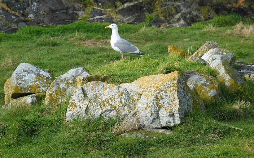 The Historic and pre-historic side of Race Rocks :
For many years, humans have played an important role as part of the ecosystem at Race Rocks, known to some early first nations people as “Xwayen”, the area of fast flowing water. This area was like a banquet spread before them, and its abundant resources supplied generations of people with an important area for food. Many of the coastal areas on Southern Vancouver Island have burial cairns used by First Nations between 1000 to 1500 years ago. Eight of the large boulder cairns still exist on Great Race Rock and another 450 of them are located on nearby Rocky Point. They have been documented by an anthropologist, Darcy Mathews who did a Master’s thesis on these cairns for the University of Victoria
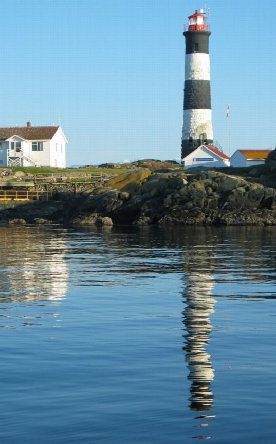 Race Rocks Tower
There was a strong need for navigation safety in the mid- nineteenth century, in this area of high current, frequent fog and rough seas. Race Rocks was one of first two lighthouses constructed on the Pacific Coast of Canada by the British living in the Vancouver Island Colony in 1860. After 150 years of use and exposure to harsh weather, Race Rocks will now be one of the lighthouses restored and protected as a heritage lighthouse in legislation passed by the Canadian government in 2008. Although automated, the tower and foghorn still remain as active aids to navigation operated by the Canadian Coast Guard.
More information can be found on the racerocks.ca website and from the references below.
Internet References:
Race Rocks /Xwayen Ecological Reserve and Marine Protected Area: http://www.racerocks.ca
Contacts for further information:
https://racerocks.ca/administration-of-race-rocks/contacts/
Educational Resources of Race Rocks:
https://racerocks.ca/educational-resources/
Burial Cairns at Race Rocks:
https://racerocks.ca/history-of-race-rocks/first-nations-burial-cairns-at-great-race-rocks/
First Nations on Southern Vancouver Island:
https://racerocks.ca/first-nations/
History of Race Rocks
https://racerocks.ca/history-of-race-rocks/
The Integrated Energy System of Race Rocks
https://racerocks.ca/energy/
Over 300 Animals and Plants of the Race Rocks area are profiled with images and videos in the Race Rocks Biodiversity file: https://racerocks.ca/race-rocks-animals-plants/taxonomy-image-gallery/
Ecosystem Services:
https://racerocks.ca/ecology/ecosystemservices/
Coastal Ecosystems of Metchosin District on Southern Vancouver Island. https://metchosinmarine.ca
Geology of the Area https://racerocks.ca/?s=geology&submit=Search
Rocky Point Bird Observatory:
http://www.islandnet.com/~rpbo/
The home page of Lester B. Pearson College: http://www.pearsoncollege.ca
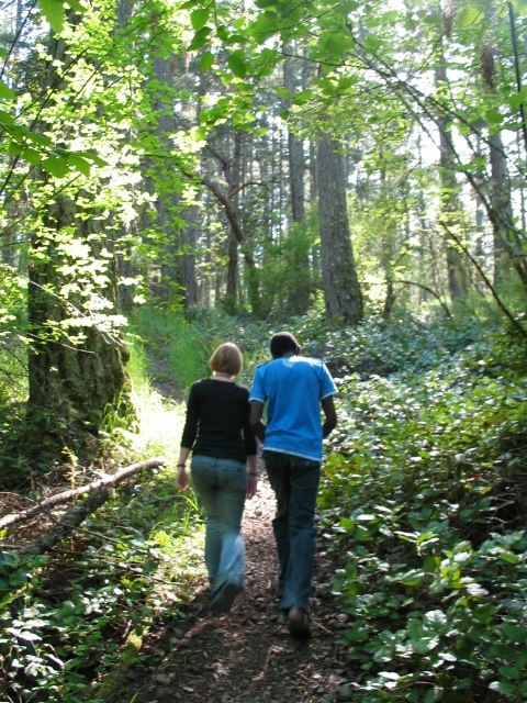 Acknowledgements:
Photo Personnel:
Erica Kafwimi, Tanzania,
Elise Kassis, Canada (NB)
Ellen Denney, USA
Petros Vilakati, Swaziland
Pascoela Sequeira, East Timor
Jacob Schweda, Canada (BC)
Zuzanna Wojcieszak, Poland
Nayely del Carmen Perea – Arenas, Mexico
Jack Liang and Colin MacDonald, summer program participants
Members of Environmental Systems Classes
Photo credits:
Ryan Murphy..Race Rocks and Pedder Bay birds.
Chris Blondeau.. Turbine underwater
at Race Rocks.
Erik Schauff–Race Rocks
underwater pictures.
Moralea Milne.. Sharp-tailed snake.
Ellen Denny.. broom pulling.
Pam Birley..Great Blue Heron.
Dr. Anita Brinkmann-Voss..hydroids.
Sherry Crawford..Soccer Field and snow pictures.
Capital Regional District Natural
Areas Atlas.. map.
Canadian Hydrographic Service..uw map.
Garry Fletcher.. all remaining photos.
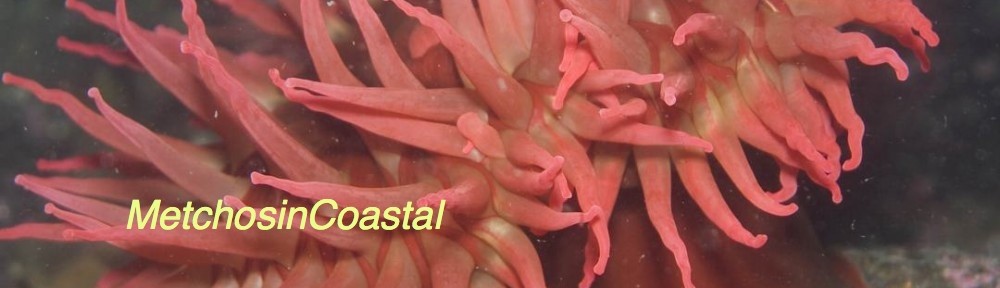
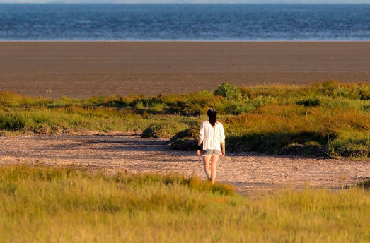 Subject: