Determination of the “NATURAL BOUNDARY ” of the Coastline

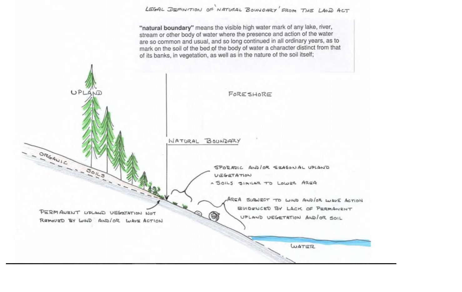
The determination of the natural boundary of the coastline is important in establishing ownership of property  and therefore public access along a coastline:   The following reference may help clarify this .


http://www.friendsofislandviewbeach.com/uploads/2/4/3/5/24351508/island_view_beach_natural_boundary.pdf

Policy and Planning for Coastal Ecosystems in British Columbia through a Blue Carbon Lens. WCEL

Subject: 
Climate Adaptation, Blue Carbon, Nature-Based Climate Solutions, Coastal Ecosystems
Author: 
Deborah Carlson – Staff Lawyer
Summary: 

Healthy coastal ecosystems are essential for maintaining biodiversity and liveable coastal communities, providing critical habitat, water quality protection, food and medicinal plants for harvesting, lessening of coastal erosion, resilience to climate change, and flood regulation.

Perhaps less well known is that coastal ecosystems also play an important role in long-term carbon storage and sequestration. This paper looks at emerging policy opportunities and needs in Canada, and specifically British Columbia, for “blue carbon” – the carbon stored in vegetated coastal ecosystems – and how protecting blue carbon as a climate action measure aligns with coastal biodiversity protection and resilience more broadly.

Publication Date: 
November 18, 2020
Publication Pages: 
44
Publication Format: 
PDF

Tower Point Subdivision

I went over to Tower Point today to get a better sense of the seafront north of the Tower Point portion of Witty’s lagoon CRD park. It is part of  a subdivision proposal. This is a good example of natural Capital of the Municipality. Public access to this area would be possible by all of the other holders of property in the subdivision, as well as the public. With the pressures from increasing population in the neighbouring communities of Langford and Colwood the value of this area kept as public property would be very high.
2015-04-13 towerpointproperty

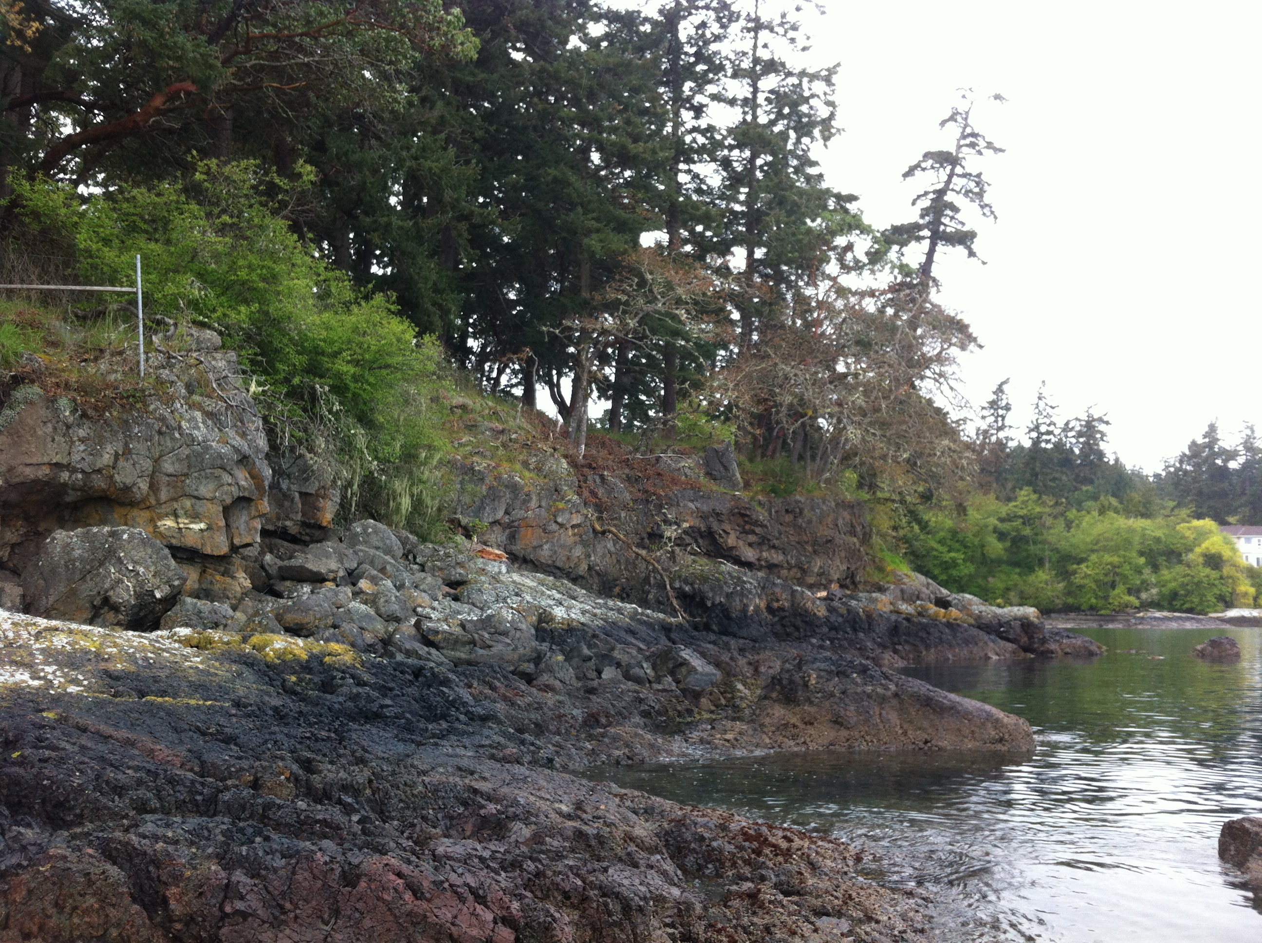
The shorefront on the property north of Tower Point which  is subject to a subdivision proposal

From an APRM newsletter:
Parkland Acquisition at Subdivision: Under section 941 of the Local Government ACT, the owner of land being subdivided must provide park land when three or more additional lots are being created and at least one of the parcels is 3 Hs(4.94 acres) or smaller.  The amount of parkland that is required, without compensation, is 5% of the land being proposed for subdivision….where the local govenment has the authority to decides whether it wants 5% deducation or cash-in-lieu, it is up to Council (unless specifically delegated to the Approving Officer) to determine the amount (up to 5%) and location.
…where the OCP has policies and designations for future parks, the local government can decide whether to accept land or cash-oin-lieu  Absent such policies, the landowner decides, with the compensation equal to market value of the entire parcel prior to its subdivision but it has preliminary approval for subdivision…
towerpointmap

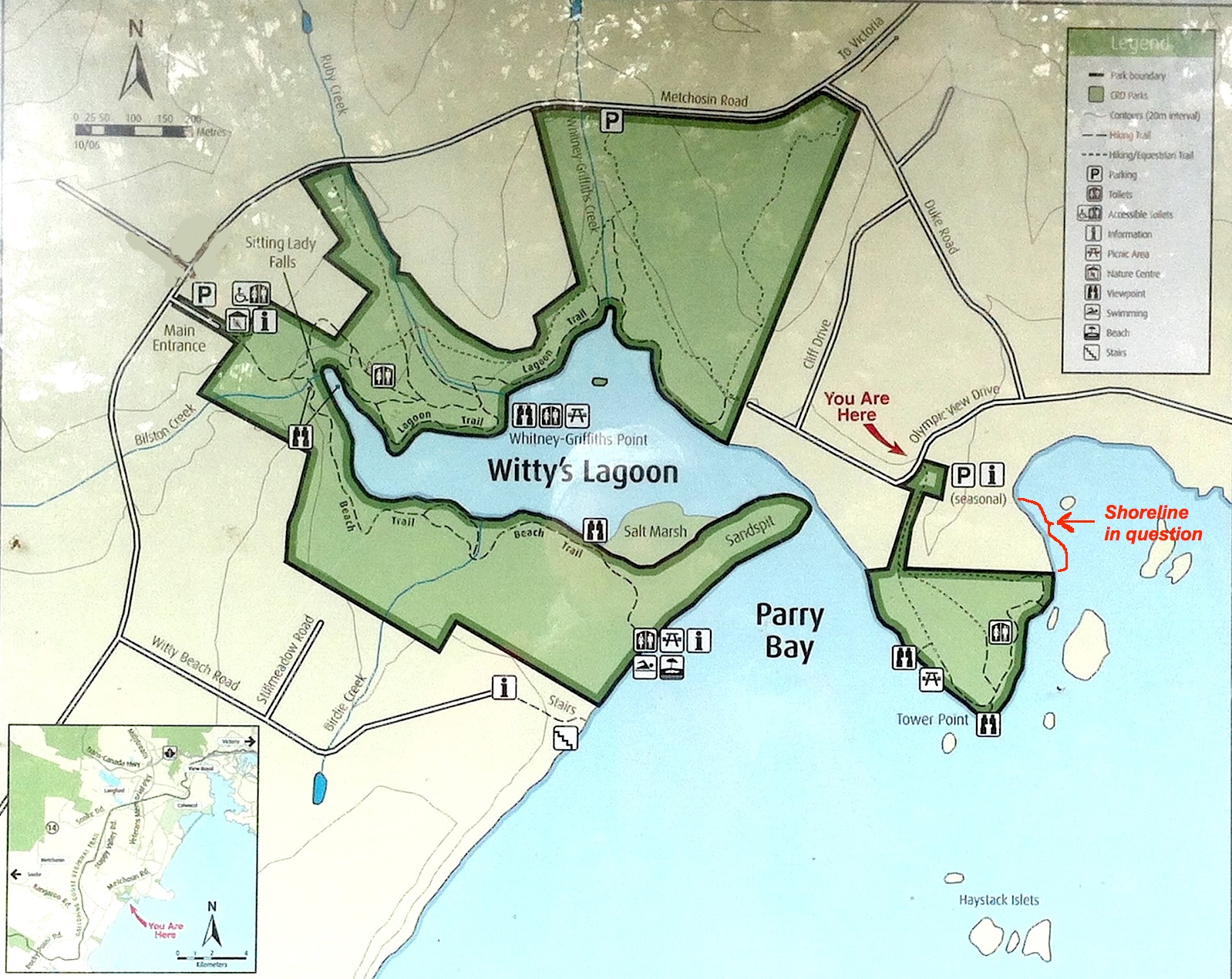
The shoreline location— see red arrow and bracket on the right.

The shorefront here would make a very good addition to the part of Witty’s Lagoon regional park which is locted at Tower Point . Residents of the community made a submission at tonight’s council meeting pointing out the advantages of a park dedication for a strip along the shoreline. It is hoped that the council, when provided with the final version of the application will recommend this park border extension.

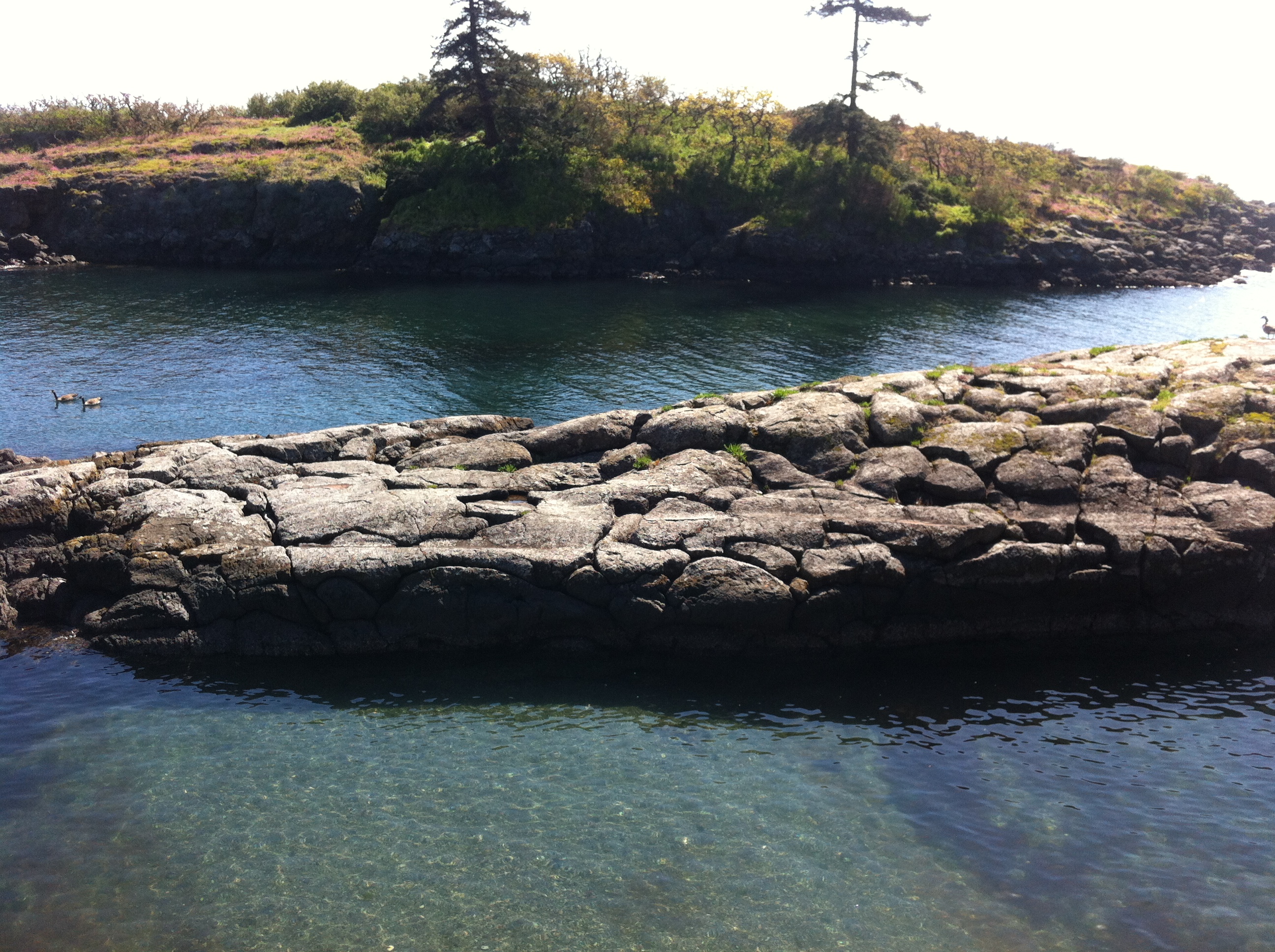
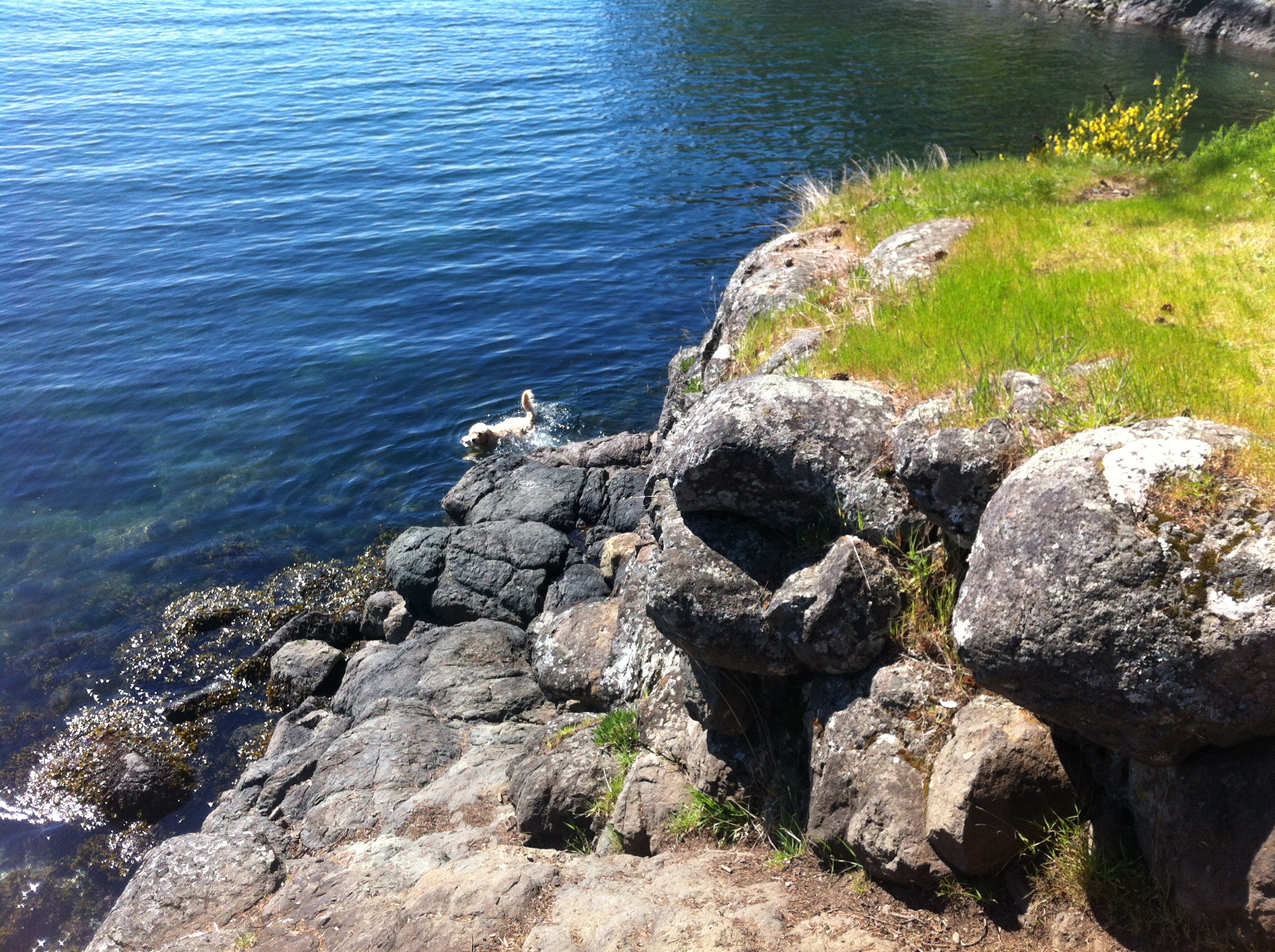
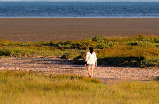
I also took some pictures of the wildflowers and features of the shoreline in the park at Tower Point bordering this subdivision. See in the next blog.

Publication: Protecting Your Communities Coastal Assets

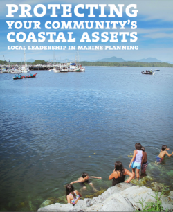
Local Leadership in marine planning: Local governments on B.C.’s Coast have the power to protect the ecosystems we depend on.

This report describes easily accessible resources local governments can use to maintain aquatic Ecosystem Value and Productivity, including maps and tools to guide decisions and bylaws regarding management of activities on land , and in intertidal and sub-tidal zones.

protectingassetsicon


Download .pdf from this website

or

Originally available here:
powerinhands

BC Government Publications Index for Stewardship Centre on Coastal Planning and Land Use

BC Government Publications
Index for:
Stewardship Centre for British Columbia
Coastal Shore Stewardship: A Guide for Planners, Builders and Developers on Canada’s Pacific Coast

http://www.llbc.leg.bc.ca/public/pubdocs/bcdocs/368207/

The four PDFs linked to this government site have also been included here since we find that external URLs often change:
Part 1: Coastal Shore Stewardship A Guide for planners, Builders and Developers on Canada’s Pacific Coast: part1

Part 2  Coastal Planning and Approvals, Who does What: part2

Part 3  Don’t disrupt, Don’t harden, Don’t pollute: Land Development,  Marine Facilities, Seawalls and Revetments, etc.   Links to many  Stewardship resources; part3

Internet resources: internetaddresses

Riparian Rights and Public Foreshore Use in the Administration of Aquatic Crown Land


Occasional Paper No. 5  Revised: August 2008
Prepared by:
Ministry of Agriculture and Lands Crown Land Administration Division Province of British Columbia in cooperation with the Land Title and Survey Authority of British Columbia

District of Metchosin Official Community Plan Section on Shoreline Slopes Development Permit Areas

From the Official Community Plan : Available at this link

Map6_Development_Permit_Areas

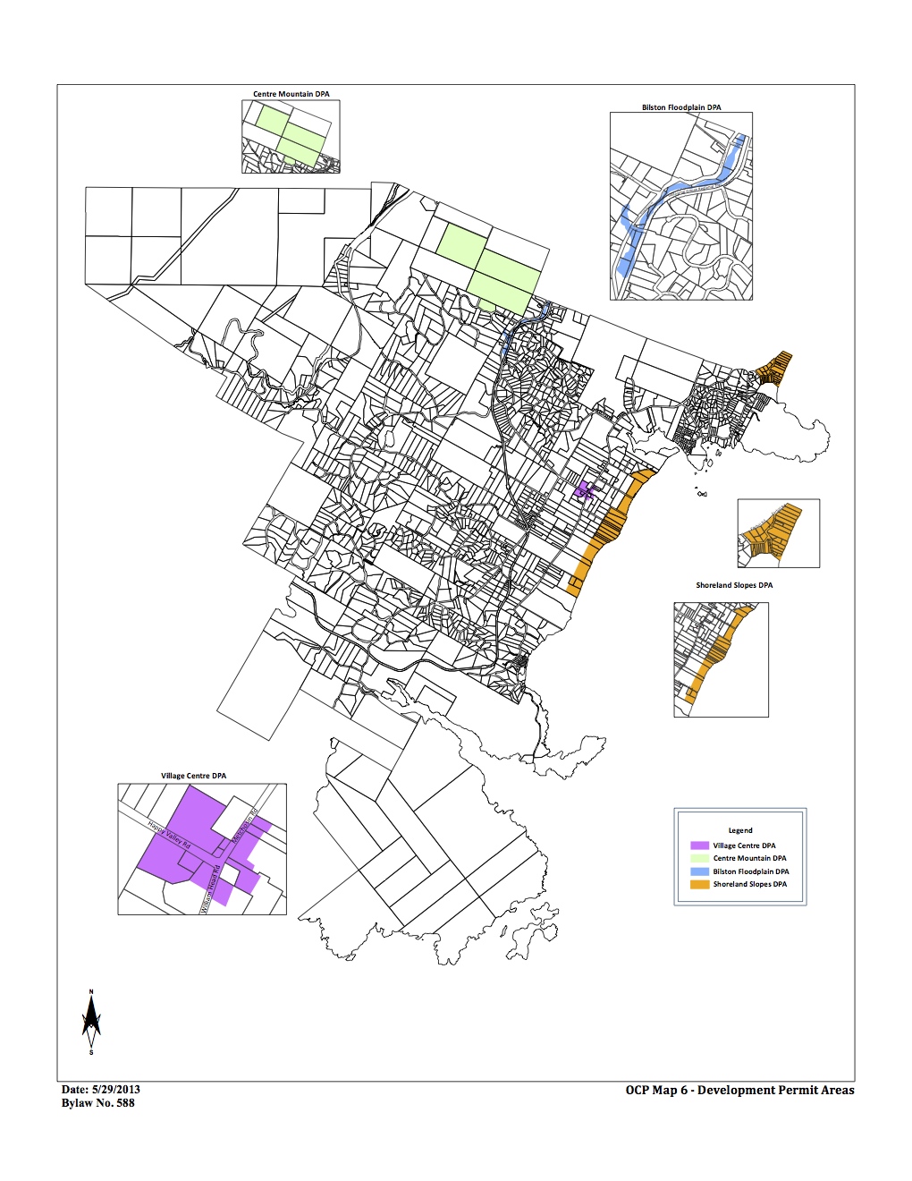
DPAs in Metchosin ( click to enlarge)

2.16    SHORELAND SLOPES DEVELOPMENT PERMIT AREAS:
The Municipal Act
provides that a community plan may designate development areas to be protected from hazardous conditions. The Municipal Act further provides that in such areas land shall not be altered in any way or subdivided and structures not be built or added to until a Development Permit has been  issued. Council has established the following designation, special conditions, and guidelines.

2.16.1    Designation:  (Bylaw 418, 2004)
The 1993 Hazard Land Management Plan has identified areas of the Metchosin shoreland slopes as having erosion, land sloughing and drainage problems.

AlbertHead portion of DPAs

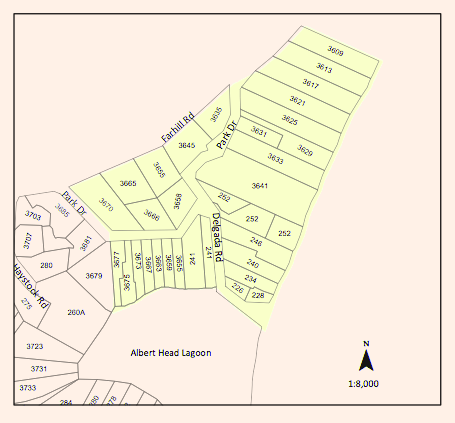
Farhill Road portion of DPAs,

southsectionDPA

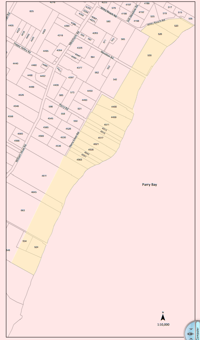
Parry Bay ( Taylor Beach ) section of DPA lands

The Shoreland Slopes areas are shown on Map 6 Shoreline Slopes DPA, and are hereby designated as areas for the protection of development from hazardous conditions pursuant to Section 919.1(1)(b) of the Local Government Act.
The Plan has identified three Shoreland Slope classification zones, based on the degree of slope instability and surface erosion potential. Slopes classified as zone 2 and 3 are slopes with the greatest potential for sloughing, slumping and debris flows and have been included in the Development Permit Area.
2.16.2    Special Conditions:
The major concern is that lands, particularly in the Park Drive – Farhill Road area, have experienced a  dramatic rise in ground water levels due to adjacent developments during the last two decades. Other areas of the Shoreland slopes have experienced significant slope erosion in the past. There is a community desire to mitigate any further development related impacts on the marine shorelands.

2.16.3    Policies Development Permits issued shall be in accordance with the following:
(1)    The construction or alteration of buildings on existing lots shall be permitted subject to the Building  Permit process when Council is satisfied that the Development Permit Guidelines (Section 2.14.4) have been met, and, when required, Council is satisfied with the Engineer’s Report (Section 2.14.5).
(2)Where a Development Permit is applied for in conjunction with an application for subdivision approval, rezoning, or both, the Development Permit shall be conditional on the successful completion of those other permits and shall lapse if the subdivision or rezoning is not approved.

2.16.4    Guidelines:
(1)    All applications for new development in the Development Permit Areas shall be required to have an Engineer’s Report (described below).
(2) Removal of vegetation shall be minimized.
(3) House construction, regrading, and excavation of till (including for road building) is not permitted within 60 metres of the edge of the slope except where geotechnical engineering and resource management studies indicate that a lesser setback is acceptable.
page 31

2.16.5    Engineer’s Report:
Before a development permit is issued, the applicant shall be required to furnish a report at his\her expense from a registered professional engineer with geotechnical experience which will certify that the proposed development will produce no adverse impacts on the shoreland slopes and will not place buildings or structures in danger of slope slippage.

The Engineer’s Report shall demonstrate that consideration has been given to the following:
(1)(a) siting and setbacks of development structures, roads, and services,
(b) minimizing paving and impervious materials, and,
(c) implementing infiltration techniques so as to limit runoff;
(2) designing runoff detention ponds, drainage works, or
sediment traps or basins to reduce the flow of  runoff and silt during land clearing and construction.
(3) development near shoreland slopes must address the impact of surface water on slope stability, vegetation and soils, and make recommendations to remedy that already damaged; and
(4) removal of trees (with a valid tree-cutting permit) or other vegetation should be allowed only where  necessary and where alternate vegetation and/or erosion control measures are established. If possible,  stumps should be left in place to provide some soil stabilizing influence until alternative vegetation is  established. Plans delineating extent of vegetation/tree removal (location, species and diameter of trees) and location of proposed construction, ex cavation and/or blasting, may be required.

The DISTRICT, at its discretion, may also submit the Engineer’s Report to review by a second Engineer at the applicant’s expense, and/or directly to the Ministry of Environment for their comments.

2.16.6    Municipal Response, 
The DISTRICT should:
(1) evaluate the feasibility of purchasing environmentally sensitive shorelands for use as park, forest reserve, or greenbelt;
(2) initiate programs to monitor both surface and ground water to establish patterns of change;
(3)work with proximate agencies to establish erosion and land sloughing control measures.

Coastal Jurisdiction in BC : History

In Metchosin when issues of development or cleanup of our coastal areas come along, we are often left wondering about which level of government has jurisdiction over marine issues. This file provides some of the background of those issues. It often determines who has responsibility for permitting development along shorelines, or even who cleans up when there is a coastal problem.

In 1979 this issue came to light when we were involved in having the ecological reserve created to a depth of 20 fathoms at Race Rocks. An ecological reserve created by the province, could only involve provincial territory, so the B.C. Attorney General’s Office was consulted by the then “Ministry of Lands Parks and Housing” for clarification. The reserve was created in 1980, but it took a Supreme Court of Canada decision in 1982 to make it official that the province really did have jurisdiction over the seabed that far out in the Strait of Juan de Fuca.

I have taken a quote from the admiraltylaw.com website which describes in Part 1-Who Controls the Offshore?, Some of the interesting history around this case in law. Note that the concern at the time for the upcoming importance of seabed resources such as oil, contributed to the urgency of this decision.

  • How British Columbia is Different: In 1967, British Columbia posed much the same question to the Supreme Court of Canada. The Court found that the seabed and its resources, from the mean low water mark to the outer limit of the Territorial Sea (12 nautical miles), was within the exclusive control of the Federal Government.However, like Newfoundland, British Columbia wasn’t satisfied with this answer. In 1981, the Province declared the entire coast an “Inland Marine Zone” (figure #1), in an attempt to assert its jurisdiction over the area. This declaration was political at best, and had little, if any, legal significance.In 1982, BC returned to the Supreme Court to ask the Court if the seabed resources between Vancouver Island and the mainland, particularly the seabed of Queen Charlotte Straight, Johnstone Straight, Georgia Straight and Juan de Fuca Straight, were within the jurisdiction of the Province.In deciding for the Province, the Court looked to the unique history of British Columbia. The Court found that when the Province was originally created as a colony by the British Parliament in 1866, its borders were defined with the most western outer limit of the Province being the “Pacific Ocean”. The court contemplated the meaning of “Pacific Ocean” and found that the water and seabed between Vancouver Island and the mainland were not commonly considered part of the Pacific Ocean and were therefore within the jurisdiction of the province.

    Importantly, we know from the Geological Survey of 1998 that the hydrocarbon reserves under these areas of Provincial control, particularly the Georgia Basin, contain minimal oil, but do contain modest natural gas reserves (6.5 trillion cubic feet). We further know from the 1998 Survey that the majority of BC’s offshore oil (9.8 billion barrels) and gas (26 trillion cubic feet) lies under the Queen Charlotte Basin in the Queen Charlotte Sound and Hecate Strait.Unfortunately for the BC government, the question posed to the Supreme Court in 1982 did not include a question as to who controls the bulk of the resources, those being under Queen Charlotte Sound and Hecate Straight. As a result, there is no binding authority that states specifically that those areas are under the control of the Federal Government. Indeed, if the Supreme Court were to find that Hecate Straight and Queen Charlotte Sound were not part of the “Pacific Ocean” proper, than the seabed resources would fall within the boundaries and the control of the Province. However, politicians may wish to settle this question themselves.Present Status of JurisdictionsAs it stands now, the province clearly has jurisdiction over the resources under the Queen Charlotte Straight, Johnstone Straight, Georgia Strait and Juan de Fuca Strait. The Federal Government, arguably, has jurisdiction over the vast majority resources under Queen Charlotte Sound and Hecate Strait. Whether the province will attempt to capitalize on its self-pronounced “Inland Marine Zone” and assert jurisdiction over the reserves under Hecate Straight is questionable as it would likely mean a long and drawn out legal battle. In the following article I will discuss how a similar battle was settled on the Atlantic coast, and why the approach taken there is likely the best approach for B.C.Before closing, it is interesting to note that the B.C. government could avoid a dispute over jurisdiction in Hecate Straight and still explore and develop a portion of the Queen Charlotte Basin. Maps forming part of the 1998 Geological Survey Canada show that a portion of this massive petroleum reserve lies under Graham Island. This oil can be accessed from Graham Island without the jurisdictional complications and the added complexity of drilling in the marine environment. The reserves directly under Hecate Straight might also be reached by drilling from land using directional and horizontal drilling. Although such ideas may successfully avoid a conflict of jurisdictions with the Federal Government, they still contain serious social, economic and political issues with respect to drilling on Haida Gwai.”

From this BC government page for Oil spills:

  • Guiding Principle
    The Province of British Columbia is committed to protecting British Columbia’s coastal environmental resources from harmful oil spills emanating from marine vessels, industrial facilities or inland sources.
    Because of its responsibility to protect and manage Crown lands, the Province is a major stakeholder in any marine oil spill. Its jurisdiction includes all land between the high and low water mark, the seabed of the Strait of Georgia, Juan de Fuca and Queen Charlotte Sound-Johnstone Strait, and the coastal seabed between major headlands unless responsibility has been transferred specifically to a federal jurisdiction or is in private ownership.
    Residing in or on these foreshore and seabed areas are provincial resources that include archaeological, recreational, heritage, wildlife and aquatic resources. Responsibility to protect and manage marine resources, such as waterfowl and fisheries, is often shared with federal agencies.
    It is these provincial and shared resources of the foreshore, offshore and seabed that are at risk from a spill and that are vital to many coastal communities for their livelihood.
    Since the federal government is also responsible for shipping and for certain other marine resources, responsibility to protect and manage marine resources is a joint effort between provincial and federal agencies.
  • Provincial Role
    The Province will take an active leadership and participatory role in coastal resource identification and, in the event of an oil spill, the protection and cleanup of the intertidal shoreline and seabed, which are under the jurisdiction of the Province.
    The Province’s response efforts will focus on the identification and mapping of provincial Crown resources, which include, but are not limited to, intertidal marine habitats, wildlife habitats and populations, archaeological, cultural, aquatic, park and ecological reserves.
    The Province will set priorities for resource protection and will establish oil spill protection and cleanup measures for shorelines. As well, it will ensure the availability of equipment and trained personnel to manage spill response safely and effectively.
    The Province will work in concert with federal agencies wherever both federal and provincial resources are to be protected.
    The level of response capability of the Province will also recognize the particular expertise and resources of the Canadian Coast Guard, Environment Canada, and Fisheries and Oceans Canada to undertake emergency response. Opportunities will be established for contractors to provide skilled assistance and resources in the event of a major spill.”

The Management Plan for the Race Rocks Ecological reserve also refers to jursisdictions:

  • “Cooperation with the Federal Government
    Jurisdictional responsibilities for the management of the marine environment and marine values are shared between the federal and provincial governments. For example, Fisheries and Oceans Canada (DFO) is responsible for the regulations of fisheries and the lead responsibility for navigation and marine mammal protection. The Coast Guard, an agency within DFO, is
    responsible for the automated lightstation on Great Race Rock. The Department of National Defence uses explosives in the area, which may also have impacts on the Reserve.
    The province, on the other hand, is responsible for the terrestrial areas, the seabed, and the natural values on those lands. The Province is working with federal agencies, including DFO, Parks Canada and Environment Canada, to develop and implement a marine protected areas strategy, and with Parks Canada to implement the Pacific Marine Heritage Legacy (PMHL)
    program.
    The highest level of protection for the Race Rocks area can only be achieved through the cooperative application of both federal and provincial authorities. “

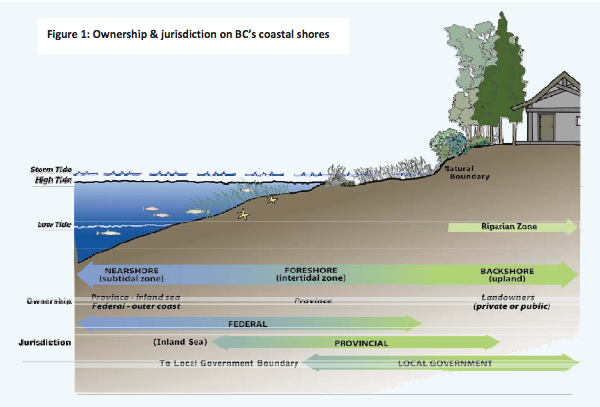
Further Information about jurisdiction concerning coastal development can be found in  Coastal Jurisdiction in British Columbia (Green Shores) This is an excellent resource, summarizing the issues of coastal jurisdiction. It describes the limits of landowner, BC Crown and Federal jurisdiction along the coastal areas.


Coastal Shore Jurisdiction in British Columbia

Green Shores –  Oct 2009

jurisdiction

Who’s in charge of coastal shores?
All levels of government have some role in managing coastal shores in BC( Figure1andTable1
“Local governments (municipalities and regional districts) hold the authority to plan andregulate land use within their respective boundaries, which may extend over foreshoreand near shore areas.They do this through official community plans, zoning,development permits, subdivision authority, building permits, and a variety of regulatory bylaws that affect land development.”