2.0 Ecological Sustainability as the Primary Theme

Environmental Sustainability is now on the forefront of political agendas around the world, and is at the centre of concern for many of the world’s population. Due to obvious impacts that the environment is reflecting back on humans, it is not a topic which will go out of fashion in the near future. In this resource, the need to provide a stimulating experience to raise awareness in students about the value of our marine resources and the reinforcement of the role for education for sustainable development is emphasized . Where possible, global examples are brought in to emphasize the interdependence of all the world oceans.

  • 2.1 The wide diversity of ocean ecosystems: Within our immediate ocean we have a wide variety of ecosystem types.
  • 2.1.1 Coastal Ecosystems: There is a wide contrast in the character of our Coastline in British Columbia.
  • 2.1.0.1 Kelp Forest : Many issues are brought to light when considering these ecosystems: The effects of contaminants, the effects of introduced species, the ecosystem services provided in the form of habitat for other species.
  • 2.1.0.2 Rocky Shore, (sub and intertidal) Tidepools and rocky shore can show biodiversity as well as food web relationships. In addition, the effect of pollution, chemical and oil become crucial in these habitats.
  • 2.1.0.3 Beaches: sand and pebble : Geological processes create them and human actions can destroy. Their role as habitat for organisms, the importance of sedimentation and habitat and the energy dynamics of a strand line with natural and human debris.
  • 2.1.2 Benthic areas.
  • 2.1.3 Other ecosystems of the global seas, (ex. Arctic ice, Mangroves, coral reefs).
  • 2.1.4 Pelagic – Open ocean ecosystems. Plankton and its the interaction with ocean currents, can be indicators of food webs gone wrong.
  • 2.1.5 Abyssal Ecosystems :In the inland and outer coastal areas, B.C., has a number of significant regions.

We have individuals who are “doing sustainability” in their professional or personal lives in BC. Examples are “Dr. Pauly” .. see Fishing Down Food webs or Dr.Chan ..see Ecosystem Services: , Dr. Andrew Weaver actively involved in researching Climate Change at the University of Victoria, and First Nations members who are educating about First Nations Marine History and Culture.

See also the page on Individuals as role models: for marine environmental sustainability.

SUSTAINABILITY IN EDUCATION:

Linkage of specific educational objectives with experiences in which students from K to 12 can participate are outlined here.

Over the past 10 years or more the possibility of achieving the goals of ecological sustainability for the earth are tied closely to education , see the Background Rationale for the role of Education:

The BC Curriculum section contains links from Objectives to resources that they could find in the Marine Centre.

One document which provides the clearest goals related to sustainability is the
Earth Charter
, http://www.earthcharterinaction.org/2000/10/the_earth_charter.html The following points are extracted to highlight the many ways that it is appropriate for the activities associated with the NMC.

  1. Respect Earth and life in all its diversity.
    a. Recognize that all beings are interdependent and every form of life has value regardless of its worth to human beings
  2. Care for the community of life with understanding, compassion, and love.
    a. Accept that with the right to own, manage, and use natural resources comes the duty to prevent environmental harm and to protect the rights of people
  3. Build democratic societies that are just, participatory, sustainable, and peaceful.
    b. Promote social and economic justice, enabling all to achieve a secure and meaningful livelihood that is ecologically responsible.
  4. Secure Earth’s bounty and beauty for present and future generations.
    a. Recognize that the freedom of action of each generation is qualified by the needs of future generations.
    b. Transmit to future generations values, traditions, and institutions that support the long-term flourishing of Earth’s human and ecological communities.

 In order to fulfill these four broad commitments, it is necessary to focus on the concept of

ECOLOGICAL INTEGRITY

5. Protect and restore the integrity of Earth’s ecological systems, with special concern for biological diversity and the natural processes that sustain life.

  • a. Adopt at all levels sustainable development plans and regulations that make environmental conservation and rehabilitation integral to all development initiatives
  • b. Establish and safeguard viable nature and biosphere reserves, including wild lands and marine areas, to protect Earth’s life support systems, maintain biodiversity, and preserve our natural heritage
  • c. Promote the recovery of endangered species and ecosystems
  • d. Control and eradicate non-native or genetically modified organisms harmful to native species and the environment, and prevent introduction of such harmful organisms
  • e. Manage the use of renewable resources such as water, soil, forest products, and marine life in ways that do not exceed rates of regeneration and that protect the health of ecosystems
  • f. Manage the extraction and use of non-renewable resources such as minerals and fossil fuels in ways that minimize depletion and cause no serious environmental damage

6. Prevent harm as the best method of environmental protection and, when knowledge is limited, apply a precautionary approach

  • a. Take action to avoid the possibility of serious or irreversible environmental harm even when scientific knowledge is incomplete or inconclusive
  • b. Place the burden of proof on those who argue that a proposed activity will not cause significant harm, and make the responsible parties liable for environmental harm
  • c. Ensure that decision making addresses the cumulative, long-term, indirect, long distance, and global consequences of human activities
  • d. Prevent pollution of any part of the environment and allow no build-up of radioactive, toxic, or other hazardous substances
  • e. Avoid military activities damaging to the environment

7. Adopt patterns of production, consumption, and reproduction that safeguard Earth’s regenerative capacities, human rights, and community well-being.

  • a. Reduce, reuse, and recycle the materials used in production and consumption systems, and ensure that residual waste can be assimilated by ecological systems
  • b. Act with restraint and efficiency when using energy, and rely increasingly on renewable energy sources such as solar and wind
  • c. Promote the development, adoption, and equitable transfer of environmentally sound technologies
  • d. Internalize the full environmental and social costs of goods and services in the selling price, and enable consumers to identify products that meet the highest social and environmental standards
  • e. Ensure universal access to health care that fosters reproductive health and responsible reproduction
  • f. Adopt lifestyles that emphasize the quality of life and material sufficiency in a finite world

8. Advance the study of ecological sustainability and promote the open exchange and wide application of the knowledge acquired.

3.0  Ecosystem Integrity

Return to Index

1.0 Strategies for a Sustainable Marine Future : Introduction

1.0 Introduction:

The key message of this curriculum resource is on global marine issues, and the integral role of all humans in maintaining environmentally sustainable marine ecosystems. Examples from the British Columbia marine environment are used to illustrate the principles which can also apply on a global scale. The over-arching concept of this resource is what marine environmental sustainability means locally and how people can be encouraged to commit to contribute to the process. We believe that people of all ages can use the tools to actively participate in making our marine environment sustainable.

logoWe thank the Shaw Ocean Discovery Centre, in Sidney on Vancouver Island in British Columbia for supporting the development of the document that provides the basis for this curriculum resource. I encourage you to visit this Centre which opened in the spring of 2009.

Garry Fletcher
Marine Education Consulting, Metchosin, BC

Index:

Proceed to 2.0 Marine Environmental Sustainability

3.0 Biodiversity and the need to Conserve

As a sub-theme, Biodiversity can accomplish many goals and provides a wealth of opportunities for curricular applications.

The Curriculum pages provide many objectives that relate to biodiversity.

cbd1.The best resource for this topic can be found on the CBD website:

http://www.cbd.int/default.shtml

2. Also, this pdf from the UNEP website: http://www.unep.org/geo/geo4/report/05_Biodiversity.pdf

Biodiversity

  • People rely on biodiversity in their daily lives, often without realizing it.
  • Current losses of biodiversity are restricting future development options.
  • Biodiversity plays a critical role in providing livelihood security for people.
  • From the use of genetic resources to harnessing other ecosystem services, agriculture throughout the world is dependent on biodiversity.
  • Many of the factors leading to the accelerating loss of biodiversity are linked to the increasing use of energy by society.
  • Human health is affected by changes in biodiversity and ecosystem services.
  • Human societies everywhere have depended on biodiversity for cultural identity, spirituality, inspiration, aesthetic enjoyment and recreation.
  • Biodiversity loss continues because current policies and economic systems do not incorporate the values of biodiversity effectively in either the political or the market systems, and many current policies are not fully implemented.
 Although many losses of biodiversity, including the degradation of ecosystems, are slow or gradual, they can lead to sudden and dramatic declines in the capacity of biodiversity to contribute to human well- being. Modern societies can continue to develop without further loss of biodiversity only if market and policy failures are rectified.  These failures include perverse production subsidies, undervaluation of biological resources, failure to internalize environmental costs into prices and failure to appreciate global values at the local level. Reducing the rate of biodiversity loss by 2010 or beyond will require multiple and mutually supportive policies of conservation, sustainable use and the effective recognition of value for the benefits derived from the wide variety of life on Earth. Some such policies are already in place at local, national and international scales, but their full implementation remains elusive."

3. “From http://www.unep.org/geo/geo4/report/06_Regional_Perspectives.pdf

“Population and economic growth are major factors fuelling increased demand on resources, and contributing to global environmental change in terms of the atmosphere, land, water and biodiversity….”

“A number of factors have led to the deterioration of marine and coastal areas, including fisheries, mangroves and coral reefs. They include rapid development of urban and tourism infrastructure, and of refineries, petrochemical complexes, power and desalination plants, as well as oil spills from ship ballast. Vast areas of terrestrial and marine ecosystems have been severely affected by wars, which led to the discharge of millions of barrels of crude oil into coastal waters. They have also been harmed by the infiltration of oil and seawater into aquifers, and by hazardous waste disposal. Environmental impact assessment requirements were introduced recently. Other responses include programmes to conserve biodiversity, manage coastal zones and develop marine protected areas. is also increasing in the environment.”

Box5.4 Deep Sea Biodiversity recently extended to the deep sea with the designation in 2003 of the Juan de Fuca Ridge system and associated Endeavour Hydrothermal Vents (2,250 metres deep and 250 kilometres south of Vancouver Island, Canada) as a Marine Protected Area.

4. See Value of biodiversity and ecosystem services

5. In October of 2007, The minister of Environment for Brazil spoke in a conference in Norway that focused on the importance of biodiversity in combating poverty and in achieving sustainable development. ( http://www.regjeringen.no/en/dep/md/Selected-topics/Naturmangfold/Vedlegg/Ecosystems-and-People–biodiversity-for-.html?id=487378 )

6. Species Diversity: http://www.millenniumassessment.org/documents/document.287.aspx.pdf

The lowered biomass and fragmented habitats resulting from overexploitation of marine resources is likely to lead to numerous extinctions, especially among large, long-lived, late-maturing spe- cies (Sadovy and Cheung 2003; Sadovy et al. 2003a; Denney et al. 2002).

Fishing is thus one of the major direct anthropogenic forces that has an impact on the structure, function, and biodiversity of the oceans today. Climate change will also have impacts on biodiversity through changes in marine species distributions and abundances. In the coastal biome, other factors, including water quality, pollution, river and estuarine inputs, have large impacts on coastal and marine systems. (See Chapter 19.) Historical over- fishing and other disturbances have caused dramatic decreases in the abundance of large predatory species, resulting in structural and functional changes in coastal and marine ecosystems and the collapse of many marine ecosystems (Jackson et al. 2001). One well-documented example is that of the historic fishing grounds ranging from New England to Newfoundland and Labrador, which once supported immense cod fisheries but which have now been almost completely replaced by fisheries targeting invertebrates, the former prey of these fish (providing a classic example of fishing down marine food webs). The system that once sup- ported cod has almost completely disappeared, fueling fears that this species will not rebuild its local populations, even though fishing pressure has been much reduced (Hutchings and Ferguson 2000; Hutchings 2004; Lilly et al. 2000). However, some col- lapsed stocks have been able to recover once fishing pressure is removed: the North Sea herring fishery collapsed due to over- harvest in the late 1970s but recovered after a four-year closure (Bjørndal 1988). On a much smaller scale, but nevertheless wide- spread throughout the tropics, coral reef areas have been degraded by a combination of overfishing, pollution, and climate variability.

Archives : The  Metchosin Biodiversity Strategy

3.1.0 Ecosystem Integrity

Index


Chapter 16. The Case for a Coastal Zone Management Act.

This is a chapter extracted from ” Maintaining Natural BC for Our Children: Selected Law reform Proposals , Environmental Law Centre, University of Victoria,  November 2012

Editing, Design and Photographs: Holly Pattison, UVic Environmental Law Centre
page 78:
caseforcoastalact
The Case for a Coastal Zone Management Act
By Jamie Alley and Calvin Sandborn
The BC coast is perhaps the province’s most important single asset. Home to most of our population, it is also home to some of the most important and productive ecosystems on earth.
Today the coast faces unprecedented challenges, including:
•Increased development and loss of public access to the coastline;
•Proposals for new oil ports and marine transportation corridors;
•Threatened fish stocks; and
•The need for emergency programs to deal with earthquakes, tsunamis, and
the extreme weather, storm surges and sea level rise caused by climate
change.
Response to these challenges often falls short because the coast is governed

by a patchwork of federal, provincial and municipal agencies that largey fail to co-ordinate regulatory efforts. The province needs a Coastal Zone Management Act to secure the future of the BC coast.

It is clear that the province must not abdicate coastal protection to other levels of government. Because the province has not yet legislated a strategy and overall plan for our coast:
•The federal National Energy Board’s hearings on the Northern Gateway
Project – the most important coastal management issue to face BC in
decades – will be decided by a three person panel, none of whom are
British Columbians. Unfortunately, BC failed to plan beforehand about oil
ports and other infrastructure decisions;
•  When industrial interests objected to funding arrangements, Ottawa’s
process for developing a north coast ocean management plan faltered.
That process is now likely to ignore major issues such as oil terminals.
Although the province and First Nations are now working to create Coastal
Management Area Plans, they are doing so without a clear statutory
mandate;
• It took the Cohen Commission to remind us that the future of salmon
rests as much upon actions of BC as on Canada. Salmon are affected by
stormwater, riparian development and numerous activities under provincial
jurisdiction. Yet there has not been a co-ordinated federal/provincial
strategy to protect salmon and our coast; and
• Most coastal resources are common property with ill-defined access rights.
This has caused overuse, neglect and degradation of essential ecosystems.
This problem has not been addressed.
Coastal Jurisdiction and Ownership
Management of coastal and marine resources is an area of complex, shared
jurisdiction between all orders of government, including First Nations and
local governments. For example, Ottawa has jurisdiction over fisheries
regulation and navigation. Local governments have zoning and other powers
over local shorelines and some coastal waters.
Meanwhile, the province has broad regulatory jurisdiction over numerous
activities in the coastal zone. In addition, it has jurisdiction and ownership
over the foreshore seaward of the high tide mark and all coastal or “inland”
waters within the “jaws of the land,” including the seabed. The seabed of
the Strait of Juan de Fuca, the Strait of Georgia, Johnstone Strait and Queen
Charlotte Strait are the property of British Columbia.
As a consequence, the coastal ecosystem is regulated by a plethora of
agencies from numerous governments. This thwarts effective planning
and management – especially because of the absence of effective legislative
mechanisms to coordinate the actions of multiple agencies.
Thus, it is not surprising that management of the coastal zone has been
more problematic than terrestrial resource management. The province
needs to address this. It needs to create a legislative framework to assert

jurisdiction and ownership of coastal resources – and to coordinate with other

governments

page 79:
“Management of coastal and marine resources is an area of complex, shared jurisdiction between all orders of government, including First Nations and local governments…”
 
Models of Coastal Management Legislation
There are successful models in other jurisdictions around the world. For
example, the US Coastal Zone Management Act of 1972 empowered US
coastal states to develop some of the most progressive coastal management in
the world. Under the Act, state level coastal management programs provide
for:
•Protection of wetlands, floodplains, estuaries, beaches, dunes, barrier
islands, and fish and wildlife habitats;
•Management of coastal development to minimize the loss of life and property;
•Initiatives to improve coastal water quality;
•Siting of coastal-dependent uses and restriction of inappropriate development on the coast;
•Public access to the coasts for recreation;
•Re development of deteriorating urban waterfronts and ports, and
preservation of historic and cultural features;
•Coordination and simplification of coastal management decision making;
•Opportunities for public and local government participation; and
•Improved coordination between coastal management agencies.
[/blockquote]
In Canada, provinces such as Nova Scotia and Newfoundland and Labrador
have developed Coastal Management Strategies that have highlighted the need
for improved governance arrangements and may lead to specific provincial
legislation. The Law Faculty at Dalhousie University is currently reviewing
integrated coastal zone management law to develop options for Coastal Zone
Management model legislation.
Potential Elements of Coastal Management Legislation for BC
Following the models in the Canadian Oceans Act and the US Coastal Zone Management Act, a coastal management act for BC could include some or all of the following provisions:
• A preamble to reaffirm BC’s commitment to the conservation and sustainable management of estuarine, coastal and marine resources;
page 80
• Powers to enter into agreements and to delegate and accept powers from
other orders of government;
• Development of a Coastal Management Strategy;
• A legislative basis for coastal and marine spatial planning, including
regional management plans for estuarine, coastal and marine ecosystems;
• Establishment of a comprehensive network of marine protection areas within provincial waters that link with other networks of marine protection areas;
• Establishment of a voluntary local government coastal management program to protect and restore coastal ecosystems and private and public property. That has been the basis of shoreline restoration programs in US;
• Coastal and marine emergency planning and preparedness;
• Climate change adaptation strategies for issues such as e xtreme weather events, storm surges and sea level rise;
• Strategic assessment of marine transportation corridors, including decision-making processes for coastal infrastructure and port facilities;
•Programs for the revitalization of coastal communities; and
•Provisions to allow for collaboration with other levels of government and
First Nations.
A Coastal Zone Management Act would signal BC’s intent to take coastal
management seriously and fully exercise its jurisdiction and ownership. This
is preferable to leaving the future of the coast to the National Energy Board,
foreign governments like China, or to disorganization and neglect.
————————————————————————————————
Jamie Alley is former Director of the BC Oceans and Marine Fisheries Branch.
He currently teaches Integrated Coastal Zone Management at Universities in Canada and Iceland, and is Vice President (Pacific) for the Coastal Zone Canada Association.
Calvin Sandborn is the Legal Director of Environmental Law Centre.
———————————————————————————————–
For more information, see:

CRD Coastal Process

Image

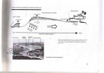
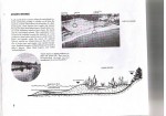
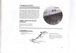
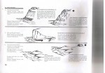
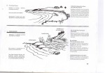
This booklet was written in the 1970’s based on the report done by Dr. Wolf Bauer.

Click on the icon of each page of the gallery to view.


District of Metchosin Official Community Plan Section on Marine Shorelands

Documents Presented in the past to Metchosin Council
There is a history of concern about the values associated with the coastal part of Metchosin, the following examples illustrate this.

From  the Official Community Plan of Metchosin, the following references pertain to Marine Shorelands.

Section 2.6 MARINE SHORELANDS:

Definition: Within Metchosin, there are Rocky Shores, Drift Sector Beaches, Pocket Beaches, Low- Energy Shores and Lagoon Ecosystems, as shown on Marine Shorelands, Map 5. In addition, the two types of beaches are further categorized into three distinct classes of beach based on the accretion and erosion characteristics. The combinations of shore categories and distinct beach classes produce a diverse range of marine shorelands. Most of the geotechnical and environmental concerns about shores relate to the processes of drift and accretion along the shore and the process of slope regression above the shores.

(a) General Marine Shoreland Policies:

2.6.1 The District of Metchosin may give consideration to the following:

.    (1)  discuss with senior levels of government for coordinating future land use policies as they pertain to the management of Metchosin’s marine shorelands.

.    (2)  monitor shore processes with particular concern for slope regression rates,lateral drift rate and stability of Class I accretion beaches.

.    (3)  determine,in conjunction with the Ministry of Environment, Lands and Parks, ways and means of undertaking:

(a)  where desirable and feasible, a program of beach stabilization using natural nonstructural techniques, such as the planting of dune grasses where appropriate;

(b)  beach enhancement programs wherever it is possible to upgrade a Class II beach to a Class I beach (see Definitions of beaches); and

(c)  the removal or reduction of development intrusions not consistent with the maintenance of the shoreline.

2.6.2. The set back requirements specified in this Section may be increased as local conditions warrant.

2.6.3  The improvement of public access should be ensured in the course of land development where such access is not detrimental to Sensitive Environments.

2.6.4  Any desired works to be placed on foreshore lands from the mean high water mark seaward requires application to the appropriate provincial and/or federal government agency responsible.

2.6.5  Public recreational use of marine shorelands should be consistent with the suitability of each shore type for the proposed use.

(b) Rocky Shores:

Definition: Rocky shores are stable shores comprised of exposed bedrock with an absence of unconsolidated material at extreme low tide. Relative to other types of shores, they are low in biological productivity but rich in biotic diversity and aesthetic quality and are characterized by lichens, snails, barnacles, mussels, seaweeds, anemones and sea stars.

.    2.6.6  No building or structure shall be located and no fill shall be placed or removed from any site within 15 horizontal metres (50 feet) of mean high water on Rocky Shore slopes except where engineering and resource management studies indicate that a lesser setback is acceptable.

.    2.6.7  Although the biological capability of Rocky Shore slopes to support life is relatively low, the natural biota may provide habitat for rare species of animal life and that value should be considered with each development proposed.

(c) Drift-Sector Beaches:

Definition: A Drift-Sector is an integrated and independently operating erosion beach system which may extend for many miles in length and be separated from adjacent drift-sectors by either natural or artificial boundaries. Metchosin contains one large drift-sector extending from Weir Beach to Witty’s Lagoon. A drift-sector generally contains the following three classes of beaches:

Class III Beaches are erosional beaches located at the base of coastal bluffs or cliffs from which sand and gravel is provided for accretion of Class I beaches further along the drift-sector. Class III beaches are totally submerged at high tide with no dry backshore berm.

Class II Beaches are marginal erosion beaches located at the base of coastal bluffs or cliffs from which sand and gravel is eroded providing a secondary source of beach material for accretion on Class I beaches further along the drift-sector. Class II beaches are largely submerged at high tide with only a limited amount of walkable dry backshore under such conditions.

– 15 –

Class I Beaches are the accretion terminals of a drift-sector where material eroded from Class II and III beaches is deposited. Class I beaches remain dry and walkable at high tide and have a large backshore berm permitting ease of public access and use. They constitute the most important recreational beaches. Biotically, beach shores are of intermediate productivity and diversity relative to the other shore types.

.    2.6.8  The use and management of the Drift-Sector Beaches should be based on the maintenance of the present natural system of erosion, transport and build up of beach material along the length of the Drift-Sector designated on Map 5.

.    2.6.9  Because the existence and maintenance of the Class I beaches are dependent on the supply of material eroded from Class II and III beaches, no bulkheading or placement of any shore protection structures will be permitted within a drift-sector except where engineering and resource management studies indicate otherwise.

.    2.6.10  To ensure that material eroded from Class II and III beaches is transported the full length of the shoreline to Class I beaches, docking or other facilities which impede the natural processes will not be permitted within drift-sectors.

.    2.6.11  Due to active slope recession with considerable sloughing and slide evidence, no building or structure will be permitted within a minimum of 60 horizontal metres (200 feet) from mean high water adjacent to Class II and Class III drift-sector beaches except where geotechnical engineering and resource management studies indicate a lesser setback is acceptable.

.    2.6.12  On the slopes adjacent to Drift Sector Beaches, no material of any kind shall be removed within a minimum of 60 horizontal metres (200 feet) landward of mean high water.

.    2.6.13  The location of the mean high water mark and the establishing of setbacks from Class II and Class III slopes should be reviewed at 5 year intervals, or as required, to determine if slope regression has placed residences at risk.

(d) Pocket Beaches:

Definition: A Pocket Beach is a sand and gravel beach along which no lateral drift of beach material takes place because it is contained between two headlands. The Pocket Beach is formed by the onshore and offshore movement of material. Pocket beaches are generally between 30.5 metres (100 feet) and 91.5 metres (300 feet) in length.

With Pocket Beaches, as with Drift-Sector Beaches, there are three classes. However, unlike the classes of Drift-Sector Beaches which are contained adjacent to one another within the Drift- Sector. Each class of Pocket Beach exists independently.

Class III Beaches are erosional beaches located at the base of coastal bluffs or cliffs with no dry backshore berm. Such beaches are totally submerged at high tide.

– 16 –
Class II Beaches are marginal erosion beaches located at the base of coastal bluffs or cliffs that supply the upper foreshore with a fairly heavy drift berm without creating a stable dry backshore zone above high tide.

Class I Beaches are rollback pocket beaches characterized by a backshore wetted only under extreme tide and wave conditions permitting ease of public access and use. They constitute the most important recreational class of beach.

.    2.6.14  No building or structure shall be located and no fill shall be placed or removed from any site within 15 horizontal metres (50 feet) of mean high water adjacent to Class I and Class II pocket beaches except where engineering and resource management studies indicate that a lesser setback is acceptable.

.    2.6.15  Because Class III pocket beaches are located at the base of cliffs which are subject to erosion, no building or structure, no placing or removal of fill or other material will be permitted within 15 horizontal metres (50 feet) landward of mean high water adjacent to Class III pocket beaches.

.    2.6.16  No bulkheading or placement of any shore protection structures will be permitted on Class I, Class II or Class III pocket beaches except where engineering and resource management studies indicate otherwise.

(e) Low-EnergyShoreZone

Definition: Low-Energy Shores are estuarine shores which form part or all of a cove or inlet. They may be characterized by marshy shores, shallow and muddy foreshores, and generally having low banks. As with Pocket Beaches, there are three classes of Low-Energy Shores each existing independently. However, in Metchosin, there is only one Low-Energy Shore – entirely a Class III (erosional) located at the head of Pedder Inlet.

Similar to a Lagoon Ecosystem, the estuarine shore also provides a unique biological environment. Fresh-water creeks and streams flowing into the cove or inlet offer rather unusual habitat. There is currently insufficient information available relating to the protection and preservation of the Low-Energy Shore zones. Therefore, further research is recommended.

.    2.6.17  No building or structure shall be located and no fill shall be placed or removed from any site within 15 horizontal meters (50) feet of mean high water adjacent to the Low-Energy Shore, except where engineering and resource management studies indicated that a lesser setback is acceptable.

.    2.6.18  No bulkheading or placement of any shore protection structures will be permitted on a Low- Energy Shore except where engineering and resource management studies indicate otherwise.
– 17 –

(f) Lagoon Ecosystems:

Definition: The central component of a Lagoon Ecosystem is a body of salt water which has been cut off from the ocean by a barrier or spit of land and which allows the formation of a sheltered biological environment. This unique environment frequently includes a salt-water marsh and estuarine area into which flows fresh water from upland creeks and streams. This combination of fresh and salt water has very high biological productivity and diversity. It offers significant aesthetic and habitat attributes.

2.6.19 Only such uses as limited agriculture and low intensity recreational uses, which do not require structural intrusion, will be permitted in Lagoon Ecosystems.


Sustainability Report Marine References: 2011

In  the Sustainability Report of MEASC to Council of 2011: ( This report has been shelved by council ), The following recommendations were made:

Recommendations from Sustainability 2011 Report:

Metchosin’s existing shoreline slopes development permit area, large lots and low density zoning have helped to reduce development impacts along coastlines, and have protected marine coastal habitat and its ability to store and sequester carbon.

Metchosin will help achieve sustainability and resiliency in its coastal areas by implementing the following:

  • Lobby senior governments to recognize that municipalities are often the first to notice problems along their marine coasts and municipalities need the authority to protect these ecosystems;
  • Consider zoning all marine shorelines in Metchosin as a development permit area in order to protect their natural values;
  •  Establish a program to document and monitor coastal resources, including eel-grass and kelp beds, and forage fish habitat, with the goal of ensuring no net loss of those resources;
  • Identify and map areas important to forage fish and consider a method of restricting beach fires and other damaging activities in these areas at times of the year which are sensitive for forage fish.
  • Emergency Preparedness Program – know who to contact, how, when where, why and in what circumstances
  • Produce a pamphlet and  to help educate both .the public, and land \owners with property bordering on the shoreline, of the sensitivity of coastal ecosystems, in order to reduce harmful impacts on coastal ecosystems.
  • Post essential messages from and distribute Transport Canada’s boaters guide at key locations to educate public.  


Projected Sea Level Changes for British Columbia in the 21st Century

This federal Govt. report from December 2008 was based on a report by R.E. Thomson, B.D., Bornhold and S. Mazzotti,

“An Examination of the Factors Affecting Relative and Absolute Sea Level in British Columbia”  Canadian Technical Report of Hydrography and Ocean Sciences 260, Fisheries and Oceans Canada (2008); both of these reports are a result of a joint project between Fisheries and Oceans Canada, Natural Resources Canada and the Province of British Columbia.

For the complete document, see:

http://www.env.gov.bc.ca/cas/pdfs/sea-level-changes-08.pdf

Summary

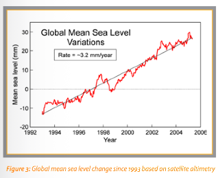
globalsealevelThe 21st century is expected to witness a continued rise in global average sea level as a result of the melting of continental glaciers and ice caps, and warming (expansion) of the upper ocean. At the regional scale, sea level will change in response to these global effects, as well as local effects, including ocean and weather conditions and
vertical movements of the land due to geological processes. Consequently, the expected changes in sea level for the British Columbia coast will differ from the global projections; they will not be uniform. For instance, estimates of most probable sea level rise range from 11 cm at Nanaimo to more than 50 cm in parts of the Fraser River delta. Because of the many uncertainties in measuring past sea level
changes and predicting future sea levels, the possible range could be much greater. Applying a possible, but extreme, global rise rate, sea level could rise 80 cm for Nanaimo and 120 cm for the Fraser River delta by 2100.
The anticipated changes in sea level could have significant consequences for areas currently protected by dikes (such as the Fraser and Squamish deltas), where coastal erosion is already an issue (eastern Graham Island, Haida Gwaii), or where development and harbour infrastructure is close to present high tide limits.
Of particular concern will be extreme weather events, such as storm surges, occurring at the same time as these high sea levels. These extreme events can add as much
as one metre to sea levels, regardless of local shoreline features and waves.

This report summarizes the current scientific knowledge on projected sea level changes as it applies to B.C. during the 21st century to inform decision-making and planning by coastal communities and other authorities. It is a summary of a technical report entitled “An Examination of the Factors Affecting Relative and Absolute Sea Level in Coastal British Columbia” by R.E. Thomson, B.D. Bornhold and S. Mazzotti
(2008) in conjunction with Fisheries and Oceans Canada and Natural Resources Canada.

Metchosin Marine Issues, an Expression of Concern.

The Unique Value of our Coastal Ecosystems

The Coastal Resources of Metchosin are a valuable form of Natural Capital that must have special consideration when Development Planning is done in the District.   The Crown owns the foreshore to the high tide mark, and although one would think this allowed protection, there are still considerable threats to the ecological integrity of this area, which must be considered. The shoreline is an interface between two systems, the terrestrial uplands and the open ocean. As typical of any natural system, one cannot separate them in terms of management decisions, as they have processes, which interact.   Community members of a progressive coastal community should tolerate no activities involving human action that contribute to any level of destabilization or decline of our present shoreline ecosystems.

Along our shorelines in Metchosin, we have a variety of unique marine ecosystems.

  • Tidal marshes,
  • lagoons,
  • estuaries,
  • bays,
  • eel-grass beds,
  • high speed current channels,
  • underwater caves,
  • vertical underwater cliffs,
  • boulder beaches,
  • sand beaches,
  • and pebble (pocket) beaches.

Every metre of coastal intertidal zone also has a characteristic set of organisms, which can be impacted by actions of humans either from the land side or the ocean side.  Larger commercial species of fish often feed or spawn near the shoreline interface, juvenile fish migrate along shorelines, often relying on protective habitat of overhanging vegetation or kelp beds, and the energy flow in the food webs of at least 7 local marine mammal species are directly affected.

It is further recognized that a viable commercial crab fishery, as well as an extensive sports fishery operates along the coastal areas of Metchosin.

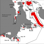
Rockfishconservationareas19_20 The ocean environment in the area of Race Passage has also been recognized as an important habitat for the regeneration of Rockfish stock leading to the creation of a DFO rockfish conservation areas where all fishing is prohibited.


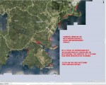
anthroimpactThis file and map of the the Metchosin Shoreline shows the major areas where humans have modified the habitat, often resulting in ecosystem modification and loss of habitat for local species of fish, invertebrates and marine mammals. The term Anthropogenic refers to human modification.


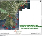
ecoareasThis file contains a map with the ecologically sensitive areas of Metchosin’s Coastal Ecosystems.
Terrestrial Threats:

  • Erosion from road building, utility and sewer installation, subdivision development carrying silt into the receiving waters has a negative impact on filter feeders (e.g. Clams, mussels and anemone) in the ocean.
  • Crushed rock deposited in upland areas in road building and building lot creation may have serious toxic impacts on marine life as water leaches through it carrying dissolved metallic ions to the sea.
  • Accidental or planned deposition of hazardous materials in soils can also lead to leaching to the marine waters.
  • Deforestation on upland slopes leads to deterioration of coastal ecosystems.
  • Channelization of streams leads to silt output and increased fresh water flow to ocean environments.
  • Human traffic, (especially horses) on beaches can severely impact on spawning areas of needle fish (on Taylor beach)
  • Uncontrolled dogs can have a serious impact on feeding patterns of shorebirds- especially crucial during migration.
  • Humans and dogs on beaches can impact on molting elephant seals.
  • Beach debris can be washed seaward, to be ingested by marine animals.
  • Oil and chemicals from storm sewer drains is toxic to marine creatures.
  • Building too close to cliffs can lead to destabilization and therefore slumping of land into the ocean. This is especially of concern along the cliffs of Parry Bay and Albert Head.
  • Sewage disposal on land in septic fields, contributes a large nutrient load as it leaches through to the shoreline. The heavy die-off of algal growth on Weir?s beach annually, is evidence of this.
  • Development on the coastline as has recently occurred South of Devonian Park can lead to alteration of the coastal resource, habitat smothering and destruction, and increases shoreline erosion risk.
  • Backshore alteration of any beach habitat for intended purposes of bank stabilization, inevitably in the long run leads to shorefront habitat deterioration.

Marine Threats:

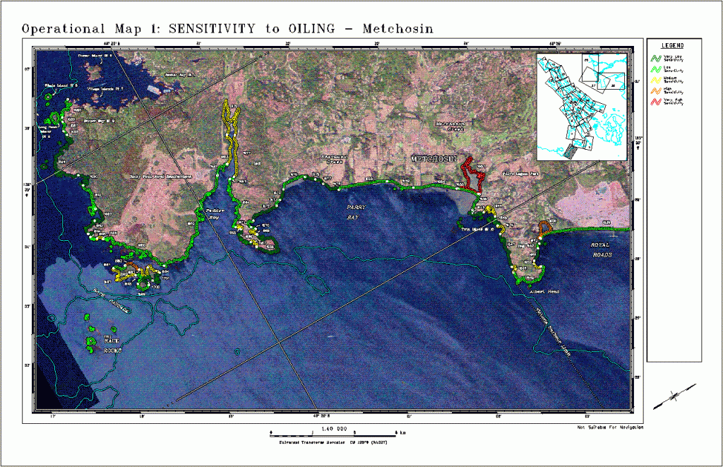
Tanker traffic very close to our shores, poses a continual risk of oil and chemical spills. In the areas shown in the map, red indicates highly sensitive and a long term residency of oil. Yellow indicates a lesser residence time of oil. Green indicates a faster cleanup may be possible because of exposure to waves and currents. See this reference on Threats from tanker traffic 

  • Increase in cruise lines in recent years has a potential to impact our coastal resources.
  • Increasing fast boat traffic is hazardous to harbour seal pups and slow moving marine mammals (such as elephant seals) in particular.  It also increases rates of coastal erosion in sheltered bays.
  • Boat motor sound underwater affects animals relying on the underwater seascape for communication.
  • whalewiseWhale watching boating patterns have an impact on the time whales can spend foraging in the area.


  • Antifouling compounds on ships (some military) and in boats in marinas provide a further risk to the marine environment

Return to MetchosinCoastal

Originally published by G.Fletcher in 2004.