Multiscale impacts of armoring on Salish Sea shorelines: Evidence for cumulative and threshold effects

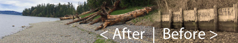
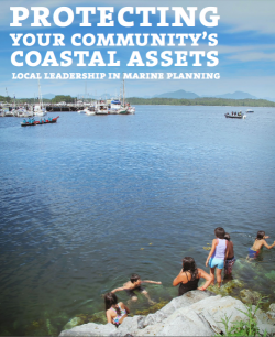
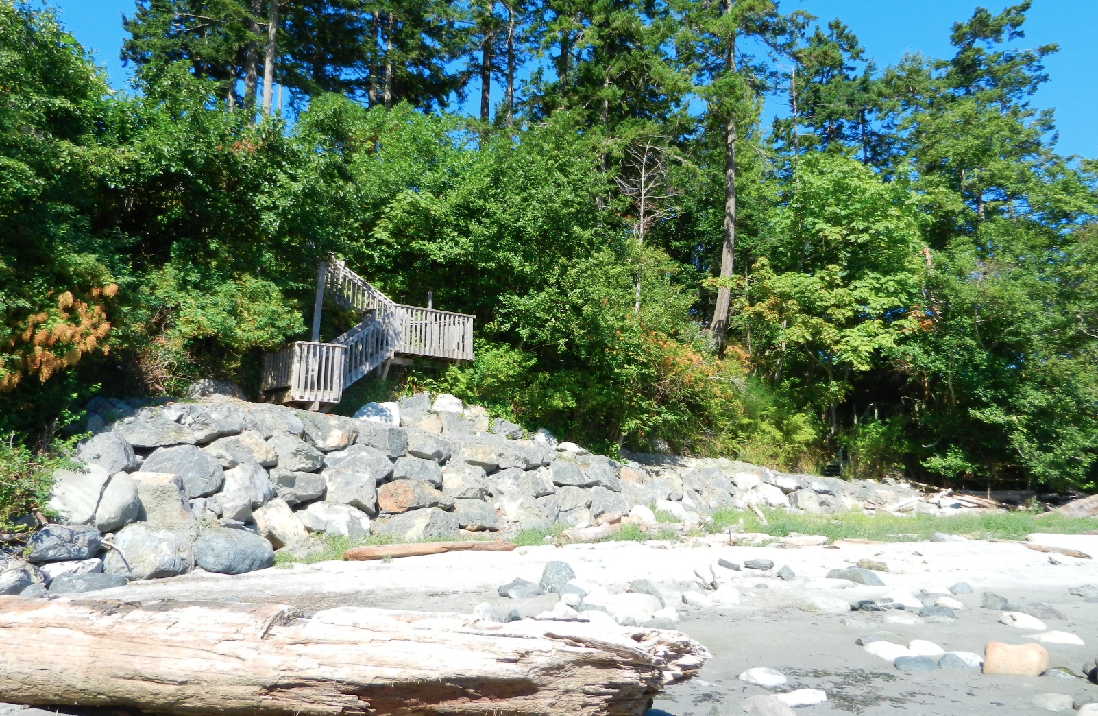
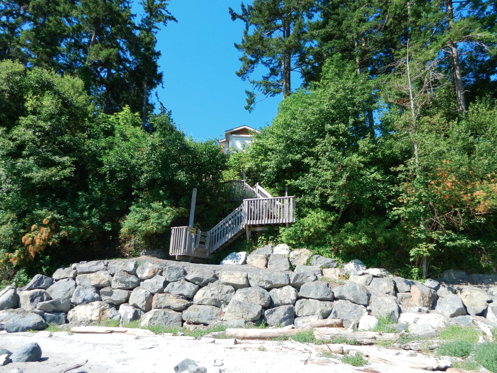
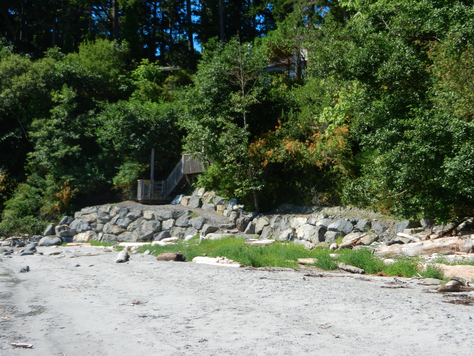
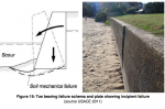
This article is of particular importance to Metchosin since we have ongoing efforts in creating seawalls with the intent of protecting property.

https://www.researchgate.net/publication/299590287_Multiscale_impacts_of_armoring_on_Salish_Sea_shorelines_Evidence_for_cumulative_and_threshold_effects

Multiscale impacts of armoring on Salish Sea shorelines: Evidence for cumulative and threshold effects Megan N. Dethier a, * Jeffery R. Cordell c

a Friday Harbor Laboratories, University of Washington, Friday Harbor, WA 98250, USA
b Skagit River System Cooperative, LaConner, WA 98257, USA c School of Aquatic and Fishery Sciences, University of Washington, Seattle, WA 98195, USA d School of Oceanography, University of Washington, Seattle, WA 98195, USA e Washington State Department of Natural Resources, Olympia, WA 98504, USA, Wendel W. Raymond a, Andrea S. Ogston d, Aundrea N. McBride b, Sarah M. Heerhartz c

abstract:

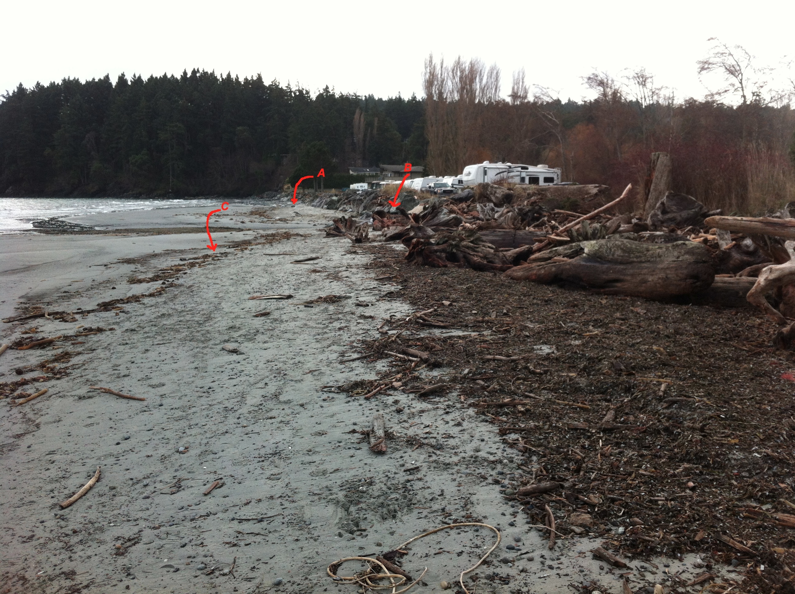
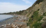
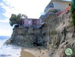
Shoreline armoring is widespread in many parts of the protected inland waters of the Pacific Northwest,U.S.A, but impacts on physical and biological features of local nearshore ecosystems have only recently begun to be documented. Armoring marine shorelines can alter natural processes at multiple spatial and temporal scales; some, such as starving the beach of sediments by blocking input from upland bluffs may take decades to become visible, while others such as placement loss of armoring construction are im-
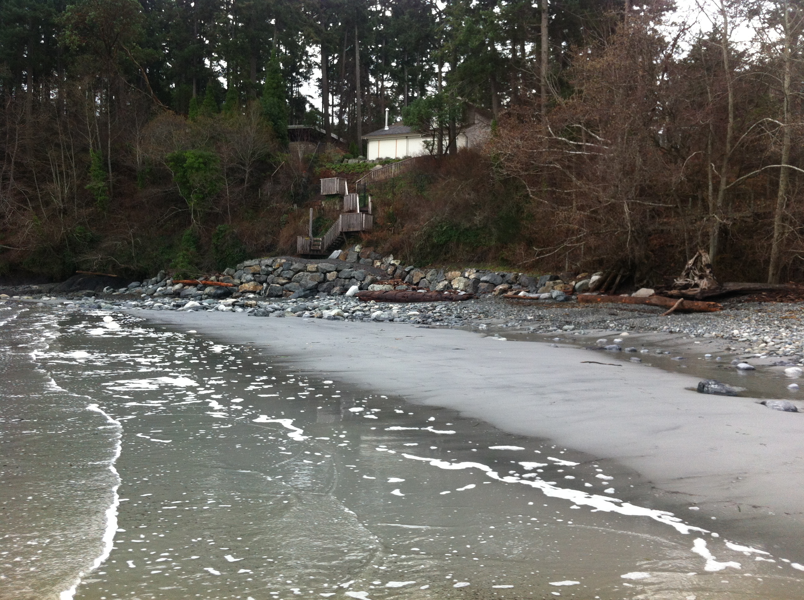
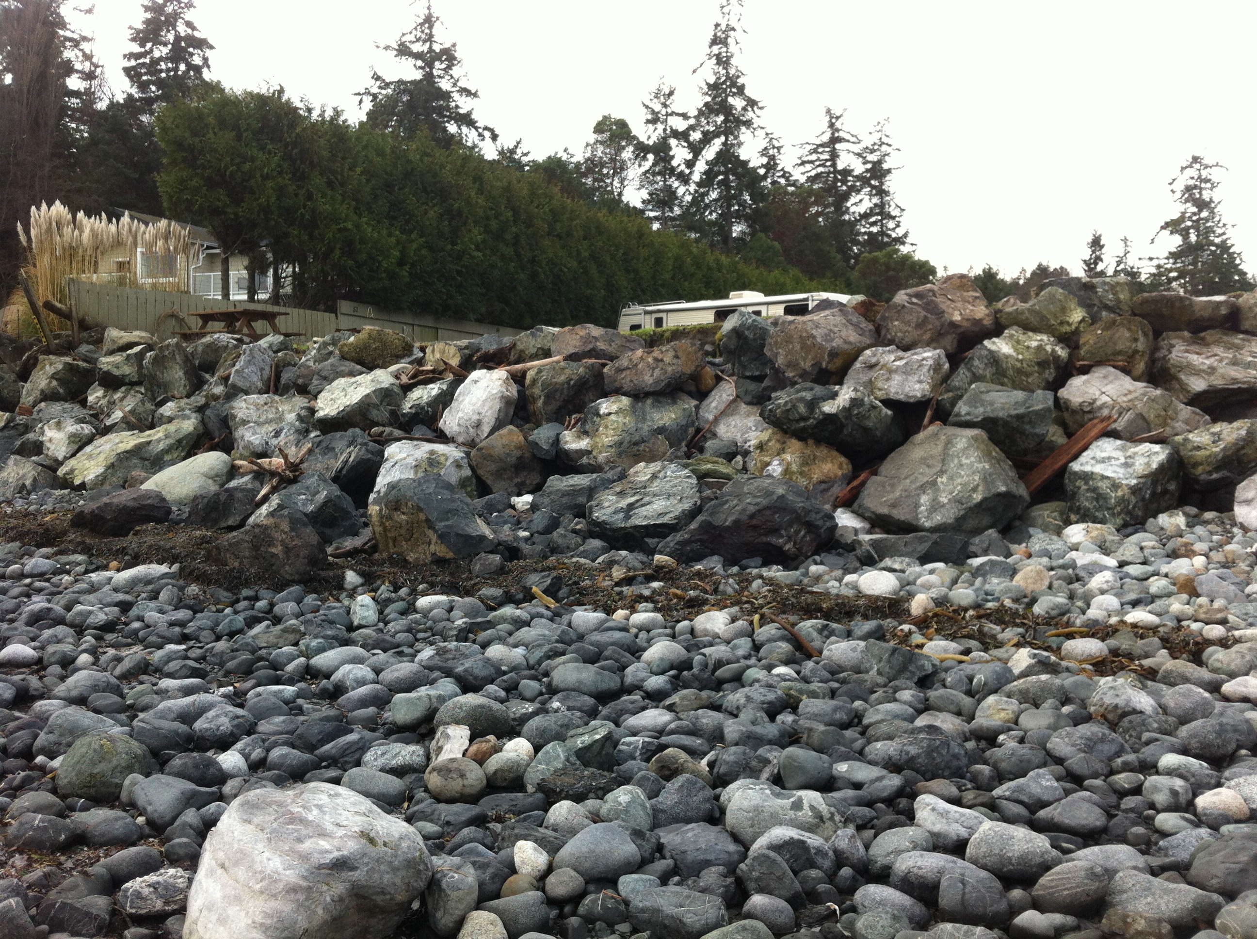
mediate. We quantified a range of geomorphic and biological parameters at paired, nearby armored and unarmored beaches throughout the inland waters of Washington State to test what conditions and parameters are associated with armoring. We gathered identical datasets at a total of 65 pairs of beaches: 6 in South Puget Sound, 23 in Central Puget Sound, and 36 pairs North of Puget Sound proper. At this broad scale, demonstrating differences attributable to armoring is challenging given the high natural variability in measured parameters among beaches and regions. However, we found that armoring was
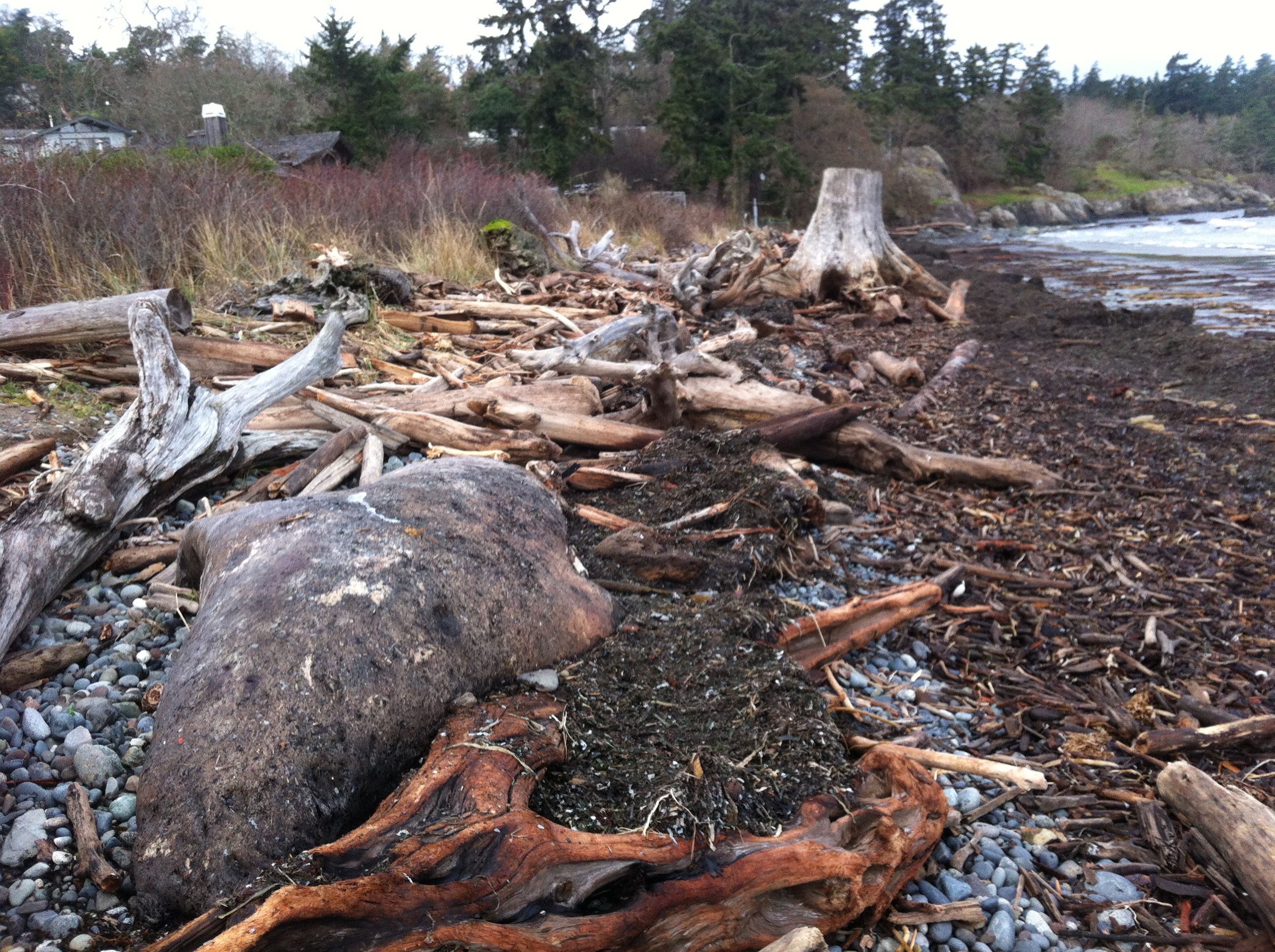
consistently associated with reductions in beach width, riparian vegetation, numbers of accumulated logs, and amounts and types of beach wrack and associated invertebrates. Armoring-related patterns at lower beach elevations (further vertically from armoring) were progressively harder to detect. For some parameters, such as accumulated logs, there was a distinct threshold in armoring elevation that was associated with increased impacts. This large dataset for the first time allowed us to identify cumulative impacts that appear when increasing proportions of shorelines are armored. At large spatial and temporal scales, armoring much of a sediment drift cell may result in reduction of the finer grain-size
fractions on beaches, including those used by spawning forage fish. Overall we have shown that local impacts of shoreline armoring can scale-up to have cumulative and threshold effects – these should be considered when managing impacts to public resources along the coast. © 2016 Elsevier Ltd. All rights reserved.

Rethinking Shoreline Armoring

Given the many occurances of slumping of coastal bluffs in Metchoisn over the past winter, this series provides an excellent analysis reflecting on the effects of human interference in natural shoreline processes and the mitigation efforts being made in Puget Sound.

Rethinking shoreline armoring

Before and after view of shoreline restoration project at Penrose Point State Park in Pierce County, WA.

Salish Sea Currents presents an in-depth series focusing on shoreline armoring in the Puget Sound region. Close to a third of Puget Sound’s shoreline is classified as armored with bulkheads and other structures meant to hold back storm surge and erosion. But new studies reveal the often significant toll this is taking on the environment. To be notified of new Salish Sea Currents stories, subscribe to the Puget Sound Institute eNews.

Post North-easterly Storm on Weir’s beach, Dec 2014

During the past few weeks, we have experienced several storms out of the north east at high tide. These images were taken to document some of the on-going problems from the extensive rip-rapping and seawall construction on that beach. See this page for summer 2013 images for comparison.

2014-12-26 weirserosion2

The solid sea-wall built only last year will lead to increased scouring and removal of sand. Unfortunately it will not only affect the crown land property in front of the wall, but the crown land foreshore adjacent to this property .


2014-12-26 weirserosin

Recent storms have dislodged many of the boulders near the south end of the beach. Note the rubble foreground which was previously sand beach.

2014-12-26 controlgate

This concrete control gate was built many years ago to control flooding into a lagoon. The rip-rap boulders around it have been disturbed by wave action.

2014-12-26 weirsbeachwidth

Site A= south end of the beach-sand eroded from base of rip-pap wall. Site B The border of where the rip-rap ends and the natural beach (going northward,) begins. C=the widened sand beach area backed by the natural beach. Scouring of the sand does not occur as it does further south on the beach.

2014-12-26 natural-portion

The berm on the North end of Weir’s beach is in a more natural state with logs and debris thrown up by storms. The and natural beach vegetation and debris absorbs the impact of the ocean energy and no scouring of the beach sand has occurred. This will lead to long-term beach stability and erosion-resistance.

See other posts and references on hardening of the shorelines by clicking on links below.
See this file on early pictures of Weir’s beach

Coastal erosion as a sediment source – implications for shoreline management

Puget Sound Feeder Bluffs: Coastal erosion as a sediment source and its implications for shoreline management Shipman et al 2014 .
See the PDF: pugetsoundhardening1406016

feederbluffreport

This report examines the role of eroding bluffs as a source of sediment for Puget Sound beaches and includes a review of related geology and coastal processes. It summarizes recent mapping of feeder bluffs and examines ways in which this information can be used to improve shoreline management.

This report is one part of a larger project on Puget Sound feeder bluffs that also includes maps and a series of web pages that cover much of the material in this report. The project was funded by EPA and the WA Department of Fish and Wildlife. Hugh Shipman and colleagues  published this  important report on feeder bluffs processes and management. Coastal Watershed Index of Port Angeles has been working on the complex and critical topic of feeder bluff management for over a decade. One of their biggest challenges is imparting the critical and unique elements of feeder bluff function and management (including the reality that there are no ‘soft armoring’ techniques appropriate for this land form ). This report provides scientific and management focus specifically to feeder bluffs of the Salish Sea- it’s long overdue.


feederbluffmaps


Part 2 is of the maps of feeder bluffs of Puget sound:


Accessed Nov 4, 2014 at :
https://fortress.wa.gov/ecy/publications/SummaryPages
Maps:
https://fortress.wa.gov/ecy/publications/publications/1406016part2.pdf/1406016.html.

See More on Feeder Bluff mapping:


Publication: Protecting Your Communities Coastal Assets

Local Leadership in marine planning: Local governments on B.C.’s Coast have the power to protect the ecosystems we depend on.

This report describes easily accessible resources local governments can use to maintain aquatic Ecosystem Value and Productivity, including maps and tools to guide decisions and bylaws regarding management of activities on land , and in intertidal and sub-tidal zones.

protectingassetsicon


Download .pdf from this website

or

Originally available here:
powerinhands

New Seawall on Weir’s Beach

Over the summer of 2013, a new seawalll was built at the south end of Weir’s beach. The purpose of the wall is not obvious, other than to create a walkway to the ocean for the residence above.
The provincial government owns the ocean floor and the foreshore (the area between the low water level and the natural boundary) along Metchosin’s Coastline. This structure sits within this foreshore area, as there is sand at it’s base,  so it is questionable how this shoreline modification was permitted.

UPDATE:

  •  Under the General  Marine Shoreline policies desired works require application to the appropriate Provincial/and or Federal agencies responsible.  This particular property located at 5289 William Head Road was able to proceed under the following conditions: 
  • 1. Requirements of the Department of Fisheries & Oceans must be fulfilled.
  • 2. Any work below the high water mark must have the approval of the Ministry Forests, Lands & Natural Resource Operations
  • 3.  Work was  conducted in April according to the measures outlined in the Ryzuk Geotechnical Report dated March 7, 2013 and the report by Lehna Malmkvist, Swell Environmental Consulting Ltd., March 8, 2013

———————————————————————————————————–

Readers are recommended to read all parts of the publication below before attempting any alterations on shorefront property:

Coastal Shore Stewardship: A Guide for Planners, Builders and Developers on Canada’s Pacific Coast

Another reference on hardening the shorelines states the problem rather plainly: “Hard structures, especially vertical walls, often create conditions that lead to failure of the structure. In time, the substrate of the beach coarsens and scours down to bedrock or a hard clay. The footings of bulkheads are exposed, leading to undermining and failure. … Failed bulkheads and walls adversely impact beach aesthetics, may be a safety or navigational hazard, and may adversely impact shoreline ecological functions.”

southendstairnorth

View of the seawall from the south.

southendstairway

View of the seawall from the beach directly in front.

seawallfrombeach

View of sea wall from the north.

Metchosin Shoreline Report : MEASC 2013

The Metchosin Environmental Advisory Select Committee of  Metchosin District submitted this report to Council in June  2013.

See the complete report as a  PDF: Metchosin Shoreline Report 2013June 10-2

Executive Summary

The unique values attributed to the Coastal Areas of Metchosin have been recognized both historically and by outside researchers. They have also been outlined at length in the Official Community Plan and other documents produced for the District.

The objective of the Metchosin Shoreline Report is to provide Mayor and Council with a background document and decision-making tools for issues related to Metchosin’s shoreline environment: the jurisdictional boundaries are delineated; examples of ecologically sensitive areas are highlighted; and the biological and geographical values of eight zones of the forty-five km of shoreline are profiled.

The values of biodiversity, education, natural capital, aesthetics, philosophy, and ecotourism are all affected by our coastal areas. Therefore, the risks from human activity on the sustainability of these areas are emphasized.

With the increasing likelihood of changing climatic events impacting on our shoreline, and in order to mitigate these risks, a number of recommendations are proposed for the Municipality to implement:

  1. Create a development permit zone in the area between the end of provincial jurisdiction at the high water mark and the end of the high tide storm-driven wash on the landowner’s property.
  2. Prevent the human caused hardening of the shoreline by sea walls, roadways or bulkheading, and shoreline modifications.
  3. Design a “Coastal Covenant,” which landowners could sign, in order to guarantee the protection of the integrity of their section of shoreline.
  4. Establish and protect vegetation buffer zones along streams and along the total shoreline, including special attention to salt marshes and eelgrass beds.
  5. Protect eelgrass beds by eliminating damage from log booms, docks and other structures.
  6. Divert runoff of fertilizers, pesticides and herbicides from streams and surrounding farmlands away from shoreline, salt marsh, and seagrass habitats.
  7. Develop emergency response plans for the District in the event of a land or ocean-based toxic spill, which could potentially threaten the shoreline.

See the complete report as a  PDF: Metchosin Shoreline Report 2013June 10-2


Hardening of the Shorelines: Principles

The following is from :
Shorelines Modification , by the State of Washington Dept of Ecology

(ii) Principles. Shorelines are by nature unstable, although in varying degrees. Erosion and accretion are natural processes that provide ecological functions and thereby contribute to sustaining the natural resource and ecology of the shoreline. Human use of the shoreline has typically led to hardening of the shoreline for various reasons including reduction of erosion or providing useful space at the shore or providing access to docks and piers. The impacts of hardening any one property may be minimal but cumulatively the impact of this shoreline modification is significant.

Shoreline hardening typically results in adverse impacts to shoreline ecological functions such as:

  • Beach starvation. Sediment supply to nearby beaches is cut off, leading to “starvation” of the beaches for the gravel, sand, and other fine-grained materials that typically constitute a beach.
  • Habitat degradation. Vegetation that shades the upper beach or bank is eliminated, thus degrading the value of the shoreline for many ecological functions, including spawning habitat for salmonids and forage fish.
  • Sediment impoundment. As a result of shoreline hardening, the sources of sediment on beaches (eroding “feeder” bluffs) are progressively lost and longshore transport is diminished. This leads to lowering of down-drift beaches, the narrowing of the high tide beach, and the coarsening of beach sediment. As beaches become more coarse, less prey for juvenile fish is produced. Sediment starvation may lead to accelerated erosion in down-drift areas.
  • Exacerbation of erosion. The hard face of shoreline armoring, particularly concrete bulkheads, reflects wave energy back onto the beach, exacerbating erosion.
  • Ground water impacts. Erosion control structures often raise the water table on the landward side, which leads to higher pore pressures in the beach itself. In some cases, this may lead to accelerated erosion of sand-sized material from the beach.
  • Hydraulic impacts. Shoreline armoring generally increases the reflectivity of the shoreline and redirects wave energy back onto the beach. This leads to scouring and lowering of the beach, to coarsening of the beach, and to ultimate failure of the structure.
  • Loss of shoreline vegetation. Vegetation provides important “softer” erosion control functions. Vegetation is also critical in maintaining ecological functions.
  • Loss of large woody debris. Changed hydraulic regimes and the loss of the high tide beach, along with the prevention of natural erosion of vegetated shorelines, lead to the loss of beached organic material. This material can increase biological diversity, can serve as a stabilizing influence on natural shorelines, and is habitat for many aquatic-based organisms, which are, in turn, important prey for larger organisms.
  • Restriction of channel movement and creation of side channels. Hardened shorelines along rivers slow the movement of channels, which, in turn, prevents the input of larger woody debris, gravels for spawning, and the creation of side channels important for juvenile salmon rearing, and can result in increased floods and scour.

Additionally, hard structures, especially vertical walls, often create conditions that lead to failure of the structure. In time, the substrate of the beach coarsens and scours down to bedrock or a hard clay. The footings of bulkheads are exposed, leading to undermining and failure. This process is exacerbated when the original cause of the erosion and “need” for the bulkhead was from upland water drainage problems. Failed bulkheads and walls adversely impact beach aesthetics, may be a safety or navigational hazard, and may adversely impact shoreline ecological functions.

Hard” structural stabilization measures refer to those with solid, hard surfaces, such as concrete bulkheads, while “soft” structural measures rely on less rigid materials, such as biotechnical vegetation measures or beach enhancement. There is a range of measures varying from soft to hard that include:

  • Vegetation enhancement;
  • Upland drainage control;
  • Biotechnical measures;
  • Beach enhancement;
  • Anchor trees;
  • Gravel placement;
  • Rock revetments;
  • Gabions;
  • Concrete groins;
  • Retaining walls and bluff walls;
  • Bulkheads; and
  • Seawalls.

Generally, the harder the construction measure, the greater the impact on shoreline processes, including sediment transport, geomorphology, and biological functions.

The Effect of Seawalls

“Seawalls damage virtually every beach they are built on. If they are built on eroding beaches—-and they are rarely built anywhere else,—-they eventually destroy the beach. ”  –Cornelia Dean, (Science Editor of the New York Times) Against the Tide, The Battle of America’s Beaches 53 (1999) 

A serious problems which has developed on the coastline  of Metchosin, is the building of seawalls under the pretext of protecting private property from erosion. Owners of properties along a coast are often not aware of the mechanics of the interaction with ocean energy of the shoreline. After an intense storm, evidence of erosion along a shore-front often leads land owners, desperate to save their property to go to often very expensive extremes in order to try to protect their property.

A survey of literature from various parts of the world indicates this is not only a local problem, but is indeed very wide spread. The series of photographs documented on this website from Puget Souperkinslane_pugetsoundnd, show the problem not far from our shores. We should consider ourselves lucky so far in Metchosin as we have yet to experience the disasters that have happened in Puget Sound.  This link to an Image Gallery shows how bad it could get:


Impact of Coastal Erosion in Australia 7 Mar, 2013
Senior Coastal Scientist at Coastalwatch Professor Andrew Short has compiled a comprehensive piece focusing on coastal erosion in Australia.

For the 50% of the Australian coast that is composed of sand and in some places mud, the shoreline is prone to change, building seaward and in some places eroding landward. In most locations this is a natural process with usually no impact on human settlement. Coastal protection of the shoreline is rarely required in Australia, however in a few locations the dynamic shoreline has become a problem, in some cases a major and expensive problem, and in almost all of these cases the problem is related to human interference or encroachment on the shoreline. Coastal protection works, such as breakwaters, groynes, or seawalls, are usually built to guard against erosion. In doing so they harden the coast and reduce its ability to adjust naturally. As a consequence, these defences can exacerbate further erosional problems, with seawalls reflecting and concentrating wave energy and erosion, and groynes starving downdrift the coast of sediment thereby leading to further erosion. There are areas where human have encroached into the dynamic beach environment only to suffer the consequences, and others where they have interfered with coastal processes leading to accelerated coastal erosion.

The Utilization of Seawalls in Response to Shoreline Erosion Consequences, Socio-Economic, Political and Legal Forces, and Alternatives Shawn W. Kelly , Donald Bren School of Environmental Science and Management University of California, Santa Barbara November 30, 2000

Executive Summary
See the full PDF version: Seawall

seawallWhen coastal buildings or roads are threatened, the typical response is to harden the coast with a seawall. Seawalls run parallel to the beach and can be built of concrete, wood, steel, or boulders. Seawalls are also called bulkheads or revetments; the distinction is mainly a matter of purpose. They are designed to halt shoreline erosion caused primarily by wave action. If seawalls are maintained, they may temporarily hold back the ocean from encroaching on shoreline development. In spite of their ability to hold back the ocean, when waves hit a seawall, the waves are reflected back out to sea, taking beach sand with them and eventually causing the beach to disappear. Moreover, seawalls can cause increased erosion at the ends of the seawall on an adjacent beach that is not walled. Alternatives to seawalls exist, such as beach nourishment and managed retreat. Making coastal land use decisions that ensure a seawall will not be needed in the
future to protect structures, however, is the most prudent coastal management solution. This can be accomplished by establishing setback lines and conducting managed retreat of structures that are threatened by shoreline erosion before the situation worsens, or structures that have the potential for being threatened in the future. Regional case studies are presented to illustrate.
And finally an amusing story about coastal erosion and the origin of the term

“The Streisand effect”

The following excerpt from George Monbiot ( on SLAPP suits) mentions a very interesting case :

In Canto 21 of the Inferno, Dante watches lawyers who made a habit of bringing frivolous or oppressive suits being perpetually submerged in a lake of boiling tar by demons with boathooks. They get off quite lightly, in other words. But perhaps hell of a different kind awaits on earth. It’s called the Streisand Effect. In 2003 Barbra Streisand’s lawyers launched an action to have an aerial photograph of her home in Malibu removed from a collection of 12,000 such shots, whose purpose was to document coastal erosion(11). They demanded $50m in damages. Before they became involved, the photo was downloaded four times. In the month after they launched their stupid suit, it was downloaded 420,000 times(12). “The Streisand Effect,” in other words, is blowback: disastrous unintended consequences of an attempt at censorship.”


Climate Change, Coastal Erosion and Seawalls

These links to external sources on this post are focused on the interactions with Humans in Coastal Areas.

waterfront_cottage CRD– Limit the Impacts of Shoreline and Streamside Development
KONICA MINOLTA DIGITAL CAMERA CRD–Protecting Shorelines and Streamsides
rockyshores CRD –Rocky Shorelines
structures Shoreline Structures Environmental Design ( pdf file) –
A Guide for Structures along Estuaries and Large Rivers
greenshore From Green Shores–The Green Shores program promotes sustainable use of coastal ecosystems through planning and design that recognizes the ecological features and functions of coastal systems.
coastalsediment Coastal Sediment Processes
climchange Climate Change and Coastal Shores In British Columbia
CoastErosionTH Center for Ocean Solutions:
Coastal Erosion and Climate Change
olympia Climate Change : Pacific NW of USA
Impacts on Coastal Areas
seawallclimchange