Oil Tanker Traffic -Metchosin Town Hall Meeting

This letter went out from Karyn Woodland to Dogwood Supporters:
Thursday’s Town Hall on Kinder Morgan was a great success. Presentations (to a full house) were informative and thought-provoking, and the questions from the audience further illuminated the issues. Moderator Jackie Larkin expertly kept the event equitable and flowing. At the close of the evening photographer Bev Hall presented the panel with gifts of local scenery cards … and we acknowledged Terry Dance Bennink’s calm and strong shepherding of her Dogwood flock. Green Party (Oak Bay/Gordon Head) MLA Andrew Weaver praised Dogwood for their focused, non-partisan work on behalf of ‘ordinary citizens’

SPEAKERS: Garry Fletcher, Andrew Weaver, Kai Nagata

A huge thank you to our excellent speakers: Garry illustrated, with stunning photographs, what we have to lose; Andrew gave a candid account of how the NEB hearing process is flawed; Kai (27 years young!) emphasized the significance of municipal governments in environmental stewardship.

A FEW KEY POINTS FROM THE DISCUSSION

• Climatologist Andrew Weaver said coal – the burning of which constitutes 50% of greenhouse gas emissions – is the culprit when it comes to ‘climate crisis.’
• The greatest risk from oil tanker traffic is a spill which will decimate the marine environment and create havoc for humans (unknown health impacts, job loss from industries like tourism and recreation, agricultural loss, property value decline…); despite the glitzy ads to the contrary form Trans Mountain.
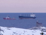
• We all held our breath while the Russian ship Simushir, carrying 400 tonnes of bunker oil and 50 tonnes of diesel fuel, drifted off the coast of Haida Gwai. Veteran West Coast Mariner, Brian Falconer, maintains the coast guard underestimated the risk: “…they’re setting up a false sense that we can actually do something about an oil spill. The reality is we won’t be able to do anything” (TC, Oct 22, p A5). The tankers carrying bitumen will be far larger than Simushir. (As I write, a 134′ barge carrying 3,600 l of diesel fuel is adrift in the Beaufort Sea …)
Dilbit is already being shipped past our shores with ‘temporary’ permits.
• Christy Clark says she has five conditions before approving pipeline expansion (http://www.newsroom.gov.bc.ca/2012/07/statement-by-premier-christy-clark.html). Andrew Weaver says – implement those conditions now.
• Andrew also noted that, on Wednesday of this week, Christy Clark’s gov’t dismantled large portions of the climate legislation enacted by Gordon Campbell’s gov’t; an action with huge implications which went unnoticed because of events on Parliament Hill.

MUNICIPAL MATTERS

• Good to see the following candidates in attendance at the Metchosin Town Hall: Moralea Milne (incumbent Councillor, who initiated the first motion opposing increased tanker traffic in 2012); Andy MacKinnon, Anne Richmond. (Apologies received from: Chris Moehr, Kyara Kahakawila; Bob Gramigma was at a Council related meeting).

• Municipal candidates responses to the Dogwood survey are now posted: http://www.localvote2014.ca/

• Municipal mayors/councillors/candidates may say, “It’s not my jurisdiction,” but Kai Nagata pointed out
Municipal Mayors and Councils have a great deal of influence – if they choose to use it.

We, the voters, must support those brave enough to take a stand.

(e.g., Andrew Weaver is pushing for a complete ban on heavy oil tankers in BC waters – municipal councils could get behind him on this initiative)
• Municipal Councils – backed by the citizens they represent – are perhaps the “last bastion” to stop the massive giveaway of public resources to large corporations.
RAVEN
• Donations to Raven – a Trust for 1st Nations Legal Defense, totalled $170;  thanks to Allison’s generous initiative. (And we had not even thought to collect donations, as evidenced by our blue recycling bin ‘collection plate’!)

THANK YOU VOLUNTEERS!

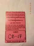
Drift Cards for Oil Spill Study Recovered on Taylor Beach

A number of NGOs concerned with the threat of increasing oil tanker traffic through the Georgia Strait and The Strait of Juan de Fuca have released drift cards in the Drift Card Ocean Circulation Study. The aim is to provide accurate models for predicting the trajectory of an oil spill in the Fraser River, Puget Sound or the Strait of Juan de Fuca. This is especially important to know now since the Kinder Morgan Trans Mountain Pipeline Expansion Project looms on our doorstep.

There is a map with locations of recovered cards.  http://www.salishseaspillmap.org/

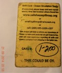
The pink  card released by The Friends of San Juans had not spent very much time in the water but  it is apparent that the yellow card spent a great deal more time in the ocean as it is considerably more warn and scratched than the first pink card.

There was a brisk wind blowing from the East today, The first time I noticed eel-grass close to the water in the strand line, and this card was recovered from there. at 48°22’10.1″N 123°31’48.2″W.

On November 9, 2014 : The following  card was on Taylor beach, at high tide level, driven up by the storms with surge from the East in the past week. This card is fairly worn, the messsage was very hard to read, indicating it has been floating around for some time.

raincoast-logo-2014

Andy of Raincoast Conservation Foundation provided the following feedback on the yellow card I found today:”That’s a very cool find! It is from our drops last October, from the mouth of the Fraser River. These cards all moved south initially, and out the Juan de Fuca and up the west side of Vancouver Island. The furthest recovery from that drop location is on BC’s central coast.”

If you find a Drift Card report it as soon as possible with information about date,and time and location of recovery. Directions are included on the card.

This link provides information on the risk of an oil spill on our shores:  https://metchosinmarine.ca/gf/?cat=94


Update on the Kinder Morgan TMX National Energy Board Hearings

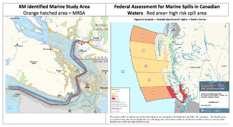
Our coastline in Metchosin is highly exposed to the potential risks from the increase in tanker traffic that will come if the Kinder Morgan/ Trans Mountain Pipeline Expansion s allowed to proceed. (400 Aframax size tankers per year) In order to provide access to the Information requests from the over 400 intervenors which are available on the NEB website, the following link is provided. The Board of the Friends of Ecological Reserves has posted their first set of Information Requests to the National Energy Board and Kinder Morgan as Intervenors in the Trans Mountain Pipeline Expansion Project . Their concerns focus on the Ecological reserves of Southern Vancouver Island such as Race Rocks . See this link with a further link to all intervenors Information requests. kmstudyarea-1

B.C. coast, St. Lawrence Estuary most at Risk for Major Marine Oil Spill: Report

Adapted from the Times Colonist at this link:
http://www.timescolonist.com/opinion/b-c-coast-st-lawrence-estuary-most-at-risk-for-major-marine-oil-spill-report-1.806714

The Canadian Press
January 29, 2014 01:24 PM  

OTTAWA — A government-commissioned risk analysis says the coast of southern British Columbia and the Gulf of St. Lawrence are the Canadian areas most vulnerable marine oil spills and among the most likely for a major spill to occur.

The findings will add to the debate over several pipeline proposals — including two in B.C. that the report says will substantially increase marine risks.

The 256-page study, delivered this month to Transport Canada, looks at the risks associated with marine oil spills south of the 60th parallel under current shipping volumes.

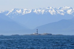
race-rocks-lighthouseIt identifies the southern tip of Vancouver Island, the Cabot Strait off Newfoundland, the eastern coast of Cape Breton Island and the Gulf of St. Lawrence as the most probable areas for a major oil spill.

But the study also assesses the potential impact of four proposed pipeline projects, including the Northern Gateway Pipeline to Kitimat and Kinder Morgan’s plan to almost triple its Trans Mountain line into Vancouver.

The report says the Kinder Morgan proposal would essentially double oil traffic in an already vulnerable marine environment — with a corresponding increase in spill frequency — while the Northern Gateway marine route would turn what are currently very low, near-shore risks into very high risks.

The study found that reversing Enbridge’s Line 9 to carry Western Canadian crude to refineries in Montreal and Quebec City would actually lower marine spill risks, as it would reduce oil imports through the sensitive Gulf of St. Lawrence.

And the study found that the proposed Energy East Pipeline to St. John, N.B., would likely be a wash, reducing shipping imports but increasing oil exports to leave the overall marine risk about where it is now.

© Copyright Times Colonist

Posts on this website about the risk of oil spills on Metchosin’s shores:

Posts on the Ecological Reserves website about the threat of Oil Spills from Tanker Traffic

Posts on the Race Rocks website about the Risk from Increased Tanker Traffic

See the following posts for further information on Tanker traffic off our shores:

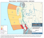
figure-3-overall-risks-oil- spills

 Review of Canada’s Ship-Source Oil-Spill Preparedness and response Regime: 


Application to NEB by Board of Friends of Ecological Reserves

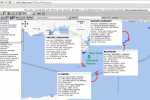
mapandships
 Ship traffic in the Strait of Juan de Fuca

The Future for our Elephant Seal Population in the Event of Oil Spills.


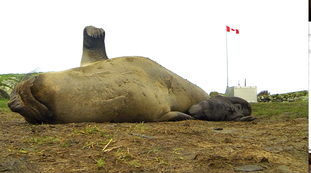
Elephant seal mother and pup born at Race Rocks Ecological reserve on January 14, 2014

Elephant seal mother and pup born at Race Rocks Ecological Reserve on January 14, 2014,  Photo by Alex Fletcher

This post has been adapted from a January 24 entry on the racerocks.ca website

British Columbians and Metchosinites in particular can take great satisfaction in the fact that an Elephant seal colony is being slowly established in British Columbia right on their doorstep, We can can still go to camera 1 on racerocks.ca to see an elephant seal pup being nursed via a webcam on an island beside Metchosin.  The reality is that the risks these animals face in the Strait of Juan de Fuca if they are to maintain a population increase are now becoming even more challenging.

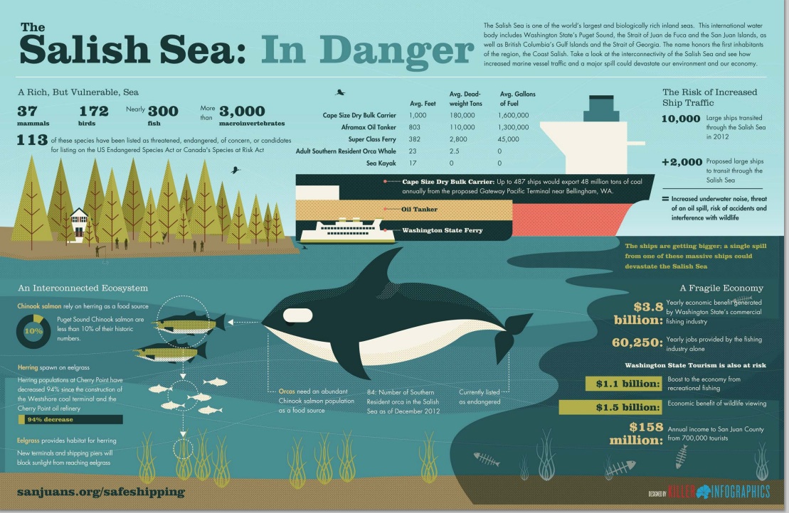
Currently about 6,000 large commercial vessels transit Canadian and U.S. waters toward Vancouver or Washington ports each year. Each month about five large oil tankers ply the waters down the international border within a few kilometres of the Race Rocks Ecological Reserve.

Under the Kinder Morgan Pipeline Proposal, up to 34 tankers a month would be loaded with oil at a terminal outside Vancouver, then travel through Haro Strait and the Strait of Juan de Fuca for export to markets in Asia and the U.S.  These are tankers in excess of 200 metres in length. 

The $5.4 billion expansion project would nearly triple pipeline capacity from about 300,000 to 890,000 barrels of crude oil a day to meet customer demand. Much of that future cargo will likely be diluted bitumen from Canada’s tar  sands. If approved, the expansion is expected to be operational in late 2017. The pipeline is operated by Kinder Morgan Canada and owned by Houston-based Kinder Morgan Energy Partners LP.

The potential of collision and oil spills is unparalleled, and you can’t clean oil off a two ton marine mammal very easily let alone the volumes of marine life it consumes daily for survival. It would be a miracle indeed if we still have elephant seals at Race Rocks in 2020, the 40th anniversary of the Ecological Reserve. 

G.Fletcher

References we could all consider seriously:

  • Financial Liability for Kinder Morgan – Georgia Strait Alliance,

    “Residents of the Salish Sea region—Vancouver, Victoria, the Gulf Islands and Washington State—could see a four-fold increase in the number of oil tankers traveling from the Port of Metro Vancouver through Juan de Fuca Strait, if Kinder Morgan is permitted to build a new pipeline to carry oil from the tar sands to markets in Asia. Such a dramatic increase signals exponentially higher risk of oil spills and raises many questions about what is at risk, how the oil is “cleaned up”, and who pays for oil spill response. “

  • The Deepwater Horizon Oil Spill and Marine Mammals by the marine mammal Commission, an independent commission of the US government
  • Effects of Oil Spills on Marine and Coastal Wildlife–“Oil spills can impact wildlife directly through three primary pathways: —ingestion – when animals swallow oil particles directly or consume prey items that have been exposed to oil .—–absorption – when animals come into direct contact with oil inhalation – when animals breathe volatile organics released from oil or from “dispersants” applied by response teams in an effort to increase the rate of degradation of the oil in seawater. ——inhalation – when animals breathe volatile organics released from oil or from “dispersants” applied by response teams in an effort to increase the rate of degradation of the oil in seawater”
  • Effects of Oil Pollution on Marine WIldlife ”  Seals are very vulnerable to oil pollution because they spend much of their time on or near the surface of the water. They need to surface to breathe, and regularly haul out onto beaches. During the course of an oil pollution incident, they are at risk both when surfacing and when hauling out.”
  • Marine mammals and the Exxon Valdez Auteur : LOUGHLIN Thomas R. “This recently published book is a unique longitudinal study of the demise of an ecosystem due to a single acute environmental perturbation.”

Posts on this and other  local websites about the effects of Oilspills.

Metchosin Marine Issues, an Expression of Concern.

The Unique Value of our Coastal Ecosystems

The Coastal Resources of Metchosin are a valuable form of Natural Capital that must have special consideration when Development Planning is done in the District.   The Crown owns the foreshore to the high tide mark, and although one would think this allowed protection, there are still considerable threats to the ecological integrity of this area, which must be considered. The shoreline is an interface between two systems, the terrestrial uplands and the open ocean. As typical of any natural system, one cannot separate them in terms of management decisions, as they have processes, which interact.   Community members of a progressive coastal community should tolerate no activities involving human action that contribute to any level of destabilization or decline of our present shoreline ecosystems.

Along our shorelines in Metchosin, we have a variety of unique marine ecosystems.

  • Tidal marshes,
  • lagoons,
  • estuaries,
  • bays,
  • eel-grass beds,
  • high speed current channels,
  • underwater caves,
  • vertical underwater cliffs,
  • boulder beaches,
  • sand beaches,
  • and pebble (pocket) beaches.

Every metre of coastal intertidal zone also has a characteristic set of organisms, which can be impacted by actions of humans either from the land side or the ocean side.  Larger commercial species of fish often feed or spawn near the shoreline interface, juvenile fish migrate along shorelines, often relying on protective habitat of overhanging vegetation or kelp beds, and the energy flow in the food webs of at least 7 local marine mammal species are directly affected.

It is further recognized that a viable commercial crab fishery, as well as an extensive sports fishery operates along the coastal areas of Metchosin.

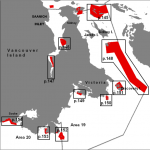
Rockfishconservationareas19_20 The ocean environment in the area of Race Passage has also been recognized as an important habitat for the regeneration of Rockfish stock leading to the creation of a DFO rockfish conservation areas where all fishing is prohibited.


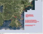
anthroimpactThis file and map of the the Metchosin Shoreline shows the major areas where humans have modified the habitat, often resulting in ecosystem modification and loss of habitat for local species of fish, invertebrates and marine mammals. The term Anthropogenic refers to human modification.


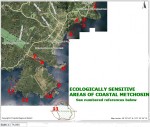
ecoareasThis file contains a map with the ecologically sensitive areas of Metchosin’s Coastal Ecosystems.
Terrestrial Threats:

  • Erosion from road building, utility and sewer installation, subdivision development carrying silt into the receiving waters has a negative impact on filter feeders (e.g. Clams, mussels and anemone) in the ocean.
  • Crushed rock deposited in upland areas in road building and building lot creation may have serious toxic impacts on marine life as water leaches through it carrying dissolved metallic ions to the sea.
  • Accidental or planned deposition of hazardous materials in soils can also lead to leaching to the marine waters.
  • Deforestation on upland slopes leads to deterioration of coastal ecosystems.
  • Channelization of streams leads to silt output and increased fresh water flow to ocean environments.
  • Human traffic, (especially horses) on beaches can severely impact on spawning areas of needle fish (on Taylor beach)
  • Uncontrolled dogs can have a serious impact on feeding patterns of shorebirds- especially crucial during migration.
  • Humans and dogs on beaches can impact on molting elephant seals.
  • Beach debris can be washed seaward, to be ingested by marine animals.
  • Oil and chemicals from storm sewer drains is toxic to marine creatures.
  • Building too close to cliffs can lead to destabilization and therefore slumping of land into the ocean. This is especially of concern along the cliffs of Parry Bay and Albert Head.
  • Sewage disposal on land in septic fields, contributes a large nutrient load as it leaches through to the shoreline. The heavy die-off of algal growth on Weir?s beach annually, is evidence of this.
  • Development on the coastline as has recently occurred South of Devonian Park can lead to alteration of the coastal resource, habitat smothering and destruction, and increases shoreline erosion risk.
  • Backshore alteration of any beach habitat for intended purposes of bank stabilization, inevitably in the long run leads to shorefront habitat deterioration.

Marine Threats:

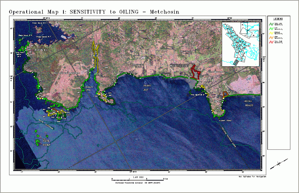
Tanker traffic very close to our shores, poses a continual risk of oil and chemical spills. In the areas shown in the map, red indicates highly sensitive and a long term residency of oil. Yellow indicates a lesser residence time of oil. Green indicates a faster cleanup may be possible because of exposure to waves and currents. See this reference on Threats from tanker traffic 

  • Increase in cruise lines in recent years has a potential to impact our coastal resources.
  • Increasing fast boat traffic is hazardous to harbour seal pups and slow moving marine mammals (such as elephant seals) in particular.  It also increases rates of coastal erosion in sheltered bays.
  • Boat motor sound underwater affects animals relying on the underwater seascape for communication.
  • whalewiseWhale watching boating patterns have an impact on the time whales can spend foraging in the area.


  • Antifouling compounds on ships (some military) and in boats in marinas provide a further risk to the marine environment

Return to MetchosinCoastal

Originally published by G.Fletcher in 2004.