Clupea pallasii: Pacific Herring

These small herring –12cm were found washed up on Taylor Beach

Herring found on Taylor Beach

Pacific Herring, (Clupea pallasii) found on Taylor Beach-photo by G.Fletcher

Cause of death unknown.
Kingdom: Animalia
Phylum: Chordata
Class: Actinopterygii
Order: Clupeiformes
Family: Clupeidae
Subfamily: Clupeinae
Genus: Clupea
Species: C. pallasii

Link to other posts on this website on Fish ;

Link to the organisms added to our species list for Metchosin shores.

Weir’s Beach erosion.

In July 2013 at Low tide, the loss of sand from near the south end of Weir’s Beach has become obvious. This was predictable because of the hardening of the shoreline several years ago with the installation of large rock rip-rap along the front of the adjacent Weir’s Beach Trailer Park. As many of the references such as  Hardening the shorelines indicates:  “Hard structures, especially vertical walls, often create conditions that lead to failure of the structure. In time, the substrate of the beach coarsens and scours down to bedrock or a hard clay. The footings of bulkheads are exposed, leading to undermining and failure. … Failed bulkheads and walls adversely impact beach aesthetics, may be a safety or navigational hazard, and may adversely impact shoreline ecological functions.”

riprap

Large rock riprap on the berm

trailers1

Trailer park perched on the edge of the berm.

weirserosion

Loss of fine sand material from the beach in front of the trailer park.

See this file for earlier images of the beach and comparisons: https://metchosinmarine.ca/7taylorbeach/weirs/beachcompare.htm

New Seawall on Weir’s Beach

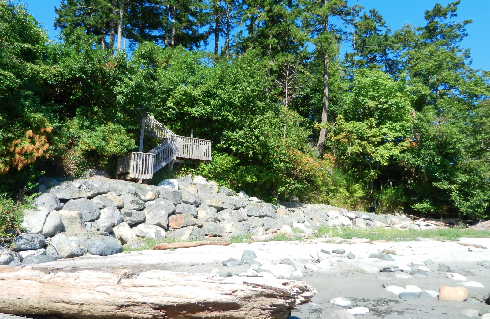
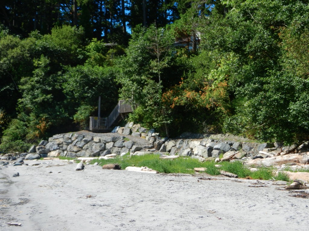
Over the summer of 2013, a new seawalll was built at the south end of Weir’s beach. The purpose of the wall is not obvious, other than to create a walkway to the ocean for the residence above.
The provincial government owns the ocean floor and the foreshore (the area between the low water level and the natural boundary) along Metchosin’s Coastline. This structure sits within this foreshore area, as there is sand at it’s base,  so it is questionable how this shoreline modification was permitted.

UPDATE:

  •  Under the General  Marine Shoreline policies desired works require application to the appropriate Provincial/and or Federal agencies responsible.  This particular property located at 5289 William Head Road was able to proceed under the following conditions: 
  • 1. Requirements of the Department of Fisheries & Oceans must be fulfilled.
  • 2. Any work below the high water mark must have the approval of the Ministry Forests, Lands & Natural Resource Operations
  • 3.  Work was  conducted in April according to the measures outlined in the Ryzuk Geotechnical Report dated March 7, 2013 and the report by Lehna Malmkvist, Swell Environmental Consulting Ltd., March 8, 2013

———————————————————————————————————–

Readers are recommended to read all parts of the publication below before attempting any alterations on shorefront property:

Coastal Shore Stewardship: A Guide for Planners, Builders and Developers on Canada’s Pacific Coast

Another reference on hardening the shorelines states the problem rather plainly: “Hard structures, especially vertical walls, often create conditions that lead to failure of the structure. In time, the substrate of the beach coarsens and scours down to bedrock or a hard clay. The footings of bulkheads are exposed, leading to undermining and failure. … Failed bulkheads and walls adversely impact beach aesthetics, may be a safety or navigational hazard, and may adversely impact shoreline ecological functions.”

southendstairnorth

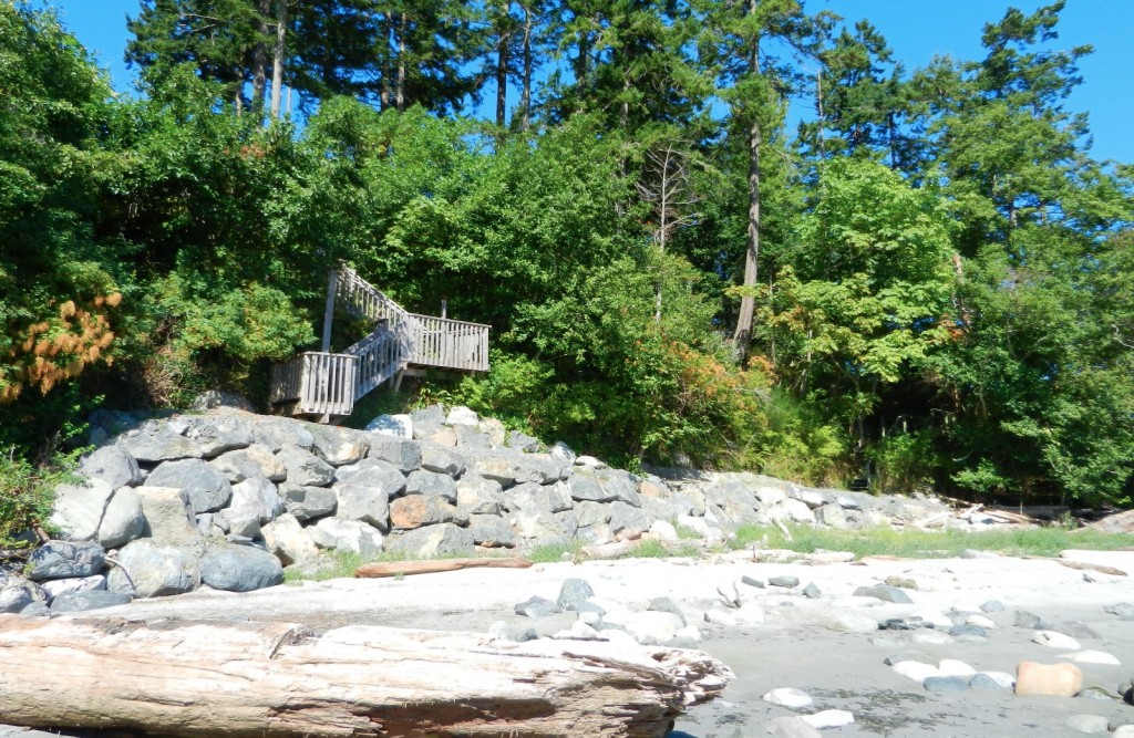
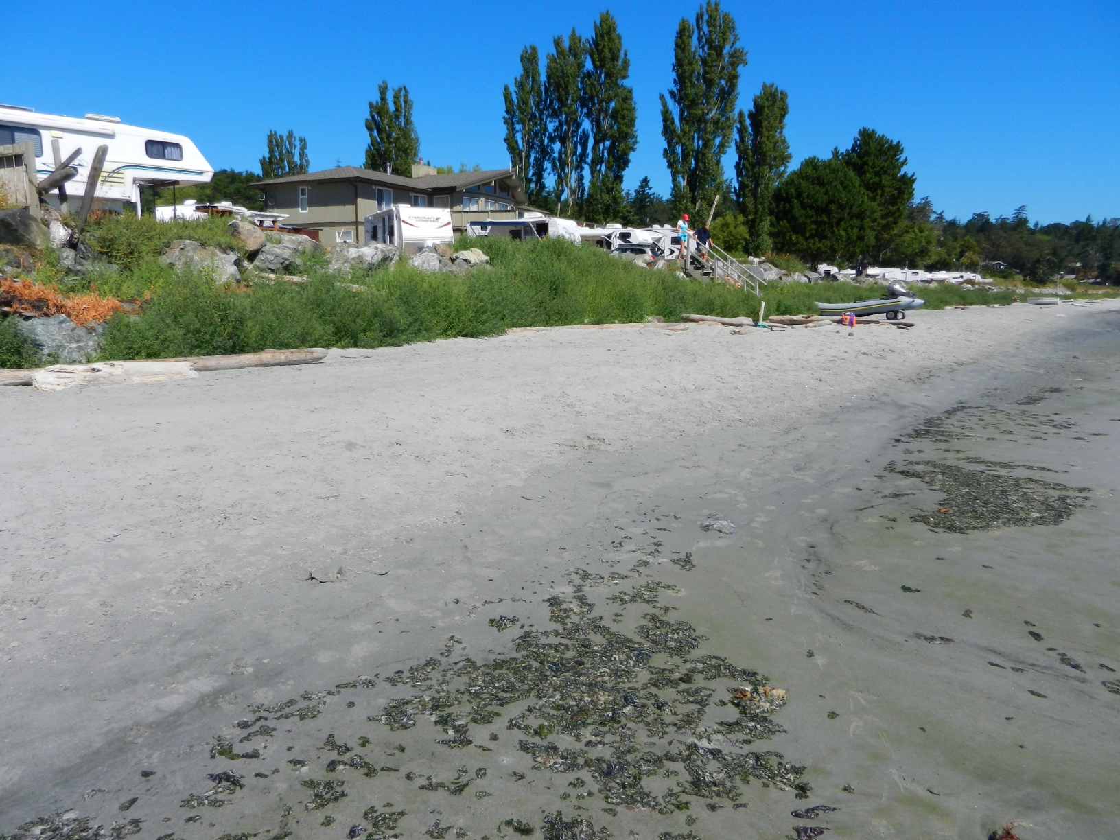
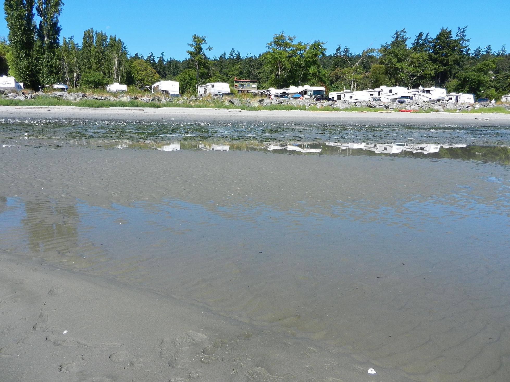
View of the seawall from the south.

southendstairway

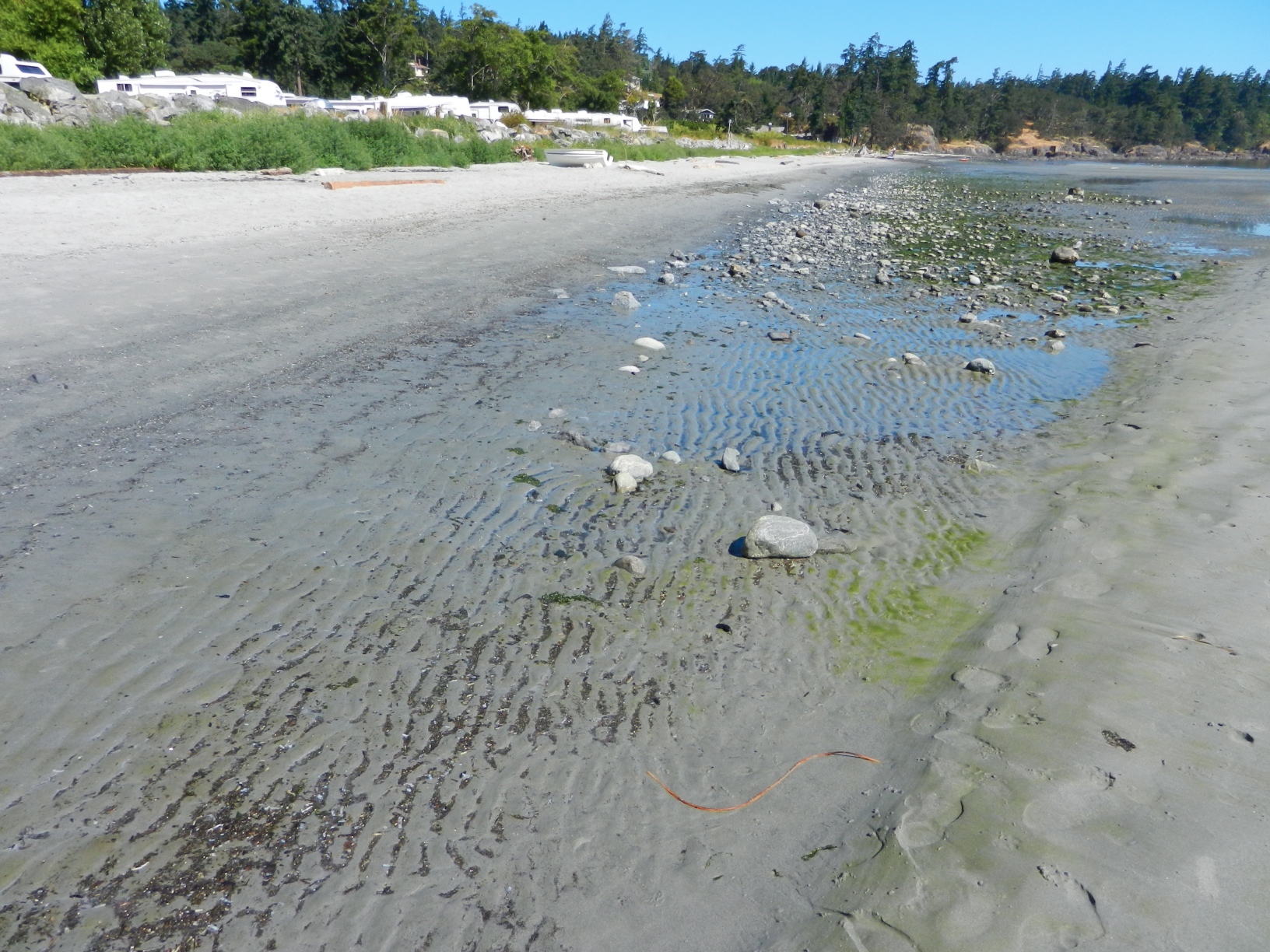
View of the seawall from the beach directly in front.

seawallfrombeach

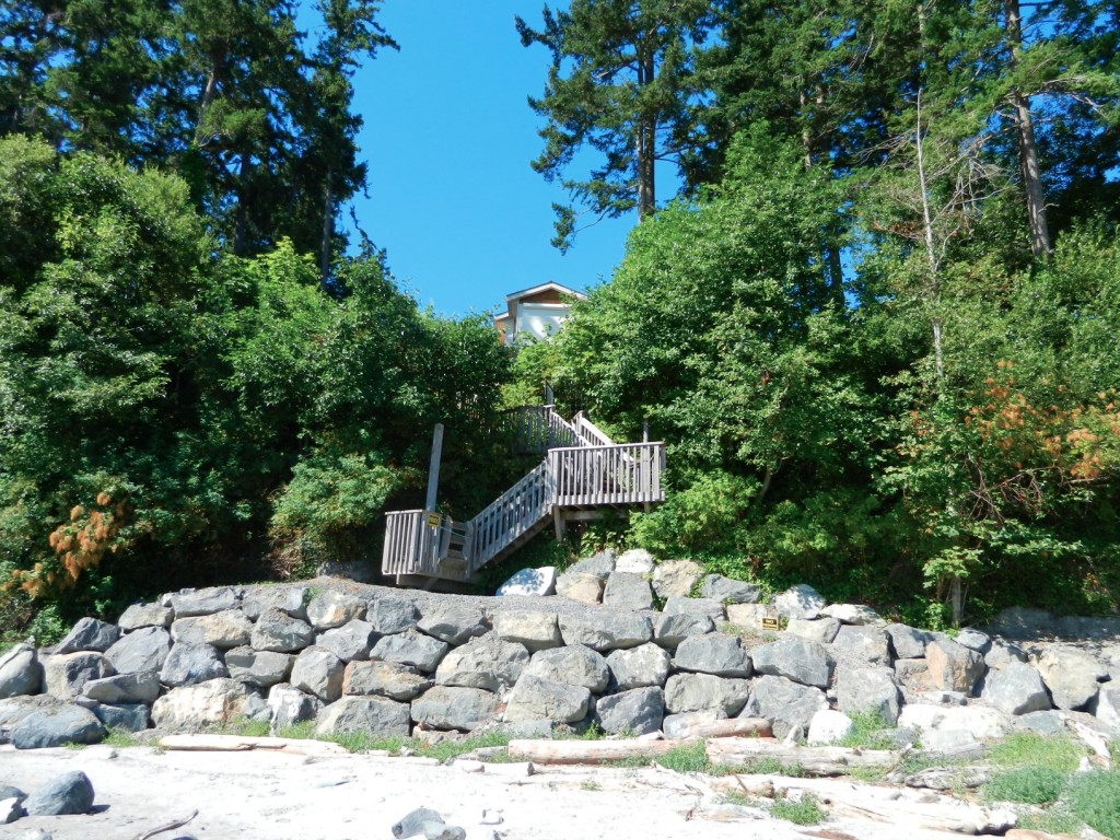
View of sea wall from the north.

Ammodytes hexapterus: Pacific Sand lance, (Needle fish) : forage fish of Metchosin’s shoreline

See this post on Sandlance on Taylor Beach: gf-sandlance-july1320154

sandlance

Image from the  presentation below

One of the unusual characteristics of sandlance  on Taylor Beach is that in less  thAN a minute after emerging from the sand after spawning, If they are not consumed by crows or gulls, then they will die. ( so far I have not found this reported in the literature?)

Kingdom: Animalia
Phylum: Chordata
Class: Actinopterygii
Order: Perciformes
Family: Trachinoidea  (Bonaparte, 1832)
Genus: Ammodytes
Species: A. hexapteris
Binomial name Ammodytes hexapterus

Ramona de Graaf –2021 provides a good background on the importance of habitat for Forage Fish on our shores.

Metchosin Shoreline Report : MEASC 2013

The Metchosin Environmental Advisory Select Committee of  Metchosin District submitted this report to Council in June  2013.

See the complete report as a  PDF: Metchosin Shoreline Report 2013June 10-2

Executive Summary

The unique values attributed to the Coastal Areas of Metchosin have been recognized both historically and by outside researchers. They have also been outlined at length in the Official Community Plan and other documents produced for the District.

The objective of the Metchosin Shoreline Report is to provide Mayor and Council with a background document and decision-making tools for issues related to Metchosin’s shoreline environment: the jurisdictional boundaries are delineated; examples of ecologically sensitive areas are highlighted; and the biological and geographical values of eight zones of the forty-five km of shoreline are profiled.

The values of biodiversity, education, natural capital, aesthetics, philosophy, and ecotourism are all affected by our coastal areas. Therefore, the risks from human activity on the sustainability of these areas are emphasized.

With the increasing likelihood of changing climatic events impacting on our shoreline, and in order to mitigate these risks, a number of recommendations are proposed for the Municipality to implement:

  1. Create a development permit zone in the area between the end of provincial jurisdiction at the high water mark and the end of the high tide storm-driven wash on the landowner’s property.
  2. Prevent the human caused hardening of the shoreline by sea walls, roadways or bulkheading, and shoreline modifications.
  3. Design a “Coastal Covenant,” which landowners could sign, in order to guarantee the protection of the integrity of their section of shoreline.
  4. Establish and protect vegetation buffer zones along streams and along the total shoreline, including special attention to salt marshes and eelgrass beds.
  5. Protect eelgrass beds by eliminating damage from log booms, docks and other structures.
  6. Divert runoff of fertilizers, pesticides and herbicides from streams and surrounding farmlands away from shoreline, salt marsh, and seagrass habitats.
  7. Develop emergency response plans for the District in the event of a land or ocean-based toxic spill, which could potentially threaten the shoreline.

See the complete report as a  PDF: Metchosin Shoreline Report 2013June 10-2


Apodichthys flavidus –penpoint gunnel

June 8, 2013: Charlie Carpenter my neighbour arrived from next door with a bucket with a 15cm. gunnel and cling-fish he had found down on the rocky intertidal at the mid-north section of Taylor Beach. We took this photo for the species list before returning it.

gfblenny3These gunnels live under the rocks which are exposed at low tide.

Kingdom: Animalia
Phylum: Chordata
Class: Actinopterygii
Order: Perciformes
Family: Pholidae
Genus: Apodichthys
Species: A. flavidus
Binomial name Apodichthys flavidus, Girard, 1854

Tonicella lineata–Lined chiton

Tonicella lineata, the lined chiton : These photos taken in May, 2013 were submitted by Gretchen Markle . They were taken on the area known as Laird’s Beach  (on Parry Bay south of Taylor Road)

gmtonicella

Kingdom: Animalia
Phylum: Mollusca
Class: Polyplacophora
Order: Neoloricata
Family: Ischnochitonidae
Genus: Tonicella
Species: T. lineata
Binomial name:Tonicella lineata , Wood, 1815

Cryptolithoides sitchensis–turtle crab

Cryptolithoides sitchensis, the turtle crab : These photos taken in May, 2013 were submitted by Gretchen Markle . They were taken on the area known as Laird’s Beach  (on Parry Bay south of Taylor Road)

gmturtlecrab gmturtlecrab2p1030812Also see another more colourful example of this species found  at Christopher Point by a diving student in the Pearson College Marine Science class in October, 2014

 
Cryptolithoides sitchensis, turtle crab
Kingdom: Animalia
Phylum: Arthropoda
Subphylum: Crustacea
Class: Malacostraca
Order: Decapoda
Infraorder: Anomura
Family: Lithodidae
Genus: Cryptolithodes
Species: C. sitchensis
Cryptolithodes sitchensis (Brandt, 1853 [1]


Riparian Rights and Public Foreshore Use in the Administration of Aquatic Crown Land


Occasional Paper No. 5  Revised: August 2008
Prepared by:
Ministry of Agriculture and Lands Crown Land Administration Division Province of British Columbia in cooperation with the Land Title and Survey Authority of British Columbia