The Future for our Elephant Seal Population in the Event of Oil Spills.


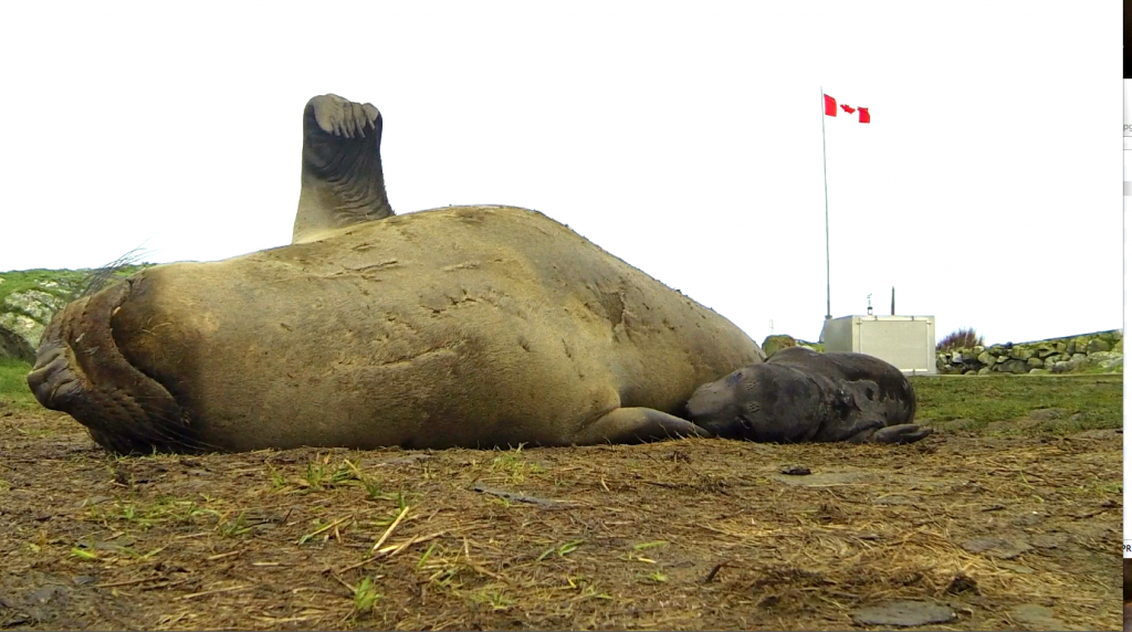
Elephant seal mother and pup born at Race Rocks Ecological reserve on January 14, 2014

Elephant seal mother and pup born at Race Rocks Ecological Reserve on January 14, 2014,  Photo by Alex Fletcher

This post has been adapted from a January 24 entry on the racerocks.ca website

British Columbians and Metchosinites in particular can take great satisfaction in the fact that an Elephant seal colony is being slowly established in British Columbia right on their doorstep, We can can still go to camera 1 on racerocks.ca to see an elephant seal pup being nursed via a webcam on an island beside Metchosin.  The reality is that the risks these animals face in the Strait of Juan de Fuca if they are to maintain a population increase are now becoming even more challenging.

Currently about 6,000 large commercial vessels transit Canadian and U.S. waters toward Vancouver or Washington ports each year. Each month about five large oil tankers ply the waters down the international border within a few kilometres of the Race Rocks Ecological Reserve.

Under the Kinder Morgan Pipeline Proposal, up to 34 tankers a month would be loaded with oil at a terminal outside Vancouver, then travel through Haro Strait and the Strait of Juan de Fuca for export to markets in Asia and the U.S.  These are tankers in excess of 200 metres in length. 

The $5.4 billion expansion project would nearly triple pipeline capacity from about 300,000 to 890,000 barrels of crude oil a day to meet customer demand. Much of that future cargo will likely be diluted bitumen from Canada’s tar  sands. If approved, the expansion is expected to be operational in late 2017. The pipeline is operated by Kinder Morgan Canada and owned by Houston-based Kinder Morgan Energy Partners LP.

The potential of collision and oil spills is unparalleled, and you can’t clean oil off a two ton marine mammal very easily let alone the volumes of marine life it consumes daily for survival. It would be a miracle indeed if we still have elephant seals at Race Rocks in 2020, the 40th anniversary of the Ecological Reserve. 

G.Fletcher

References we could all consider seriously:

  • Financial Liability for Kinder Morgan – Georgia Strait Alliance,

    “Residents of the Salish Sea region—Vancouver, Victoria, the Gulf Islands and Washington State—could see a four-fold increase in the number of oil tankers traveling from the Port of Metro Vancouver through Juan de Fuca Strait, if Kinder Morgan is permitted to build a new pipeline to carry oil from the tar sands to markets in Asia. Such a dramatic increase signals exponentially higher risk of oil spills and raises many questions about what is at risk, how the oil is “cleaned up”, and who pays for oil spill response. “

  • The Deepwater Horizon Oil Spill and Marine Mammals by the marine mammal Commission, an independent commission of the US government
  • Effects of Oil Spills on Marine and Coastal Wildlife–“Oil spills can impact wildlife directly through three primary pathways: —ingestion – when animals swallow oil particles directly or consume prey items that have been exposed to oil .—–absorption – when animals come into direct contact with oil inhalation – when animals breathe volatile organics released from oil or from “dispersants” applied by response teams in an effort to increase the rate of degradation of the oil in seawater. ——inhalation – when animals breathe volatile organics released from oil or from “dispersants” applied by response teams in an effort to increase the rate of degradation of the oil in seawater”
  • Effects of Oil Pollution on Marine WIldlife ”  Seals are very vulnerable to oil pollution because they spend much of their time on or near the surface of the water. They need to surface to breathe, and regularly haul out onto beaches. During the course of an oil pollution incident, they are at risk both when surfacing and when hauling out.”
  • Marine mammals and the Exxon Valdez Auteur : LOUGHLIN Thomas R. “This recently published book is a unique longitudinal study of the demise of an ecosystem due to a single acute environmental perturbation.”

Posts on this and other  local websites about the effects of Oilspills.

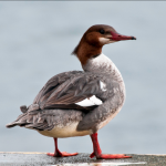
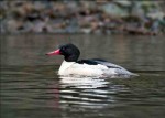
Mergansers out in full force today.

In the Christmas Bird Count this year, one of the marine birds noted in particularly high numbers was the Common  Merganser, Mergus merganser, with a count of 258 along the Metchosin/Sooke shores.

I noted today( rainy and overcast)  that there were 32 Common Mergansers ( 6 males and  26 females down on the north end of Taylor Beach . Often when we see them there throughout the winter, they are in smaller groups and are continually diving for food. Today the pattern was quite different as they were all in  courtship mood.  The males have a distinctive forward bow, then an upward stretch of their necks  and then a quick scurry on the surface around  a female. These are probably one of the most colourful seabirds on our coast and well worth looking for in protected bays and inlets during the winter. (Pedder Bay also often has a dozen or so) .

Of course these birds as other over-wintering seabirds in our water are very vulnerable to oil spills. If the Kinder-Morgan Pipeline goes through, The current risk from a maximum of  5 oil tankers going through the southern entrance to the Strait of Juan de Fuca each day, is bad enough, but when one contemplates the added risk of accidents from 34 tankers (each over 200 metres in length) plying our waters  by 2015, the future for overwintering birds like this is rather dismal.

Other articles about this concern:


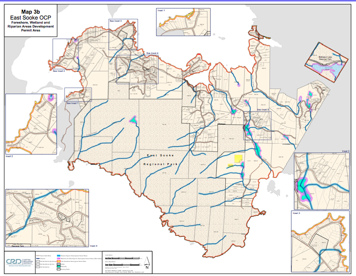
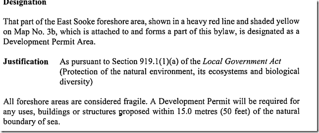
Development Permit Areas Line Most of East Sooke’s Shoreline.

The following CRD Map shows almost the Complete Coastline of our Neighbouring District. This East Sooke Official Community Plan Map 3b  on Foreshore , Wetland and Riparian Areas Development Permit Areas shows the DPA designation:

East_Sooke_Land_Use_Map in PDF format.

or click on the map below for link

eastsookedpa


devpermareas

A new Lease on Life for the Rare Marsh Plant: Phragmites australis subsp. americanus–A note of caution when attempting to control Invasive Species

By Garry Fletcher, Metchosin, British Columbia
goochcreekpops

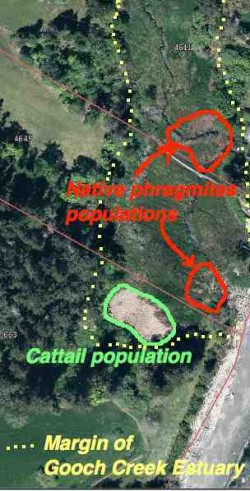
The yellow dots show the margin of the Gooch Creek Estuary. The populations of native Phragmites are shown in red. Location: 48deg,22′,11.01″N—123deg 31’52.19″ W.


Introduced species are no doubt one of the most serious challenges for us in the effort to preserve ecological integrity*. Occasionally however we can mete out  a death sentence to an innocent which can have serious consequences.  This post is about one such occurrence with the native marsh/estuary grass Phragmites australis (Cav.) Trin. ex Steud. subsp. americanus

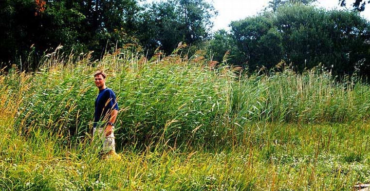
When we first bought our property on William Head Road, I was intrigued with the variety of ecosystems that could fit into one small 4 hectare piece of land. One such ecosystem was the  seasonally flooded salt marsh at the foot of the property. In that marsh were two populations of a very tall (2-3 metre) marsh reed grass.

In the mid-1980s, I asked one of our members of * MEASC, Robert Prescott-Allen to identify the species for me and he came up with the genus name Phragmites. He indicated that it used to be more common in our coastal estuaries, but it had been destroyed in the early years with cattle trampling and grazing. Now it only occurs in limited  populations in BC and in some populations along the Oregon Coast.

When I made the website MetchosinCoastal , I included a profile on the marsh with images of this plant on the Taylor Beach/Gooch Creek page . phragmiteskalleFast forward twenty years or so until 2009. I received a call from the Invasive Plant EDRR Coordinator | B.C. Ministry of Forests, Lands & Natural Resource Operations
PO Box 9513, 8-727 Fisgard St, Victoria B.C. CANADA V8W 9C1. She indicated that there were 9 populations of the introduced species Phragmites australis (Cav.) Trin. in BC and it was their mandate to control all of them. She came out to the farm, took samples and pictures and I sent her pictures of the extent of the grass in the marsh over the last few years indicating it really hadn’t spread that much. She made reference to a sample in the RBC museum which had been collected from our pond in 1992 which was identified as the introduced variety.

She indicated she would be out with a crew in the fall to cut the plants to the ground and spray with the herbicide Glyphosate . (and this being next to a sea-run cutthroat stream!)

On their website, the locations of this plant in BC were identified .  When the call came that they were coming out, I started to do research on the species.  I valued this plant as a great nesting habitat for red-winged blackbirds, and in the summer they get infested with aphids, providing food to wasps, marsh wrens and other birds. In addition, the hollow stems made excellent homes for Mason Bees.
2013-05-15redstem3

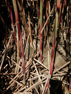
The red stems mentioned on the Oregon ID website are visible in the growing season on our population of reeds. I checked in early Dec.2013 and the red color is still visible.

I referred to a website from the Government of Oregon, which gave a comparison on the physical features of native , (Phragmites australis subsp.americanus) and introduced species samples. It looked very much like the native species to me, with most of the morphological characteristics corresponding. It also indicated that DNA analysis of tissue samples was the only definitive way to determine the genotype of the species.

I also contacted Dr. Adolf Ceska for his opinion, he indicated that the invasive variety probably came into BC in the 1980s. This population in our marsh was well established before the 1980s, and has not progressed very much since then. It is in a seasonal estuary, it floods with fresh
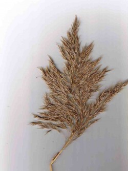
This species reproduces both asexually by underground rootstalks as well as sexually by seeds born on panicles such as this.

This species reproduces both asexually by underground root-stalks as well as sexually by seeds born on panicles such as this.

water with heavy winter rains,  but only gets flooded with a salt water intrusion at high tides driven by a east-wind driven storm surge. (winter only)
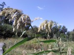
phragmitestassleoct13I tend to think that the salt water controls its distribution  somewhat in this particular marsh.  Interestingly,  in recent years cattails have spread  in the pond and they were previously also controlled by salt water. The main invasive in the marsh is reed canary grass.

I told the  Invasive Plant EDRR Coordinator when she showed up with her crew of two to “remove it”  that I would not allow it unless it was proven to be the invasive by DNA analysis.  I heard back from her in the spring 2014.
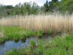
Phragmites australis subsp. americanus growing in the Gooch Creek marsh

Phragmites australis subsp. americanus growing in the Gooch Creek marsh (in November) of the year

In December of 2013, I was contacted by a wetlands restoration company from Nanaimo, BC about the population, as  they found out from the RBC museum that our population was the native variety. I had not heard this yet so I contacted Dr. Ken Marr at the museum, and he indicated that DNA tests had been done and that it was indeed the native species.


  • He writes “At this very moment I happen to be at UVIC looking at the raw data from the DNA analysis that was mostly completed a year ago.  We have been doing a parallel study of morphology and DNA of 140 or so samples of Phragmites.  Long story short, we have determined from the DNA analysis, that the populations on your land are the native genotype.  In fact, the analysis of the the sample from your land convinced the coordinator of the value of doing the DNA analysis since she had thought the plants on your land were the invasive genotype. Her conclusion may have been based upon my tentative ID of a specimen collected in 1992(?) from your land and that I thought to be the invasive genotype using the characters that have been used to distinguish the native from the invasive. All who have worked on this group acknowledge that for some individual plants, it is difficult to be certain which genotype to which a plant belongs, however DNA markers are viewed to be unambiguous.”
So having regained its “native species” reputation it is protected. The moral of the story is that we must not act impulsively on eliminating introduced species unless we are absolutely certain of the species, and in the case of Phragmites, DNA testing is a minimum requirement before extirpation is promoted.
This has ben published in the BEN ( Botanical Electronic Newsletter)  http://bomi.ou.edu/ben/ben475.html
  • One value added  aspect of the dead hollow stems of Phragmites australis subsp. americanus is that they make great Mason Bee homes. The bottom metre and a half of the larger stems have internode lengths of up to 20 cm, and the inside diameter of the stems is 8 mm.

REFERENCES:

1.BEN , Botanical Electronic News: References on the identification of native and introduced varieties of Phragmites
2. Native to North America or introduced (or both)?
Information on the Morphological Differences between the Native and Introduced
3. Saltonstall, K., Burdick, D., Miller, S., and Smith B. 2005.  Native and Non-native Phragmites : Challenges in Identification, Research, and Management of the Common Reed,  National Estuarine Research Reserve Technical Report Series 2005. (This publication has a good set of comparative photographs of the two varieties.)
4. Swearingen, J. and K. Saltonstall. 2010. Phragmites Field Guide Distinguishing Native and Exotic Forms of Common Reed (Phragmites australis) in the United States. Plant Conservation Alliance, Weeds Gone Wild.
5. from The Encyclopedia of Earth,   Phragmites australis – cryptic invasion of the Common Reed in North America, “Kristin Saltonstall of the Smithsonian Tropical Research Institute has conducted a series of groundbreaking genetic analyses on P. australis. Her research has identified 29 unique genetic types, or haplotypes, of the grass globally. Of these, 13 are native to North America and historical pre-1910 samples indicate a wide distribution of these native haplotypes across the continent. Modern sampling has revealed the widespread presence of a non-native haplotype growing throughout North America. This newcomer’s DNA matches that of a Eurasian haplotype that is the most common P. australis haplotype in the world.”

Kingdom Plantae – plantes, Planta, Vegetal, plants
Subkingdom Viridaeplantae – green plants
Infrakingdom Streptophyta – land plants
Division Tracheophyta – vascular plants, tracheophytes
Subdivision Spermatophytina – spermatophytes, seed plants, phanérogames
Infradivision Angiospermae – flowering plants, angiosperms, plantas com flor, angiosperma, plantes à fleurs, angiospermes, plantes à fruits
Class Magnoliopsida
Superorder Lilianae – monocots, monocotyledons, monocotylédones
Order Poales
Family Poaceae – grasses, graminées
Genus Phragmites Adans. – reed
Ed. Note: Species subspecies americanus is the native species
in North America. Phragmites australis (Cav.) Trin. ex Steud. – common reed
-introduced species in North America

See posts on the use of Phragmites stems for culturing Mason Bees here:http://www.gfletcher.ca/?tag=phragmites
 

BC Government Publications Index for Stewardship Centre on Coastal Planning and Land Use

BC Government Publications
Index for:
Stewardship Centre for British Columbia
Coastal Shore Stewardship: A Guide for Planners, Builders and Developers on Canada’s Pacific Coast

http://www.llbc.leg.bc.ca/public/pubdocs/bcdocs/368207/

The four PDFs linked to this government site have also been included here since we find that external URLs often change:
Part 1: Coastal Shore Stewardship A Guide for planners, Builders and Developers on Canada’s Pacific Coast: part1

Part 2  Coastal Planning and Approvals, Who does What: part2

Part 3  Don’t disrupt, Don’t harden, Don’t pollute: Land Development,  Marine Facilities, Seawalls and Revetments, etc.   Links to many  Stewardship resources; part3

Internet resources: internetaddresses

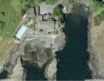
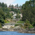
Anthropogenic habitat modification from Witty’s lagoon to the south side of Albert Head.

This area has in the past been modified significantly from the natural shoreline. Several seawalls have been installed in the past to deal with drainage problems or erosion threats , or to improve sea views or add to usable property on the foreshore. Typically land owners do not like to be criticized for actions on their properties which they believe will be constructive. However current  standards as outlined  in the documents “BC Government Publications Index for Stewardship Centre on Coastal Planning and Land Use” would probably not allow such impacts any more.


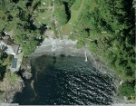
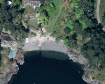
The images below were from earlier aerial photos of other modifications in the area.

Aerial views courtesy of the CRD NATURAL AREAS ATLAS

Return to the sector 8 

Trees of the Coast of Metchosin

Terrestrial and Marine Systems Interact with exchanges of materials and energy between the two. This page when developed further will illustrate that interaction.
Some ideas to be developed here:

1. Energy and materials transfer to the ocean of terrestrial vegetative material  by freshwater runoff . Carbon and Nutrient input from forests to the oceans.

2. The close ties between salmon and forest productivity

3. Overhanging trees in Coastal areas providing shelter and insect food for forage fish.

4. Control of coastal erosion by tree cover.

5. Coastline aesthetics of tree cover.

Link to posts on this website tagged with “Trees”

————————————————————————————–
See the Protected Tree Map of Metchosin
The Protected Trees of Metchosin was a topic of one of the Blue-Green Spaces Walk and Talk Series. The files on the trees have been prepared by Jim MacPherson and Moralea Milne.

Link to the Tree Cutting Bylaw proposal of MEASC, 2013

Link to the  Tree Management Bylaw :

Link to:Times Colonist:  Metchosin stops short of requiring permits to cut trees


First Nations and Coastal Metchosin

First Nations Peoples have lived on the shores of Metchosin for millenia using the bountiful resources of the sea, the forests and the fields of Camus.  Many different groups occupied the shorelands and this location was at the boundary of the lands of the inner Coast Salish people and the outer coast where more warlike Nootka tribes lived The local tribes  were often caught in the middle of intertriibal warfare.  In the documentation that follows from the Race Rocks website, one such group, from 1500 to 1000 years ago inhabited the area and built the many burial cairns still present in fields of Metchosin, Rocky Point and Race Rocks. Then without any record of what happened, that complete cultural tradition disappeared.

Link to posts on this website tagged “First Nations”

Link to the First Nations FIle:

firstnationheader


Weir’s Beach erosion.

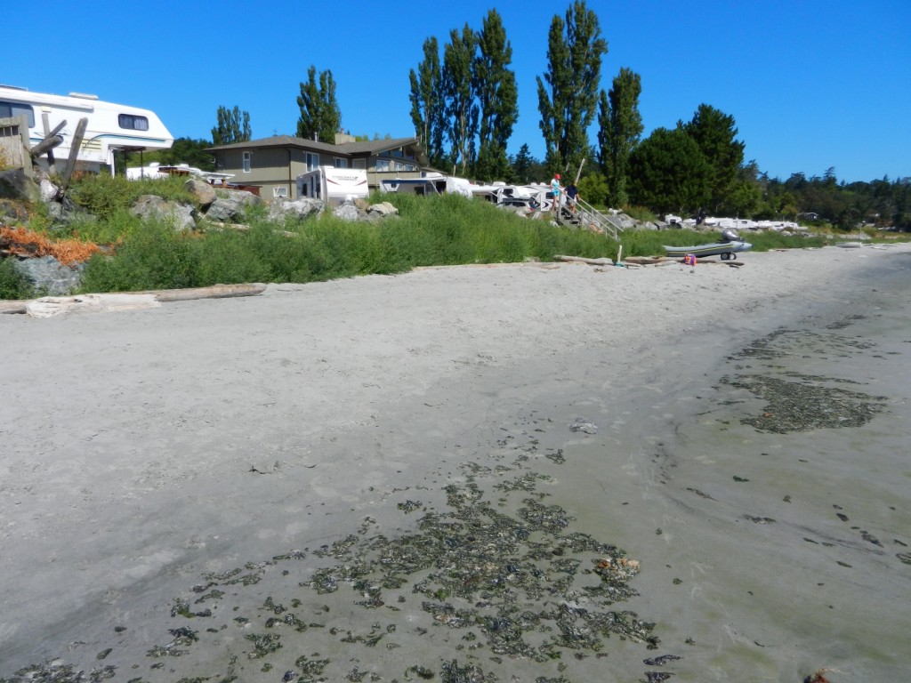
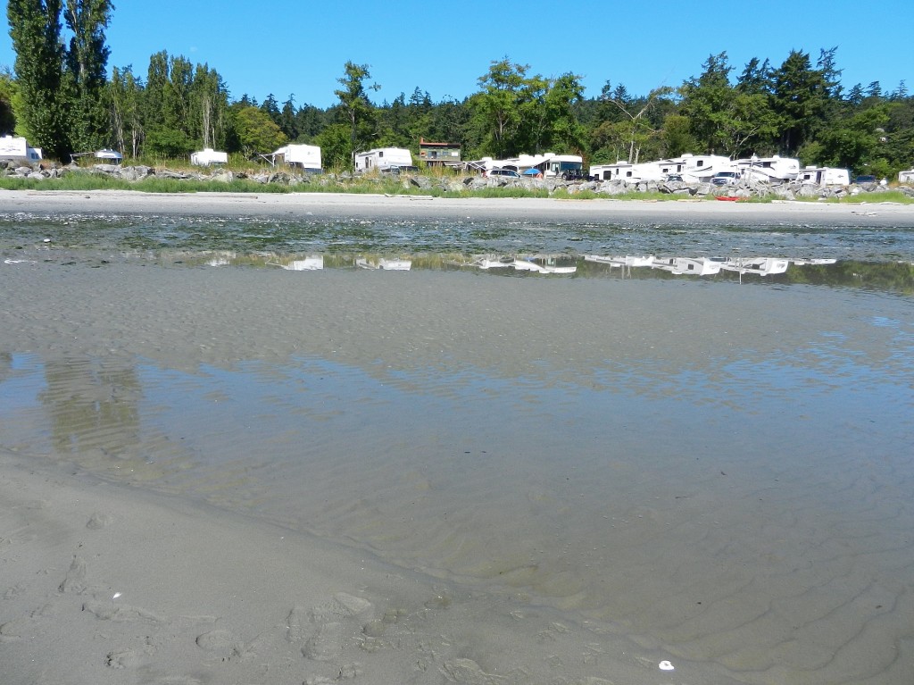
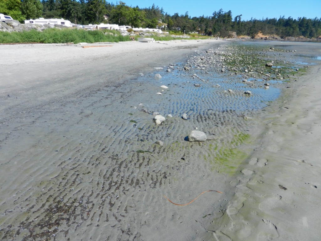
In July 2013 at Low tide, the loss of sand from near the south end of Weir’s Beach has become obvious. This was predictable because of the hardening of the shoreline several years ago with the installation of large rock rip-rap along the front of the adjacent Weir’s Beach Trailer Park. As many of the references such as  Hardening the shorelines indicates:  “Hard structures, especially vertical walls, often create conditions that lead to failure of the structure. In time, the substrate of the beach coarsens and scours down to bedrock or a hard clay. The footings of bulkheads are exposed, leading to undermining and failure. … Failed bulkheads and walls adversely impact beach aesthetics, may be a safety or navigational hazard, and may adversely impact shoreline ecological functions.”

riprap

Large rock riprap on the berm

trailers1

Trailer park perched on the edge of the berm.

weirserosion

Loss of fine sand material from the beach in front of the trailer park.

See this file for earlier images of the beach and comparisons: https://metchosinmarine.ca/7taylorbeach/weirs/beachcompare.htm

New Seawall on Weir’s Beach

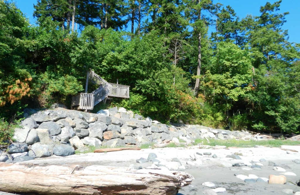
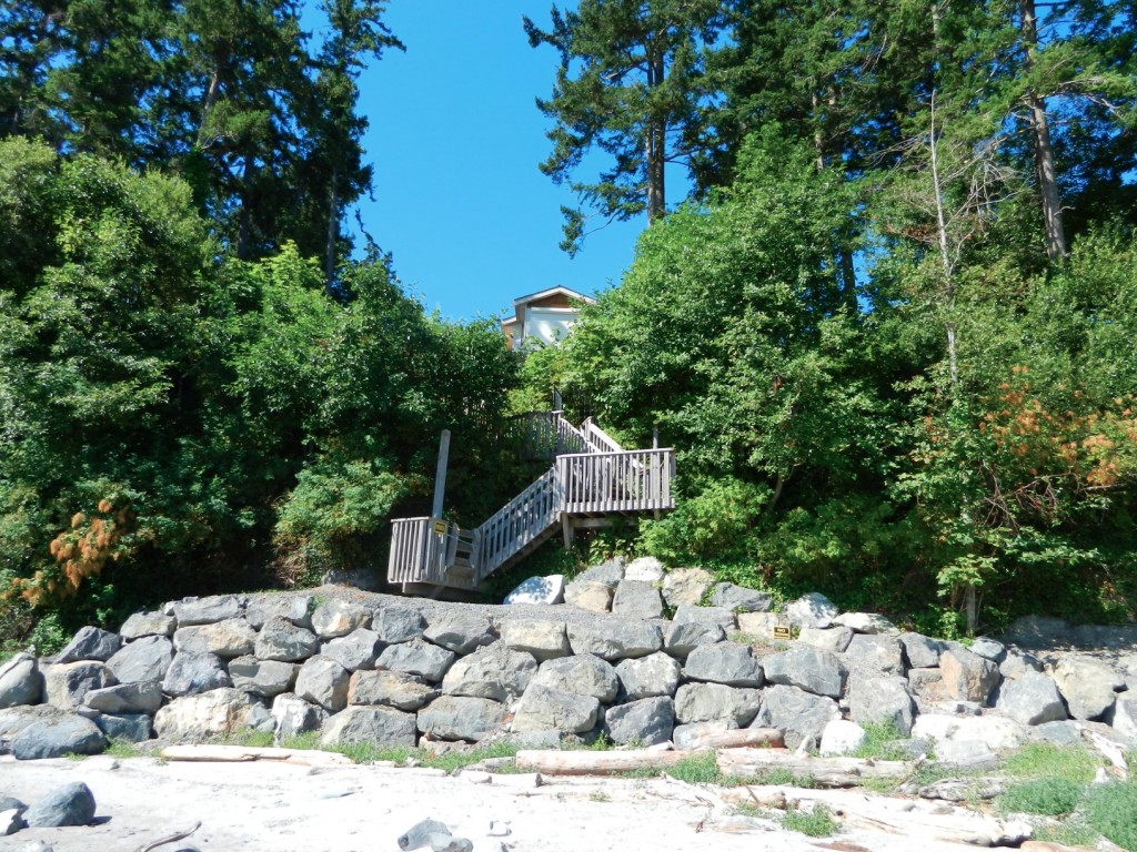
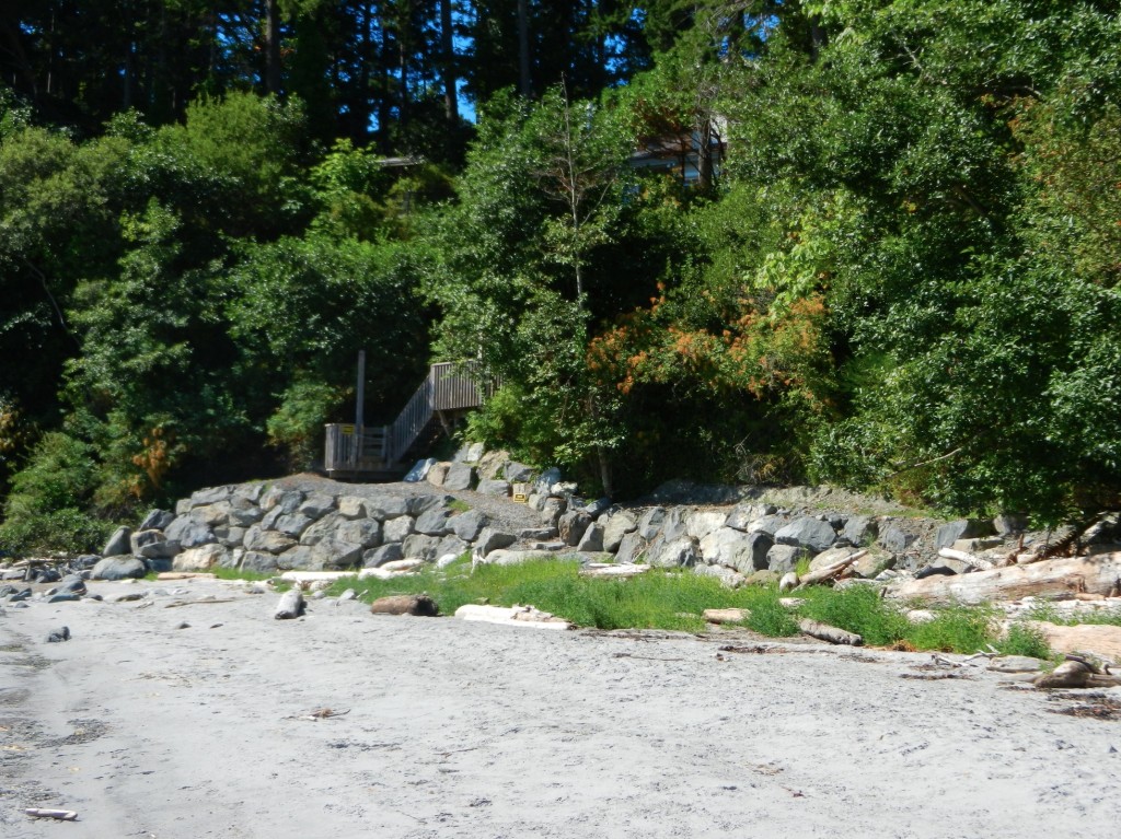
Over the summer of 2013, a new seawalll was built at the south end of Weir’s beach. The purpose of the wall is not obvious, other than to create a walkway to the ocean for the residence above.
The provincial government owns the ocean floor and the foreshore (the area between the low water level and the natural boundary) along Metchosin’s Coastline. This structure sits within this foreshore area, as there is sand at it’s base,  so it is questionable how this shoreline modification was permitted.

UPDATE:

  •  Under the General  Marine Shoreline policies desired works require application to the appropriate Provincial/and or Federal agencies responsible.  This particular property located at 5289 William Head Road was able to proceed under the following conditions: 
  • 1. Requirements of the Department of Fisheries & Oceans must be fulfilled.
  • 2. Any work below the high water mark must have the approval of the Ministry Forests, Lands & Natural Resource Operations
  • 3.  Work was  conducted in April according to the measures outlined in the Ryzuk Geotechnical Report dated March 7, 2013 and the report by Lehna Malmkvist, Swell Environmental Consulting Ltd., March 8, 2013

———————————————————————————————————–

Readers are recommended to read all parts of the publication below before attempting any alterations on shorefront property:

Coastal Shore Stewardship: A Guide for Planners, Builders and Developers on Canada’s Pacific Coast

Another reference on hardening the shorelines states the problem rather plainly: “Hard structures, especially vertical walls, often create conditions that lead to failure of the structure. In time, the substrate of the beach coarsens and scours down to bedrock or a hard clay. The footings of bulkheads are exposed, leading to undermining and failure. … Failed bulkheads and walls adversely impact beach aesthetics, may be a safety or navigational hazard, and may adversely impact shoreline ecological functions.”

southendstairnorth

View of the seawall from the south.

southendstairway

View of the seawall from the beach directly in front.

seawallfrombeach

View of sea wall from the north.