Occasional Paper No. 5 Revised: August 2008
Prepared by:
Ministry of Agriculture and Lands Crown Land Administration Division Province of British Columbia in cooperation with the Land Title and Survey Authority of British Columbia
The following is from :
Shorelines Modification , by the State of Washington Dept of Ecology
(ii) Principles. Shorelines are by nature unstable, although in varying degrees. Erosion and accretion are natural processes that provide ecological functions and thereby contribute to sustaining the natural resource and ecology of the shoreline. Human use of the shoreline has typically led to hardening of the shoreline for various reasons including reduction of erosion or providing useful space at the shore or providing access to docks and piers. The impacts of hardening any one property may be minimal but cumulatively the impact of this shoreline modification is significant.
Shoreline hardening typically results in adverse impacts to shoreline ecological functions such as:
Additionally, hard structures, especially vertical walls, often create conditions that lead to failure of the structure. In time, the substrate of the beach coarsens and scours down to bedrock or a hard clay. The footings of bulkheads are exposed, leading to undermining and failure. This process is exacerbated when the original cause of the erosion and “need” for the bulkhead was from upland water drainage problems. Failed bulkheads and walls adversely impact beach aesthetics, may be a safety or navigational hazard, and may adversely impact shoreline ecological functions.
“Hard” structural stabilization measures refer to those with solid, hard surfaces, such as concrete bulkheads, while “soft” structural measures rely on less rigid materials, such as biotechnical vegetation measures or beach enhancement. There is a range of measures varying from soft to hard that include:
Generally, the harder the construction measure, the greater the impact on shoreline processes, including sediment transport, geomorphology, and biological functions.
From the Official Community Plan : Available at this link
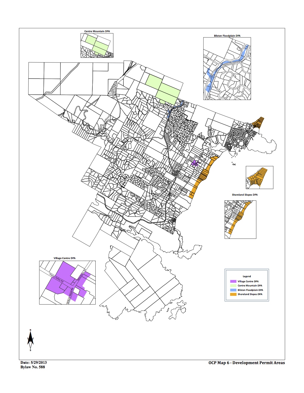
DPAs in Metchosin ( click to enlarge)
2.16 SHORELAND SLOPES DEVELOPMENT PERMIT AREAS:
The Municipal Act
provides that a community plan may designate development areas to be protected from hazardous conditions. The Municipal Act further provides that in such areas land shall not be altered in any way or subdivided and structures not be built or added to until a Development Permit has been issued. Council has established the following designation, special conditions, and guidelines.
2.16.1 Designation: (Bylaw 418, 2004)
The 1993 Hazard Land Management Plan has identified areas of the Metchosin shoreland slopes as having erosion, land sloughing and drainage problems.
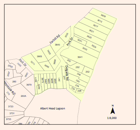
Farhill Road portion of DPAs,
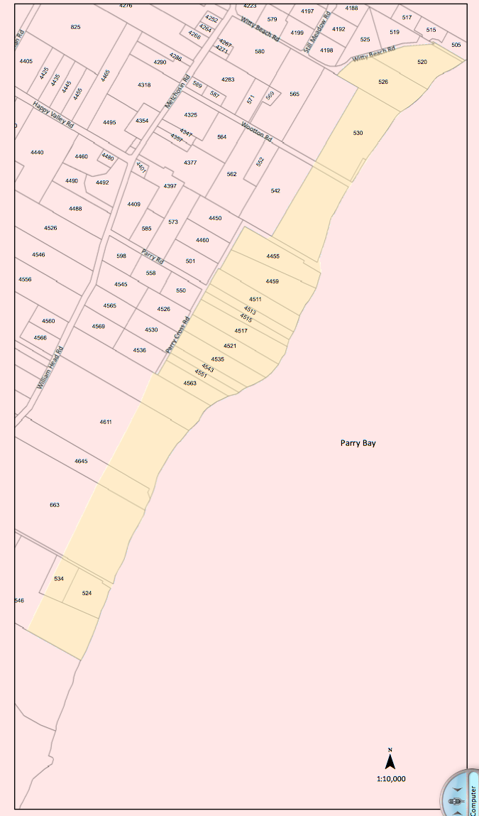
Parry Bay ( Taylor Beach ) section of DPA lands
The Shoreland Slopes areas are shown on Map 6 Shoreline Slopes DPA, and are hereby designated as areas for the protection of development from hazardous conditions pursuant to Section 919.1(1)(b) of the Local Government Act.
The Plan has identified three Shoreland Slope classification zones, based on the degree of slope instability and surface erosion potential. Slopes classified as zone 2 and 3 are slopes with the greatest potential for sloughing, slumping and debris flows and have been included in the Development Permit Area.
2.16.2 Special Conditions:
The major concern is that lands, particularly in the Park Drive – Farhill Road area, have experienced a dramatic rise in ground water levels due to adjacent developments during the last two decades. Other areas of the Shoreland slopes have experienced significant slope erosion in the past. There is a community desire to mitigate any further development related impacts on the marine shorelands.
2.16.3 Policies Development Permits issued shall be in accordance with the following:
(1) The construction or alteration of buildings on existing lots shall be permitted subject to the Building Permit process when Council is satisfied that the Development Permit Guidelines (Section 2.14.4) have been met, and, when required, Council is satisfied with the Engineer’s Report (Section 2.14.5).
(2)Where a Development Permit is applied for in conjunction with an application for subdivision approval, rezoning, or both, the Development Permit shall be conditional on the successful completion of those other permits and shall lapse if the subdivision or rezoning is not approved.
2.16.4 Guidelines:
(1) All applications for new development in the Development Permit Areas shall be required to have an Engineer’s Report (described below).
(2) Removal of vegetation shall be minimized.
(3) House construction, regrading, and excavation of till (including for road building) is not permitted within 60 metres of the edge of the slope except where geotechnical engineering and resource management studies indicate that a lesser setback is acceptable.
page 31
‐
2.16.5 Engineer’s Report:
Before a development permit is issued, the applicant shall be required to furnish a report at his\her expense from a registered professional engineer with geotechnical experience which will certify that the proposed development will produce no adverse impacts on the shoreland slopes and will not place buildings or structures in danger of slope slippage.
The Engineer’s Report shall demonstrate that consideration has been given to the following:
(1)(a) siting and setbacks of development structures, roads, and services,
(b) minimizing paving and impervious materials, and,
(c) implementing infiltration techniques so as to limit runoff;
(2) designing runoff detention ponds, drainage works, or
sediment traps or basins to reduce the flow of runoff and silt during land clearing and construction.
(3) development near shoreland slopes must address the impact of surface water on slope stability, vegetation and soils, and make recommendations to remedy that already damaged; and
(4) removal of trees (with a valid tree-cutting permit) or other vegetation should be allowed only where necessary and where alternate vegetation and/or erosion control measures are established. If possible, stumps should be left in place to provide some soil stabilizing influence until alternative vegetation is established. Plans delineating extent of vegetation/tree removal (location, species and diameter of trees) and location of proposed construction, ex cavation and/or blasting, may be required.
The DISTRICT, at its discretion, may also submit the Engineer’s Report to review by a second Engineer at the applicant’s expense, and/or directly to the Ministry of Environment for their comments.
2.16.6 Municipal Response,
The DISTRICT should:
(1) evaluate the feasibility of purchasing environmentally sensitive shorelands for use as park, forest reserve, or greenbelt;
(2) initiate programs to monitor both surface and ground water to establish patterns of change;
(3)work with proximate agencies to establish erosion and land sloughing control measures.
On May 26 2013, Gretchen Markle reported on a nudibrach
” Today we found two specimens of the grey phase Acanthodoris nanaimoensis (unmistakable with its maroon-tipped rhinopores and gills) on the beach at Chris Pratt’s.” (see location image below.)
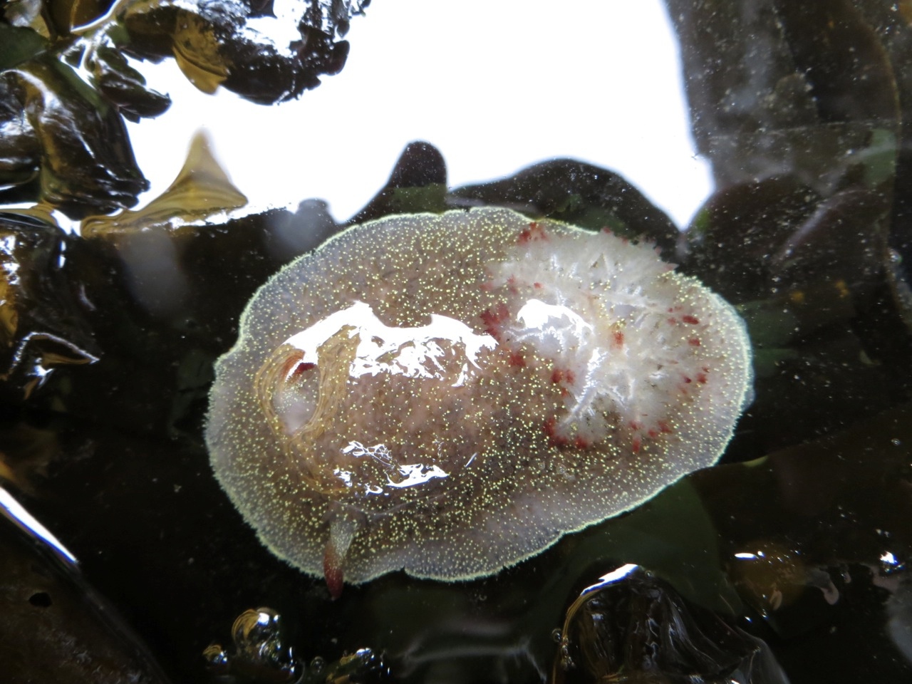 Phylum Mollusca
The range of this species is Baranof Island, Alaska to Santa Barbara, CA; less common in southern portion of range.
Click on this image from Google Earth 3D for the location.
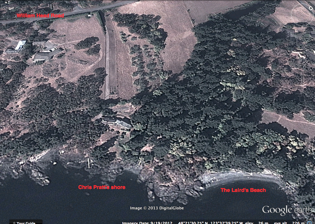
Shoreline in front of Chris Pratt’s place.
Gretchen Markle reported a new seastar Henricia pumila for the April 27 Metchosin Bioblitz on the Laird’s beach , south of Taylor Road and north off Weir’s beach (see Google image below). Henricia pumila is an uncommon seastar, having only been officially described in 2010. Phil Lambert confirmed the identification.
See http://www.mapress.com/
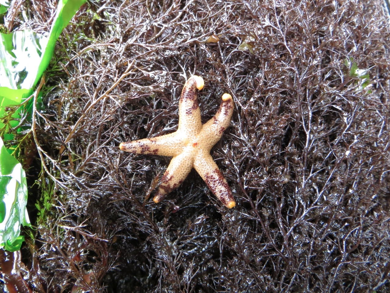
Phylum Echinodermata
Class Asteroidea
Order Spinulosida
Suborder Leptognathina
Family Echinasteridae
Genus Henricia
Species pumila, Eernisse et al., 2010
Common name: Dwarf mottled henricia.
Shoreline in front of Chris Pratt’s place.
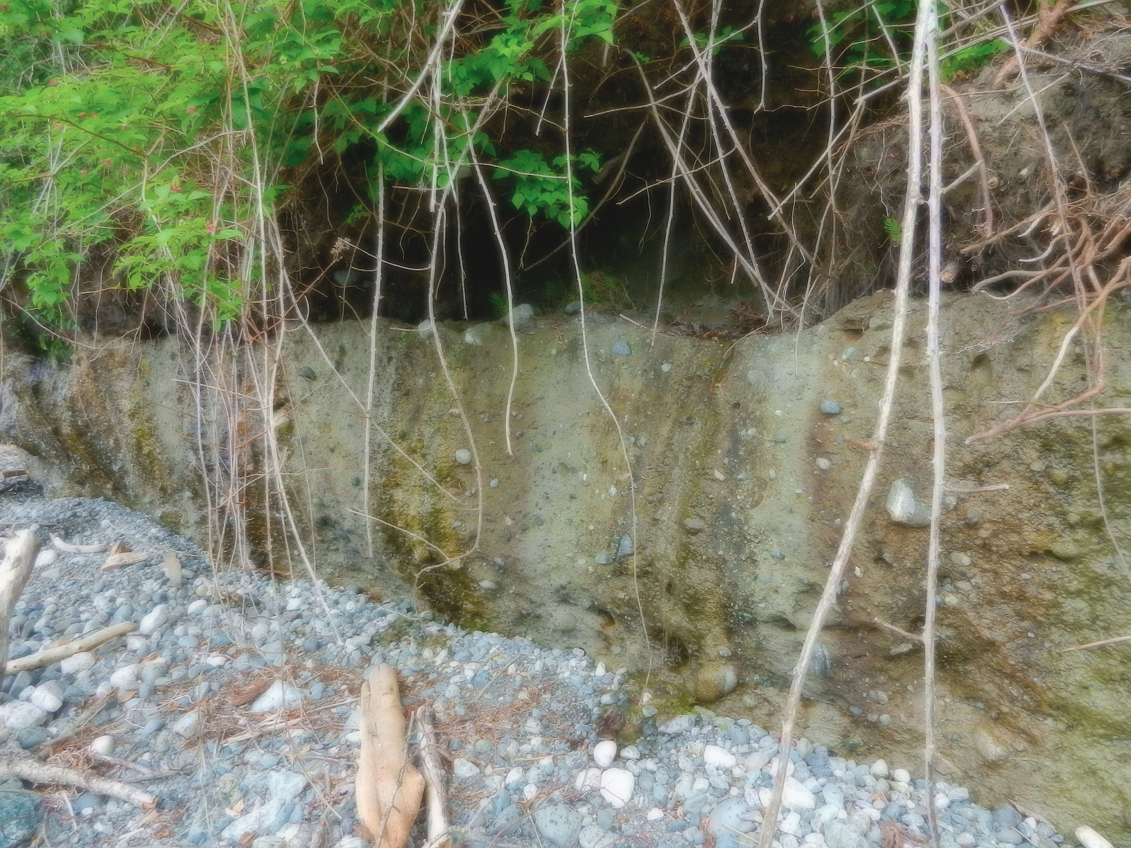
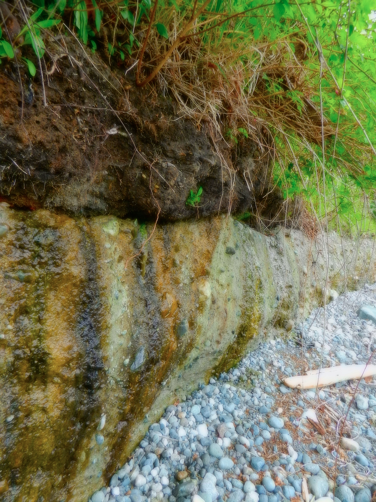
Living on a steep coastal bluff with million dollar views may be a dream of many, but with it comes a few responsibilities. The references on development along coastal areas provides many examples of how development has to be done responsibly. One aspect of concern is vegetation removal and tree cutting and topping on cliffs in order to provide better views to the landowner. In Metchosin, two areas, the Albert Head Cliffs and the Taylor Beach Cliffs provide many examples of this.
In April of 2013 the sound of a chainsaw on the Taylor cliffs led to the discovery of many alder trees on the almost vertical slope that had been topped and even a few arbutus trees had been cut down.
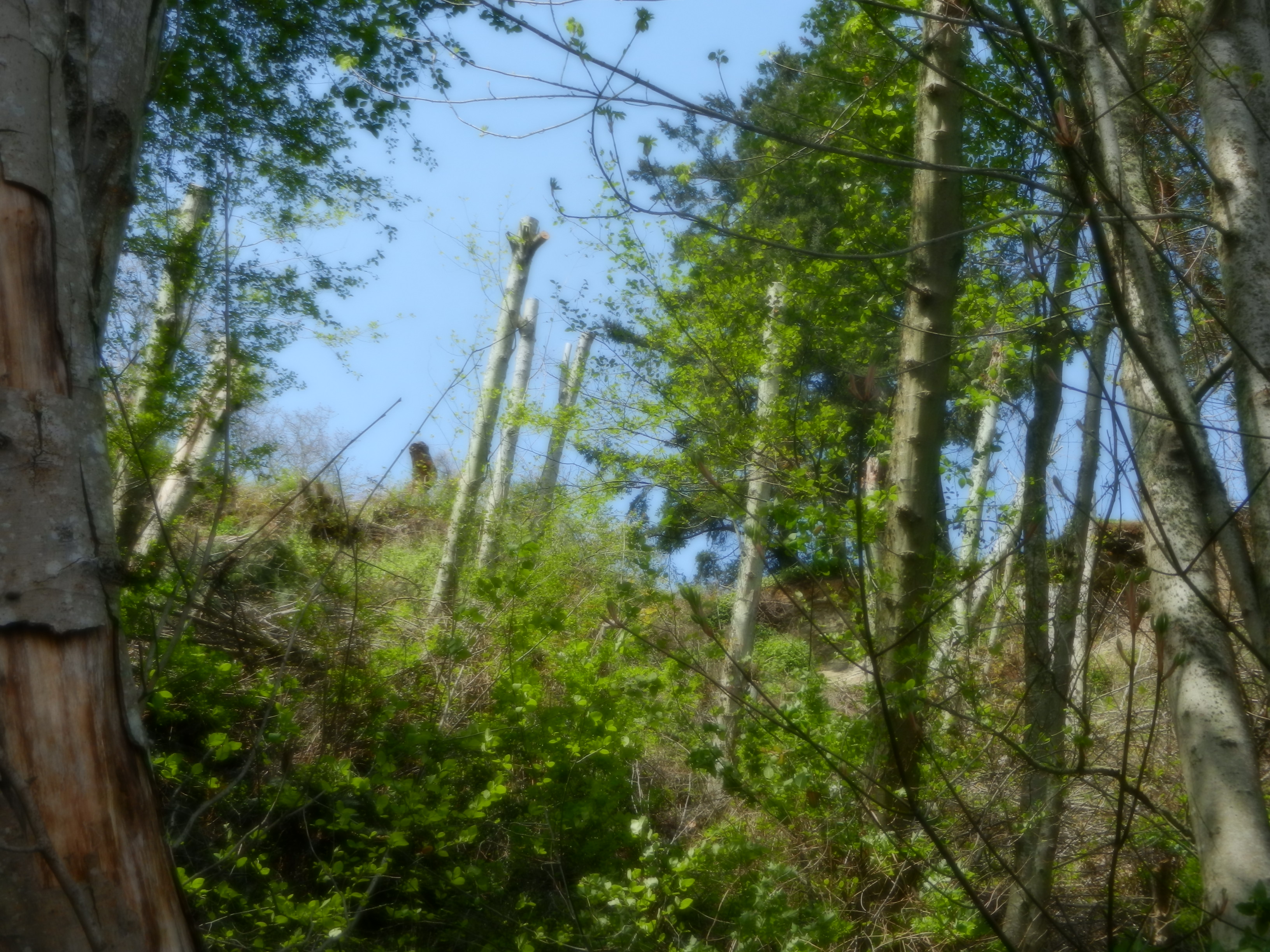
Topped Alder Trees on the Taylor Beach Cliffs
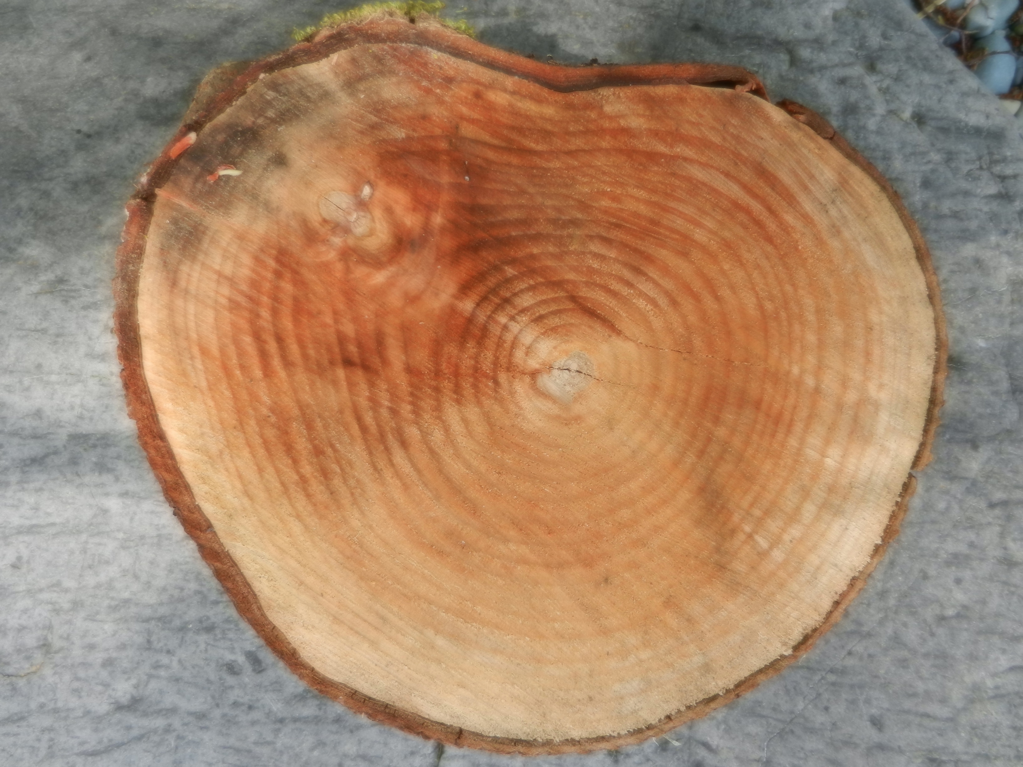 These trees were about 25 years old as can be seen by the tree rings on chunks of trees that had rolled down to the beach.
It might be pointed out that these trees are from the area of Metchosin’s Coastline included in the development permit zone.
This reference from the Center for Ocean Solutions points out he problems of interferring with natural processes on an seaside cliff given the threats of climate change and sea level rise.
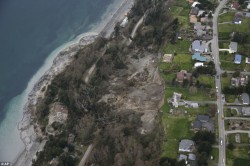
Photo of slope failure from Mail Online
A good example taken from “Mail Online” of what slope failure looked like on Whidbey Island.
 And if one still has doubts, check out these images :
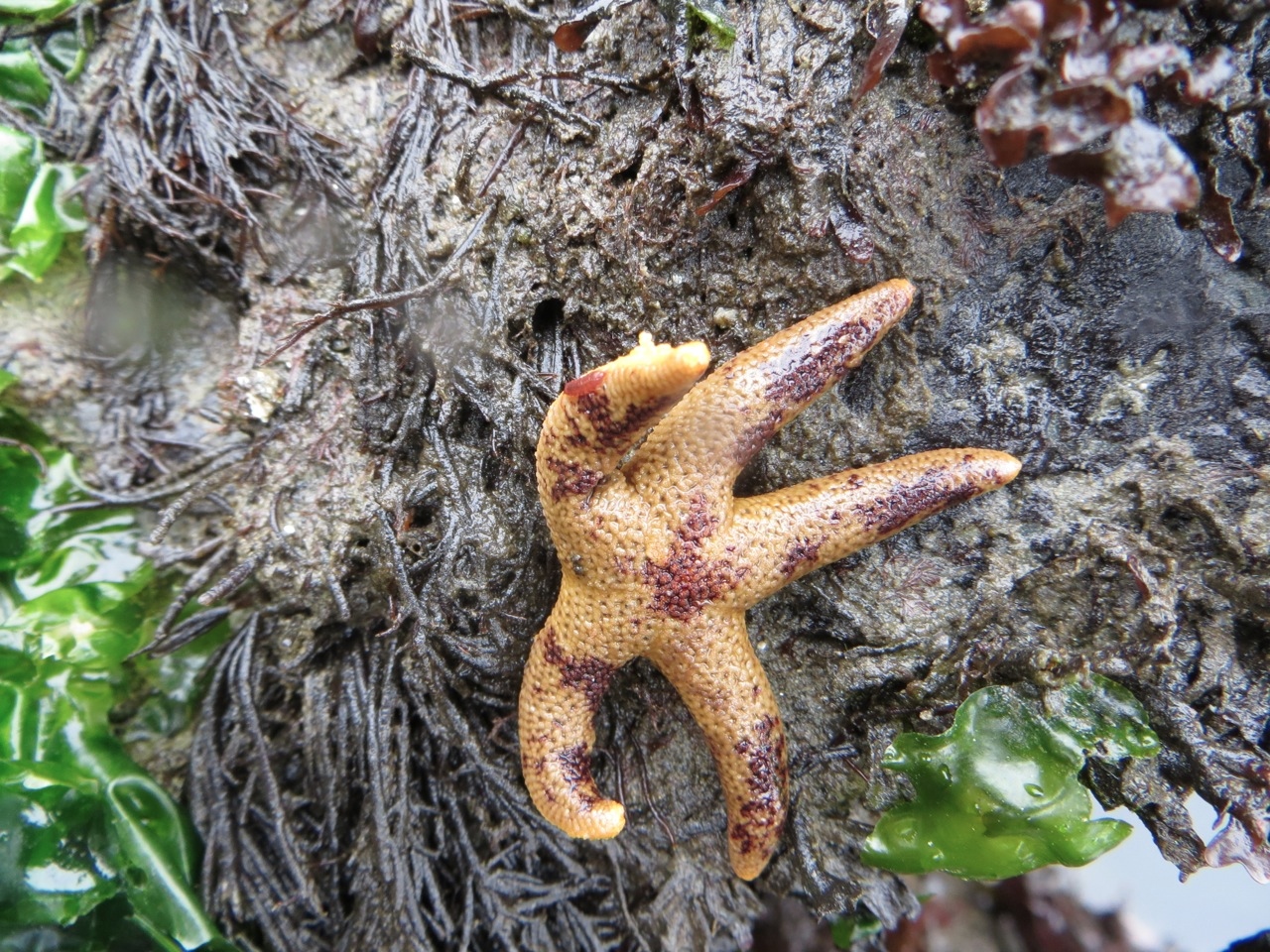
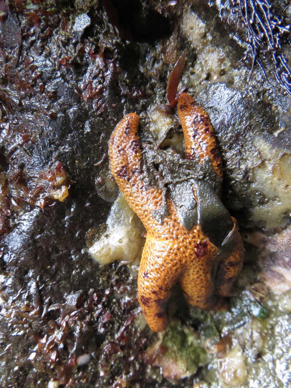
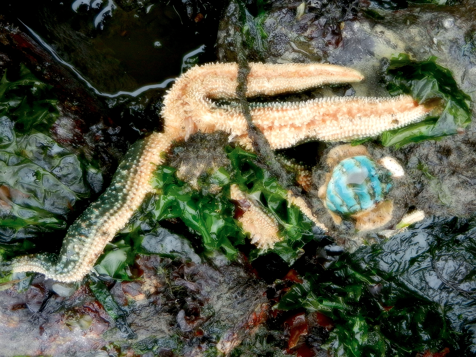
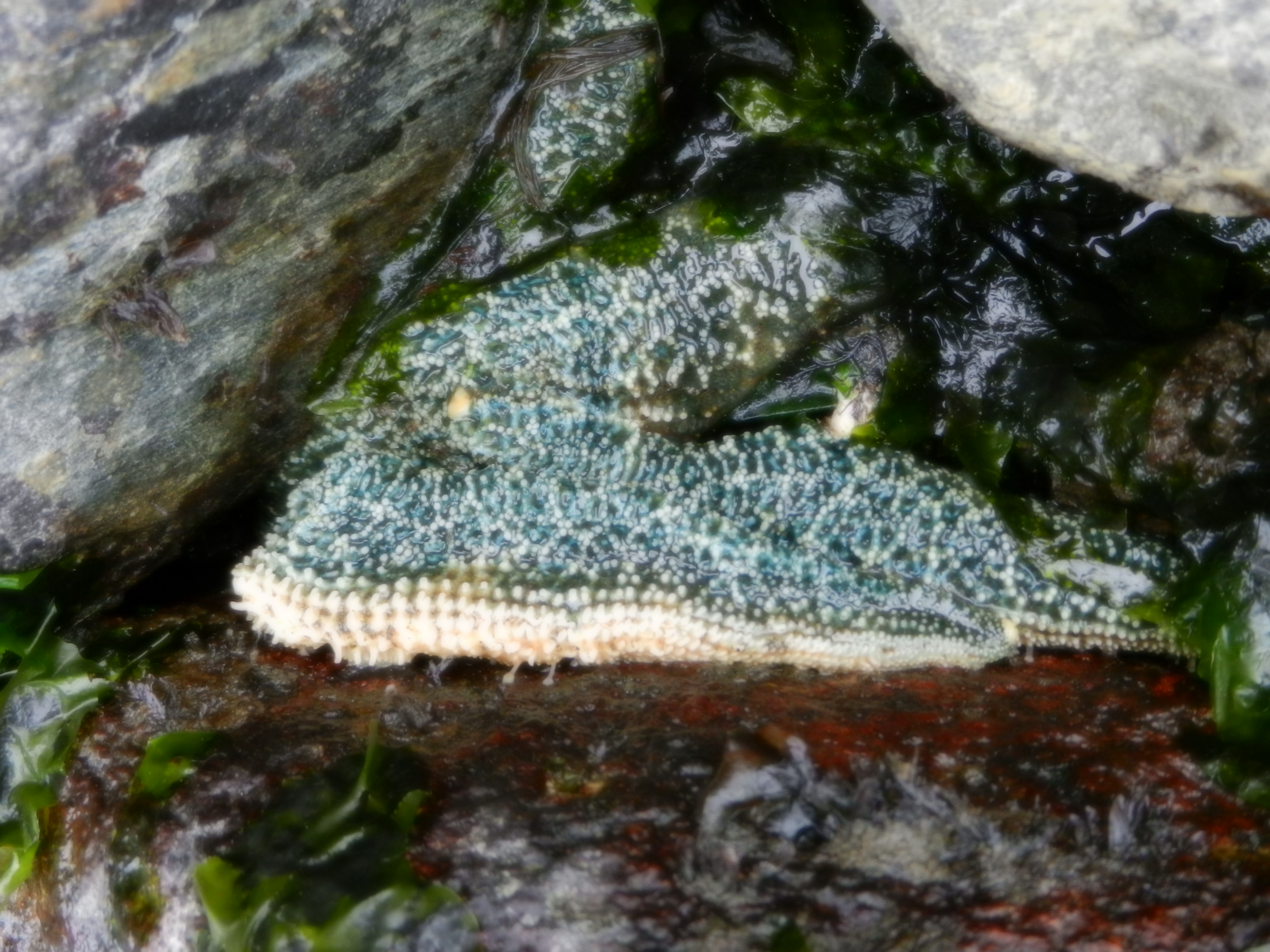
These photos taken by Garry Fletcher on the rocky intertidal at the base of Taylor Bluffs on Parry Bay shows an unusual green phase of the Evasterias troscheli
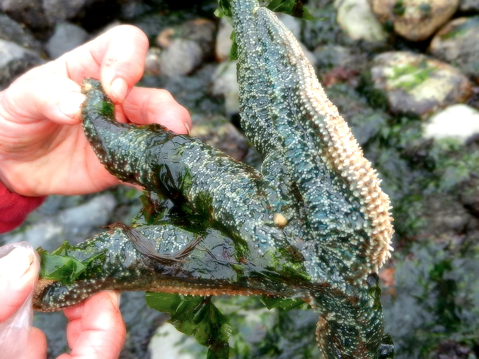
| Kingdom: Animalia |
| Phylum: Echinodermata |
| Subphylum: Eleutherozoa |
| Superclass: Asterozoa |
| Class: Asteroidea |
| Order: Forcipulatida |
| Family: Asteriidae |
| Genus: Evasterias |
| Species: E. troscheli |
| Binomial name: Evasterias troscheli, (Stimpson, 1862) |
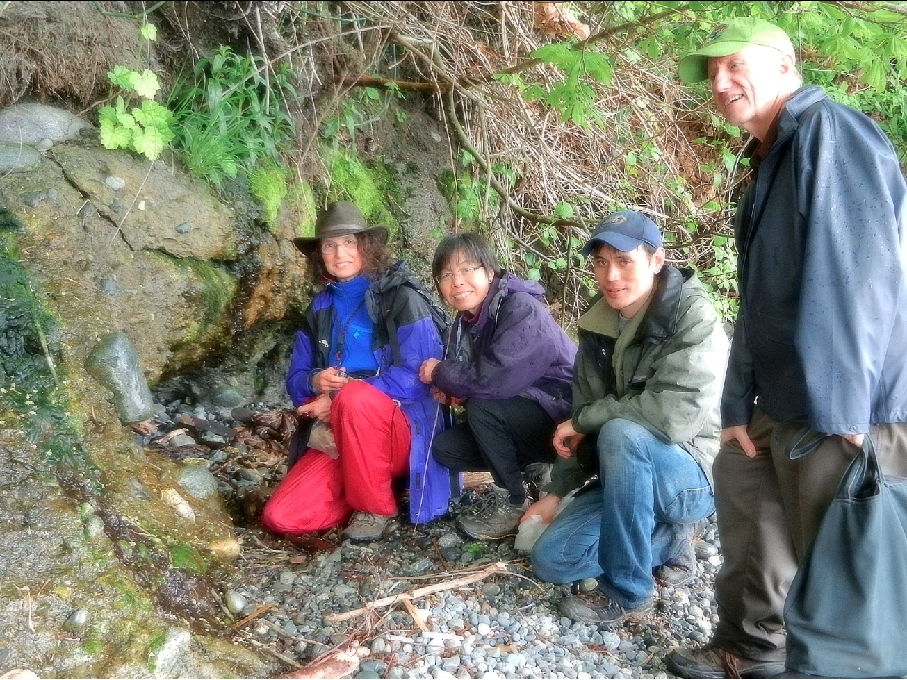
Metchosin BioBlitz Observations by Garry Fletcher and Sandra______on April 27, 2013 on the floodplane and estuary of Gooch Creek, on the 4645 William Head Road Property.