Publication: Protecting Your Communities Coastal Assets

Local Leadership in marine planning: Local governments on B.C.’s Coast have the power to protect the ecosystems we depend on.

This report describes easily accessible resources local governments can use to maintain aquatic Ecosystem Value and Productivity, including maps and tools to guide decisions and bylaws regarding management of activities on land , and in intertidal and sub-tidal zones.

protectingassetsicon


Download .pdf from this website

or

Originally available here:
powerinhands

Why Sand Is Disappearing ( from beaches)

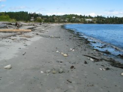
beachlooknorth

The heavily impacted Weir’s Beach which has experienced considerable sand loss in recent years largely due to bad management of the shoreline.

This article highlights a good example how human interference ( anthropogenic) in a number of ways can result in the loss of Natural Capital and long term sustainability . 

The beaches of Metchosin are not immune  to the forces of Climate change and uninformed decisions of upland landowners and municipal governments which refuse to enact rigid Shoreline Development Bylaws. 

This has been quoted  from: The NYT Opinion Pages    NOV. 4, 2014

” BERKELEY, Calif. — To those of us who visit beaches only in summer, they seem as permanent a part of our natural heritage as the Rocky Mountains and the Great Lakes. But shore dwellers know differently. Beaches are the most transitory of landscapes, and sand beaches the most vulnerable of all. During big storms, especially in winter, they can simply vanish, only to magically reappear in time for the summer season.

It could once be said that “a beach is a place where sand stops to rest for a moment before resuming its journey to somewhere else,” as the naturalist D. W. Bennett wrote in the book “Living With the New Jersey Shore.” Sand moved along the shore and from beach to sea bottom and back again, forming shorelines and barrier islands that until recently were able to repair themselves on a regular basis, producing the illusion of permanence.

Today, however, 75 to 90 percent of the world’s natural sand beaches are disappearing, due partly to rising sea levels and increased storm action, but also to massive erosion caused by the human development of shores. Many low-lying barrier islands are already submerged.

Yet the extent of this global crisis is obscured because so-called beach nourishment projects attempt to hold sand in place and repair the damage by the time summer people return, creating the illusion of an eternal shore.

Before next summer, endless lines of dump trucks will have filled in bare spots and restored dunes. Virginia Beach alone has been restored more than 50 times. In recent decades, East Coast barrier islands have used 23 million loads of sand, much of it mined inland and the rest dredged from coastal waters — a practice that disturbs the sea bottom, creating turbidity that kills coral beds and damages spawning grounds, which hurts inshore fisheries.

The sand and gravel business is now growing faster than the economy as a whole. In the United States, the market for mined sand has become a billion-dollar annual business, growing at 10 percent a year since 2008. Interior mining operations use huge machines working in open pits to dig down under the earth’s surface to get sand left behind by ancient glaciers. But as demand has risen — and the damming of rivers has held back the flow of sand from mountainous interiors — natural sources of sand have been shrinking.

One might think that desert sand would be a ready substitute, but its grains are finer and smoother; they don’t adhere to rougher sand grains, and tend to blow away. As a result, the desert state of Dubai brings sand for its beaches all the way from Australia.

And now there is a global beach-quality sand shortage, caused by the industries that have come to rely on it. Sand is vital to the manufacturing of abrasives, glass, plastics, microchips and even toothpaste, and, most recently, to the process of hydraulic fracturing. The quality of silicate sand found in the northern Midwest has produced what is being called a “sand rush” there, more than doubling regional sand pit mining since 2009.

But the greatest industrial consumer of all is the concrete industry. Sand from Port Washington on Long Island — 140 million cubic yards of it — built the tunnels and sidewalks of Manhattan from the 1880s onward. Concrete still takes 80 percent of all that mining can deliver. Apart from water and air, sand is the natural element most in demand around the world, a situation that puts the preservation of beaches and their flora and fauna in great danger. Today, a branch of Cemex, one of the world’s largest cement suppliers, is still busy on the shores of Monterey Bay in California, where its operations endanger several protected species.

The huge sand mining operations emerging worldwide, many of them illegal, are happening out of sight and out of mind, as far as the developed world is concerned. But in India, where the government has stepped in to limit sand mining along its shores, illegal mining operations by what is now referred to as the “sand mafia” defy these regulations. In Sierra Leone, poor villagers are encouraged to sell off their sand to illegal operations, ruining their own shores for fishing. Some Indonesian sand islands have been devastated by sand mining.

It is time for us to understand where sand comes from and where it is going. Sand was once locked up in mountains and it took eons of erosion before it was released into rivers and made its way to the sea. As Rachel Carson wrote in 1958, “in every curving beach, in every grain of sand, there is a story of the earth.” Now those grains are sequestered yet again — often in the very concrete sea walls that contribute to beach erosion.

We need to stop taking sand for granted and think of it as an endangered natural resource. Glass and concrete can be recycled back into sand, but there will never be enough to meet the demand of every resort. So we need better conservation plans for shore and coastal areas. Beach replenishment — the mining and trucking and dredging of sand to meet tourist expectations — must be evaluated on a case-by-case basis, with environmental considerations taking top priority. Only this will ensure that the story of the earth will still have subsequent chapters told in grains of sand.


New Publication on Shoreline Erosion Control out of Washington State

I attended the Salish Sea Ecosystem Conference in Seattle several weeks ago and one of the sessions I attended was delivered by the presenter of the following report.
In  Puget Sound there is no hesitation in bsing very specific on what needs to be done about controlling the impact of humans on the shoreline as they have a long history of making a real mess of many kilometers of shoreline.

http://wdfw.wa.gov/publications/01583/


BC Government Publications Index for Stewardship Centre on Coastal Planning and Land Use

BC Government Publications
Index for:
Stewardship Centre for British Columbia
Coastal Shore Stewardship: A Guide for Planners, Builders and Developers on Canada’s Pacific Coast

http://www.llbc.leg.bc.ca/public/pubdocs/bcdocs/368207/

The four PDFs linked to this government site have also been included here since we find that external URLs often change:
Part 1: Coastal Shore Stewardship A Guide for planners, Builders and Developers on Canada’s Pacific Coast: part1

Part 2  Coastal Planning and Approvals, Who does What: part2

Part 3  Don’t disrupt, Don’t harden, Don’t pollute: Land Development,  Marine Facilities, Seawalls and Revetments, etc.   Links to many  Stewardship resources; part3

Internet resources: internetaddresses

Sharing our Shoreline

Values and Views
Island Trust Communities
Marine By Nature
The Islands within the Salish Sea have been  shaped by ancient glaciers and modern oceanic forces. Whether you visit the islands seasonally or live here year round, Islanders treasure the marine environment.  The North Pender Local Trust Committee has developed this brochure to introduce you to where sensitive marine habitats exist, how you can recognize them, and what simple steps you can take to ensure our local waters continue to support a vibrant and abundant marine ecosystem.

This PDF has been produced by the North Pender Island Local Trust Committee: Sharing Our shorelines_lowres

IslandstrustContents:

Clean Water
Shoreline erosion
Coastal Bluffs and Shoreline beaches
Marine Riparian Vegetation
Intertidal Habitats
Beach-spawning Forage Fish
Eelgrass habitats
Kelp Forests and Rocky Reefs
Marine shorelines as critical fish habitats

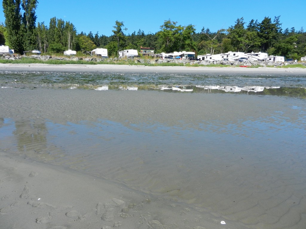
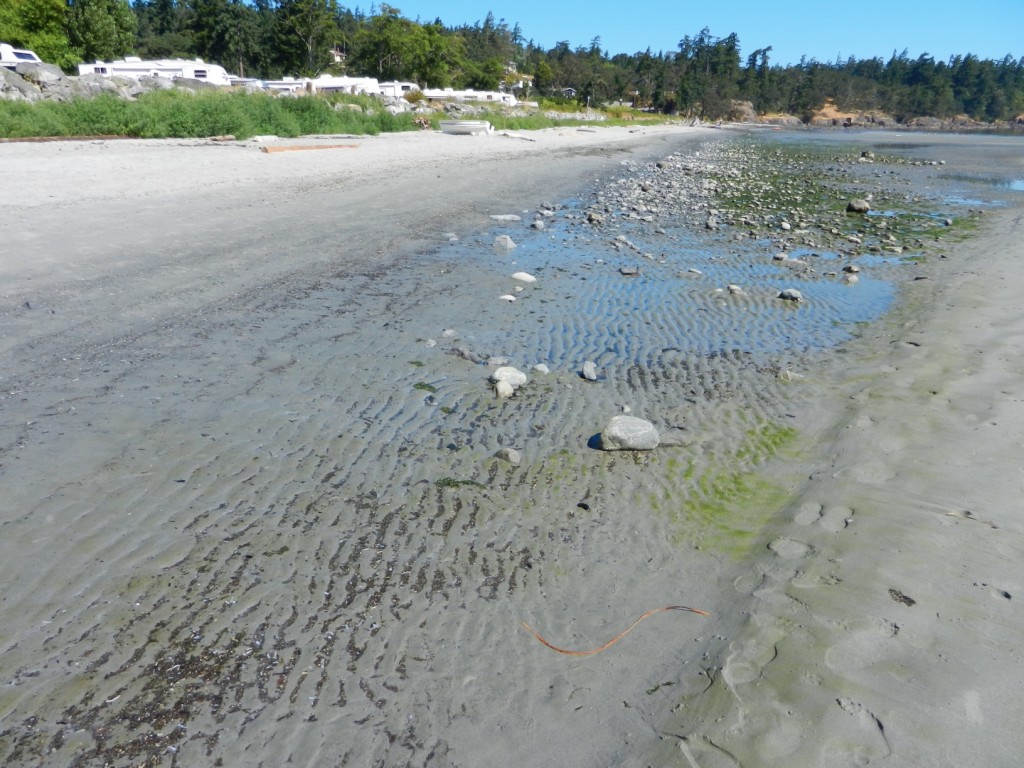
Weir’s Beach erosion.

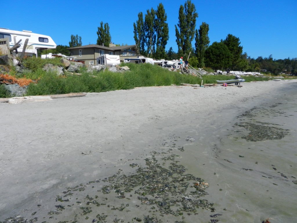
In July 2013 at Low tide, the loss of sand from near the south end of Weir’s Beach has become obvious. This was predictable because of the hardening of the shoreline several years ago with the installation of large rock rip-rap along the front of the adjacent Weir’s Beach Trailer Park. As many of the references such as  Hardening the shorelines indicates:  “Hard structures, especially vertical walls, often create conditions that lead to failure of the structure. In time, the substrate of the beach coarsens and scours down to bedrock or a hard clay. The footings of bulkheads are exposed, leading to undermining and failure. … Failed bulkheads and walls adversely impact beach aesthetics, may be a safety or navigational hazard, and may adversely impact shoreline ecological functions.”

riprap

Large rock riprap on the berm

trailers1

Trailer park perched on the edge of the berm.

weirserosion

Loss of fine sand material from the beach in front of the trailer park.

See this file for earlier images of the beach and comparisons: https://metchosinmarine.ca/7taylorbeach/weirs/beachcompare.htm

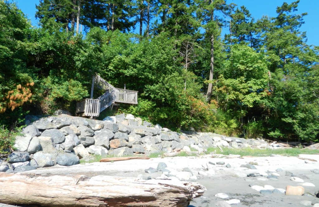
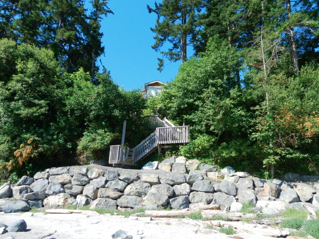
New Seawall on Weir’s Beach

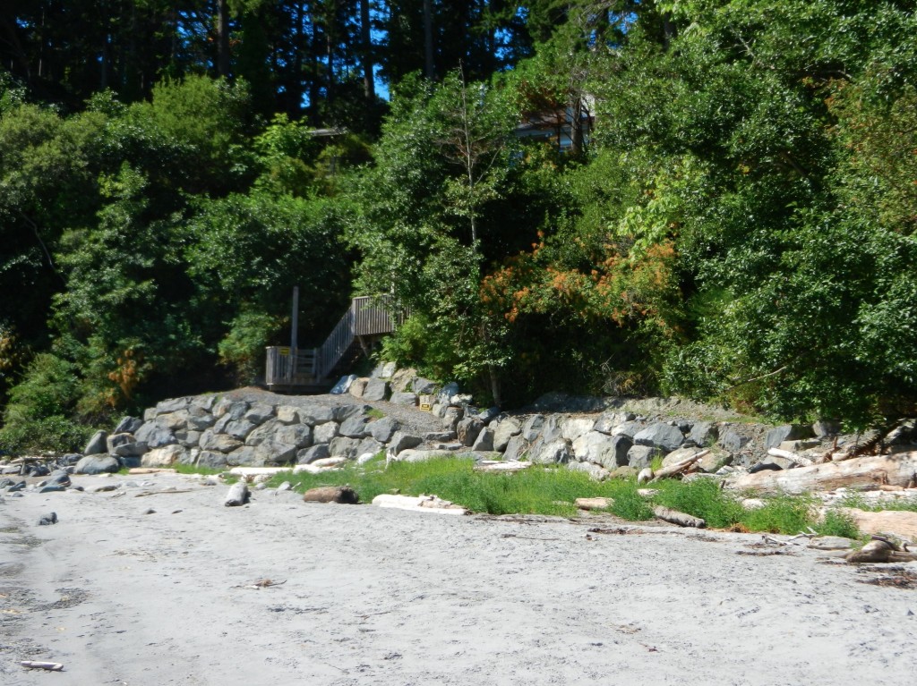
Over the summer of 2013, a new seawalll was built at the south end of Weir’s beach. The purpose of the wall is not obvious, other than to create a walkway to the ocean for the residence above.
The provincial government owns the ocean floor and the foreshore (the area between the low water level and the natural boundary) along Metchosin’s Coastline. This structure sits within this foreshore area, as there is sand at it’s base,  so it is questionable how this shoreline modification was permitted.

UPDATE:

  •  Under the General  Marine Shoreline policies desired works require application to the appropriate Provincial/and or Federal agencies responsible.  This particular property located at 5289 William Head Road was able to proceed under the following conditions: 
  • 1. Requirements of the Department of Fisheries & Oceans must be fulfilled.
  • 2. Any work below the high water mark must have the approval of the Ministry Forests, Lands & Natural Resource Operations
  • 3.  Work was  conducted in April according to the measures outlined in the Ryzuk Geotechnical Report dated March 7, 2013 and the report by Lehna Malmkvist, Swell Environmental Consulting Ltd., March 8, 2013

———————————————————————————————————–

Readers are recommended to read all parts of the publication below before attempting any alterations on shorefront property:

Coastal Shore Stewardship: A Guide for Planners, Builders and Developers on Canada’s Pacific Coast

Another reference on hardening the shorelines states the problem rather plainly: “Hard structures, especially vertical walls, often create conditions that lead to failure of the structure. In time, the substrate of the beach coarsens and scours down to bedrock or a hard clay. The footings of bulkheads are exposed, leading to undermining and failure. … Failed bulkheads and walls adversely impact beach aesthetics, may be a safety or navigational hazard, and may adversely impact shoreline ecological functions.”

southendstairnorth

View of the seawall from the south.

southendstairway

View of the seawall from the beach directly in front.

seawallfrombeach

View of sea wall from the north.

Riparian Rights and Public Foreshore Use in the Administration of Aquatic Crown Land


Occasional Paper No. 5  Revised: August 2008
Prepared by:
Ministry of Agriculture and Lands Crown Land Administration Division Province of British Columbia in cooperation with the Land Title and Survey Authority of British Columbia

Preparing for Climate Change: DPAs

From:
PREPARING FOR CLIMATE CHANGE:
Page 35 Development Permit Areas
Creating a DPA is a way to shape the development or redevelopment of a given area, and guidelines for the DPA (in the OCP or in a zoning bylaw) can include both broad prescriptions for land use as well as site specific requirements. Preparing for climate change impacts may mean updating existing DPAs to account for different levels of risk or changes to best practices, or in some cases developing new DPAs. There is already well-established practice in BC with respect to using DPAs to manage land use in areas with defined hazards, such as interface wildfires, or slope stability issues and many examples to draw on. DPAs for wildfire hazards may also include requirements about landscaping and the siting, form, exterior design and finish of buildings. DPAs can also be used to restrict development and protect and/or restore natural features and areas, and can be used to help protect key natural ecosystems in the face of climate change.
DPAs can offer local governments a more flexible approach to regulating development than zoning because guidelines can specify results and allow site-specific solutions. For example, a DPA can specify a certain level of onsite stormwater infiltration, while a zoning bylaw could only specify the site coverage allowed.
The Local Government (Green Communities) Statutes Amendment Act (2008) created the opportunity for new types of DPAs, including those designed to promote energy and water conservation. Local governments can employ these DPAs to help make their communities more resilient to climate change impacts like water shortages and potential disruptions in centralized energy supply due to heavy seasonal demand or extreme weather events. Like
DPAs for wildfire hazards, they may also include requirements about landscaping and the siting, form, exterior design and finish of buildings to further energy and water conservation and greenhouse gas reduction goals. For more information see
DPAs can offer local governments a more flexible approach to regulating development than zoning because guidelines can specify results and allow site- specific solutions.

An Implementation Guide for Local Governments in British Columbia DPAs for energy and water conservation may also establish restrictions on the type and placement of trees and other vegetation in proximity to the buildings and other structures in order to provide for the conservation of energy, which can be considered in the context of reducing the heat island effect in urban areas. DPAs can be used together with complementary measures such as servicing requirements, development cost charges and other local government tools to achieve climate change adaptation objectives


DEVELOPMENT PERMIT AREAS: Local Government Act, ss. 919.1-920
In an OCP a local government may designate areas within its jurisdiction where development permits are required before any subdivision, rezoning, construction or (in some cases) any disturbance of the land may occur, the reason the development permit is required, along with guidelines outlining the requirements for obtaining a development permit (which may be in the OCP or a zoning bylaw). The range of purposes that may be relied on for creating development permit areas is quite broad. Those of most interest with respect to climate change adaptation measures are likely protection of the natural environment, protection of the community from hazardous conditions, and establishing objectives to promote conservation of water and energy