Post North-easterly Storm on Weir’s beach, Dec 2014

During the past few weeks, we have experienced several storms out of the north east at high tide. These images were taken to document some of the on-going problems from the extensive rip-rapping and seawall construction on that beach. See this page for summer 2013 images for comparison.

2014-12-26 weirserosion2

The solid sea-wall built only last year will lead to increased scouring and removal of sand. Unfortunately it will not only affect the crown land property in front of the wall, but the crown land foreshore adjacent to this property .


2014-12-26 weirserosin

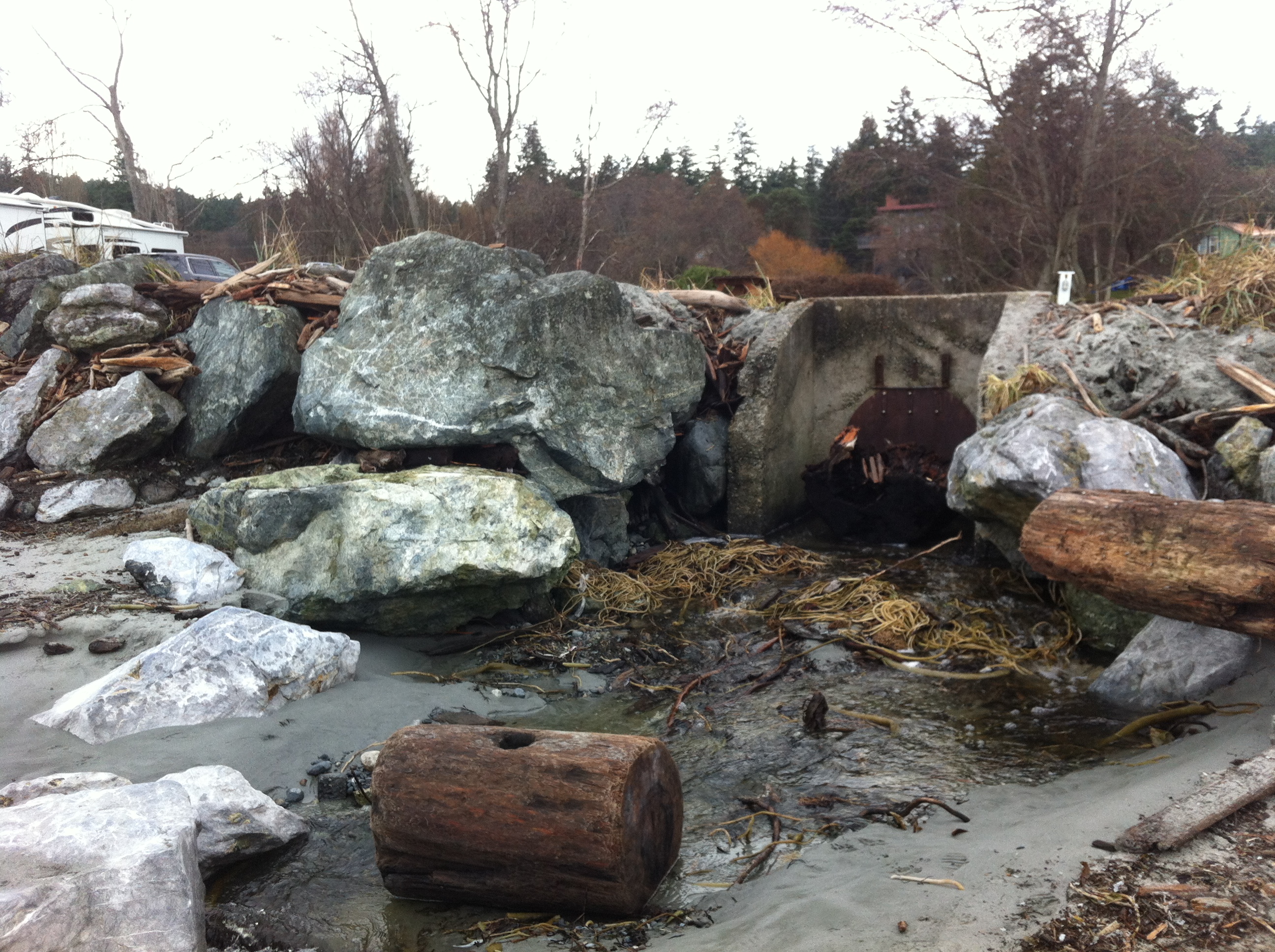
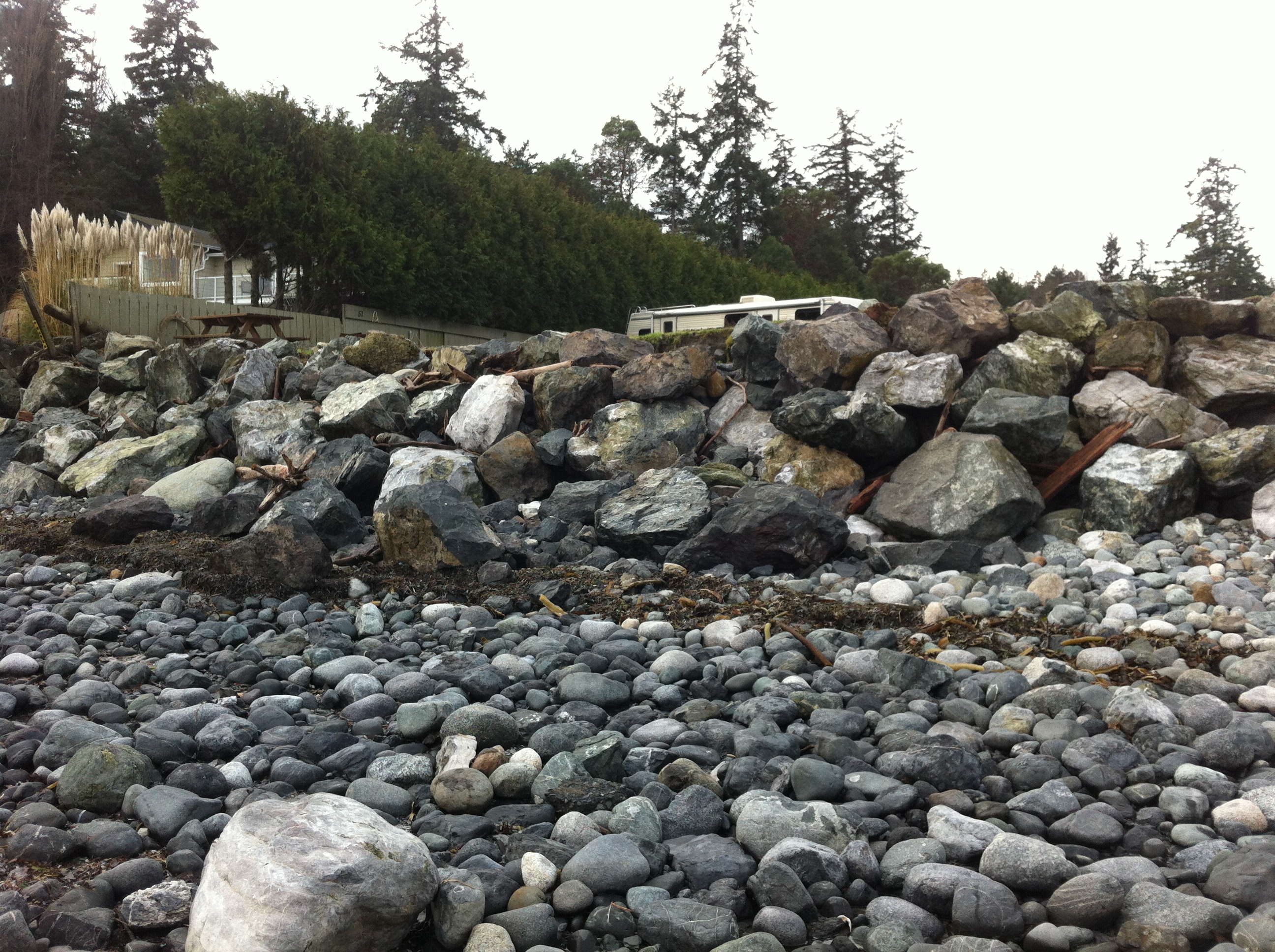
Recent storms have dislodged many of the boulders near the south end of the beach. Note the rubble foreground which was previously sand beach.

2014-12-26 controlgate

This concrete control gate was built many years ago to control flooding into a lagoon. The rip-rap boulders around it have been disturbed by wave action.

2014-12-26 weirsbeachwidth

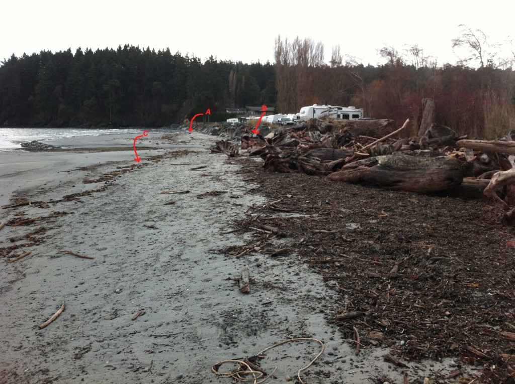
Site A= south end of the beach-sand eroded from base of rip-pap wall. Site B The border of where the rip-rap ends and the natural beach (going northward,) begins. C=the widened sand beach area backed by the natural beach. Scouring of the sand does not occur as it does further south on the beach.

2014-12-26 natural-portion

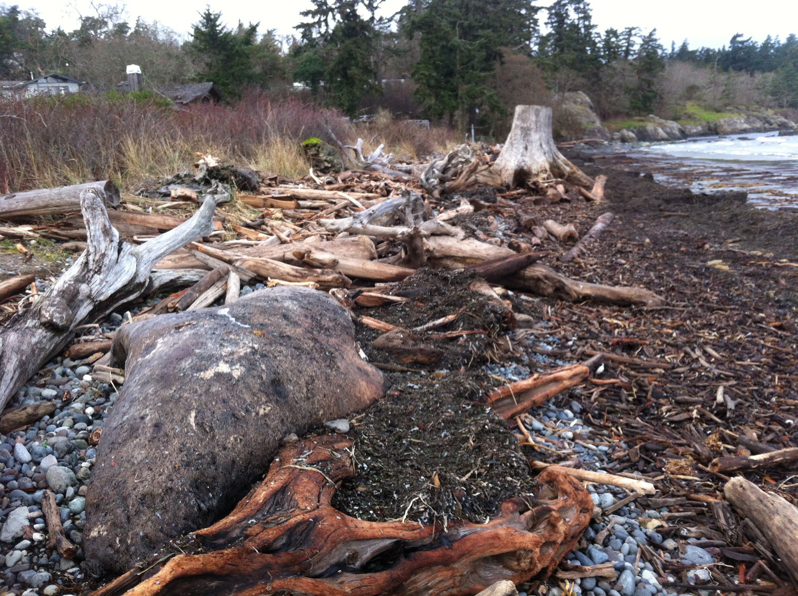
The berm on the North end of Weir’s beach is in a more natural state with logs and debris thrown up by storms. The and natural beach vegetation and debris absorbs the impact of the ocean energy and no scouring of the beach sand has occurred. This will lead to long-term beach stability and erosion-resistance.

See other posts and references on hardening of the shorelines by clicking on links below.
See this file on early pictures of Weir’s beach

Elephant Seal-dead on Weir’s beach

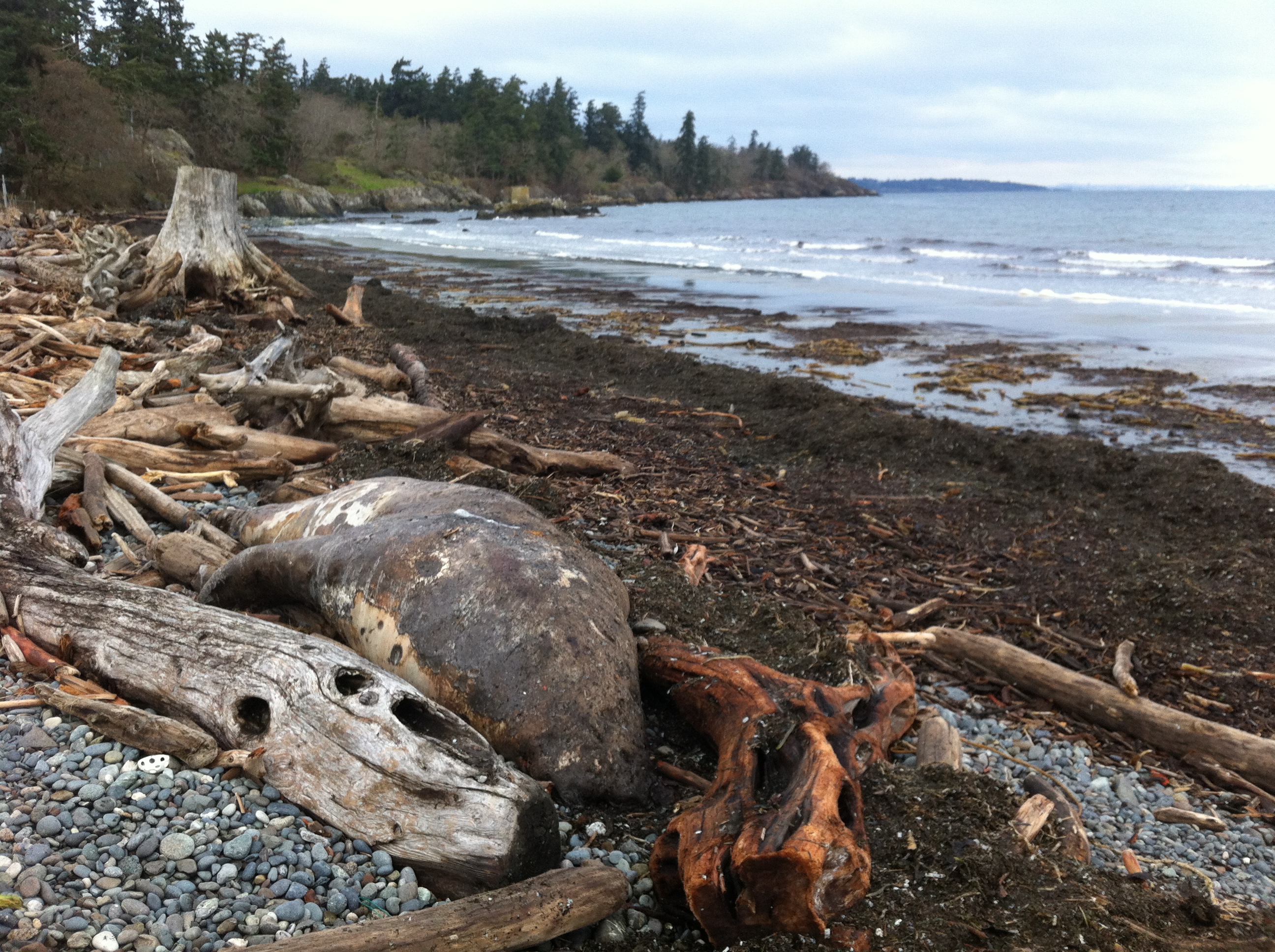
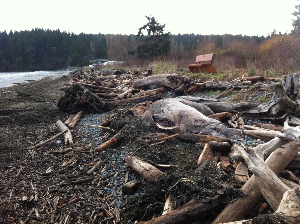
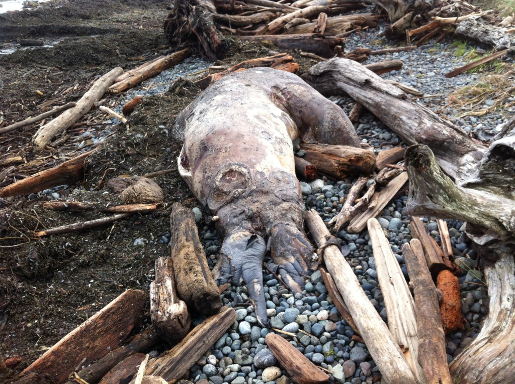
Metchosin resident Jan Poulin reported a dead marine mammal today on Weir’s beach. Below are some pictures. It looks like a mature male, up to 4 m in length. It had been washed up in the swell form the North East storms over the last week. It has been dead for some time and will eventually probably cause a problem for the residents of the area. It has been reported to DFO.

2014-12-26 gfweirselsealdead

male elephant seal, dead on Weir’s Beach photo: G. Fletcher

Other images of the elephant seal : December 26, 2014


Coastal erosion as a sediment source – implications for shoreline management

Puget Sound Feeder Bluffs: Coastal erosion as a sediment source and its implications for shoreline management Shipman et al 2014 .
See the PDF: pugetsoundhardening1406016

feederbluffreport

This report examines the role of eroding bluffs as a source of sediment for Puget Sound beaches and includes a review of related geology and coastal processes. It summarizes recent mapping of feeder bluffs and examines ways in which this information can be used to improve shoreline management.

This report is one part of a larger project on Puget Sound feeder bluffs that also includes maps and a series of web pages that cover much of the material in this report. The project was funded by EPA and the WA Department of Fish and Wildlife. Hugh Shipman and colleagues  published this  important report on feeder bluffs processes and management. Coastal Watershed Index of Port Angeles has been working on the complex and critical topic of feeder bluff management for over a decade. One of their biggest challenges is imparting the critical and unique elements of feeder bluff function and management (including the reality that there are no ‘soft armoring’ techniques appropriate for this land form ). This report provides scientific and management focus specifically to feeder bluffs of the Salish Sea- it’s long overdue.


feederbluffmaps


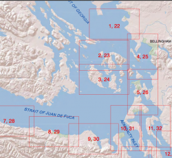
Part 2 is of the maps of feeder bluffs of Puget sound:


Accessed Nov 4, 2014 at :
https://fortress.wa.gov/ecy/publications/SummaryPages
Maps:
https://fortress.wa.gov/ecy/publications/publications/1406016part2.pdf/1406016.html.

See More on Feeder Bluff mapping:


Taylor Beach and November sun.

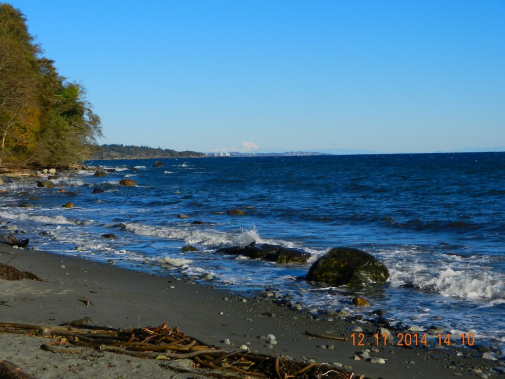
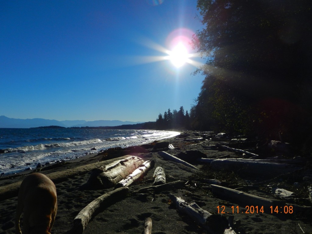
The skies are clear this week with out-flow winds from the northeast clearing the view of Mount Baker and the Olympic Mountains. With this comes colder temperatures and a few degrees of frost at night. Rains are expected to return next week.

2014-11-12taylorviewnorth

View North to Victoria, with Mount Baker (in Northern Washington State)  in the distance .

2014-11-12-taylorbeachsun

Mid-afternoon view south to William Head and the Olympic Mts. in the background.

2014-11-11 tankers

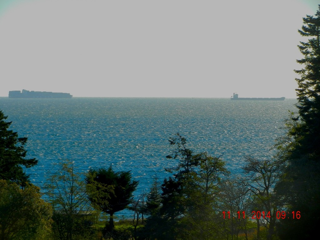
View East over Taylor Beach where the tanker and container ship traffic looms precariously.


Why Sand Is Disappearing ( from beaches)

beachlooknorth

The heavily impacted Weir’s Beach which has experienced considerable sand loss in recent years largely due to bad management of the shoreline.

This article highlights a good example how human interference ( anthropogenic) in a number of ways can result in the loss of Natural Capital and long term sustainability . 

The beaches of Metchosin are not immune  to the forces of Climate change and uninformed decisions of upland landowners and municipal governments which refuse to enact rigid Shoreline Development Bylaws. 

This has been quoted  from: The NYT Opinion Pages    NOV. 4, 2014

” BERKELEY, Calif. — To those of us who visit beaches only in summer, they seem as permanent a part of our natural heritage as the Rocky Mountains and the Great Lakes. But shore dwellers know differently. Beaches are the most transitory of landscapes, and sand beaches the most vulnerable of all. During big storms, especially in winter, they can simply vanish, only to magically reappear in time for the summer season.

It could once be said that “a beach is a place where sand stops to rest for a moment before resuming its journey to somewhere else,” as the naturalist D. W. Bennett wrote in the book “Living With the New Jersey Shore.” Sand moved along the shore and from beach to sea bottom and back again, forming shorelines and barrier islands that until recently were able to repair themselves on a regular basis, producing the illusion of permanence.

Today, however, 75 to 90 percent of the world’s natural sand beaches are disappearing, due partly to rising sea levels and increased storm action, but also to massive erosion caused by the human development of shores. Many low-lying barrier islands are already submerged.

Yet the extent of this global crisis is obscured because so-called beach nourishment projects attempt to hold sand in place and repair the damage by the time summer people return, creating the illusion of an eternal shore.

Before next summer, endless lines of dump trucks will have filled in bare spots and restored dunes. Virginia Beach alone has been restored more than 50 times. In recent decades, East Coast barrier islands have used 23 million loads of sand, much of it mined inland and the rest dredged from coastal waters — a practice that disturbs the sea bottom, creating turbidity that kills coral beds and damages spawning grounds, which hurts inshore fisheries.

The sand and gravel business is now growing faster than the economy as a whole. In the United States, the market for mined sand has become a billion-dollar annual business, growing at 10 percent a year since 2008. Interior mining operations use huge machines working in open pits to dig down under the earth’s surface to get sand left behind by ancient glaciers. But as demand has risen — and the damming of rivers has held back the flow of sand from mountainous interiors — natural sources of sand have been shrinking.

One might think that desert sand would be a ready substitute, but its grains are finer and smoother; they don’t adhere to rougher sand grains, and tend to blow away. As a result, the desert state of Dubai brings sand for its beaches all the way from Australia.

And now there is a global beach-quality sand shortage, caused by the industries that have come to rely on it. Sand is vital to the manufacturing of abrasives, glass, plastics, microchips and even toothpaste, and, most recently, to the process of hydraulic fracturing. The quality of silicate sand found in the northern Midwest has produced what is being called a “sand rush” there, more than doubling regional sand pit mining since 2009.

But the greatest industrial consumer of all is the concrete industry. Sand from Port Washington on Long Island — 140 million cubic yards of it — built the tunnels and sidewalks of Manhattan from the 1880s onward. Concrete still takes 80 percent of all that mining can deliver. Apart from water and air, sand is the natural element most in demand around the world, a situation that puts the preservation of beaches and their flora and fauna in great danger. Today, a branch of Cemex, one of the world’s largest cement suppliers, is still busy on the shores of Monterey Bay in California, where its operations endanger several protected species.

The huge sand mining operations emerging worldwide, many of them illegal, are happening out of sight and out of mind, as far as the developed world is concerned. But in India, where the government has stepped in to limit sand mining along its shores, illegal mining operations by what is now referred to as the “sand mafia” defy these regulations. In Sierra Leone, poor villagers are encouraged to sell off their sand to illegal operations, ruining their own shores for fishing. Some Indonesian sand islands have been devastated by sand mining.

It is time for us to understand where sand comes from and where it is going. Sand was once locked up in mountains and it took eons of erosion before it was released into rivers and made its way to the sea. As Rachel Carson wrote in 1958, “in every curving beach, in every grain of sand, there is a story of the earth.” Now those grains are sequestered yet again — often in the very concrete sea walls that contribute to beach erosion.

We need to stop taking sand for granted and think of it as an endangered natural resource. Glass and concrete can be recycled back into sand, but there will never be enough to meet the demand of every resort. So we need better conservation plans for shore and coastal areas. Beach replenishment — the mining and trucking and dredging of sand to meet tourist expectations — must be evaluated on a case-by-case basis, with environmental considerations taking top priority. Only this will ensure that the story of the earth will still have subsequent chapters told in grains of sand.
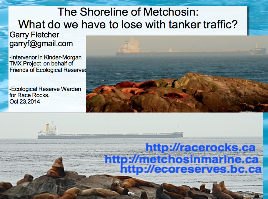
The Shoreline of Metchosin: What do we have to lose with tanker traffic

Along the shoreline of Metchosin and underwater we have ecosystems which are at risk of being heavily impacted in the event of an impending oil spill catastrophe given all the proposed projects which will increase ship traffic to unacceptable levels in the Strait of Juan de Fuca. The presentation by Garry Fletcher linked here was done on the evening of October 23rd, 2014 at the Metchosin Community Hall organized by Karyn Woodland and the local Dogwood Initiative Group. ( NOTE: comments are included under the images and all images are copyright of the photographers who took them, John Harper(GeoBC); the ecoguardians at Race Rocks: Ryan Murphy, Raisa Mirza, Alex Fletcher, Anne Stewart, Adam Harding, Mike Robinson and Courtenay Edwards, and myself. The graphics from the first part on Oil Spill Risk are from  posts of Nov.4 on Oil Spill Risks
Link to a description of the three presentations to the Town hall meeting by Kai Nagata of the Dogwood Initiative, Andrew Weaver, Green Party MLA for Oak Bay and Intervenor in the Kinder Morgan hearings, and Garry Fletcher, Intervenor for the Board of Friends of Ecological Reserves in the Kinder-Morgan / Trans Mountain Expansion project hearings. gfpresent

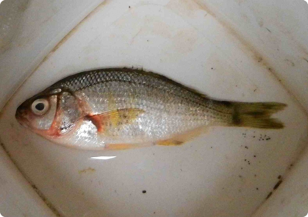
Shiner Perch, Cymatogaster aggregata on the beach

This Shiner Perch, Cymatogaster aggregata was at the water’s edge on Taylor Beach this morning. Cause of death is unknown. They are often found along our coast in shallow waters, and eel-grass communities, and serve as important forage fish, especially as juveniles.

2014=aug-perch1
Classification from Species 2000 & ITIS Catalogue of Life: April 2013
Animalia
Chordata
Actinopterygii
Perciformes
Embiotocidae
Cymatogaster
Cymatogaster aggregata Gibbons, 1854

2014 Metchosin Bioblitz: Gooch Creek species

A large group of interested Metchosinites took a tour through the Gooch Creek estuary and shorefront as part of the Bioblitz which this year focused on Fresh water and estuarine habitats.

Below is the list of some of the findings:

iron bacteria Bacteria Bacteria gooch creek upland ID: Garry Fletcher
Tuber gibosum oregon white truffle fungus Fungus gooch creek upland ID: Ben Hircock
Gerris remigis water strider invertebrate insect gooch creek estuary ID: Garry Fletcher
Tipula spp. crane fly invertebrate insect gooch creek estuary ID: Garry Fletcher
? unidentified water
mite species
Invertebrate arthropod Gooch Creek Pond ID: Rick Nordin
Planaria sp flatworm Invertebrate Platyhelminthes Gooch Creek Pond ID: Rick Nordin
Physella gyrina snail Invertebrate mollusca Gooch Creek Pond ID: Rick Nordin
Planaria sp flatworm Invertebrate Platyhelminthes Gooch Creek Pond ID: Rick Nordin
Physella gyrina snail Invertebrate mollusca Gooch Creek Pond ID: Rick Nordin
Philaneus spumarius spittle bug Invertebrate Insect gooch creek estuary ID: Garry Fletcher
Tipula spp. crane fly invertebrate insect gooch creek estuary ID: Garry Fletcher
Oscillatoria (2 species) diatom Phytoplankton: diatom Gooch Creek Pond ID: Rick Nordin
Synedra sp diatom Phytoplankton: diatom Gooch Creek Pond ID: Rick Nordin
Cyclotella sp diatom Phytoplankton: diatom Gooch Creek Pond ID: Rick Nordin
Sphaerozosma sp diatom Phytoplankton: diatom Gooch Creek Pond ID: Rick Nordin
Hydrosera diatom -spectacular and uncommon Phytoplankton: diatom Gooch Creek Pond ID: Rick Nordin
Kephyrion diatom Phytoplankton: diatom Gooch Creek Pond ID: Rick Nordin
Achillea millefolium yarrow Vascular plant Forb adjacent toTaylor beach ID: Garry Fletcher
Ambrosia chamissonis Silver burr ragweed Vascular plant Forb adjacent to Taylor beach ID: Garry Fletcher
Cakille edentula American Sea Rocket Vascular plant forb adjacent to Taylor beach ID: Garry Fletcher
Chenopodium album red goosefoot Vascular plant Forb gooch creek estuary ID: Garry Fletcher
? Colomia heterophylla vari-leaved collomia Vascular plant Forb gooch creek estuary ID: Garry Fletcher
Epipactis helleborine. orchid Vascular plant forb gooch creek estuary ID: Garry Fletcher
Equisetum arvense field horsetail Vascular plant forb gooch creek estuary ID: Garry Fletcher
Galium aparine cleavers Vascular plant Forb adjacent to Taylor beach ID: Garry Fletcher
Lathyrus littoralis Beach Pea Vascular plant Forb adjacent toTaylor beach ID: Garry Fletcher
Lemna minor Common duckweed Vascular plant forb gooch creek estuary ID: Garry Fletcher
Lysichiton americanum skunk cabbage Vascular plant forb gooch creek estuary ID: Garry Fletcher
Maianthemum dilatatum false lily of the valley Vascular plant Forb gooch creek estuary ID: Garry Fletcher
Oenanthe sarmentosa Pacific water parsley Vascular plant Forb gooch creek upland ID: Garry Fletcher
Potentilla anserina silverweed Vascular plant Forb gooch creek estuary ID: Garry Fletcher
Ranunculus occidentalis Western buttercup Vascular plant Forb gooch creek estuary ID: Garry Fletcher
? Ranunculus repens Creepinng buttercup Vascular plant Forb gooch creek estuary ID: Garry Fletcher
Rumex cripsus curled dock Vascular plant Forb gooch creek estuary ID: Garry Fletcher
Rumex obtusifolius broad leafed dock Vascular plant Forb gooch creek estuary ID: Garry Fletcher
Sanicle crassicaulis Pacific sanicle Vascular plant Forb gooch creek upland ID: Garry Fletcher
Sonchus oleraceus Sow thistle Vascular plant Forb gooch creek estuary ID: Garry Fletcher
Stachys cooleyae Cooley’s hedge nettle Vascular plant Forb gooch creek estuary ID: Garry Fletcher
Veronica beccabunga American brooklime Vascular plant Forb gooch creek estuary ID: Garry Fletcher
Holcus lanatus Velvet grass Vascular plant grass gooch creek estuary ID: Garry Fletcher
Festuca arundenacea tall fescue Vascular plant grass gooch creek estuary ID: A.Ceska
Distichlis spicata seasaide saltgrass Vascular plant grass gooch creek estuary ID: Garry Fletcher
Triglochin maritima Sea arrowgrass Vascular plant grass gooch creek estuary ID: Garry Fletcher
Lemus mollis tall beachgrass Vascular plant grass adjacent toTaylor beach ID: Garry Fletcher
Typha latifolia cattail Vascular plant grass gooch creek estuary ID: Garry Fletcher
Phragmites australis (Cav.)
Trin. ex Steud. subsp. americanus
marsh reed grass Vascular plant grass gooch creek estuary ID: Garry Fletcher, by DNA Sampling-FLNRO
Scirpus microcarpus small-flowered bulrush Vascular plant Rush gooch creek estuary ID: A.Ceska
Scirpus validus hard-stemmed bulrush Vascular plant Rush gooch creek estuary ID: A.Ceska
Juncus balticus Artic rush Vascular plant Rush gooch creek estuary ID: A.Ceska
Juncus effusus common rush Vascular plant Rush gooch creek estuary ID: A.Ceska
Carex obnupta slough sedge Vascular plant sedge gooch creek estuary ID: A.Ceska
Carex sitchensis Sitka sedge Vascular plant sedge gooch creek estuary ID: A.Ceska
Cystis scoparius Scotch broom Vascular plant shrub gooch creek estuary ID: Garry Fletcher
Rosa nutkana Nootka rose Vascular plant shrub gooch creek estuary ID: Garry Fletcher
Mahonia aquifolium oregon grape Vascular plant shrub gooch creek upland ID: Garry Fletcher
Physocarpus capilatus Pacific ninebark Vascular plant shrub gooch creek estuary ID: Garry Fletcher
Oemleria cerasiformis Indian plum Vascular plant Shrub gooch creek estuary ID: Garry Fletcher
Rubus spectabilis salmon berry Vascular plant Shrub gooch creek estuary ID: Garry Fletcher
Symphoricarpos albus snowberry Vascular plant Shrub gooch creek estuary ID: Garry Fletcher
Ulex europaeus gorse Vascular plant Shrub adjacent to Taylor beach ID: Garry Fletcher
Viburnum edule highbush cranberry Vascular plant Shrub gooch creek estuary ID: Garry Fletcher
Cornus sericea red osier dogwood Vascular plant Shrub gooch creek estuary ID: Garry Fletcher
Populus balsamifera Black Poplar Vascular plant tree gooch creek estuary ID: Garry Fletcher
Acer macrophyllum big leaf maple Vascular plant Tree gooch creek upland ID: Garry Fletcher
Alnus rubra red alder Vascular plant Tree gooch creek upland ID: Garry Fletcher
Arbutus menziesii arbutus Vascular plant Tree gooch creek upland ID: Garry Fletcher
Malus fusca Pacific crabapple Vascular plant Tree gooch creek upland ID: Garry Fletcher
Prunus emarginata Bitter cherry Vascular plant Tree gooch creek upland ID: Garry Fletcher
Pseudotsuga menziesii Douglas fir Vascular plant Tree gooch creek upland ID: Garry Fletcher
Salix sitchensis Sitka willow Vascular plant Tree gooch creek estuary ID: Garry Fletcher
Abies grandis grand fir Vascular plant tree adjacent toTaylor beach ID: Garry Fletcher
Taxus brevifolia Pacific western yew Vascular plant Tree gooch creek estuary ID: Garry Fletcher
Anas platyrhynchos mallard Vertebrate Bird gooch creek estuary ID: Garry Fletcher
Agelaius phoeniceus red-winged blackbird Vertebrate Bird gooch creek estuary ID: Garry Fletcher
Geothlypis trichas yellowthroat Vertebrate Bird gooch creek estuary ID: Rick Shortinghouse
Falco columbarius merlin Vertebrate Bird gooch creek upland ID: Rick Shortinghouse
Callipepla californica California quail Vertebrate Bird gooch creek upland ID: Garry Fletcher
Gasterosteus aculeatus, 3-spined Stickleback Vertebrate Fish gooch creek estuary ID: Moralea Milne
Bioblitz Species in the Gooch Creek Area, May 2014,
submitted by Garry Fletcheramerican_brooklime_flowermany grass species and mosses were groups that were not identified< 

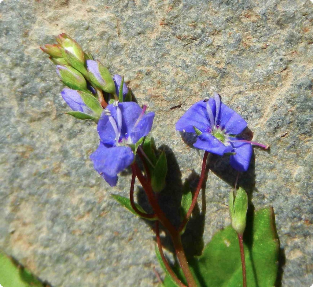
American Brooklime Veronica beccabunga in Gooch Creek Estuary

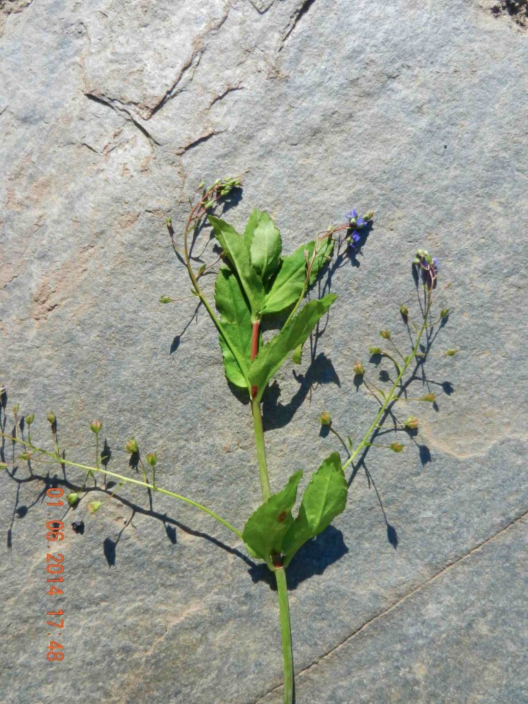
In the Metchosin Bioblitz I came across a plant which I had not seen before called American Brooklime, Veronica beccabunga.

This plant grows as an edible herbaceous perennial in a 1 Meter square patch in amongst the grasses in the estuary lagoon .  The area is only flooded  with sea water in the winter at an extreme high tide with a strong east wind blowing. Close up, it has very striking flowers. The plant was in bloom on May 24, 2014.

american_brooklime_flower

American brooklime

2014-06-01-American-brooklimeallm

American Brooklime- [plant form]

Kingdom: Plantae
(unranked): Angiosperms
(unranked): Eudicots
(unranked): Asterids
Order: Lamiales
Family: Plantaginaceae
Genus: Veronica
Species: V. americana


Strand line of Rhodophytes (red algae)

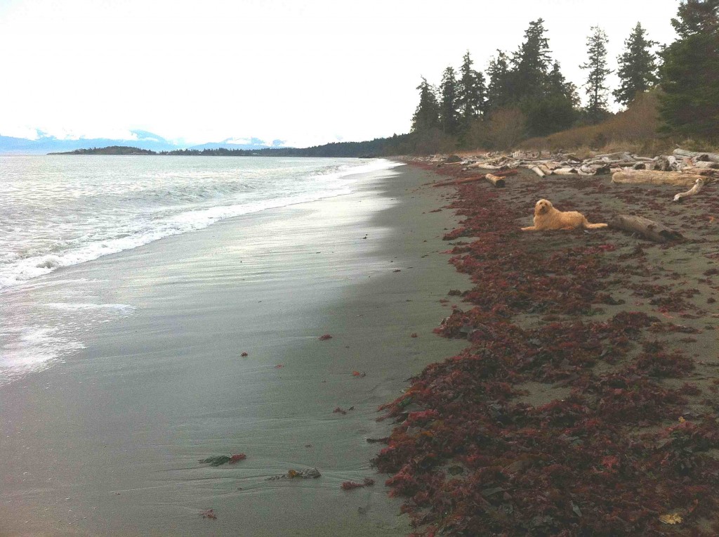
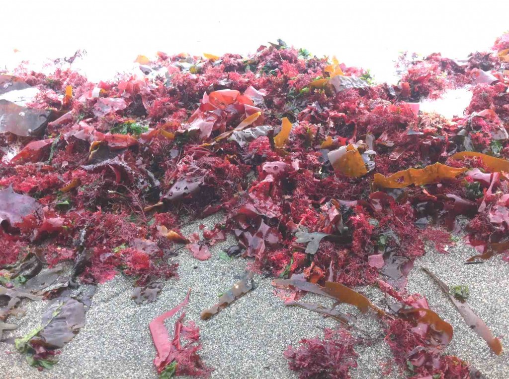
Today there is a strong swell from the North East on Taylor beach which has deposited a good sample of the diversity of the algae that live in the subtidal zone just  below the low-tide level.

gingeronstrasndline2014-03-28

Taylor Beach in Parry Bay at the southern end of Vancouver Island. This beach gets winds and waves from the East in the fall, winter and spring months, but is protected by having only west winds from June to September. There is long-shore drift toward the north end of the beach  in the summer as the energy from the westerlies refract around William Head, visible in the distance on the left.

rhodophytestrand

The Red algae as they lay in the strand line showing the upper limits of the last high tide and the swell which deposited the algae.

redalgaediversity2014-03-28

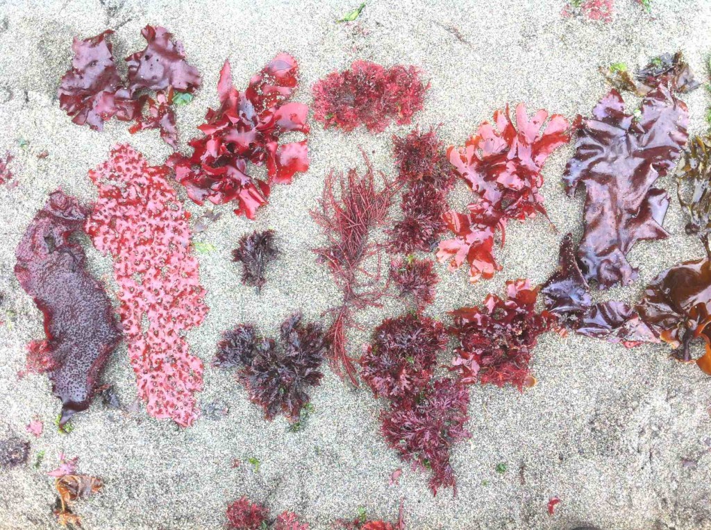
The greatest biodiversity is shown in the Rhodophytes or red algae shown here picked out from the strand line within a few square metres.

redalgaeprionitis2014-03-28

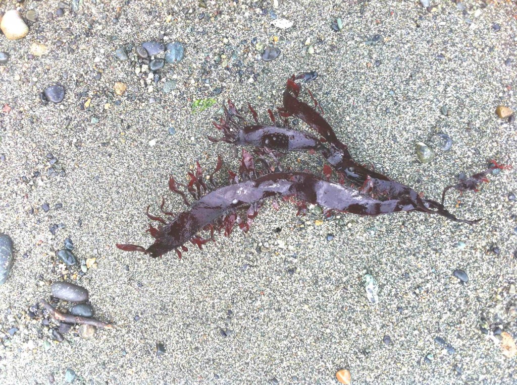
A sample of the red algae, Prionitis lanceolata . which is normally found on the low intertidal of rocky shores.

alaria2014-03-28

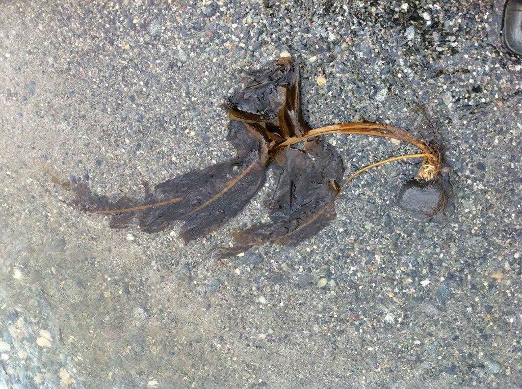
Alaria marginata, a brown algae firmly attached by it’s holdfast which has carried a rock up onto the beach in the surf.

phaeophyte diversity

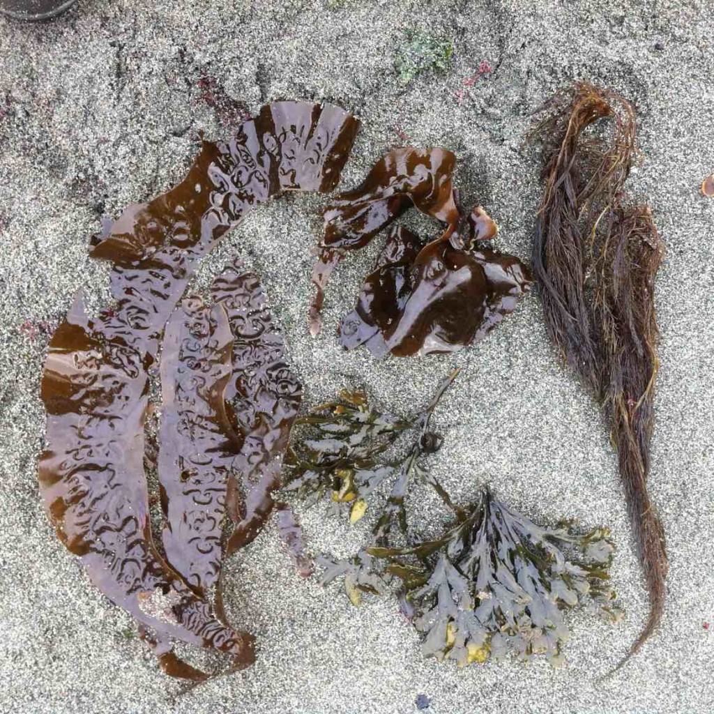
Some of the brown algae ( Phaeophyte) species in the strand line