Mergansers out in full force today.

In the Christmas Bird Count this year, one of the marine birds noted in particularly high numbers was the Common  Merganser, Mergus merganser, with a count of 258 along the Metchosin/Sooke shores.

I noted today( rainy and overcast)  that there were 32 Common Mergansers ( 6 males and  26 females down on the north end of Taylor Beach . Often when we see them there throughout the winter, they are in smaller groups and are continually diving for food. Today the pattern was quite different as they were all in  courtship mood.  The males have a distinctive forward bow, then an upward stretch of their necks  and then a quick scurry on the surface around  a female. These are probably one of the most colourful seabirds on our coast and well worth looking for in protected bays and inlets during the winter. (Pedder Bay also often has a dozen or so) .

Of course these birds as other over-wintering seabirds in our water are very vulnerable to oil spills. If the Kinder-Morgan Pipeline goes through, The current risk from a maximum of  5 oil tankers going through the southern entrance to the Strait of Juan de Fuca each day, is bad enough, but when one contemplates the added risk of accidents from 34 tankers (each over 200 metres in length) plying our waters  by 2015, the future for overwintering birds like this is rather dismal.

Other articles about this concern:


A new Lease on Life for the Rare Marsh Plant: Phragmites australis subsp. americanus–A note of caution when attempting to control Invasive Species

By Garry Fletcher, Metchosin, British Columbia

goochcreekpops

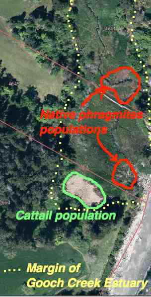
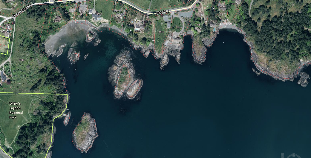
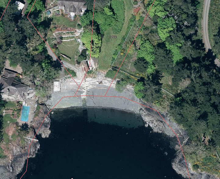
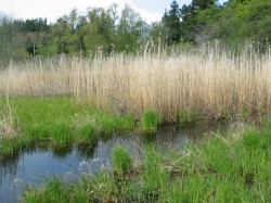
The yellow dots show the margin of the Gooch Creek Estuary. The populations of native Phragmites are shown in red. Location: 48deg,22′,11.01″N—123deg 31’52.19″ W.


Introduced species are no doubt one of the most serious challenges for us in the effort to preserve ecological integrity*. Occasionally however we can mete out  a death sentence to an innocent which can have serious consequences.  This post is about one such occurrence with the native marsh/estuary grass Phragmites australis (Cav.) Trin. ex Steud. subsp. americanus

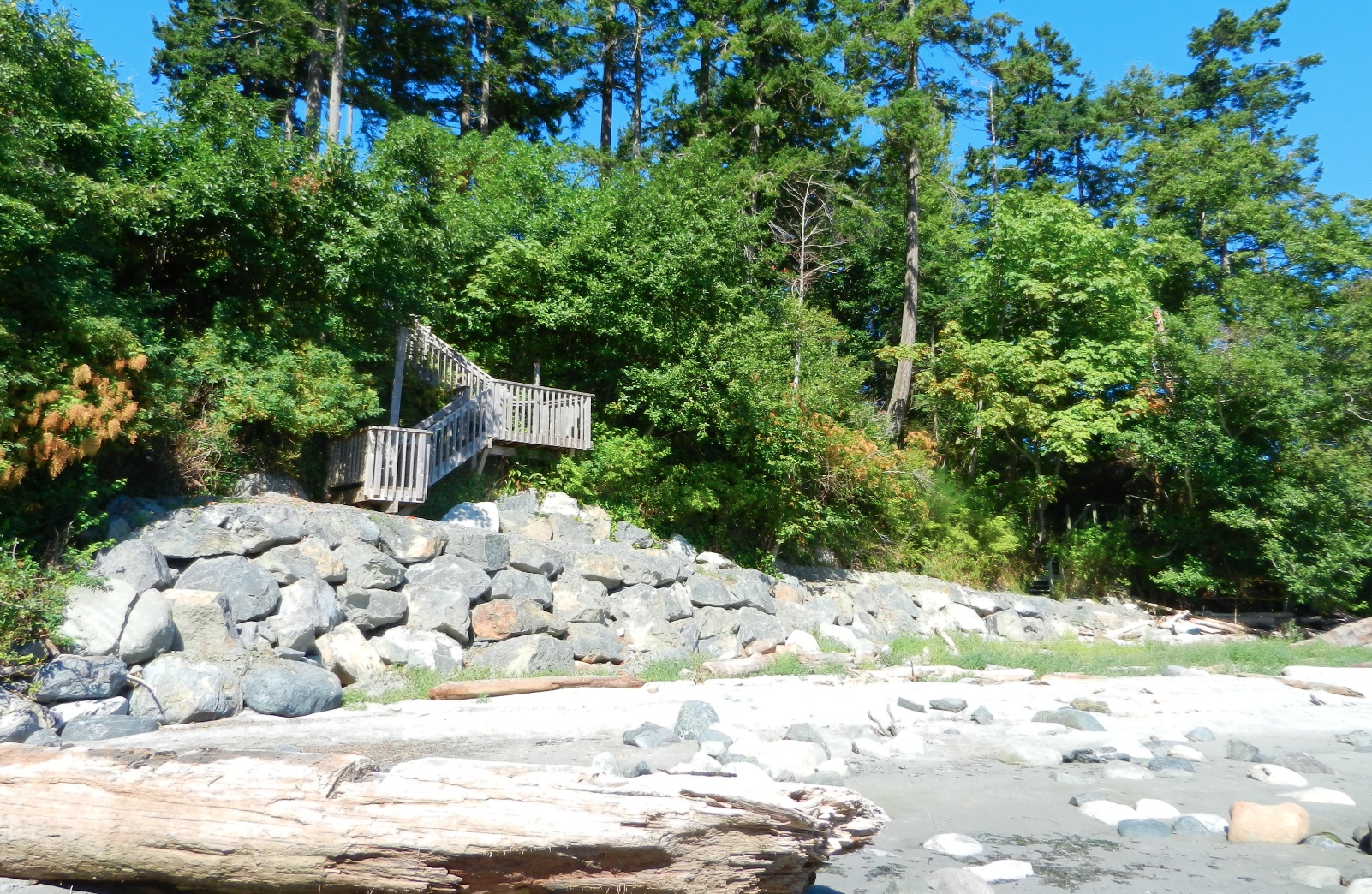
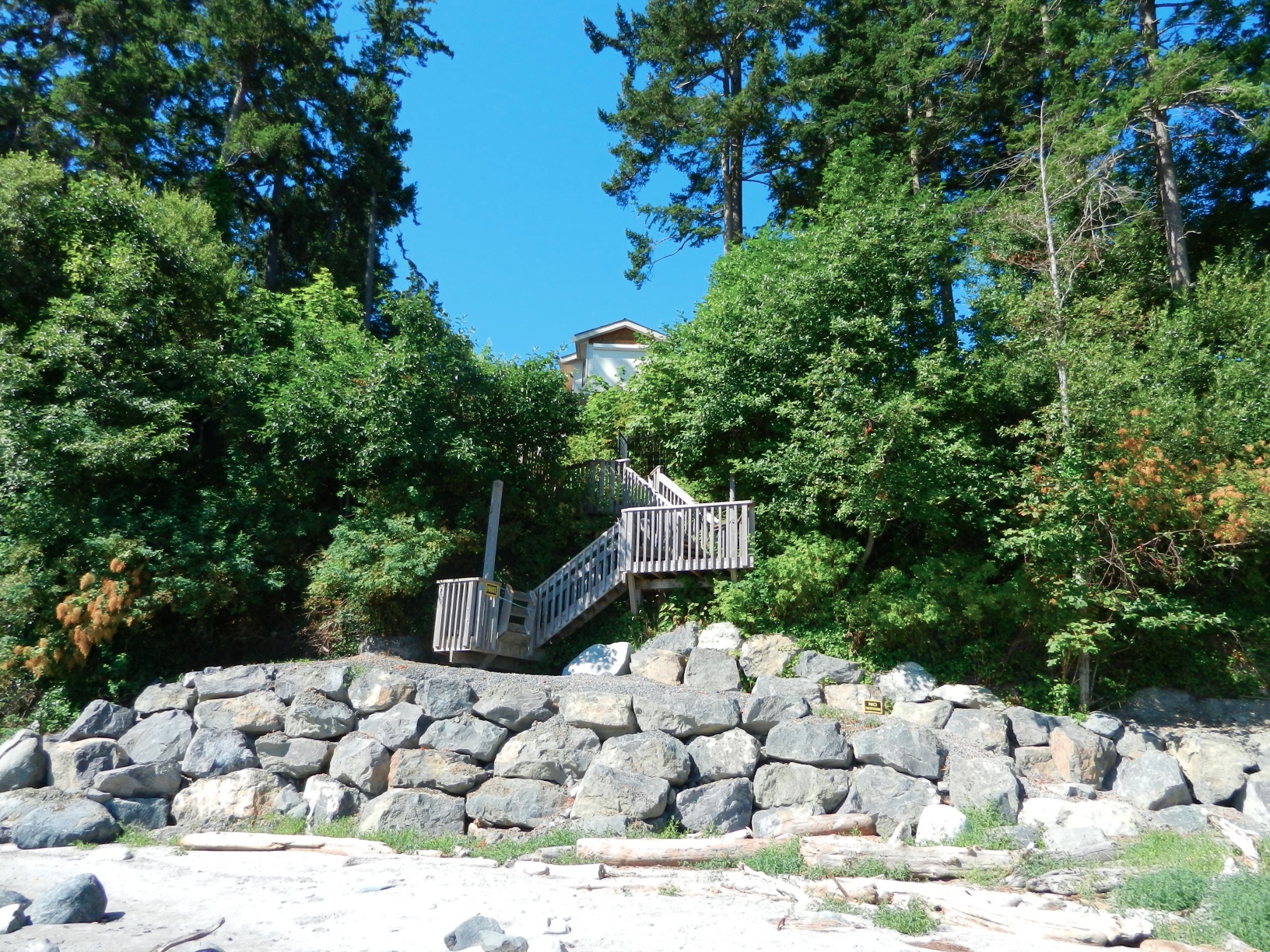
When we first bought our property on William Head Road, I was intrigued with the variety of ecosystems that could fit into one small 4 hectare piece of land. One such ecosystem was the  seasonally flooded salt marsh at the foot of the property. In that marsh were two populations of a very tall (2-3 metre) marsh reed grass.

In the mid-1980s, I asked one of our members of * MEASC, Robert Prescott-Allen to identify the species for me and he came up with the genus name Phragmites. He indicated that it used to be more common in our coastal estuaries, but it had been destroyed in the early years with cattle trampling and grazing. Now it only occurs in limited  populations in BC and in some populations along the Oregon Coast.

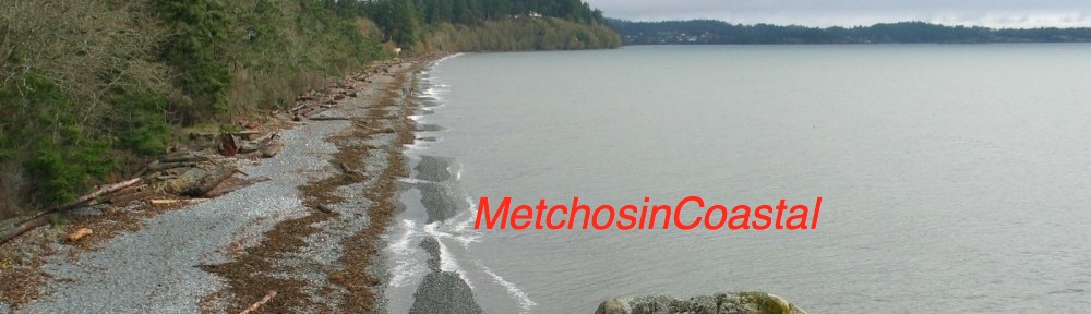
When I made the website MetchosinCoastal , I included a profile on the marsh with images of this plant on the Taylor Beach/Gooch Creek page . phragmiteskalle
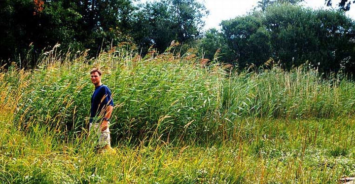
Fast forward twenty years or so until 2009. I received a call from the Invasive Plant EDRR Coordinator | B.C. Ministry of Forests, Lands & Natural Resource Operations
PO Box 9513, 8-727 Fisgard St, Victoria B.C. CANADA V8W 9C1. She indicated that there were 9 populations of the introduced species Phragmites australis (Cav.) Trin. in BC and it was their mandate to control all of them. She came out to the farm, took samples and pictures and I sent her pictures of the extent of the grass in the marsh over the last few years indicating it really hadn’t spread that much. She made reference to a sample in the RBC museum which had been collected from our pond in 1992 which was identified as the introduced variety.

She indicated she would be out with a crew in the fall to cut the plants to the ground and spray with the herbicide Glyphosate . (and this being next to a sea-run cutthroat stream!)

On their website, the locations of this plant in BC were identified .  When the call came that they were coming out, I started to do research on the species.  I valued this plant as a great nesting habitat for red-winged blackbirds, and in the summer they get infested with aphids, providing food to wasps, marsh wrens and other birds. In addition, the hollow stems made excellent homes for Mason Bees.

2013-05-15redstem3

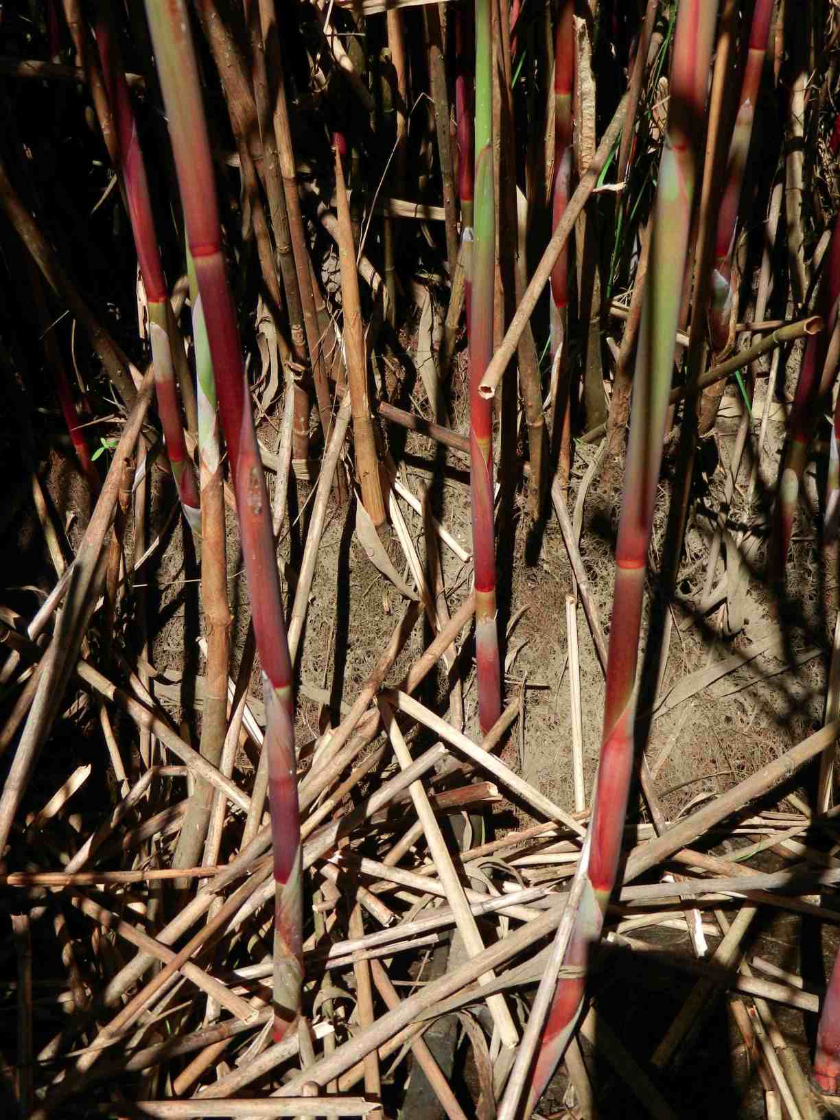
The red stems mentioned on the Oregon ID website are visible in the growing season on our population of reeds. I checked in early Dec.2013 and the red color is still visible.

I referred to a website from the Government of Oregon, which gave a comparison on the physical features of native , (Phragmites australis subsp.americanus) and introduced species samples. It looked very much like the native species to me, with most of the morphological characteristics corresponding. It also indicated that DNA analysis of tissue samples was the only definitive way to determine the genotype of the species.

I also contacted Dr. Adolf Ceska for his opinion, he indicated that the invasive variety probably came into BC in the 1980s. This population in our marsh was well established before the 1980s, and has not progressed very much since then. It is in a seasonal estuary, it floods with fresh
This species reproduces both asexually by underground rootstalks as well as sexually by seeds born on panicles such as this.

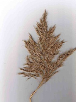
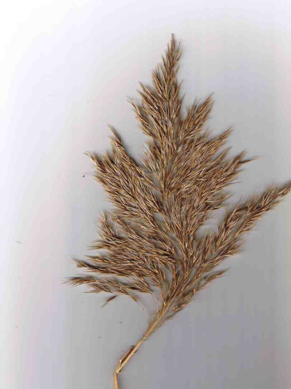
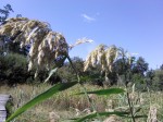
This species reproduces both asexually by underground root-stalks as well as sexually by seeds born on panicles such as this.

water with heavy winter rains,  but only gets flooded with a salt water intrusion at high tides driven by a east-wind driven storm surge. (winter only)

phragmitestassleoct13I tend to think that the salt water controls its distribution  somewhat in this particular marsh.  Interestingly,  in recent years cattails have spread  in the pond and they were previously also controlled by salt water. The main invasive in the marsh is reed canary grass.

I told the  Invasive Plant EDRR Coordinator when she showed up with her crew of two to “remove it”  that I would not allow it unless it was proven to be the invasive by DNA analysis.  I heard back from her in the spring 2014.
Phragmites australis subsp. americanus growing in the Gooch Creek marsh

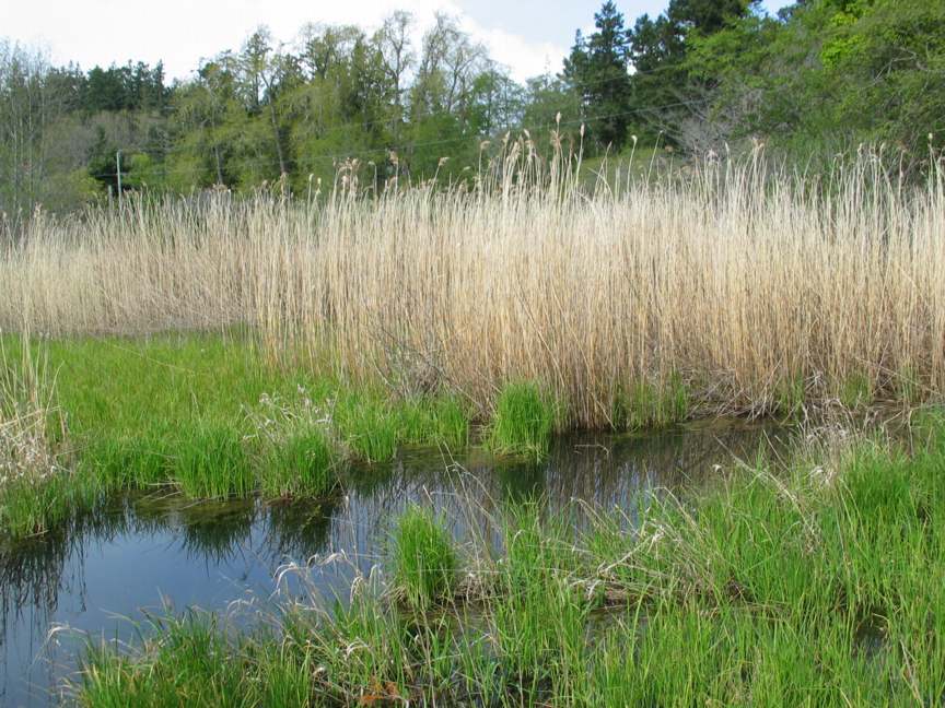
Phragmites australis subsp. americanus growing in the Gooch Creek marsh (in November) of the year

In December of 2013, I was contacted by a wetlands restoration company from Nanaimo, BC about the population, as  they found out from the RBC museum that our population was the native variety. I had not heard this yet so I contacted Dr. Ken Marr at the museum, and he indicated that DNA tests had been done and that it was indeed the native species.


  • He writes “At this very moment I happen to be at UVIC looking at the raw data from the DNA analysis that was mostly completed a year ago.  We have been doing a parallel study of morphology and DNA of 140 or so samples of Phragmites.  Long story short, we have determined from the DNA analysis, that the populations on your land are the native genotype.  In fact, the analysis of the the sample from your land convinced the coordinator of the value of doing the DNA analysis since she had thought the plants on your land were the invasive genotype. Her conclusion may have been based upon my tentative ID of a specimen collected in 1992(?) from your land and that I thought to be the invasive genotype using the characters that have been used to distinguish the native from the invasive. All who have worked on this group acknowledge that for some individual plants, it is difficult to be certain which genotype to which a plant belongs, however DNA markers are viewed to be unambiguous.”
So having regained its “native species” reputation it is protected. The moral of the story is that we must not act impulsively on eliminating introduced species unless we are absolutely certain of the species, and in the case of Phragmites, DNA testing is a minimum requirement before extirpation is promoted.
This has ben published in the BEN ( Botanical Electronic Newsletter)  http://bomi.ou.edu/ben/ben475.html
  • One value added  aspect of the dead hollow stems of Phragmites australis subsp. americanus is that they make great Mason Bee homes. The bottom metre and a half of the larger stems have internode lengths of up to 20 cm, and the inside diameter of the stems is 8 mm.

REFERENCES:

1.BEN , Botanical Electronic News: References on the identification of native and introduced varieties of Phragmites
2. Native to North America or introduced (or both)?
Information on the Morphological Differences between the Native and Introduced
3. Saltonstall, K., Burdick, D., Miller, S., and Smith B. 2005.  Native and Non-native Phragmites : Challenges in Identification, Research, and Management of the Common Reed,  National Estuarine Research Reserve Technical Report Series 2005. (This publication has a good set of comparative photographs of the two varieties.)
4. Swearingen, J. and K. Saltonstall. 2010. Phragmites Field Guide Distinguishing Native and Exotic Forms of Common Reed (Phragmites australis) in the United States. Plant Conservation Alliance, Weeds Gone Wild.
5. from The Encyclopedia of Earth,   Phragmites australis – cryptic invasion of the Common Reed in North America, “Kristin Saltonstall of the Smithsonian Tropical Research Institute has conducted a series of groundbreaking genetic analyses on P. australis. Her research has identified 29 unique genetic types, or haplotypes, of the grass globally. Of these, 13 are native to North America and historical pre-1910 samples indicate a wide distribution of these native haplotypes across the continent. Modern sampling has revealed the widespread presence of a non-native haplotype growing throughout North America. This newcomer’s DNA matches that of a Eurasian haplotype that is the most common P. australis haplotype in the world.”

Kingdom Plantae – plantes, Planta, Vegetal, plants
Subkingdom Viridaeplantae – green plants
Infrakingdom Streptophyta – land plants
Division Tracheophyta – vascular plants, tracheophytes
Subdivision Spermatophytina – spermatophytes, seed plants, phanérogames
Infradivision Angiospermae – flowering plants, angiosperms, plantas com flor, angiosperma, plantes à fleurs, angiospermes, plantes à fruits
Class Magnoliopsida
Superorder Lilianae – monocots, monocotyledons, monocotylédones
Order Poales
Family Poaceae – grasses, graminées
Genus Phragmites Adans. – reed
Ed. Note: Species subspecies americanus is the native species
in North America. Phragmites australis (Cav.) Trin. ex Steud. – common reed
-introduced species in North America

See posts on the use of Phragmites stems for culturing Mason Bees here:http://www.gfletcher.ca/?tag=phragmites


BC Government Publications Index for Stewardship Centre on Coastal Planning and Land Use

BC Government Publications
Index for:
Stewardship Centre for British Columbia
Coastal Shore Stewardship: A Guide for Planners, Builders and Developers on Canada’s Pacific Coast

http://www.llbc.leg.bc.ca/public/pubdocs/bcdocs/368207/

The four PDFs linked to this government site have also been included here since we find that external URLs often change:
Part 1: Coastal Shore Stewardship A Guide for planners, Builders and Developers on Canada’s Pacific Coast: part1

Part 2  Coastal Planning and Approvals, Who does What: part2

Part 3  Don’t disrupt, Don’t harden, Don’t pollute: Land Development,  Marine Facilities, Seawalls and Revetments, etc.   Links to many  Stewardship resources; part3

Internet resources: internetaddresses

Anthropogenic habitat modification from Witty’s lagoon to the south side of Albert Head.

This area has in the past been modified significantly from the natural shoreline. Several seawalls have been installed in the past to deal with drainage problems or erosion threats , or to improve sea views or add to usable property on the foreshore. Typically land owners do not like to be criticized for actions on their properties which they believe will be constructive. However current  standards as outlined  in the documents “BC Government Publications Index for Stewardship Centre on Coastal Planning and Land Use” would probably not allow such impacts any more.


The images below were from earlier aerial photos of other modifications in the area.

Aerial views courtesy of the CRD NATURAL AREAS ATLAS

Return to the sector 8 

Weir’s Beach erosion.

In July 2013 at Low tide, the loss of sand from near the south end of Weir’s Beach has become obvious. This was predictable because of the hardening of the shoreline several years ago with the installation of large rock rip-rap along the front of the adjacent Weir’s Beach Trailer Park. As many of the references such as  Hardening the shorelines indicates:  “Hard structures, especially vertical walls, often create conditions that lead to failure of the structure. In time, the substrate of the beach coarsens and scours down to bedrock or a hard clay. The footings of bulkheads are exposed, leading to undermining and failure. … Failed bulkheads and walls adversely impact beach aesthetics, may be a safety or navigational hazard, and may adversely impact shoreline ecological functions.”

riprap

Large rock riprap on the berm

trailers1

Trailer park perched on the edge of the berm.

weirserosion

Loss of fine sand material from the beach in front of the trailer park.

See this file for earlier images of the beach and comparisons: https://metchosinmarine.ca/7taylorbeach/weirs/beachcompare.htm

New Seawall on Weir’s Beach

Over the summer of 2013, a new seawalll was built at the south end of Weir’s beach. The purpose of the wall is not obvious, other than to create a walkway to the ocean for the residence above.
The provincial government owns the ocean floor and the foreshore (the area between the low water level and the natural boundary) along Metchosin’s Coastline. This structure sits within this foreshore area, as there is sand at it’s base,  so it is questionable how this shoreline modification was permitted.

UPDATE:

  •  Under the General  Marine Shoreline policies desired works require application to the appropriate Provincial/and or Federal agencies responsible.  This particular property located at 5289 William Head Road was able to proceed under the following conditions: 
  • 1. Requirements of the Department of Fisheries & Oceans must be fulfilled.
  • 2. Any work below the high water mark must have the approval of the Ministry Forests, Lands & Natural Resource Operations
  • 3.  Work was  conducted in April according to the measures outlined in the Ryzuk Geotechnical Report dated March 7, 2013 and the report by Lehna Malmkvist, Swell Environmental Consulting Ltd., March 8, 2013

———————————————————————————————————–

Readers are recommended to read all parts of the publication below before attempting any alterations on shorefront property:

Coastal Shore Stewardship: A Guide for Planners, Builders and Developers on Canada’s Pacific Coast

Another reference on hardening the shorelines states the problem rather plainly: “Hard structures, especially vertical walls, often create conditions that lead to failure of the structure. In time, the substrate of the beach coarsens and scours down to bedrock or a hard clay. The footings of bulkheads are exposed, leading to undermining and failure. … Failed bulkheads and walls adversely impact beach aesthetics, may be a safety or navigational hazard, and may adversely impact shoreline ecological functions.”

southendstairnorth

View of the seawall from the south.

southendstairway

View of the seawall from the beach directly in front.

seawallfrombeach

View of sea wall from the north.

Metchosin Shoreline Report : MEASC 2013

The Metchosin Environmental Advisory Select Committee of  Metchosin District submitted this report to Council in June  2013.

See the complete report as a  PDF: Metchosin Shoreline Report 2013June 10-2

Executive Summary

The unique values attributed to the Coastal Areas of Metchosin have been recognized both historically and by outside researchers. They have also been outlined at length in the Official Community Plan and other documents produced for the District.

The objective of the Metchosin Shoreline Report is to provide Mayor and Council with a background document and decision-making tools for issues related to Metchosin’s shoreline environment: the jurisdictional boundaries are delineated; examples of ecologically sensitive areas are highlighted; and the biological and geographical values of eight zones of the forty-five km of shoreline are profiled.

The values of biodiversity, education, natural capital, aesthetics, philosophy, and ecotourism are all affected by our coastal areas. Therefore, the risks from human activity on the sustainability of these areas are emphasized.

With the increasing likelihood of changing climatic events impacting on our shoreline, and in order to mitigate these risks, a number of recommendations are proposed for the Municipality to implement:

  1. Create a development permit zone in the area between the end of provincial jurisdiction at the high water mark and the end of the high tide storm-driven wash on the landowner’s property.
  2. Prevent the human caused hardening of the shoreline by sea walls, roadways or bulkheading, and shoreline modifications.
  3. Design a “Coastal Covenant,” which landowners could sign, in order to guarantee the protection of the integrity of their section of shoreline.
  4. Establish and protect vegetation buffer zones along streams and along the total shoreline, including special attention to salt marshes and eelgrass beds.
  5. Protect eelgrass beds by eliminating damage from log booms, docks and other structures.
  6. Divert runoff of fertilizers, pesticides and herbicides from streams and surrounding farmlands away from shoreline, salt marsh, and seagrass habitats.
  7. Develop emergency response plans for the District in the event of a land or ocean-based toxic spill, which could potentially threaten the shoreline.

See the complete report as a  PDF: Metchosin Shoreline Report 2013June 10-2


District of Metchosin Official Community Plan Section on Shoreline Slopes Development Permit Areas

From the Official Community Plan : Available at this link

Map6_Development_Permit_Areas

DPAs in Metchosin ( click to enlarge)

2.16    SHORELAND SLOPES DEVELOPMENT PERMIT AREAS:
The Municipal Act
provides that a community plan may designate development areas to be protected from hazardous conditions. The Municipal Act further provides that in such areas land shall not be altered in any way or subdivided and structures not be built or added to until a Development Permit has been  issued. Council has established the following designation, special conditions, and guidelines.

2.16.1    Designation:  (Bylaw 418, 2004)
The 1993 Hazard Land Management Plan has identified areas of the Metchosin shoreland slopes as having erosion, land sloughing and drainage problems.

AlbertHead portion of DPAs

Farhill Road portion of DPAs,

southsectionDPA

Parry Bay ( Taylor Beach ) section of DPA lands

The Shoreland Slopes areas are shown on Map 6 Shoreline Slopes DPA, and are hereby designated as areas for the protection of development from hazardous conditions pursuant to Section 919.1(1)(b) of the Local Government Act.
The Plan has identified three Shoreland Slope classification zones, based on the degree of slope instability and surface erosion potential. Slopes classified as zone 2 and 3 are slopes with the greatest potential for sloughing, slumping and debris flows and have been included in the Development Permit Area.
2.16.2    Special Conditions:
The major concern is that lands, particularly in the Park Drive – Farhill Road area, have experienced a  dramatic rise in ground water levels due to adjacent developments during the last two decades. Other areas of the Shoreland slopes have experienced significant slope erosion in the past. There is a community desire to mitigate any further development related impacts on the marine shorelands.

2.16.3    Policies Development Permits issued shall be in accordance with the following:
(1)    The construction or alteration of buildings on existing lots shall be permitted subject to the Building  Permit process when Council is satisfied that the Development Permit Guidelines (Section 2.14.4) have been met, and, when required, Council is satisfied with the Engineer’s Report (Section 2.14.5).
(2)Where a Development Permit is applied for in conjunction with an application for subdivision approval, rezoning, or both, the Development Permit shall be conditional on the successful completion of those other permits and shall lapse if the subdivision or rezoning is not approved.

2.16.4    Guidelines:
(1)    All applications for new development in the Development Permit Areas shall be required to have an Engineer’s Report (described below).
(2) Removal of vegetation shall be minimized.
(3) House construction, regrading, and excavation of till (including for road building) is not permitted within 60 metres of the edge of the slope except where geotechnical engineering and resource management studies indicate that a lesser setback is acceptable.
page 31

2.16.5    Engineer’s Report:
Before a development permit is issued, the applicant shall be required to furnish a report at his\her expense from a registered professional engineer with geotechnical experience which will certify that the proposed development will produce no adverse impacts on the shoreland slopes and will not place buildings or structures in danger of slope slippage.

The Engineer’s Report shall demonstrate that consideration has been given to the following:
(1)(a) siting and setbacks of development structures, roads, and services,
(b) minimizing paving and impervious materials, and,
(c) implementing infiltration techniques so as to limit runoff;
(2) designing runoff detention ponds, drainage works, or
sediment traps or basins to reduce the flow of  runoff and silt during land clearing and construction.
(3) development near shoreland slopes must address the impact of surface water on slope stability, vegetation and soils, and make recommendations to remedy that already damaged; and
(4) removal of trees (with a valid tree-cutting permit) or other vegetation should be allowed only where  necessary and where alternate vegetation and/or erosion control measures are established. If possible,  stumps should be left in place to provide some soil stabilizing influence until alternative vegetation is  established. Plans delineating extent of vegetation/tree removal (location, species and diameter of trees) and location of proposed construction, ex cavation and/or blasting, may be required.

The DISTRICT, at its discretion, may also submit the Engineer’s Report to review by a second Engineer at the applicant’s expense, and/or directly to the Ministry of Environment for their comments.

2.16.6    Municipal Response, 
The DISTRICT should:
(1) evaluate the feasibility of purchasing environmentally sensitive shorelands for use as park, forest reserve, or greenbelt;
(2) initiate programs to monitor both surface and ground water to establish patterns of change;
(3)work with proximate agencies to establish erosion and land sloughing control measures.

The Green and Blue Spaces Strategy, December, 2007

The PDF of this report from  2007 may be viewed in it’s entirety here:
Blue-green-spaces-Document

Note in particular: page 4 : TYPES OF GREEN and BLUE SPACES

part 5. Marine Areas.

a. Nearshore marine areas: These areas  occur along the coastlines of Metchosin. They are productive nursery areas and habitat for marine life, and include eelgrass beds, kelp beds, and subtitle rocky areas.

b. Marine shorelines: these are areas of natural shoreline on land. They are an important part of the scenic character of the community, contain recreational trails or beach access points, and provide a buffer between buildings and natural dynamic processes such as shoreline erosion. Examples include rocky marine shorelines and beaches [especially between Helberg had and church island], tidal lagoons, estuaries and offshore islands.

Under recommendations  —Municipal governments:

  •   while Metchosin has no formal management responsibility for nearshore marine areas, we should continue to acquire and maintain inventories of these areas, and have municipal input into provincial and federal government decisions regarding their management.
  • Recognize the importance of and encourage the protection and restoration of Metchosin’s natural shoreline.

Link: The CRD Blue-Green report


The Effect of Seawalls

“Seawalls damage virtually every beach they are built on. If they are built on eroding beaches—-and they are rarely built anywhere else,—-they eventually destroy the beach. ”  –Cornelia Dean, (Science Editor of the New York Times) Against the Tide, The Battle of America’s Beaches 53 (1999) 

A serious problems which has developed on the coastline  of Metchosin, is the building of seawalls under the pretext of protecting private property from erosion. Owners of properties along a coast are often not aware of the mechanics of the interaction with ocean energy of the shoreline. After an intense storm, evidence of erosion along a shore-front often leads land owners, desperate to save their property to go to often very expensive extremes in order to try to protect their property.

A survey of literature from various parts of the world indicates this is not only a local problem, but is indeed very wide spread. The series of photographs documented on this website from Puget Souperkinslane_pugetsoundnd, show the problem not far from our shores. We should consider ourselves lucky so far in Metchosin as we have yet to experience the disasters that have happened in Puget Sound.  This link to an Image Gallery shows how bad it could get:


Impact of Coastal Erosion in Australia 7 Mar, 2013
Senior Coastal Scientist at Coastalwatch Professor Andrew Short has compiled a comprehensive piece focusing on coastal erosion in Australia.

For the 50% of the Australian coast that is composed of sand and in some places mud, the shoreline is prone to change, building seaward and in some places eroding landward. In most locations this is a natural process with usually no impact on human settlement. Coastal protection of the shoreline is rarely required in Australia, however in a few locations the dynamic shoreline has become a problem, in some cases a major and expensive problem, and in almost all of these cases the problem is related to human interference or encroachment on the shoreline. Coastal protection works, such as breakwaters, groynes, or seawalls, are usually built to guard against erosion. In doing so they harden the coast and reduce its ability to adjust naturally. As a consequence, these defences can exacerbate further erosional problems, with seawalls reflecting and concentrating wave energy and erosion, and groynes starving downdrift the coast of sediment thereby leading to further erosion. There are areas where human have encroached into the dynamic beach environment only to suffer the consequences, and others where they have interfered with coastal processes leading to accelerated coastal erosion.

The Utilization of Seawalls in Response to Shoreline Erosion Consequences, Socio-Economic, Political and Legal Forces, and Alternatives Shawn W. Kelly , Donald Bren School of Environmental Science and Management University of California, Santa Barbara November 30, 2000

Executive Summary
See the full PDF version: Seawall

seawallWhen coastal buildings or roads are threatened, the typical response is to harden the coast with a seawall. Seawalls run parallel to the beach and can be built of concrete, wood, steel, or boulders. Seawalls are also called bulkheads or revetments; the distinction is mainly a matter of purpose. They are designed to halt shoreline erosion caused primarily by wave action. If seawalls are maintained, they may temporarily hold back the ocean from encroaching on shoreline development. In spite of their ability to hold back the ocean, when waves hit a seawall, the waves are reflected back out to sea, taking beach sand with them and eventually causing the beach to disappear. Moreover, seawalls can cause increased erosion at the ends of the seawall on an adjacent beach that is not walled. Alternatives to seawalls exist, such as beach nourishment and managed retreat. Making coastal land use decisions that ensure a seawall will not be needed in the
future to protect structures, however, is the most prudent coastal management solution. This can be accomplished by establishing setback lines and conducting managed retreat of structures that are threatened by shoreline erosion before the situation worsens, or structures that have the potential for being threatened in the future. Regional case studies are presented to illustrate.
And finally an amusing story about coastal erosion and the origin of the term

“The Streisand effect”

The following excerpt from George Monbiot ( on SLAPP suits) mentions a very interesting case :

In Canto 21 of the Inferno, Dante watches lawyers who made a habit of bringing frivolous or oppressive suits being perpetually submerged in a lake of boiling tar by demons with boathooks. They get off quite lightly, in other words. But perhaps hell of a different kind awaits on earth. It’s called the Streisand Effect. In 2003 Barbra Streisand’s lawyers launched an action to have an aerial photograph of her home in Malibu removed from a collection of 12,000 such shots, whose purpose was to document coastal erosion(11). They demanded $50m in damages. Before they became involved, the photo was downloaded four times. In the month after they launched their stupid suit, it was downloaded 420,000 times(12). “The Streisand Effect,” in other words, is blowback: disastrous unintended consequences of an attempt at censorship.”